|
| I-64 east combines with I-81 north for 29.91 miles. The two routes initially run between Grassy Ridge and Timber Ridge. 09/23/14 |
|
| The independent city of Staunton lies just beyond the separation of I-64/81. I-81 continues from there to Harrisonburg and Winchester. 09/23/14 |
|
| U.S. 11 (Lee Highway) heads 4.09 miles north from I-64 at Exit 55 and East Lexington to I-64/81 at Exit 195. 09/23/14 |
|
| A diamond interchange joins I-64/81 and U.S. 11 (Lee Highway) at Exit 195. U.S. 11 constitutes a four lane, divided highway from Lexington north to Fairfield. 09/23/14 |
|
| U.S. 11 (Lee Highway) continues six miles northeast to Fairfield and 11 miles to Steeles Tavern. 07/16/05 |
|
| I-64/81 expand to six overall lanes north from Exit 195. 09/23/14 |
|
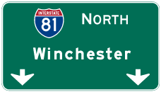
| Winchester lies at the north end of the state in 120 miles. Richmond is 130 miles to the east along the I-95 corridor. 09/23/14 |
|
| Passing the Fairfield Safety Rest Area for I-64/81 southbound, I-81 travels another 33 miles to the succeeding northbound rest area. 09/23/14 |
|
| SR 710 (Swope Lane / Sterrett Road) winds 3.86 miles eastward from SR 252 (Brownsburg Turnpike) to meet I-64/81 at a diamond interchange (Exit 200) near Fairfield. 09/23/14 |
|
| Exit 200 leaves I-64/81 north for SR 710 (Sterret Road). SR 710 connects with U.S. 11 (Lee Highway) at Fairfield nearby. 09/23/14 |
|
| A lane drop occurs along the ensuing stretch of I-64/81 northbound beyond Exit 200. 09/23/14 |
|
| Progressing north by Lusk Hill, I-81 reaches Staunton in 24 miles. 09/23/14 |
|
| SR 606 (Raphine Road) meets U.S. 11 (Lee Highway) 1.61 miles east of forthcoming Exit 205 at Steeles Tavern by the west end of SR 56. SR 56 ascends into the Blue Ridge Mountains to Vesuvius and Montebello. 09/23/14 |
|
| Raphine Road meanders 4.71 miles west from the diamond interchange with I-64/81 to Wades Mill and SR 252 (Brownsburg Turnpike) north of Brownsburg. 09/23/14 |
|
| I-64/81 enter Augusta County north ahead of Spottswood. 09/23/14 |
|
| I-64/81 remain rural northeast 15 miles to SR 262 (Woodrow Wilson Parkway), the first exit for the city of Staunton. 09/23/14 |
|
| I-64/81 bypass the rural community of Greenville ahead of the parclo interchange (Exit 213) with U.S. 11 (Lee-Jackson Memorial Highway) to U.S. 340 (Stuarts Draft Highway). 09/23/14 |
|
| U.S. 11 continues north from Exit 213 to Mint Spring and Staunton. U.S. 340 ventures east seven miles from U.S. 11 nearby to Stuarts Draft en route to Waynesboro. U.S. 340 measures just 156 miles overall to Frederick, Maryland. 09/23/14 |
|
| Leading away from Exit 213, I-64/81 initially parallels U.S. 340 (Stuarts Draft Highway). 09/23/14 |
|
| Winchester lies 94 miles beyond the separation of I-64/81 in Frederick County. 09/23/14 |
|
| A diamond interchange (Exit 217) joins I-64/81 with SR 654 (White Hill Road) at Mint Spring. 09/23/14 |
|
| SR 654 runs 4.72 miles southeast from U.S. 11 (Lee Jackson Memorial Highway) along White Hill Road to U.S. 340 (Stuarts Draft Highway) at Stuarts Draft. 09/23/14 |
|
| I-64/81 cross Folly Mills Creek seven miles south of Staunton. 09/23/14 |
|
| SR 262 constitutes an expressway loop around the west side of Staunton from the trumpet interchange at Exit 220 to I-81 at Exit 225. 09/23/14 |
|
| Interstate 64 branches east from I-81 at a directional T interchange (Exit 221) beyond the exchange with SR 262 (Woodrow Wilson Parkway). 09/23/14 |
|
| Interstate 64 connects with Skyline Drive north to Shenandoah National Park at Exit 99 and Rockfish Gap. 09/23/14 |
|
| SR 262 circles northward from I-64/81 along a limited access highway to U.S. 250 in Staunton. The northern arc of the 13.91 mile loop constitutes an expressway with at-grade intersections between U.S. 250 (Churchville Avenue) and I-81. 09/23/14 |
|
| Interstate 64 resumes its eastward course from Staunton to Waynesboro, Charlottesville and the capital city of Richmond. 05/28/21 |
|
| I-81 continues north to Staunton, Harrisonburg and Winchester. I-64 crosses the Commonwealth of Virginia east to Hampton Roads. U.S. 250 (Jefferson Highway) parallels I-64 east to Waynesboro from Exit 222. 05/28/21 |
|
| Interstate 64 travels 300.38 miles overall in Virginia, concluding at I-264/664 in the city of Chesapeake. 09/23/14 |
Page Updated 08-10-2021.

 East
East  North
North