|
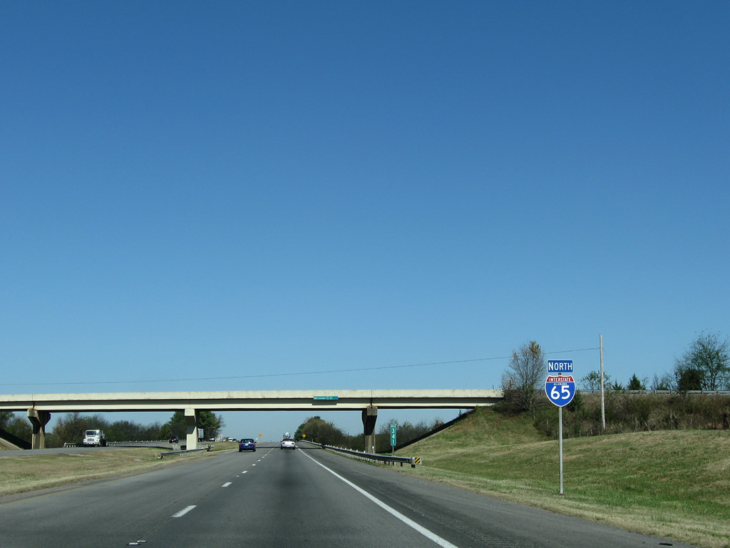
| I-65 partitions with Exit 318 to U.S. 31 just beyond the county line. U.S. 31 parallels the freeway as a four lane divided highway northward through Lacon, Falkville and Hartselle.
This guide sign was removed by 2013 and not replaced as of 2015. 11/04/09 |
|
| Leaving the Lacon Mountain area, Interstate 65 turns northeasterly, passes over a CSX Railroad line, and bypasses Falkville to the east. 11/04/09 |
|
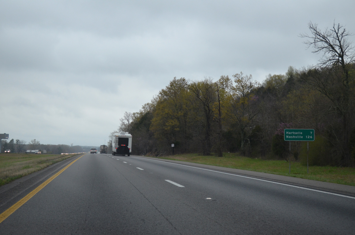
| The city of Hartselle lies seven miles ahead while Nashville is now 129 miles away. 04/04/13 |
|
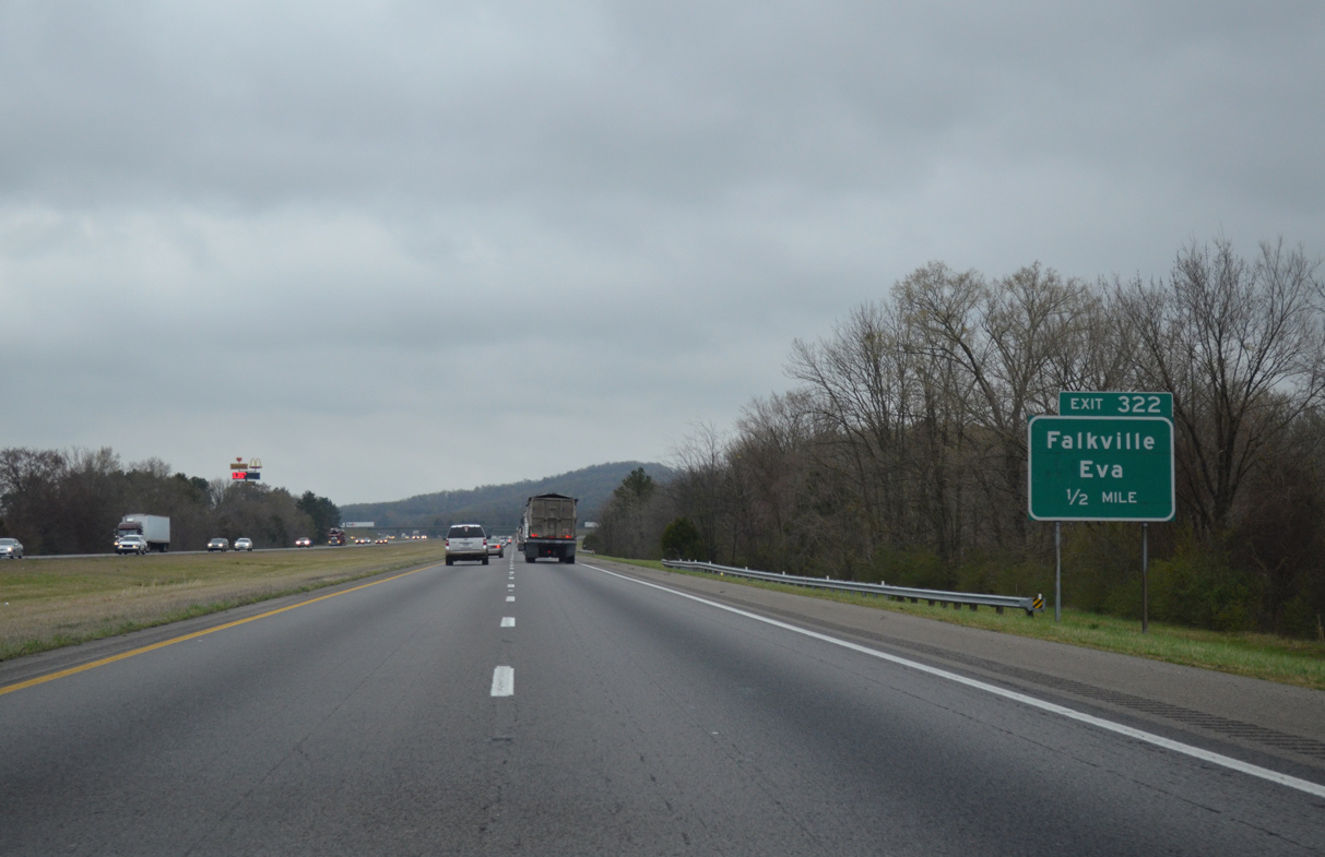
| One mile south of the diamond interchange (Exit 322) with Morgan County Route 55 (Pike Road) at the Piney Grove Road overpass. 04/04/13 |
|
| Pike Road leads west one mile from Interstate 65 to U.S. 31 (2nd Avenue) in Falkville. 04/04/13 |
|
| Morgan County Route 55 continues east from Exit 322 and Interstate 65 to Cole Spring and Eva. 04/04/13 |
|
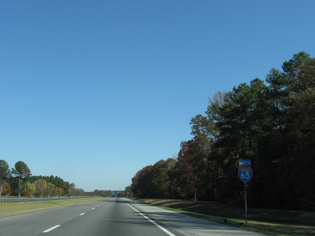
| Huntsville and Decatur are again ignored in favor of Nashville on northbound Interstate 65 signage in Morgan County. 11/04/09, 04/04/13 |
|
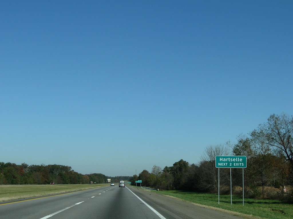
| One of the first instances of Clearview-based signing on Interstate 65 in northern Alabama was the "Hartselle Next 2 Exits" sign posted ahead of Exit 325. 11/04/09 |
|
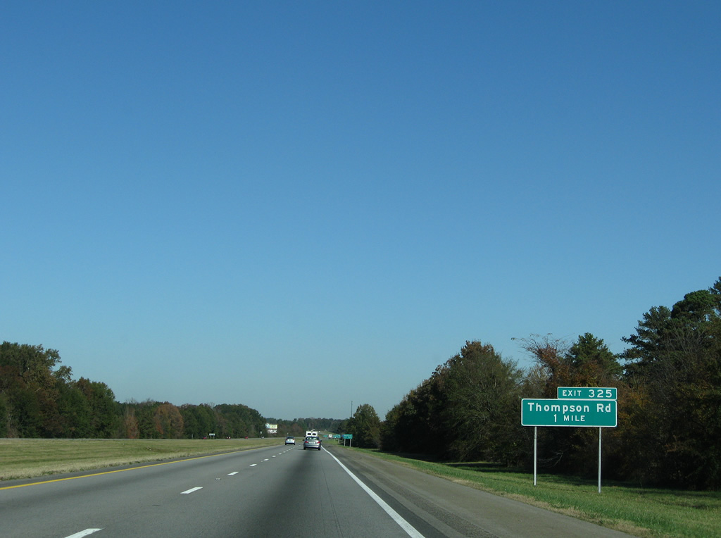
| Thompson Road links Interstate 65 with U.S. 31 south of Hartselle and Morgan County 27 (Mount Tabor Road / Mt. Zion Road) west of Cedar Cove. 11/04/09 |
|
| Several industrial parks line Thompson Road between the diamond interchange at Exit 322 and U.S. 31. 11/04/09 |
|
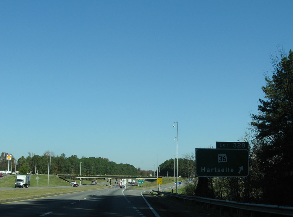
| SR 36 follows Main Street east from downtown Hartselle to meet Interstate 65 at Exit 328. 11/04/09 |
|
| Traveling 47.47 miles in length, SR 36 begins at Wren (SR 33) to the west of Hartselle and ends at U.S. 231 near Laceys Spring. 04/04/13 |
|
| Interstate 65 reaches the diamond interchange (Exit 328) with SR 36 (Main Street). SR 36 east to U.S. 231 provides a route into south Huntsville from Hartselle. 11/04/09 |
|
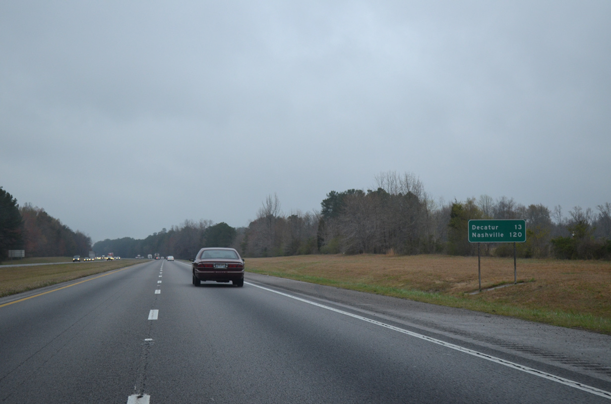
| Interstate 65 passes just to the east of Decatur over the next ten miles. The city center lies 13 miles to the northwest. 04/04/13 |
|
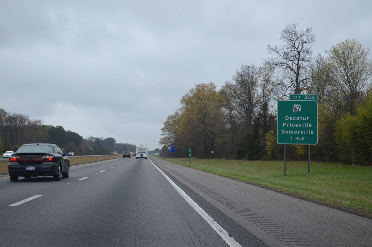
| One mile south of Priceville and Exit 334 / SR 67 (Point Mallard Parkway) on Interstate 65 north. 04/04/13 |
|
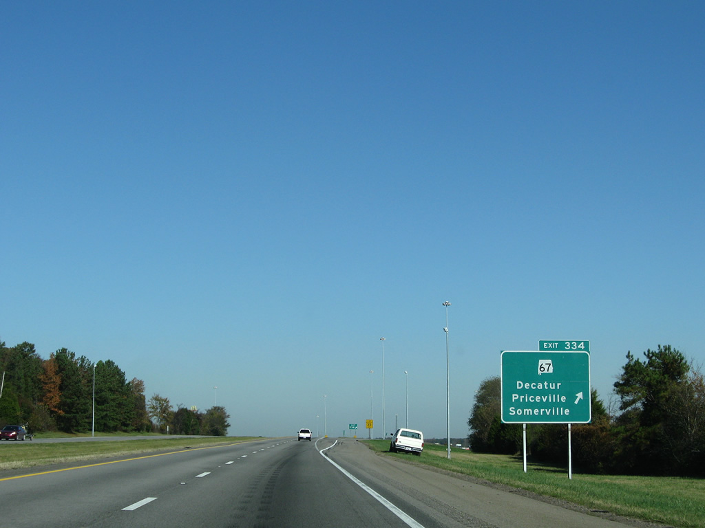
| SR 67 joins the city of Decatur with Priceville and Somerville to the southeast of Flint Creek. Exit 334 represents the first of two interchanges for the Morgan County seat from I-65. 11/04/09 |
|
| Exit 334, the last Morgan County exit, is a diamond interchange. SR 67 forms Beltine Road west from U.S. 31 (6th Avenue S), a commercialized bypass to SR 24 (Corridor V) and SR 20 around Decatur. 11/04/09 |
|
| Continuing north, Interstate 65 next meets Interstate 565, U.S. 72 Alternate, and SR 20 which provide routes to Decatur to the west and Huntsville to the east. 11/04/09 |
|
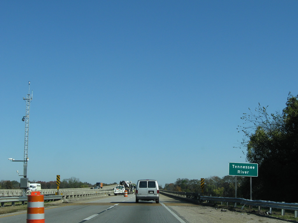
| Twin bridges carry Interstate 65 travelers across Garth Slough and the Tennessee River. The 1973-completed bridges include viaducts through Wheeler National Wildlife Refuge west of Limestone Creek. 11/04/09 |
|
| Interstate 65 returns to dry land one mile south of a directional cloverleaf interchange (Exits 340A/B) with Interstate 565 east, U.S. 72 Alternate and SR 20 (Huntsville-Decatur Highway) west. 11/04/09 |
|
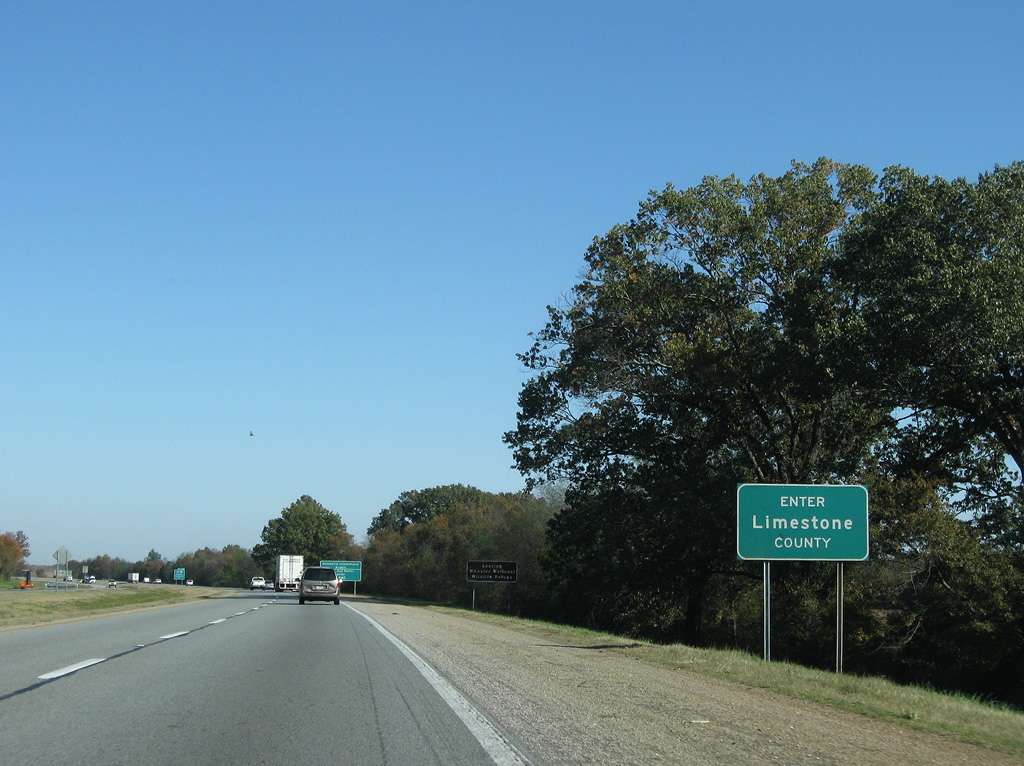
| Interstate 65 formally entered Limestone County at the mid point of the Tennessee River. The official county line sign lies much farther north as the freeway leaves Wheeler National Wildlife Refuge. 11/04/09 |
|
| I-565/U.S. 72 Alternate travel east nine miles to Huntsville International Airport (HSV), 16 miles to the U.S. Space and Rocket Center and 20 miles to Downtown Huntsville. U.S. 72 Alternate follows all of Interstate 565 to Exit 21 (U.S. 72). 11/04/09 |
|
| A two lane collector distributor roadway leaves Interstate 65 north at Exit 340 for Interstate 565, U.S. 72 Alternate and SR 20. Interstate 565 opened to traffic fully in 1991 and replaced SR 20 as the main route between Decatur and Huntsville. SR 20 was cosigned with the freeway until the late 1990s when the route was truncated to Exit 340 from the east. 11/04/09 |
|
| Exit 340A carries drivers onto I-565/U.S. 72 Alternate east to Madison and Huntsville. The freeway ends beyond the interchange with U.S. 72 at Chapman Mountain; U.S. 72 continues the divided highway east to Scottsboro. 11/04/09 |
|
| SR 20 begins and cosigns with U.S. 72 Alternate (Huntsville-Decatur Highway) 2.9 miles west to U.S. 31 (Bee Line Highway). The trio cross Wheeler Lake and the Tennessee River into downtown Decatur. A short section of old SR 20 exists to the east through Mooresville. 11/04/09 |
|
| Continuing north from Interstate 565, Interstate 65 passes under Bibb Garrett Road and over a Norfolk-Southern Railroad line between Haney Bottoms and Piney Creek. 11/04/09 |
|
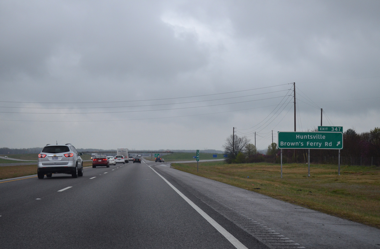
| The upcoming diamond interchange (Exit 347) joining Interstate 65 with Huntsville-Brown's Ferry Road opened in October 2009. 11/04/09 |
|
| Huntsville-Brown's Ferry Road (Limestone County 24) leads west from Exit 347 to U.S. 31 (Bee Line Highway) at Tanner Crossroads and Ripley. 11/04/09 |
|
| Northbound I-65 reaches Exit 347. Huntsville-Brown's Ferry Road runs east to Peets Corner and suburban areas of north Madison at the Madison County line. 04/04/13 |
|
| Interstate 65 next reaches the Limestone County seat of Athens in six miles while U.S. 72 provides a 23 mile return drive to Huntsville. 11/04/09 |
|
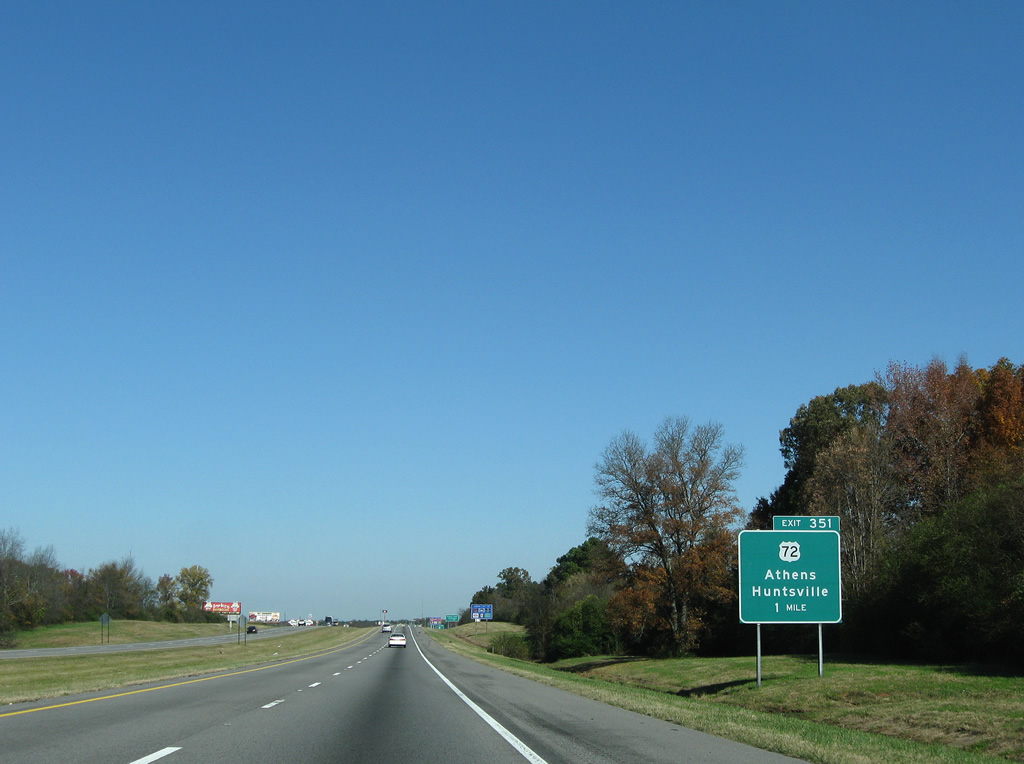
| Exit 351 joins Interstate 65 with U.S. 72 (Lee Highway) at a diamond interchange 2.8 miles southeast of the Athens city center and Athens State University. 11/04/09 |
|
| U.S. 72 and 31 skim the outskirts of Athens. U.S. 72 stays south of town on the 51 mile drive to Florence. U.S. 31 utilizes a 1950s-bypass to the east, connecting with downtown via old U.S. 31 (Clinton Street) and Hobbs Street west. 11/04/09 |
|
| Northbound Interstate 65 at the Exit 351 off-ramp to U.S. 72 (Lee Highway). U.S. 72 is mostly a four lane divided highway on the 170 mile trek across northern Alabama. 11/04/09 |
|
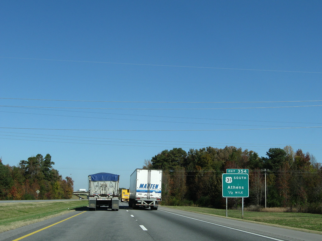
| U.S. 31 angles northeast from the 1950s-bypass of Athens to merge onto Interstate 65 at the Exit 354 trumpet interchange. 11/04/09 |
|
| One half mile south of the Exit 354 loop ramp onto U.S. 31 south back to Athens. Original U.S. 31 followed Pryor Street east from Clinton Street and downtown Athens to current SR 251. SR 251 represents the former US highway northeast to Oakdale, Sardis Springs and Bethel and northwest to Ardmore and the Tennessee state line. 11/04/09 |
|
| Interstate 65 and U.S. 31 combine northward to Exit 1 in Tennessee. The pair first meet Limestone County Route 100 (Sandlin Road) at Exit 361. 11/04/09 |
|
| Limestone County 100 follows Sandlin Road west from Exit 361 to Elkmont and Limestone County 120 (Upper Fort Hampton Road). 11/04/09 |
|
| Heading east from the diamond interchange at Exit 361, Sandlin Road becomes Thach Road en route to Thach, Oak Grove, and SR 251 (old U.S. 31). 11/04/09 |
|
| No mention of U.S. 31 on this Interstate 65 shield assembly posted after Exit 361. 11/04/09 |
|
| Ardmore represents the last Alabama city of Interstate 65 northbound. Nashville is 87 miles out. 11/04/09 |
|
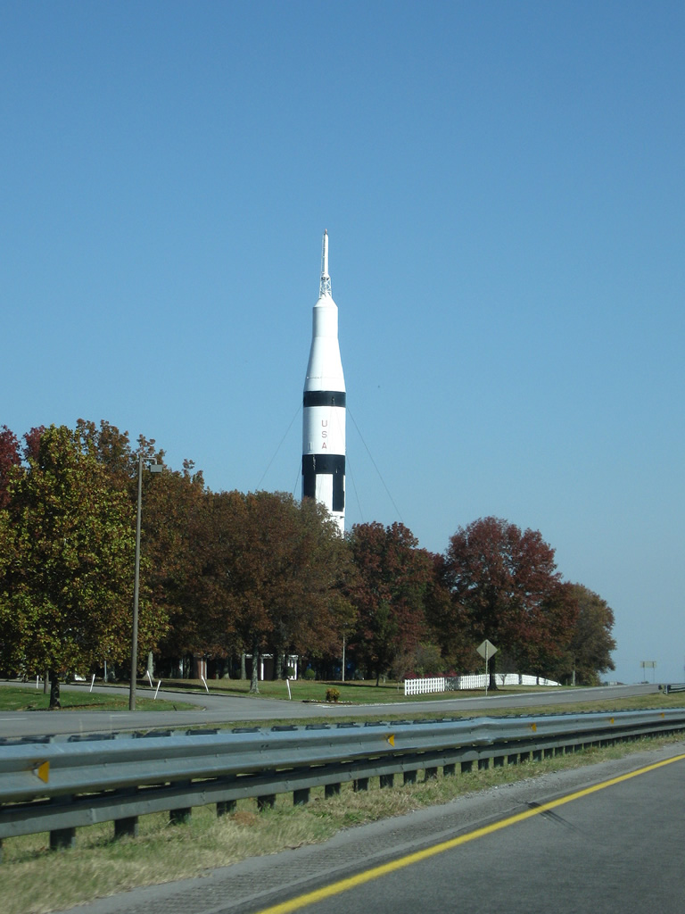
| A rocket represents Huntsville's contribution to the space program and regional economy as it welcomes southbound Interstate 65 drivers from Tennessee. 11/04/09 |
|
| SR 53 begins at a diamond interchange (Exit 365) with Upper Elkton Road and leads east into Ardmore from Interstate 65. 04/04/13 |
|
| SR 53 provides a direct route to Huntsville from Ardmore at the state line. SR 53 travels the length of the state south along a 368 mile course to Florida at Grangeburg. 04/04/13 |
|
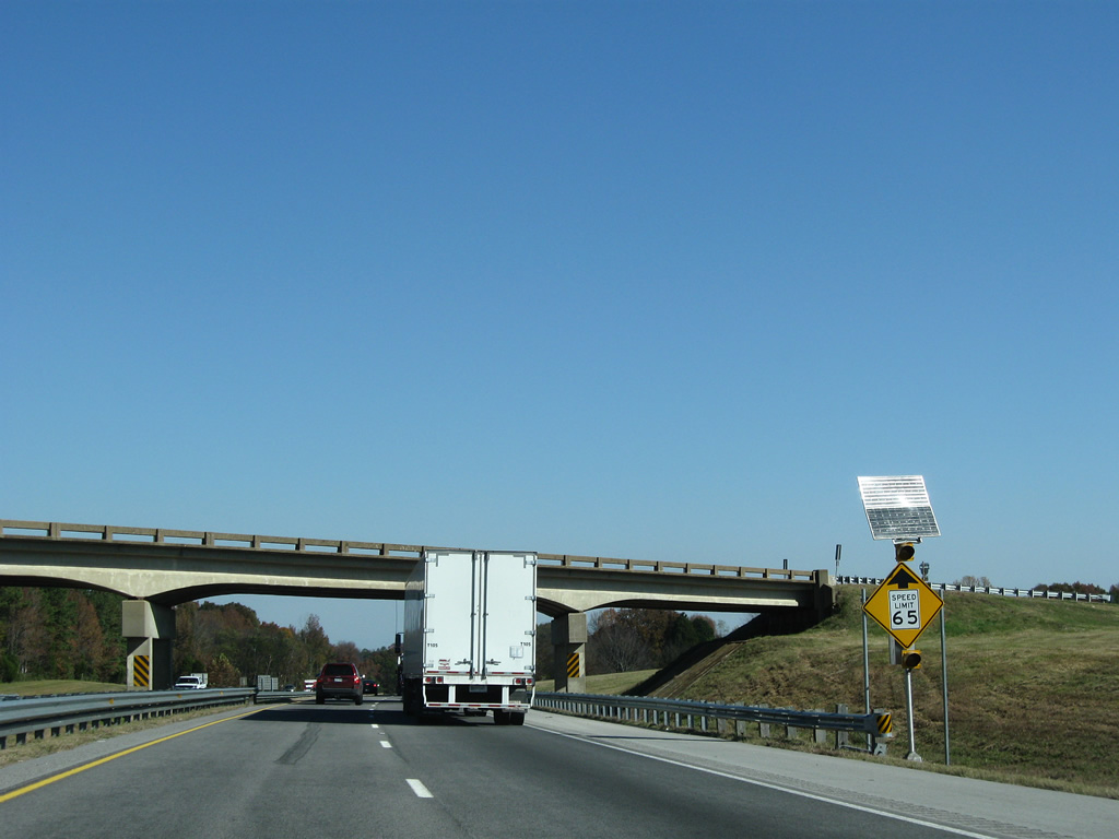
| Speed limits lower from 70 to 65 mph leading into the Volunteer State. 11/04/09 |
|
| Another confirming assembly for I-65 north omits U.S. 31 on the approach to the state line. 11/04/09 |
|
| I-65/U.S. 31 travel through Blowing Spring Hollow into Giles County, Tennessee. Elkton is the next control point for the U.S. 31 (Elkton Pike) split at Exit 1. 04/04/13 |
|
| 367.00 miles after beginning, Interstate 65 enters the state of Tennessee. 06/10/17 |
Page Updated 02-22-2016.

 North
North


 North
North