|
| Interstate 69/SR 57 shields north of Exit 21. These were the first reassurance shields for I-69 north posted in southern Indiana, added when the first two miles of interstate opened in 2009. 05/30/16 |
|
| The forthcoming diamond interchange connects I-69 with SR 68 west to Haubstadt and east to Lynnville. Prior to the extension of Interstate 69 in November 2012, SR 57 north was the primary corridor to Petersburg. 05/30/16 |
|
| SR 57 parts was with I-69 north for SR 68 east at Exit 22. SR 57 originated at U.S. 41 in Evansville. The state road was either replaced or built upon with both I-164 and I-69 from north of Daylight to Wheatonville. Paralleling I-64 along a 53.9 mile route, SR 68 ventures west to New Harmony and east to Dale overall. 05/30/16 |
|
| SR 57 travels 25 miles northeast to Petersburg and 80.1 miles to U.S. 231 near Worthington. Haubstadt is 6.5 miles to the west along SR 68. Lynnville is nine miles to the east in northern Warrick County. 05/30/16 |
|
| Interstate 69 north of Exit 22 opened to traffic on November 21, 2012. The freeway continues 24 miles to Petersburg and 40 miles to Washington. As of October 2018, I-69 extends 113 miles to Martinsville. Indianapolis is less than a 2.5 hour drive from here via I-69 and the SR 37 expressway. 05/30/16 |
|
| Spanning Pigeon Creek, Section 3 of Interstate 69 advances northward across a bucolic landscape to U.S. 231. 11/21/12 |
|
| Approaching the diamond interchange (Exit 27) with SR 168. Unlike most interstates in Indiana, this stretch of I-69 utilizes two mile advance signs for each exit. 05/30/16 |
|
| Indiana State Road 168 goes for 17 miles across southern Gibson County from SR 65 in Owensville to SR 57 in Mackey. 05/30/16 |
|
| The half mile sign for Exit 27 is a replacement of the assembly posted in 2012. A common feature for guide signs along I-69 in southwestern Indiana are placards indicating the distance to the succeeding exit. This signing aspect is only used on one other highway in the state, the Indiana Toll Road. 05/30/16 |
|
| Exit 27 departs I-69 north for SR 168. Mackey lies 2.25 miles east at the crossroads with SR 57 while Fort Branch is 7.3 miles to the west at the junction with U.S. 41. 05/30/16 |
|
| I-69 proceeds north from SR 168, 19 miles to Petersburg, 35 miles to Washington and 60 miles to U.S. 231. 05/30/16 |
|
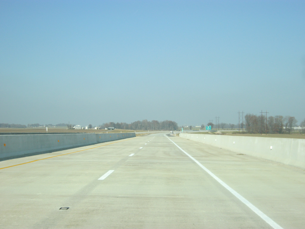
| Interstate 69 north from Exit 27 to Exit 33 was generally paved with asphalt. The terrain in eastern Gibson County consists of very gentle rolling hills and fields, typical for Southwest Indiana. 11/21/12, 05/30/16 |
|
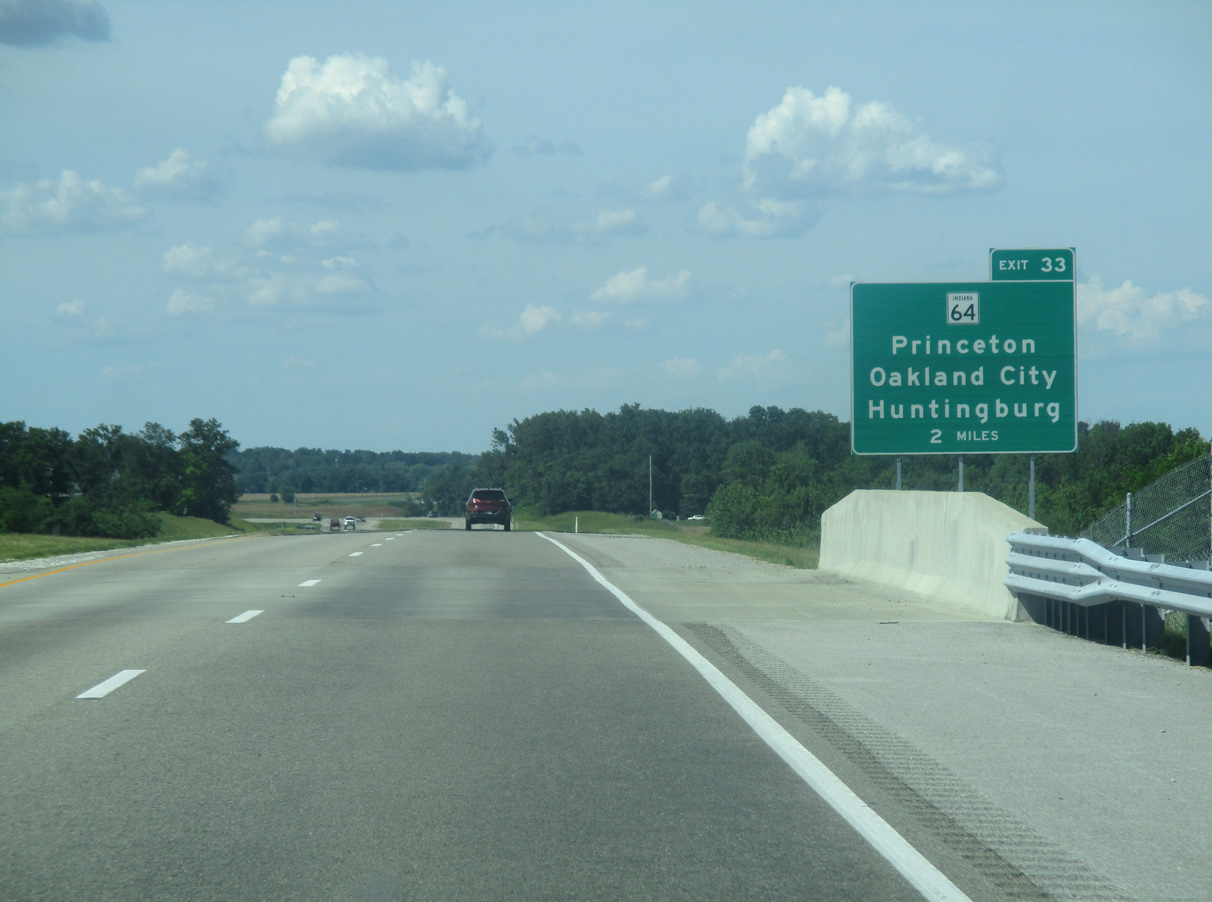
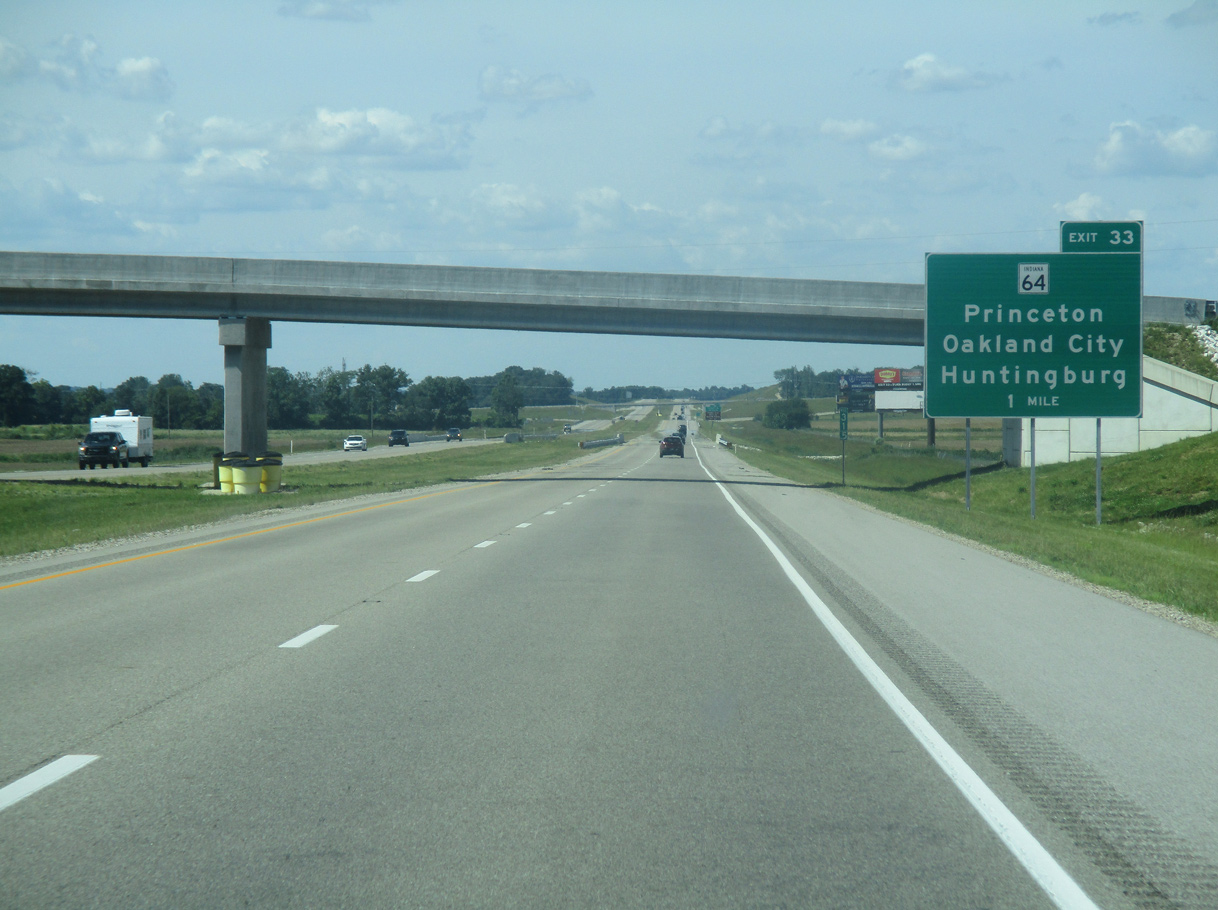
| Interstate 69 north on the two mile approach to Exit 33 for SR 64. Guide signs for Exit 33 were changed since the 2012 opening of Section 3 to include the community of Oakland City. 05/30/16 |
|
| I-69 passes underneath County Road 350 S, one mile ahead of Exit 33. SR 64 is a 107.5 mile route mirroring the I-64 corridor from the Illinois state line at East Mt. Carmel eastward through Princeton, Oakland City, Huntingburg, Birdseye and Marengo. SR 64 concludes at I-64/SR 62 in Georgetown. 05/30/16 |
|
| Oakland City University, a private college based in nearby Oakland City, is a mile to the east via SR 64. The Patoka River National Wildlife Refuge can be reached via SR 64 east to SR 57 north. 05/30/16 |
|
| Interstate 69 reaches the diamond interchange (Exit 33) with SR 64. Oakland City lies 2.5 miles to the east beyond parallel SR 57. 05/30/16 |
|
| The Gibson County seat of Princeton, where SR 64 meets U.S. 41, is 8.7 miles to the west. The Dubois County city of Huntingburg lies 25 miles to the east. 11/21/12 |
|
| Confirming marker posted at the Norfolk Southern Railroad underpass west of Oakland City. The freeway continues 16 miles northward to Petersburg, 50 miles to Washington and 54 miles to U.S. 231 near Crane. 05/30/16 |
|
| I-69 curves northeast across the East Fork of Keg Creek as it bypasses Oakland City to the west. 11/21/12 |
|
| Progressing northeast through Columbia Township, I-69 passes below County Road 50 N. 05/30/16 |
|
| Crossing Hurricane Creek, Interstate 69 advances toward a tree line indicative of areas within Patoka River National Wildlife Refuge. 05/30/16 |
|
| Interstate 69 crosses the Patoka River and Pike County line through Patoka River National Wildlife Refuge. 05/30/16 |
|
| The 4,400-foot long bridge spanning the Patoka River and its floodplain was designed to have as little impact as possible to the environmentally sensitive area. 05/30/16 |
|
| North from the Patoka River, Interstate 69 crosses the western part of Pike County through Logan township. 05/30/16 |
|
| Interstate 69 converges with SR 57 again north of Glezen. The freeway spans the state road, Flat Creek and the Indiana Southern Railroad here. 11/21/12 |
|
| Located two miles ahead, Exit 46 for SR 56/61 is the only interchange along I-69 within Pike County. The freeway median expands as Prides Creek. 05/30/16 |
|
| Forthcoming SR 56 measures 194 miles from a western endpoint at U.S. 41 near Hazelton, east through Petersburg, Jasper, Paoli, Salem, Scottsburg, Madison, Vevey and U.S. 50 in Aurora. 05/30/16 |
|
| SR 61 constitutes a 64 mile long route from SR 66 near Newburgh north through Boonville, Lynnville, Winslow and Petersburg to Vincennes. 05/30/16 |
|
| Entering the diamond interchange (Exit 46) with SR 56/61 on Interstate 69 northbound. SR 56/61 combine northward 1.5 miles to Downtown Petersburg and the Pike County Courthouse. 05/30/16 |
|
| The Dubois County seat of Jasper is 21 miles to the east on SR 56. The Pike County community of Winslow lies seven miles to the south along SR 61. 11/21/12 |
|
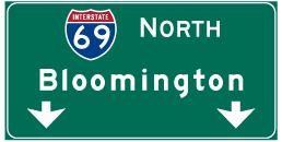
| Interstate 69 advances north from the Petersburg area 16 miles to Washington and 69 miles to Bloomington. 05/30/16 |
|
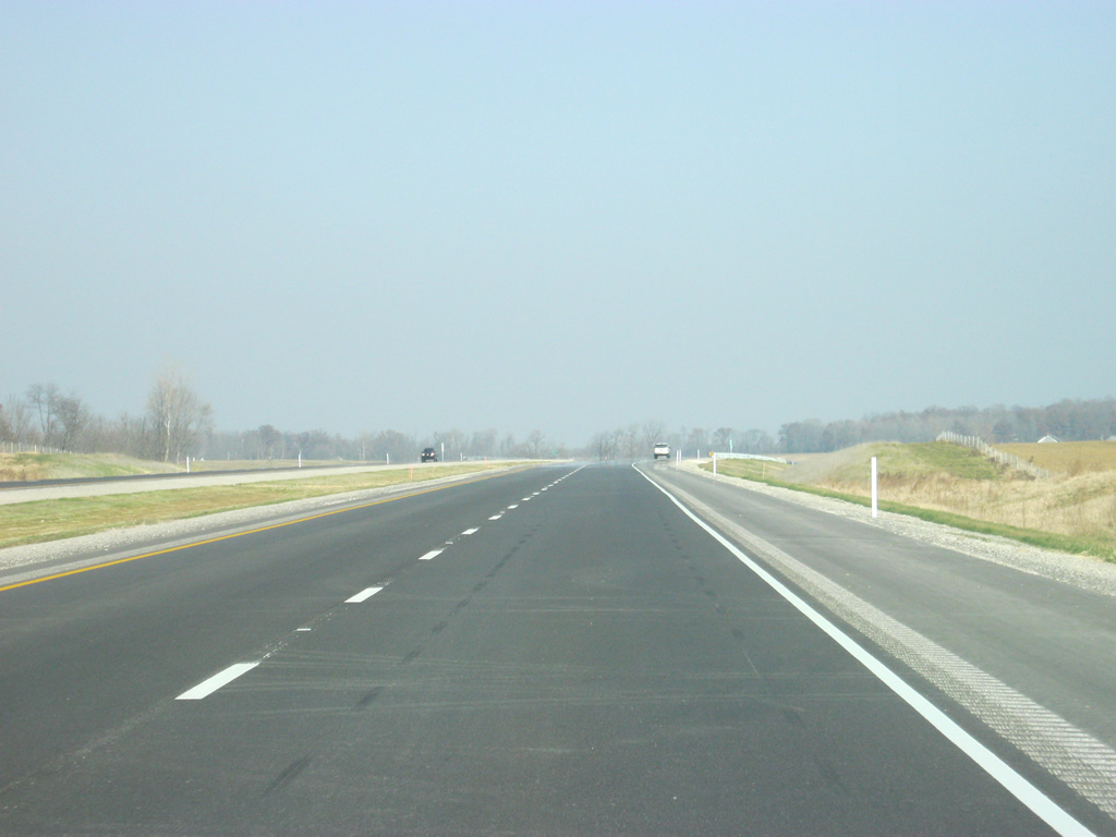
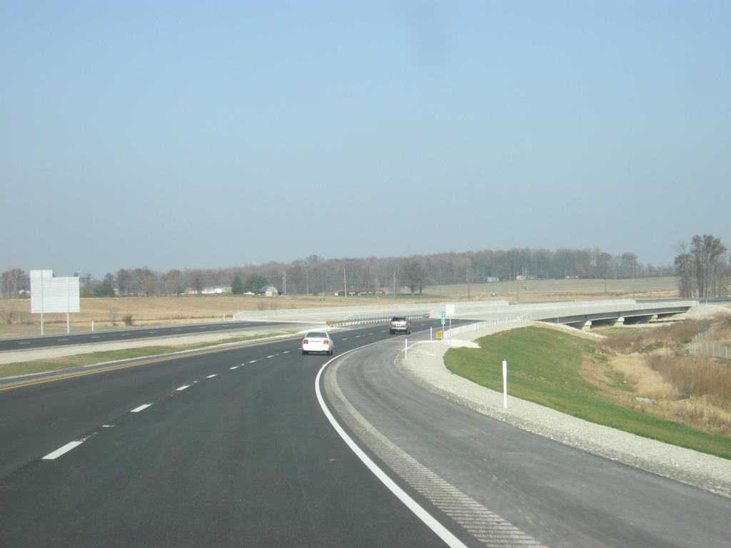
| Curving northeast past the unincorporated community of Alford, I-69 transitions from asphalt to concrete. Traveling through coal country, the freeway was built in an effort to shift coal trucks away from SR 57 and Petersburg. There are two coal-burning power plants nearby. 11/21/12 |
|
| SR 356, a nine mile long highway that begins in Petersburg at SR 57 and ends at SR 257 near Otwell, passes over Interstate 69. This is one of three locations where a state road does not have an interchange with I-69. 05/30/16 |
|
| An interchange was planned along Interstate 69 at County Road 600 N at this location. Eliminated as a part of a cost-saving measure from INDOT, the exchange may be added to the system at a later date. 05/30/16 |
|
| The freeway crosses Mud Creek north of County Road 650 N. A mixture of agricultural fields and timberland line Interstate 69 in this part of Pike County. 11/21/12 |
|
| Interstate 69 curves northward across a flood relief bridge for the White River East Fork east of Rogers. 05/30/16 |
|
| Interstate 69 north crosses the Private Richard Taylor Memorial Bridge over the East Fork of the White River and enters Daviess County. 11/21/12, 05/30/16 |
Page Updated 05-09-2020.