|
| Business Loop I-70 takes a 2.81 mile route north along 5th Street to First Capitol Drive (Missouri 94) west back to I-70 at Exit 228. 10/16/04 |
|
| Exit 229A loops away from Interstate 70 west onto 5th Street south to River Road. River Road parallels the Missouri southwest o Arena Parkway and its interchange with Missouri 364. 10/16/04 |
|
| A single point urban interchange (SPUI) links Interstate 70 with Missouri 94 (First Capitol Drive) in a half mile. A seven year project upgraded the previous diamond interchange with MO 94 to a SPUI by 2008. 10/16/04 |
|
| Westbound at the two lane off-ramp (Exit 228) for Business Loop I-70 east and MO 94 (First Capitol Drive). MO 94 curves east by Lindenwood University to Downtown, where it turns north along a dog-leg route using 5th Street, Clark Street and 2nd Street to eventually reach MO 370 at the west end of the Discovery Bridge. West from St. Charles, the state highway commingles with the MO 364 freeway through south St. Peters en route to the city of Weldon Spring. 10/16/04 |
|
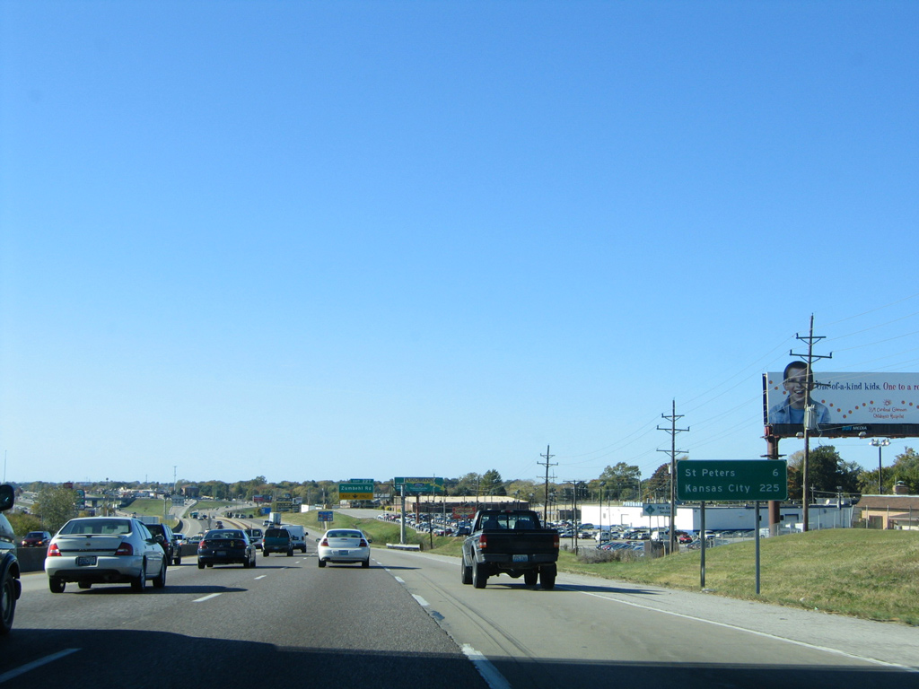
| The distance to Kansas City (225 miles) appears for the first time to westbound motorists along Interstate 70 at the Hawks Nest Drive overpass. 10/16/04 |
|
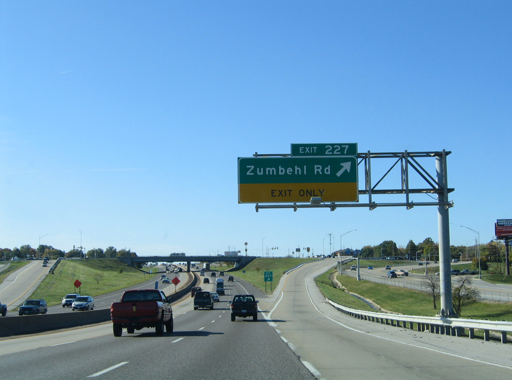
| A diamond interchange (Exit 227) anchors the commercialized area surrounding Zumbehl Road just ahead. 10/16/04 |
|
| Zumbehl Road constitutes an arterial southward from Exit 227 to Missouri 94 at Friedens Road. North from adjacent West Clay Street, the road becomes more residential to a 100 foot drop in elevation to Elm Point Road. 10/16/04 |
|
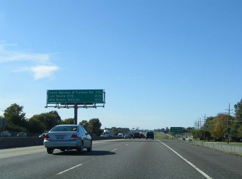
| Harry S. Truman Road south and Cave Springs Road north come together at the St. Peters and St. Charles city line in 1.25 miles. The Missouri 370 adds traffic to I-70 west in 2.5 miles. 10/16/04 |
|
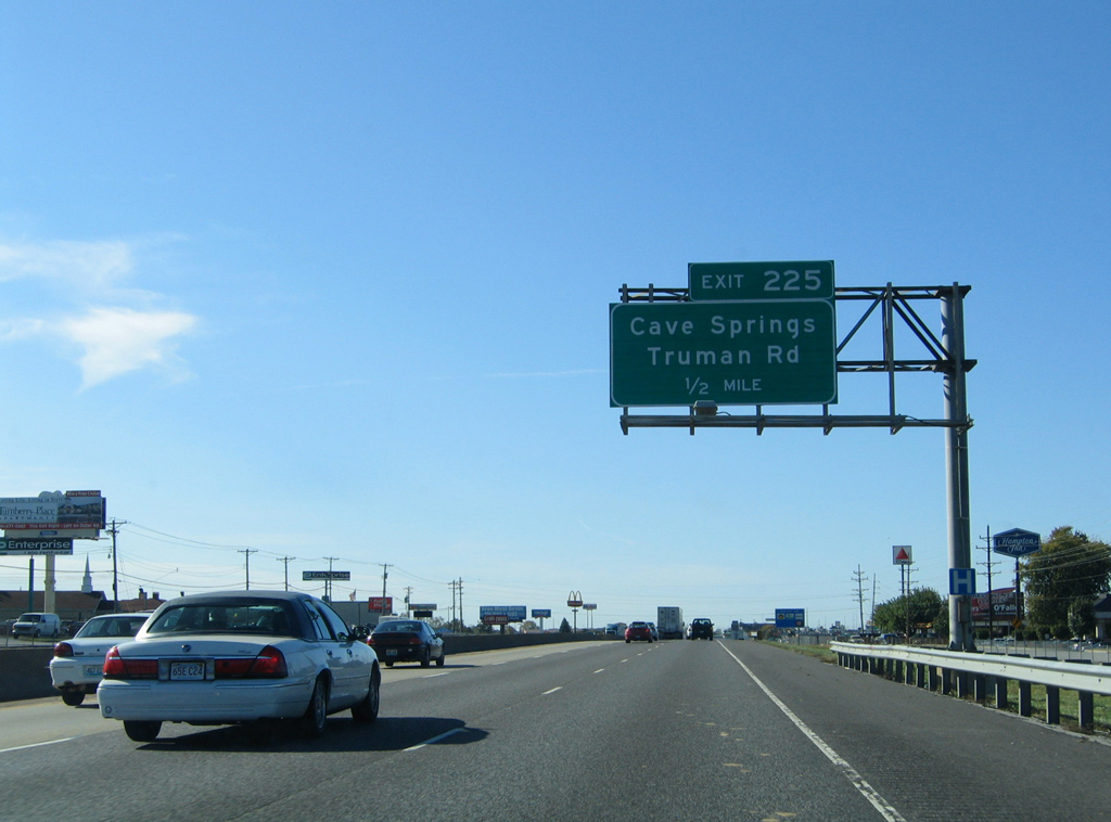
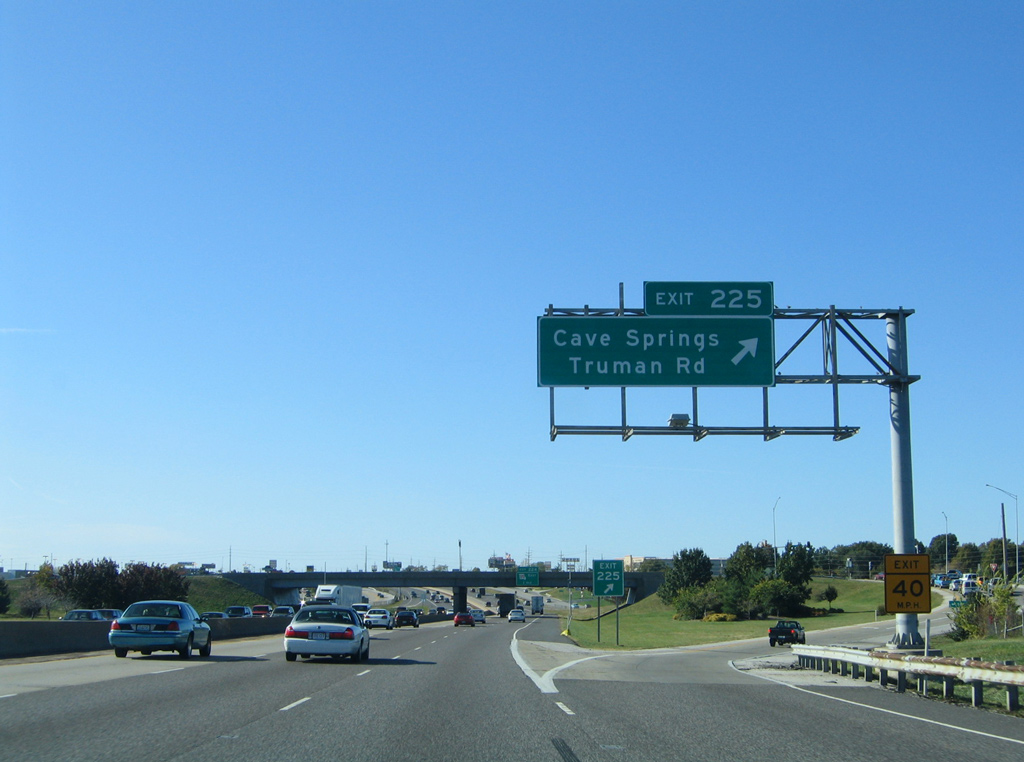
| A commercialized diamond interchange (Exit 225) joins Interstate 70 with Cave Springs and Harry S. Truman Roads in one mile. 10/16/04 |
|
| Harry S. Truman Road winds northward from Exit 225 to Exit 2 of Missouri 370 and 370 Lakeside Park, a 300 acre park surrounding a lake along Dardenne Creek. 10/16/04 |
|
| Exit 225 leaves Interstate 70 west. Cave Springs Road constitutes a short connector south to adjacent Mexico Road and Muegge Road southeast to the MO 364 freeway at MO 94. 10/16/04 |
|
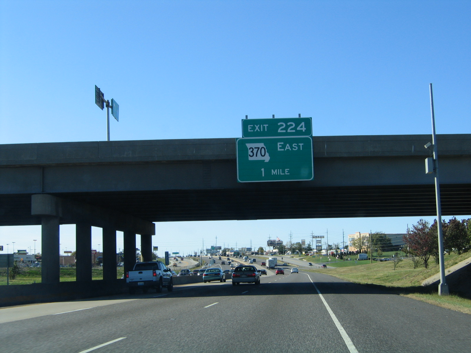
| Drivers along I-70 west next meet the directional-T interchange (Exit 224) with the Missouri 370 freeway leading east back to St. Charles and Bridgeton. 10/16/04 |
|
| Missouri 370 measures 12.67 miles along a bypass freeway of St. Charles for interests east to Interstate 270. The freeway opened in stages between 1988 and November 1996. 10/16/04 |
|
| Replaced distance sign posted listing the distances to the next three St. Peters exits along Interstate 70 west. The new sign uses shields for both MO 370 and MO 79. 10/16/04 |
|
| Westbound at the off-ramp (Exit 224) for Missouri 370 east on I-70 west. Missouri 370 varies between six and eight lanes on the eight mile drive to the Discovery Bridge across the Missouri River. 10/16/04 |
|
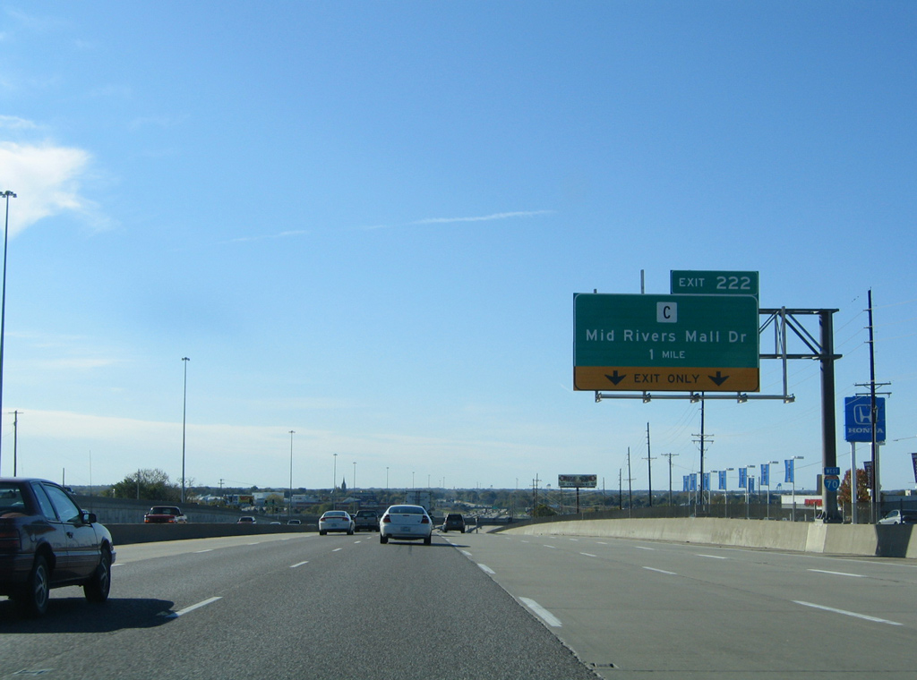
| The advent of traffic from MO 370 expands Interstate 70 west to six lanes to Exit 222 with Mid Rivers Mall Drive (formerly Highway C). 10/16/04 |
|
| T.R. Hughes Boulevard rounds out the St. Peters exits at the O'Fallon city line in 3.5 miles. 05/03/12 |
|
| Mid Rivers Mall Drive ends a short distance to the north of Exit 222 at Salt River Road, east of Highway C north to the Mississippi River. Southward the arterial serves adjacent Mid Rivers Mall en route to Highway N at Cottleville. 10/16/04 |
|
| The six-ramp parclo interchange at Mid Rivers Mall Drive was reconstructed into a diverging diamond interchange (DDI). $13 million in work commenced on March 11, 2013 and was completed with a ribbon cutting ceremony held on November 8, 2013.1 05/03/12 |
|
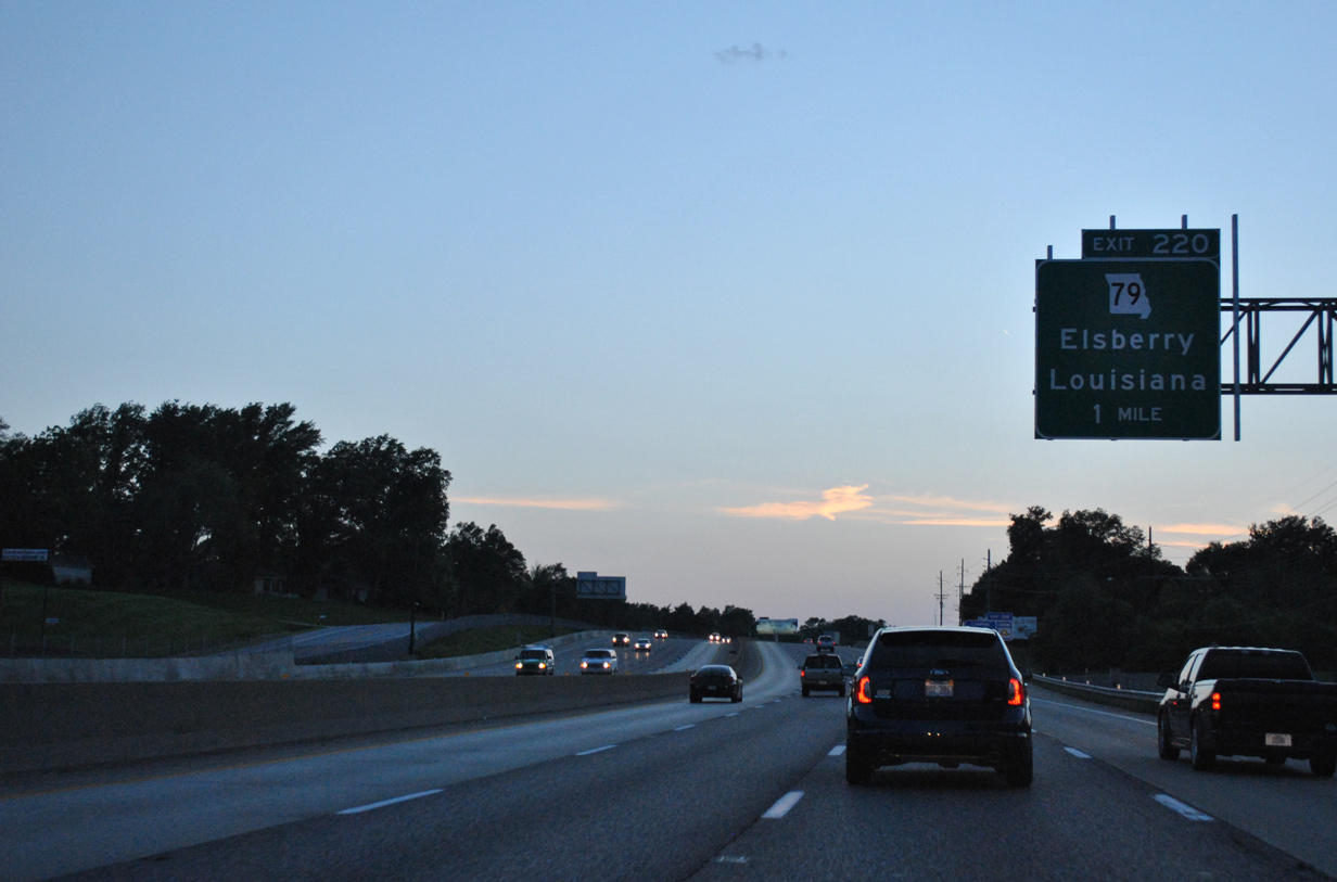
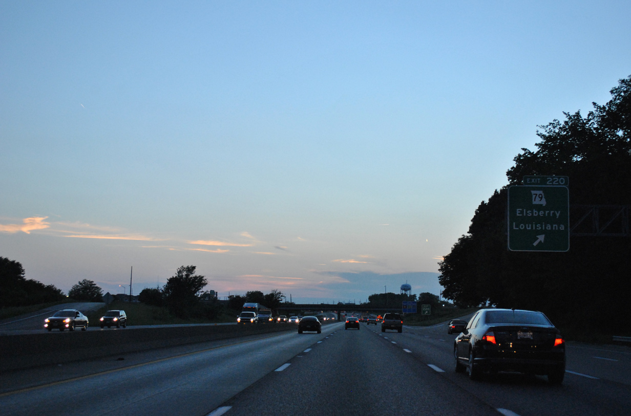
| Missouri 79 commences a 87.94 mile route north to Hannibal at the parclo interchange (Exit 220) between I-70 and Salt Lick Road. Salt Lick Road extends south from Exit 220 to Mexico and Birdie Hills Road in St. Peters. 05/03/12 |
|
| Exit 220 is the first of five interchanges serving the city of O'Fallon along Interstate 70 west. 05/03/12 |
|
| Missouri 79 initially travels an expressway north between industrial park areas to Belleau Creek. The state highway becomes the scenic Little Dixie Highway (Great River Road) along the limestone bluffs above the Mississippi River to Winfield, Elsberry and Louisiana. 05/03/12 |
|
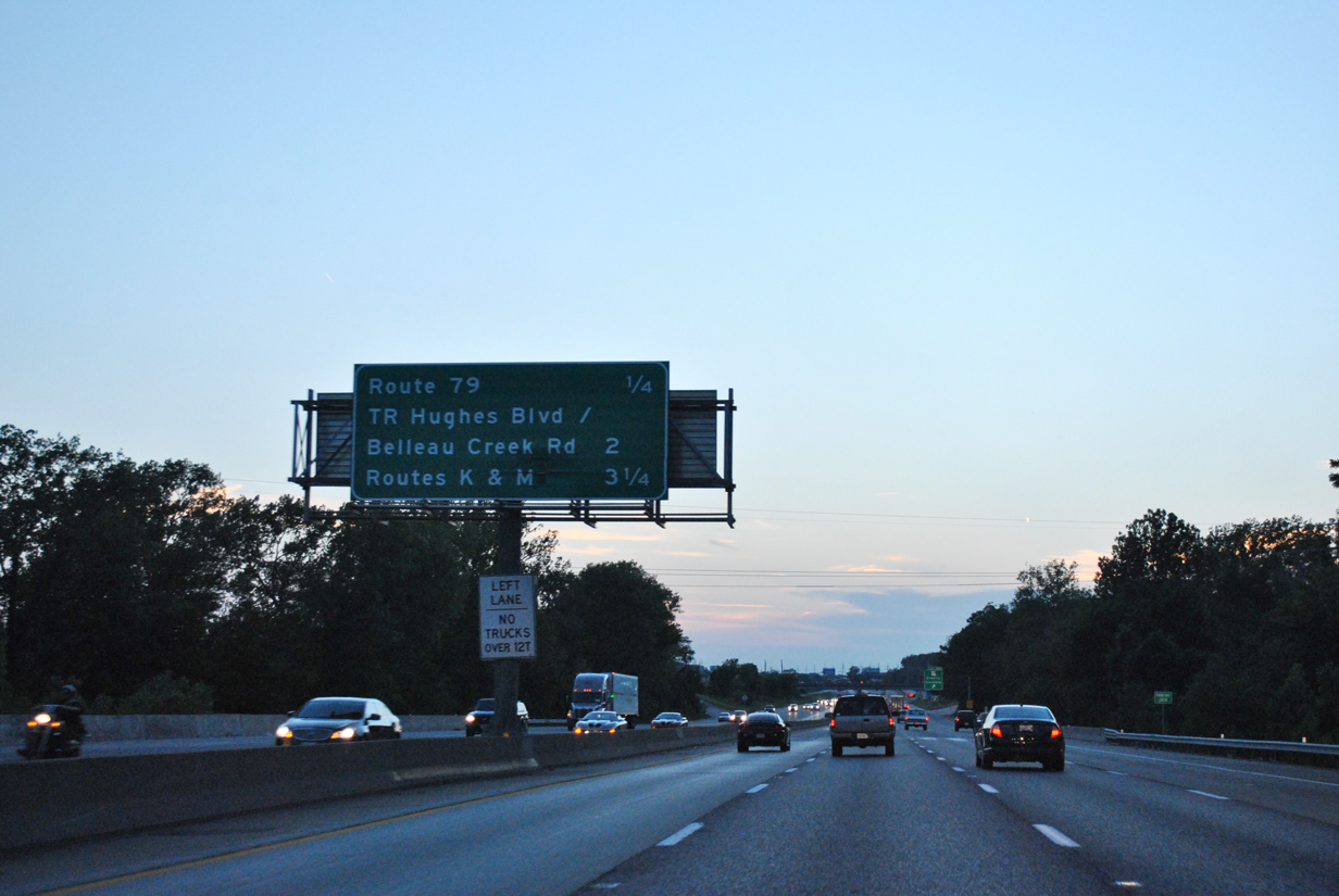
| Terra Lane and Veterans Memorial Parkway parallel Interstate 70 as a frontage road pair to T.R. Hughes Road north and Belleau Creek Road south.
The Exit Only placard here was removed by 2013, reflecting expansion of I-70 west to four through lanes. 05/03/12 |
|
| One half mile out from the SPUI with T.R. Hughes and Belleau Creek Roads in O'Fallon. 05/03/12 |
|
| T.R. Hughes Road forms an L-shaped route north to the Ozzie Smith Sports Complex and east to Missouri 79 from Exit 219. The five lane arterial opened in October 2004.
Belleau Creek Road continues the road south to become Knaust Road through St. Peters after Mexico Road. 05/03/12 |
|
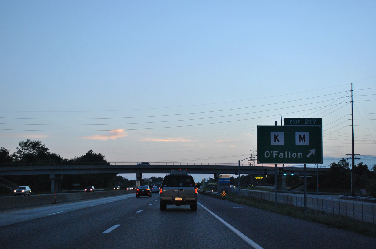
| This ground level sign was replaced by an overhead as I-70 sees a lane drop at the diamond interchange (Exit 217) with Highway K south and Main Street (former Highway M) north. Highway K constitutes a 6.56 mile arterial route south to I-64/U.S. 40-61 in south O'Fallon. Highway M retains just 1.00 miles as a connector between Highway P and Main Street to MO 79. 05/03/12 |
|
| Six lanes of Interstate 70 parallel Terra Lane to the south and Veterans Memorial Parkway to the north in this scene one mile east of Exit 216 with Bryan Road. 05/03/12 |
|
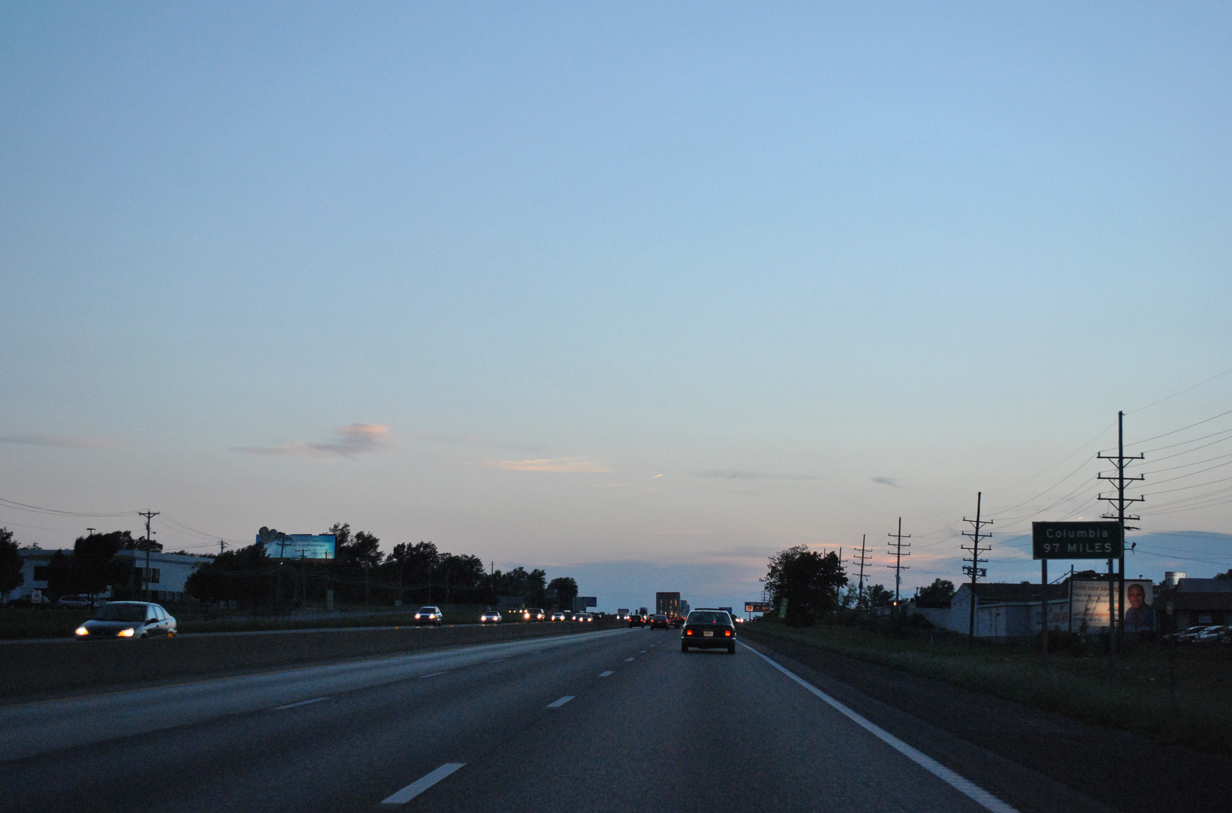
| A small distance sign references Columbia (97 miles), the largest city along Interstate 70 between the St. Louis area and Kansas City. 05/03/12 |
|
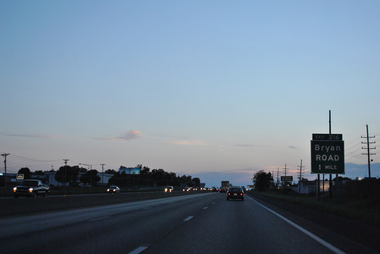
| Bryan Road stems south from adjacent Terra Lane by a number of subdivisions in west O'Fallon to the 2014-opened Missouri 364 freeway at Exit 2. 05/03/12 |
|
| Westbound motorists along Interstate 70 enter the city of Lake St. Louis one mile ahead of the diamond interchange (Exit 214) with Lake St. Louis Boulevard. 10/16/04 |
|
| Lake St. Louis Boulevard winds south from Guthrie Road and Exit 214 to encircle Lake Saint Louis south and west to I-64/U.S. 40-61 at Exit 2. 05/03/12 |
|
| Interstate 70 straddles northern reaches of Lake St. Louis alongside Veterans Memorial Parkway and Pitman Street (old Highway AA). 05/04/12 |
|
| I-64/U.S. 40-61 converge with Interstate 70 in two miles at Wentzville and Exits 210B/A. I-64 was extended west to I-70 on October 14, 2009. 05/04/12 |
|
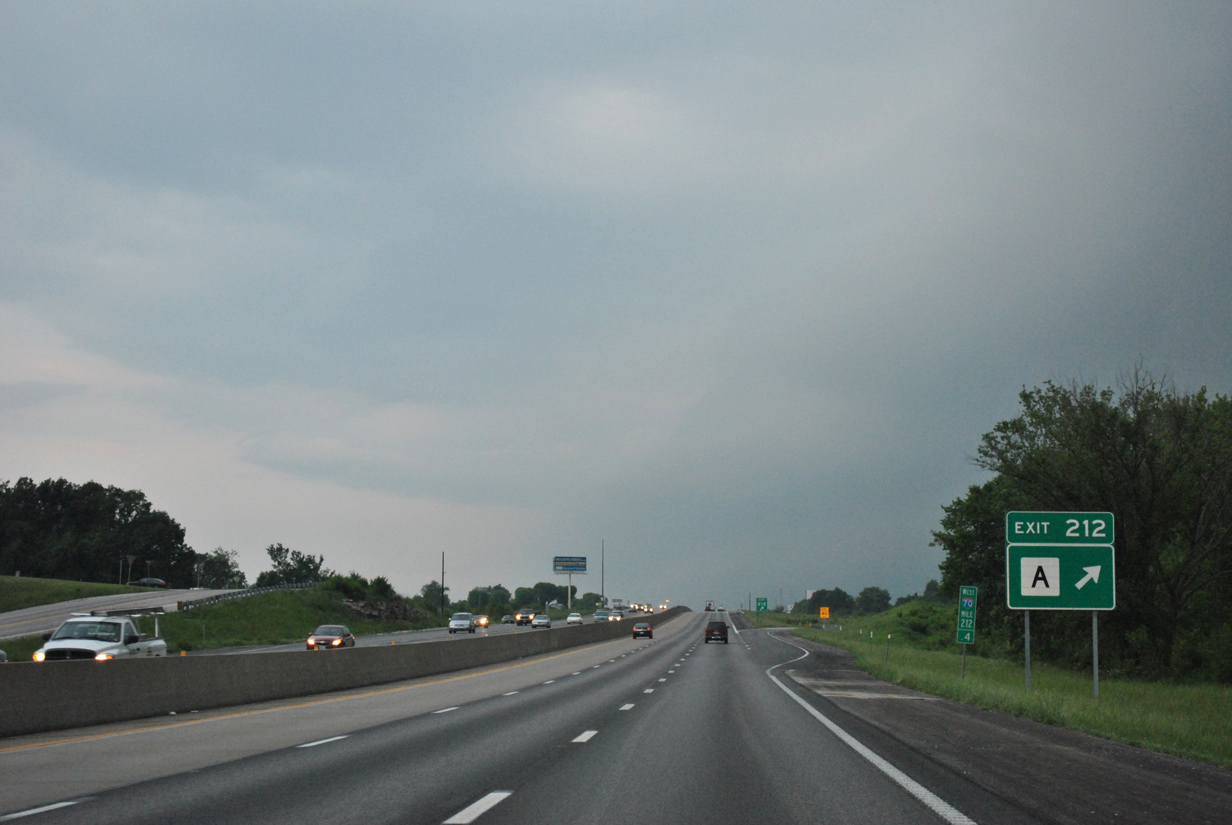
| Highway A arcs northwest 3.37 miles from forthcoming Exit 212 to U.S. 61 in Wentzville. 05/04/12 |
|
| Entering the diamond interchange (Exit 212) with Highway A west to the GM Wentzville Assembly Plant and Freymuth Road south to Founders Park in Lake St. Louis. 05/04/12 |
|
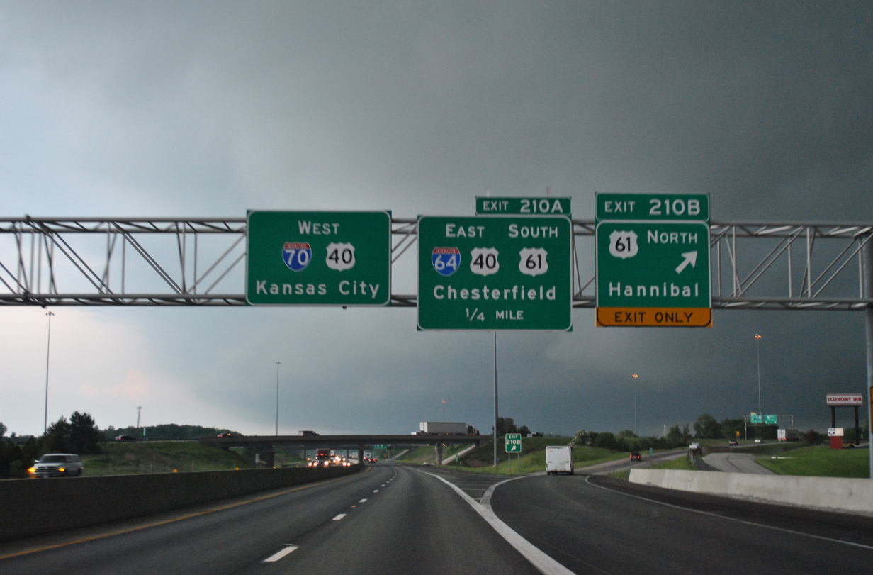
| Interstate 64 concludes a 963.52 mile route from Hampton Roads, Virginia at Interstate 70 (Exit 210) in Wentzville. The freeway doubles as U.S. 40 to East St. Louis and U.S. 61 south to Frontenac. 05/04/12 |
|
| U.S. 61 extends north from the ending Interstate 64 as an expressway bypassing central Wentzville to the Lincoln County seat of Troy and Pike County seat of Bowling Green. The route north to Clark County is part of the Avenue of the Saints Corridor running north to Saint Paul, Minnesota. 05/04/12 |
|
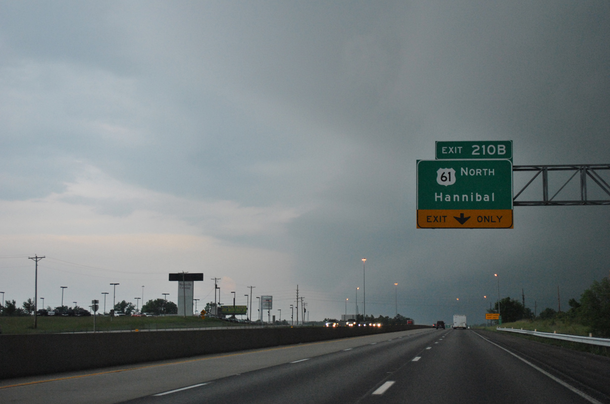
| Exit 210B leaves Interstate 70 west for U.S. 61 (Avenue of the Saints) north. U.S. 61 reaches Hannibal in 76 miles.
A loop ramp follows in one quarter mile for I-64-U.S. 40/61 east back into Lake St. Louis, Dardenne Prairie and Weldon Spring. 05/04/12 |
|
| Westbound Interstate 70 at Exit 210A for Interstate 64 east. I-64 directly replaced U.S. 40 (Daniel Boone Expressway) from the state line west to I-270 in 1987 and in stages from 2003 to 2009 through Chesterfield and St. Charles County. 05/04/12 |
|
| U.S. 40 combines with Interstate 70 west for 97 miles to Exit 121, west of Columbia. 04/13/13 |
|
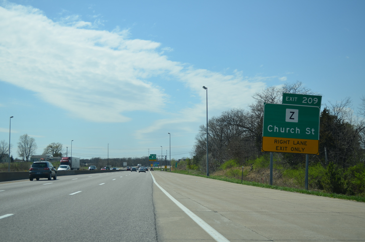
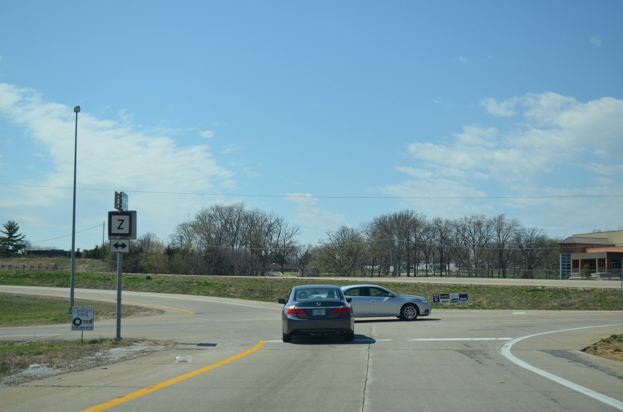
| Highway Z extends south from the diamond interchange with Church Street to growing suburban areas of Wentzville to Highway N. 04/13/13 |
|
| Church Street connects Exit 209 with Main street and Downtown Wentzville. 04/13/13 |
|
| Highway Z runs 7.32 miles south from Exit 209 to Highway D at New Melle. The arrow pointing to Church Street at the ramp end is erroneous. 04/13/13 |
|
| I-70/U.S. 40 curves northwest to pass under a Norfolk Western Railroad line to next meet Wentzville Parkway north at a diamond interchange (Exit 208). 10/16/04 |
|
| Wentzville Parkway hooks east 2.62 miles to circle around Wentzville from Exit 208 to U.S. 61 at Highway A. The north-south portion of the parkway consists of a five lane arterial lined with big box stores. 10/16/04 |
Page Updated 12-12-2014.

 West
West


 West
West