|
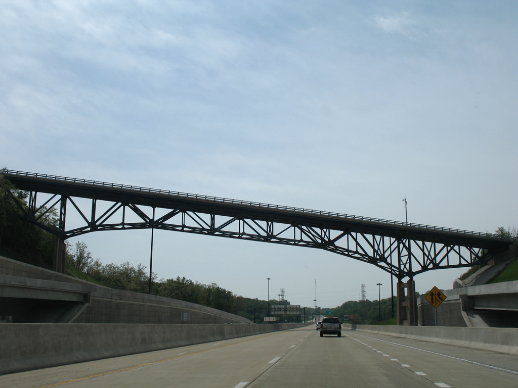
| East from I-474 and IL 6 north, Interstate 74 traverses a valley across both Big Hollow Creek and a Union Pacific Railroad to suburban areas in west Peoria. This stretch of freeway was completed in 1965. A $3.2 million project underway between March and November 2012 replaced the overpasses above the UP Railroad.1 05/24/18 |
|
| An interchange sequence sign outlines the first of seven exits for the city of Peoria on I-74 east. 05/24/18 |
|
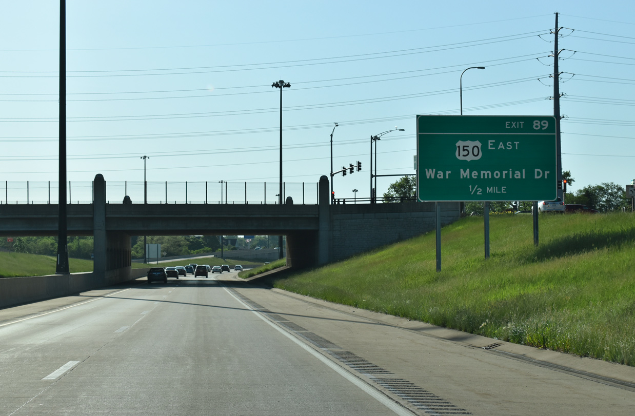
| U.S. 150 (War Memorial Drive) heads southeast from IL 6 at Orange Prairie and travels alongside Interstate 74 at Golden Acres. A trumpet interchange and access road links the two routes at Exit 89. 05/24/18 |
|
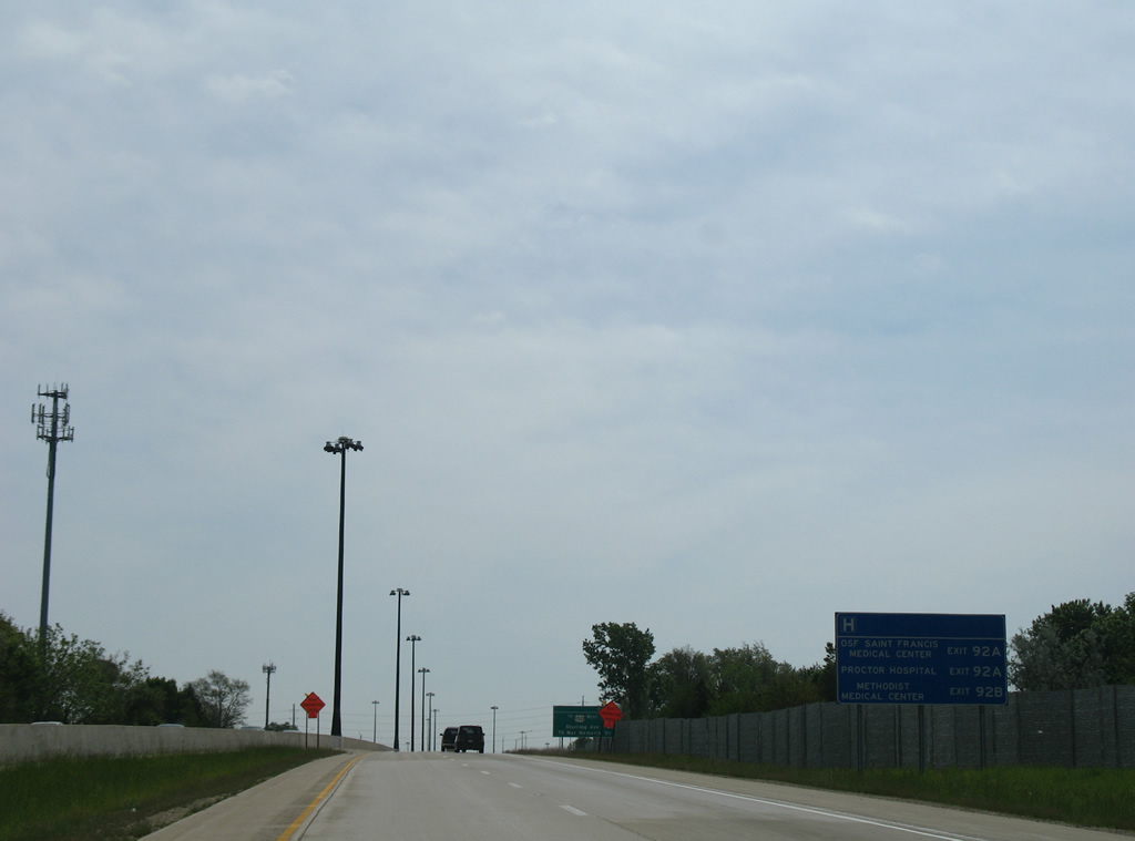
| A distance sign lists the exits for three Peoria area hospitals, all located off of Exit 92. 05/24/08 |
|
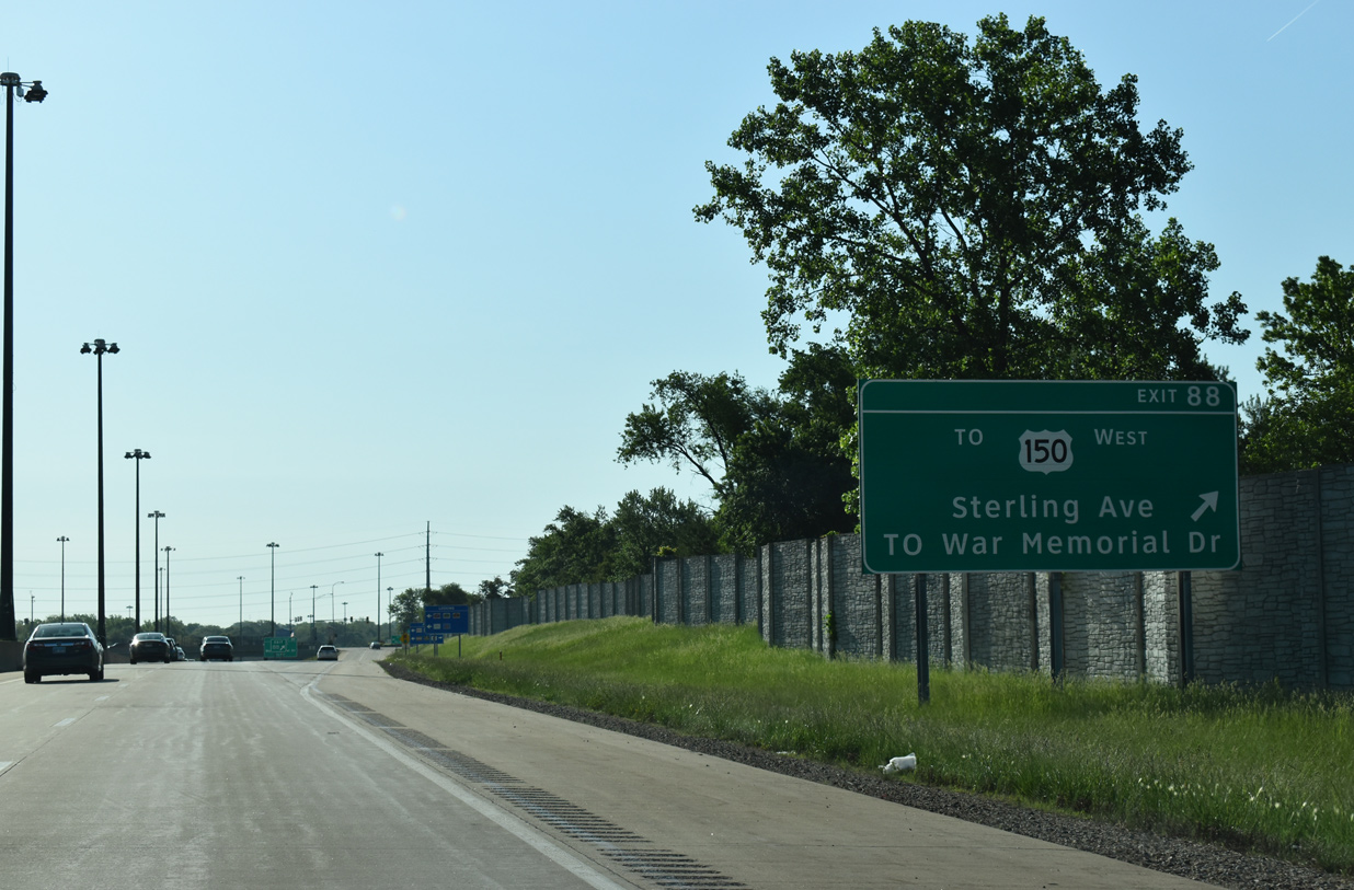
| Glen Avenue leads west from Peoria Heights to become Sterling Avenue south at U.S. 150 (War Memorial Drive). The arterial passes by Northwoods Mall to meet Interstate 74 en route to El Vista and Farmington Road (IL 8) at West Peoria. 05/24/18 |
|
| Exit 89 follows in one half mile to U.S. 150 (War Memorial Drive). 05/24/18 |
|
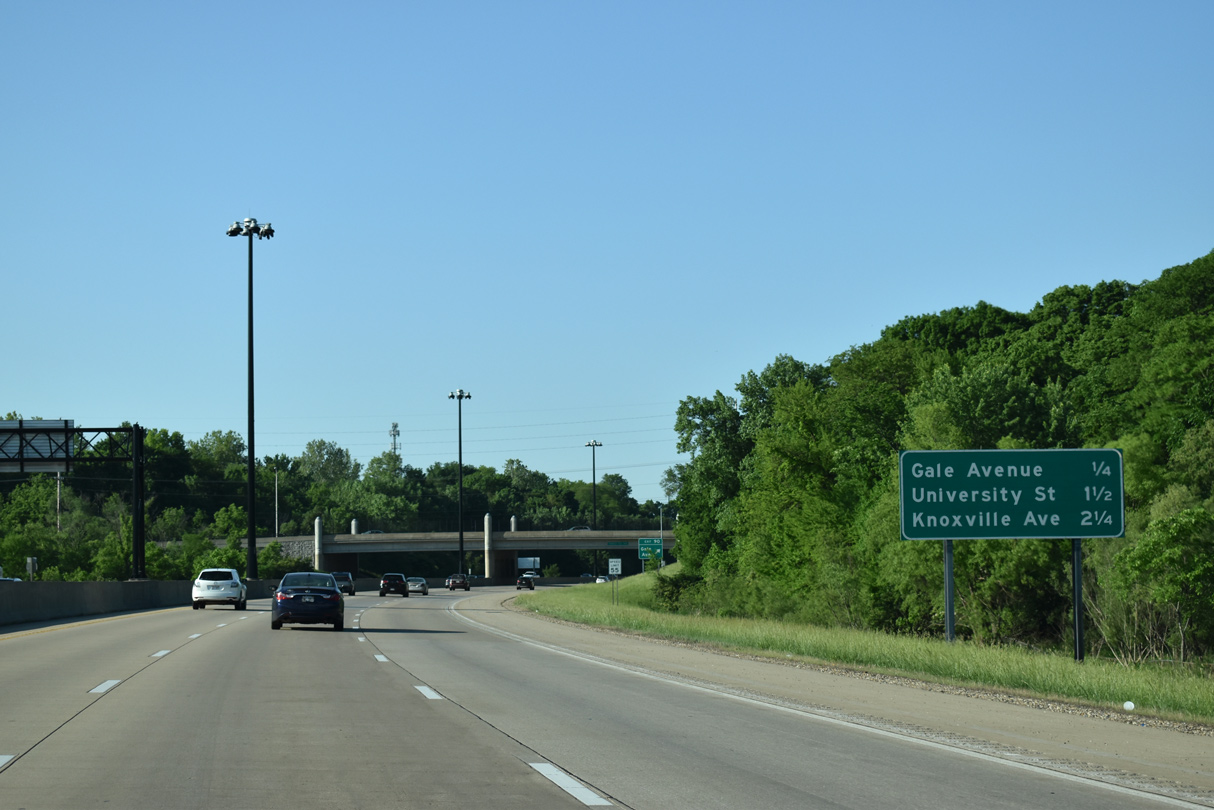
| Interstate 74 curves south along Dry Run by El Vista from the Memorial Drive off-ramp to Gale Avenue (Exit 90) and University Street (Exit 91) over the next 2.25 miles. 05/24/18 |
|
| A third eastbound lane joins Interstate 74 east from the Sterling Avenue on-ramp to the U.S. 150 access road (Exit 89). 05/24/18 |
|
| U.S. 150 turns east from near Exit 89 to the village of Peoria Heights and the Mc Clugage Bridge across Peoria Lake to East Peoria. Points of interest for Exit 89 include the Lakeview Museum, the EXPO Gardens and the Illinois Fairgrounds (via University Street north). 05/24/18 |
|
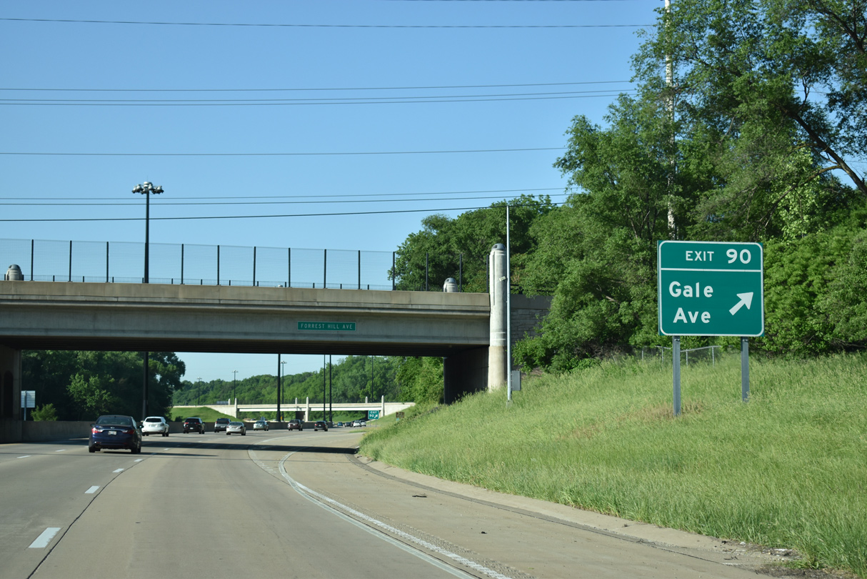
| Facing south, Interstate 74 continues one half mile to a diamond interchange (Exit 90) with Gale Avenue. 05/24/18 |
|
| Ramps at Exit 89 expand Interstate 74 to six overall lanes. Exit 91 for University Street departs in 1.5 miles followed by Exit 92 A for Knoxville Avenue in 2.25 miles. 05/24/18 |
|
| Gale Avenue angles southeast from Sterling Avenue in El Vista to cross Interstate 74 at Exit 90. The residential street continues through the Parkview neighborhood to Sheridan Road. 05/24/18 |
|
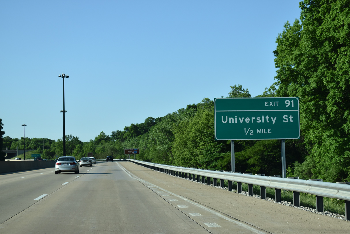
| University Street originates in an industrial area south of the IL 6 freeway in north Peoria. The boulevard leads by the Illinois Fairgrounds to eventually meet Interstate 74 at a six-ramp parclo interchange (Exit 91). 05/24/18 |
|
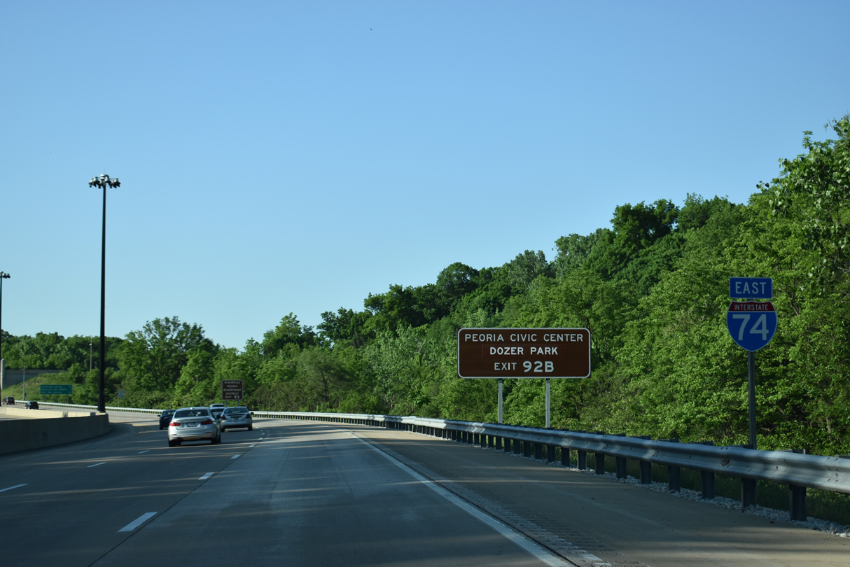
| Interstate 74 begins to turn east en route to Downtown Peoria at the Nebraska Avenue overpass. Visitors bound for the Peoria Civic Center and Dozer Park, home of the Class A Minor League Baseball - Peoria Chiefs, are directed onto Exit 92 B for IL 40. 05/24/18 |
|
| Interstate 74 reaches the central business district in two miles. Exit 92B for Knoxville Avenue (IL 40 south) provides the main access to Downtown via Glen Oak Avenue and Fayette Street in 1.25 miles. 05/24/18 |
|
| Exit 91 departs Interstate 74 east for University Street south toward Bradley University and Laura Bradley Park along Dry Run. University Street was part of U.S. 150 from Meadowbrook Road to Columbia Terrace at one time. 05/24/18 |
|
| IL 40, a 108 mile route from Mt. Caroll to East Peoria, meets Interstate 74 at a pair of wye interchanges tying the freeway with Knoxville Avenue at Pennsylvania Avenue by OSF Saint Francis Medical Center. 05/24/18 |
|
| Unique support structures are found at University and Broadway Streets over a channelized tributary of Dry Run between the east and westbound lanes of Interstate 74. The modern design of I-74 through Peoria is attributed to the "Upgrade 74" construction project of 2002-06. 05/24/18 |
|
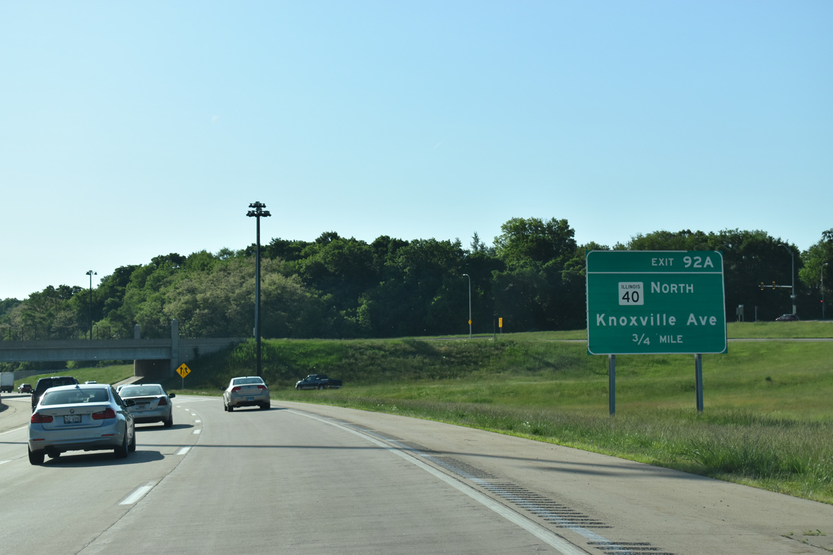
| Interstate 74 drops below grade under a series of overpasses starting with Sheridan Road. Exit 92A departs after the Ellis Street bridge for IL 40 (Knoxville Avenue). IL 40 follows Knoxville north through Peoria to Mount Hawley Auxiliary Airport (3MY) and an interchange with the IL 6 freeway by the far northern suburbs. 05/24/18 |
|
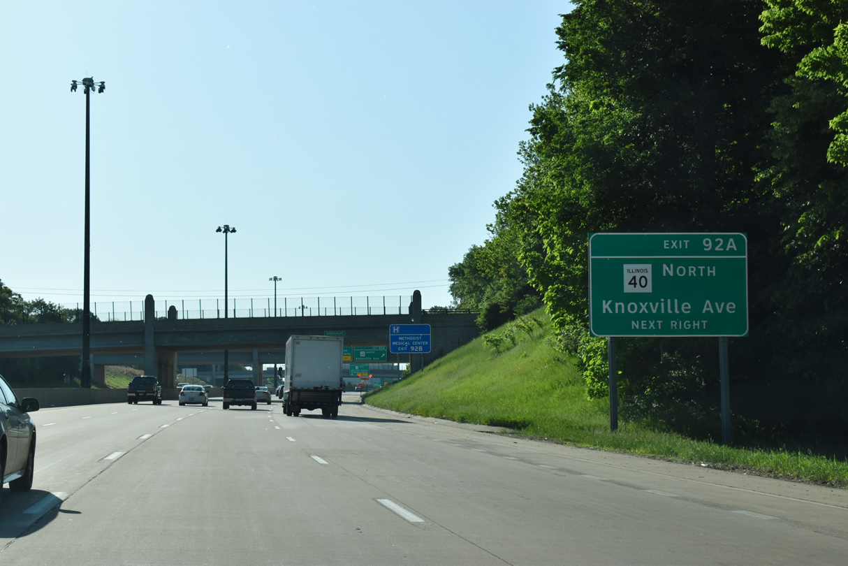
| The wye interchange of Exit 92A was added during Upgrade 74 work. Previously there was no access to IL 40 (Knoxville Avenue) north from I-74 east. Instead ramps joined the left side of I-74 east from Knoxville Avenue south, and to IL 40 north from I-74 west. 05/24/18 |
|
| Exit 92B leaves Interstate 74 east at the North Street overpass for IL 40 south onto Fayette Street at Glen Oak Avenue for Downtown Peoria. The original off-ramp utilized a sharp turn to the intersection of Fayette Street and Glendale Avenue. 05/24/18 |
|
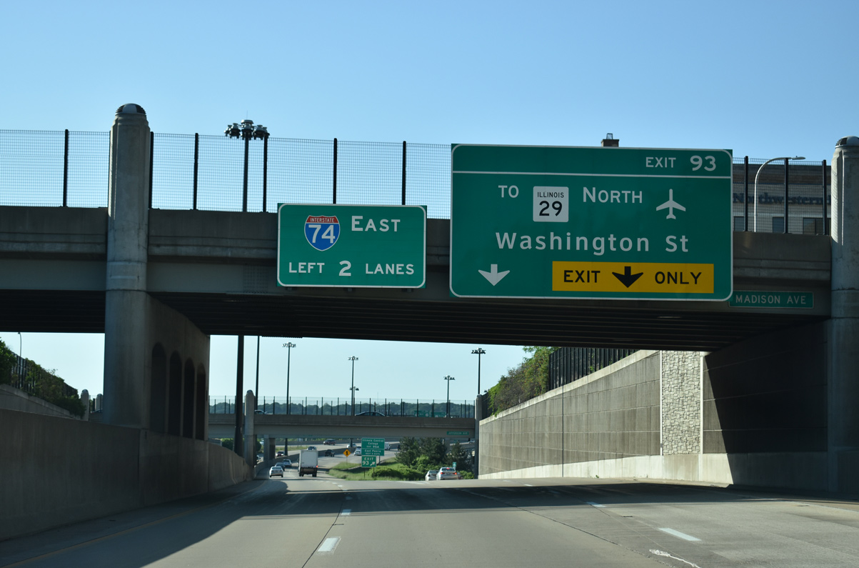
| Exit 93 for Washington Street and IL 29 departs in three quarters of a mile for the Riverplex and Peoria's Riverfront District. A flyover (Exit 92A) passes above as Exit 92B partitions with the freeway mainline to IL 40. IL 40 follows the tandem of Glendale and Perry Avenues southwest to William Kumpf Boulevard on the west side of Downtown. 05/24/18 |
|
| The Peoria skyline comes into view as Interstate 74 elevates above Glen Oak Avenue. Originally a split viaduct passed over Glen Oak Avenue, with Knoxville Avenue ending between the roadways below. 05/24/18 |
|
| The Washington Street exit leaves in a quarter mile as Interstate 74 again drops below grade leading toward the Murray Baker Bridge into East Peoria. 05/24/18 |
|
| Lowering toward the Perry Avenue overpass on Interstate 74 between Spalding Avenue and Fayette Streets. The portion of I-74 built in 1958 began here with ramps to and from Glendale Avenue (since removed), one block west of Perry Avenue. 05/24/18 |
|
| Two half diamond interchanges interlace with I-74 at the foot of the Murray Baker Bridge. The eastbound ramp joins Washington Street, one block south of IL 29, which joins I-74 across the Illinois River to East Peoria. IL 29 follows the couplet of Adams Street and Jefferson Avenue northeast toward U.S. 150. U.S. 24/IL 29 were removed from Washington Street through Downtown after a Peoria city council vote in 2010 to take over maintenance of the street.2 05/24/18 |
|
| Narrow ramps with sharp curves originally tied into the freeway from Madison and Jefferson Avenues and at Adams and Washington Streets. These were removed during Upgrade 74 work. 05/24/18 |
|
| Exit 93 parts ways with two lanes for Washington Street at the Madison Avenue overpass as I-74 reduces to four overall lanes across the Murray Baker Bridge. Until 2010, U.S. 24 and IL 29 combined from the Mc Clugage Bridge (U.S. 150) southwest through Downtown to IL 8/116, where IL 29 crossed the Cedar Street Bridge to East Peoria. 05/24/18 |
|
| Interstate 74 proceeds to cross the Illinois River into East Peoria, with the next five exits serving the city of 22,939 (2016 census estimate). 06/01/11 |
|
| The Murray Baker Bridge comes into view at the Jefferson Avenue entrance ramp. The span closed from April 1, 2005 to October 2, 2005 for the reconstruction of I-74 east from Adams Street. This included raising the freeway ten feet and removing 180 feet of truss from the bridge end.3 05/24/18 |
|
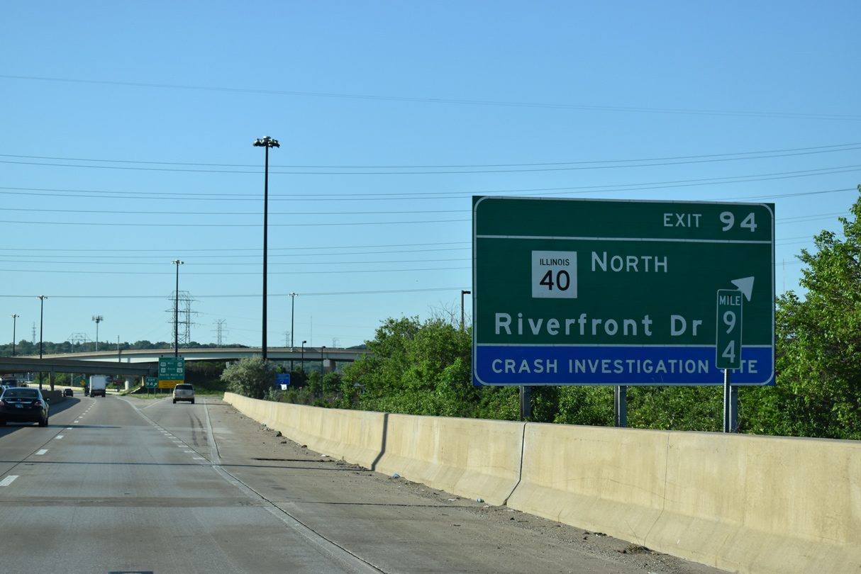
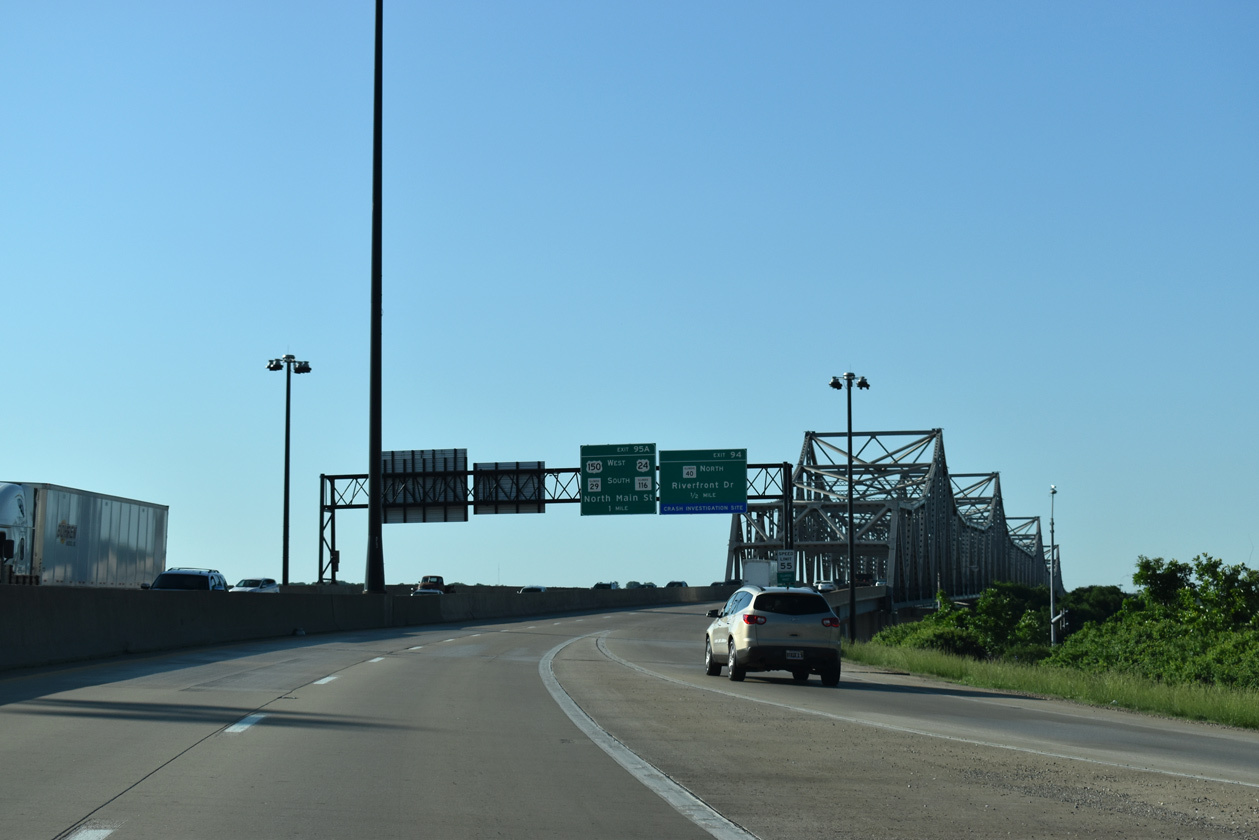
| Exit 94 departs from the east end of the Murray Baker Bridge for the northbound beginning of IL 40 (Washington Street) and the East Peoria Riverfront. U.S. 24-150/IL 116 (N Main Street) and IL 29 south follow in one mile at a diamond interchange (Exit 95). 05/24/18 |
|
| The Murray Baker Bridge supports a 55 foot wide deck at a maximum height of 66 feet above the Illinois River. The cantilever steel truss bridge measures 3,036 feet in length.4 05/24/18 |
|
| Looking southwest at the nondescript steel girder bridge opened in 1993 that carries IL 40 across the Bob Michel Bridge. Further south in view is the Shade-Lohmann Bridge (Interstate 474). 06/01/11 |
|
| The Illinois River separates Peoria and Tazewell Counties across the Murray Baker Bridge on Interstate 74. 05/24/18 |
|
| Originally a trumpet interchange, Exit 94 was modified to include new flyover ramps for IL 40 west to Washington Street. The state route passes over Camp Road (old U.S. 150) ahead of another trumpet interchange with Washington Street, which leads south from the Bob Michel Bridge to The Levee District retail development. 05/24/18 |
|
| U.S. 24-150 and IL 116 combine along North Main Street along the Peoria Lakefront from Camp Street north four miles to a separation just east of the Mc Clugage Bridge. U.S. 24 was relocated onto Main Street through both East Peoria and Creve Coeur in 2010. IL 29 leaves the freeway for Main Street south to rejoin its Main Street alignment at Exit 95A as well. 05/24/18 |
|
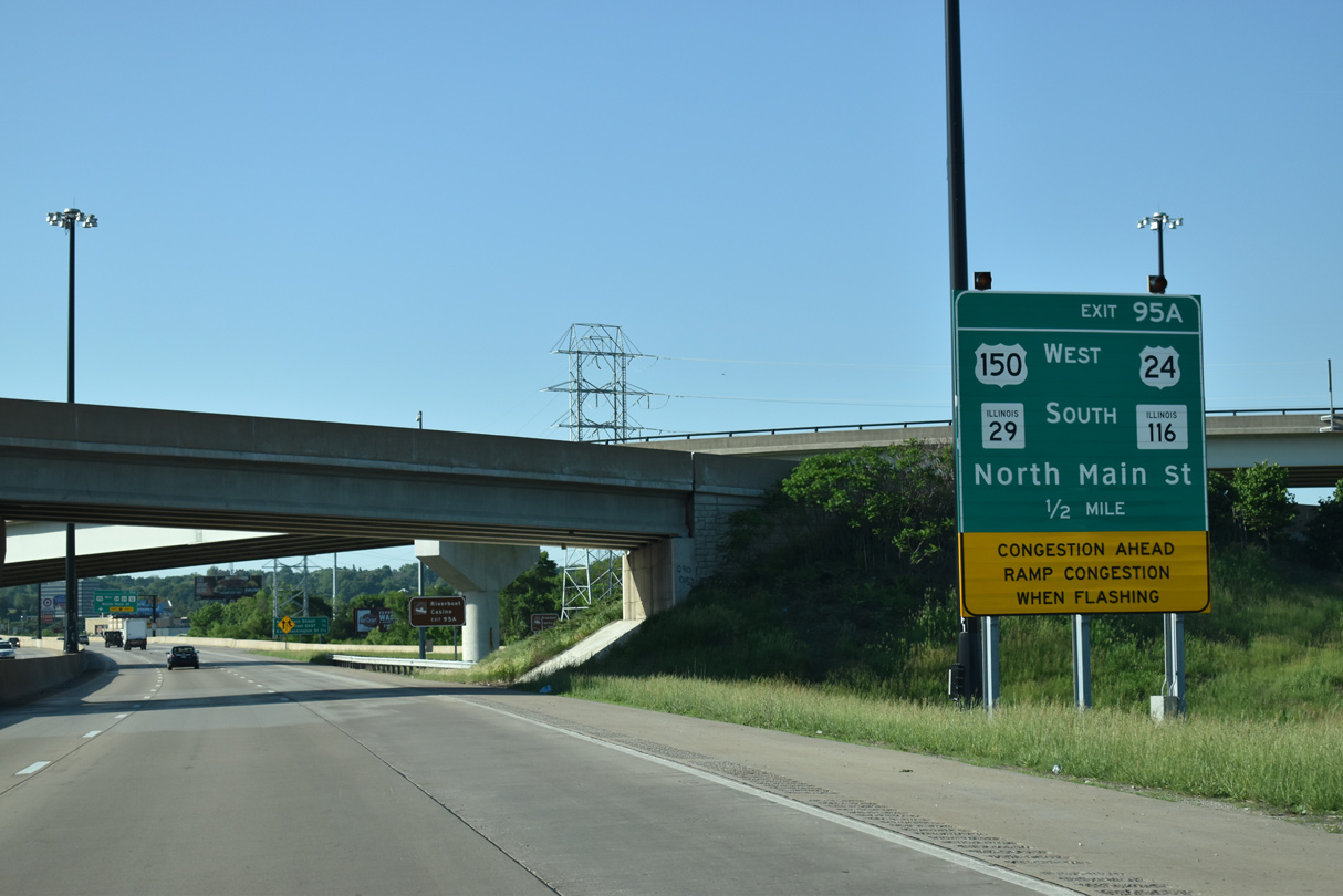
| Exit 95 A provides access to U.S. 150 west while Exit 95 B consists of a wye interchange onto U.S. 150 leading east along Camp Street. Washington Street meets the freeway directly in 1.25 miles at Exit 96. 05/24/18 |
|
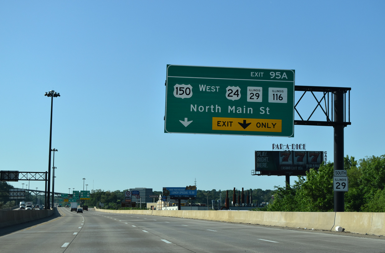
| Two lanes depart at Exit 95A to U.S. 24-150 (North Main Street), IL 116 and IL 29 south. IL 116 constitutes a 190 mile route nearly across the width of the state, from U.S. 34 in Henderson County to U.S. 45 at Ashkum. 05/24/18 |
|
| Interstate 74 swells to eight overall lanes between IL 40 and IL 116. 05/24/18 |
|
| Main Street leads southwest from Exit 95A as IL 29 south into Creve Coeur. IL 116 follows the route to the Cedar Street expressway, where it combines with IL 8 west into Peoria. 05/24/18 |
|
| Exit 95B immediately follows Exit 95A onto U.S. 150/IL 8 (Camp Street) east. IL 8 follows Main Street east from IL 29 to combine with U.S. 150 briefly to the split of Washington Street and Meadow Avenue. U.S. 150 follows Meadow Avenue out from East Peoria to Morton while IL 8 ends at U.S. 24 in Washington. 05/24/18 |
|
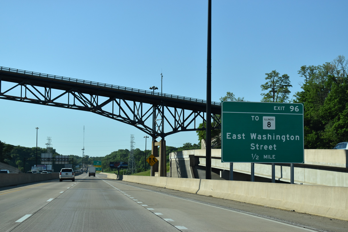
| A folded diamond interchange (Exit 96) joins Interstate 74 with E Washington Street in one half mile. 05/24/18 |
|
| A high level overpass carries Fondulac Drive above Interstate 74 just east of N Main Street. Originally a tight cloverleaf interchange joined the freeway with U.S. 150/IL 116. 05/24/08 |
|
| Interstate 74 proceeds to cross over Camp Street, a Norfolk Southern Railroad, and Farm Creek ahead of the loop ramp (Exit 96) to Washington Street. 05/24/18 |
|
| Washington Street becomes U.S. 150/IL 8 just north of Veterans Drive and I-74. Historically Washington Street east from the Cedar Point Bridge and IL 8 represent the original alignment of U.S. 24 east to Washington. 05/24/18 |
|
| Reducing to four lanes, Interstate 74 heads southeast across forested hills to Cloverdale. 05/24/18 |
|
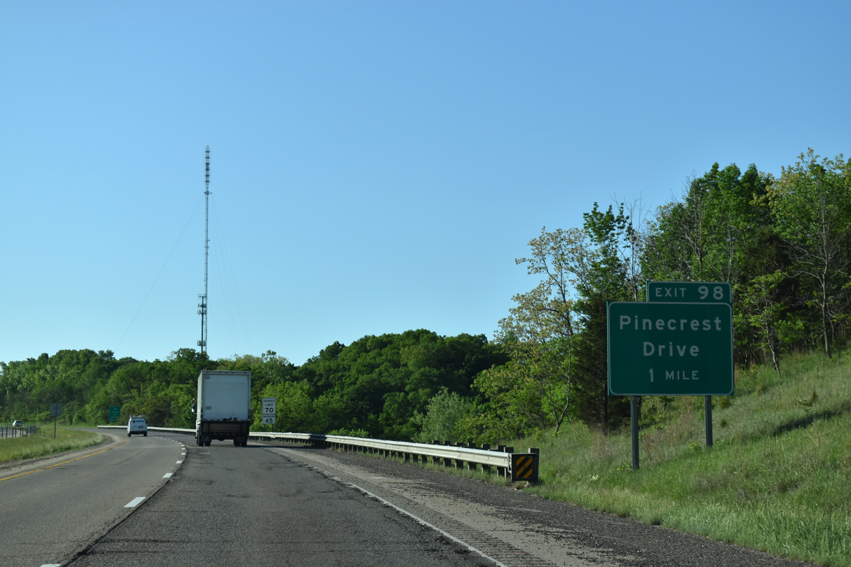
| Pinecrest Drive connects Interstate 74 with Muller Road (CR 22 east) from a diamond interchange (Exit 98) in East Peoria. 05/24/18 |
|
| The first distance sign posted since before Peoria references Interstate 155 in four miles, Bloomington in 34 miles and Indianapolis in 200 miles. 05/24/18 |
|
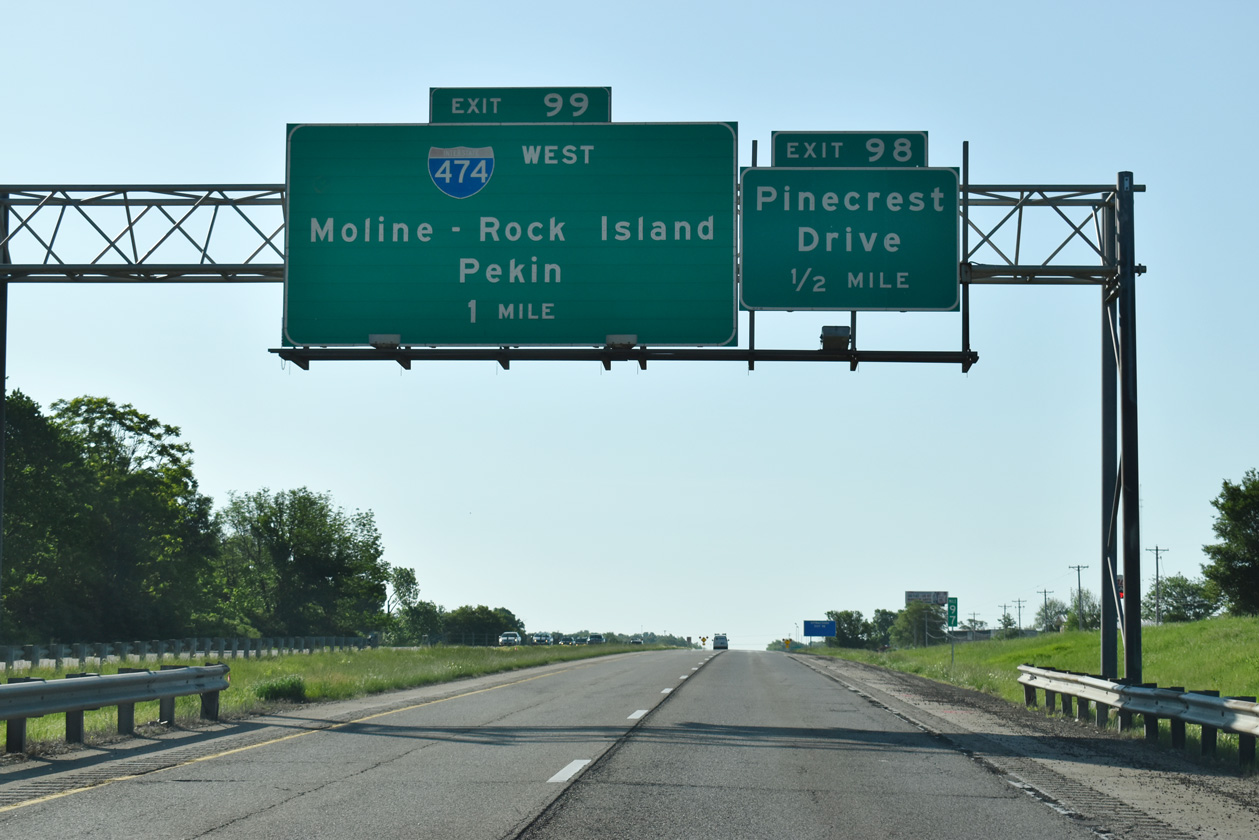
| Interstate 474 returns to I-74 one half mile beyond Pinecrest Drive at Exit 99. I-474 joins East Peoria with General Wayne A. Downing Peoria International Airport (PIA) while providing a bypass route of downtown for interests to the Quad Cities. 05/24/18 |
|
| Exit 98 leaves Interstate 74 east for Pinecrest Drive. Fahey-Hollow Road winds northwest from Pinecrest Road to Bloomington Road while frontage roads (Sabrina Drive and High Point Lane) line the freeway west to a handful of industrial businesses. 05/24/18 |
|
| I-474 leads 5.3 miles west from I-74 near Cloverdale to Creve Coeur and IL 29. IL 29 leads south to Pekin. 05/24/18 |
|
| Interstate 474 was completed on December 20, 1979 to provide a bypass for through traffic between the Quad Cities and Bloomington-Normal. The freeway became the de facto mainline for I-74 during the mid-2000s Upgrade 74 project and remains a commuter route for Creve Coeur, Pekin, Bartonville and Bellevue. 05/24/18 |
|
| I-74/474 come together at a two-wye interchange with a loop ramp linking I-474 east to I-74 west. 05/24/18 |
Page Updated 06-06-2018.

 East
East


 South
South