|
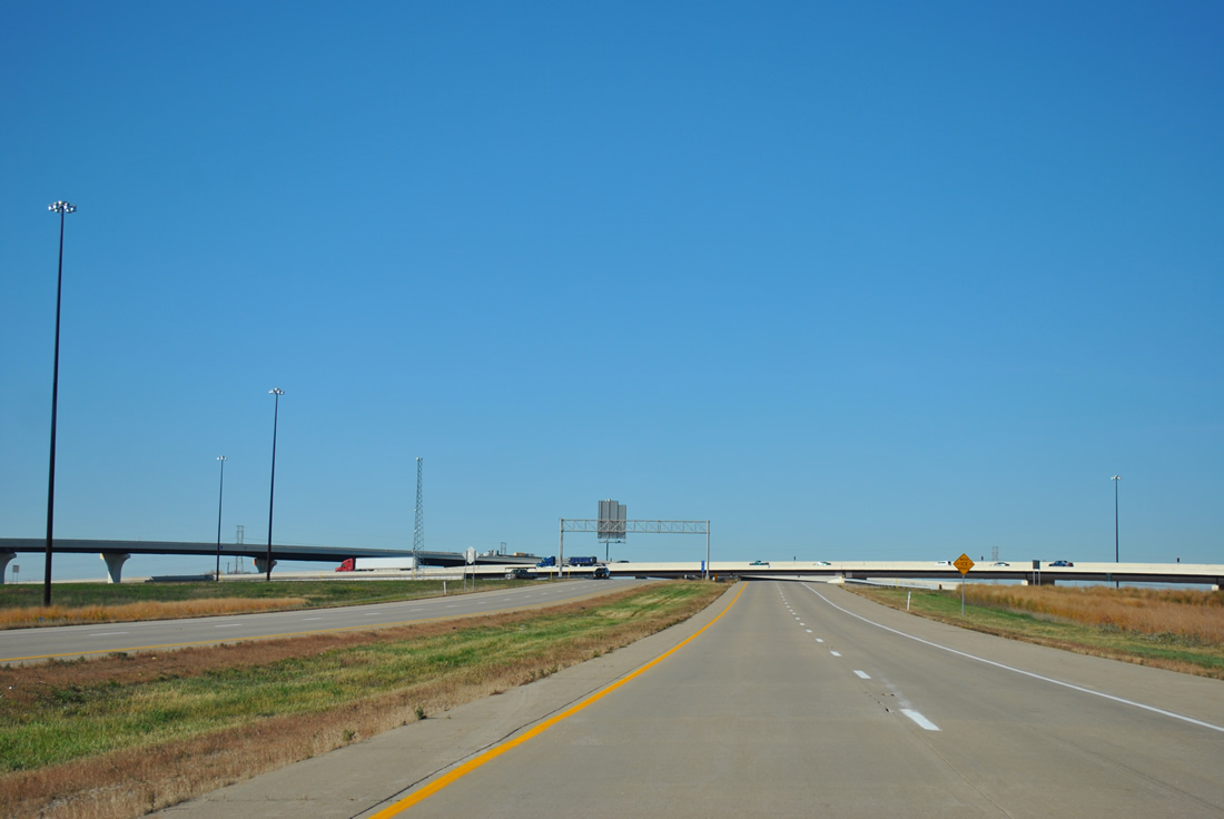
| Spanning Deer Creek beyond another set of markers posted for II-74/U.S. 421 north. 11/04/11 |
|
| A transmission corridor crosses I-74/U.S. 421 at Middletown on an otherwise rural stretch between farm land. 11/04/11 |
|
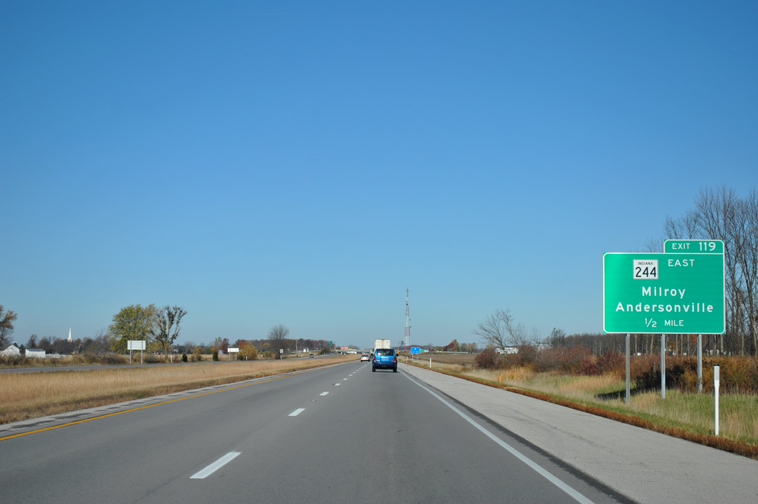
| The only guide sign posted for Exit 119 at the time of these photos was situated one mile out from the diamond interchange with SR 244's western terminus. 11/04/11 |
|
| Exit 119 departs the westbound freeway for SR 244 and County Road 250 South west to Michigan Road. SR 244 bee lines east 19.5 miles to Milroy and U.S. 52 near Andersonville. 11/04/11 |
|
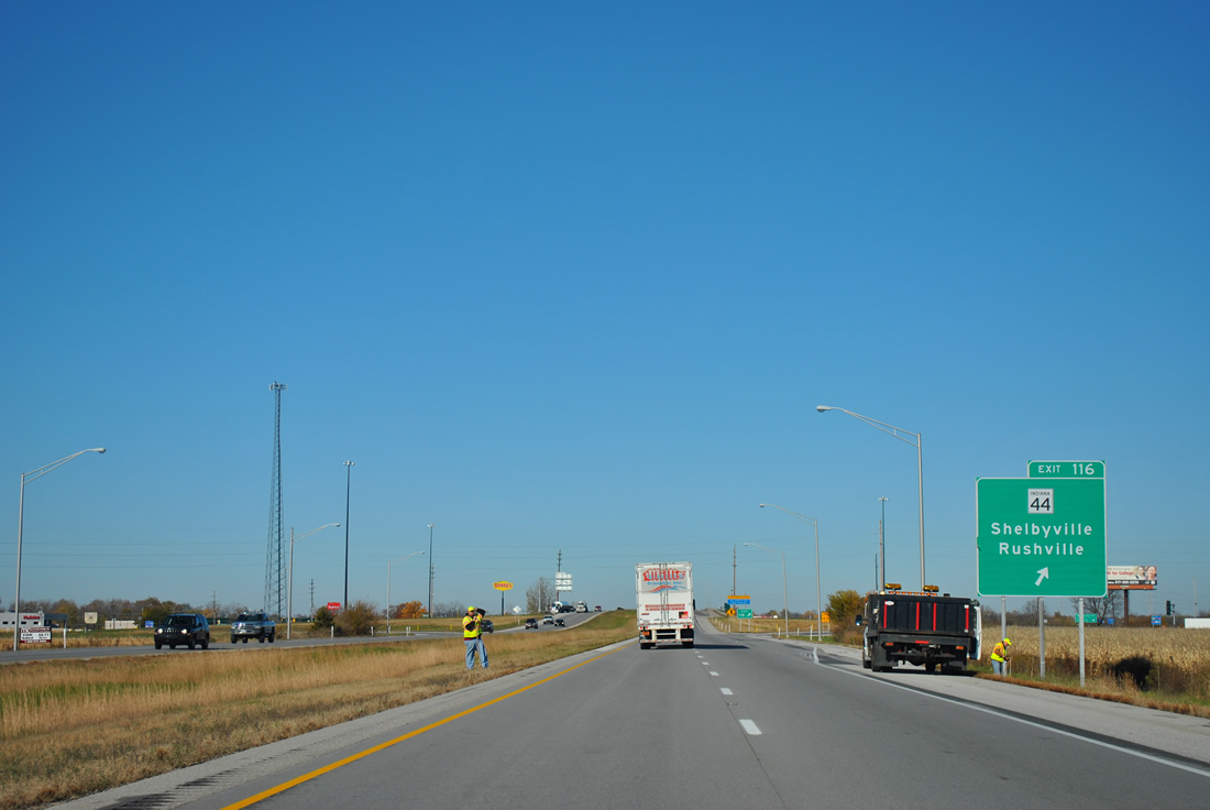
| The next three interchanges serve Shelbyville, so the westbound distance sign simply lists the distance to Indianapolis (downtown). 11/04/11 |
|
| Commercialized SR 44 sees a folded diamond interchange (Exit 116) with I-74/U.S. 421 on the east side of Shelbyville in one mile. 11/04/11 |
|
| Truckers destined for SR 9 south from Shelbyville should follow a truck route consisting of SR 44 west to Progress Parkway, a bypass road off SR 44, to join SR 9 south of the city. The truck route is in place because of the Public Square traffic circle along SR 9 (Harrison Street) in Downtown Shelbyville. 11/04/11 |
|
| One half mile east of Exit 116 with SR 44 at the Blue Ridge Road overpass. SR 44 totals 89.8 miles from Martinsville (SR 67) east to Franklin, Shelbyville, Rushville, Connersville, Liberty and the Ohio state line (SR 725). 11/04/11 |
|
| I-74/U.S. 421 bypasses Shelbyville to the northeast, while the original U.S. 421 follows Michigan Road into town. SR 44 combines with Michigan Road along Broadway Street to a merge with SR 9 (Harrison Street) in Downtown Shelbyville. 11/04/11 |
|
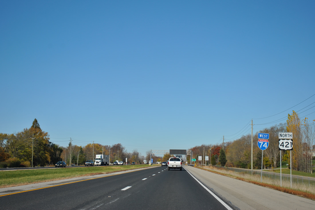
| A SR 9 Truck trailblazer accompanies this set of shields posted for II-74/U.S. 421 north for the aforementioned Shelbyville truck bypass route of SR 9. 11/04/11 |
|
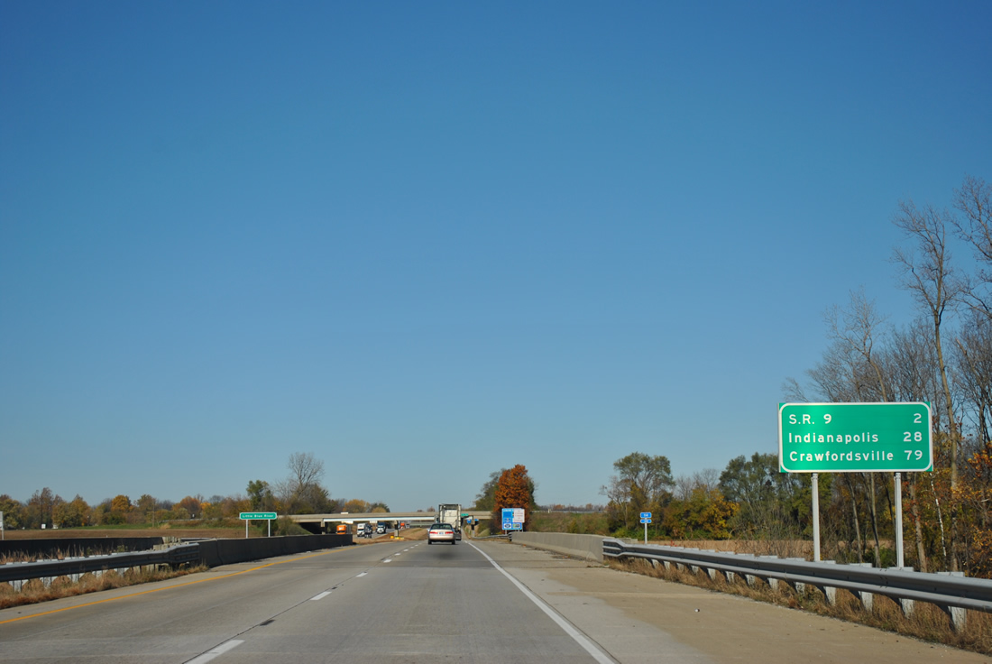
| Crossing Little Blue River on a 1959-completed stretch of Interstate 74 west. Crawfordsville appears as the westbound destination beyond Indianapolis. Peoria is the control city of I-74 along that stretch. 11/04/11 |
|
| SR 9 follows Harrison Street north from Downtown Shelbyville to split with Michigan Road (old U.S. 421). North from there, State Road 9 sees a parclo interchange (Exit 113) with I-74/U.S. 421. 11/04/11 |
|
| A 196 mile route, SR 9 leads south from Shelbyville to Hope and a conclusion at SR 46, east of Columbus. Northward the state road (Riley Highway) journeys to Greenfield and Anderson. 11/04/11 |
|
| Truck traffic that bypassed Shelbyville via Progress Parkway and SR 44 departs II-74/U.S. 421 north to rejoin SR 9 leading north. SR 9 ends at the Michigan state line, becoming M-66 near Sturgis. 11/04/11 |
|
| Westbound at the Exit 113 off-ramp to SR 9 (Riley Highway). Much of the area surrounding Exit 113 is suburban in nature with a hodgepodge of subdivisions and business parks. SR 9 reaches Greenfield, U.S. 40 and Interstate 70 in 19 miles. 11/04/11 |
|
| Annexations of Shelbyville extend the city alongside I-74/U.S. 421 to Exit 109. Michigan Road rejoins the frontage northwest to Exit 103, where the freeway directly overtakes the former U.S. 421 path. 11/04/11 |
|
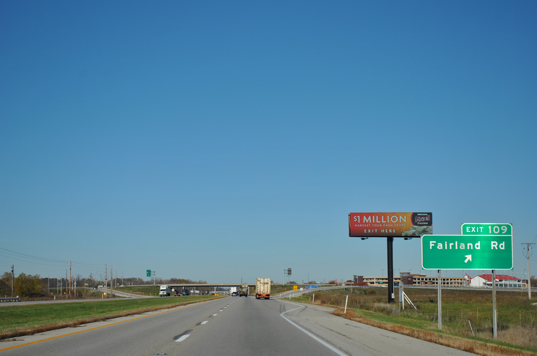
| A diamond interchange (Exit 109) joins I-74/U.S. 421 with Fairland Road in one mile. 11/04/11 |
|
| Fairland Road starts at Michigan Road to the east and heads west to eastern Johnson County, passing through the town of Fairland on the way. Shelbyville Municipal Airport can be reached by taking Fairland Road east. 11/04/11 |
|
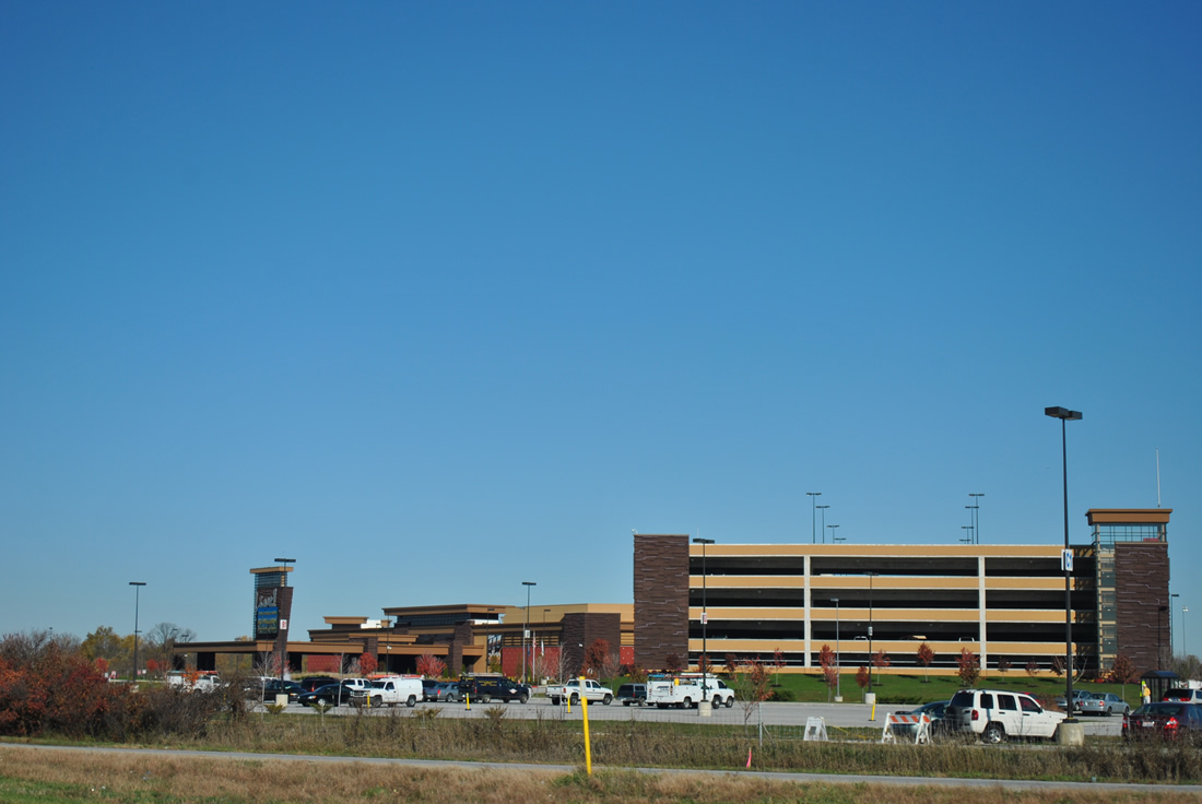
| Drivers along II-74/U.S. 421 north reach the Exit 109 ramp departure to Fairland Road. The Indiana Downs horse racing track and Indiana Live Casino can be reached just to the east of the interchange. 11/04/11 |
|
| What Exit 109 is best known for is the Indiana Downs Horse racing track and the Indiana Live Casino. The Casino is the closest gambling establishment to Indianapolis and has brought many from the metro area down I-74/U.S. 421 to the Fairland Road exit. 11/04/11 |
|
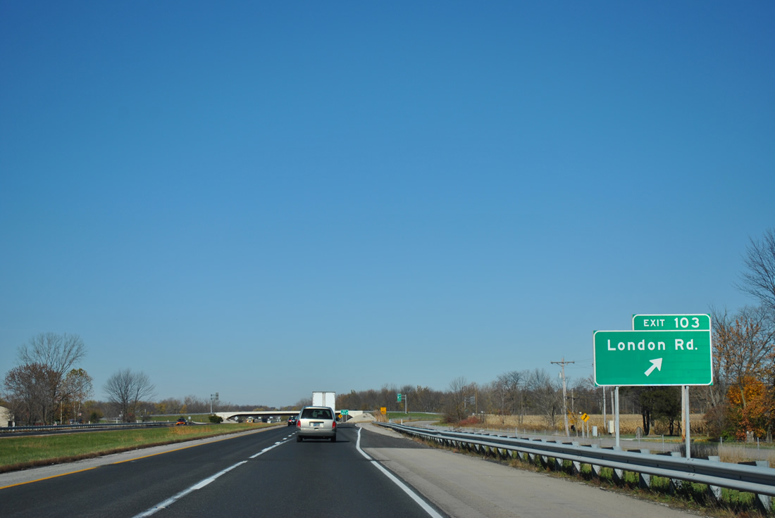
| Crossing Brandywine Creek, I-74/U.S. 421 continue six miles to London Road and 15 miles to their respective merges with Interstate 465. 11/04/11 |
|
| London Road / County Road 700 West sees a parclo interchange (Exit 103) with I-74/U.S. 421 at Sugar Creek in one mile. 11/04/11 |
|
| The small community of Boggstown can be reached by taking London Road to the south. Boggstown is located at the cross roads of several county roads that once connected Indianapolis with Shelbyville before U.S. 421. 11/04/11 |
|
| Exit 103 leaves II-74/U.S. 421 north for London Road / County Road 700 West. Heading south, London Road follows Sugar Creek to London and Boggstown on a rural drive. Michigan Road ends on the north side of the interchange. 11/04/11 |
|
| I-74/U.S. 421 span Sugar Creek next. The original crossing of the waterway opened in 1954 as U.S. 421. 11/04/11 |
|
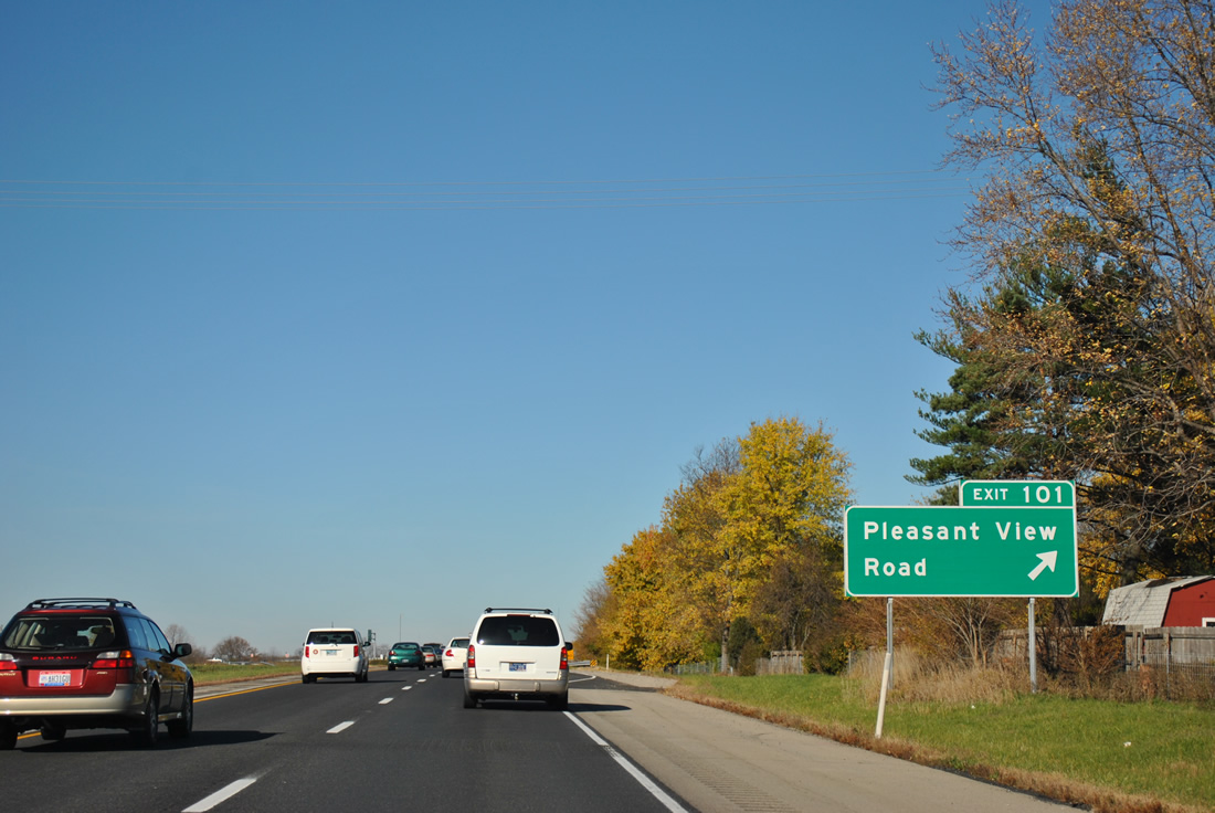
| A short distance to the northwest is the community of Pleasant View and Exit 101 with Pleasant View Road from I-74/U.S. 421. 11/04/11 |
|
| I-74/U.S. 421 kink westward to bypass Pleasant View and the original alignment of U.S. 421 (Main Street). Main Street dead ends just south of County Road 950 North adjacent to the field in this scene. 11/04/11 |
|
| Pleasant View Road connects the freeway with parallel Main Street and Sycamore Road leading northeast from the village. Southward via County Road 940 North and McGregor Road links I-74/U.S. 421 with the Indianapolis town of Acton. 11/04/11 |
|
| Shields posted for II-74/U.S. 421 north adjacent to an industrial type stretch of Main Street / Southeastern Avenue (former U.S. 421). 11/04/11 |
|
| Entering Marion County along II-74/U.S. 421 north. Marion County doubles as the capital city of Indiana as the two entities merged in 1970 as part of the Unigov system. Indianapolis, "the Circle City" is best known as the home of Indianapolis Motor Speedway and the Indianapolis 500 auto race. 11/04/11 |
|
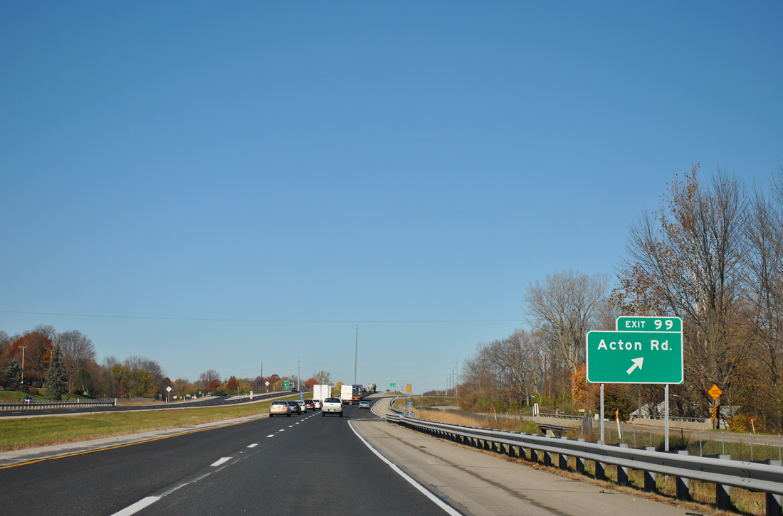
| Acton Road leads south from the Exit 99 diamond interchange of I-74/U.S. 421 for the community of Acton in southeast Indianapolis. 11/04/11 |
|
| Westbound traffic approaches a crossing of Buck Creek as I-74/U.S. 421 again overtake the original alignment of U.S. 421. Acton Road ends at Frontage Road on the north side of Exit 99, providing a connection with Senour Road north to U.S. 52. 11/04/11 |
|
| Exit 99 parts ways with the westbound freeway. Acton Road becomes County Road 700 East in Johnson County, ending at Reds Corner. Southport Road stems west from Acton Road near Acton to growing suburban areas to Exit 103 of Interstate 65. 11/04/11 |
|
| I-74/U.S. 421 veer northward away from Southeastern Avenue (old U.S. 421) on the two mile approach to Post Road. Downtown Indianapolis is 12 miles to the northwest via the continuation of former U.S. 421 from Exit 94. 11/04/11 |
|
| One mile out from the Exit 96 diamond interchange with Post Road along the westbound freeway. 11/04/11 |
|
| Post Road consists of an arterial leading north to U.S. 40 (Washington Street), U.S. 36/SR 67 (Pendleton Pike) at Lawrence, and an ending at the former Fort Benjamin Harrison, hence the name of the road. Southward, Post Road ends less than a mile at Southeastern Avenue and the Wanamaker community. 11/04/11 |
|
| A construction advisory sign at the Vandergriff Road overpass advised motorists of the Accelerate465 project to widen the west side of the Indianapolis beltway and modernize interchanges with Interstate 70, Sam Jones Expressway and U.S. 40 (Washington Street) among others. The bulk of work was completed by 2012, with work at the western split with I-74 ongoing. 11/04/11 |
|
| Traffic to Post Road leaves II-74/U.S. 421 north at Exit 96. Post Road is among the most important roads across the Far East Side of Indianapolis. 11/04/11 |
|
| Subdivisions appear both south and north of I-74/U.S. 421 leading west to the Indianapolis Beltway. This is the final shield assembly for the tandem. 11/04/11 |
|
| One mile diagrammatic overhead posted for the Interstate 74 westbound merge onto Interstate 465 encircling the south side of Indianapolis. The freeway mainline continues as Exit 94 to Southeastern Avenue (old U.S. 421). 11/04/11 |
|
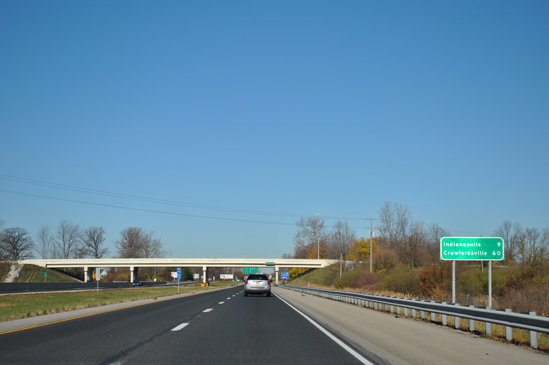
| Distance sign posted nine miles out from the Indianapolis central business district and an hour from Crawfordsville, the largest city along Interstate 74 between the Circle City and the Illinois state line. 11/04/11 |
|
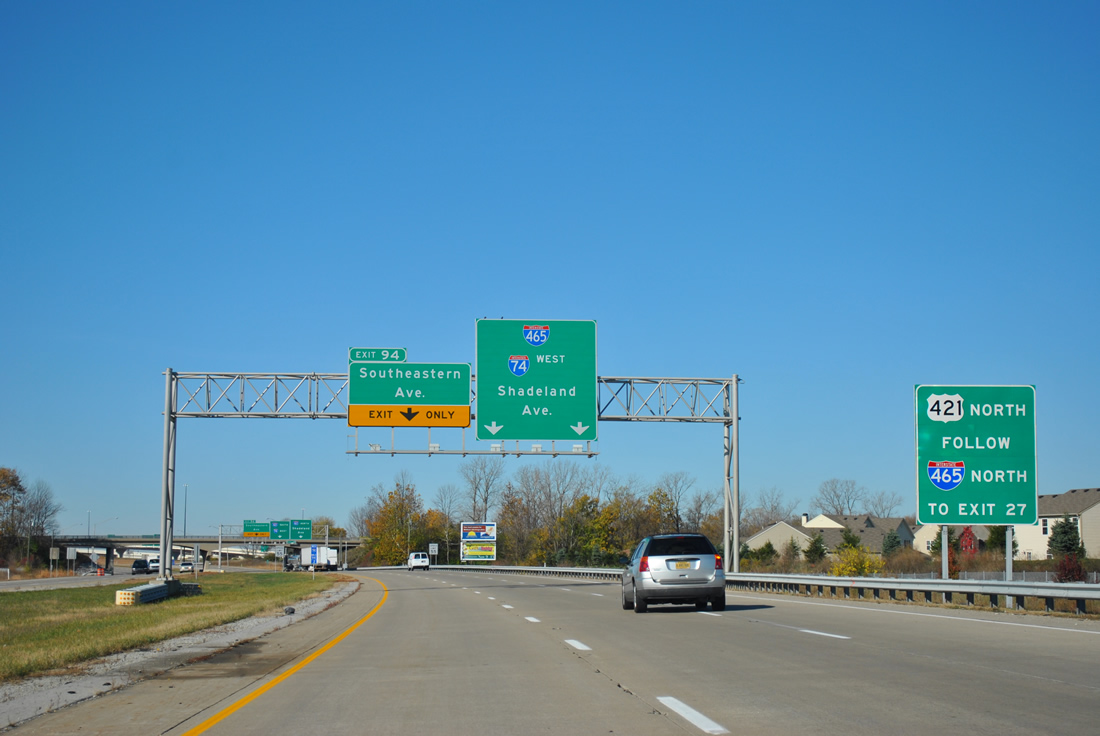
| All traffic to Interstate 465 departs in unison via a two lane ramp from the freeway mainline at Exit 94. A single lane flyover ramp connects with the southbound beltway ahead of Beech Grove. Motorists headed north join a collector distributor roadway to the wye interchange with Shadeland Avenue (former SR 100) north to Warren Park. 11/04/11 |
|
| U.S. 421 joins Interstate 465 in hidden fashion from Interstate 74 to Exit 27 on the North Side of Indianapolis. There it rejoins Michigan Road north to Zionsville. 11/04/11 |
|
| The right two lanes default onto Interstate 465 as the mainline carries the left lane onto a freeway spur for Southeastern Avenue near Five Points. 11/04/11 |
|
| Fisher Road passes of II-74/U.S. 421 north at the Exit 94 ramp departure to Southeastern Avenue. Originally a cloverleaf interchange joined the two freeways. Upgrades replaced two of the loop ramps with directionals by 2001. 11/04/11 |
|
| Similar to how the Interstate 695 spur west at Interstate 70 reduces to one lane at Baltimore, Interstate 74 traffic to Exit 94 briefly narrows to one lane before again expanding to two across the I-465 mainline. No control cities are given for Interstate 465, and this is generally the case throughout the 53 mile route. 11/04/11 |
|
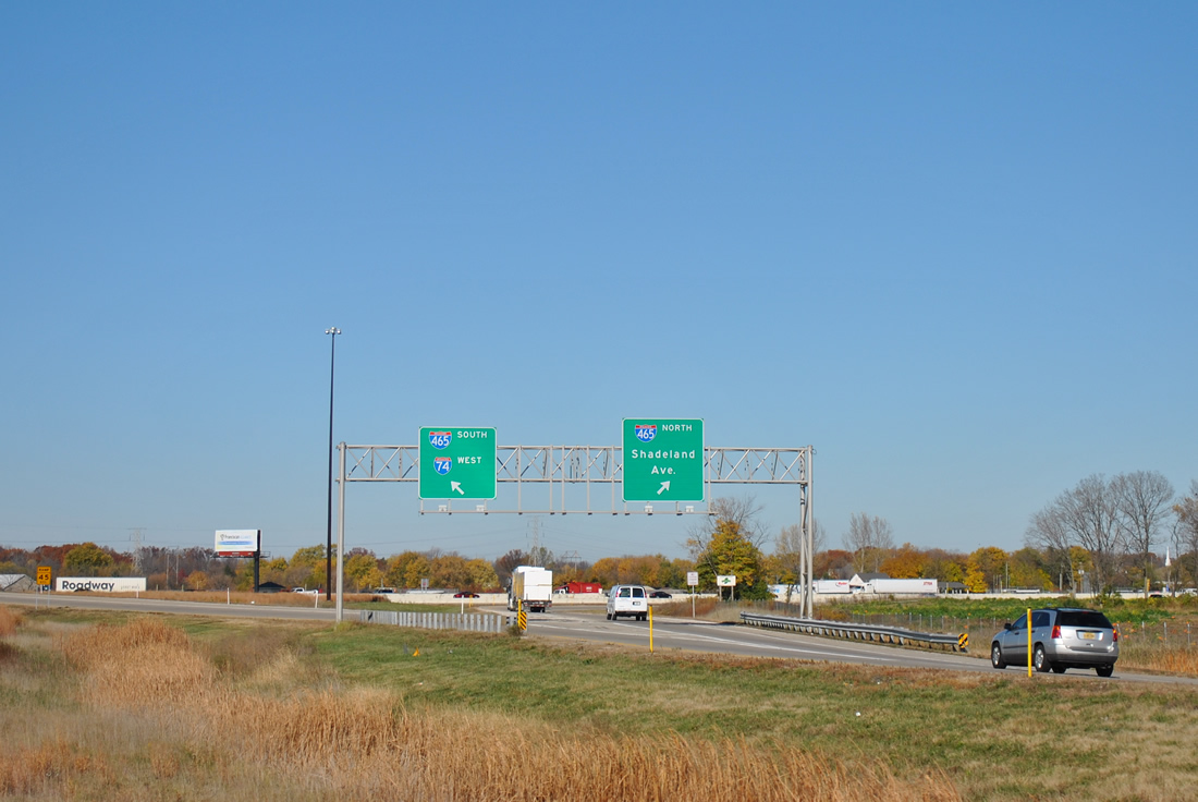
| A parting shot of the ramp partition of I-74 traffic to Interstate 465. Interstate 74 west joins the inner loop of the beltway for 20.65 miles from Five Points to Speedway. 11/04/11 |
|
| Continuing west along the Interstate 74 freeway spur (Exit 94) through the directional cloverleaf interchange with Interstate 465. The highest flyover carries southbound to eastbound motorists. 11/04/11 |
|
| Interstate 74 mileposts are maintained on the freeway spur to Southeastern Avenue. The spur originates from a time when it was thought that Interstate 74 was going to be routed through the city following Southeastern Avenue. 11/04/11 |
|
| Milepost 93.0 is the last posted on the Interstate 74 spur to Southeastern Avenue. The four lane freeway overtakes former U.S. 421 at an unsignalized at-grade intersection ahead. 11/04/11 |
Page Updated 01-17-2012.

 West
West  North
North