|
| South from Barneyville, Interstate 75 traverses forest and wetland areas to the town of Sparks. 06/26/22 |
|
| A diamond interchange (Exit 41) joins Interstate 75 with Sparks Cutoff Road west, Rountree Bridge Road north and Colquitt Street east into the Sparks town center. 06/26/22 |
|
| Guide signs for Exit 41 along I-75 include space for what was Business Loop I-75. The business route followed Colquitt Street east to U.S. 41/SR 7 (Goodman Road) south from Sparks to Hutchinson Avenue through Adel. The loop returned to I-75 via Old Quitman Road and Exit 37. 06/26/22 |
|
| Rountree Bridge Road stems 4.77 miles northwest from Sparks Cutoff Road by Exit 41 to the Rountree Bridge across the Little River into Colquitt County. Sparks Cutoff Road arcs 1.60 miles southwest to SR 37 west for Moultrie. 06/26/22 |
|
| Interstate 75 kinks eastward to cross Giddens Mill Creek ahead of the Adel city limits. 06/26/22 |
|
| SR 37, a 153.83 mile long highway east from Alabama State Route 10 at Fort Gaines to U.S. 84 outside Homerville, meets Interstate 75 along 4th Street in Adel. 06/26/22 |
|
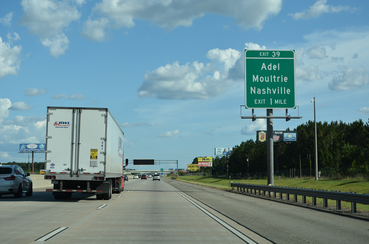
| Signs for Exit 39 omit the SR 37 designation and simply reference Moultrie for SR 37 west, Adel and Nashville for SR 76 east. SR 37/76 combine for 2.50 miles through Downtown Adel to a rural split east of Bear Creek. 06/26/22 |
|
| The diamond interchange at Exit 39 lies between Cook County Airport (15J) and the separation of SR 37 (4th Street) with SR 76 (Elm Street) south to Barney. 06/26/22 |
|
| Old Quitman Road, the pre-1950 alignment of SR 76 south to Barney, links with I-75 at a diamond interchange (Exit 37) in south Adel. 06/26/22 |
|
| I-75 spans both SR 76 (Elm Street) and an adjacent Norfolk Southern Railroad line. 08/07/13 |
|
| Old Quitman Road branches 1.19 miles west from U.S. 41/SR 7 (Hutchinson Avenue) to Interstate 75 at Exit 37. This minor arterial represented the southern extent of Business Loop I-75 from Adel. 06/26/22 |
|
| Paralleling Interstate 75 to the east, U.S. 41/SR 7 continue south 4.2 miles from Old Quitman Road to South Georgia Motorsports Park. 06/26/22 |
|
| Old Quitman Road spurs southwest 3.72 miles from Exit 37 to a dead end by Whitehurst Pond. Old Union Road leads north from there to SR 76 at Pine Valley. 06/26/22 |
|
| Leading away from Adel, Interstate 75 runs east of Heart Pine Pond and Cecil Bay, wetland areas to the north of Cecil. 06/26/22 |
|
| Passing by South Georgia Motorsports Park, Interstate 75 advances to the diamond interchange (Exit 32) with Old Coffee Road in the town of Cecil. 06/26/22 |
|
| Old Coffee Road arcs 1.8 miles southwest from Exit 32 to become Salem Church Road in adjacent Lowndes County. 06/26/22 |
|
| U.S. 41/SR 7 follow A-Ray Street through the heart of Cecil. Old Coffee Road intersects the pair three blocks east of Exit 32 at Fellowship Road. 08/07/13 |
|
| The overhead at Exit 32 was missing in 2022. 06/26/22 |
|
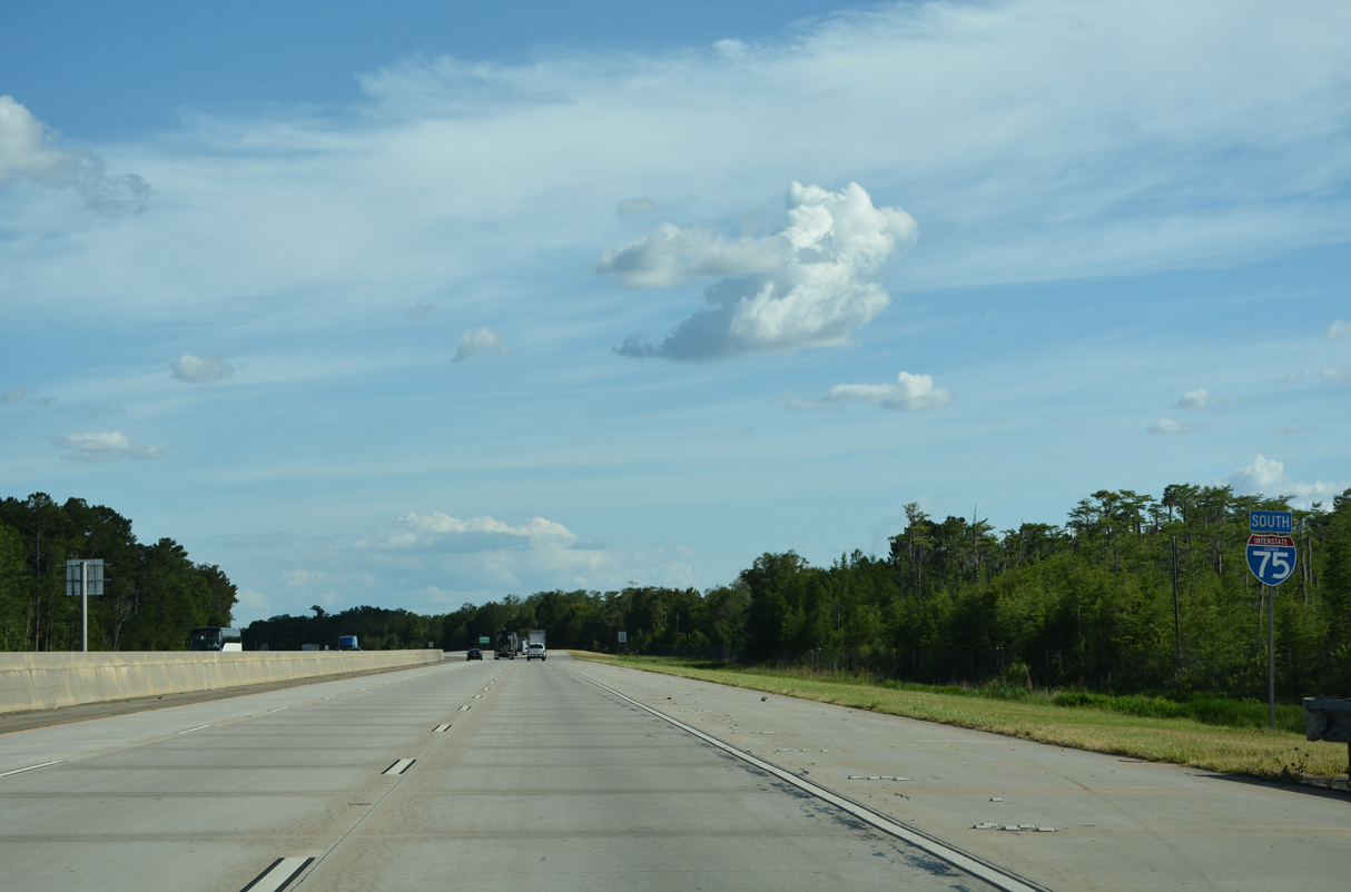
| Continuing south from Cecil, Interstate 75 passes between wetlands areas to the Lowndes County line. 06/26/22 |
|
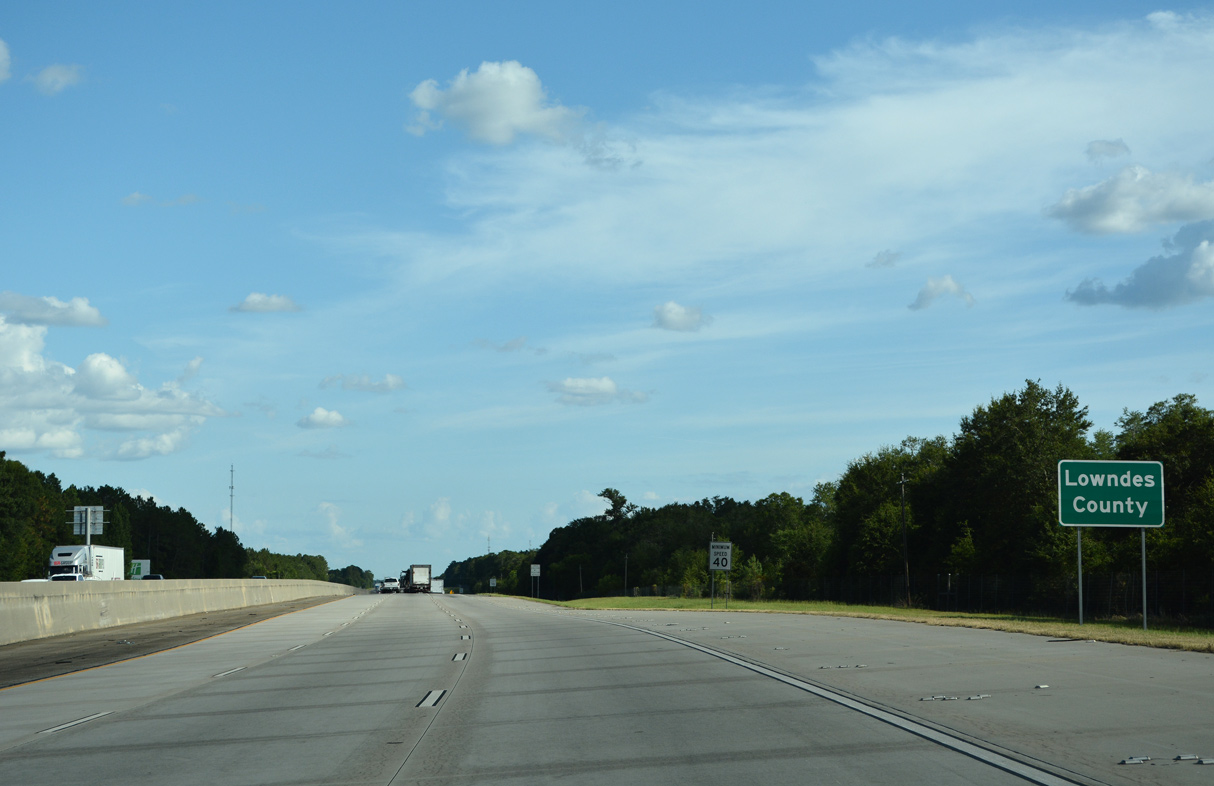
| South into Lowndes County, Interstate 75 advances across Franks Creek and by abandoned rest areas in both directions. 06/26/22 |
|
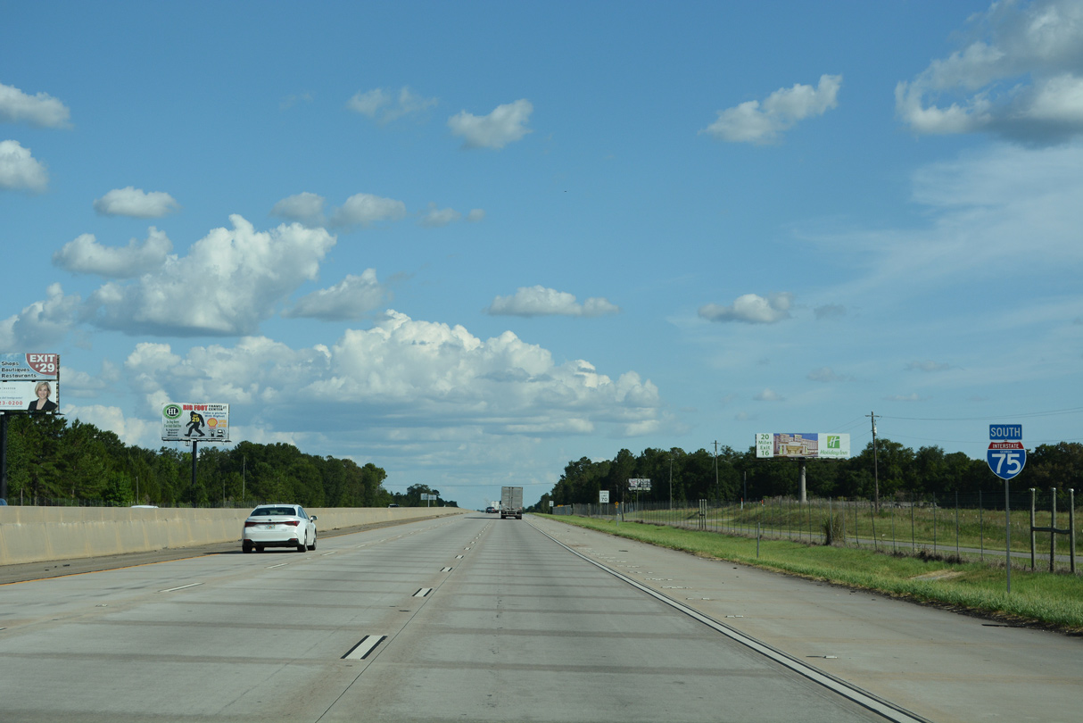
| Exit 29 joins Interstate 75 south with U.S. 41/SR 7 north and SR 122 to the Hahira city center. 06/26/22 |
|
| SR 122 enters Hahira from Barney, 7.2 miles to the west. East from Exit 29, SR 122 runs 18.7 miles to the Lanier County seat of Lakeland. SR 122 travels 98.31 miles overall between U.S. 19/SR 300 at Thomasville and U.S. 1-82/SR 520 in the Waycross area. 06/26/22 |
|
| SR 122 east 11.8 miles and SR 125 south 3.3 miles leads to Moody Air Force Base. 06/26/22 |
|
| U.S. 41/SR 7 overlap with I-75 south from the diamond interchange (Exit 29) with SR 122. Old U.S. 41 extends south from Church Street 7.24 miles from Hahira to Tillman, Mineola and N Valdosta Road. 08/07/13 |
|
| Running concurrent with I-75 south for 7.01 miles, U.S. 41/SR 7 are omitted from the succeeding shield assembly. U.S. 41/SR 7 shifted west onto I-75 between Hahira and north Valdosta in 1982. 04/18/20 |
|
| 14 miles from Valdosta along Interstate 75 south. Lake City is 60 miles further by the crossroads with Interstate 10. 06/26/22 |
|
| Weigh stations operate in both directions of I-75/U.S. 41-SR 7 west of Tillman. 04/18/20, 06/26/22 |
|
| Interstate 75 proceeds south from the weigh stations along the west of the Stone Creek Golf Club community. 06/26/22 |
|
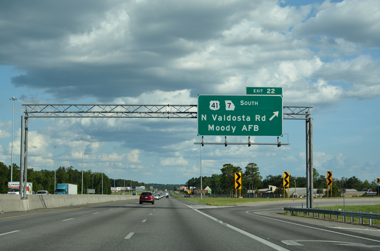
| U.S. 41/SR 7 part ways with I-75 south for Valdosta Road at a parclo interchange (Exit 22). The forthcoming exchange was rebuilt in 2018-19 with a new overpass for Valdosta Road. 06/26/22 |
|
| Dropped from signs in 2018, Business Loop I-75 followed U.S. 41/SR 7 (N Valdosta Road) east to Five Points in Valdosta. There U.S. 41/SR 7 shift onto Inner Perimeter Road while Valdosta Road (U.S. 41BU) turns south toward Ashley Street and Downtown. 06/26/22 |
|
| Business Loop I-75 in Valdosta is unsigned south until U.S. 41BU/SR 7BU (l Ashley Street) reaches Downtown. Business 75 combines with U.S. 84/221 west back to I-75 at Exit 16. 06/26/22 |
|
| The loop ramp at Exit 22 ties into Valdosta Road east and Shiloh Road west across from Amber Drive. U.S. 41/SR 7 bypass Valdosta along Inner Perimeter Road, an at-grade bypass encircling the city to Valdosta Regional Airport (VLD). 08/07/13 |
|
| Interstate 75 travels south without any other overlaps for the remaining 493 miles to South Florida. 06/26/22 |
|
| Forthcoming Exit 18 joins Interstate 75 with SR 133 (St. Augustine Road) west of Valdosta State University and the city of Remerton. 06/26/22 |
|
| I-75 advances across the Withlacoochee River to the diamond interchange (Exit 18) with SR 133 (St. Augustine Road) at Troupville. 06/26/22 |
|
| SR 133 travels 82.85 miles southeast from U.S. 19/SR 3 in the Albany area to Moultrie, Morven and U.S. 84/221 and Business Loop I-75 in Valdosta. 06/26/22 |
|
| SR 133 (St. Augustine Road) runs southeast through a retail area anchored by Valdosta Mall. 06/26/22 |
|
| West from Exit 18, SR 133 spans the Little River into Brooks County, following the former alignment of SR 94 north to SR 333 near New Rock Hill. 06/26/22 |
|
| Lowndes High School and additional big box retail lines the east side of Interstate 75 south along the western outskirts of Valdosta. 04/18/20 |
|
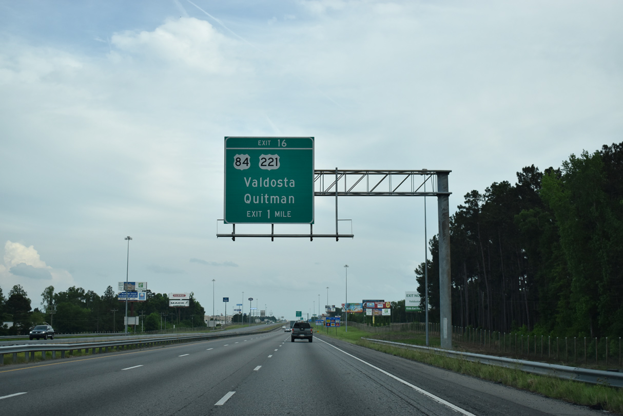
| Paralleling a CSX Railroad, U.S. 84/221-SR 38 join Valdosta with the Brooks County seat of Quitman, 14 miles to the west of Exit 16. 04/18/20 |
|
| U.S. 84 doubles as the Wiregrass Georgia Parkway along the 259 mile long cross state route between the Alabama state line at Saffold and I-95 at Exit 76. U.S. 221 runs concurrent with U.S. 84 from Inner Perimeter Road (U.S. 41/SR 7) on the east side of Valdosta to Quitman. 04/18/20 |
|
| An array of traveler services line U.S. 84/221, SR 38 and Business Loop I-75 east toward Downtown from the folded diamond interchange at Exit 16. U.S. 84/221 west from Valdosta transitions into a four lane divided highway to Quitman, where U.S. 221 turns south to Greenville, Florida. 04/18/20 |
|
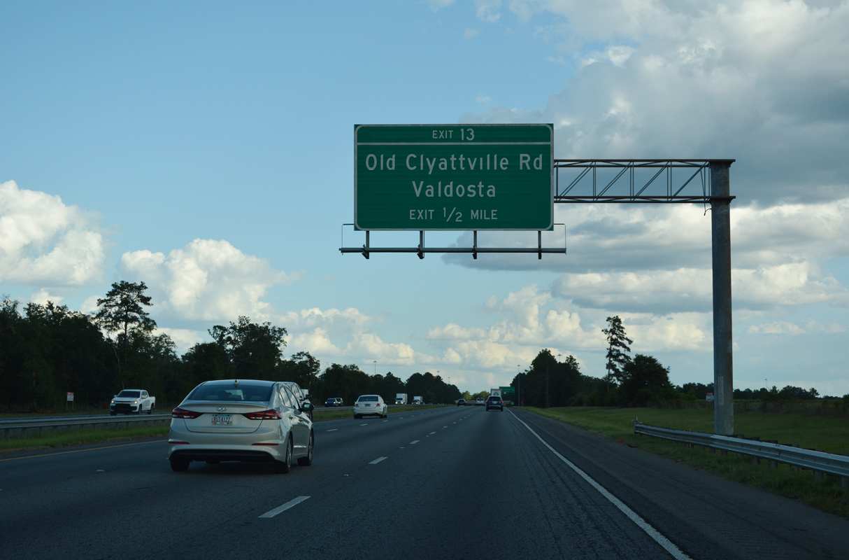
| Old Clyattsville Road winds along the west side of Valdosta Regional Airport (VLD) 2.47 miles south from S Stanley Street to Interstate 75 at Exit 13. 06/26/22 |
|
| Interstate 75 crosses Mud Swamp leading south to Exit 13 with Old Clyattville Road. 06/26/22 |
|
| The parclo interchange (Exit 13) with Old Clyattville Road was added after the completion of Interstate 75. 06/26/22 |
|
| A minor arterial, Old Clyattville Road continues 6.21 miles south from I-75 at Exit 13 to the community of Clyattville. 06/26/22 |
|
| Interstate 75 elevates to pass over the Valdosta Southern Railroad line west of the Fern Pond wetlands. 06/26/22 |
|
| SR 31, the counterpart of U.S. 221 south from Douglas and Lakeland, emerges along the southernmost extent of Inner Perimeter Road. U.S. 41/SR 7 leave the arterial beltway for Dasher, Twin Lakes and Lake Park while SR 31 continues the loop southwest to Madison Highway. 04/18/20 |
|
| One half mile ahead of the diamond interchange (Exit 11) with SR 31 (Madison Highway). Madison Highway 3.65 miles north of Inner Perimeter Road and VLD Airport is the former alignment of SR 31 to Patterson Street outside Downtown. 06/26/22 |
|
| South from Exit 11, SR 31 continues 4.4 miles to Clyattville and 8.87 miles to the state line. The 166.53 mile long route from Wrightsville transitions into Florida State Route 145 south en route to Madison. 06/26/22 |
|
| Ten miles of Interstate 75 south remain in the Peach State beyond this confirming marker. 06/26/22 |
|
| Twin Lakes, an unincorporated community along U.S. 41/SR 7, is just north of the city of Lake Park. Lake City lies 57 miles to the southeast in North Florida. 06/26/22 |
|
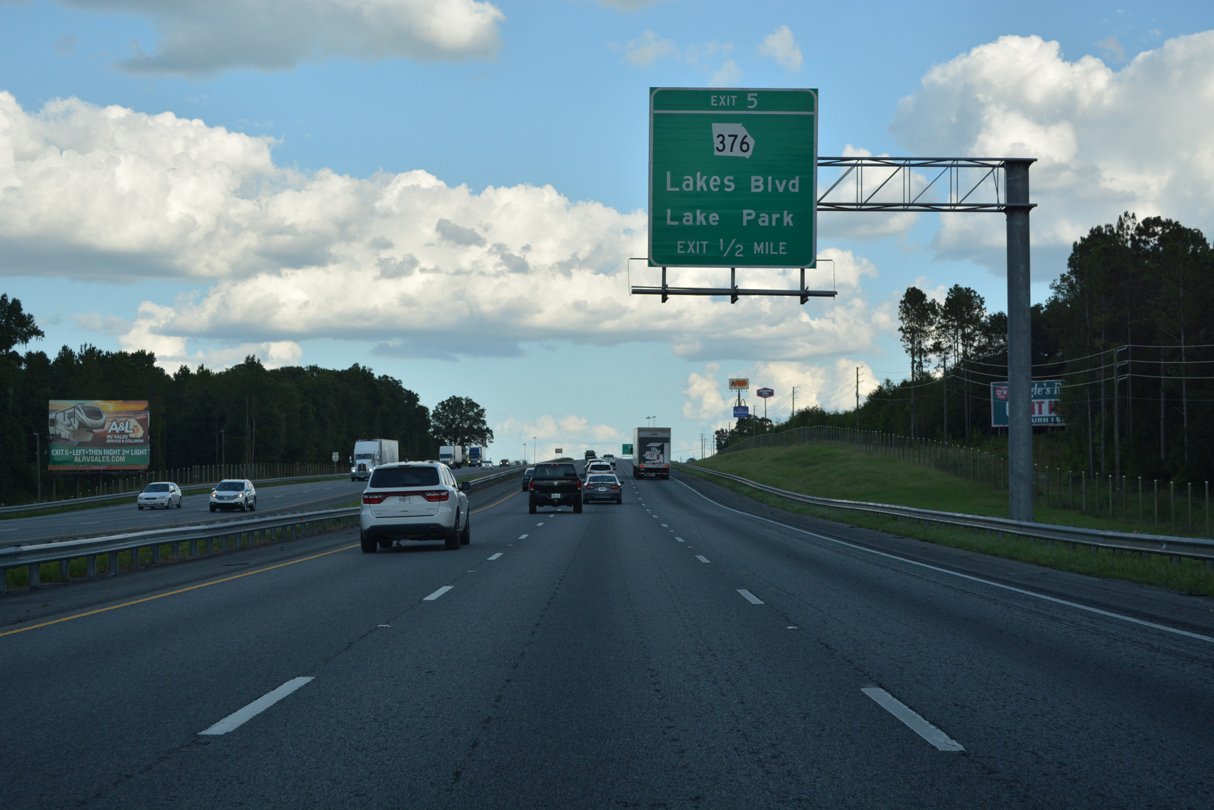
| SR 376, a 15.99 mile long route between Clyattville and SR 135 west of Statenville, meets Interstate 75 at Exit 5. 06/26/22 |
|
| SR 376 (Lakes Boulevard) leads east from Exit 5 along Francis Lake Golf Club to an overlap with U.S. 41/SR 7 (Marion Avenue) through the city of Lake Park. The area is home to a number of lakes, Hammock Lake, Long Pond and Ocean Pond. 06/26/22 |
|
| Retail and traveler services occupy three quadrants of the diamond interchange (Exit 5) with SR 376. SR 376 west transitions into a rural highway along Clyattville Lake Park Road to SR 31. 06/26/22 |
|
| Interstate 75 angles southeast between Pike Pond and Ocean Pond on the ensuing stretch. 04/18/20 |
|
| Bellville Road extends 2.05 miles south from Main Street at Ocean Pond Road in Lake Park to a diamond interchange (Exit 2) with Interstate 75. 06/26/22 |
|
| Southwest from Exit 2, Bellville Road continues another 1.25 miles to the Florida state line. Hamilton County Road 145 commences south from there to CR 152 near the settlement of Bellville. 06/26/22 |
|
| Beyond a pair of truck stops by Exit 2, Bellville Road north leads to a Home Depot distribution center at Mill Store Road. Main Street north connects with U.S. 41/SR 7, one from the east split with SR 376 (East Street). 06/26/22 |
|
| The last state named shield for Interstate 75 southbound. 04/18/20 |
|
| Interstate 75 enters the Hamilton County in the Sunshine State near Enoch Pond. 2019 GDOT traffic counts here topped out at 44,900 vpd. 06/26/22 |
Page Updated 09-22-2022.

 South
South