|
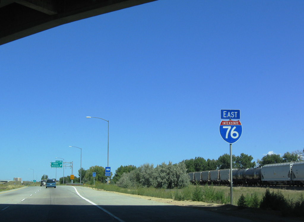
| The next exit along eastbound I-76/U.S. 6 is with 136th Avenue. 04/22/17 |
|
| Four interchanges serve the city of Brighton from Interstate 76 east. 04/22/17 |
|
| Reassurance marker preceding the diamond interchange (Exit 20) with 136th Avenue. The BNSF Railroad line runs just east of the freeway within the vicinity of Barr Lake. 08/29/04 |
|
| 136th Avenue spurs east from Exit 20 to Barr Lake and west to U.S. 85 (Canam Highway) and Brighton Road. 04/22/17 |
|
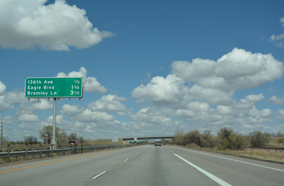
| Continuing northeast, I-76/U.S. 6 meet Eagle Boulevard at a diamond interchange (Exit 21) in one mile. 04/22/17 |
|
| I-76 runs between old U.S. 6 to the east and Prairie Center Parkway, a commercial boulevard, to the west. 04/22/17 |
|
| West from Exit 21 to 27th Avenue, 144th Avenue was realigned and renamed to Eagle Boulevard. The northeast suburbs extend along I-76 to Lochbuie, located 4.75 miles north of Barr Lake. 04/22/17 |
|
| Exit 21 departs I-76/U.S. 6 east for Eagle Boulevard west to the Prairie Center big box retail area and 144th Avenue east to adjacent Barr Lake State Park. 04/22/17 |
|
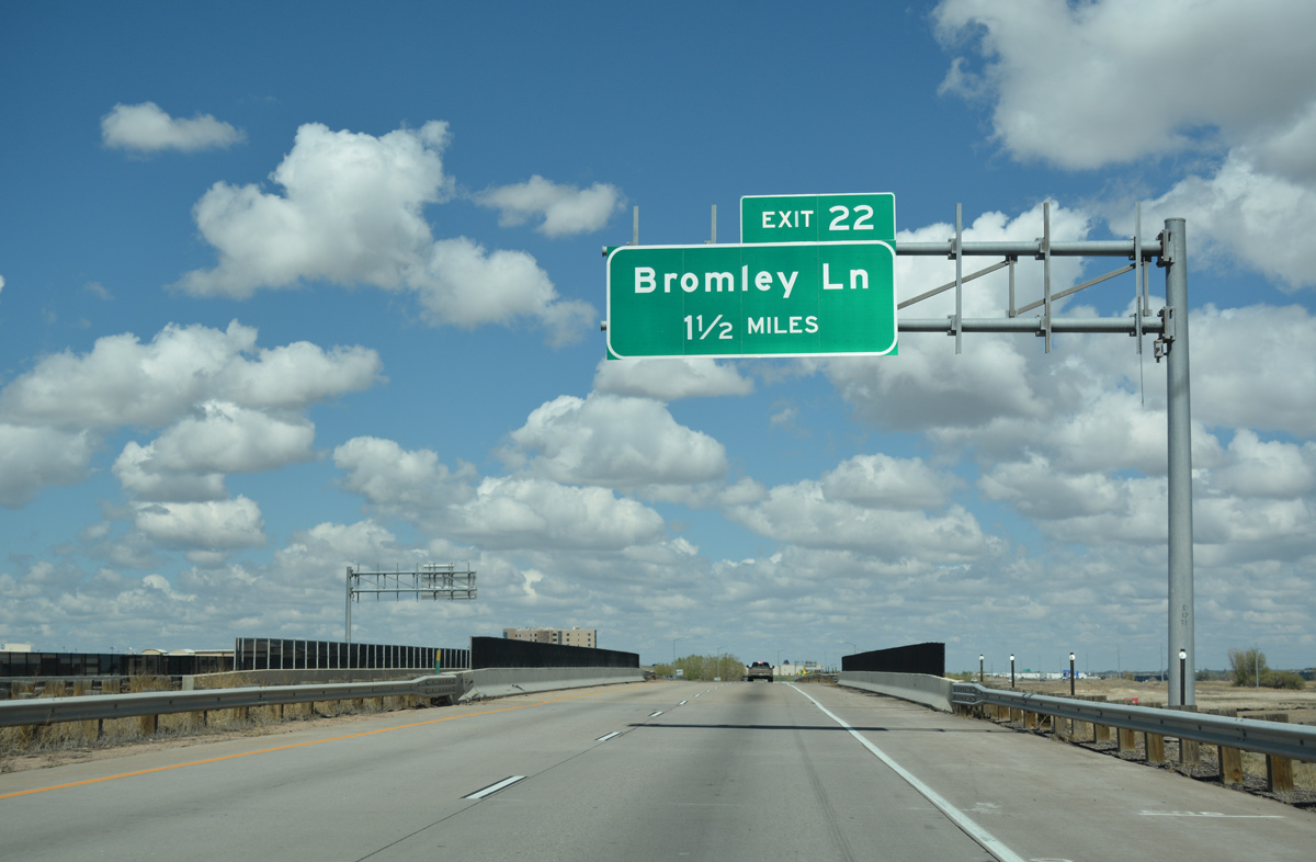
| Straddling eastern reaches of Brighton, I-76/U.S. 6 east next meets Bromley Lane at Exit 22. 04/22/17 |
|
| Bromley Lane also connects to Barr Lake State Park; it approaches the park from the northeast, offering access to the dam and most recreational areas via Piccadilly Road south. 04/22/17 |
|
| Interchange sequence sign posted 3.25 miles ahead of Baseline Road and the Adams / Weld County line, and 9.5 miles from SH 52 at the town of Hudson. 04/22/17 |
|
| Bromley Lane extends west from the diamond interchange (Exit 22) with Interstate 76 to the Adams County Courthouse and the south end of the Brighton street grid to U.S. 85. 152nd Avenue continues the road east through rural areas toward Horse Creek Reservoir. 04/22/17 |
|
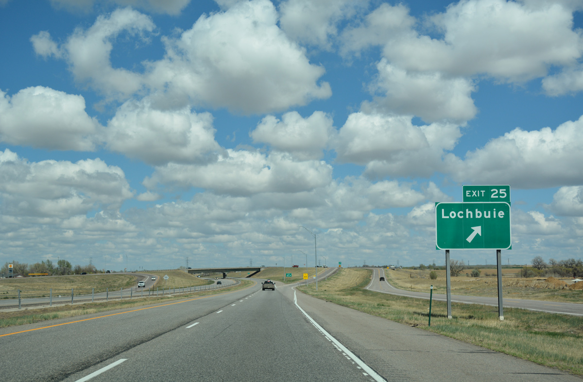
| Progressing north, Interstate 76 travels three miles to the town of Lochbuie and 104 miles to Sterling. 04/22/17 |
|
| A sign replacement made ahead of the 160th Avenue overpass replaced Julesburg (162 miles) with Junction I-80 (163 miles). 04/22/17 |
|
| The Lochbuie exit from I-76 connects with Baseline Road. Baseline runs along the county line west between Lochbuie and Brighton to N 50th Avenue. 08/29/04 |
|
| A diamond interchange (Exit 25) joins Baseline Road with Interstate 76 on the southeast side of Lochbuie. Baseline Road / 168th Avenue doubles as County Road 2. 04/22/17 |
|
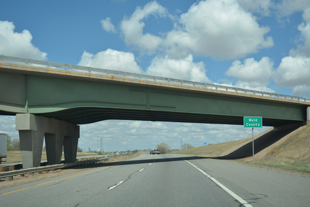
| Interstate 76 and U.S. 6 enter Weld County. With a land area of 3,999 square miles, Weld County reaches as far north as Wyoming. Greeley, located at the cross roads of U.S. 85 and U.S. 34, is the county seat. 04/22/17 |
|
| I-76/U.S. 6 straddle the Lochbuie town line north to milepost 28.5, where the Hudson town limits take over. 04/22/17 |
|
| Weld County Road 4 spans both I-76 and the adjacent BNSF Railroad. 04/22/17 |
|
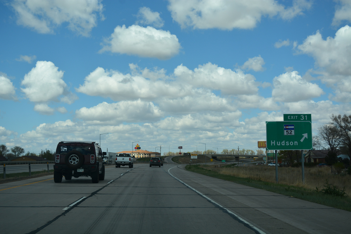
| Advancing northeast five miles from the Adams County line, I-76/U.S. 6 east meet SH 52 (Main Street) at Exit 31, the primary interchange for Hudson. 04/22/17 |
|
| The Town of Hudson is located at 5,024 feet above sea level, and it is one of the several dozen incorporated towns in Weld County. Founded in 1887, Hudson began as a stopping point along the Burlington Northern Railroad, which parallels Interstate 76 from Denver all the way to Nebraska. 04/22/17 |
|
| SH 52 (Main Street) runs east from Exit 31 in Hudson to Prospect Valley and Wiggins. Westward, SH 52 connects with U.S. 85 at Fort Lupton, Interstate 25 near Dacono, U.S. 287 south of Longmont and SH 119 (Diagonal Highway) near Niwot. 04/22/17 |
|
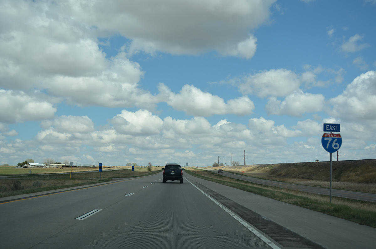
| Confirming marker for Interstate 76 posted along the west side of Hudson. 04/22/17 |
|
| Keenesburg lies seven miles ahead, following by Brush, where U.S. 34 branches southeast from the I-76 corridor, in 57 miles. 04/22/17 |
|
| The succeeding exit along eastbound is for County Road 49 (Kersey Road). Kersey Road (old SH 37) travels north to Kersey and U.S. 34, east of Greeley. 04/22/17 |
|
| Entering the diamond interchange (Exit 34) with CR 49 (Kersey Road) on I-76/U.S. 6 east. The bridge to the east of the exchange is a grade separation between the BNSF Railroad and CR 16. The south side frontage road connects Exit 34 with CR 49 south via CR 16 east. 04/22/17 |
|
| Visible next to this reassurance marker by milepost 35, the south side frontage road east to Keenesburg is former U.S. 6 and SH 2. 04/22/17 |
|
| Heading east, the freeway reaches Exit 39 and the town of Keenesburg in four miles. Fort Morgan lies 45 miles ahead. 04/22/17 |
|
| Market Street in Keenesburg doubles as unsigned Business Spur I-76 north to County Road 18 and south to Old Highway 6 and Elm Street by the town center. 04/22/17 |
|
| Exit 39 leaves Interstate 76 east for Business Spur I-76 (Market Street). 04/22/17 |
|
| Keenesburg is home to over 1,100 people, and its motto is "Where a handshake is still part of doing business." 04/22/17 |
|
| I-76/U.S. 6 angle northeast between Ennis Draw and the BNSF Railroad siding of Tampa over the next several miles. 04/22/17 |
|
| Fort Morgan replaces Brush on this distance sign, 40 miles from the city over 10,000. 04/22/17 |
|
| After passing through Keenesburg, Interstate 76 passes through open fields and ranch land. Wildflowers often populate the landscape of the high plains during the warm summer months. 04/22/17 |
|
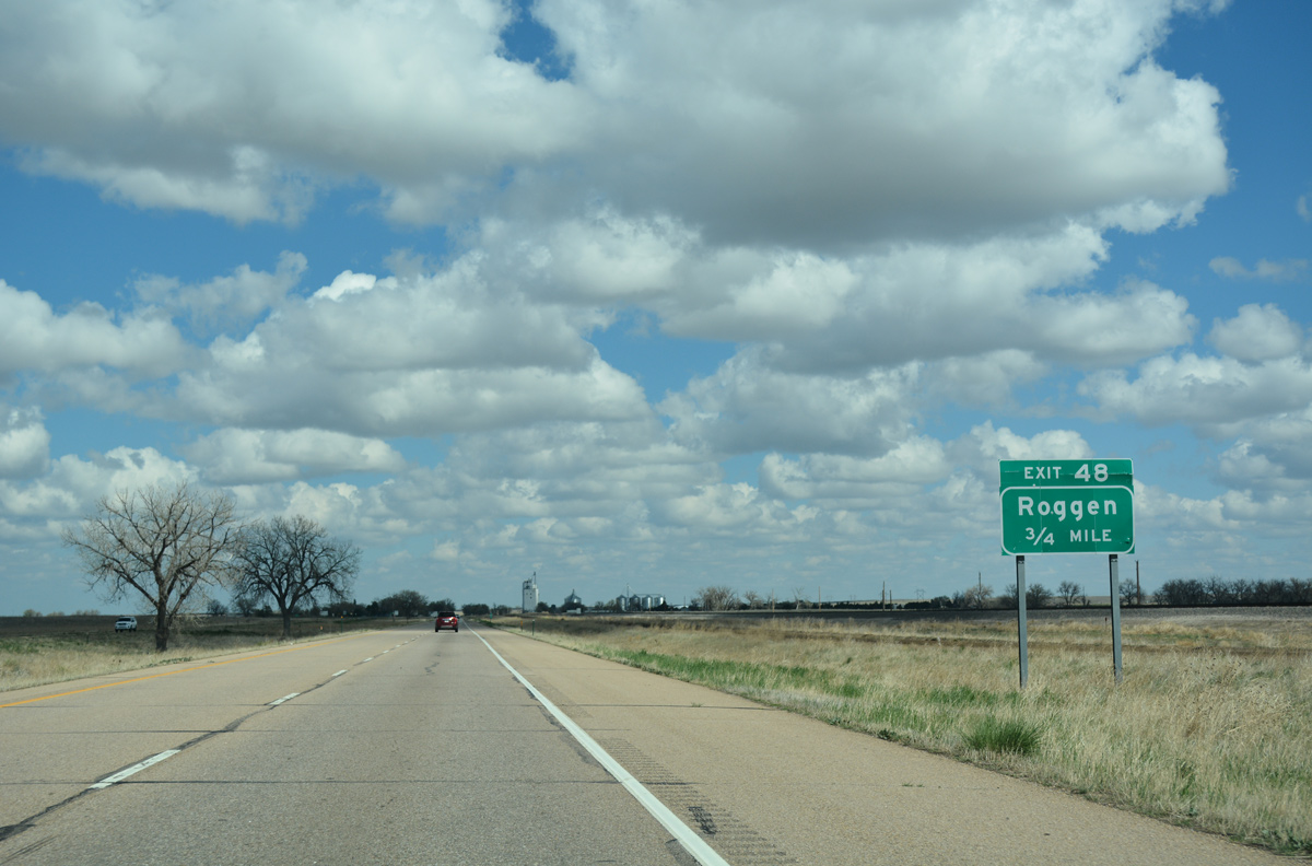
| A few trees, which have been sparse since leaving Denver, appear in the median as Interstate 76 and U.S. 6 advance to the settlement of Roggen. 04/22/17 |
|
| I-76/U.S. 6 east reach the diamond interchange (Exit 48) with County Road 73 in three quarters of a mile. 04/22/17 |
|
| Exit 48 departs I-76/U.S. 6 east for Weld County Road 73 south to SH 52 and adjacent CR 399 (old U.S. 6 / Front Street) into Roggen. 04/22/17 |
|
| Interstate 76 crosses over Weld County Road 386 beyond this confirming marker. A westbound off-ramp (Exit 49) connects with the county road north to Painter Ranch. 04/22/17 |
|
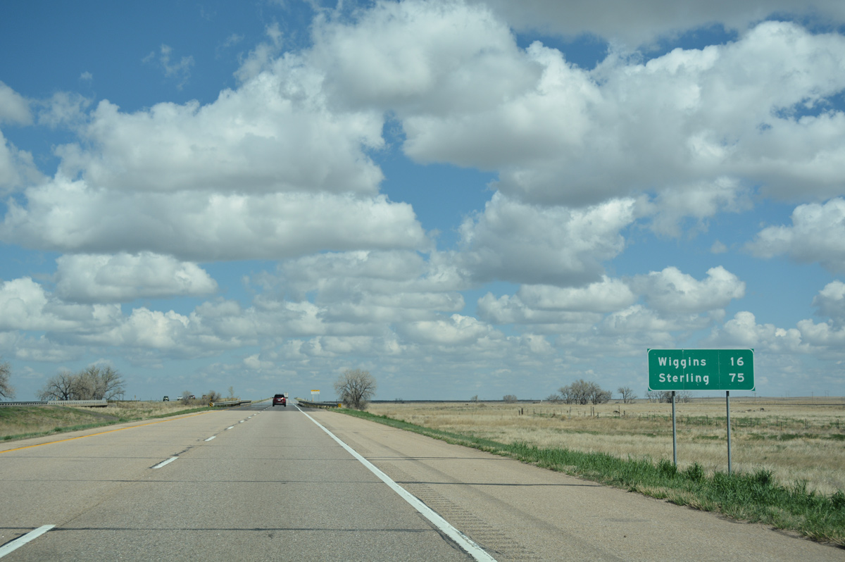
| A rural stretch takes I-76 east 16 miles to Wiggins. Sterling is 75 miles away. 04/22/17 |
|
| The freeway turns northeast, away from the parallel BNSF Railroad for a nearly ten mile straight away toward Empire Reservoir. 04/22/17 |
|
| The south side frontage road merges onto I-76/U.S. 6 east midway between milepost 51 and 52. 04/22/17 |
|
| The freeway directly overlays old U.S. 6/SH 2 to Exit 60. 04/22/17 |
|
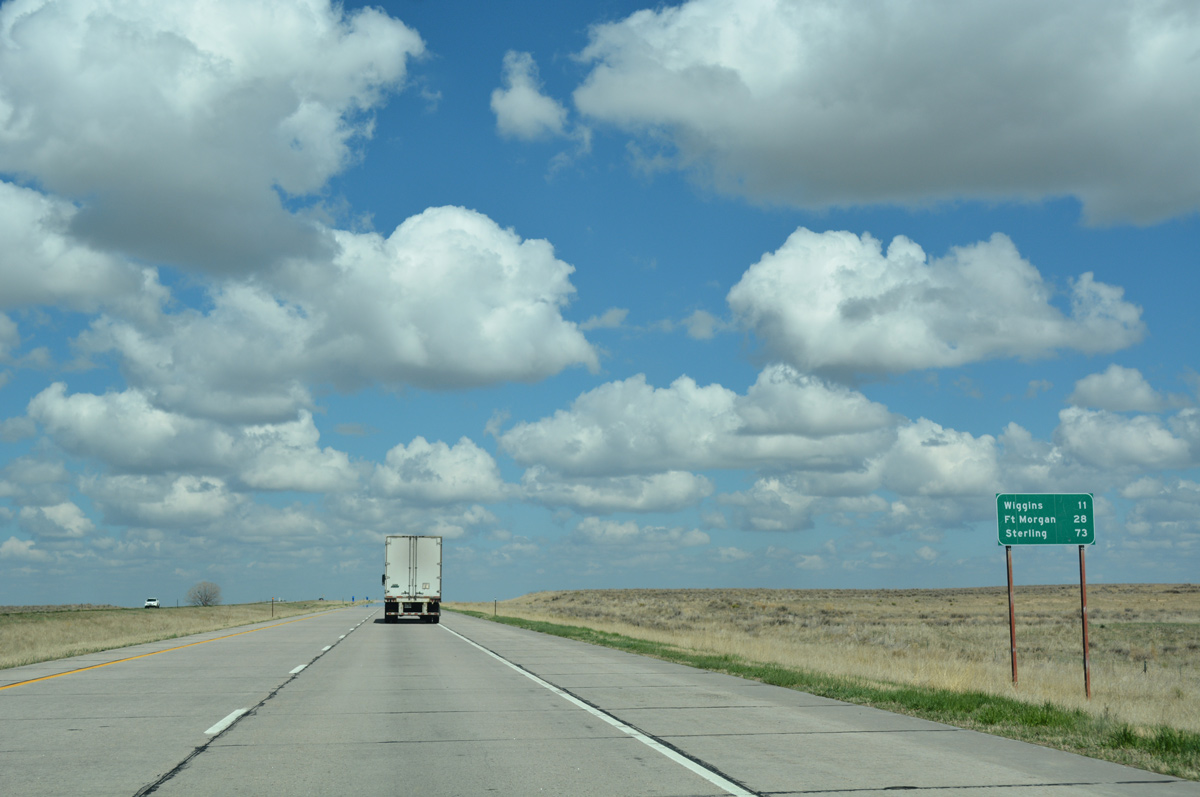
| Distance sign posted 11 miles from Wiggins, 28 miles from Fort Morgan and 73 miles from Sterling. 04/22/17 |
|
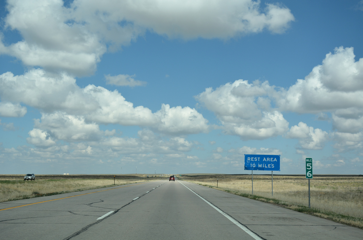
| The vast and open Northern Colorado Plains at mile marker 56 are stark in contrast when compared to the urban density found along I-76 in metro Denver. An off freeway rest area lies ten miles ahead at Exit 66A. 04/22/17 |
|
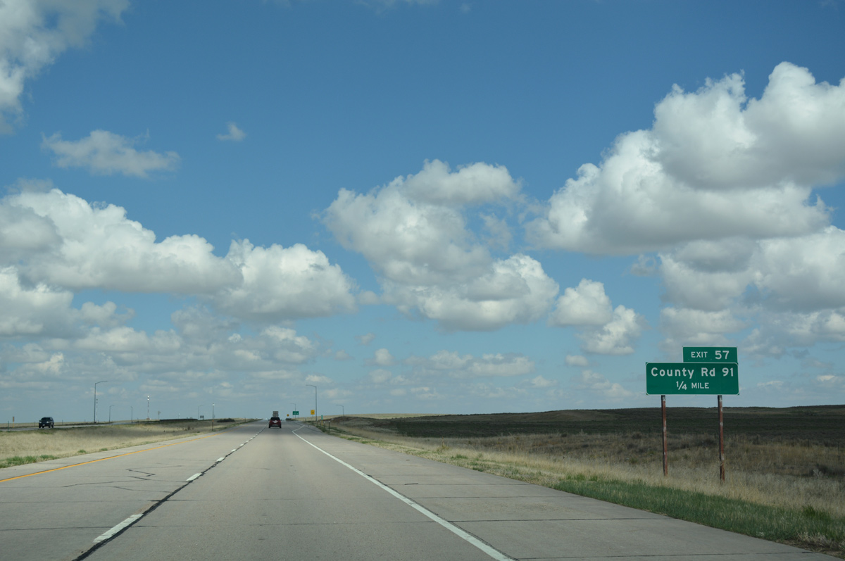
| Typical of western states, the ranch exit with County Road 91 (Chappleton Lane) receives one guide sign. 04/22/17 |
|
| County Road 91 dog legs east on a frontage road en route to U.S. 34 at the Green City Flats. 04/22/17 |
|
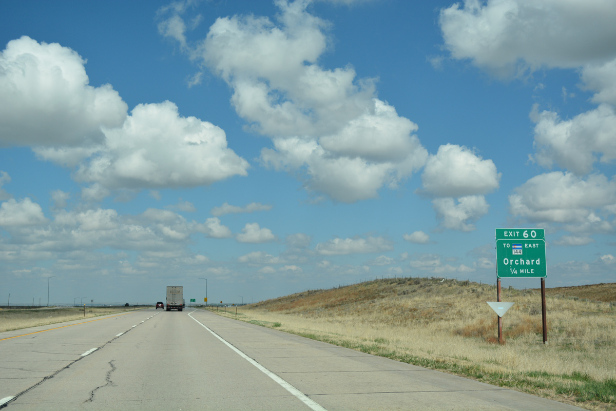
| Interstate 76 bee lines northeast to a diamond interchange (Exit 60) with the north side frontage road and ranch areas. 04/22/17 |
|
| Empire Reservoir appears along the northern horizon in this scene from I-76 near milepost 59. The reservoir was formed by the construction of eight dams, totaling nearly five miles in length, starting in May 1906. Water from the South Platte River filled the revoir through a 21 mile long inlet ditch.1 04/22/17 |
|
| The frontage road east from Exit 60 leads motorists to SH 144. SH 144 heads north to Empire Reservoir, U.S. 34, Orchard and Goodrich. 04/22/17 |
|
| Exit 60 leaves I-76/U.S. 6 east for SH 144. SH 144 runs 28.80 miles in a loop north along the South Platte River to Weldona and east to Log Lane Village. 04/22/17 |
|
| Wiggins appears in the distance beyond this reassurance marker posted after Exit 60. 04/22/17 |
|
| The South Platte River and Interstate 76 converge at Fort Morgan, 19 miles to the east. The two parallel one another northeast to Sterling (64 miles). 04/22/17 |
|
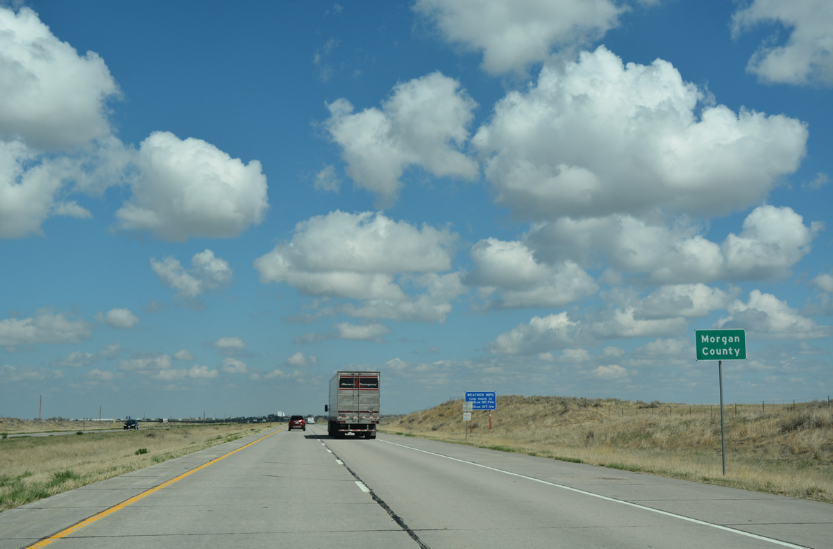
| Interstate 76 crosses the Morgan County line, a mile and half south of Empire Reservoir. 04/22/17 |
|
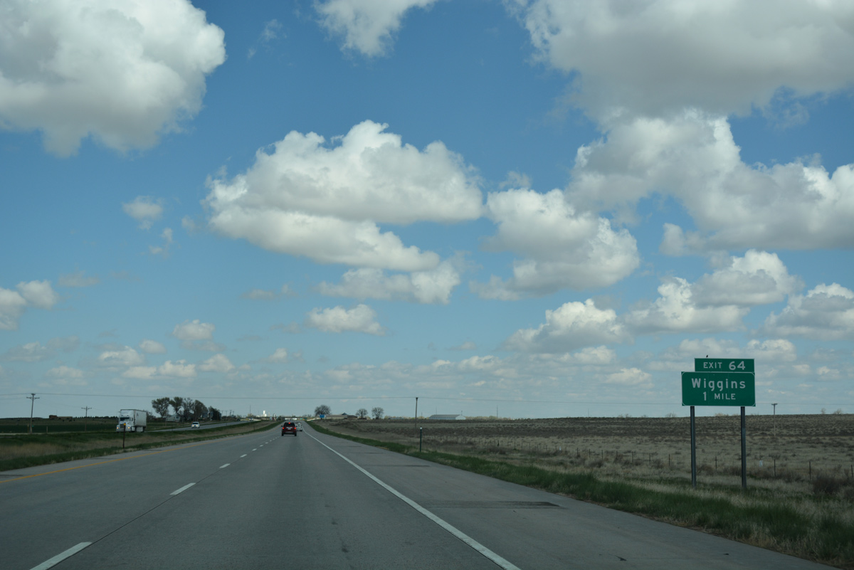
| The first exit along eastbound I-76/U.S. 6 in Morgan County is with U.S. 6 Business for the town of Wiggins. Inventoried as Route 006I by CDOT, the business loop runs 3.178 miles between Exits 64 and 66A-B. 04/22/17 |
|
| Unsigned U.S. 6 Business separates from I-76 at a half diamond interchange with County Road 300. Wiggins lies at an elevation of 4,548 feet and is home to around 900. Like other towns along I-76, Wiggins has its economy based on the railroad and agriculture. 04/22/17 |
Page Updated 05-10-2017.


 East
East