|
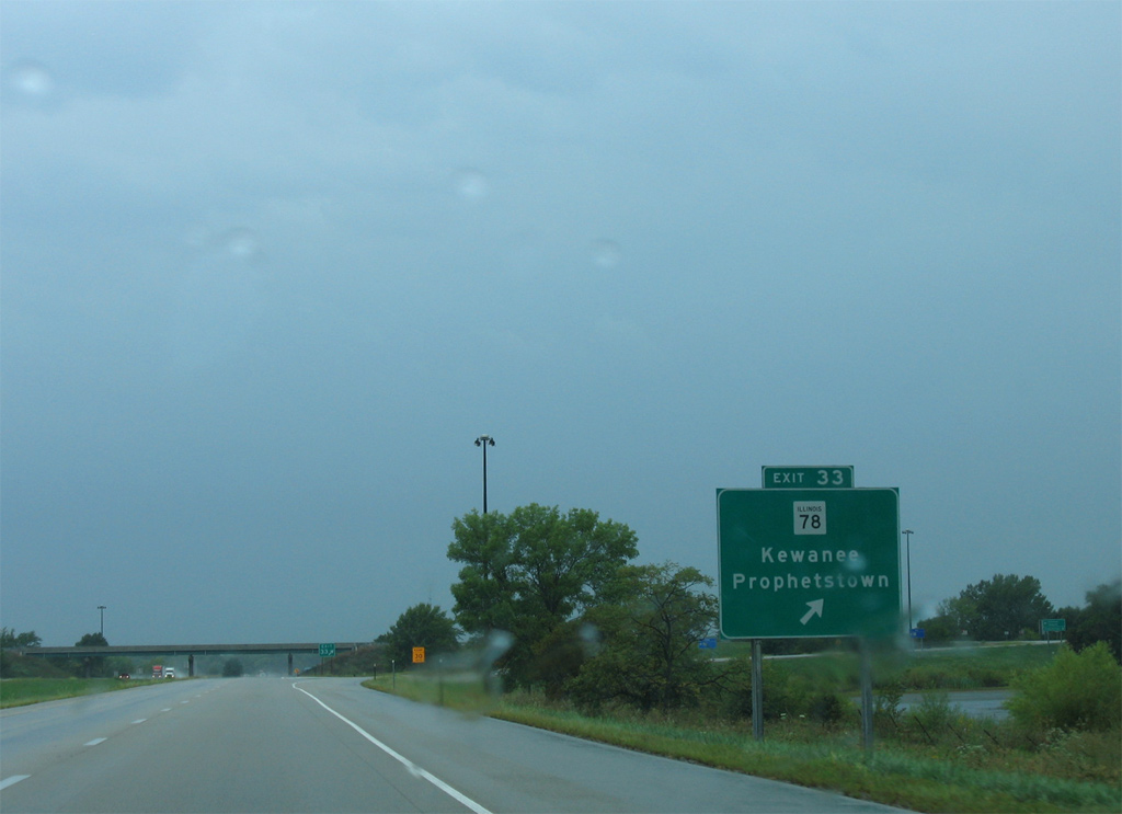
| Illinois Route 78 (Canal Street) and Interstate 80 come together at a diamond interchange (Exit 33) at the village of Annawan. IL 78 heads south 11 miles to Kewanee and 20 miles north to Prophetstown. 09/04/05 |
|
| Exit 33 is the first of six exits in Henry County along Interstate 80 west. IL 78 constitutes a 210 mile long highway from Jacksonville to the south and the Wisconsin state line near Warren to the north. 09/04/05 |
|
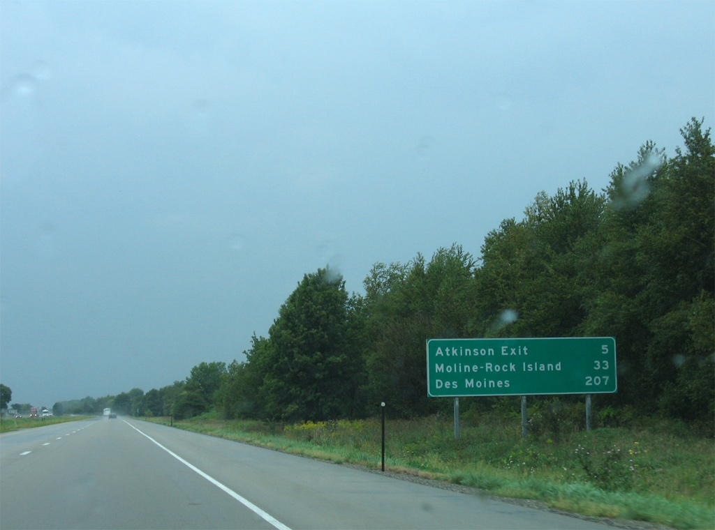
| Leading away from Annawan, Interstate 80 continues five miles to Atkinson. Moline and Rock Island are a 33 miles away via Interstate 74 west from I-80 in 22 miles. 09/04/05 |
|
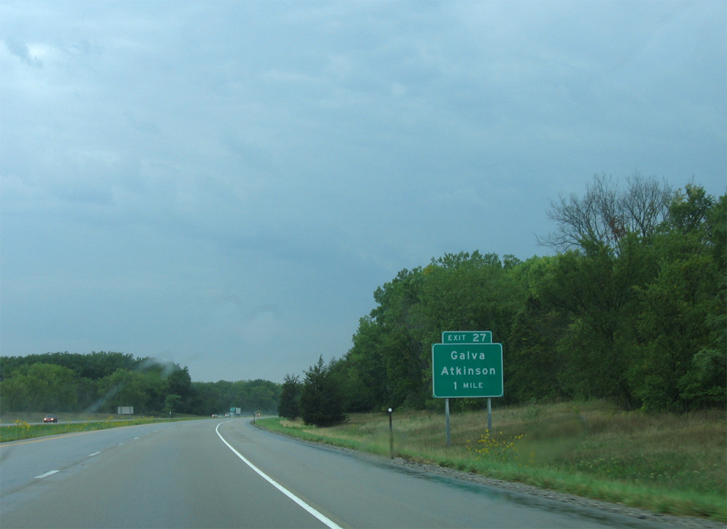
| The diamond interchange at Exit 27 connects Interstate 80 with Henry County Route 5 (State Street) at the town of Atkinson. 09/04/05 |
|
| The city of Galva is a 16.5 miles to the south of Exit 27 via County Route 5. 09/04/05 |
|
| State Street leads 0.60 miles north from Interstate 80 to U.S. 6 (Henry Street) and the Atkinson street grid. 09/04/05 |
|
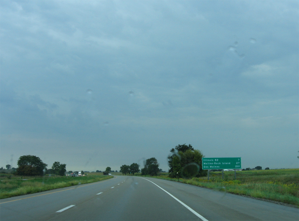
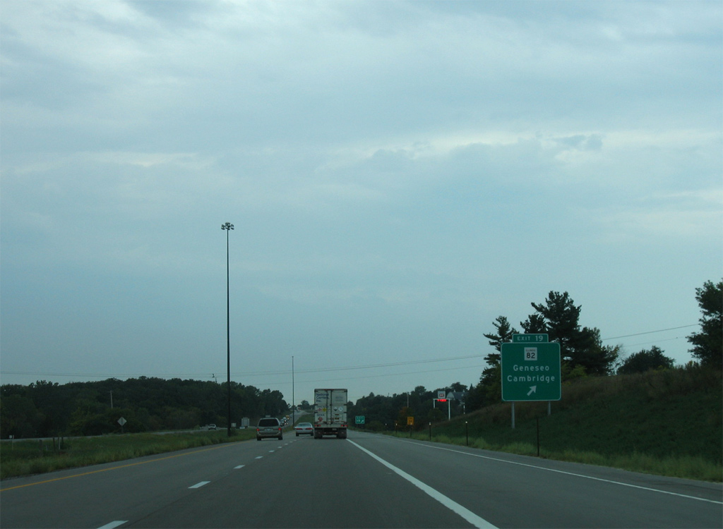
| The capital city of Iowa is 201 miles westward along Interstate 80. The freeway next meets IL 82 at Geneseo in seven miles. 09/04/05 |
|
| IL 82 travels wholly within Henry County along a 26 mile long course between IL 17 at Nekoma and IL 92 east of Joslin. 09/04/05 |
|
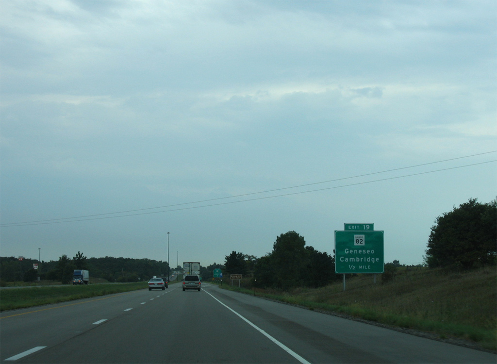
| The diamond interchange (Exit 19) with IL 82 (Oakwood Avenue) lies within southern reaches of the Geneseo city limits. IL 82 combines with U.S. 6 for 0.82 miles through Geneseo along Oakwood Avenue and W Main Street to Henry Street north. 09/04/05 |
|
| IL 82 heads ten miles south from Exit 19 to Cambridge. The historic village of Bishop Hill is further south via CR 4 (570th Avenue) east and CR 39 (1670th Street) south. 09/04/05 |
|
| An 8.6 mile exit less stretch leads Interstate 80 west to the cloverleaf interchange with I-74/IL 110 (CKC) outside the Quad Cities. 03/31/16 |
|
| Continuing west from Mineral Creek, I-80 advances two miles to the Big X Interchange (unmarked Exit 10) with I-74/IL 110 (CKC) and I-280 west by the city of Colona. 03/31/16 |
|
| I-280 comprises the southwestern half of the Quad Cities belt line to Moline and Rock Island. I-80 represents the northeastern half to East Moline and Bettendorf. The two reconvene in northwestern Davenport. 03/31/16 |
|
| Interstate 74 east links the Quad Cities area with Peoria, Bloomington-Normal and Champaign-Urbana in eastern Illinois. 03/31/16 |
|
| Interests to Quad City International Airport (MLI) are directed onto I-74/280. Located ten miles to the west of I-80, the airport is located south of I-74 along U.S. 6 in Moline. 03/31/16 |
|
| The westbound mainline of Interstate 80 utilizes a single lane ramp as part of a TOTSO (turn off to stay on) movement to overtake the freeway from I-74 northward to Colona and Le Claire, Iowa. 03/31/16 |
|
| I-74/IL 110 (Chicago Kansas City Expressway) travel south from the exchange with I-80/280 to Galesburg. IL 110 (CKC) turns west there alongside U.S. 34 to Monmouth, and south with U.S. 67 to Macomb. 03/31/16 |
|
| A small diagrammatic sign posted at the Osco Road under crossing outlines the TOTSO movement of Interstate 80 west. I-80 turns west from the Fred Schwengel Memorial Bridge across the Mississippi River to northern reaches of Bettendorf and Davenport. 03/31/16 |
|
| Interstate 80 turns north toward Cleveland and East Moline where I-280 west begins. I-280 travels 27 miles overall between Colona and northwest Davenport. 03/31/16 |
|
| Interstate 74 overlaps with I-280 west for 9.39 miles to south Moline. Within Illinois, I-74 travels 220 miles from east of Danville to the Mississippi River Bridge linking Moline with Bettendorf, Iowa. 06/21/22 |
|
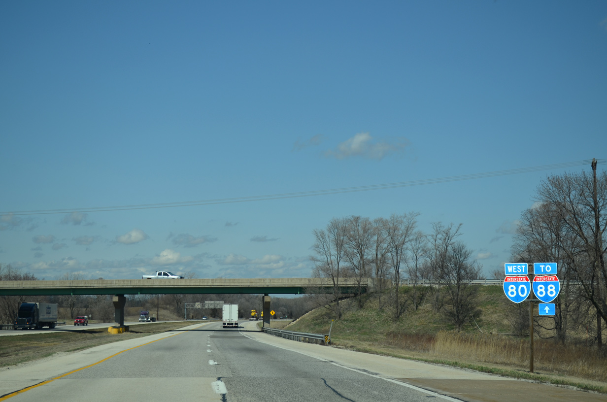
| IL 110 (Chicago-Kansas City Expressway), a multi state highway from I-35 at Claycomo, Missouri to I-290 in Chicago, combines with I-80 west from I-74 to I-88 east. 03/31/16 |
|
| U.S. 6 crosses I-80/IL 110 (CKC) 1.05 miles north of I-74/280 at Exit 9. The forthcoming exchange is the first connection from Interstate 80 west to U.S. 6 since Exit 161 at Lansing. 03/31/16 |
|
| U.S. 6 parallels the north side of Interstate 80 from Geneseo westward to the diamond interchange at Exit 9 and the city of Colona. Continuing west, U.S. 6 parallels I-74/280 to Coal Valley. 04/08/13 |
|
| Interstate 88 begins 6.7 miles north of the Big X Interchange. 04/08/13 |
|
| Interstate 80 crosses Mineral Creek for a second time with IL 110 (Chicago-Kansas City Expressway) between U.S. 6 and Poppy Garden Road. 04/08/13 |
|
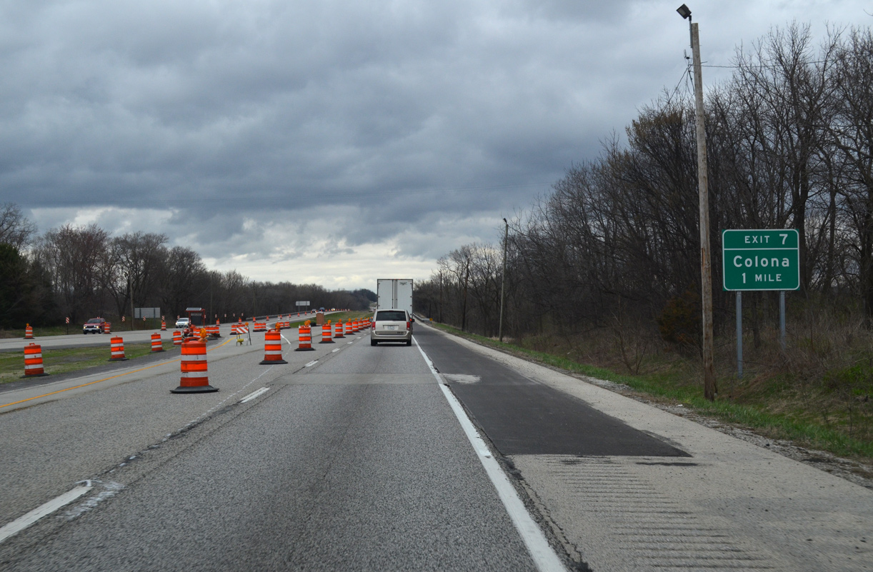
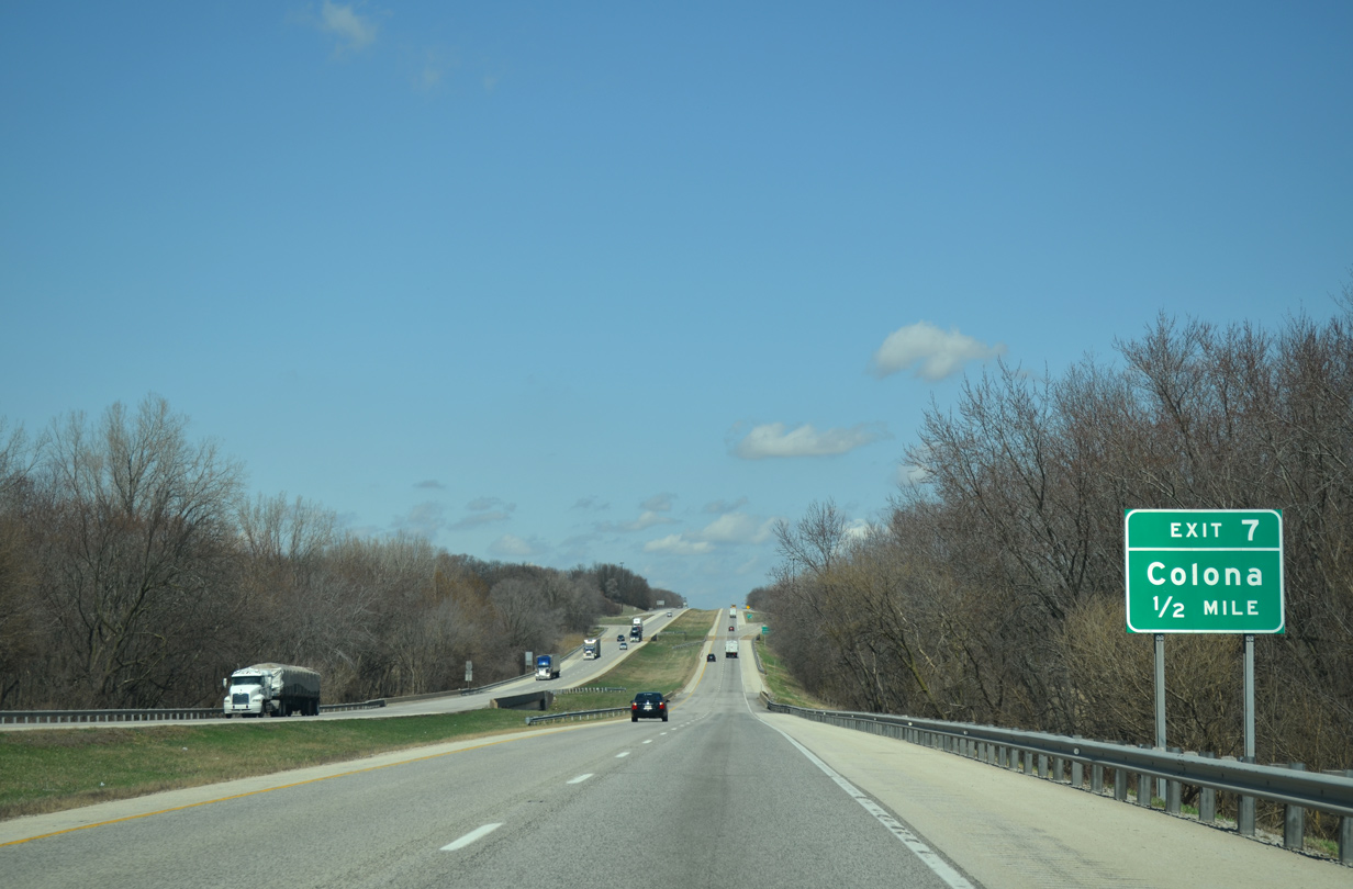
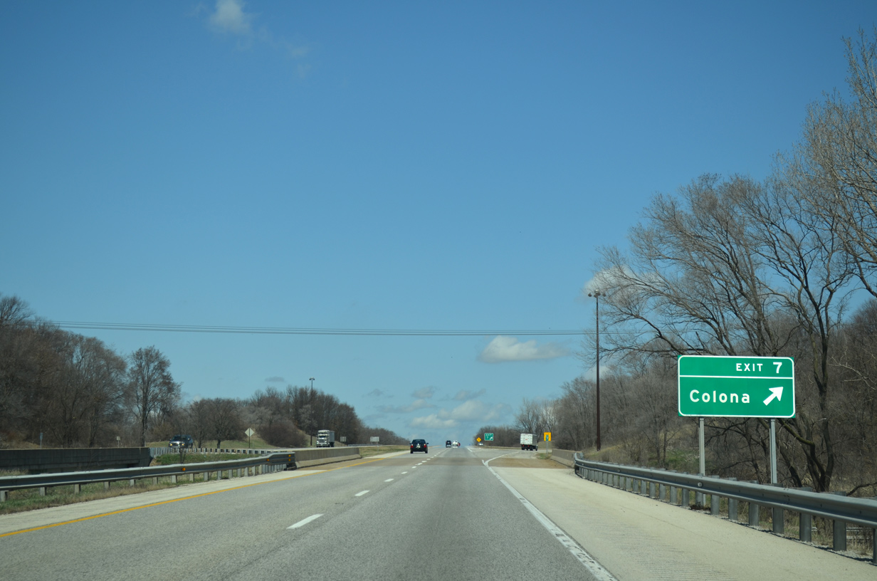
| I-80/IL 110 (CKC) reenter the Colona city limits one mile ahead of the folded diamond interchange (Exit 7) with Cleveland Road. 03/31/16 |
|
| I-80/IL-110 (CKC) span the IAIS Railroad and Green River within a half mile of Exit 7 in north Colona. 04/08/13 |
|
| Cleveland Road heads 1.07 miles west from I-80/IL 110 to IL 84 (1st Street) in Colona and east 1.73 miles to Dayton and Broadway Street in the village of Cleveland. 04/08/13 |
|
| I-80/IL 110 (CKC) proceed north from Colona along a rural stretch west of Cleveland. 06/21/22 |
|
| I-88 travels 140 miles east from I-80 at Exit 4 to Interstate 290 (Eisenhower Expressway) at Chicago. 06/21/22 |
|
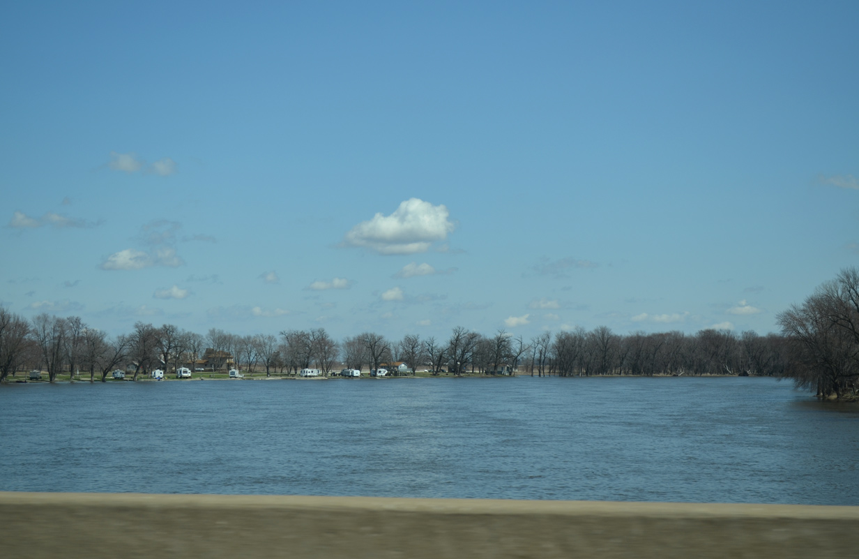
| Interstate 80 shifts westward through an S-curve across the Rock River, a 299 mile long waterway flowing southward from Theresa Marsh in Wisconsin to the Mississippi River at the Quad Cities. 06/21/22, 04/08/13 |
|
| The Rock River separates Henry and Rock Island Counties at milepost five along Interstate 80. 06/21/22 |
|
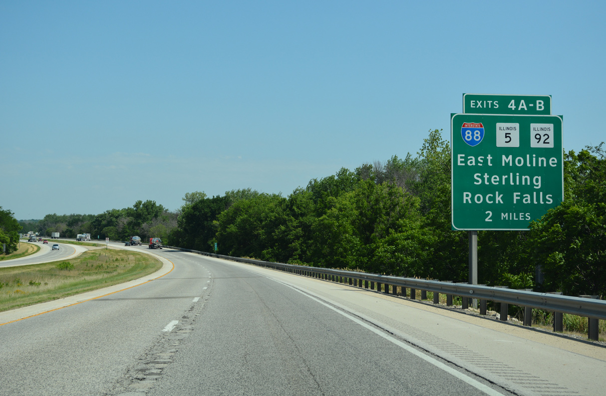
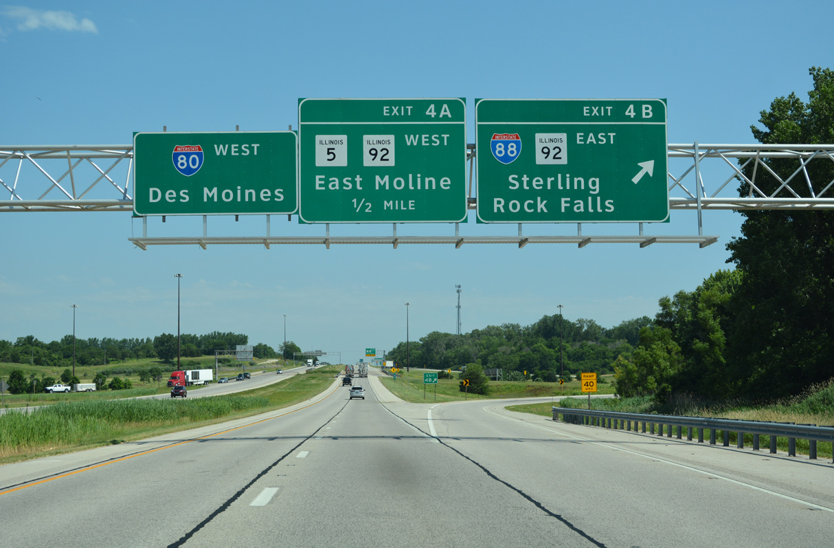
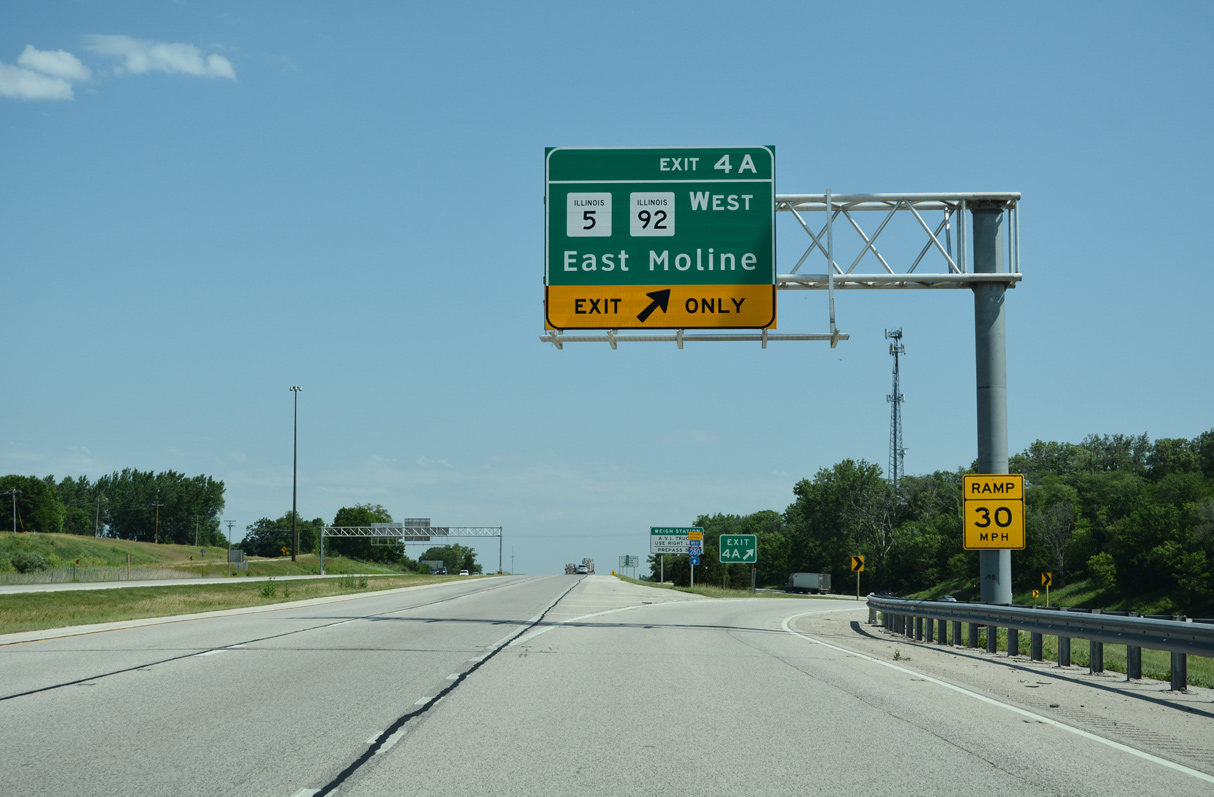
| A cloverleaf interchange (Exits 4 B/A) joins I-80 and I-88 in a rural area of East Moline. Designated in 1987, Interstate 88 replaced IL 5 along the freeway east to Sterling and along the East West Tollway to Chicago. IL 5 remains west to Silvis, East Moline, Moline and Rock Island. 06/21/22 |
|
| I-88/IL 110 (CKC) travel 44 miles to become the Ronald Reagan Memorial Tollway, which extends east from Rock Falls to Rochelle, De Kalb, Aurora, Naperville and Chicago. IL 92 branches east from I-88 in 5.6 miles along a lightly traveled route to Joslin, Walnut and U.S. 34 near La Moille. 06/21/22 |
|
| East Moline replaced Silvis on guide sign changes for Exit 4 A made by 2008. The city lies south of East Moline along IL 5 and IL 84/92. 06/21/22 |
|
| The Chicago Kansas City Expressway / IL 110 was established in 2010 with I-88 constituting the final leg of the 325 mile route. 06/21/22 |
|
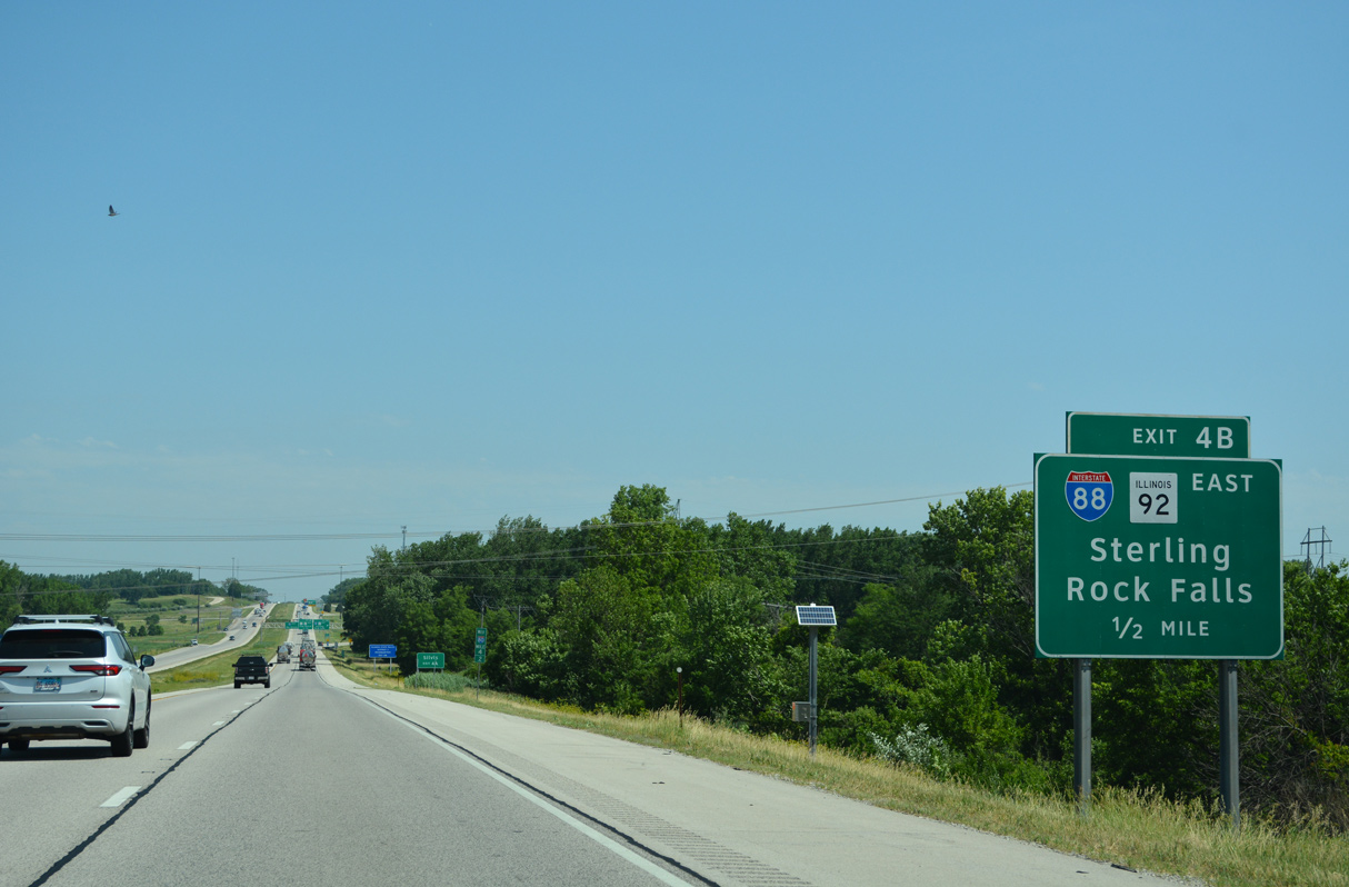
| Exit 4 B leaves Interstate 80 west for I-88/IL 110 east to Chicago. 06/21/22 |
|
| IL 5 overlaps with IL 92 west from the freeway end of I-88, 3.9 miles to IL 84 at Carbon Hill. There IL 92 joins IL 84 through Silvis while en route to the Moline and Rock Island Mississippi Riverfronts. 06/21/22 |
|
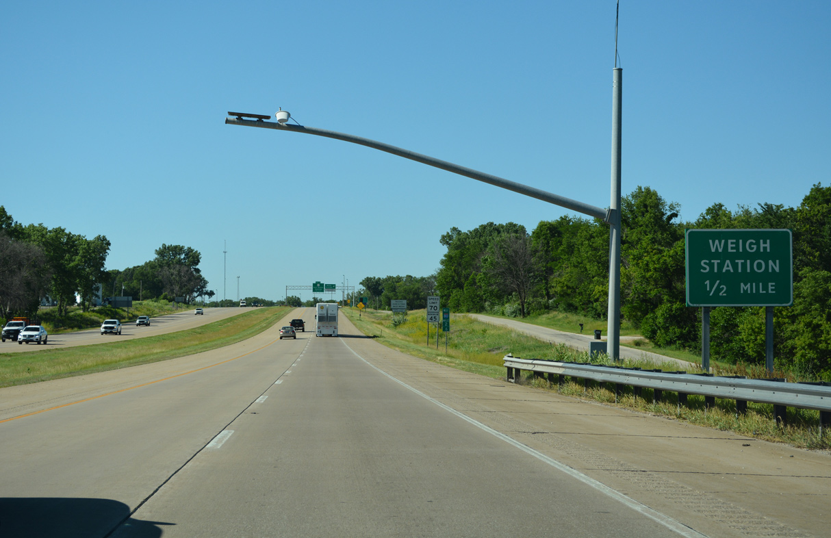
| Interstate 80 continues north along 207th Street N to a set of weigh stations. 06/20/22 |
|
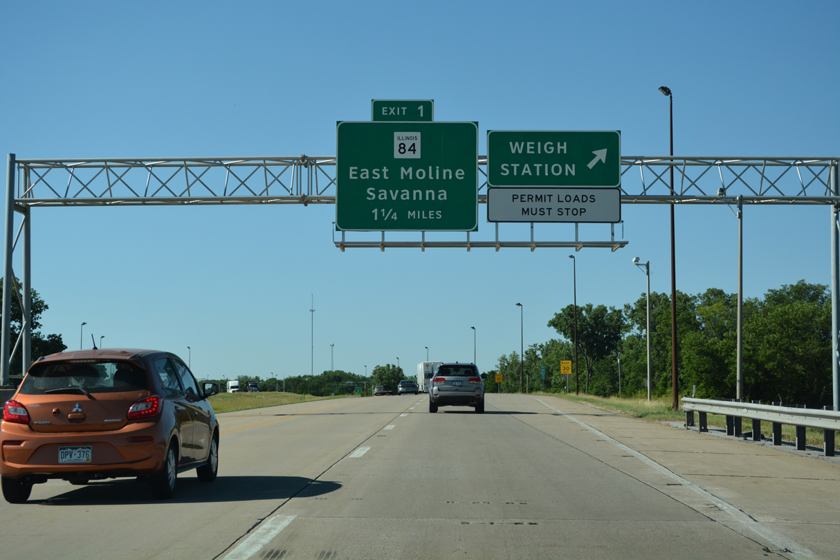
| Interstate 80 proceeds 1.25 miles north from the weigh station to a folded diamond interchange (Exit 1) with IL 84 by Rapids City. Beginning in Colona, IL 84 heads north to Silvis, East Moline, Hampton and Exit 1. 06/20/22 |
|
| IL 84 enters the village of Rapids City just east of Interstate 80 and parallels the Mississippi River northward en route to Fulton and Savanna. 06/20/22 |
|
| IL 84 is part of the Great River Road system northeast from IL 92 and East Moline to the overlap with U.S. 20 west through Galena. 06/20/22 |
|
| IL 84 continues from Rapids City to the villages of Port Byron and Cordova in northern Rock Island County. 06/20/22 |
|
| A tornado crossed the exchange at Exit 1 in March 2013. IL 84 travels 95 miles overall from U.S. 6 in Colona to become Wisconsin Trunk Highway 80, ten miles north of Galena. 06/20/22 |
|
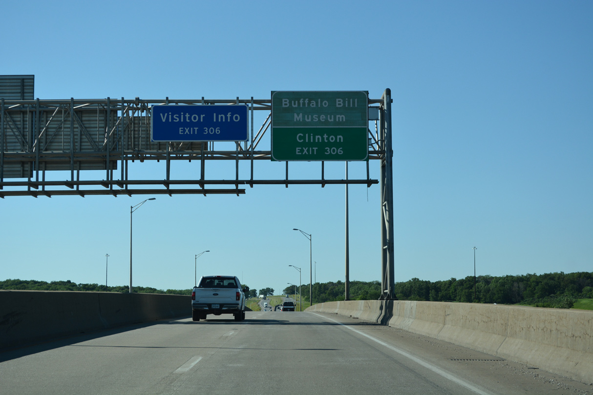
| Interstate 80 ascends onto the Fred Schwengel Memorial Bridge to cross the Mississippi River from IL 84 to Exit 306 for U.S. 67 (S Cody Road) in the city of Le Claire, Iowa. 06/20/22 |
|
| The Mississippi River bends westward from Port Byron, Illinois and Le Claire, Iowa into the Quad Cities area. 04/08/13 |
|
| Interstate 80 enters the Hawkeye State midway across the Mississippi River. U.S. 67 travels 20 miles north from Exit 1 to Clinton. 06/20/22 |
Page Updated 12-06-2023.

 West
West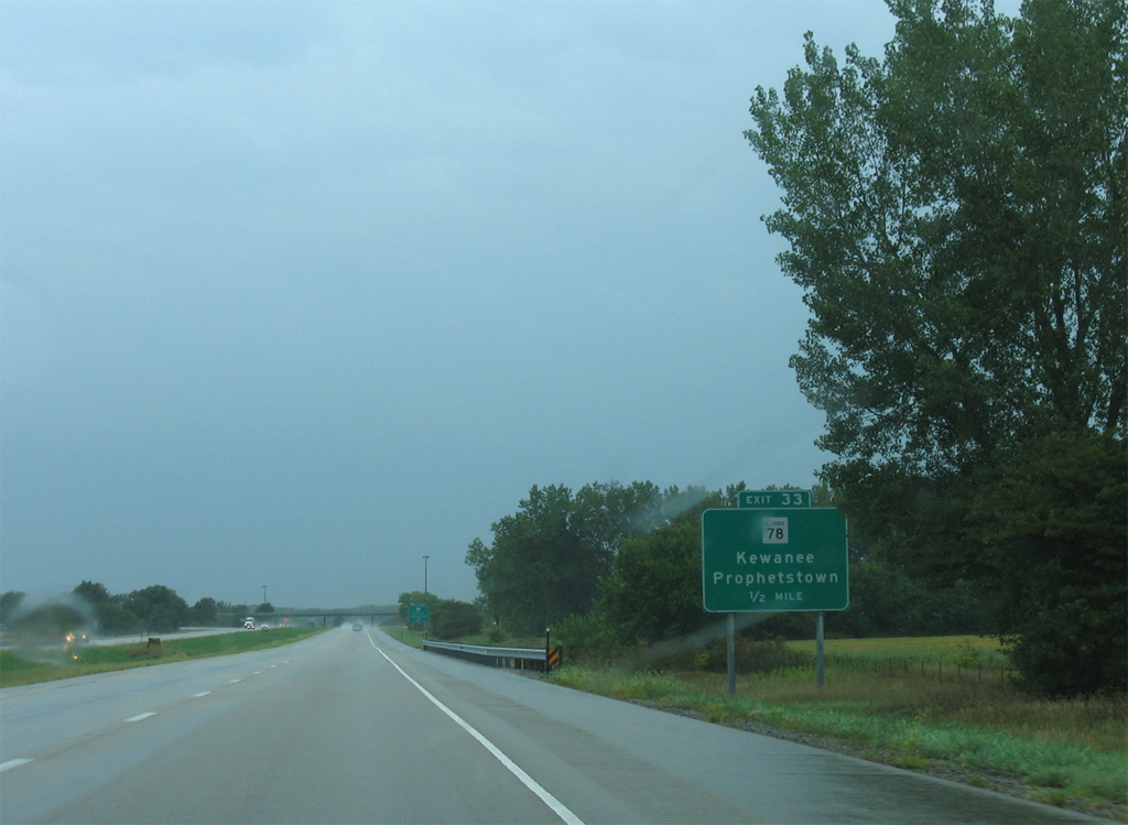


 East
East