|
| Interstate 85 advances northeastward by Hills Lake beyond this shield assembly. 10/22/15 |
|
| U.S. 441/SR 15 (Homer Road) heads north from the outskirts of Commerce to meet Interstate 85 at diamond interchange (Exit 149) in one mile. 10/22/15 |
|
| The area surrounding the crossroads of U.S. 441 and I-85 is home to Banks Crossing, a collection of retail, lodging and business centers. Atlanta Dragway and an outlet mall are also situated nearby. 10/22/15 |
|
| Interstate 85 enters Banks County ahead Exit 149 for U.S. 441/SR 15 south to Commerce and north to Homer. 10/22/15 |
|
| U.S. 441 travels the height of Georgia from Fargo to Douglas, Dublin, Milledgeville, Athens and Commerce to exit the state alongside U.S. 23 north of Dillard. SR 15 accompanies U.S. 441 to the North Carolina border and south to Watkinsville. SR 15 also travels south to Florida via Folkston. 10/22/15 |
|
| A forested median ensues east of Exit 149 as Interstate 85 nears the crossing over Grove Creek. 10/22/15 |
|
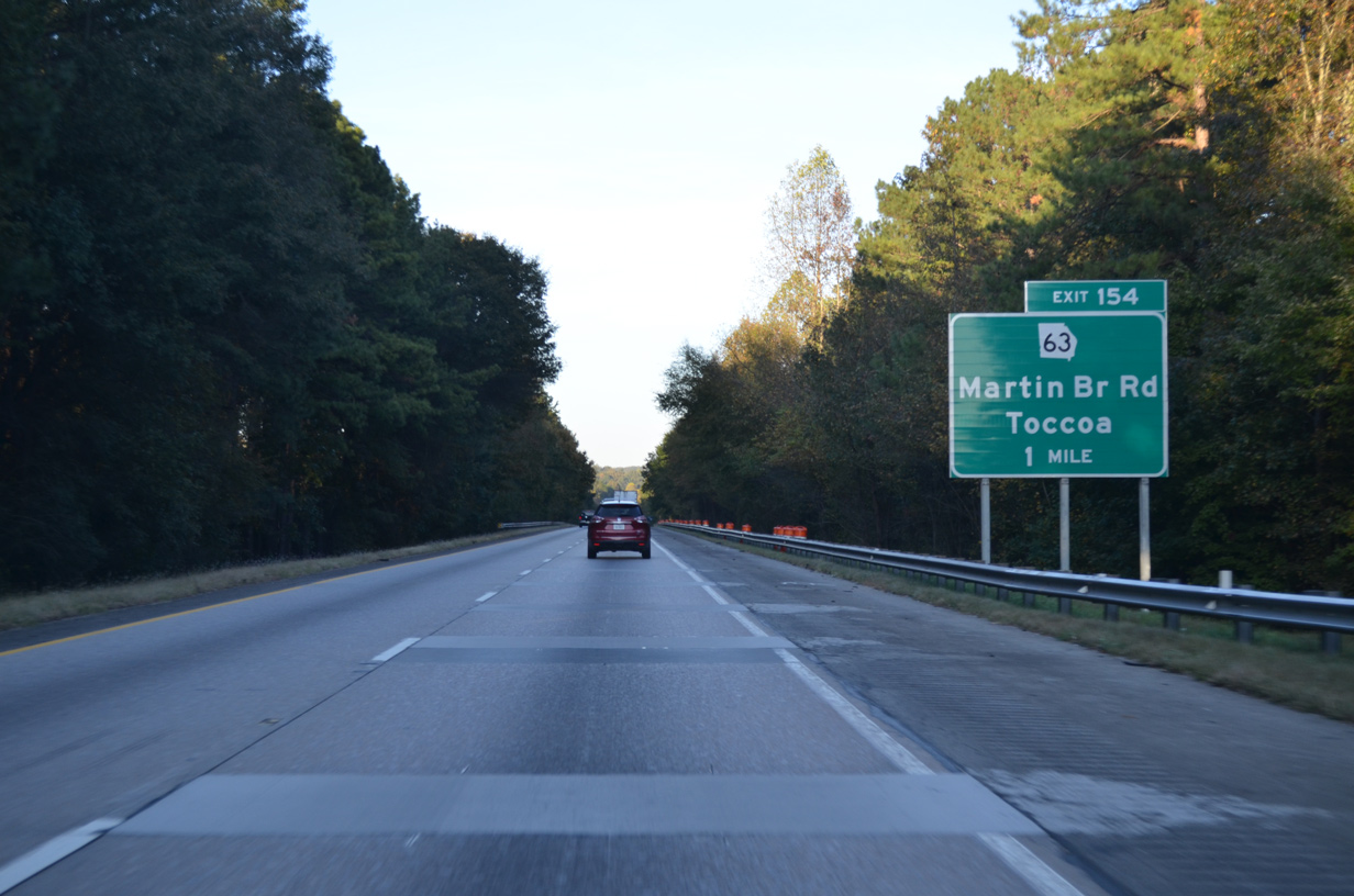
| SR 63 (Martin Bridge Road) stems north from parallel SR 59 to meet Interstate 85 at a diamond interchange (Exit 154) in one mile. 10/22/15 |
|
| Following a rural course, SR 63 (Martin Bridge Road) heads north from Exit 154 to Jewelville and Odis Crossroads. SR 63 combines with SR 106 through south Stephens County. 10/22/15 |
|
| Exit 154 leaves Interstate 85 north for SR 63. Measuring 23.02 miles in length, SR 63 concludes to the north at U.S. 123 within the Stephens County seat of Toccoa. 10/22/15 |
|
| Interstate 85 traverses a series of forested hills in this scene preceding the Neal Road overpass. 10/22/15 |
|
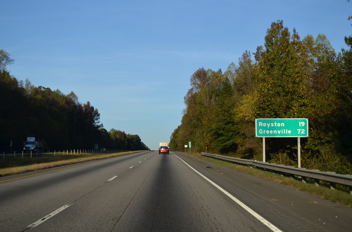
| Royston, a city of over 2,500, represents the control point of SR 51 east from the succeeding northbound exit. Greenville is over an hour away. 10/22/15 |
|
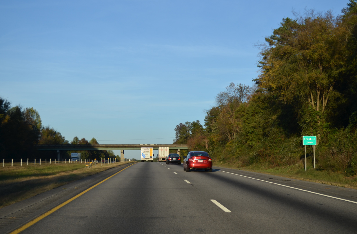
| Travelers cross the Franklin County line between Exit 154 and the Neal Road over crossing. 10/22/15 |
|
| Interstate 85 through Franklin County is designated the Ernest Vandiver Highway. Named for the 73rd Governor of Georgia who later lived in Lavonia, Vandiver advocated for I-85 to run through Franklin County. 10/22/15 |
|
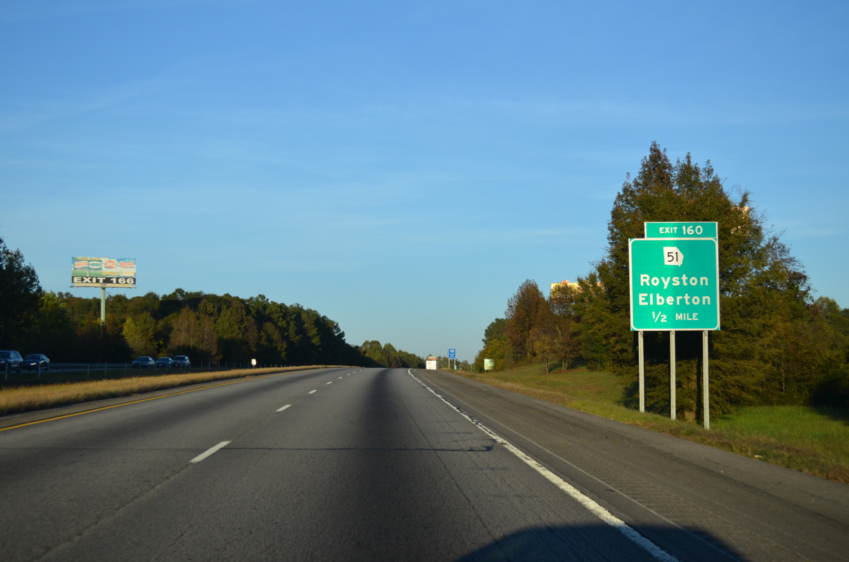
| Meeting I-85 at a diamond interchange (Exit 160), SR 51 runs 62.38 miles along a mostly east to west route through northeast Georgia. SR 51 concludes at Lula to the west and at Lake Hartwell to the east. 10/22/15 |
|
| East from Exit 160, SR 51 (Sandy Cross Road) provides part of a route to the cities of Franklin Springs and Royston along with SR 145 and U.S. 29. SR 51 bypasses those communities as it turns north toward Canon and Bowersville and east to Hartwell. 10/22/15 |
|
| West from Exit 160, SR 51 (Old Federal Road) leads to Plainview, Jewelville and the Banks County seat of Homer. 10/22/15 |
|
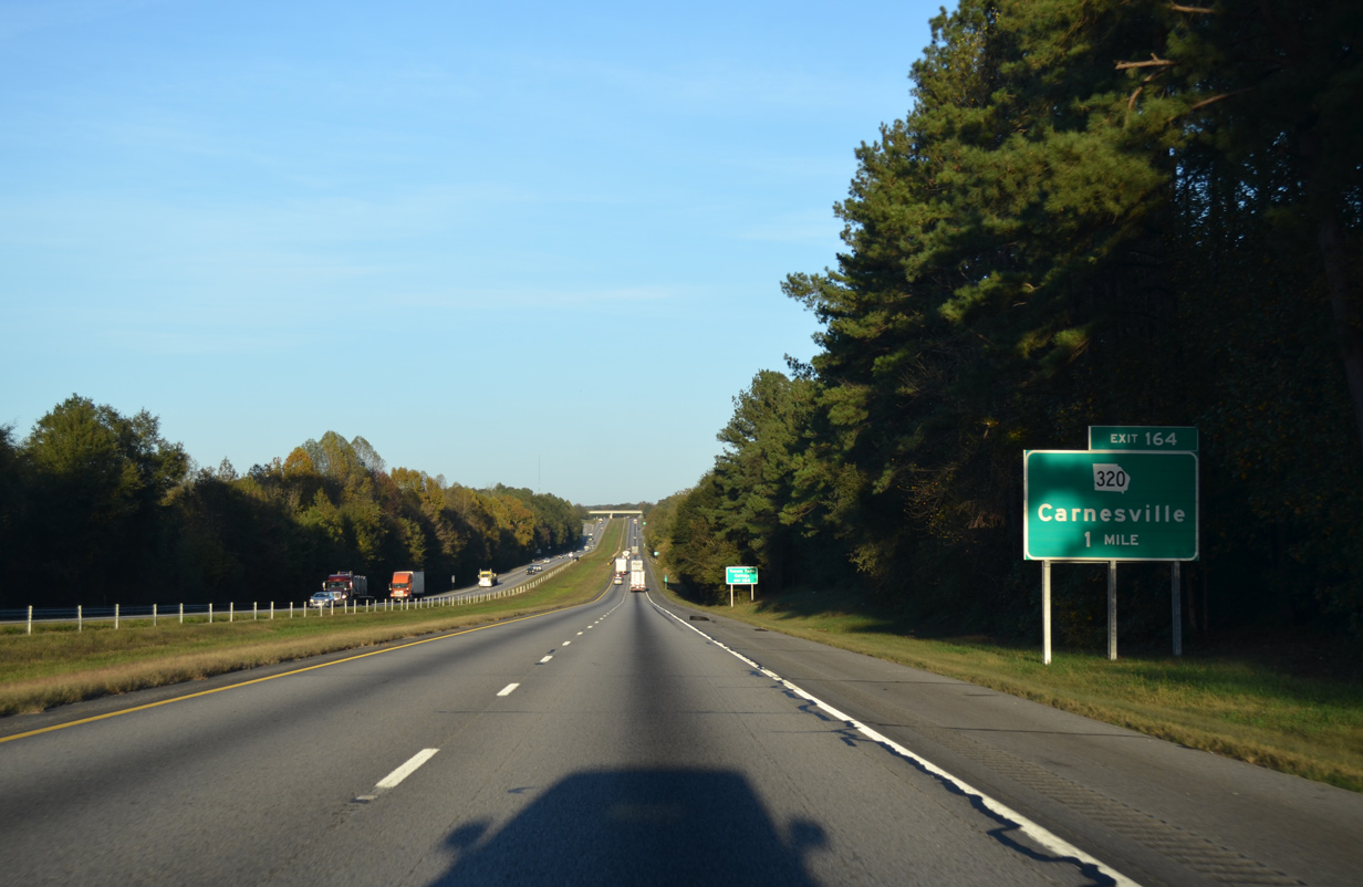
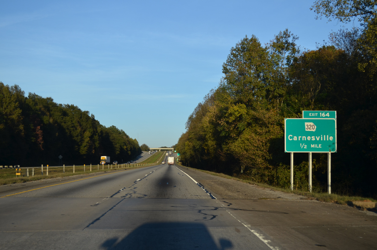
| SR 320 provides the first of two routes to the city of Carnesville from Interstate 85. The city center lies 1.5 miles to the southeast of forthcoming Exit 164. 10/22/15 |
|
| I-85 spans the Middle Fork of the Broad River a half mile from the diamond interchange (Exit 164) with SR 320. 10/22/15 |
|
| Exit 164 parts ways with Interstate 85 north for SR 320 outside Carnesville. A 9.86 mile long route, SR 320 runs from SR 59 just to the south northward to SR 106 near Mize. 10/22/15 |
|
| Interstate 85 proceeds northeast across Stephens Creek to this shield assembly. Old Stagecoach Road spans the freeway in the distance. 10/22/15 |
|
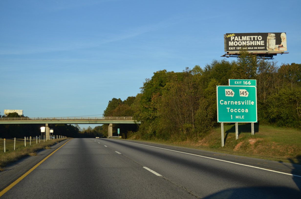
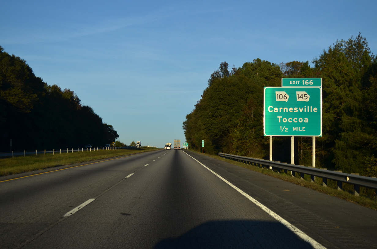
| SR 106/145 combine with SR 59 from the Carnesville city center northeast to a wye intersection just south of Exit 166. SR 59 shifts east to parallel the freeway to Lavonia while SR 106/145 meet I-85. 10/22/15 |
|
| North from Exit 166, SR 106/145 overlap another three miles to Parhams, where SR 106 loops west for 14 miles to Mize and Fowlertown before reconvening with SR 145 in Toccoa. 10/22/15 |
|
| The diamond interchange (Exit 166) with SR 106/145 serves a pair of truck stops on the north side of Carnesville. Heading 17 miles to Downtown Toccoa, SR 145 north stays on a more easterly course as compared to SR 106. SR 145 ends at U.S. 123. 10/22/15 |
|
| The next several miles of Interstate 85 vary between forest land and agricultural areas to the North Fork of the Broad River. 10/22/15 |
|
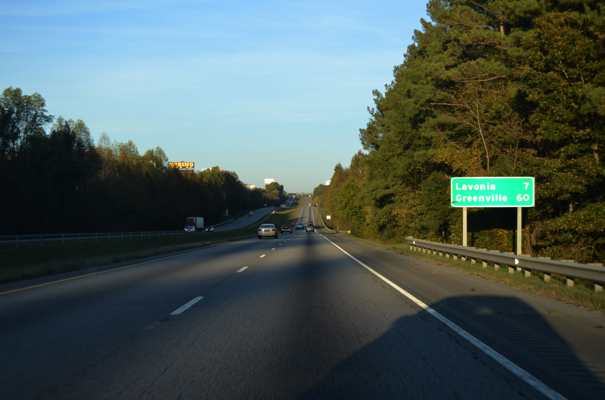
| The city of Lavonia, located seven miles ahead, is the final destination along I-85 in northeast Georgia. Greenville is 60 miles away. 10/22/15 |
|
| Weigh stations operate in both directions of the freeway near the community of Fairview. 10/22/15 |
|
| Approaching the weigh station off-ramp along I-85 north. 10/22/15 |
|
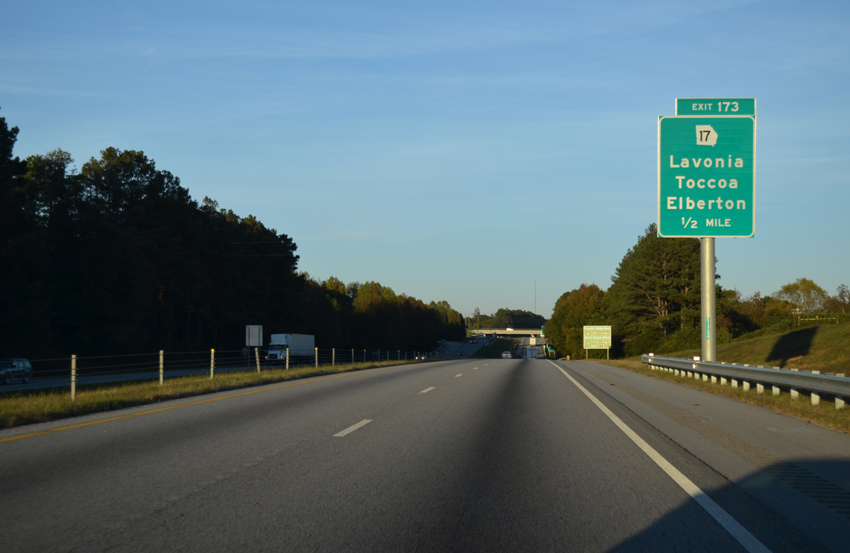
| SR 17 joins I-85 with the city of Lavonia at Exit 173. Traveling 299.50 miles overall, SR 17 ventures north from SR 21 in Port Wentworth to the North Carolina border by Chatuge Lake. SR 17 north of Helen overlaps entirely with other routes.
SR 17 between U.S. 1 at Louisville and U.S. 23/441 near Clarkesville is as a Georgia GRIP (Governor&aops;s Road Improvement Program) corridor, with upgrades expanding the route to four lanes. 10/22/15 |
|
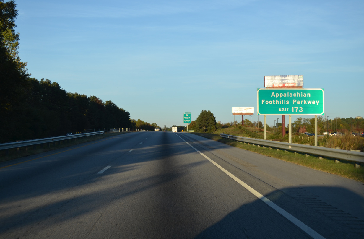
| Long distance travelers headed for Appalachian Foothills Parkway are directed northward onto SR 17. The parkway was envisioned as the Tennessee counterpart of the National Park Service's Blue Ridge Parkway. However only a 17 mile long section, from U.S. 129 at Chilhowee to U.S. 321 at Walland, and a 5.6 mile long segment between U.S. 321 at Crosby and I-40 were constructed. 10/22/15 |
|
| SR 17 (Jones Street) expands into a commercial arterial through the folded diamond interchange (Exit 173) with I-85. Points of interest for Exit 173 include Tugaloo State Park to the northeast and Hart State Park to the east of Hartwell. 10/22/15 |
|
| SR 17 (Jones Street) passes through the Lavonia city center south from Exit 173 en route to Royston and Elberton. GRIP corridor funding expanded SR 17 north to the Stephens County line, with bypass both Martin and Avalon, to a divided highway by late 2016. 10/22/15 |
|
| Interstate 85 reenters the Lavonia city limits between the Hartwell Railroad over crossing and SR 328, a 9.8 mile long loop from Lavonia to Avalon. 10/22/15 |
|
| Hartwell is the final destination for Interstate 85 north in the Peach State. The Hart County seat is a 12 mile drive to the south of upcoming Exit 177. Greenville, South Carolina is less than 50 miles from the state line. 10/22/15 |
|
| County Road 84 crosses over I-85 north one mile from Exit 177 to SR 77 (Providence Church Road). 10/22/15 |
|
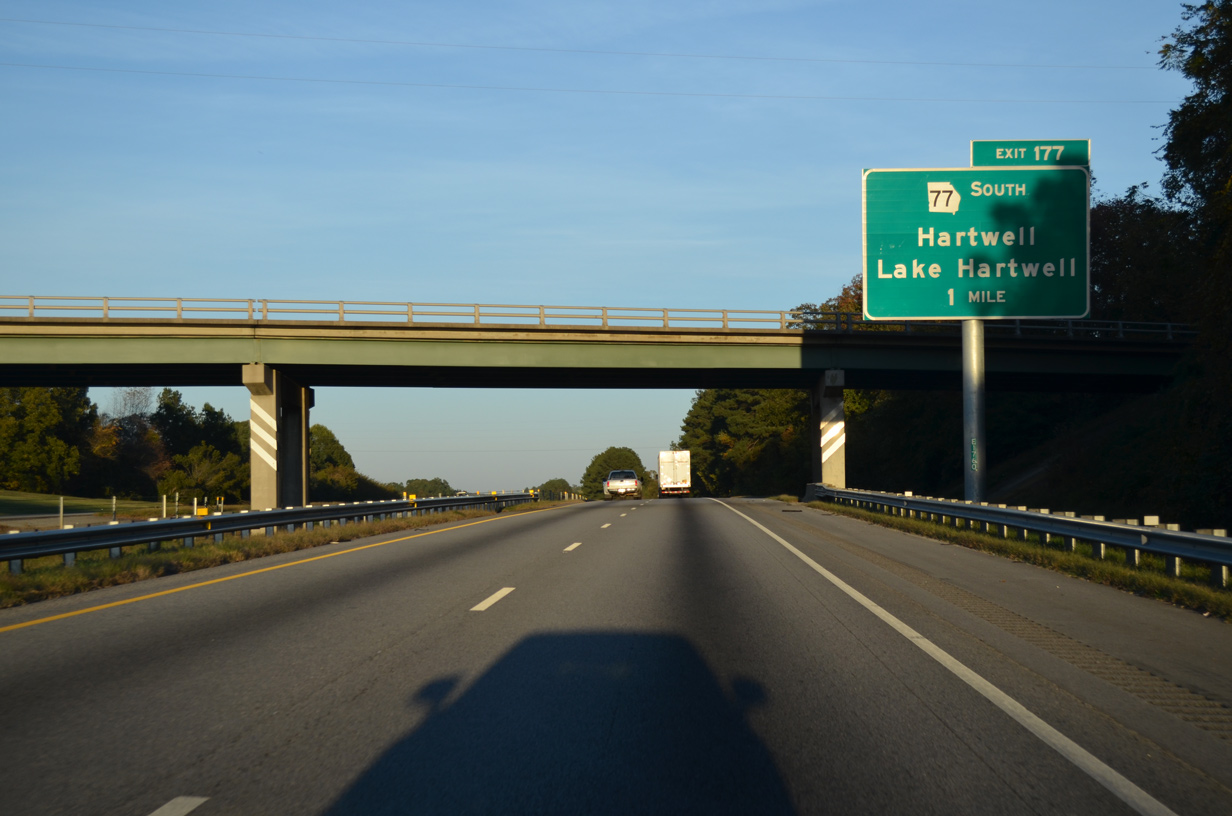
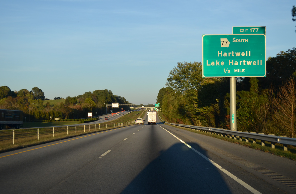
| SR 77 commences a 103 mile route at Exit 177. SR 77 runs south to Hartwell, Elberton, Lexington, Union Point and SR 16 west of Sparta. 10/22/15 |
|
| Entering the diamond interchange (Exit 177) with SR 77 (Providence Church Road) on I-85 north. Whitworth Road stems north and Harbor Light Marina Road east from the end of SR 77 to areas along Lake Hartwell. 10/22/15 |
|
| Interstate 85 nips the northern corner of Hart County between Exit 177 and Lake Hartwell. 10/22/15 |
|
| I-85 meets the south end of S.C. 11 just east of the Georgia state line. Providing both scenic vistas and access to area attractions, the Cherokee Foothills Scenic Highway follows S.C. 11 north toward the Blue Ridge and Saluda Mountains. The byway is one of two in the Upstate of South Carolina. 10/22/15 |
|
| The roadways of Interstate 85 separate just ahead of Lake Hartwell. 10/22/15 |
|
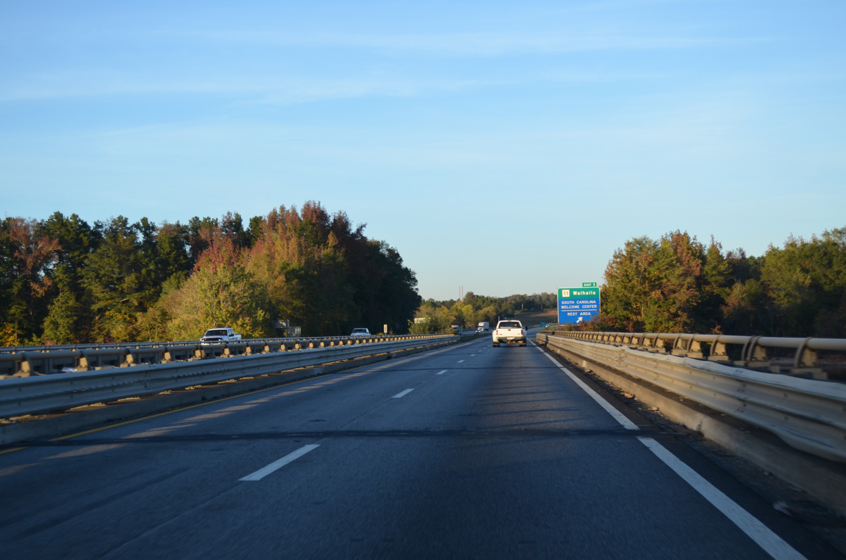
| The South Carolina Welcome Center precedes the ramps to S.C. 11 on the shore of Lake Hartwell. S.C. 11 north follows a mostly rural route 19.6 miles to the town of West Union and city of Walhalla. 05/28/05 |
|
| S.C. 11 (Cherokee Foothills Scenic Highway) runs alongside Lake Hartwell State Park leading north from Exit 1. Connections with U.S. 123 lead motorists west to Westminster and east to Seneca. 10/22/15 |
|
| Hartwell Lake is a man made reservoir formed by Hartwell Dam, which U.S. 221 crosses. Northern reaches of the lake are fed by the Tugaloo and Seneca Rivers. 05/28/05 |
|
| The Ernest Vandiver Bridges carry Interstate 85 across the Tugaloo River (Lake Hartwell) with no shoulders. The girder bridges travel 11 feet above the full pool elevation of Lake Hartwell (660 feet above sea level). 10/22/15 |
Page Updated 01-21-2016.

 North
North