

 West
West  North
North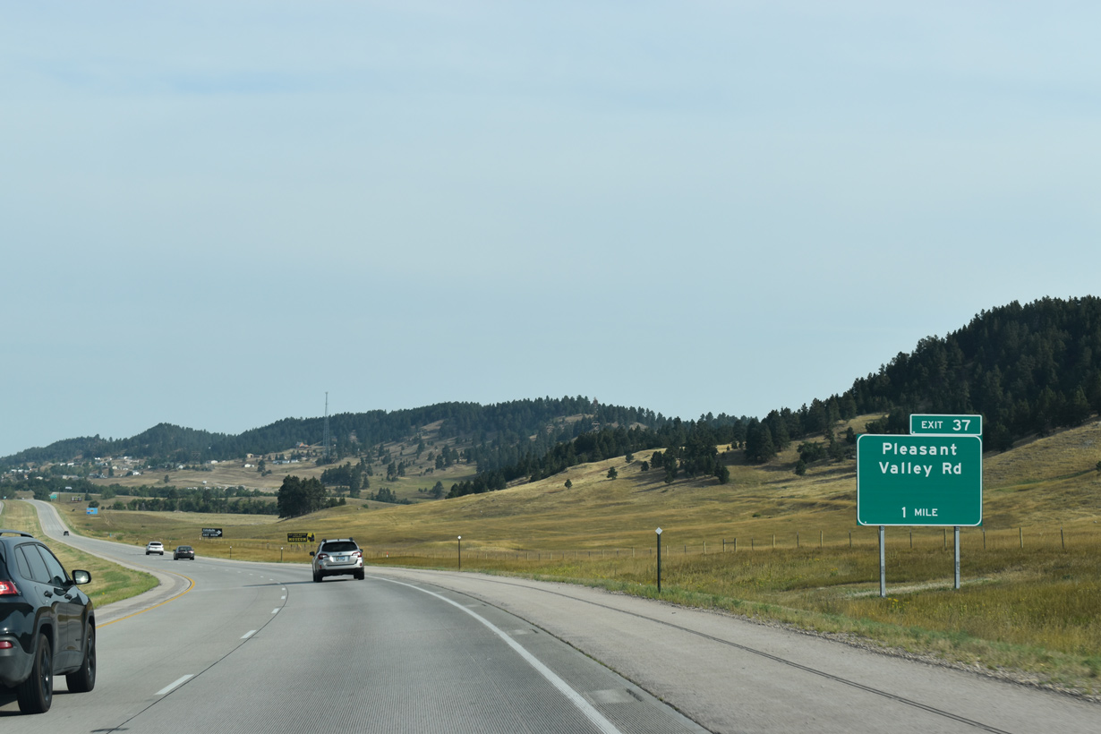
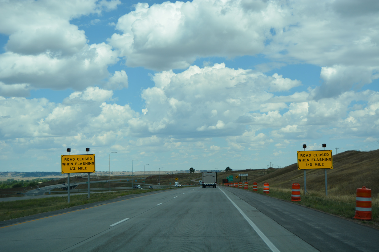
Crossing the CP Rail Systems line, Interstate 90 makes another S-curve ahead of Exit 37 to Pleasant Valley Road (CR 8).
08/21/17

07/04/18

Exit 37 departs I-90/U.S. 14 west and SD 79 north for Pleasant Valley Road (CR 8). This interchange generally provides local access for farms and ranches.
07/04/18

07/04/18
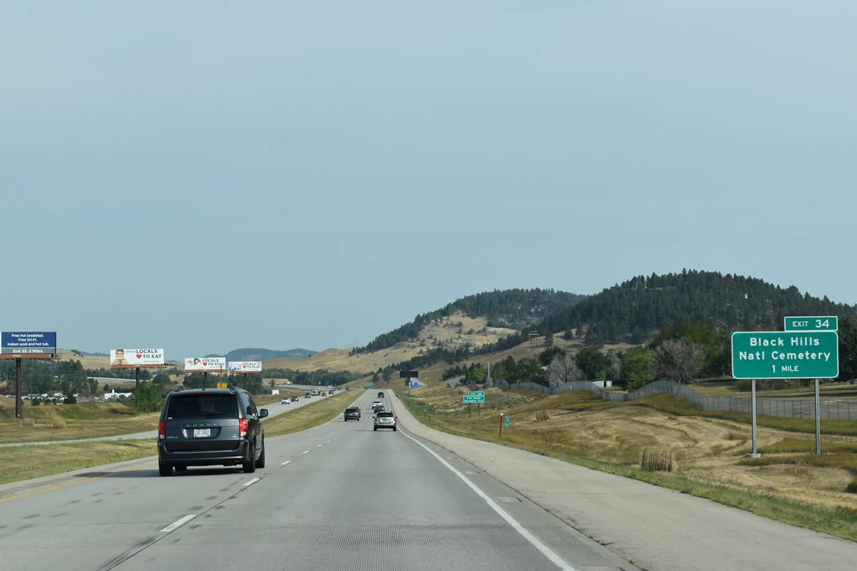
Forthcoming Exit 34 joins I-90 with Pleasant Valley Drive and Black Hills National Cemetery. Buried at the Black Hills National Cemetery are veterans of wars from the Spanish-American War to the 2000s wars in Iraq and Afghanistan.
08/21/17

East from Exit 34, Pleasant Valley Drive ties into nearby Horse Soldier Road north and Blucksberg Drive south at Fort Meade Recreation Area.
08/21/17

A roadway separation ensues north of Alkali Creek, with the eastbound lanes of I-90 directly overlaying the original U.S. 14/SD 79 alignment.
07/04/18

Known as the "Key City to the Black Hills," Sturgis was founded in August 1876 and named after Major Samuel D. Sturgis, who was commander of nearby Fort Meade. Home to over 7,000, the city is the seat of Meade County.
07/04/18

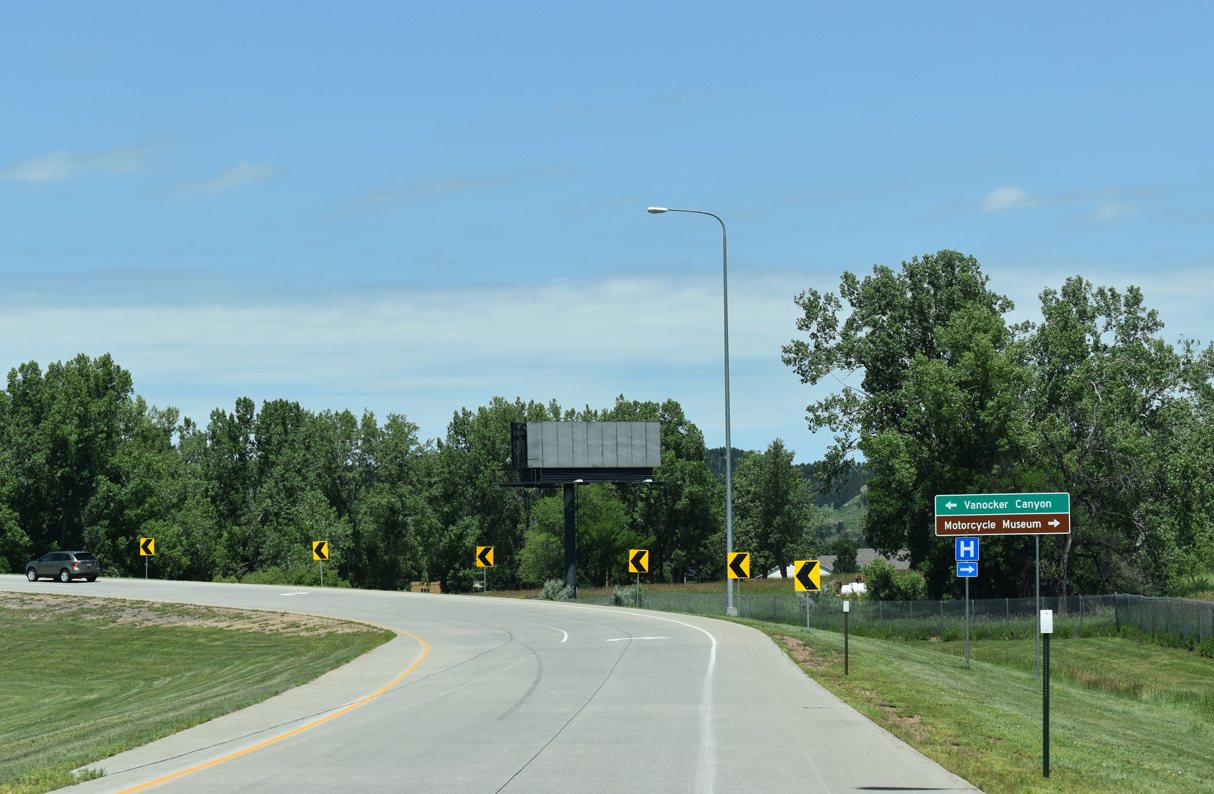
Business Loop I-90 (Junction Avenue) branches north from the diamond interchange at Exit 32 to Downtown Sturgis.
08/21/17
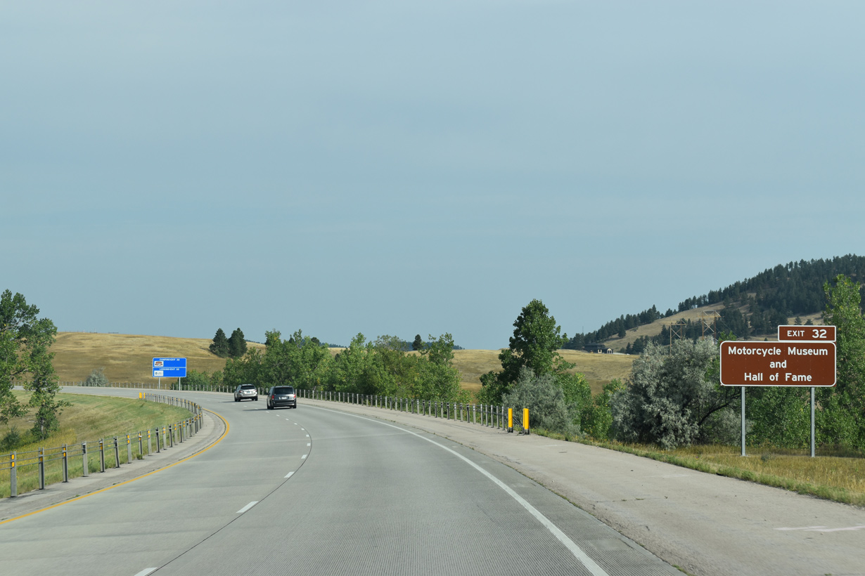
Held annually in August, the Sturgis Motorcycle Rally brings thousands of motorcyclists from around the country, swelling the city in size during the event. A motorcycle museum is one of the chief tourist draws to the city year-round.
08/21/17

Exit 32 originally consisted of a wye interchange with Junction along I-90 westbound a half diamond interchange eastbound with Vanocker Canyon Road. Junction Avenue was subsequently realigned eastward and extended south through the new exchange.
07/04/18
07/04/18
08/12/16

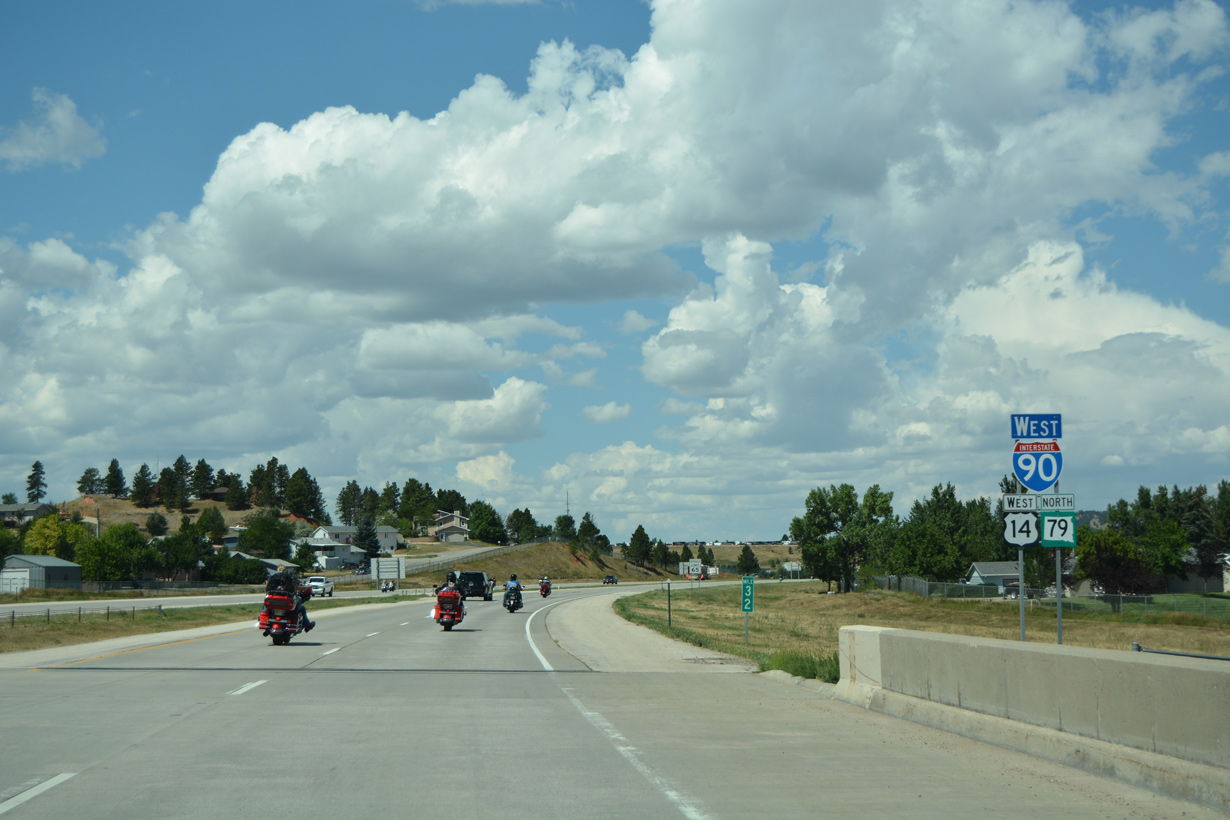
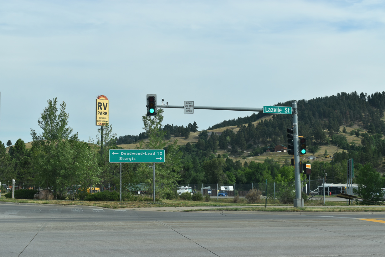
SD 79 parts ways with I-90/U.S. 14 at Exit 30 for Business Loop I-90 east along Lazelle Street to Downtown Sturgis.
08/21/17

Located east of Sturgis, Bear Butte State Park represents the north end of the 111 mile long Centennial Trail. This trail, which passes through some of the most scenic parts of the Black Hills region, was designated in 1989 in commemoration of South Dakota's 100 year anniversary of achieving statehood.
08/21/17

08/21/17

08/21/17

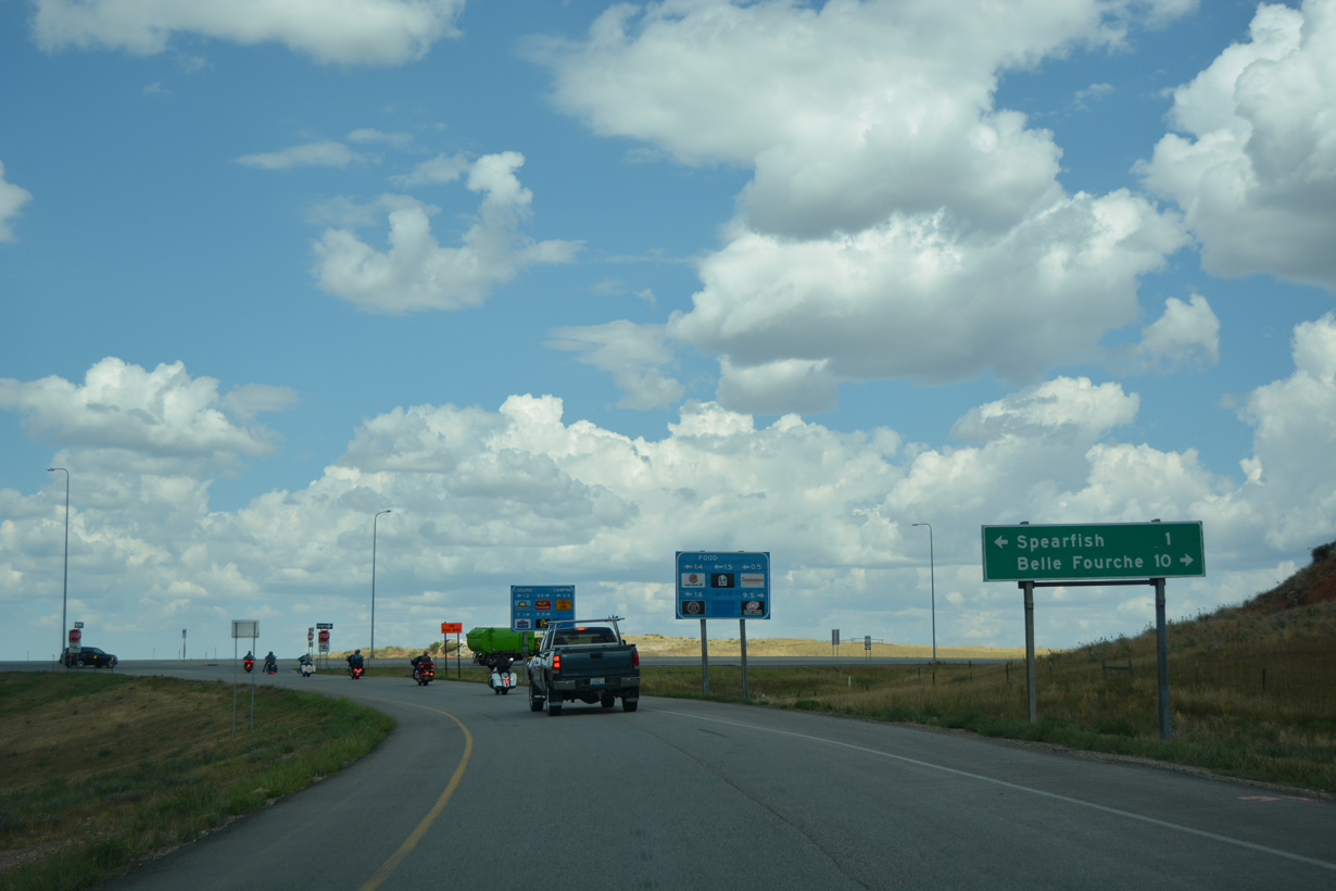
Connecting Sturgis with Deadwood and Lead in the Black Hills, U.S. 14A (Boulder Canyon Road) loops southwest from Exit 30. Forming a 43.63 mile long loop, U.S. 14A returns to I-90 via Spearfish Canyon.
08/21/17
East from Sturgis, SD 34/79 serves Fort Meade, which was established during the frontier days (1878) to protect nearby settlements from skirmishes with Native Americans. The fort is part of the Bureau of Land Management Fort Meade Recreation Area.
08/21/17
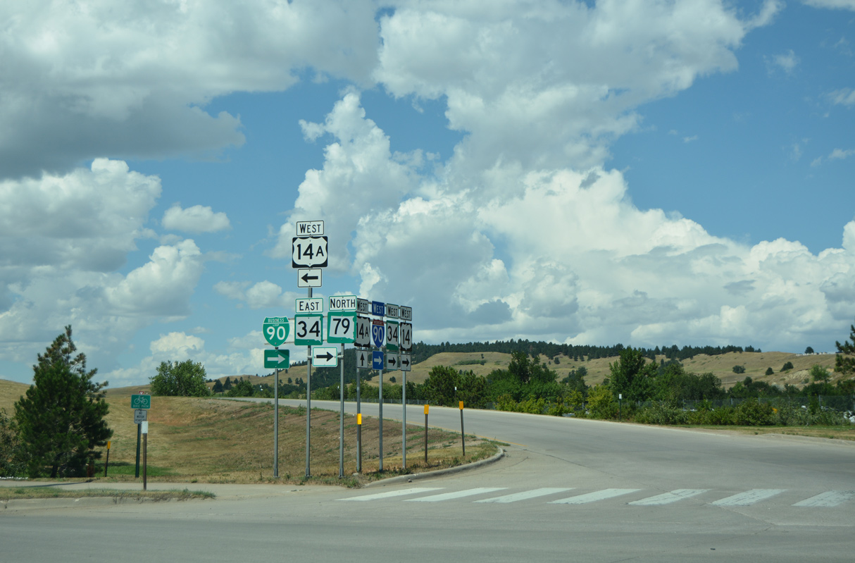
SD 34/79 overlap with Business Loop I-90 (Lazelle Street) 1.2 miles east to Junction Avenue in Downtown Sturgis.
08/12/16
 West
West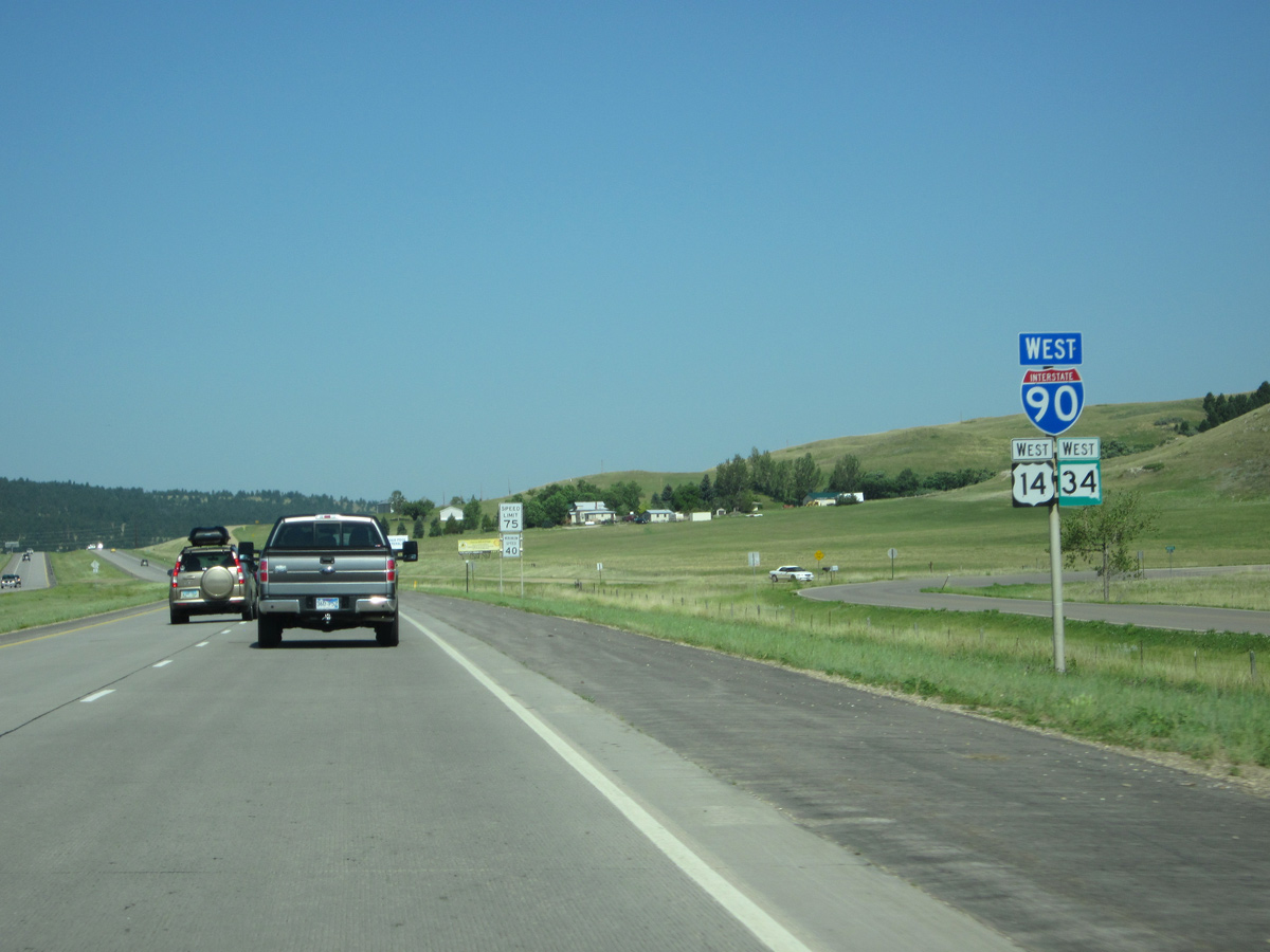
SD 34 joins I-90/U.S. 14 west 6.5 miles from Lazelle Street in Sturgis to Laurel Street outside Whitewood.
06/24/12

06/24/12

Interstate 90 crosses the Lawrence County line south of Oyster Mountain.
06/24/12

CR 143 (old U.S. 14/SR 34) runs along the west side of Interstate 90 to Eden Road in this scene.
06/24/12

SD 34 separates from I-90/U.S. 14 at Exit 23 northwest to St. Onge and Belle Fourche. SD 34 becomes WYO 24 in 27.43 miles at the state line. The highway ultimately serves Devils Tower National Monument.
06/24/12

Laurel Street extends south from the diamond interchange at Exit 23 into the small city of Whitewood.
06/24/12
West
06/24/12

Circumventing Elkhorn Peak (el. 4,501 ft), the succeeding exit along Interstate 90 west is for U.S. 85 south to Deadwood, Pluma and Lead.
06/24/12

U.S. 85 travels southwest through the northern tier of the Black Hills, emerging in Wyoming near Four Corners. U.S. 85 advances south from there toward Newcastle, Lusk, Torrington and Cheyenne in the Equality State.
06/24/12
West  North
North
U.S. 85 north combines with Interstate 90 and U.S. 14 between Exits 17 and 10.
06/24/12
06/24/12

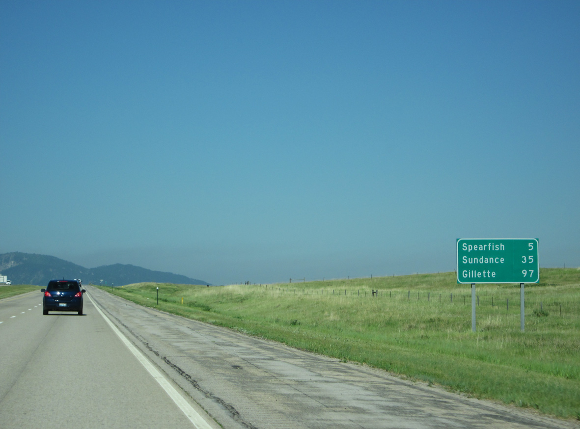
U.S. 14A returns to I-90/U.S. 14 at the first of four exits for the city of Spearfish.
06/24/12
U.S. 14A follows Spearfish Creek south into the Black Hills through Spearfish Canyon and past Bridal Veil Falls. U.S. 14A combines with U.S. 85 northeast from Cheyenne Crossing to Lead and Deadwood.
06/24/12

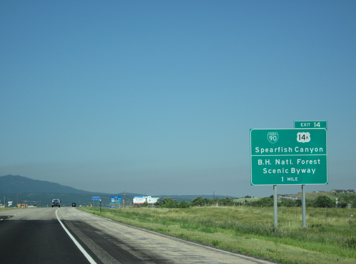
Exit 14 leaves I-90/U.S. 14-85 west for Business Loop I-90 west to Spearfish and U.S. 14A south to Spearfish Canyon and attractions within Black Hills National Forest.
06/24/12

The diamond interchange at Exit 14 was reconstructed into a SPUI during 2016/17 road work.
06/24/12

Business Loop I-90/U.S. 14A overlap west from 27th Street at I-90 along Colorado Boulevard into Spearfish. The business route follows Main Street northwest into Downtown.
06/24/12

Home of Black Hills State University, the city of Spearfish was settled in 1876 and is a hub for tourist activities in the northern Black Hills region. Spearfish is known as the Queen City due to the "crown" created by the adjacent peaks of Lookout Mountain, Spearfish Mountain and Crow Peak.
06/24/12

Black Hills State University is located west of Spearfish Creek via Jackson Boulevard and University Avenue. In addition to education and tourism, Spearfish also grew to expand its economic foundation. The Spearfish Economic Development Corporation touts its low tax base with the concept of a "taxation policy built around the word NO."
06/24/12

Jackson Boulevard stems west from the diamond interchange at Exit 12 to Business Loop I-90 (Main Street) in Downtown Spearfish.
06/24/12

Continuing north alongside Lookout Mountain Park, I-90-U.S. 14/85 straddle the western slopes of Lookout Peak (el, 4,452 ft).
08/12/16

U.S. 85 parts ways with I-90/U.S. 14 at forthcoming Exit 10 and the west end of Business Loop I-90 (North Avenue) through Spearfish.
08/12/16
08/12/16

Exit 10 departs I-90/U.S. 14 west for U.S. 85 north to Belle Fourche and Business Loop I-90 (North Avenue) south back into Spearfish.
08/12/16

08/12/16
U.S. 85 travels north from Belle Fourche toward Williston, North Dakota and the Canadian border at Saskatchewan beyond Fortuna.
08/12/16
West
Resuming a westward heading, I-90/U.S. 14 cross Higgins Gulch just ahead of the diamond interchange (Exit 8) with Ole Belle Road north and McGuigan Road south.
06/24/12
Resuming a westward heading, I-90/U.S. 14 cross Higgins Gulch just ahead of the diamond interchange (Exit 8) with Ole Belle Road north and McGuigan Road south.
06/24/12
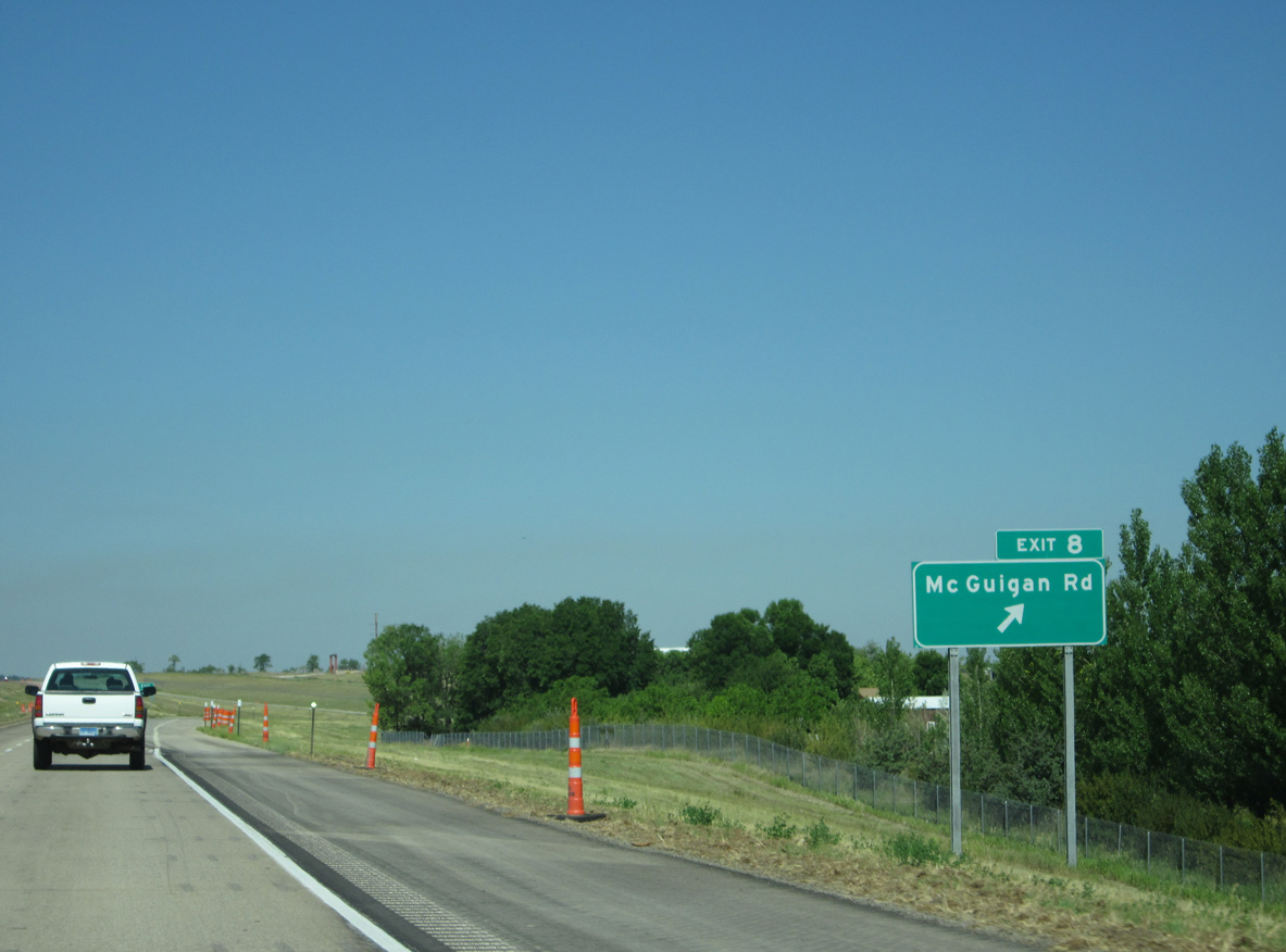
McGuigan Road extends south from Old Belle Road to Old U.S. 14 and suburban development outside Spearfish. Beyond The Reserve on Higgins Creek development, Old Belle Road (CR 1050) leads to farm land along Spearfish Creek.
06/24/12

Since replaced, this distance sign references Beulah, the first exit in Wyoming erroneously at 11 miles instead of nine. Sundance follows in 27 miles. Sheridan was dropped in favor of Gillette at 89 miles, which should be 88 miles.
06/24/12

06/24/12
06/24/12

06/24/12

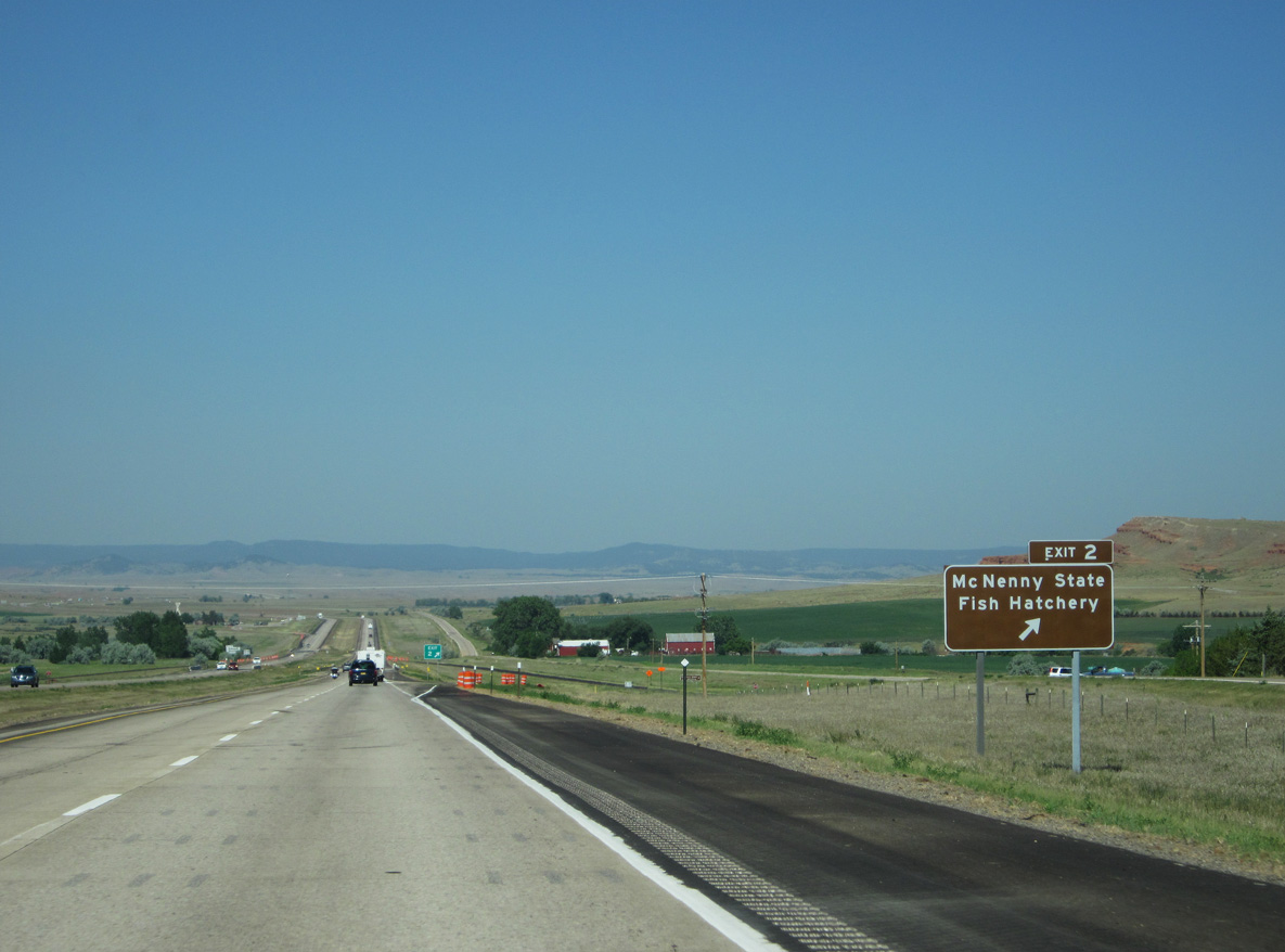
The diamond interchange at Exit 2 joins I-90/U.S. 14 with Red Hill Road south of the McNenny Fish Hatchery and parallel Old U.S. 14.
06/24/12
06/24/12

The final reassurance marker for westbound I-90/U.S. 14 in South Dakota. An ensuing S-curve takes the freeway to the Wyoming state line near Montana Lake.
06/24/12

Mile marker zero for I-90 in South Dakota coincides with mile post 207.14 for Wyoming.
06/24/12
Photo Credits:
06/24/12, 08/12/16, 08/21/17, 07/04/18 by AARoads
Connect with:
U.S. 85
Page Updated 02-26-2023.