|
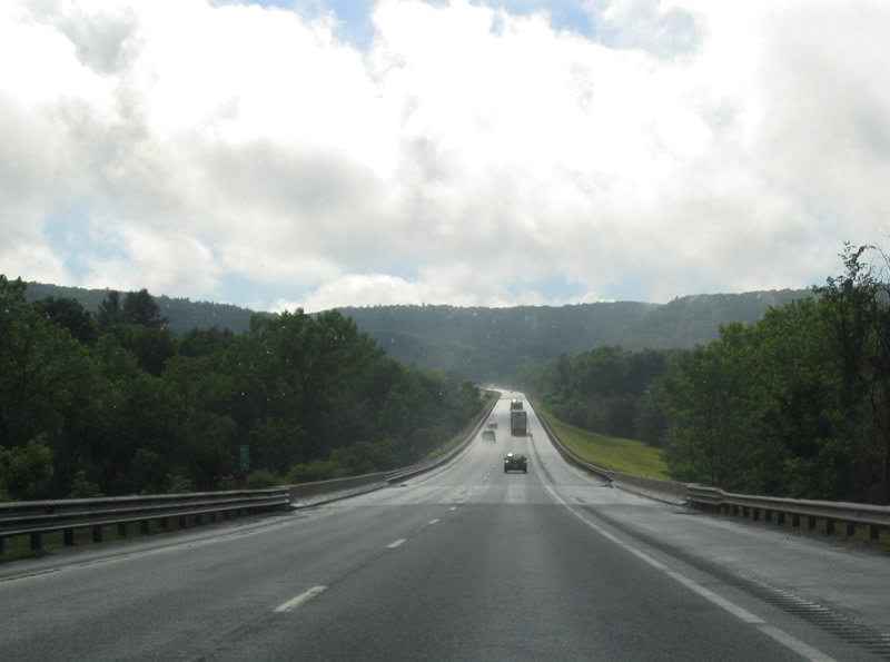
| Interstate 90 winds across Walker Mountain immediately west of I-84. 06/28/05 |
|
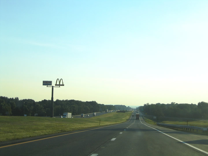
| A 15 mile exit less stretch ensues west from I-84 to Palmer and Exit 8. Springfield follows from Exit 6, with I-90 reaching Albany in 111 miles. 06/28/05 |
|
| A typical scene along the Mass Pike in rural Massachusetts. Interstate 90 enters a notch of Hampden County before reentering Worcester County along this scene ahead of the Bemis Road overpass. Hills Warren rises along the northwestern horizon. 06/28/05 |
|
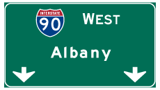
| Interstate 90 distance sign posted eight miles east of the Palmer Interchange (Exit 8) at Bemis Road. Albany, New York lies 103 miles to the west via the Mass Pike and the Berkshire Extension of the New York Thruway. 06/28/05 |
|
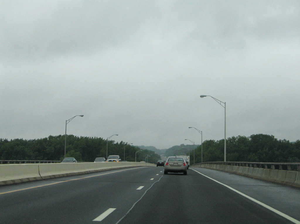
| Crossing back into Hampden County, Interstate 90 enters a valley south of West Brimfield and north of Cooks Mountain. The Mass Pike spans Washington Road, a CSX Railroad line, the Quaboag River and Route 67 (Boston Road) at back to back bridges. 06/28/05 |
|
| Upcoming Exit 8 connects Interstate 90 (Massachusetts Turnpike) with Route 32 (Thorndike Street) north of U.S. 20 and the Palmer town center. 06/28/05 |
|
| Breckenbridge Street crosses over Interstate 90 to the west of Thompson Lake and south of Palmer Center in this scene. 06/28/05 |
|
| One half mile ahead of the trumpet interchange (Exit 8) to Route 32 (Thorndike Street) on I-90 west. Route 32 runs 60.69 miles across the state, part of a nearly 130 mile long multi state route south to New London, Connecticut and north to Keene, New Hampshire. 08/09/04 |
|
| Exit 8 leaves Interstate 90 westbound for Route 32 (Thorndike Street). Route 32 south combines with U.S. 20 (Park Street) east through Palmer in 0.7 miles. The state route continue south from Palmer to Monson and Stafford Springs, Connecticut and north of I-90 four miles to Gibbs Crossing and seven miles to Ware. Use U.S. 20 (Main Street) west from Palmer to Route 181 (Sykes Street) north for Belchertown and Amherst. 08/09/04 |
|
| Interstate 90 reassurance shields along the Massachusetts Turnpike generally include the Mass Pike trailblazer. The assembly east of Baptist Hill is no exception. 08/09/04 |
|
| Westbound at the Ludlow Service Plaza on the Massachusetts Turnpike. Service plazas along Interstate 90 include travel amenities such as food, fuel, and tourist information. The next plaza lies over 30 miles to the west near Chester. 08/09/04 |
|
| Interstate 90 westbound at the trumpet interchange (Exit 7) with Route 21 (Center Street) at Ludlow. Route 21 ventures north from U.S. 20 (Boston Road) to Route 141 (Main Street) and the Mass Pike. The state route progresses northeast two miles to Ludlow Center and ten miles to U.S. 202 at Belchertown. 08/09/04 |
|
| A look at the two mile guide sign for Exit 6 and Interstate 291 on Interstate 90 westbound. Interstate 291 constitutes an urban loop between the Mass Pike and Interstate 91 at Downtown Springfield. Traffic interests to I-91 south for Hartford, Connecticut should use I-291 west. 08/09/04 |
|
| Interstate 90 parallels the Chicopee River leading toward the trumpet interchange (Exit 6) with I-291 south. Traffic departing at Exit 6 ahead meets Interstate 291 at the intersection with Burnett Road. Burnett Road stems east from the freeway end to Holyoke Street at Scott Corners in Ludlow. 08/09/04 |
|
| Three interchanges serve the city of Springfield from the Massachusetts Turnpike. They are Exit 6 (Interstate 291), Exit 5 (Route 33) and Exit 4 (Interstate 91 and U.S. 5). Interstate 291 runs 5.57 miles southwest from Burnett Road at Interstate 90 to Interstate 91. U.S. 20 merges with the freeway between Exits 5 and 1. 06/28/05 |
|
| Button copy overheads remained in use at the Exit 6 ramp departure to Interstate 291 west and Burnett Road east. Exit 5 joins Interstate 90 with Route 33 (Memorial Drive) and Montgomery Street two miles ahead. 08/09/04 |
|
| After departing the Exit 6 toll plaza, drivers meet Burnett Road and the westbound beginning of Interstate 291 at a signalized intersection. An older style sign, replaced by 2009, directed motorists onto the freeway to the left. Interstate 291 enters the Springfield city limits one half mile to the south. 08/09/04 |
|
| Interstate 291 guide sign posted at the intersection with Burnett Road. This was one of the few that included the state name for I-291. It was replaced by 2009.
Interstate 291 sees five interchanges within the city of Springfield. 08/09/04 |
|
| Interstate 90 arcs northward away from the Chicopee River to Exit 5. 06/28/05 |
|
| Route 33 (Memorial Drive) branches east from Route 141 (Bridge Street) to cross paths with the Mass Pike en route to Westover Air Reserve Base / Westover Metropolitan Airport (CEF). 06/28/05 |
|
| One half mile ahead Exit 5 on I-90 west. The forthcoming trumpet interchange ties the Mass Pike into an access road linking with Route 33 (Memorial Drive) to the east and Montgomery Street to the west. 06/28/05 |
|
| Exit 5 leaves Interstate 90 (Massachusetts Turnpike) west. Route 33 travels just 5.54 miles from Chicopee northward to U.S. 202 in South Hadley. Montgomery Street meanders north to Yelle Street ahead of the Connecticut River. 06/28/05 |
|
| Interstate 90 curves back to the southwest ahead of the Connecticut River and Exit 4 at West Springfield. Upcoming Exit 4 with I-91 serves interests to the Eastern States Exposition in West Springfield, Six Flags New England at Agawam, the Basketball Hall of Fame in Springfield and the Solders' Home health care facility in Holyoke. 06/28/05 |
|
| Interstate 90 passes over Interstate 391 on the two mile approach to Exit 4 with I-91 and U.S. 5. I-391 consists of a 5.16 mile freeway spur from I-91 north at Chicopee to Holyoke. 06/28/05 |
|
| U.S. 5 commingles with Interstate 91 from New Haven, Connecticut northward to Derby Line, Vermont. Locally the route runs along the west side of the Connecticut River through West Springfield and Holyoke. 06/28/05 |
|
| Exit 4 consists of a series of access roads linked by four trumpet interchanges just west of the Connecticut River. The ramps connect the Mass Pike with Interstate 91 to the west and U.S. 5 (Riverdale Street). 06/28/05 |
|
| Interstate 91 travels 54.90 miles through Massachusetts between Hartford, Connecticut and Brattleboro, Vermont. The freeway spans the Connecticut River southward to Chicopee (I-391) and Downtown Springfield. 06/28/05 |
|
| Spanning the Connecticut River along the Mass Pike westbound. The Connecticut flows 410 miles south from Fourth Connecticut Lake in northern New Hampshire to Long Island Sound at Fenwick, Connecticut. 06/28/05 |
|
| All traffic to Interstate 91 and U.S. 5 departs I-90 west in unison at Exit 4. 06/28/05 |
|
| Taking Exit 4 beyond the ramp toll plaza, traffic partitions into the access road east for U.S. 5 (Riverdale Street) north to Holyoke and south to West Springfield. I-91 also travels through Holyoke with three exits. 06/28/05 |
|
| Interstate 91 heads north from West Springfield 31 miles to Greenfield. Downtown Springfield lies six miles to the south. 06/28/05 |
|
| Interstate 90 passes under the I-91 mainline ahead of Prospect Hill and East Mountain. 06/28/05 |
|
| Westfield is the next westbound exit in four miles. Albany, New York is now 78 miles away. 06/28/05 |
|
| Exit 3 joins the Mass Pike with U.S. 202 & Route 10 north of the Westfield town center and south of Westfield-Barnes Regional Airport (BAF). U.S. 202 & Route 10 overlap southward from north Westfield to Avon, Connecticut. Beyond U.S. 202 to the north, Route 10 heads to Easthampton and Northampton. 06/28/05 |
|
| A 30 mile exit less stretch ensues along Interstate 90 (Mass Pike) west between Westfield and Lee. The toll road climbs into the Berkshire Mountains along this stretch, starting with the ascent here between Russell Mountain and Mt. Nero by Woronoco. 06/28/05 |
|
| Route 23 (Blandford Road) stems west from U.S. 20 at Woronoco to span Interstate 90 south of Punchbowl Mountain. The 38.41 mile route ends at the New York state line in the town of Egremont. 06/28/05 |
|
| Interstate 90 turns more northerly through the town of Blanford. A pair of service plazas line both sides of the Mass Pike along this stretch. 06/28/05 |
|
| The Blanford Plaza service area lies just north of the Blanford town center at an elevation of 450 feet. 06/28/05 |
|
| Lee remains 19 miles to the west of Blanford Plaza as Albany is now within an hour drive. 06/28/05 |
|
| Food and fuel are available to turnpike motorists as Blanford Plaza. One final service area remains ahead of the New York Thruway system. 06/28/05 |
|
| Now within the town of Lee, Interstate 90 next sees a the trumpet interchange (Exit 2) with U.S. 20 (Housatonic Street). U.S. 20 shadows the Mass Pike west from West Becket to Lee, where it turns north to Lenox and Pittsfield. Route 102 connects U.S. 20 and Exit 2 with U.S. 7 at Stockbridge, which in turn heads south to Great Barrington. 06/28/05 |
|
| Interstate 90 exits a valley fed by Greenwater Brook at East Lee on the one mile approach to Exit 2. U.S. 20 west combines with U.S. 7 north through Lenox to the city of Pittsfield. There U.S. 20 turns west toward Albany, New York while U.S. 7 pushes northward to Bennington, Vermont. 06/28/05 |
|
| Maple Street crosses over I-90 one half mile east of Exit 2. Route 102 begins a 12.32 mile route west to West Stockbridge nearby.
Points of interest served by Exit 2 include Tanglewood in Lenox, the Norman Rockwell Museum in Stockbridge, the Massachusetts Museum of Contemporary Art (Mass Mo CA) in North Adams and the Clark Art Institute in Williamstown. 06/28/05 |
|
| Lee Plaza is the last Mass Pike service area in two miles. 06/28/05 |
|
| Exit 2 leaves Interstate 90 west for U.S. 20 (Housatonic Street / Water Street) and the Lee town center. U.S. 20 and I-90 meet again at Downtown Albany, New York. 06/28/05 |
|
| Crossing both U.S. 20 and the Housatonic River along Interstate 90 west. 06/28/05 |
|
| West Stockbridge is the last Mass Pike exit in seven miles. Albany is 36 miles further. 06/28/05 |
|
| Travelers reach Lee Plaza beyond the Stockbridge Road overpass. The service area offers a fast food franchise, gas station and convenience store. 06/28/05 |
|
| West Stockbridge Mountain rises to the west in this scene at milepost 7. 06/28/05 |
|
| The roadways of I-90 separate as the Massachusetts Turnpike crosses over Route 183 (Interlaken Road) near Larrywaug. 06/28/05 |
|
| Interstate 90 shoots northward through a gap alongside Route 102 by West Stockbridge Mountain to emerge at Exit 1 with Route 41 (Great Barrington Road). 06/28/05 |
|
| A main line toll plaza precedes the half diamond interchange (Exit 1) with Route 41, concluding the Mass Pike tolled portion. 06/28/05 |
|
| A pair of high speed E-ZPass lanes accompany a five-both toll plaza in West Stockbridge. 06/28/05 |
|
| Exit 1 departs the Mass Pike immediately west of the toll plaza for Route 41. Route 41/102 overlap for 0.6 miles through the West Stockbridge town center before parting ways for Richmond and the state line respectively. 06/28/05 |
Page Updated 01-27-2015.

 West
West