|
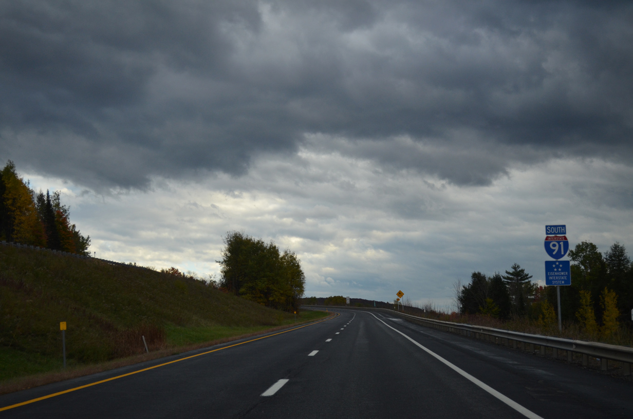
| A folded diamond interchange lies just south of the Canadian border with Interstate 91 at Caswell Avenue west and Holland Road east in Derby Line. The U.S. port of entry resides within the interchange for motorists entering from Quebec. 10/08/14 |
|
| An I-91 trailblazer stands along the on-ramp from Caswell Avenue east / Holland Road west. 10/08/14 |
|
| A short distance south of the international boundary is a Vermont welcome center and rest area. 10/08/14 |
|
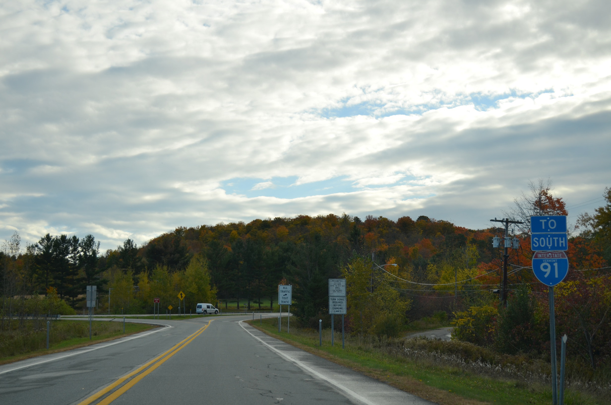
| A welcome sign greets southbound motorists as Interstate 91 angles southwest from Derby Line to the first of many crossings of U.S. 5. 10/08/14 |
|
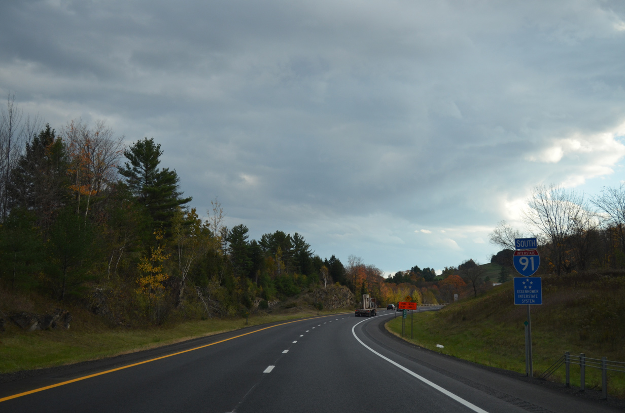
| Signs mark 45 degrees latitude on both Interstate 91 and 89 in northern Vermont. The latitude lies midway between the North Pole and Equator. 07/30/07 |
|
| Southbound travelers on I-91 reach the Derby Line rest area. 10/08/14 |
|
| U.S. 5 shifts sides with the freeway en route to Derby Center beyond the first southbound reassurance marker of Interstate 91. 10/08/14 |
|
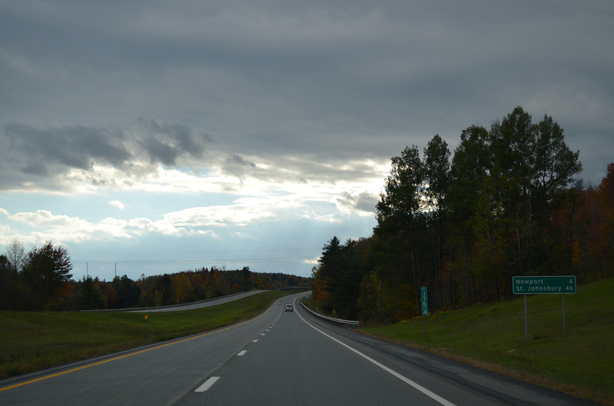
| The city of Newport, seat of Orleans County, lies eight miles to the south via the next two exits of Interstate 91. St. Johnsbury, 46 miles away, is the main control city of the freeway. 10/08/14 |
|
| U.S. 5 combines with VT 105 west from Derby Center to follow Main Street west from Exit 28 into the Newport city center. 10/08/14 |
|
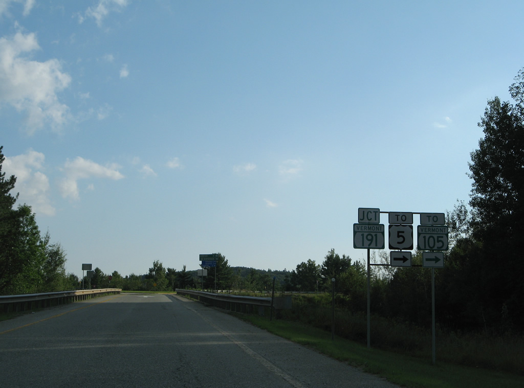
| Leading east from Derby Center, VT 105 ventures southeast by Lake Salem through the town of Charleston to Island Pond in the town of Brighton. VT 111 begins a 15.1 mile route southeast to Morgan and VT 114 nearby. 10/08/14 |
|
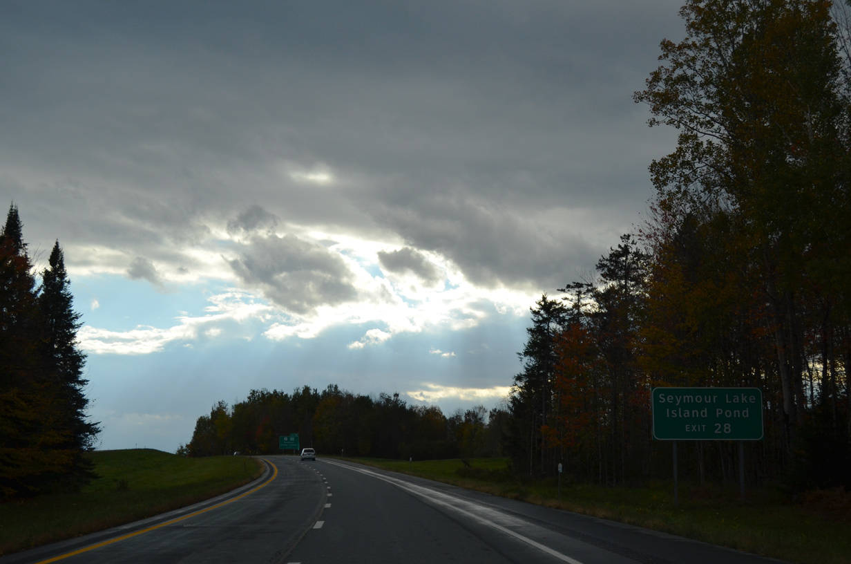
| One half mile north of the parclo interchange (Exit 28) with U.S. 5 & VT 105 on Interstate 91 south. 10/08/14 |
|
| Exit 28 leaves Interstate 91 south for U.S. 5 & VT 105. VT 105 totals 98.2 miles across northern reaches of the state. The route ends at U.S. 7 in St. Albans to the west and at North Stratford, New Hampshire to the east. 10/08/14 |
|
| Continuing south, Interstate 91 runs between Clyde Pond and Salem Hill over the next two miles. 10/08/14 |
|
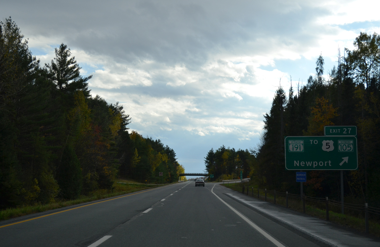
| VT 191 spurs 2.3 miles northwest from upcoming Exit 27 to U.S. 5 & VT 105 by Lake Memphremagog and the Newport city center. 10/08/14 |
|
| A parclo interchange (Exit 27) joins Interstate 91 south with VT 191 north and Schuler Road. Schuler Road extends east from Exit 27 to Hopkinson Hill and Hinman Settler Road. 10/08/14 |
|
| Southbound Interstate 91 at Exit 27 to VT 191 north and Schuler Road east. VT 191 constitutes a controlled access route north with at-grade intersections at Pine Hill Road and Western Avenue. Similar expressway spurs join I-89 with Barre and St. Albans. 10/08/14 |
|
| The Newport city center lies three miles to the northwest via VT 191 and U.S. 5 & VT 105 west. Traveler services are available two miles to the west as well. 07/30/07 |
|
| Interstate 91 swings southeast to the Coventry town line from Exit 27. 10/08/14 |
|
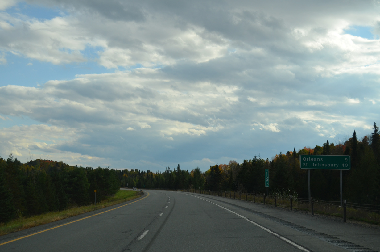
| The village of Orleans is the next southbound exit in nine miles while St. Johnsbury is now 40 miles to the south. 10/08/14 |
|
| A truck weigh station and parking area lies one mile ahead in north Coventry. 10/08/14 |
|
| Interstate 91 south at the weigh station and parking area west of Brownington Pond. 10/08/14 |
|
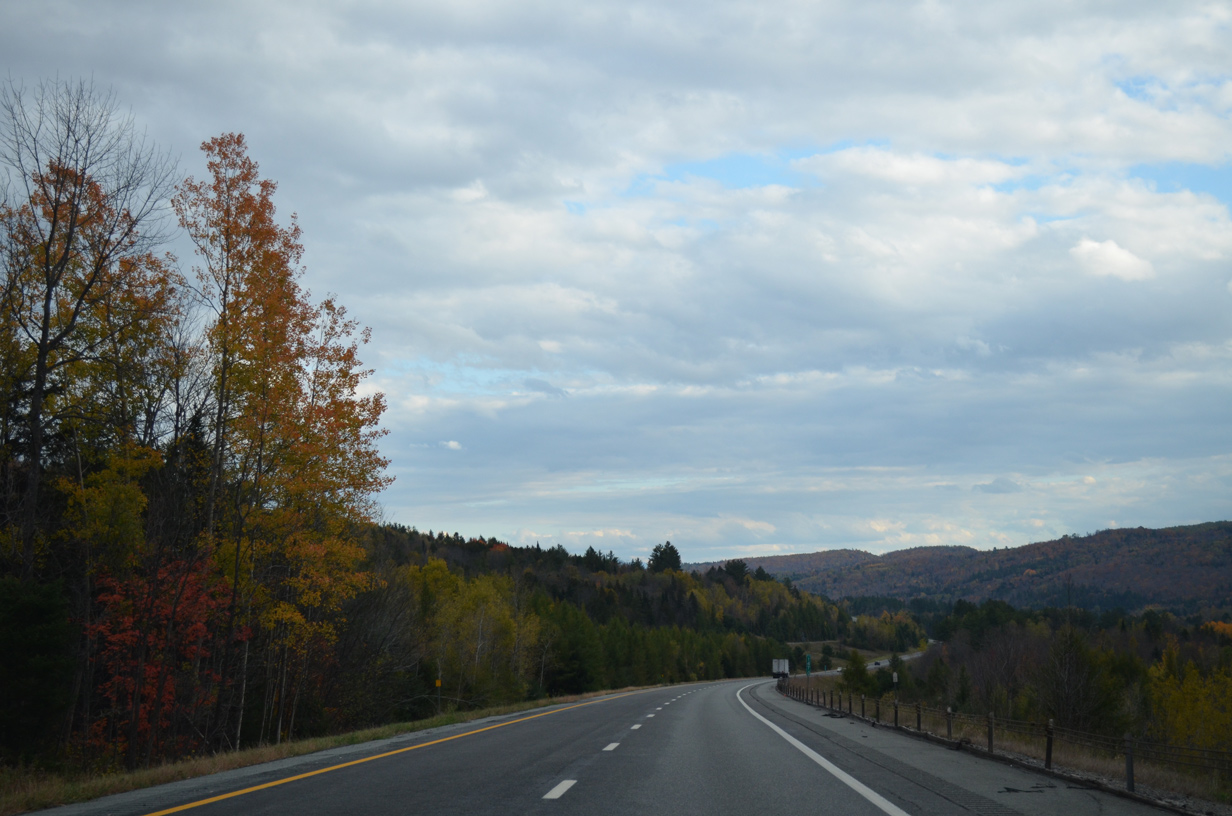
| Scenery along Interstate 91 leading southwest through Coventry. A series of hills in Irasburg rise along the southern horizon. 10/08/14 |
|
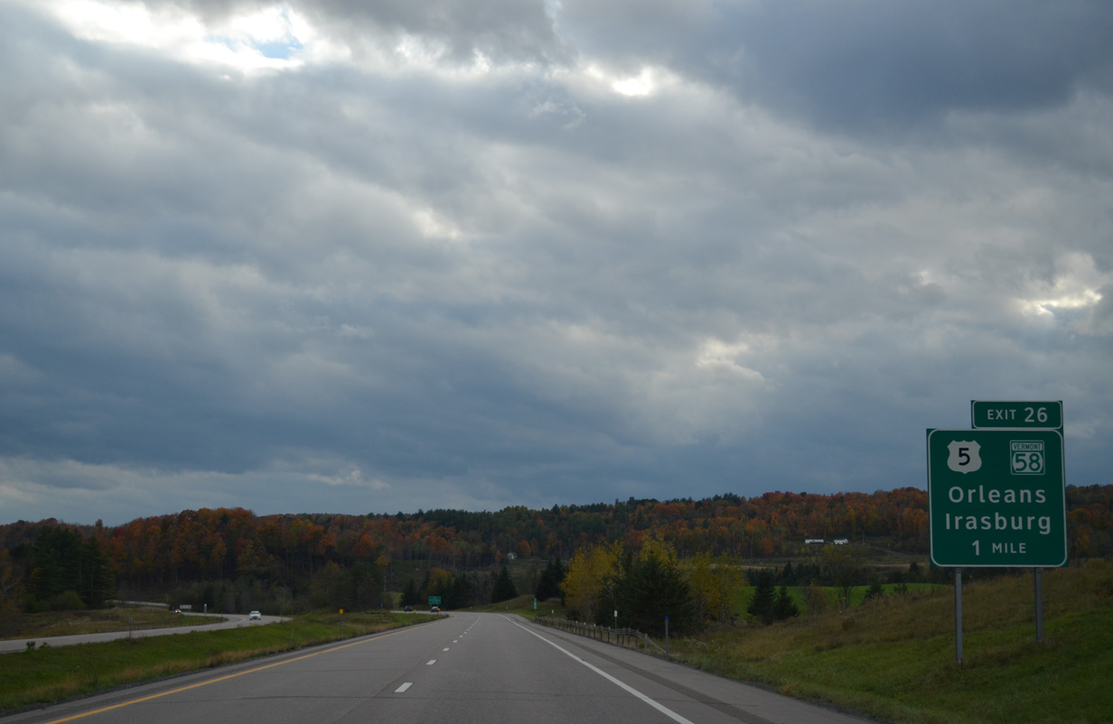
| Southbound travelers enter the town of Irasburg on the one mile approach to Exit 26 with U.S. 5 & VT 58. 10/08/14 |
|
| U.S. 5 loops west from Newport to the Coventry town center and back east to the Orleans village center. VT 58 ties into the US route from the Irasburg town center to the west. 10/08/14 |
|
| A folded diamond interchange facilitates movement between Interstate 91 and U.S. 5 & VT 58 at the Barton town and Orleans village line. VT 58 runs 30.9 miles between VT 118 at Montgomery Center and VT 5A in Brownington. U.S. 5 south stays east of I-91 along the parallel Barton River. 10/08/14 |
|
| Interstate 91 advances southward through western reaches of the town of Barton. 10/08/14 |
|
| The village of Barton lies six miles ahead along U.S. 5. St. Johnsbury is now within a half hour drive. 10/08/14 |
|
| A wide forested median comes into view as Interstate 91 lowers into a valley adjacent to the Barton River. Wide medians are a common theme of I-91 throughout Vermont. 10/08/14 |
|
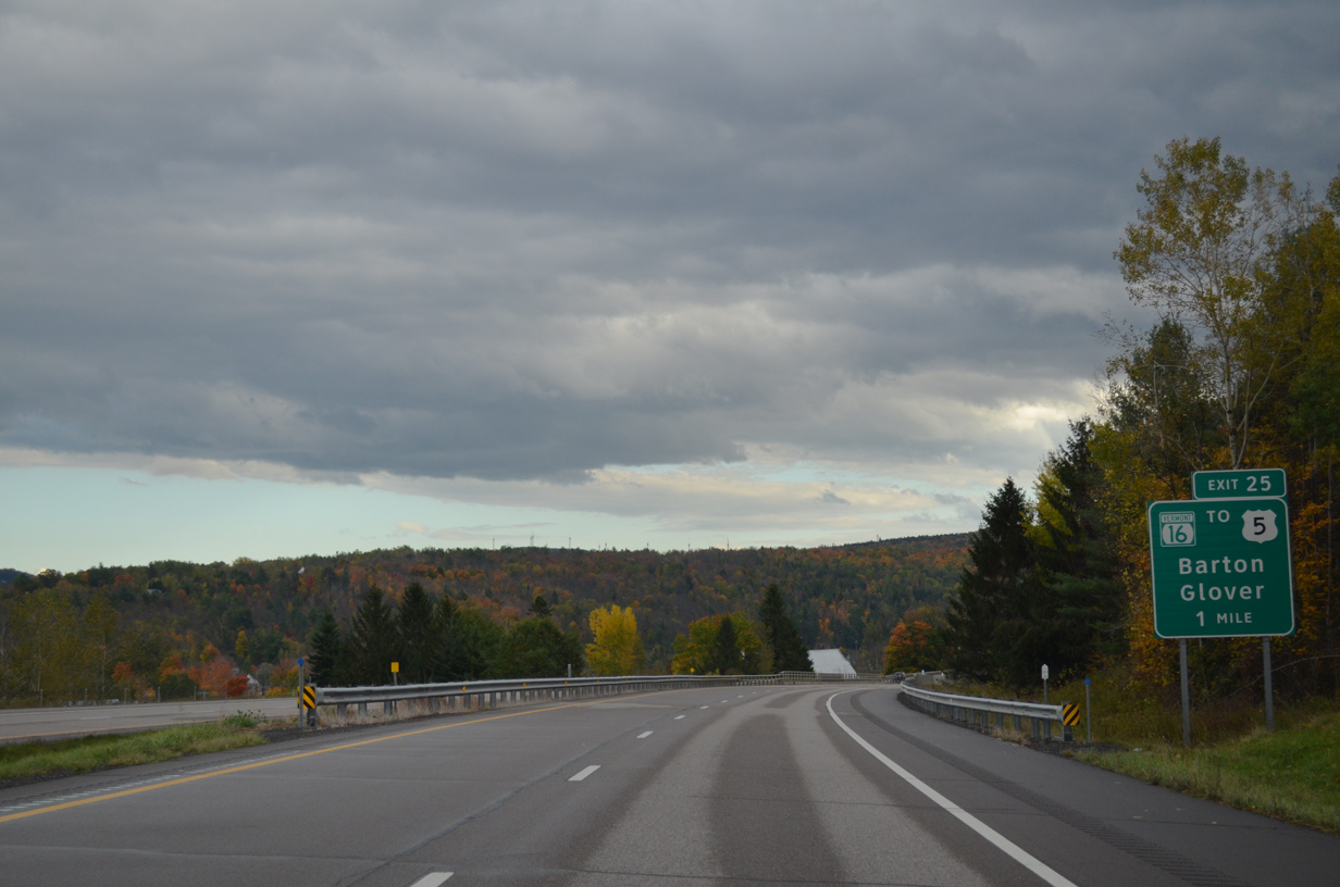
| Interstate 91 enters the village of Barton at the Elm Street underpass. A diamond interchange (Exit 25) connects the freeway with VT 16 (Glover Road) in one mile. 10/08/14 |
|
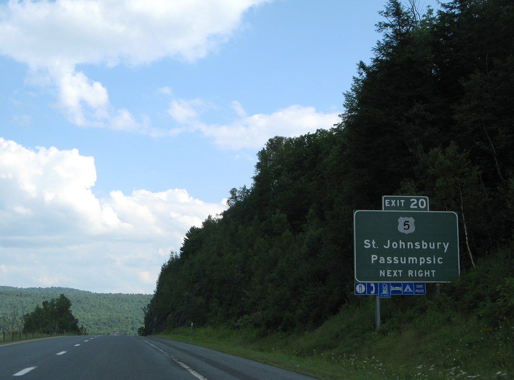
| VT 16 comprises a 27.9 mile route from VT 15 in Hardwick to VT 5A in Westmore. Locally the route travels Glover Road north 1.1 miles to a short overlap with U.S. 5 (Main Street). 10/08/14 |
|
| Exit 25 departs Interstate 91 south for VT 16 (Glover Road) north to the Barton village center and south to the Glover town center. U.S. 5 branches away from the I-91 corridor southeast by Crystal Lake to West Burke before returning at Lyndonville. 10/08/14 |
|
| Interstate 91 angles southeast to cross the northeastern corner of Glover. 10/08/14 |
|
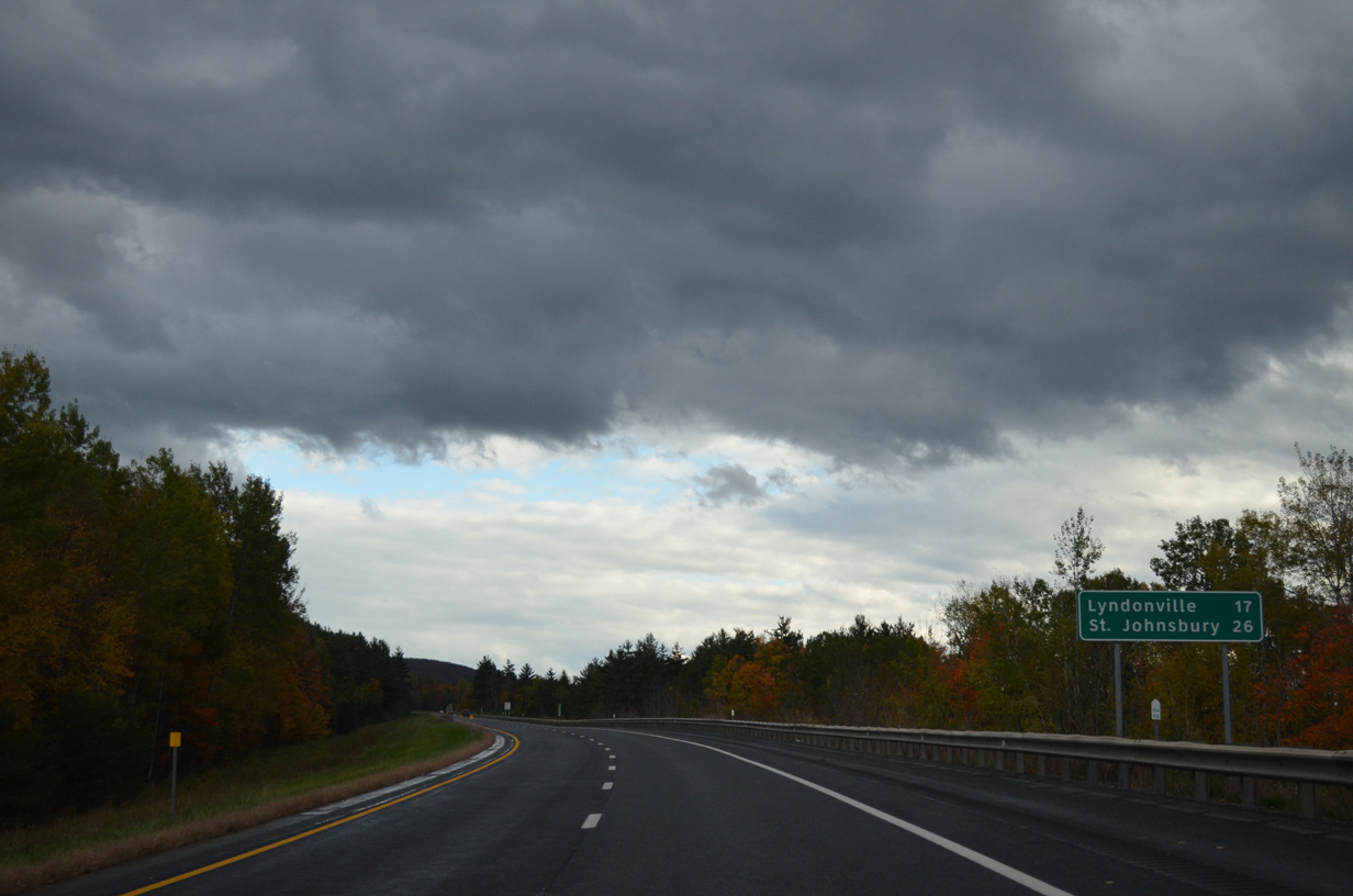
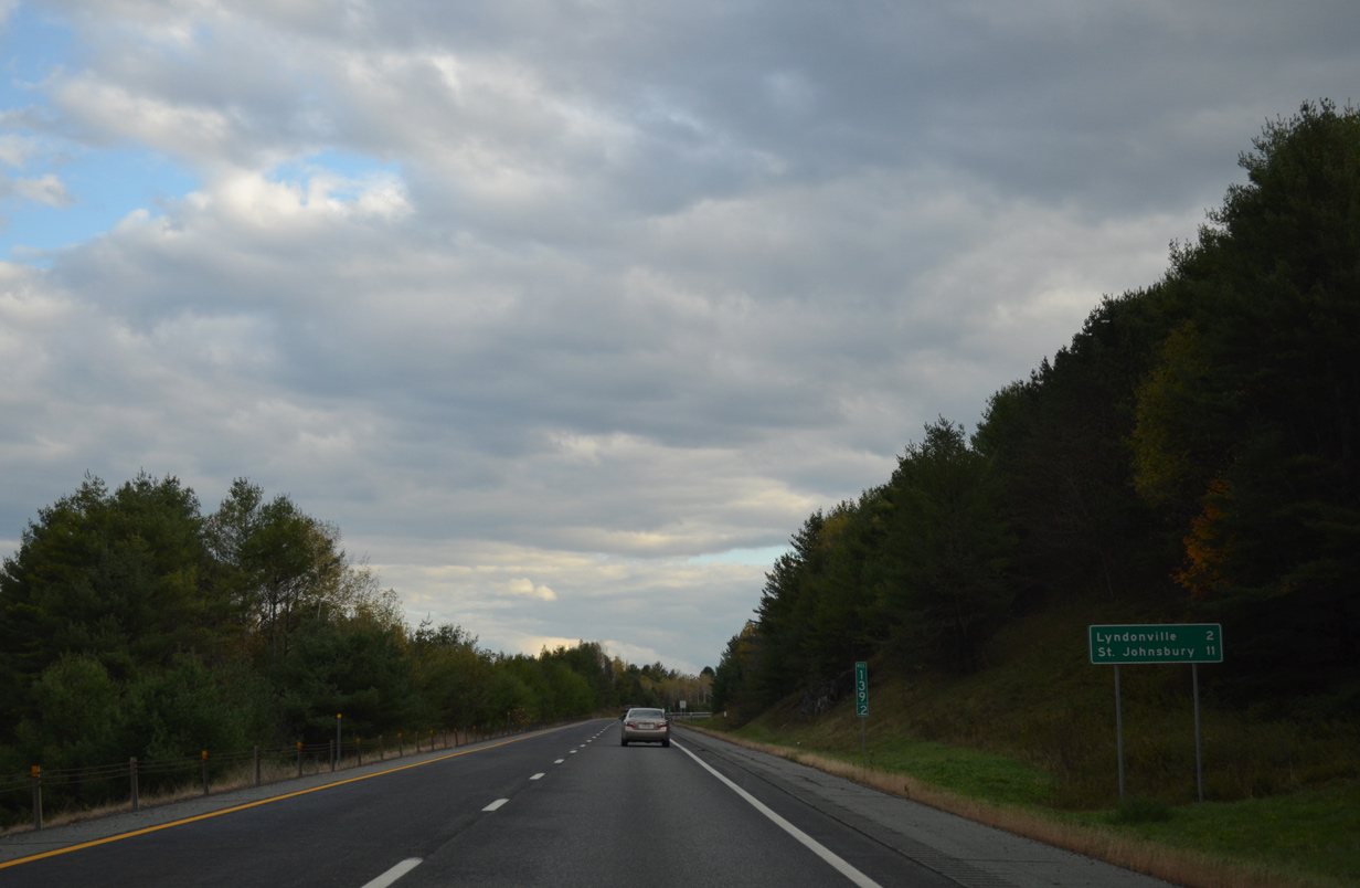
| A 15.8 mile exit less stretch takes Interstate 91 south to the first of two exits for the village of Lyndonville. St. Johnsbury is just nine miles further south. 10/08/14 |
|
| Interstate 91 swings southeast between Big Rock Hill (el. 2,156 ft) and Granby Mountain (el. 2,379 feet). 10/08/14 |
|
| Crossing the Caledonia County line, travelers along I-91 also enter the town of Sheffield. 10/08/14 |
|
| Pushing south toward Dunn Mountain (el. 1,886 ft) and Ferguson Hill (el. 1,686 ft) along Interstate 91 through Sheffield. 10/08/14 |
|
| Passing by the Sheffield town center, Interstate 91 turns more east along a valley fed by Miller Run to Wheelock and north Lyndon. 10/08/14 |
|
| Kinking southward ahead of Squabble Hollow along Interstate 91 south within the town of Lyndon. 10/08/14 |
|
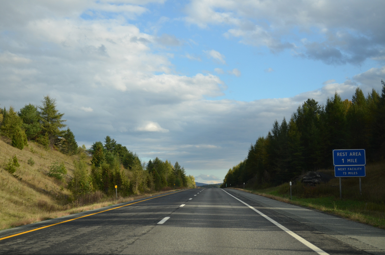
| A southbound side rest area provides a respite for drivers ahead of Exit 24. 10/08/14 |
|
| VT 122 runs alongside Interstate 91 from Sheffield through Wheelock to finally cross paths with the freeway at Exit 24 outside the Lyndonville village limits. 10/08/14 |
|
| Interstate 91 southbound at the Lyndon rest area. 10/08/14 |
|
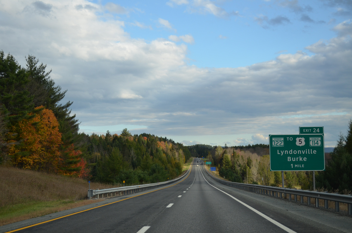
| A folded diamond interchange joins VT 122 (Gillman Road) with Interstate 91 across from Miller Run. East from Exit 24, VT 122 takes Gillman Road to Stevens Loop to end at U.S. 5 opposite VT 114 (Burke Road) north to East Burke. 10/08/14 |
|
| Southbound at the off-ramp (Exit 24) to VT 122 (Gillman Road) on I-91. VT 122 originally took a dog leg south along Center Street to U.S. 5 (Broad Street) in the Lyndonville village center. U.S. 5 leads south from there to meet I-91 again at Exit 23. 10/08/14 |
|
| Interstate 91 runs along the hillside west of Lyndonville and the Passumpsic River over the next two miles. Lyndon State College lies just to the west of the freeway. 10/08/14 |
|
| St. Johnsbury is next along Interstate 91 south beyond Lyndonville in 11 miles. 10/08/14 |
|
| U.S. 5 follows Broad Street south from Lyndonville to reenter the town of Lyndon along Memorial Drive to a parclo interchange (Exit 23) with Interstate 91. 10/08/14 |
|
| Exit 23 leaves in one half mile for the Lyndon town center as I-91 veers west by Minister and Prospect Hills (el 1,096 ft). 10/08/14 |
|
| I-91 south at Exit 23. U.S. 5 (Memorial Drive) south loops back to the east of I-91 to run alongside the Passumpsic River south to St. Johnsbury Center. 10/08/14 |
|
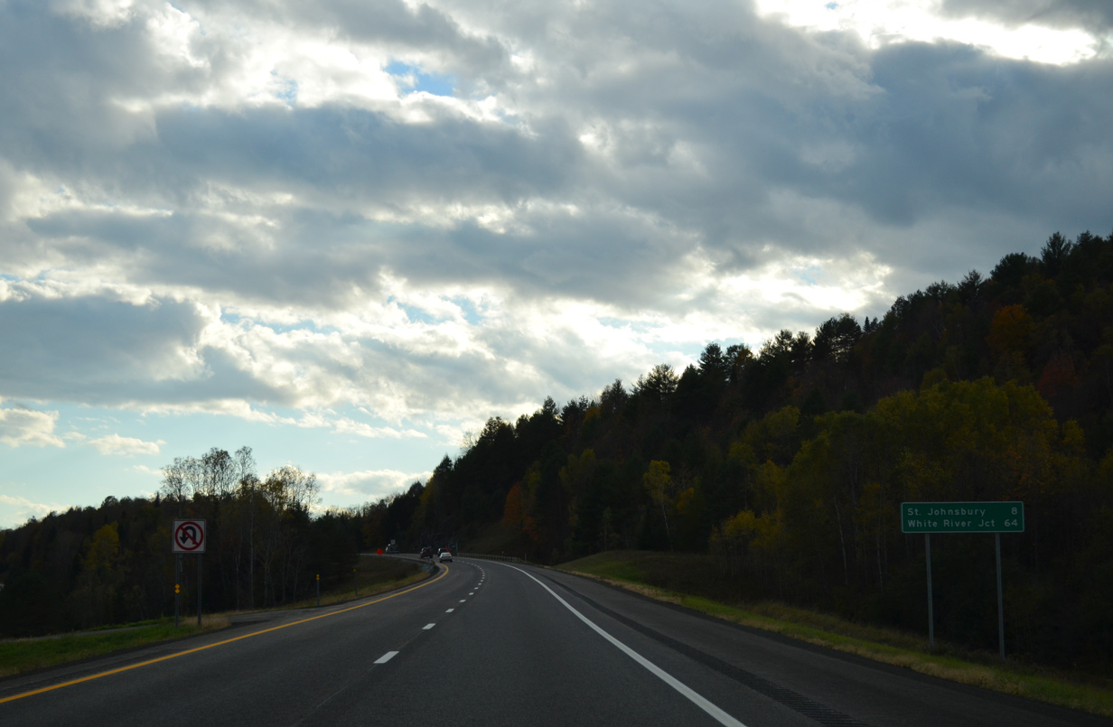
| White River Junction debuts on southbound distance signage at 64 miles out as I-91 nears St. Johnsbury. 10/08/14 |
|
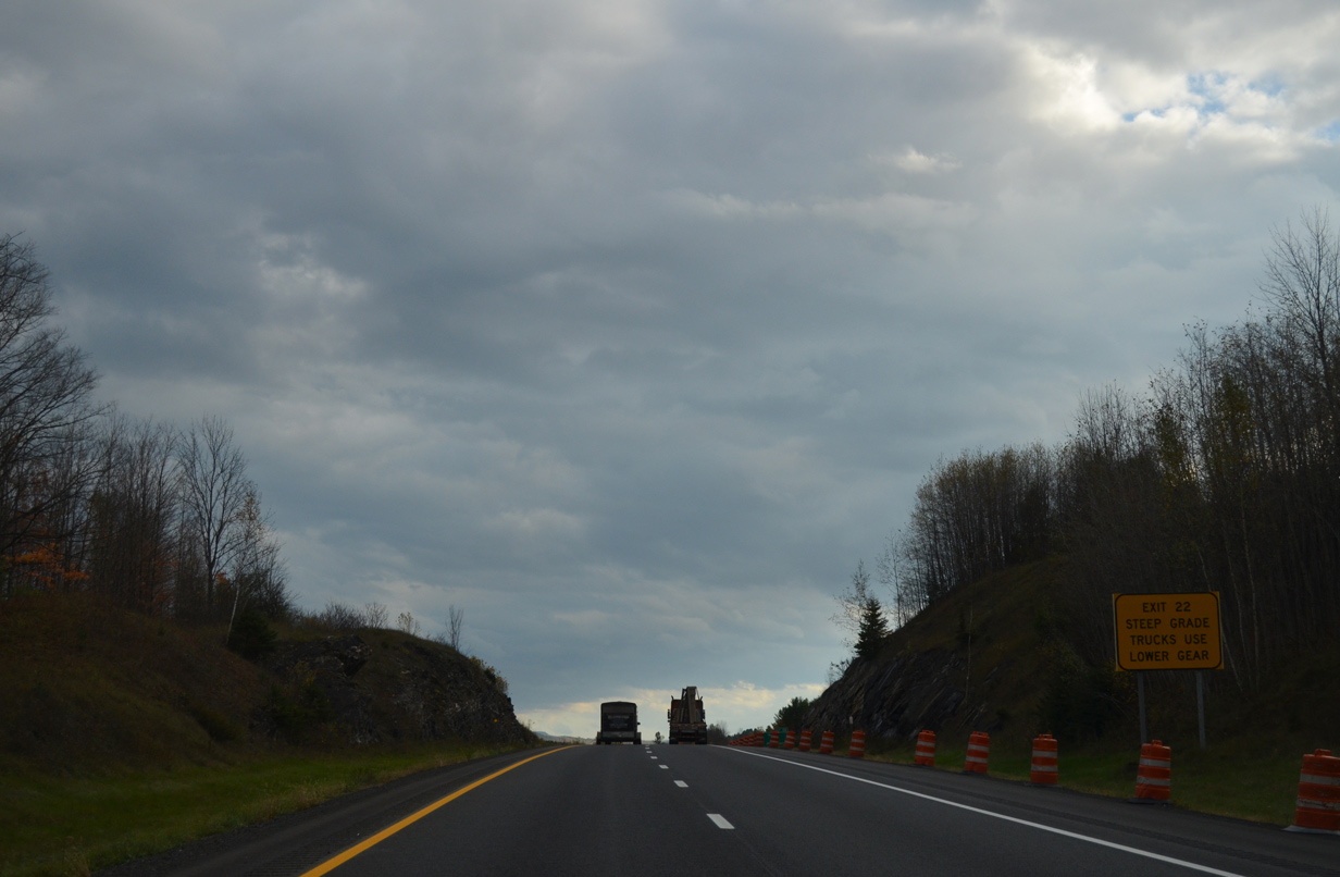
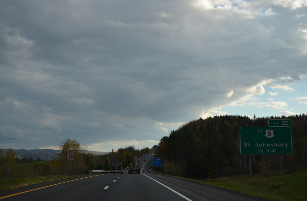
| Exit 22 is the first of three exits for the Caledonia County seat of St. Johnsbury. Joining the freeway in one mile is Hospital Drive west from U.S. 5 (Memorial Drive). 10/08/14 |
|
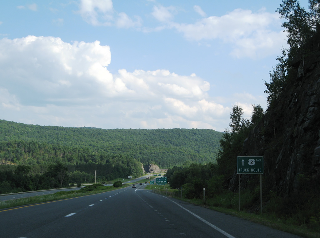
| Trucks headed for U.S. 2 west to Montpelier or east to Lancaster, New Hampshire are directed to use Interstates 91 and 93 to bypass the zigzagging route of U.S. 2 through St. Johnsbury. 10/08/14 |
|
| Hospital Drive descends abruptly from Exit 22 as I-91 straddles hills above the Passumpsic River valley. 10/08/14 |
|
| Hospital Drive crosses the Passumpsic River to intersect U.S. 5 (Memorial Drive) south of St. Johnsbury Center and north of the St. Johnsbury street grid. The road originally defaulted traffic onto Old Center Road, which stays west of the river. 10/08/14 |
|
| Entering the diamond interchange (Exit 22) with Hospital Drive on Interstate 91 south. Zarbarsky Drive ties into the exit from agricultural areas to the west. 10/08/14 |
|
| Curving southwest, Interstate 91 crosses into the town limits of St. Johnsbury ahead of The Knob (el. 1,099 ft). 10/08/14 |
|
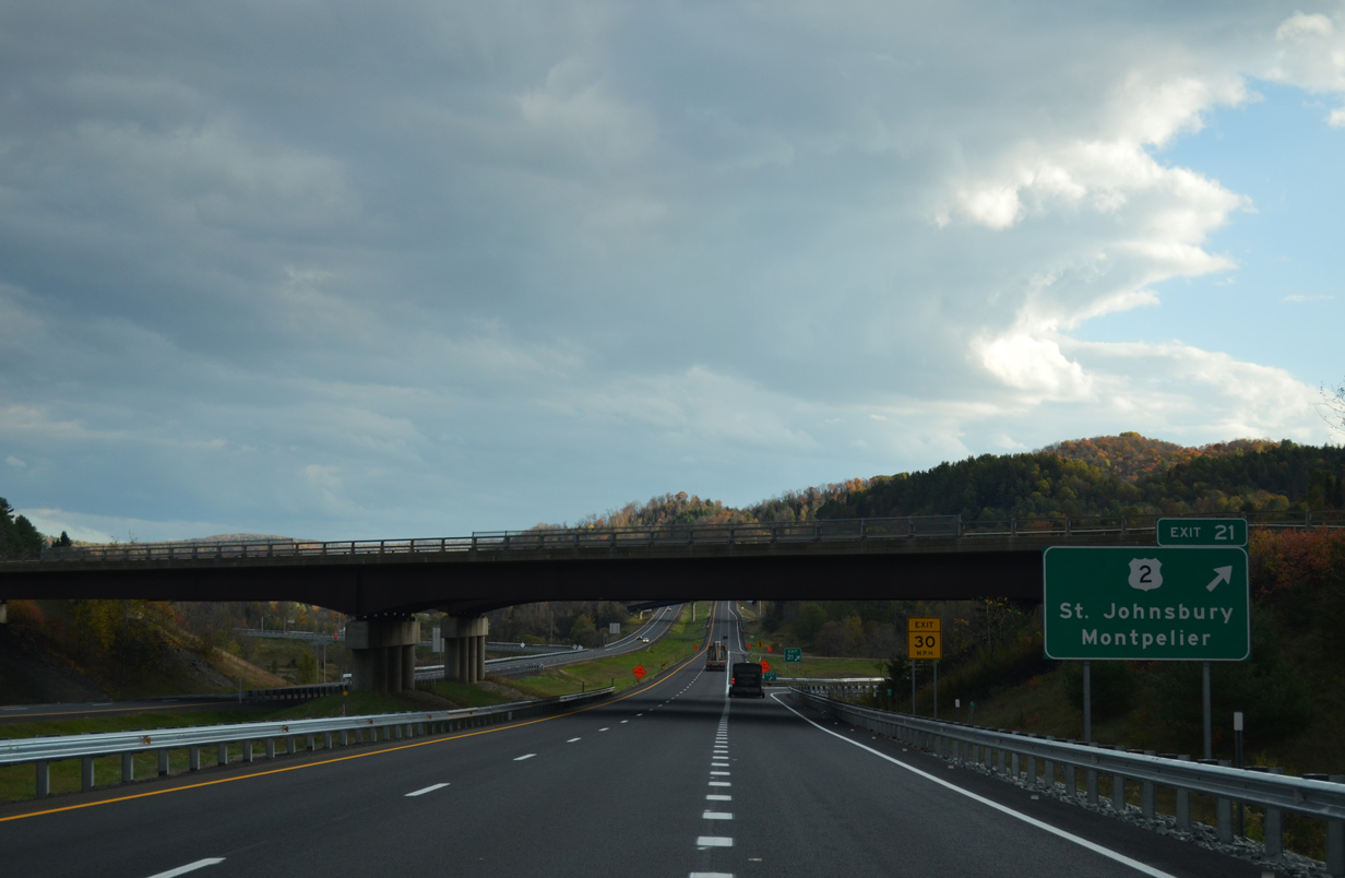
| Mount Pleasant Street spans Interstate 91 on the one mile approach to Exit 21 with U.S. 2. U.S. 2 expands into a four lane divided highway within the immediate vicinity of I-91 as it doubles as a truck route west to Danville, Marshfield, Plainfield and Montpelier. 10/08/14 |
|
| Danville is a seven mile drive to the west along U.S. 2. There VT 15 begins and ventures northwest 13 miles to Hardwick. Danville is significant in that I-91 was planned to run west through the town until 1963 when it shifted to its present alignment. 10/08/14 |
|
| The eastern segment of U.S. 2 totals 459.5 miles from the north end of Interstate 95 at Houlton to U.S. 11 at Rouses Point, New York. Within the Green Mountain State, U.S. 2 goes for 150.4 miles, connecting St. Johnsbury with the capital city, Burlington and Lake Champlain. 10/08/14 |
|
| A three quarter cloverleaf interchange joins Interstate 91 with U.S. 2 at Exit 21. 10/08/14 |
|
| Taking Exit 21, an array of shields direct motorists onto U.S. 2 east into St. Johnsbury and west to Danville. U.S. 2 makes a convoluted route east to Downtown, using Western Avenue, Main Street and Eastern Avenue. 10/08/14 |
|
| Montpelier is a 36 mile drive to the southwest. U.S. 2 accompanies the Interstate 89 corridor west from there to Waterbury, Richmond, Burlington and Colchester. 10/08/14 |
|
| Within Downtown St. Johnsbury, U.S. 2 briefly combines with U.S. 5 along Railroad Street before resuming an eastern heading along Portland Street to East St. Johnsbury. 10/08/14 |
|
| A high level overpass carries VT 2B across I-91 to its eastern terminus at adjacent U.S. 2. VT 2B represents the former alignment of U.S. 2 west 3.4 miles into the town of Danville. 07/30/07 |
|
| Leaving the St. Johnsbury business district, U.S. 5 expands into a four lane divided highway ahead of the parclo A2 interchange (Exit 20) with Interstate 91. 07/30/07 |
|
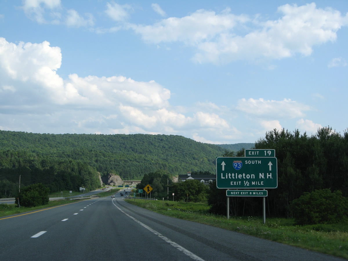
| The tri-level stack interchange (Exit 19) with Interstate 93 south lies just beyond the exchange with U.S. 5. 07/30/07 |
|
| U.S. 5 shifts to west of I-91 southward from St. Johnsbury to Passumpsic in the town of Barnet. 07/30/07 |
|
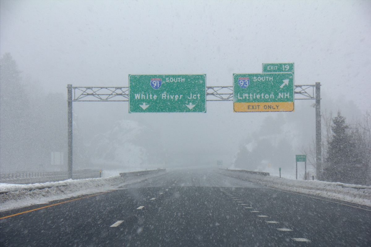
| Truckers taking I-91 south to bypass U.S. 2 through St. Johnsbury are directed to Exit 19 for Interstate 93 north. 07/30/07 |
|
| A replaced button copy sign for Interstate 93 posted within Exit 20. It seems like Boston would be a neat control city in addition to Littleton as the destination on this sign. 07/30/07 |
|
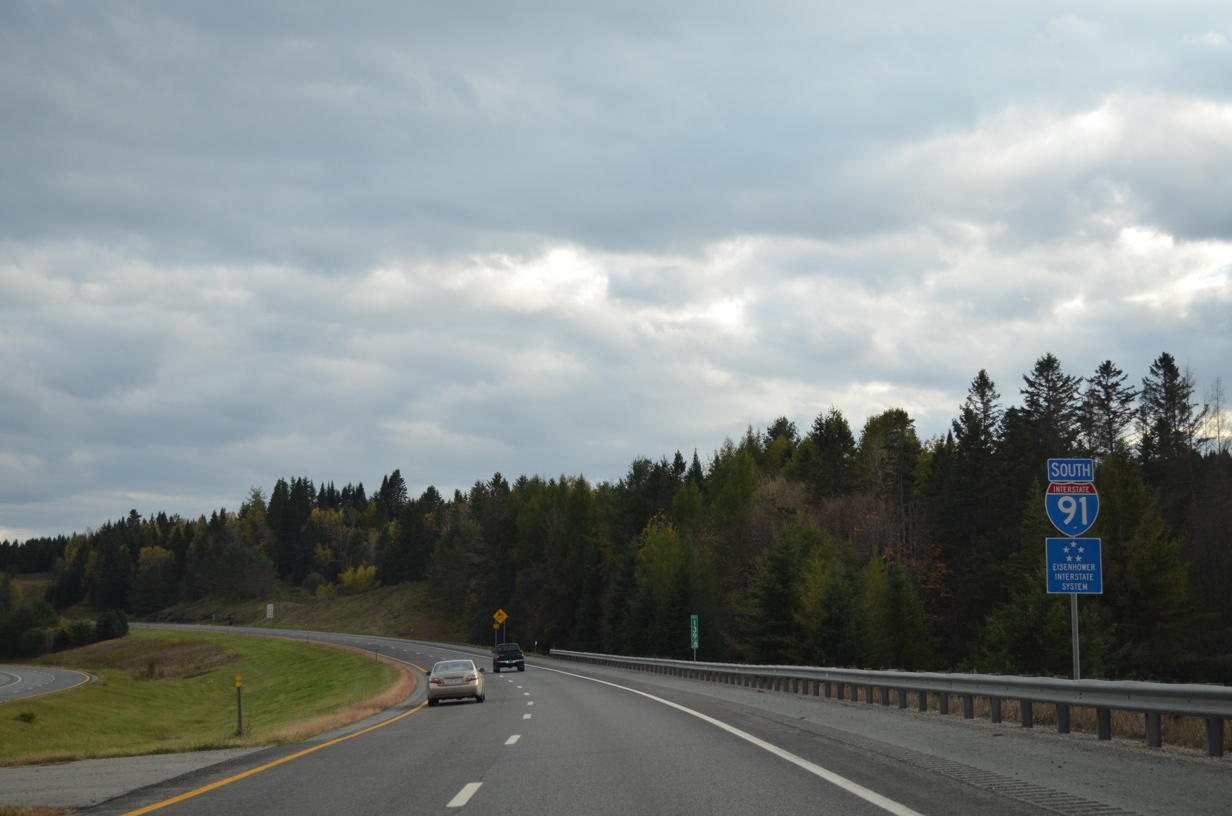
| Interstate 91 crosses the Passumpsic River ahead of the northern terminus for Interstate 93. I-93 south to VT 18 north (Exit 1) completes the truck bypass for U.S. 2 leading east to Lancaster, New Hampshire. 07/30/07 |
|
| Interstate 93 begins and arcs eastward through the town of Waterford to cross the Connecticut River en route to Littleton, New Hampshire. The freeway journeys south through the White Mountains Region, partially on Franconia Notch Parkway, to Plymouth, Concord and ultimately Boston, Massachusetts. 03/02/15 |
Page Updated 03-03-2015.

 South
South