|
| Interstate 94 continues on a southeast trajectory from Wis 312 at Exit 59. 09/04/16 |
|
| I-94 east rises to 950 feet in elevation four miles out from the folded diamond interchange (Exit 65) with Wis 37 (Hendrickson Drive). A 57 mile drive awaits motorists for Black River Falls while I-90 east joins I-94 in 88 miles near Tomah. 09/04/16 |
|
| County E (Cameron Street) passes beneath the freeway as it travels to the west of Eau Claire. Projects over a several year period along this stretch of I-94 replaced existing pavement with concrete and expanded bridges to accommodate future lanes. 09/04/16 |
|
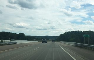
| Traffic along I-94 east crosses over Eau Claire County C and Crescent Avenue en route to the Chippewa River and Wis 37 (Exit 65). County C ends at the Eau Claire city limits while Crescent Avenue east continues into the city. 09/04/16 |
|
| The second Eau Claire exit (Exit 65) joins with I-94 in one mile. Wis 37 stems northeast from Mondovi to reach the freeway and Eau Claire. Distance placards for the next interchange are still commonplace along I-94 in northwest Wisconsin, with the next exit occurring at Wis 93 in five miles. 09/04/16 |
|
| Both the University of Wisconsin-Eau Claire and Chippewa Valley Technical College campuses are located along U.S. 12 (Clairemont Avenue) northeast of the upcoming interchange (Exit 65) with STH-37 (Hendrickson Drive). 09/04/16 |
|
| I-94 spans the Chippewa River and Fehr Road on the final approach to Exit 65 (Wis 37). The river meanders nearly 183 miles from Lake Chippewa in Sawyer County southwesterly to the Mississippi River near Pepin. 09/04/16 |
|
| Drivers reach the folded diamond interchange with STH 37 (Hendrickson Drive) to Eau Claire and Mondovi. The state trunk highway runs southward into rural Eau Claire County toward Mondovi. Northward STH 37 joins I-94 with nearby U.S. 12 (Clairemont Drive). 09/04/16 |
|
| Curving east along the south boundary of Eau Claire, the freeway travels over CTH-F (Lowes Creek Road). County F follows Lowes Creek Road north from this point joining State Street to Eau Claire city limits. 09/04/16 |
|
| Wis 93 provides Interstate 94 a connection to U.S. 53 Business in one mile (Exit 68). Wis 93 travels 68 miles between Galesville and Eau Claire, tying into U.S. 53 on either end. 09/04/16 |
|
| Drivers ascend along the off-ramp to Exit 68 (Wis 93). Eleva lies 13.8 miles to the south of the diamond interchange along the U.S. 10 corridor. STH-93 continues north from I-94 to reach U.S. 53 Business (Hastings Way) and the U.S. 53 freeway. 09/04/16 |
|
| A variable message board (VMS) stands near the base of the entrance ramp from STH 93 (Exit 68) as Interstate 94 begins to pull away from the Eau Claire area. 09/04/16 |
|
| U.S. 53 represents the final Eau Claire interchange, meeting I-94 in 0.75 miles. A 12 mile exit less stretch awaits motorists continuing along the freeway toward Black River Falls and Tomah. 09/04/16 |
|
| The U.S. 53 freeway runs north from I-94 through the city of Altoona, which lies adjacent to Eau Claire. Originally platted and founded as East Eau Claire in 1880, the city saw its name change and incorporation by 1887. 09/04/16 |
|
| A collector distributor roadway and cloverleaf interchange joins I-94 with U.S. 53 at Exit 70. 09/04/16 |
|
| U.S. 53 south turns rural as it travels along a two lane corridor seven miles to the unincorporated community of Brackett. The US highway continues south following closely with I-94 to Osseo. North of I-94, U.S. 53 extends along a freeway through Altoona en route to Chippewa Falls. The freeway section of U.S. 53 opened in several phases, with the last phase completed between Wis 93 and Wis 312 (North Crossing) in August 2006.1 09/04/16 |
Page Updated 09-24-2016.

 East
East


