Rocky Mount derives its name from the rocky mound located at the falls of the Tar River. The town first appeared on maps with the establishment of a post office on March 22, 1816, and a settlement based upon cotton mills. In 1845, the Wilmington-Weldon Railroad extended to Rocky Mount, and that coupled with the Raleigh-Tarboro stage route made the town an exchange point for travelers between the railroad and stage route. Incorporation of Rocky Mount occurred on February 19, 1867, with tobacco crops and trade spurring growth in the late 19th century.1
|
| The first of six interchanges on I-95 in Nash County connects with NC 97 north of Toisnot Swamp. 12/14/17 |
|
| NC 97 runs across southern reaches of the county east from Zebulon to Rocky Mount-Wilson Regional Airport (RMI) and Rocky Mount. 12/21/18 |
|
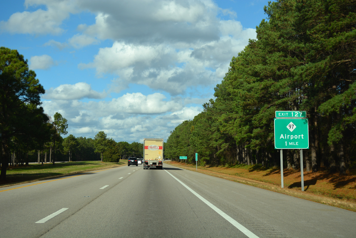
| NC 97 leads six miles west from the diamond interchange (Exit 127) with I-95 to Stanhope. Winstead Crossroads is three miles to the east at NC 58, followed by RMI Airport near Tar River Reservoir. 12/21/18 |
|
| Interstate 95 crosses the Tar River north of NC 97. 12/21/18 |
|
| Distance sign posted ahead of the SR 1745 (Bend Of The River Road) overpass. 12/21/18 |
|
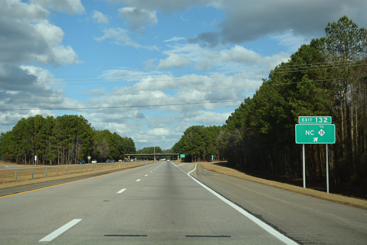
| NC 58 spans Interstate 95 near mile marker 130. Sandy Cross Road (SR 1717) connects the freeway with NC 58 at Sandy Cross to the west of upcoming Exit 132. 12/17/20 |
|
| East from Exit 132, Sandy Cross Road transitions to West Mont Drive en route to Langley Crossroads, Easonburg, and U.S. 301 in south Rocky Mount. NC 58 leads north to Nashville. 12/21/18 |
|
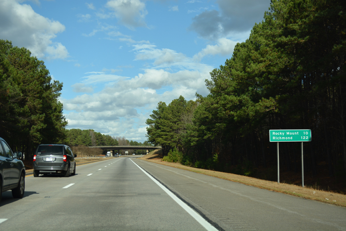
| The succeeding exit from Interstate 95 north is with U.S. 64 (Future I-87) on the outskirts of Rocky Mount. Richmond, Virginia is 122 miles away. 12/21/18 |
|
| Part of the Future I-87 corridor, U.S. 64 constitutes a long distance freeway west to Raleigh and east to Williamston. The limited access highway also provides direct access to Downtown Rocky Mount via U.S. 301 Business south. 12/21/18 |
|
| U.S. 64 extends east to NC 12 at Whalebone Junction near Nags Head. A coastal route throughout the Outer Banks, NC 12 travels south through Cape Hatteras National Seashore. Manteo, 136 miles to the east, is home to the North Carolina Aquarium at Roanoke Island. 12/21/18 |
|
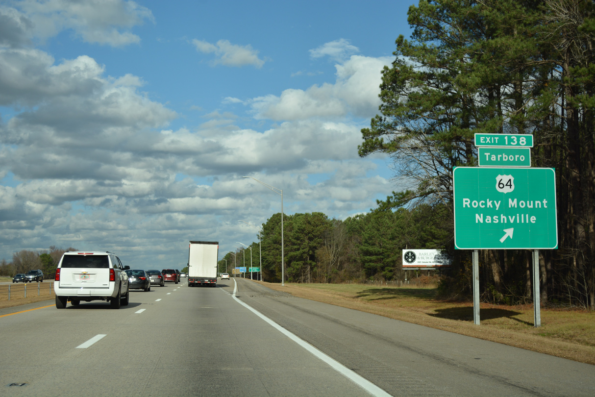
| One mile south of the cloverleaf interchange (Exit 138) with U.S. 64. U.S. 64 travels six miles east to central Rocky Mount and 20 miles to Tarboro. 12/21/18 |
|
| A collector distributor roadway (Exit 138A) partitions from I-95 for U.S. 64. Nashville, the Nash County seat, lies six miles to the west. 12/21/18 |
|
| Exit 138 departs Interstate 95 northbound for U.S. 64 east to Rocky Mount, Tarboro and the Outer Banks. The Future I-87 corridor shifts northeast along U.S. 17 from Williamston to Elizabeth City and Hampton Roads, Virginia. 12/21/18 |
|
| West from Exit 183B, U.S. 64/Future I-87 converge with U.S. 264/Future I-587 at Zebulon. Interstate 87 ties into I-440 at Raleigh in 48 miles. 12/21/18 |
|
| Confirming marker posted northbound between Stony Creek and the Hunter Hill Road (SR 1604) overpass. 12/21/18 |
|
| Located 37 miles away, Roanoke Rapids is the control city for Interstate 95 north from Rocky Mount. 12/21/18 |
|
| A diamond interchange (Exit 141) joins NC 43 (Main Street) with Interstate 95 near Dortches northwest of Rocky Mount. 12/21/18 |
|
| Exit 141 connects I-95 with NC 43 for Dortches and Rocky Mount to the south and Red Oak and Aventon to the north. NC 43 travels overall between New Bern and Liberia. 12/17/20 |
|
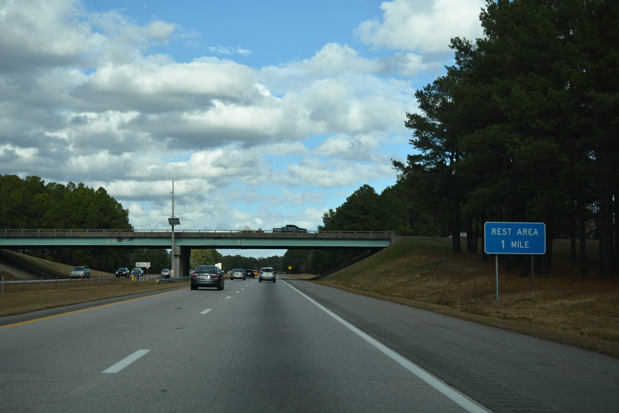
| The Nash County Rest Areas line both sides of Interstate 95 at Compass Creek. 12/21/18 |
|
| NC 4 comprises a four lane highway miles east from Exit 145 and NC 48 to U.S. 301 at Battleboro. NC 4 represents the northern leg of former Business Loop I-95 from U.S. 301 and Rocky Mount. 12/21/18 |
|
| NC 48 heads six miles north from Rocky Mount to Drake and NC 4 at Exit 145. NC 4/48 combine seven miles north to Glenview and 16 miles to their split at Brinkleyville. 12/21/18 |
|
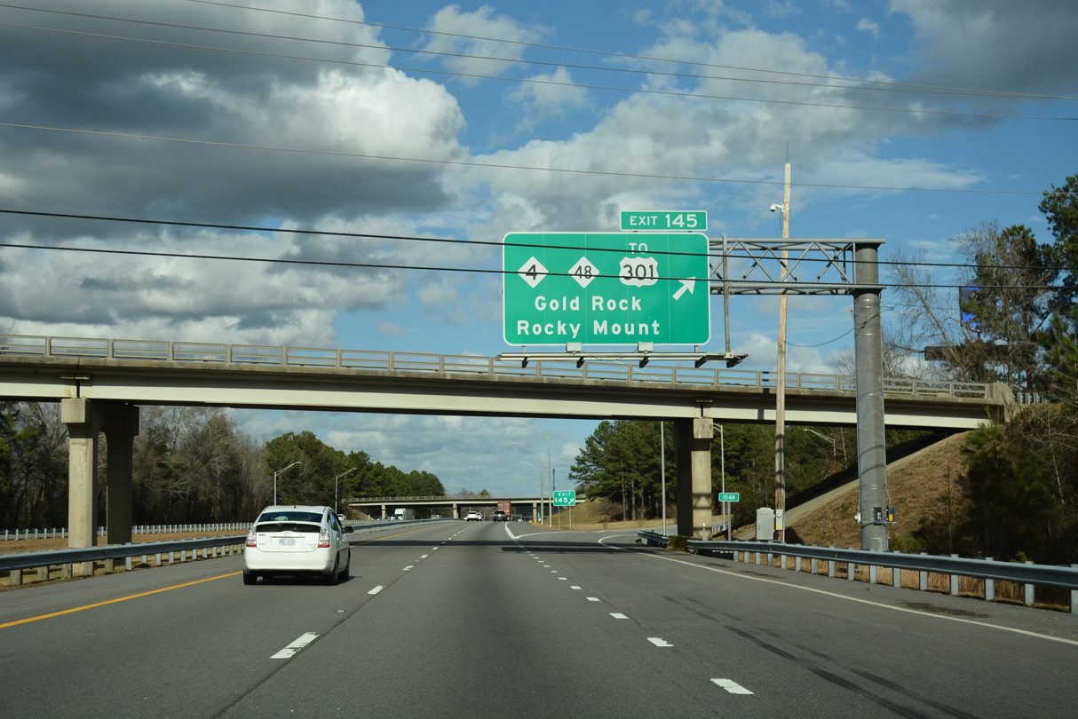
| Halifax Road passes over I-95 at the trumpet interchange (Exit 145) for NC 4/48 at Gold Rock. NC 4 ends four miles to the east at a wye interchange with U.S. 301 near the campus of North Carolina Wesleyan College. 12/21/18 |
|
| Interstate 95 crosses Swift Creek to the west of Gold Rock just beyond the entrance ramp from NC 4/48. 12/21/18 |
|
| Roanoke Rapids lies 31 miles north of Gold Rock. Richmond, Virginia is 110 miles away. 12/21/18 |
|
| Interstate 95 advances two miles north to a diamond interchange (Exit 150 with NC 33. 12/21/18 |
|
| NC 33 travels four miles east from Exit 150 to Whitakers. NC 33 overlaps with U.S. 301 for 0.15 miles in Whitakers before turning southeast 13 miles to Leggett. 12/17/20 |
|
| Interstate 95 northbound at Exit 150 to NC 33. NC 33 concludes 0.35 miles to the west at parallel NC 4/48 in Hickory. Swift Creek School Road (SR 1500) continues west from NC 33 at Hickory to Salem and NC 43 near Aventon. 12/17/20 |
|
| A truck weigh station is one mile north of the NC 33 entrance ramp. 12/21/18 |
|
| A wooded median separates the roadways of Interstate 95 preceding Fishing Creek. 12/21/18 |
|
| Interstate 95 measures 26.23 miles across Nash County. The freeway enters Halifax County at Fishing Creek. 12/21/18 |
Page Updated 02-08-2021.

 North
North