|
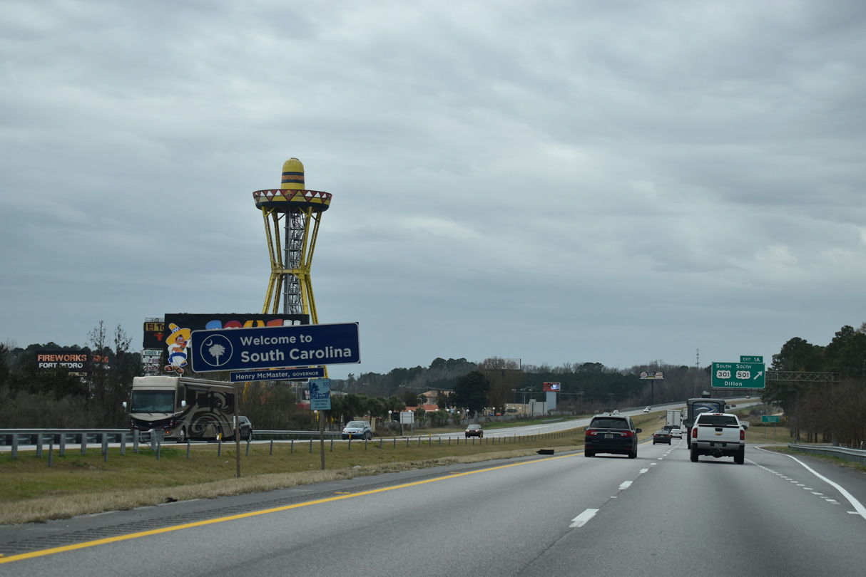
| Anchored by the 165 foot high Sombrero Tower added in the 1970s, the iconic South of the Border spreads along the east side of I-95 as it enters the Palmetto State at Exit 1A. The roadside attraction opened in 1950 and has remained one of the most recognizable sites for travelers between Florida and the Northeast. 12/30/12 |
|
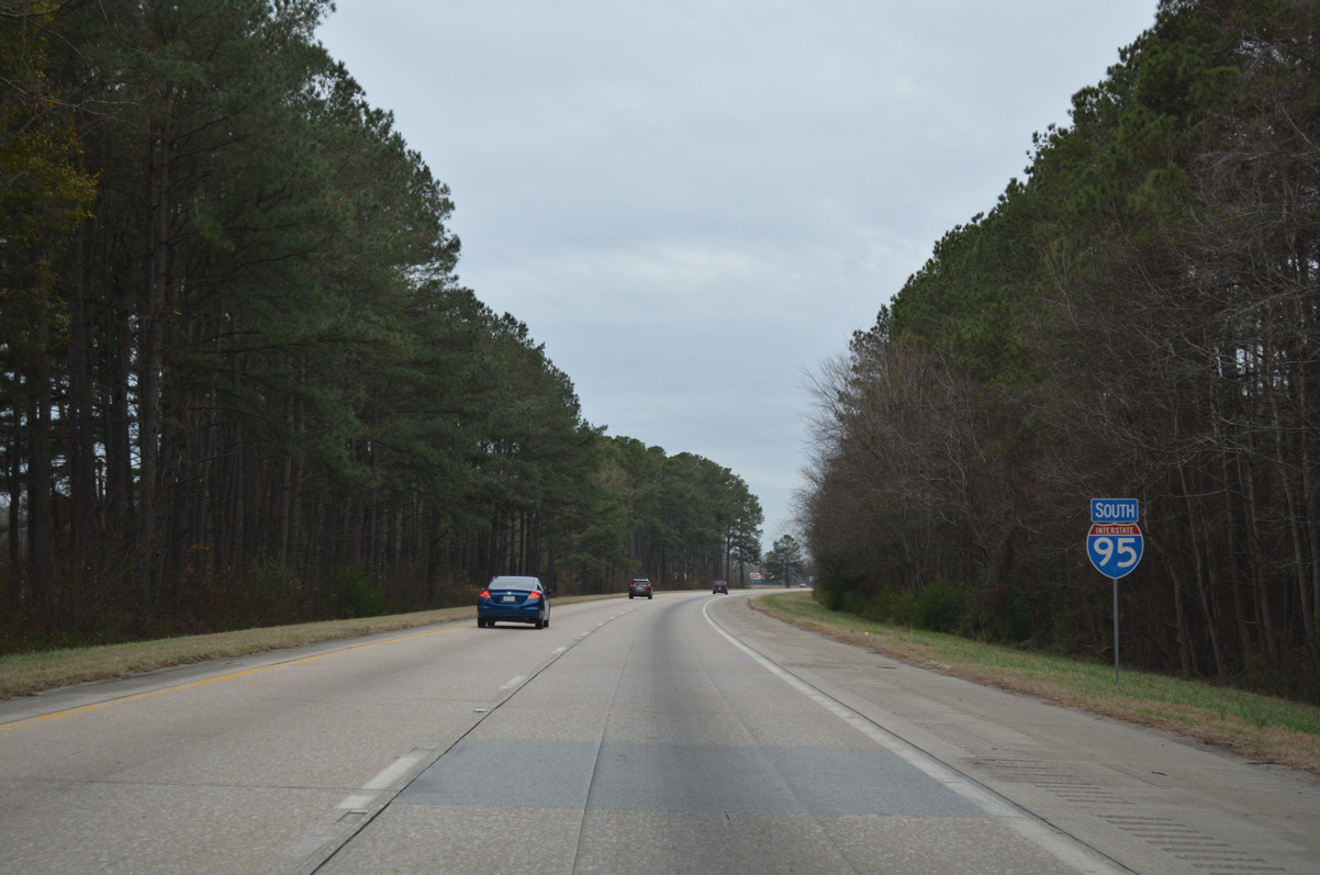
| Interstate 95 enters Dillon County, South Carolina just ahead of the unincorporated community of Hamer. 12/30/20 |
|
| Exit 1A loops from just south of the North Carolina line to U.S. 301/501 by South of the Border. 12/30/20 |
|
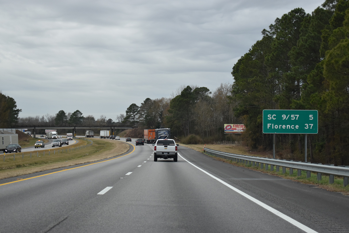
| U.S. 301/501 parallels I-95 south 6.00 miles to S.C. 57 in the city of Dillon. The Rowland, North Carolina town center is 2.5 miles to the north. 12/30/20 |
|
| U.S. 301/501 overlap south from the state border another 14.28 miles to the town of Latta. 12/30/20 |
|
| Travelers along Interstate 95 southbound reach Florence in 37 miles. S.C. 9/57 cross paths with the freeway at the succeeding exit in five miles outside of Dillon. 12/30/20 |
|
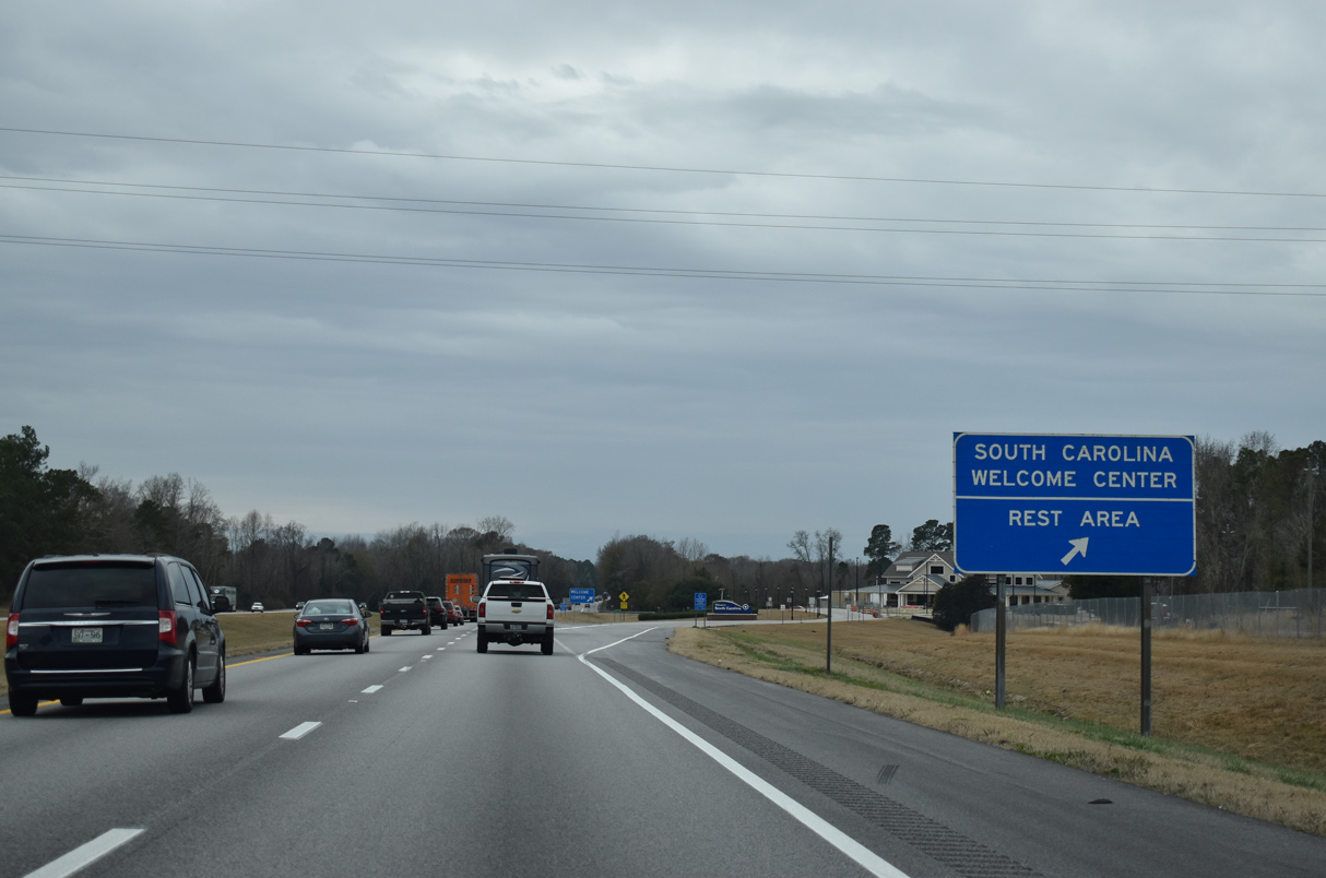
| The South Carolina Welcome Center precedes the Little Pee Dee River near Hamer. 12/30/20 |
|
| The tourist information center offers copies of the official South Carolina Highway Map and lodging coupons among brochures of Palmetto State points of interest. 12/30/20 |
|
| Interstate 95 crosses the Little Pee Dee River and Ropers Mill Branch leading southwest toward the diamond interchange (Exit 193) with S.C. 9/57 (Radford Boulevard). 12/30/20 |
|
| S.C. 9/57 (Radford Boulevard) overlap 4.45 miles south from the unincorporated community of Little Rock to U.S. 301/501 (2nd Avenue) in Dillon, and alongside 2nd Avenue 0.97 miles to S.C. 34 (Main Street). 12/30/20 |
|
| Paralleling the North Carolina line, S.C. 9 leads east from Dillon to North Myrtle Beach. Half of the S.C. 9 to the coast is four lanes. 12/30/20 |
|
| Exit 193 leaves Interstate 95 south for S.C. 9/57. S.C. 57 branches north from Little Rock 9.18 miles to conclude at the North Carolina state line while S.C. 9 ventures northwest 22.5 miles to the Marlboro County seat of Bennettsville. 12/30/20 |
|
| Proceeding southwest from the Dillon city limits, I-95 crosses W Main Street and a CSX Railroad line. 12/30/20 |
|
| The third Dillon area exit joins Interstate 95 with S.C. 34 in 1.5 miles. 12/30/20 |
|
| S.C. 34 begins in Dillon and leads west 30 miles to Darlington and 186 miles overall to Greenwood. 12/30/20 |
|
| S.C. 34 runs 2.40 miles east from the diamond interchange at Exit 190 to U.S. 301/501 (2nd Avenue) and SC 9/57 on Main Street. 12/30/20 |
|
| Interstate 95 advances southwest across wetland areas surrounding Reedy Creek and Little Reedy Creek over the next 4.5 miles. 01/01/17 |
|
| Leaving the vicinity of Dillon, Interstate 95 continues eight miles to S.C. 38 at Exit 181 and 29 miles to Florence. 12/30/20 |
|
| I-95 south between Little Reedy Creek and the Catfish Church Road overpass. The proposed route of Interstate 73 crosses I-95 here. 12/30/20 |
|
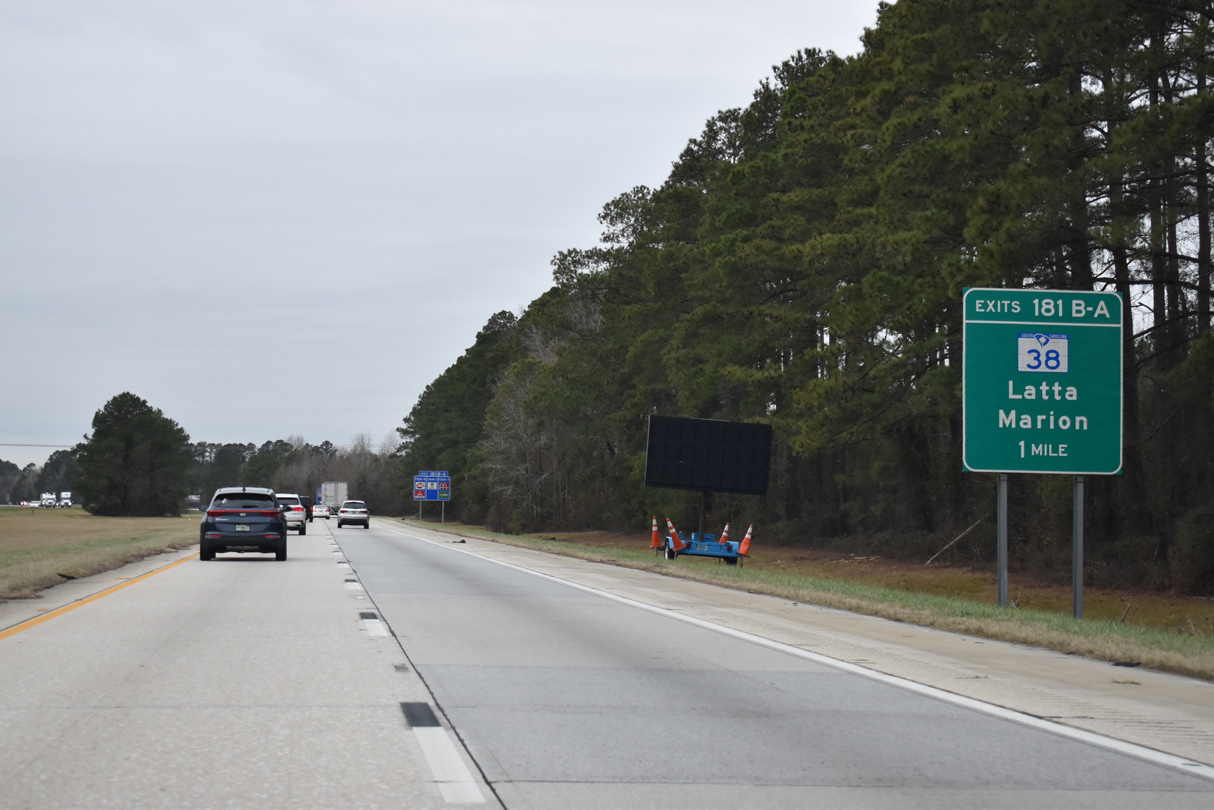
| S.C. 38 branches 6.14 miles northwest from U.S. 501 along a four lane highway to meet Interstate 95 at Exits 181B/A. S.C. 917 ties into S.C. 38 nearby from the town of Latta. 12/30/20 |
|
| Along with U.S. 501 and S.C. 9, S.C. 38 constitutes part of a multi lane corridor linking Charlotte, North Carolina with Myrtle Beach. 12/30/20 |
|
| Exit 181B departs Interstate 95 south for S.C. 38 west. No control point is used MSR 38 heads to Bennettsville and Hamlet, North Carolina. 08/28/21 |
|
| Traffic headed to Marion, Conway and Myrtle Beach loops away from Interstate 95 south for S.C. 38 east at Exit 181A. Future Interstate 73, which may be built as a toll road, parallels this corridor to the east. 08/28/21 |
|
| Interstate 95 traverses wetland areas of Poccosin Swamp beyond the six-ramp parclo interchange with S.C. 38. 12/30/20 |
|
| I-95 nips the southern corner of Marlboro County on the ten mile drive to S.C. 327. The city of Florence is 20 miles away. 01/01/17 |
|
| Crossing the Great Pee Dee River, I-95 enters Florence County. 08/28/21 |
|
| Interstate 95 rises from Pee Dee River Swamp by a set of abandoned rest areas preceding Exit 170. 01/01/17 |
|
| The first of five Florence interchanges joins I-95 with S.C. 327. Beginning at Exit 170, S.C. 327 forms the northern leg of a multi lane bypass east of Florence. The state highway turns east with U.S. 76/301 in 5.16 miles near Florence Regional Airport (FLO), as U.S. 301 continues the bypass southwest to U.S. 52. 01/01/17 |
|
| Construction in 2012-13 reconfigured the parclo A2 interchange at Exit 170 into a parclo interchange with a new southbound entrance ramp from Williston Road. Overall S.C. 327 forms a 22.62 mile long loop from Williston Road and I-95 to the south split of U.S. 52/301 at Effingham. 12/30/20 |
|
| TV Road stems 0.76 miles southwest from Pocket Road to a diamond interchange (Exit 169) with Interstate 95. 08/28/21 |
|
| Interstate 95 widens to six overall lanes from S.C. 327 to Interstate 20. Widened by April 2004, the expansion accommodates beach bound traffic headed to the Grand Strand from Columbia and other points west. 08/28/21 |
|
| South from the Senator Frank Gilbert Interchange at Exit 169 , TV Road continues 3.97 miles by the community of Quinby to become Irby Street in the city of Florence. 08/28/21 |
|
| Curving southwest, I-95 runs 1.57 miles through a wedge of Darlington County. 08/28/21 |
|
| U.S. 52 and Business Spur I-20 radiate outward from Florence and meet Interstate 95 at the succeeding two interchanges. 08/28/21 |
|
| Interstate 95 south reenters Florence County as it crosses High Hill Creek. 12/30/20 |
|
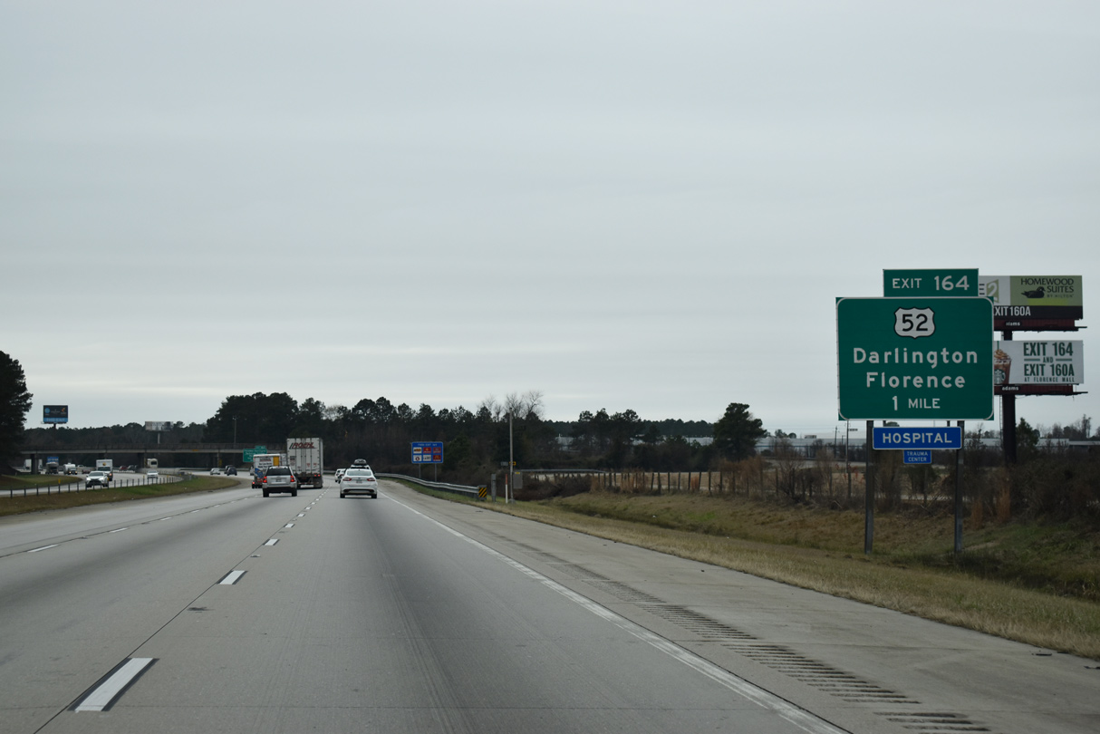
| A folded diamond interchange (Exit 164) joins I-95 with U.S. 52 in one mile. Within South Carolina, U.S. 52 travels 162 overall miles between Charleston and Cheraw. 12/30/20 |
|
| U.S. 52 and a parallel CSX Railroad line head north by Florence-Darlington Technical College six miles to Darlington. U.S. 52 bypasses the west side of the Darlington County seat by Darlington International Raceway. 12/30/20 |
|
| U.S. 52 (Lucas Street) comprises a four lane highway between Florence and the Darlington bypass to the north. 08/28/21, 06/01/21 |
|
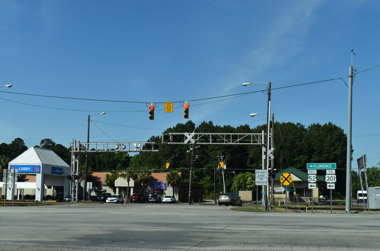
| U.S. 52 follows Lucas and Irby Streets south into Florence, meeting U.S. 76 (Palmetto Street) in Downtown. 06/01/21 |
|
| 3.64 miles south from U.S. 76 in Florence, U.S. 52 combines with U.S. 301 at a bypass opened in November 2012. U.S. 52/301 overlap 5.95 miles south to Effingham. 06/01/21 |
|
| Confirming shield for I-95 posted south of U.S. 52. SCDOT recorded 48,000 vehicles per day (vpd) on this stretch in 2015. 01/01/17 |
|
| Interstate 95 stays just west of the Florence city limits on the two miles leading to I-20 west and Business Spur I-20 east at Exit 160. 12/30/20 |
|
| The right lane defaults onto I-20 west as I-95 again reduces to four overall lanes beyond the directional cloverleaf interchange at Exit 160. 12/30/20 |
|
| Within South Carolina, I-20 links the capital city of Columbia with North Augusta, Aiken and Florence. Business Spur I-20 extends 2.11 miles east from the end of I-20 at I-95 to U.S. 76 (Palmetto Street). The series of signs for Exit 160A incorrectly show the business route as I-20. 12/30/20 |
|
| Interstate 20 heads 66 miles west from Exit 160B to I-77 (Capital Beltway) outside Columbia. The rural freeway serves Bishopville and Camden en route. 12/30/20 |
|
| Exit 160B leaves Interstate 95 south for I-20 west to Columbia. Interstate 20 is a major freight corridor west to Atlanta, Birmingham, Shreveport, Dallas, Fort Worth and to I-10 for points west to Phoenix, Los Angeles, and San Diego. 12/30/20 |
|
| Business Spur I-20 follows David H. McLeon Boulevard east along a commercial arterial from I-20 to Magnolia Mall, Florence Mall and U.S. 76 (Palmetto Street) west of Downtown Florence. 12/30/20 |
Page Updated 12-01-2022.

 South
South