|
| Ramps from I-55 combine before joining Interstate 255 east a quarter mile ahead of a loop ramp for U.S. 61/67 (Lemay Ferry Road) at Mehlville. Two exits follow before the freeway enters Monroe County, Illinois. 12/31/23 |
|
| U.S. 61/67 follow Lindbergh Boulevard south from I-64 at Ladue to separate with the boulevard at Lemay Ferry Road in Mehlville. Remaining overlapped to Festus, U.S. 61/67 turn southwest by South County Center mall to Exit 1 B for Oakville and Arnold. 12/31/23 |
|
| Exit 1 B departs Interstate 255 east for U.S. 61/67 (Lemay Ferry Road). Lemay Ferry Road continues north from Lindbergh Boulevard (U.S. 50) as Missouri Route 267 to the Patch section of south St. Louis. 12/31/23 |
|
| A five year experiment by MoDOT using variable speed limits along both I-255 and I-270 ended on October 26, 2013. The changeable limits were used to slow traffic ahead of impending congestion. Until 2011, the speed limits were enforceable. They later became advisory speeds and were removed altogether starting in October 2013.1 12/20/09 |
|
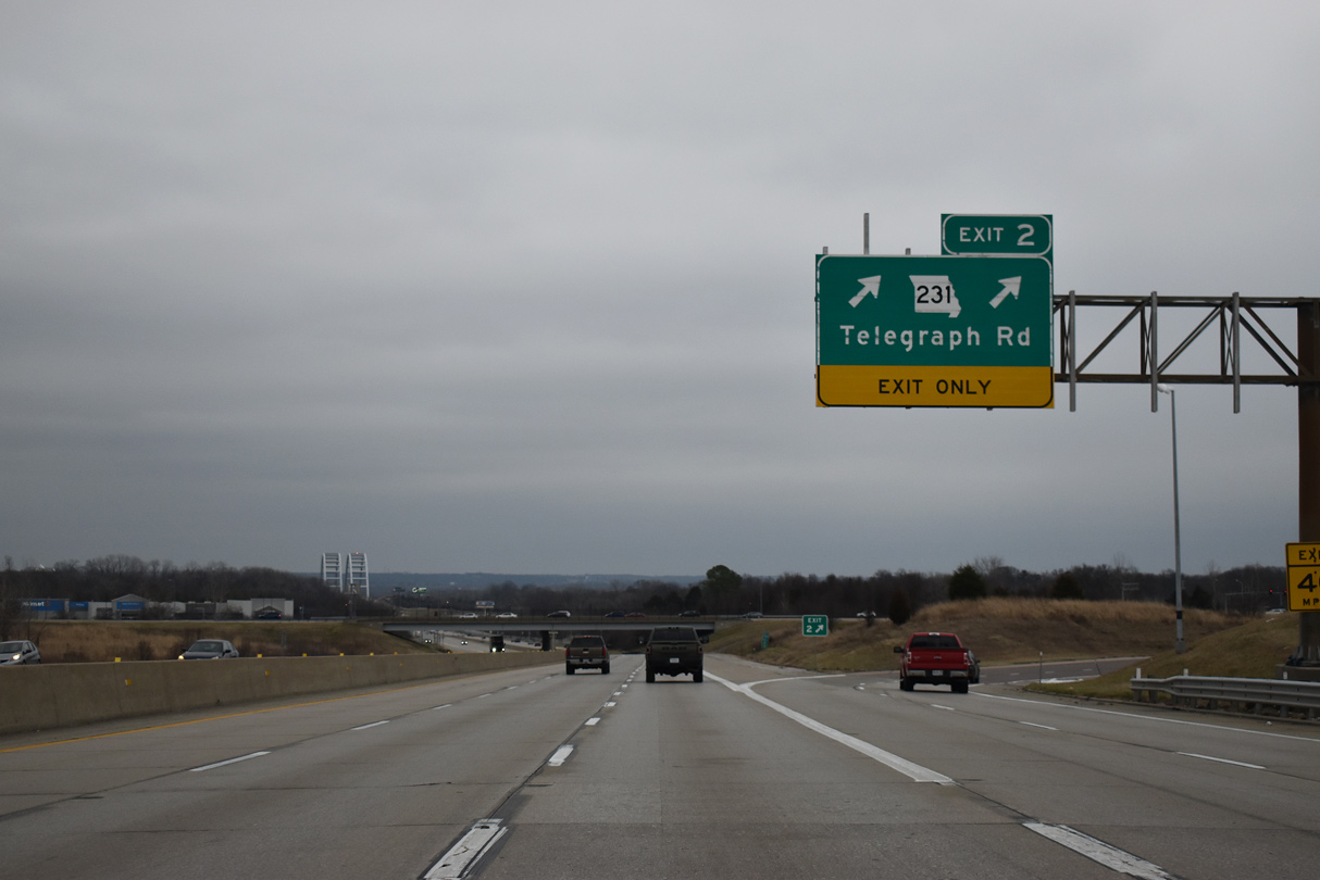
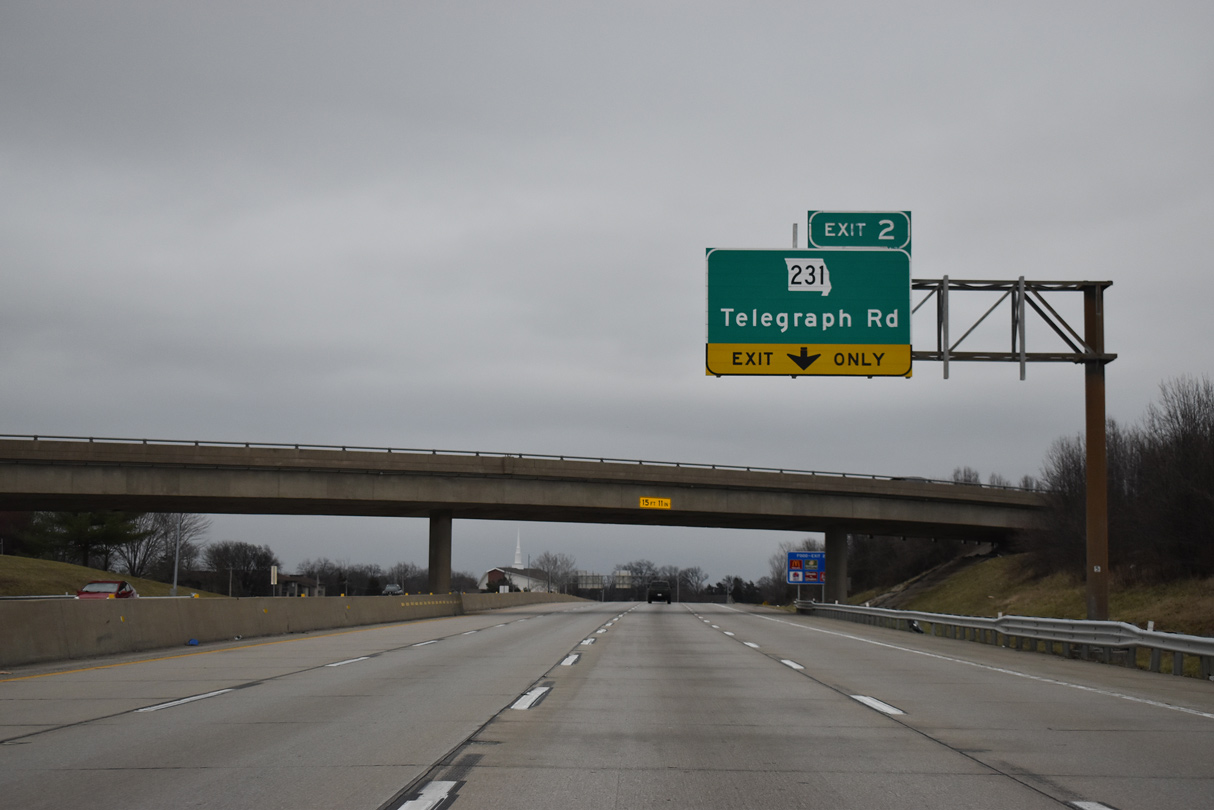
| A wye interchange adds U.S. 50 east from Lindbergh Boulevard onto I-255 ahead of Telegraph Road (Route 231). The first exit in Illinois is 5.5 miles ahead with IL 3 south at Columbia. 12/31/23 |
|
| 12.23 miles in length, forthcoming Route 231 leads north from U.S. 61/67 (Jeffco Boulevard) in Arnold to the St. Louis city line on Broadway. 12/31/23 |
|
| Kinswood Lane lines the south side of Interstate 255 from Forder Road to Koch Road. Upcoming Exit 2 joins I-255 with the Jefferson Barracks Historic Site. Koch Road connects I-255/U.S. 50 with the Jefferson Barracks VA Medical Center at the last Missouri exit. 12/31/23 |
|
| The addition of U.S. 50 east from Lindbergh Boulevard expands Interstate 255 eastbound to five overall lanes to the parclo interchange (Exit 2) with Route 231 (Telegraph Road). 12/31/23 |
|
| Two lanes leave I-255/U.S. 50 east for Route 231 (Telegraph Road) at Exit 2. Route 231 follows Telegraph Road north to Kingston Drive by Jefferson Barracks National Cemetery. The state highway replaced Highways V and VV along its course by 1967. 12/31/23 |
|
| I-255/U.S. 50 east continue one half mile to a parclo interchange (Exit 3) with Koch Road. 12/31/23 |
|
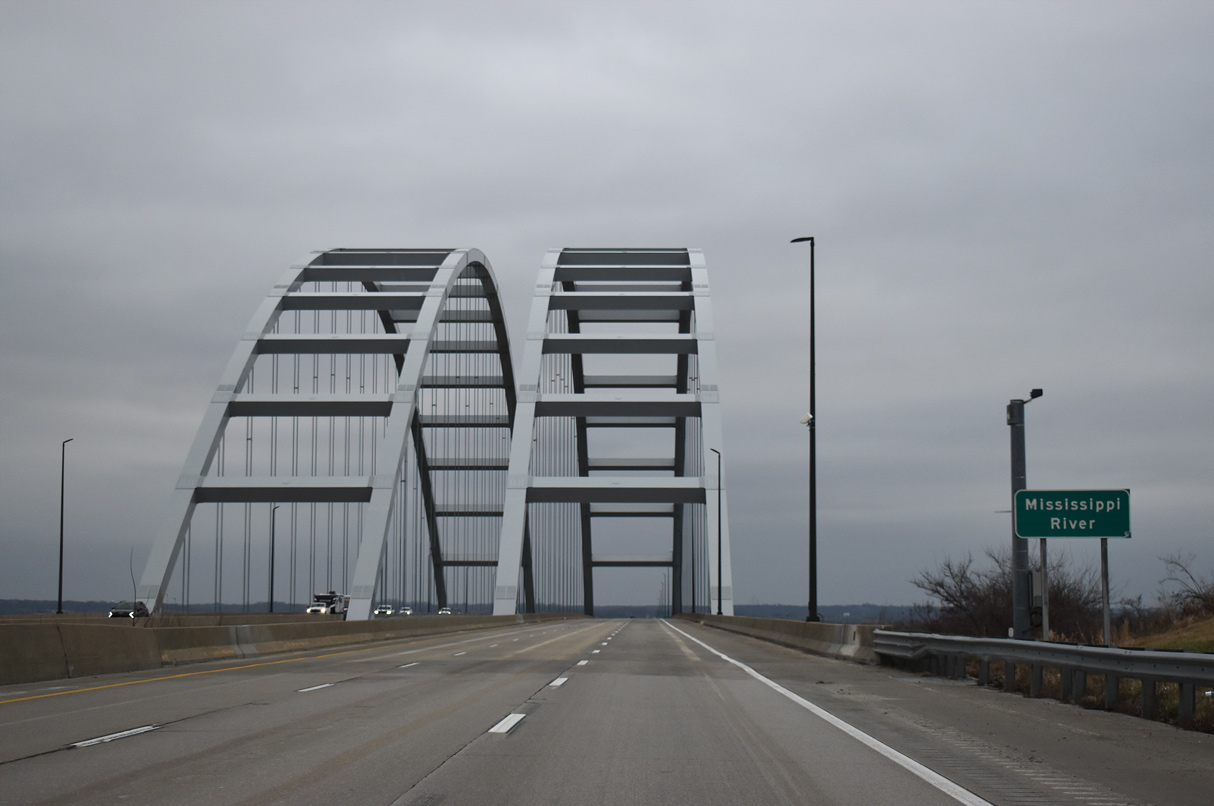
| The arches of the Jefferson Barracks Bridge appear as I-255/U.S. 50 pass by Jefferson Barracks National Cemetery. 12/31/23 |
|
| Exit 3 to Koch Road departs in a quarter mile as I-255/U.S. 50 ascend toward the Jefferson Barracks Bridge over the Mississippi River. IL 3 combines with the freeway north to Dupo in 3.5 miles. 12/31/23 |
|
| Koch Road constitutes a local road connecting I-255/U.S. 50 with Jefferson Barracks to the north, Robert Koch Hospital Road west to Oakville, and the Bussen Quarry to the south. 12/31/23 |
|
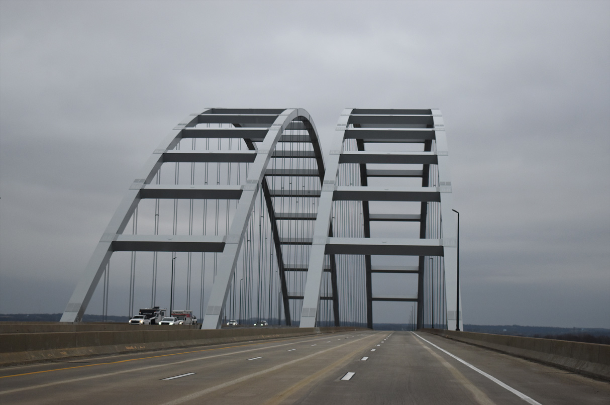
| Beyond the Koch Road underpass, I-255/U.S. 50 ascend across the Jefferson Barracks Bridge, a pair of tied-arch bridges. Each span accommodates three lanes. 12/31/23 |
|
| The westbound Jefferson Barracks Bridge was built first, opening in July 1984. The eastbound span followed on December 3, 1990. It replaced the original Jefferson Barracks Bridge, which was demolished after 1984. 12/31/23 |
|
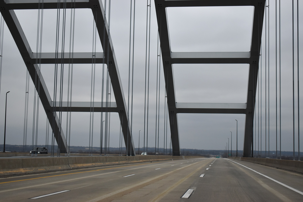
| 4,018 feet in length, the Jefferson Barracks Bridge travels 88 feet above the Mississippi River. The 175 foot high arches support the 51 foot wide decks.2 12/31/23 |
|
| Other tied bridges along the Interstate Highway System spanning the Mississippi River include I-280 at the Quad Cities and I-40 across the Hernando de Soto Bridge at Memphis, Tennessee. 12/31/23 |
|
| I-255/U.S. 50 cross the Illinois state line midway across the Jefferson Barracks Bridge. The six lane freeway emerges from the span onto a levee ahead of Fish Lake. 12/31/23 |
|
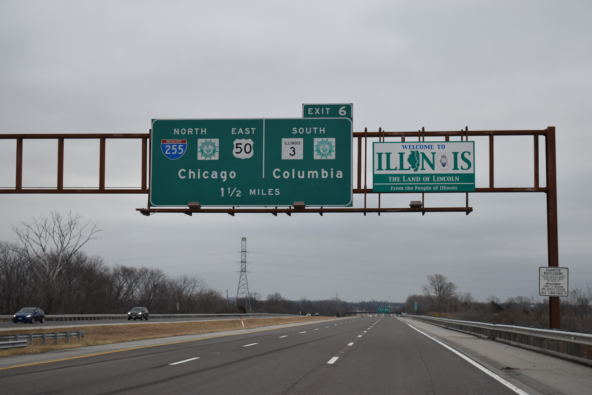
| The Illinois welcome sign appears 1.50 miles from the three wye interchange with IL 3 / Great River Road south into Columbia. 12/31/23 |
|
| I-255/U.S. 50 advance east across American Bottoms to the exchange with IL 3 / Great River Road. IL 3 generally parallels the Mississippi River southward from St. Louis to Cairo at the southern tip of the state along an 189 mile route. 12/31/23 |
|
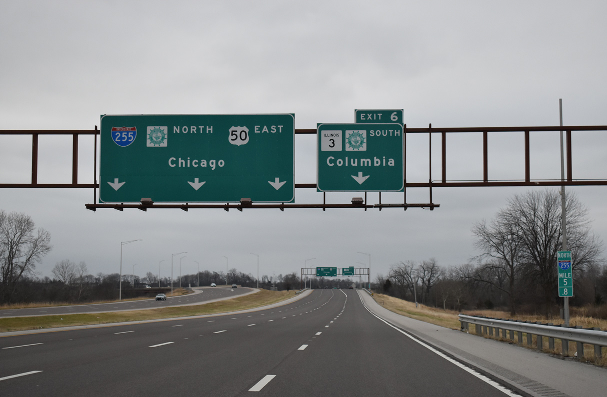
| The eastbound freeway expands to four lanes ahead of Exit 6 to IL 3 south. IL 3 (Admiral Parkway) comprises an expressway through Columbia with interchanges for Palmer Road and IL 158 east to Millstadt. 12/31/23 |
|
| Exit 6 expands to two lanes where I-255/U.S. 50 pass over a Union Pacific Railroad and turn northward with IL 3. Columbia, home to almost 11,000, started in 1820 as a community on the bluffs above the Mississippi River. The town was the destination for many German immigrants in the 1830s and 1840s.3 12/31/23 |
Page Updated 01-06-2024.

 East
East


 East
East