|
| The Gene Snyder Freeway begins a westward turn here, and remains rural and hilly. The pavement here was originally diamond ground concrete and became extremely slick in wet weather because it was so smooth. Work has been underway to replace much of it, and to add center dividers in the median. 06/06/08 |
|
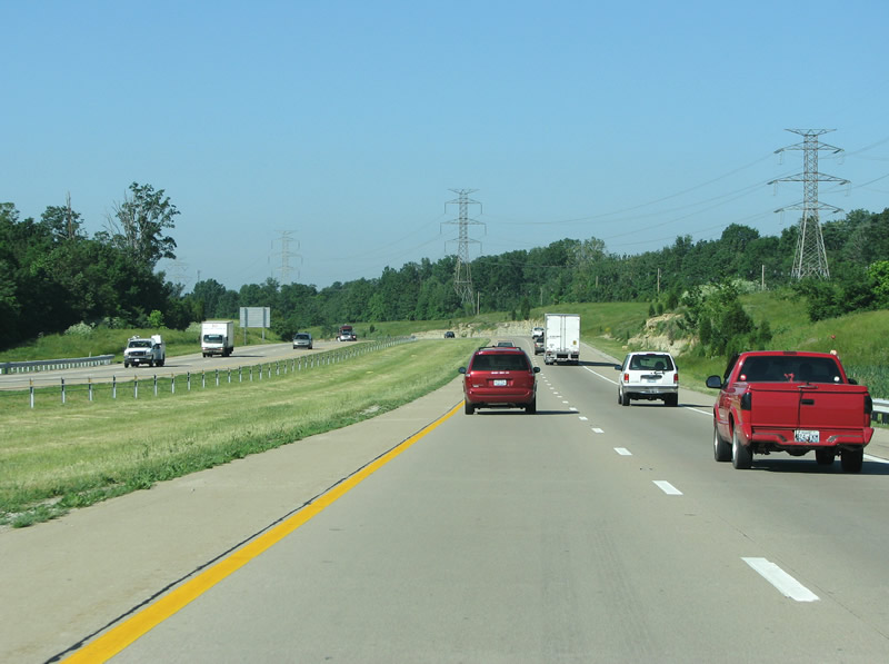
| Large power lines sit along the northern side of the freeway here. 06/06/08 |
|
| KY 1819 is the next exit, and the route forms a generally curvy one from US 60 and Jeffersontown south and east into what was until recently rural land. 06/06/08 |
|
| Another view of the freeway before Billtown Road. 06/06/08 |
|
| This exit connects what is mostly spread out residential areas. Seatonville and the creek known as Floyd's Fork is just to the south. 06/06/08 |
|
| A rare example of a KY 841 shield without the accompanying interstate marker. 06/06/08 |
|
| US 31E/150 is the next exit, in what is locally referred to as Bardstown Road. US 31E splits off from US 31W as the US highway enters Kentucky from Indiana. While US 31W runs along the Ohio River and past Fort Knox, US 31E continues southward to the town of Mount Washington and eventually to Nashville, TN. Through Louisville, it forms the spine of one of the more gentrified and bohemian neighborhoods closer to downtown. 06/06/08 |
|
| Bardstown Road was originally known as the Louisville and Bardstown Turnpike, and runs southeastward from downtown. The state legislature ordered the construction of a toll road from Louisville to Bardstown in 1831. The toll road was completed on July 1, 1838 and was one of the state's prouder engineering accomplishments during that era. The total cost of the road was about $203,000 for 29 miles. 06/06/08 |
|
| KY 864 has a somewhat tortured route. It starts near downtown as Poplar Level Road and has that name when it hits I-264. Southeast from there it becomes Fegenbush Lane and here it's Beulah Church Road. While a major route at I-264, here it is rarely busy. 06/06/08 |
|
| I-65 is the only control point here and is shown as being 6 miles further along the freeway. 06/06/08 |
|
| Beulah Church Road was named for a church that sat along it south of here in the 19th century. The area is historically the largest fruit producing region in Kentucky and that formed the basis for the Jefferson County fair, which started near here in the 1870s. The fairs were held until 1928 when the formation of the state fair and its popularity left the county one "out to pasture". 06/06/08 |
|
| Knobs come into view towards the west at Beulah Church Road. 06/06/08 |
|
| Smyrna Road and the Gene Snyder Freeway come together at a diamond interchange (Exit 14) next. 06/06/08 |
|
| Smyrna Road is not really either very long or very important. The reason there is an exit here is that this is the point that the state ran out of money for building the freeway, and they had to let the traffic off of it somehow. In 1980, KYTC officials promised that the freeway would be completed by 1985. To that end, US representative Gene Snyder slipped $52 million into a public works bill to fund the route. This last section from here at Smyrna Road back to KY 155/Taylorsville Road, opened in 1987 - two years after the promised date. 06/06/08 |
|
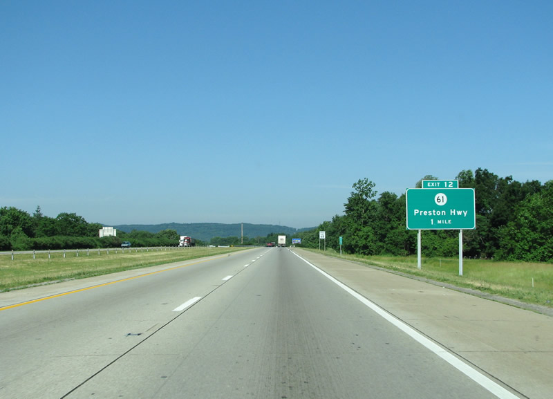
| KY 61 is an important state highway that used to form that main road south from downtown. It follows the length of I-65 south and is used as a local road. It runs about 150 miles south from Louisville to the Kentucky state line. 06/06/08 |
|
| Another view westbound before Preston Highway. 06/06/08 |
|
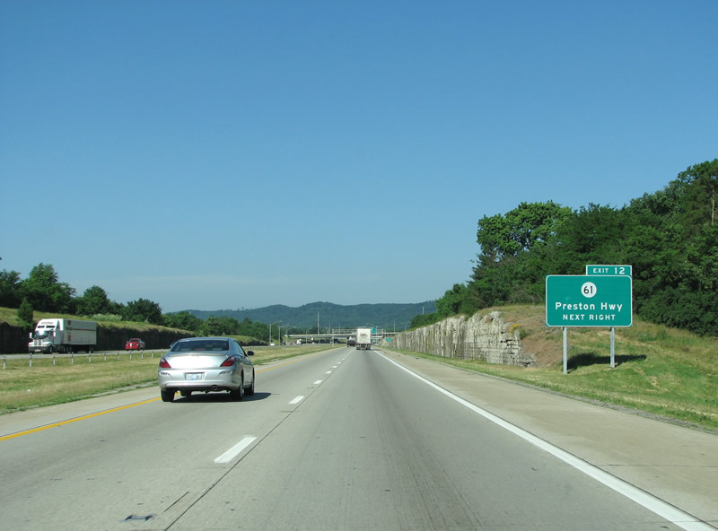
| Okolona, which is technically not a placename any longer as it has been swallowed up by Metro Louisville, is an auxiliary placename at KY 61. 06/06/08 |
|
| The Preston Highway was named for William Preston, who was a surveyor and received a land grant for his efforts from the King of England in 1774. Preston Highway runs north to the community of Okolona and to the General Electric Appliance Park. The plant opened in 1951 and currently employs about 3,000 people (down from a high of 25,000 in the 1960s). 06/06/08 |
|
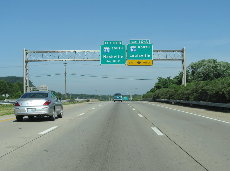
| I-65 is the next exit and marks the end of the interstate portion of the Gene Snyder Freeway; KY 841 keeps going west from here. The I-65 interchange is a monster, from an acreage perspective - but it is not that impressive from ground level. It is a modified cloverleaf with two direct connect ramps, and never sees more than one grade-separation at a time. 06/06/08 |
|
| The final I-265 westbound reassurance marker before I-65. 06/06/08 |
|
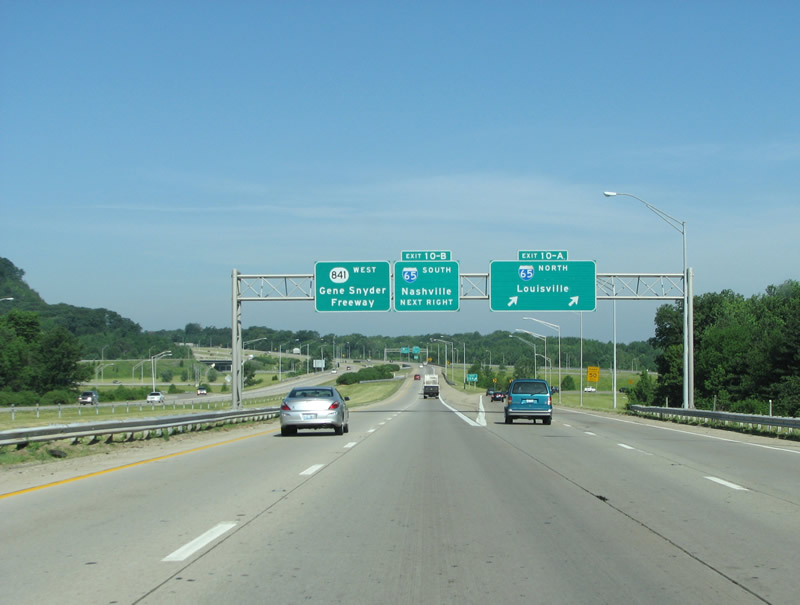
| From here, I-65 continues south to Nashville and Birmingham to end at I-10 in Mobile, near of the Gulf of Mexico. In Louisville, the freeway was upgraded in the mid-2000s and features a very wide right of way. I-265 ends here, as it only connects I-65 and I-71 while in Kentucky. From this point westward, the road is only known as KY 841. All portions share the Gene Snyder moniker, however. 06/06/08 |
|
| I-265's end at I-65 southbound. KY 841 continues westward. 06/06/08 |
|
| This area of Jefferson County is known as the knobs, and it's the edge of the bluegrass plateau that has eroded away. Conical hills known as knobs feature prominently here and many are protected from development as they sit in the Jefferson County Memorial Forest. 06/06/08 |
|
| KY 841 continues westbound for an additional 9 miles, as is shown here on the distance sign. 06/06/08 |
|
| The National Turnpike is the next exit and is also signed as KY 1020. 06/06/08 |
|
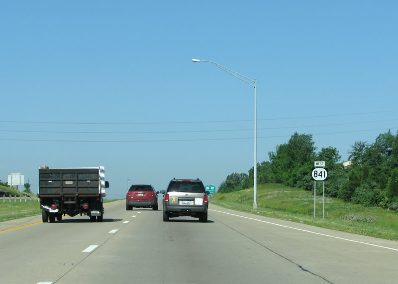
| KY 841 westbound before the National Turnpike. 06/06/08 |
|
| The National Turnpike started out as one of the Kentucky Legislature's 19th century toll roads, that were used to connect interior towns with the Ohio River, then the interstate highway of its day. The National Turnpike connected Shepherdsville with Louisville - today that route is served primarily by I-65. 06/06/08 |
|
| KY 1865/2055 is the next diamond interchange. KY 1865 runs north from here as New Cut Road, and continues north past Iroquois Park where it meets I-264 as Taylor Blvd. Iroquois Park is one of the largest in the city and features a knob at its center with beautiful vistas to every side. 06/06/08 |
|
| A KY 841 reassurance marker before New Cut Road. 06/06/08 |
|
| South of here, KY 2055 continues to the community of Fairdale, which was once its own town but has since merged with Louisville. The route runs southeastward on the north side of Mitchell Hill, past Hollyvilla, where it meets the National Turnpike. 06/06/08 |
|
| KY 1865 has an overlap with KY 841 here, as it continues west. 06/06/08 |
|
| KY 841 westbound at the local Stonestreet Road. 06/06/08 |
|
| A bucolic rural Kentucky view west of Stonestreet Road. 06/06/08 |
|
| KY 841's westbound end approaches as it nears the Dixie Highway. 06/06/08 |
|
| The Dixie Highway got its start in 1914 and functioned as a network of north/south routes that were all over 3,000 miles in length. While it was surpassed by the US highway system in the 1920s, the name still persists today in Louisville. The route carries US 60 and US 31W through the west side of town. 06/06/08 |
|
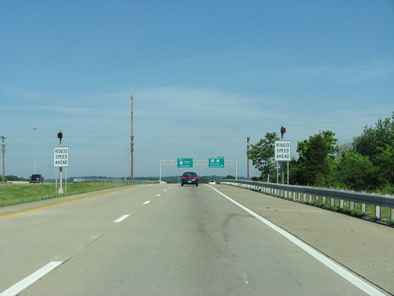
| Reduced Speed ahead signs warn of the end of the freeway. 06/06/08 |
|
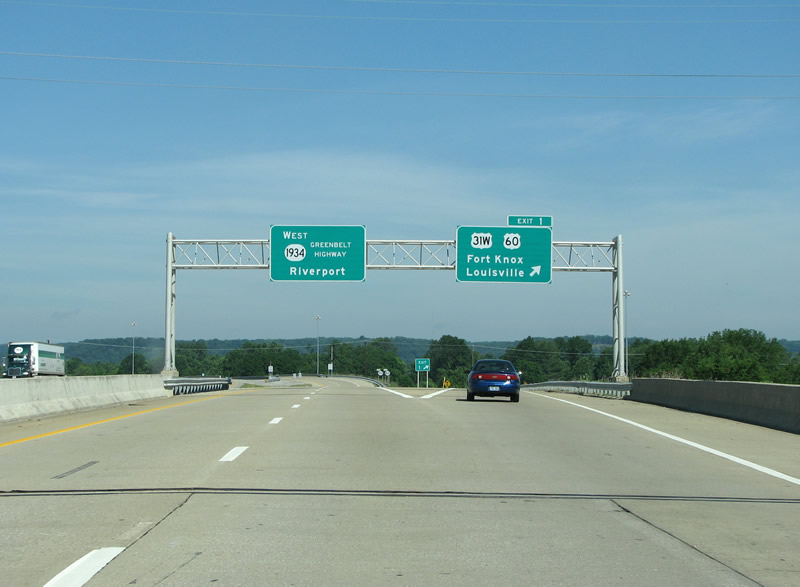
| KY 841 originally ended here, all traffic had to exit and sit at the traffic light on the Dixie Highway, either turning left or right. However in August 2000 an overpass and extension opened that saw KY 841 linked with the Greenbelt Highway, also signed as KY 1934. The extension connected the freeway with the Riverport Industrial Park along the Ohio River, which freed up large trucks from city streets. 06/06/08 |
|
| KY 841 ends here and continues on as KY 1934. 06/06/08 |
Page Updated 03-06-2012.