
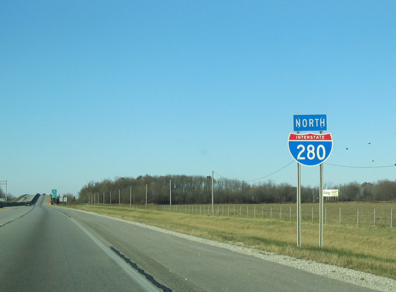
 North
North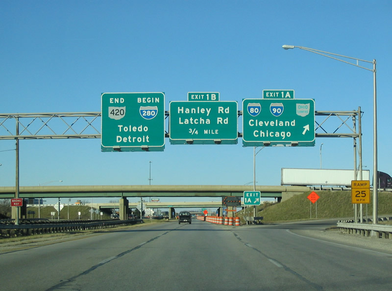
SR 420 stems 2.89 miles north from U.S. 20/23 to the trumpet interchange (Exit 1A) joining the south end of I-280 with I-80/90 (Ohio Turnpike).
11/13/04

A diamond interchange follows along I-280 north beyond the Ohio Turnpike with Bahnsen Road at Exit 1B.
09/01/05

Bahnsen Road links I-280 with parallel Baker Road and Warns Drive north to Latcha Road and south to Hanley Road.
11/13/04
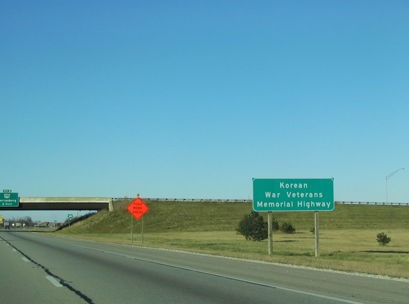
Interstate 280 is designated the Korean War Veterans Memorial Highway within Wood County. Originally the route was named the Toledo Expressway
11/13/04
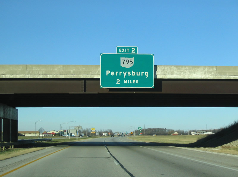
I-280 continues two miles north from Bahnsen Road to SR 795 (Moline-Martin Road) at Exit 2.
11/13/04
11/13/04
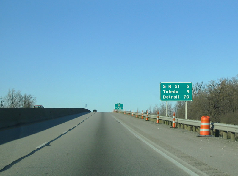
I-280 ascends above a CSX Railroad line by this distance sign posted 4.3 miles from the exit for SR 51 in Northwood.
11/13/04
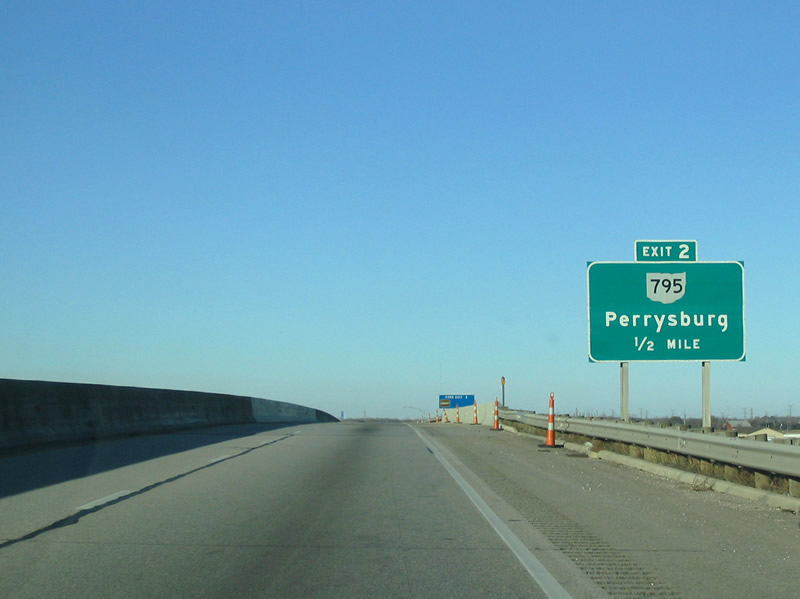
SR 795 constitutes a four lane expressway west from nearby Toledo Executive Airport (TDZ) 2.4 miles to E Broadway Street at Moline.
11/13/04

A 12.20 mile long route, SR 795 originates from U.S. 20 and SR 199 (Louisiana Avenue) in Downtown Perrysburg and concludes at SR 51 just east of the Ottawa County line.
11/13/04

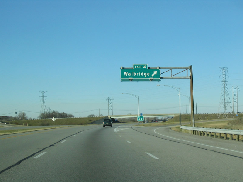
Interstate 280 shifts westward ahead of the diamond interchange (Exit 4) with Walbridge Road east and Union Street west.
11/13/04
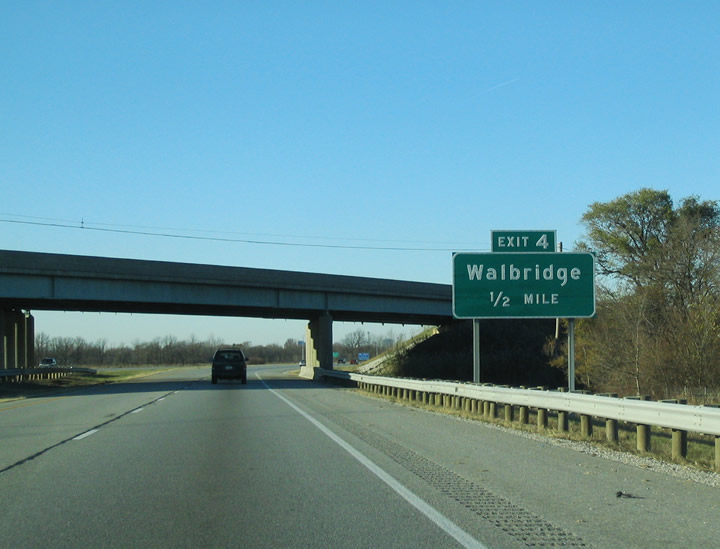
Ayers Road spans I-280 at Little Cedar Creek, a half mile from Exit 4 for the village of Walbridge.
11/13/04
11/13/04

SR 51 (Woodville Road) converges with Interstate 280 at a parclo interchange with Wales Road in the city of Northwood.
11/13/04

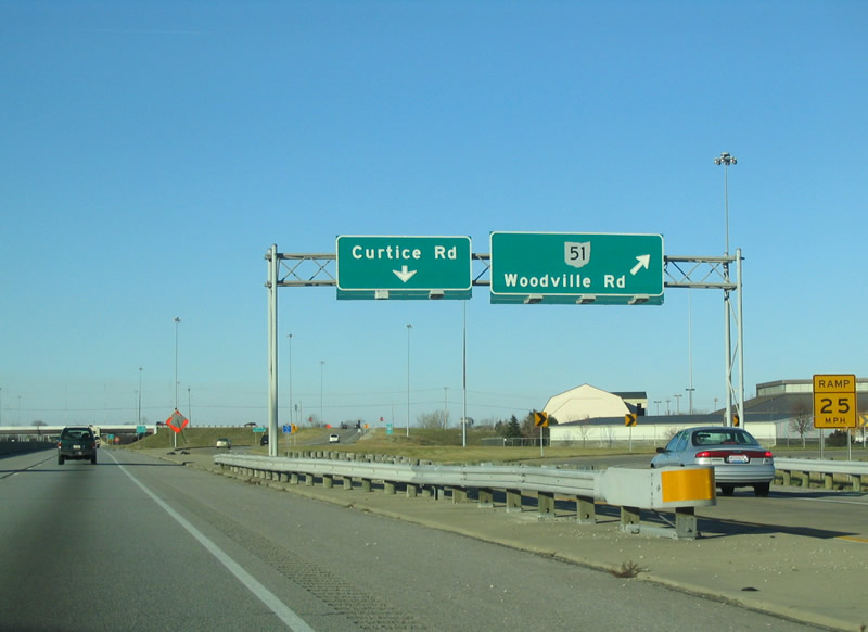
A distributor roadway separates at Exit 6 for SR 51 (Woodville Road) at Wales Road and the adjacent diamond interchange with Curtice Road.
11/13/04

Curtice Road stems east six miles from Wheeling Street in Northwood to the rural settlement of Curtice. SR 51 (Woodville Road) continues northwest through Oregon and East Toledo.
11/13/04
11/13/04
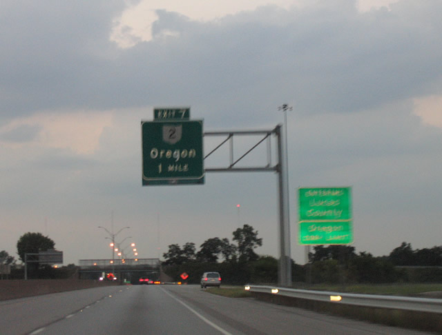
Crossing the Lucas County line, I-280 advances northwest to a split diamond interchange (Exit 7) with Wheeling Street and SR 2 (Navarre Avenue).
09/01/05
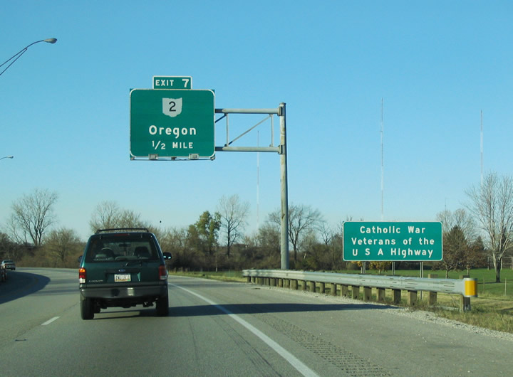
I-280 in Lucas County is the Catholic War Veterans of the U.S.A. Highway.
11/03/04
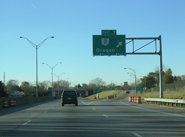
Exit 7 departs I-280 north for Wheeling Street and Munding Drive north to SR 2 (Navarre Avenue). SR 2 travels east from Oregon to Port Clinton and Sandusky.
11/03/04

SR 2 (Navarre Avenue) spans I-280 one mile from Exit 9 to SR 65 (Front Street) in Toledo.
11/03/04
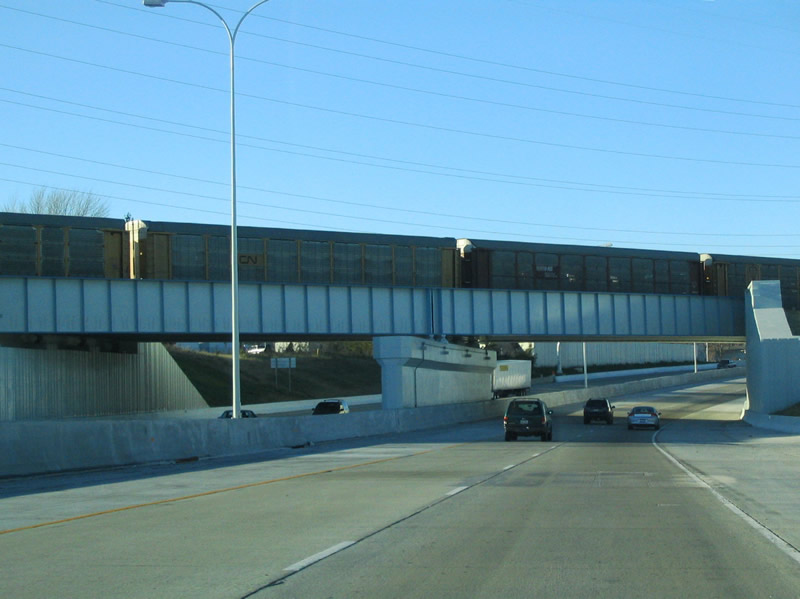
Passing under a CSX Railroad bridge, Interstate 280 north enters the city of Toledo.
11/03/04

A half diamond interchange (Exit 8) connects Starr Avenue with I-280 north ahead of Exit 9.
11/03/04
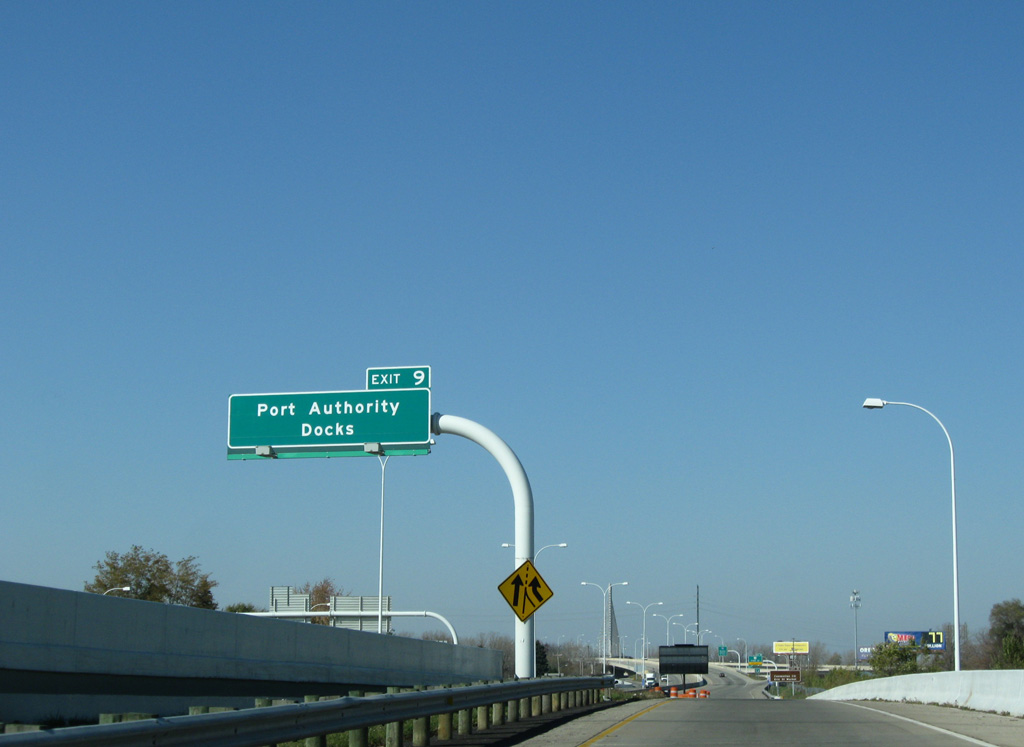
Front Street serves the Toledo Lucas County Port Authority terminals along the Maumee River northeast of I-280.
11/07/09
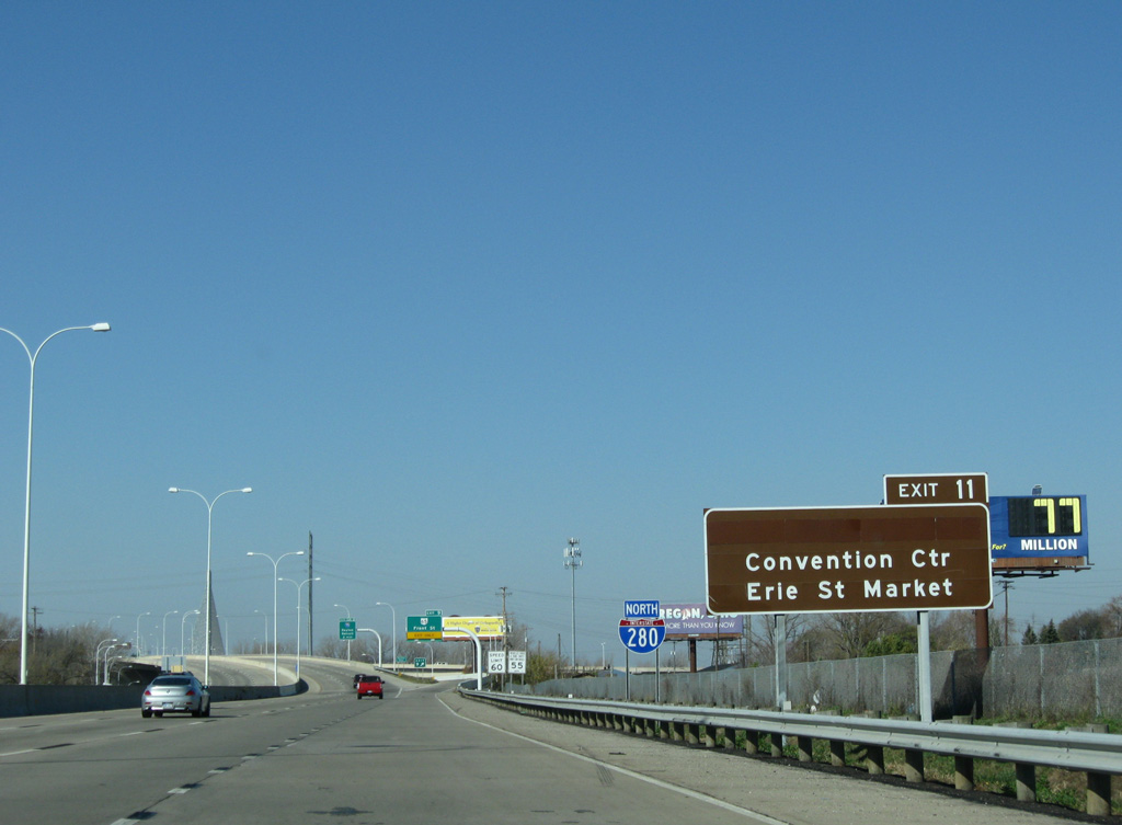
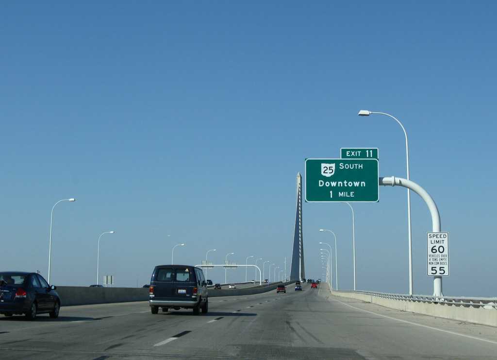
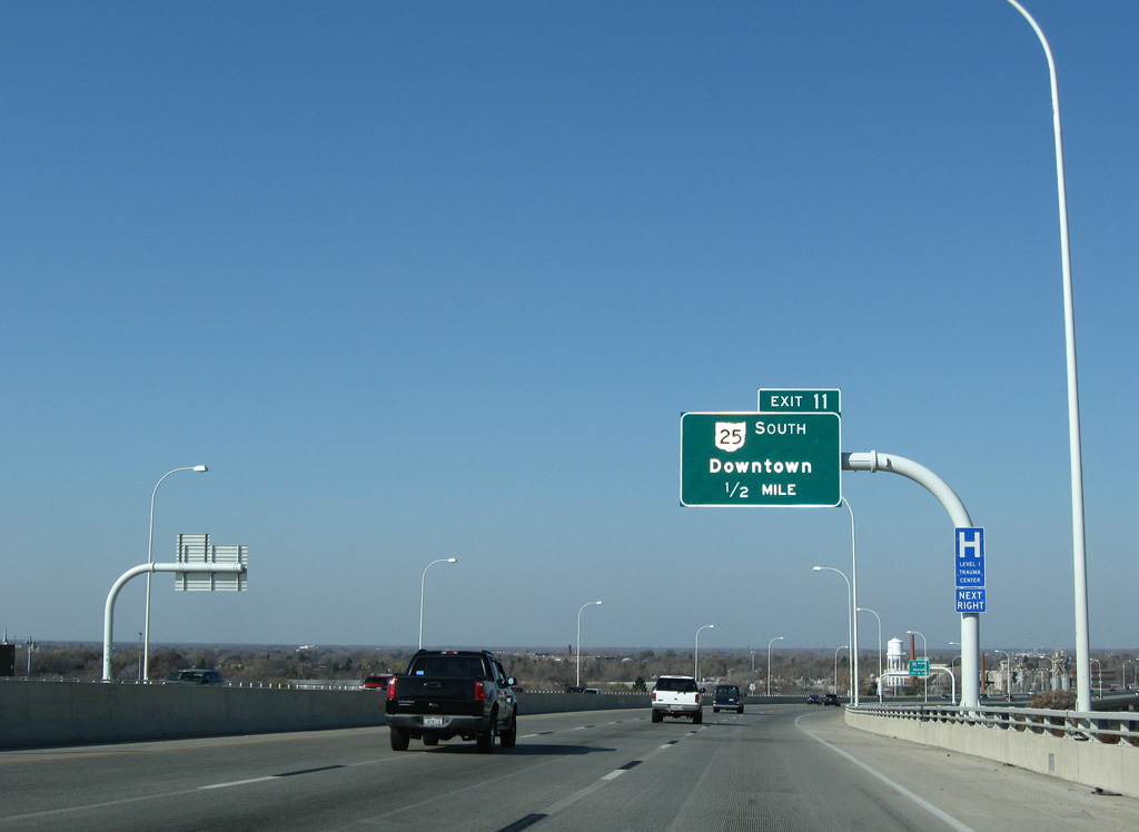
SR 25 (Greenbelt Parkway) leads southwest along an expressway to SR 120 (Cherry Street) and points of interest in Downtown Toledo.
11/07/09

Exit 9 lowers from the Veterans' Glass City Skyway to meet SR 65 at Front Street and the Craig Memorial Bridge across the Maumee River.
11/07/09

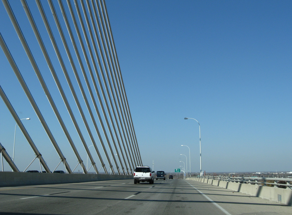
Crossing the Veterans' Glass City Skyway bridge, I-280 advances two miles north to Interstate 75.
11/07/09

Huntington Center, a concert and indoor sports arena, Fifth Third Field (home of the Toledo Mudhens) and the SeaGate Conventon Centre are located in Downtown Toledo.
11/07/09
Greenbelt Parkway opened in 1999 as a new alignment for SR 25 between I-280 and Downtown Toledo.
11/07/09

The Veterans' Glass Skyway parallels the Craig Memorial Bridge (SR 65) northwest to the Bush Street Historic District. The adjacent draw bridge was part of I-280 until 2007.
11/07/09

The Veterans' Glass City Skyway took five years to build and cost $237 million. The cable-stayed bridge opened to traffic on June 24, 2007.
11/07/09

The tower supporting the Veterans' Glass City Skyway is 403 feet high.
11/07/09
11/07/09
11/07/09

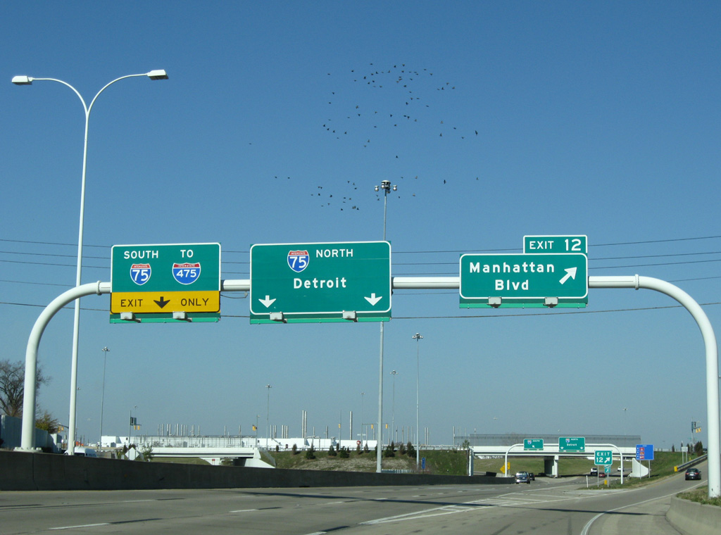
Two lanes default onto Interstate 75 north to Monroe and Detroit in southeast Michigan.
11/07/09

Interstate 280 concludes at a directional T interchange with I-75 just beyond Exit 12 to Manhattan Boulevard.
11/07/09

11/07/09

Manhattan Boulevard parallels I-75 west to Cherry Street by U.S. 24 (Detroit Avenue) and east to Summit Street near Point Place in North Toledo.
11/07/09
Interstate 75 heads north from the Toledo area to Flint, Saginaw and ultimately Sault Saint Marie. Southward the freeway continues to Findlay, Lima, Dayton and Cincinnati.
11/07/09

Interstate 75 loops west from I-280, 3.3 miles to I-475 and south toward Downtown Toledo.
11/13/04
Photo Credits:
- 11/03/04 by Carter Buchanan.
- 11/13/04 by Carter Buchanan.
- 09/01/05 by AARoads.
- 11/07/09 by AARoads.
Connect with:
Interstate 75
Interstate 80
Interstate 90
State Route 2
State Route 51
Page Updated 08-06-2021.