|
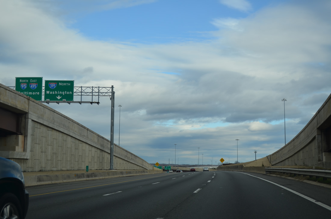
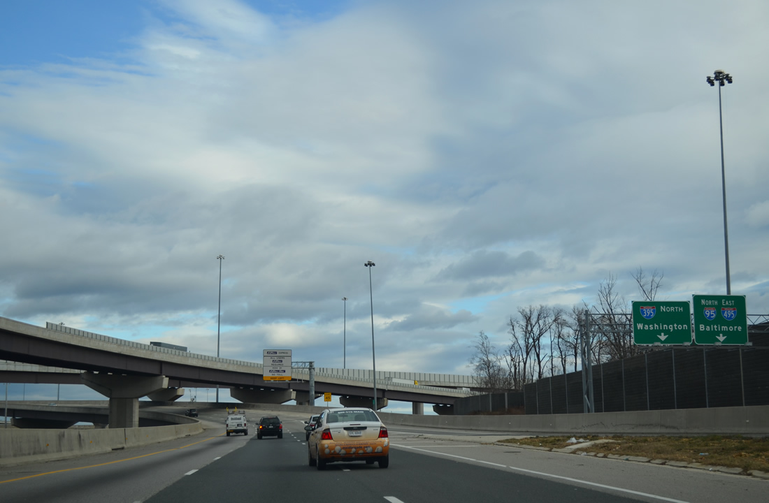
| Interstate 395 extends the Henry G. Shirley Highway northward from I-95 (Exit 170A) through the Springfield Interchange with I-495 (Capital Beltway). 12/21/12 |
|
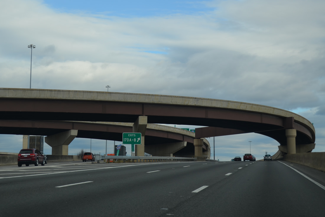
| The innermost flyover from SR 644 (Old Keene Mill Road) splits into ramps for I-95 north / I-495 eastto the left and Interstate 395 (Shirley Highway) north to the right. 12/21/12 |
|
| Traffic joining Interstate 395 from SR 644 expands the northbound lanes to five overall. Three continue to Washington while two depart at Exit 170B for Interstate 495 north to Fairfax, Vienna and Tysons Corner. 12/21/12 |
|
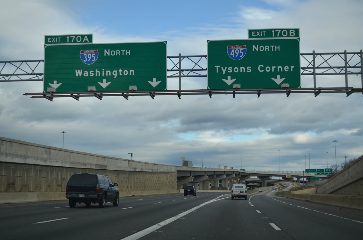
| Exit 170B leaves I-395 north for Interstate 495 north (inner loop). Travelers taking the western half of the Capital Beltway will rejoin Interstate 95 in 30 miles. 12/21/12 |
|
| Ramps from SR 644 (Franconia Road) west and Commerce Street at Springfield merge in quick succession. The ramp from Franconia Road provides options to all three Interstates. 12/21/12 |
|
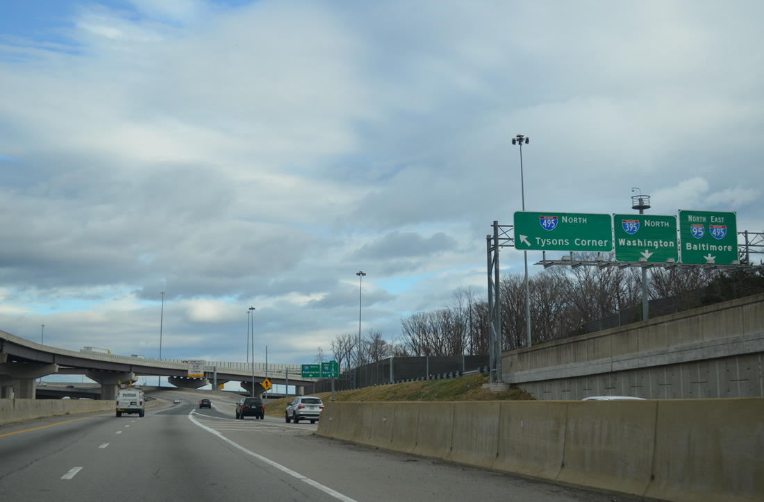
| Taking the flyover to Interstate 495 north (inner loop), motorists from SR 644 west split into ramps for I-395 north and the outer loop of the Capital Beltway nearby. 12/21/12 |
|
| The two lane flyover carrying the Interstate 95 northbound mainline to the Capital Beltway outer loop passes overhead. Springfield Interchange construction between Franconia Road and the Capital Beltway was completed on July 17, 2007. 12/21/12 |
|
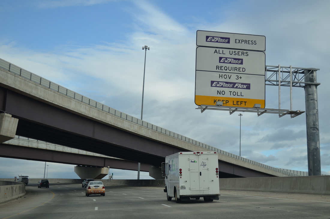
| Opened to traffic on November 17, 2012, the 495 ExpressLanes travel alongside the general purpose lanes of the Capital Beltway from the Springfield Interchange northwest to SR 267 (Dulles Access Road). The HOT (High occupancy/toll) lanes are open to HOV-3 motorists equipped with an EZPASS Flex Transponder. Variable toll rates are charged to other motorists who use the lanes. 12/21/12 |
|
| A sweeping view of the Capital Beltway west from the Springfield Interchange. The northbound mainline of I-495 merges with ramps from I-95 north and I-395 south to the right as the 495 ExpressLanes commence to the left. The HOT lanes were constructed between 2008 and 2012 at a cost of $2 billion by the companies Transurban and Fluor.1 12/21/12 |
|
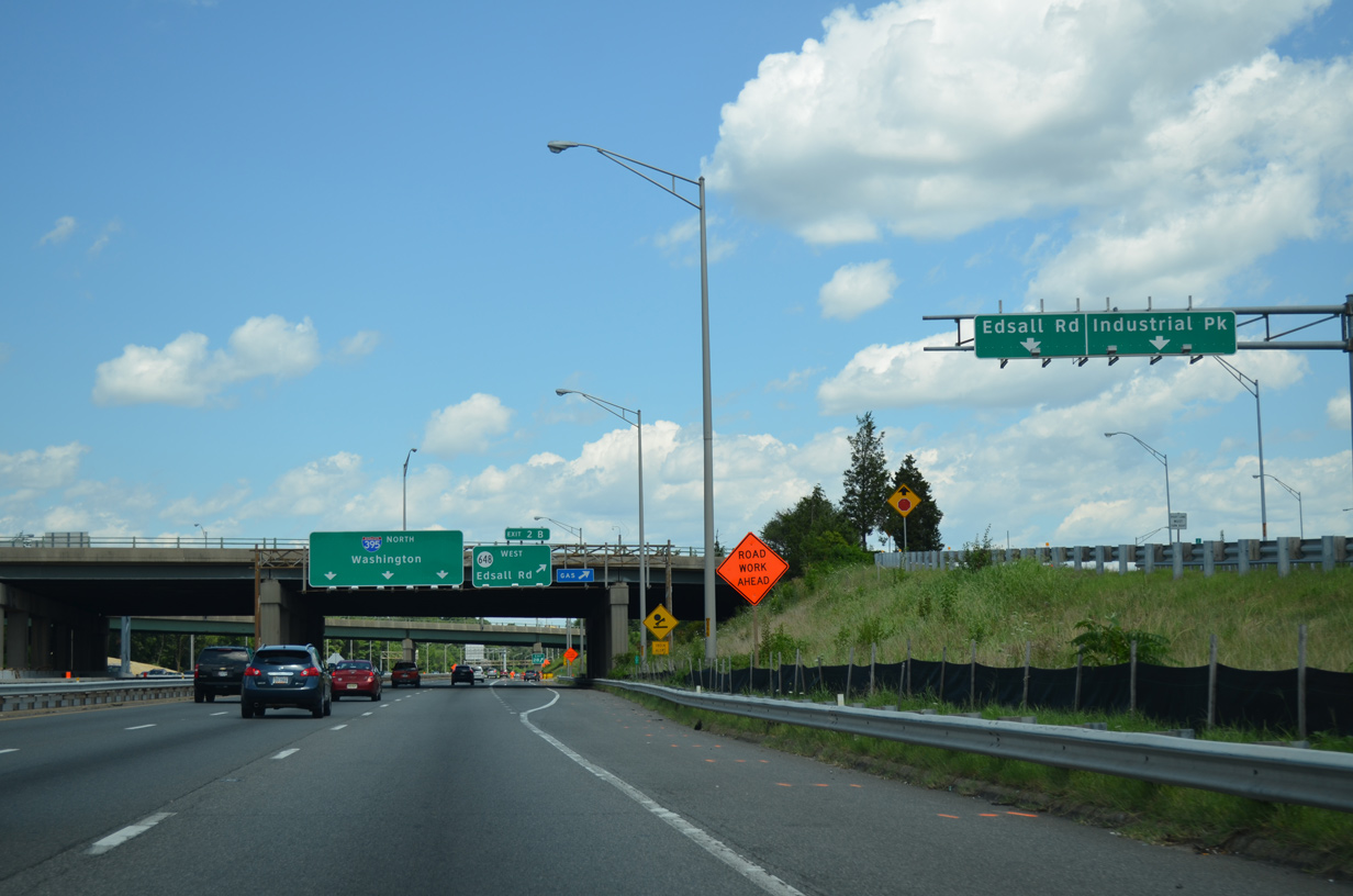
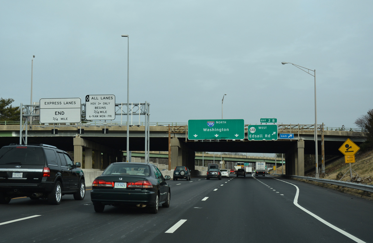
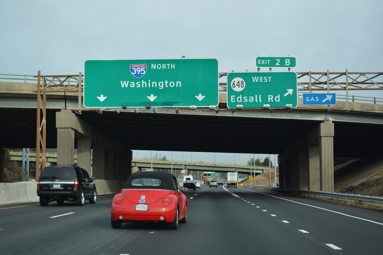
| Interstate 395 (Henry G. Shirley Memorial Highway) angles northeast from the Springfield Interchange between Shirley Industrial Park and Shell Oil Industrial Park to SR 648 (Edsall Road) at Exits 2A/B. 12/16/16 |
|
| Located midway between SR 648 (Exit 2) and SR 236 (Exit 3), the succeeding egress point from the I-395 Express Lanes lies one mile ahead. 12/16/16 |
|
| A three quarter cloverleaf interchange connects Interstate 395 north with Edsall Road (SR 648). A multi lane arterial, SR 648 runs east from Backlick Road (SR 617) to Van Dorn Street (SR 401). 12/16/16 |
|
| Exit 2A partitions with a loop to Bren Mar Drive south to Shell Oil Industrial Park and SR 648 east to the Bren Mar community and Alexandria. 08/04/13 |
|
| The reversible high occupancy vehicle (HOV) lanes continue northward within the median of the main I-395 travel lanes to the Potomac River. The Express Lanes flow inbound during morning peak hours and outbound during the afternoon and evenings. Motorcycles, alternative fuel vehicles and emergency vehicles are exempt from the HOV restrictions.2 12/16/16 |
|
| Exit 2B loops onto Edsall Road west to the Fairfax County communities of Edsall Park, Leewood and North Springfield. 12/16/16 |
|
| Advancing north between the Lincolnia Park subdivision and Overlook condominium communities, the Express Lanes connect with the I-395 general travel lanes at a system of braided ramps. 12/16/16 |
|
| The first of three interchanges for the independent city of Alexandria lies one mile east of Turkeycock Run Stream Valley Park along I-395 northbound. 12/16/16 |
|
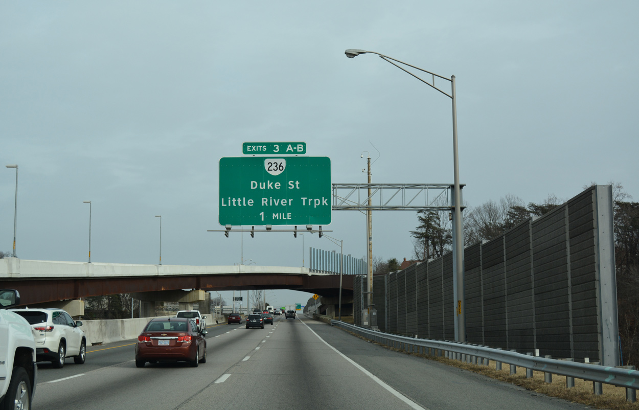
| The Express Lane flyover adds an auxiliary lane to directional cloverleaf interchange (Exit 3) with Duke Street (SR 236 east) and Little River Turnpike (SR 236 west). 12/16/16 |
|
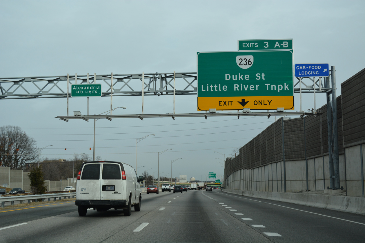
| Entering the city of Alexandria, Exit 3A leaves Interstate 395 north for SR 236 (Duke Street) east. Duke Street leads SR 236 eastward from adjacent Landmark Mall to U.S. 1 (Patrick / Henry Streets) in Downtown. 12/16/16 |
|
| Exit 3B departs for SR 236 (Little River Turnpike) westbound through the Lincolnia and Annandale communities. The 15.54 mile long route originates at U.S. 50 in the city of Fairfax. 12/16/16 |
|
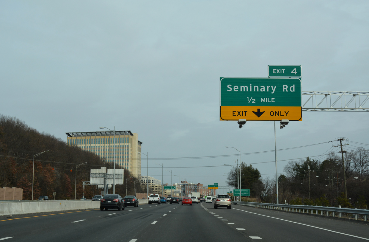
| The Lanmark Mall parking structure rises along the south side of I-395. The freeway professes east one mile to Seminary Road (Exit 4). 12/16/16 |
|
| Interstate 395 lowers 150 feet in elevation over the course of a half mile to the bridges across of Holmes Run. 12/16/16 |
|
| SR 401 (Van Dorn Street) parallels I-395 beside this reassurance marker by Holmes Run Park / Brookvalley Park. 12/16/16 |
|
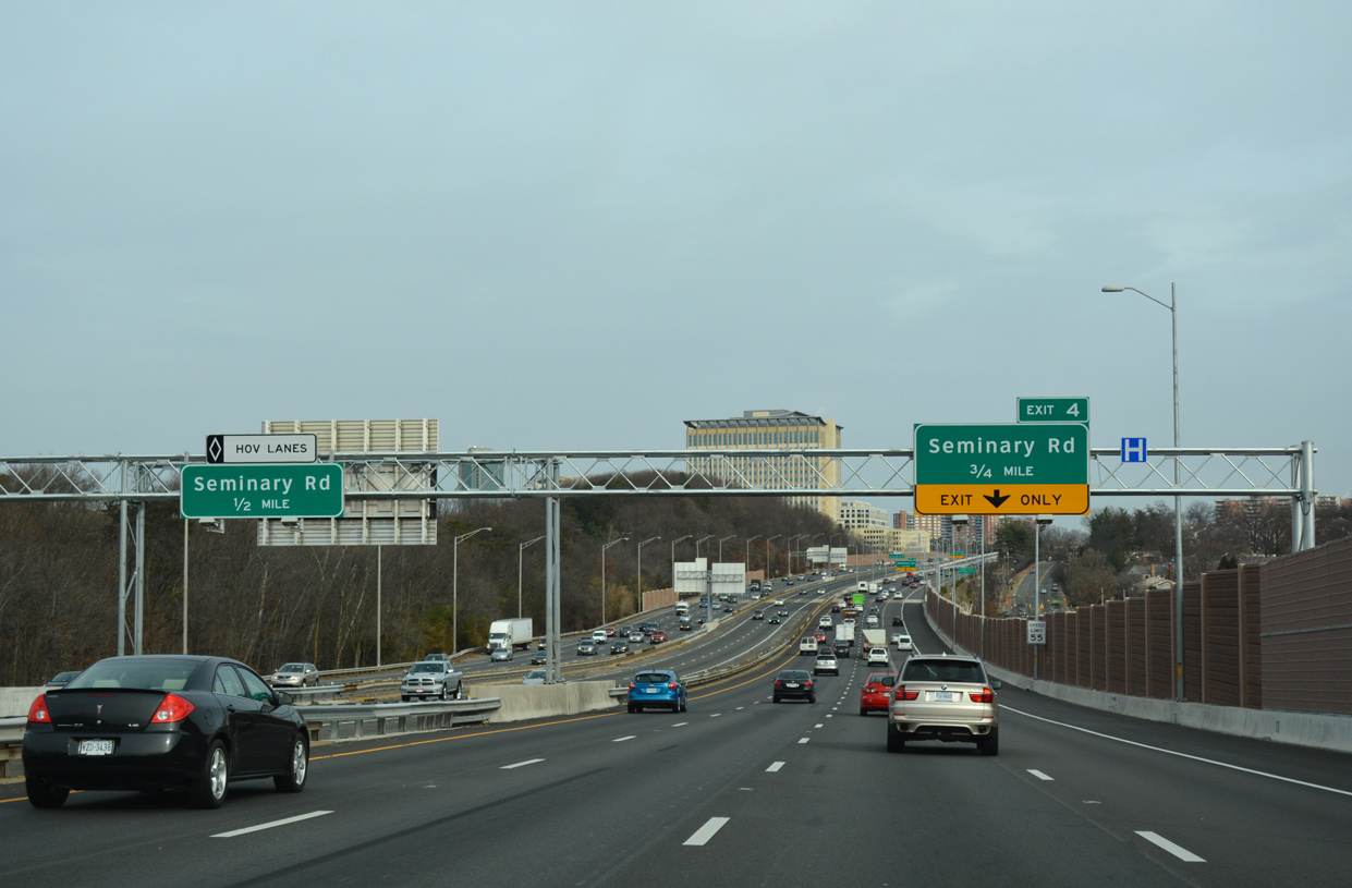
| I-395 climbs 135 feet in elevation from Holmes Run to the three level interchange (Exit 4) with SR 420 (Seminary Road). 12/16/16 |
|
| Although not acknowledged on I-395 guide signs, SR 420 follows Seminary Road southward to Janney's Lane and SR 7 (King Street) at the George Washington Park and Mt. Vernon Park neighborhoods. 12/16/16 |
|
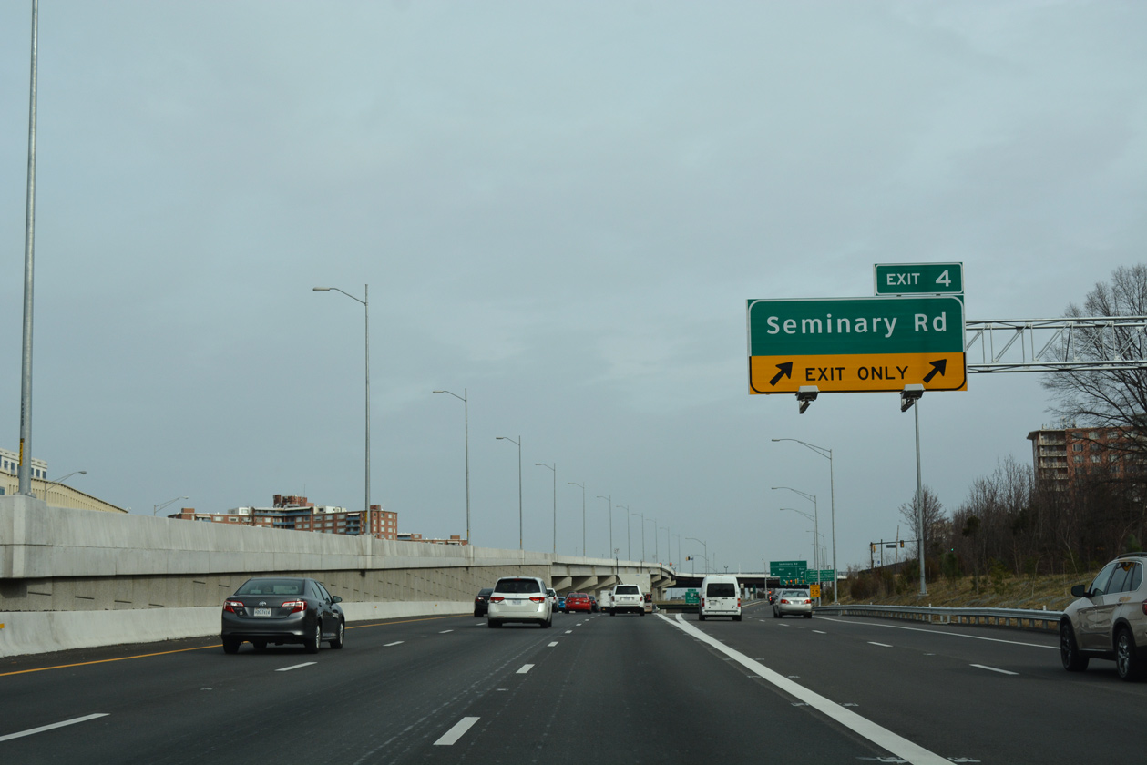
| An HOV ramp to Seminiary Road opened from I-395 in January 2016. The flyover rises to intersect Seminary Road (SR 420) directly. 12/16/16 |
|
| Two lanes branch away from the general travel lanes of I-395 north for Seminary Road (SR 420). Service roads join ramps from both the freeway and Seminary Road above SR 401 (Van Dorn Street). 12/16/16 |
|
| Interstate 395 continues with six general travel lanes through the multi level exchange with Seminary Road (SR 420). SR 420 concludes a 2.75 mile route northward beyond the Fairfax County line at George Mason Drive (SR 716). 12/16/16 |
|
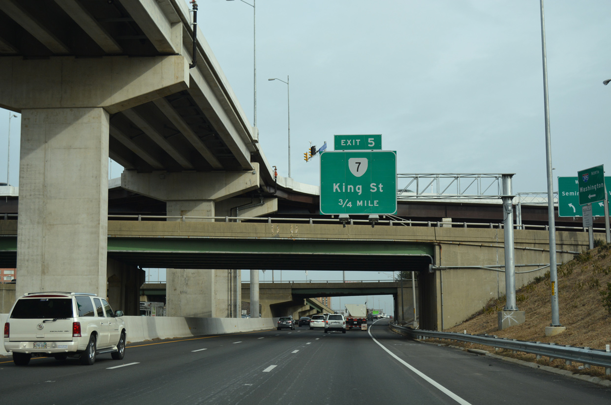
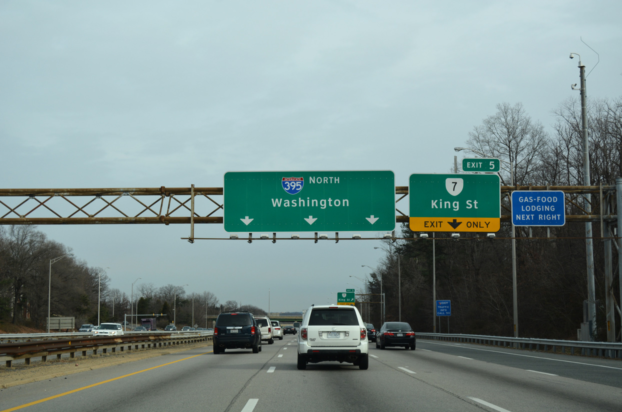
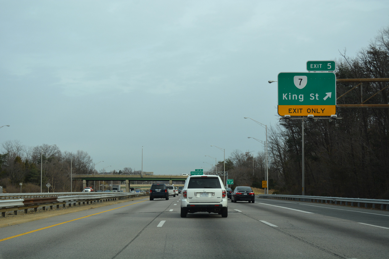
| A principal arterial route, SR 7 (King Street) angles 3.17 miles northwest from Downtown Alexandria to the east side ramps with I-395 at Exit 5. 12/16/16 |
|
| The entrance ramp from Seminary Road adds a fourth northbound lane for I-395 to Exit 5. 08/04/13 |
|
| The directional cloverleaf interchange (Exit 5) with SR 7 (King Street) connects with I-395 between the North and South Fairlington communities in Arlington County. 12/16/16 |
|
| SR 7 extends northwest from Exit 5 and the city of Alexandria to Baileys Crossroads, Falls Church, Tysons Corner and Leesburg. 12/16/16 |
|
| Advancing north, I-395 next meets the north end of SR 402 (Quaker Lane) in 0.75 miles. 12/16/16 |
|
| Interstate 395 enters a wedge of Arlington County between the SR 7 (King Street) and SR 402 (Quaker Lane) overpasses. 12/16/16 |
|
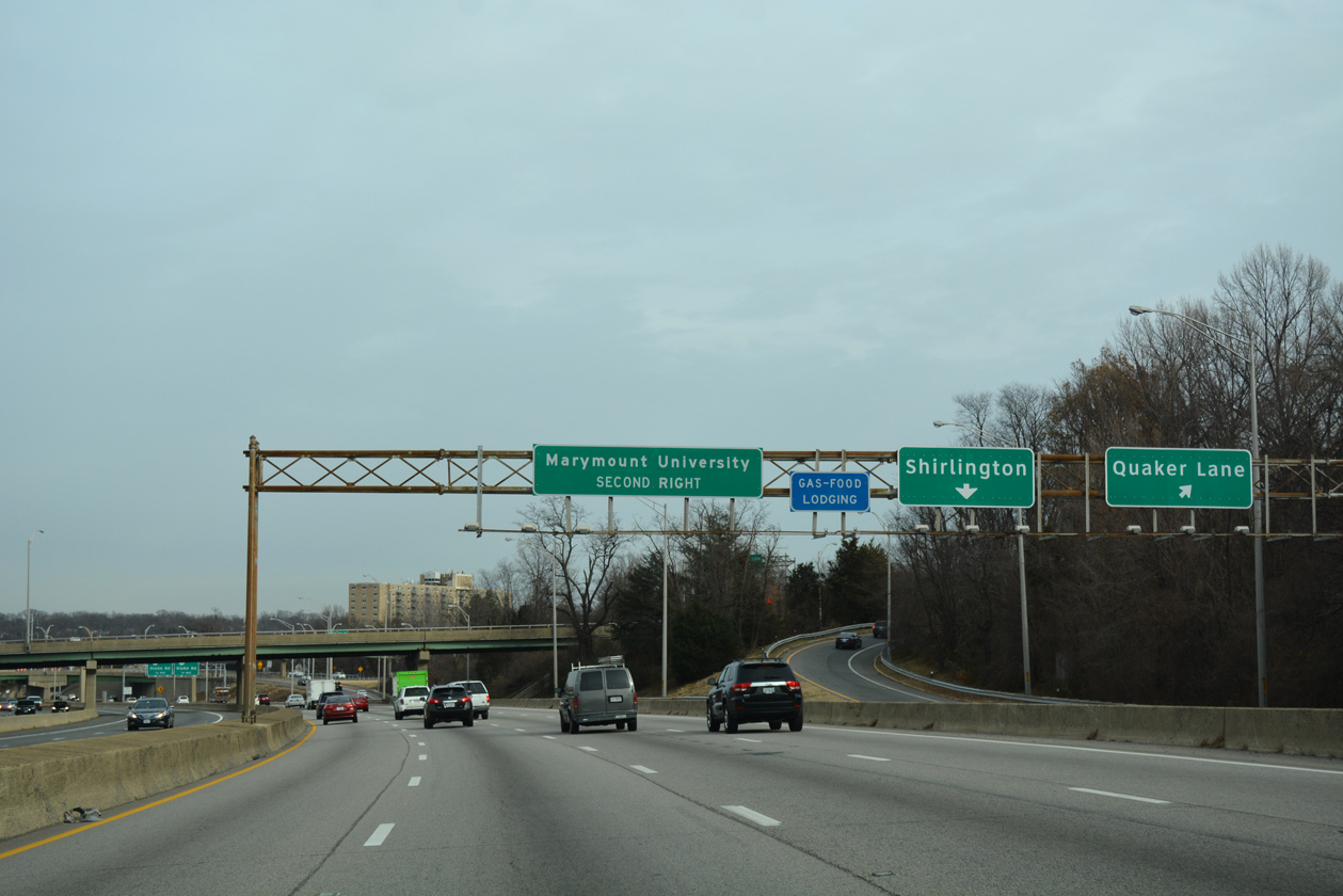
| The rotary interchange (Exit 6) with Quaker Lane (SR 402) at Shirlington is the first of seven exits for Arlington along Interstate 395 northbound. 12/16/16 |
|
| A distributor roadway separates from I-395 north for Quaker Lane (SR 402) south along the Alexandria city line and Shirlington Road north through Shirlington to SR 120 (Glebe Road). 12/16/16 |
|
| Quaker Lane leads SR 402 south 1.82 miles to SR 236 (Duke Street) at College Park in Alexandria. 12/16/16 |
|
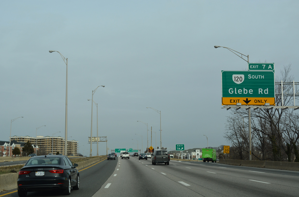
| Continuing north, I-395 reenters the city of Alexandria briefly before reaching Exits 7A/B with SR 120 (Glebe Road) at Arna Valley. 12/16/16 |
|
| Exit 7A departs Interstate 395 northbound for SR 120 south (Glebe Road). Glebe Road leads the 9.10 mile long route east to U.S. 1 (Jefferson Davis Highway) at Crystal City. 12/16/16 |
|
| A loop ramp (Exit 7B) follows from Interstate 395 northbound to SR 120 (Glebe Road) north. The state route arcs northward through Arlington to Marymount University and SR 123 at the Chain Bridge into Washington, DC. 12/16/16 |
|
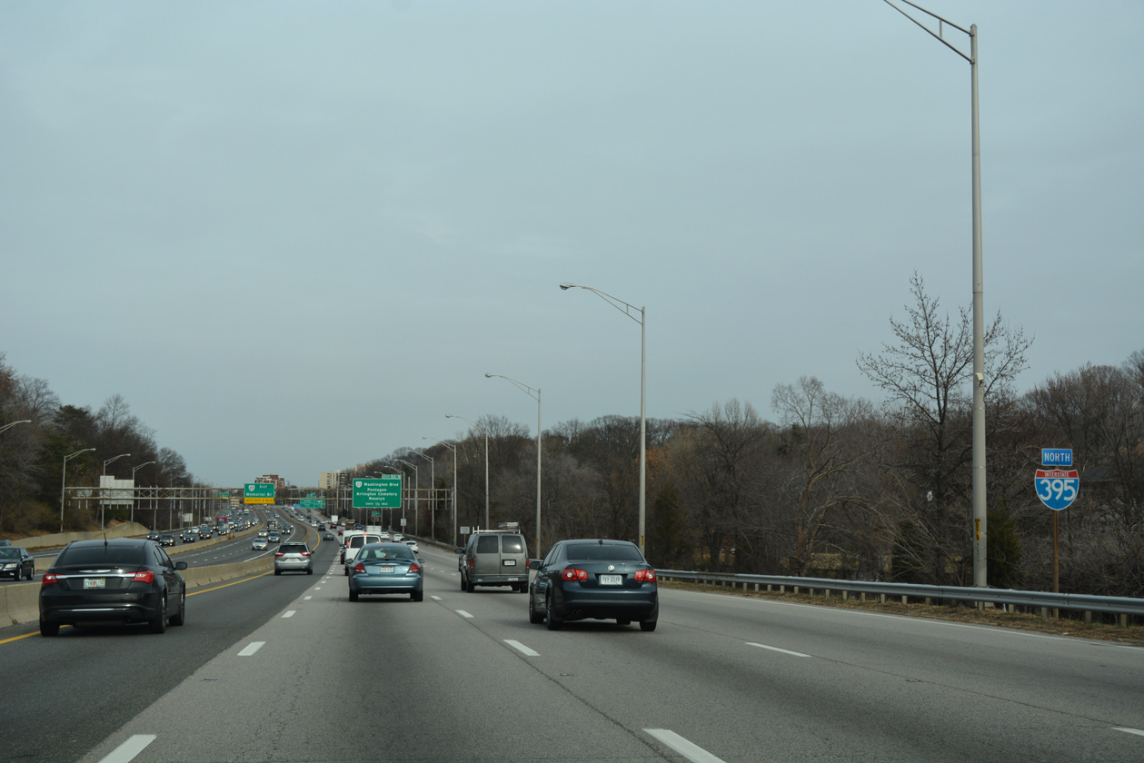
| Traveling between Army-Navy Country Club and the Virginia Highlands community, I-395 expands to 11 overall lanes. 12/16/16 |
|
| SR 27 (Washington Boulevard), a 2.54 mile long expressway encircling Arlington Cemetery to the south, connects with I-395 at a directional T interchange (Exit 8) in one half mile. 12/16/16 |
|
| Designated in 1965, SR 27 leads north to U.S. 50 Arlington Boulevard). U.S. 50 circles around the north side of Arlington National Cemetery to Fort Myer, Rosslyn and the Theodore Roosevelt Bridge (I-66) across the Potomac River. 12/16/16 |
|
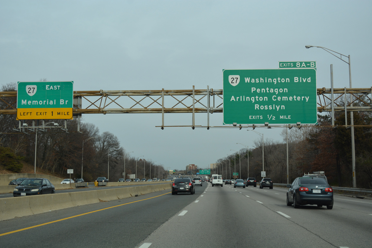
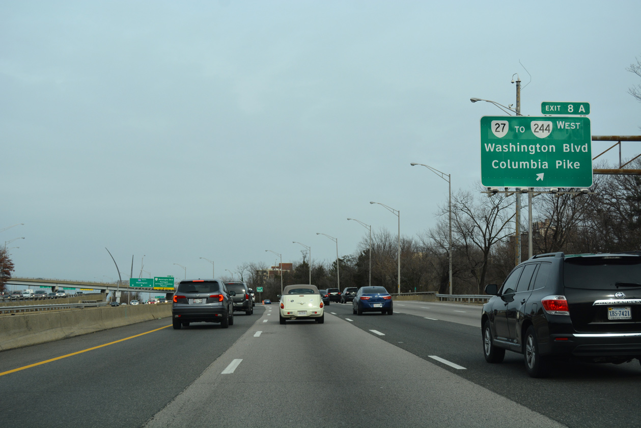
| Exit 8A leaves I-395 north for SR 27 (Washington Boulevard) north. SR 244 stems west from SR 27 nearby through the Columbia and Arlington Heights communities. The state route extends 8.19 miles along Columbia Pike to SR 236 (Little River Turnpike) at Annandale. 12/16/16 |
|
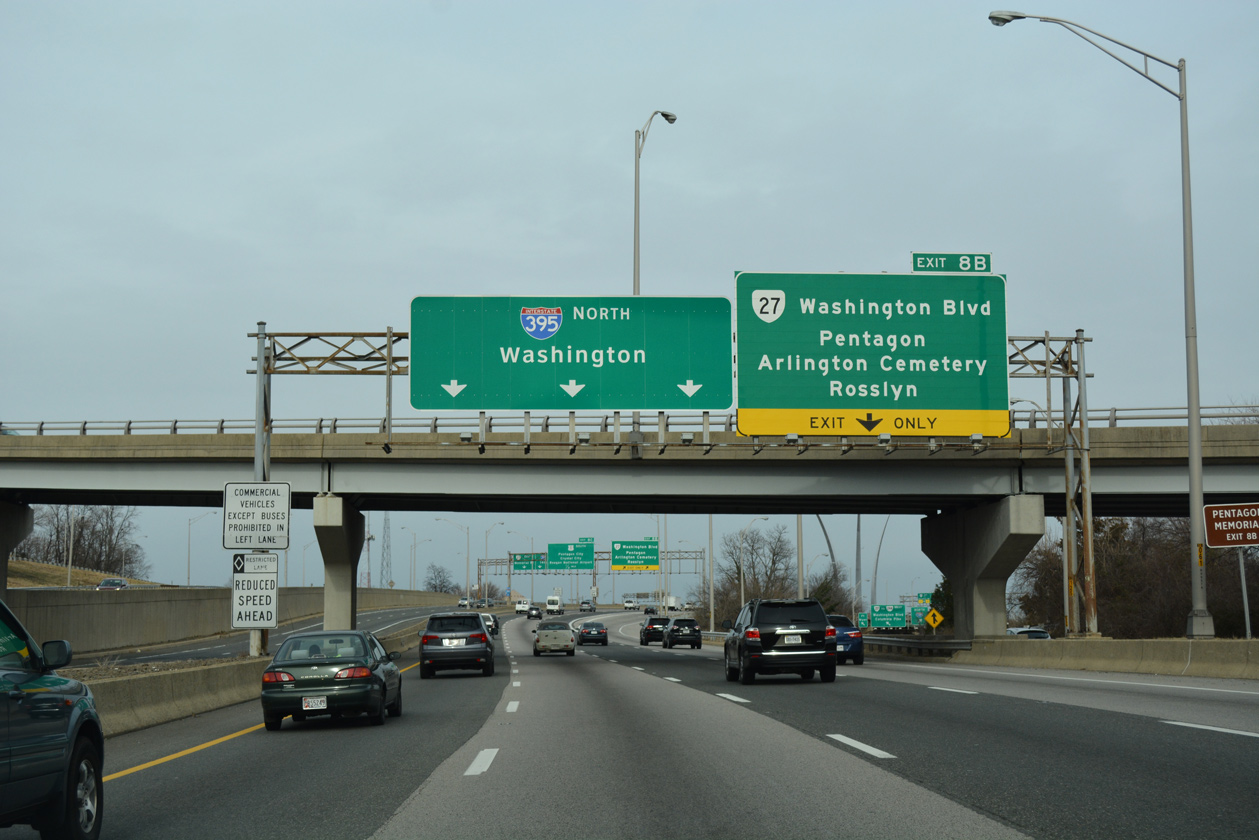
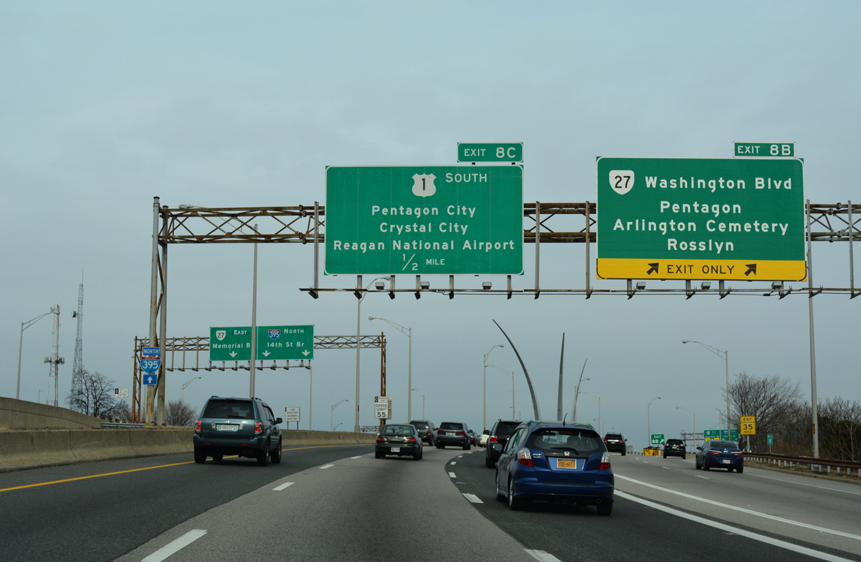
| Exit 8B leaves in a quarter mile for Washington Boulevard (SR 27) east toward The Pentagon, Memorial Drive, and the main entrance into Arlington National Cemetery. 12/16/16 |
|
| A lane drop occurs along I-395 northbound for Exit 8B and SR 27 (Washington Boulevard) eastbound. Washington Boulevard encircles Arlington National Cemetery northeast to George Washington Memorial Parkway on Columbia Island. 12/16/16 |
|
| A left exit joins the I-395 HOV roadway with SR 27 (Washington Boulevard) east to the Arlington Memorial Bridge and Rossyln. 12/16/16 |
|
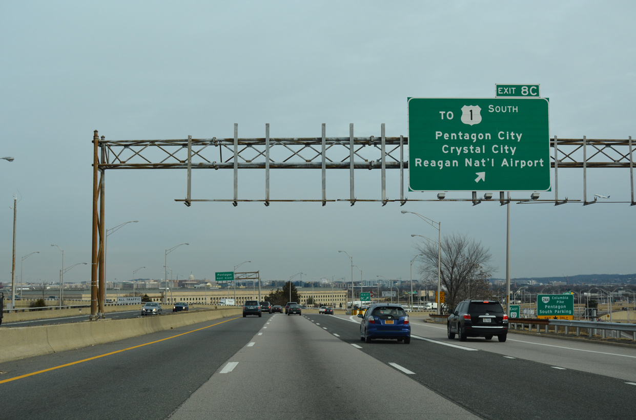
| The succeeding off-ramp (Exit 8C) ties into parallel Army Navy Drive at Hayes Street south at Pentagon City. 12/16/16 |
|
| The Pentagon spreads into view along the north side of I-395. Further north is the Washington Monument. 12/16/16 |
|
| The Exit 8C ramp separates from I-395 north. Hayes Street arcs south from Fashion Centre at Pentagon City mall to connect with 15th Street South to U.S. 1 (Jefferson Davis Highway) and 18th Street South to Crystal City. 12/16/16 |
|
| A diamond interchange joins the HOV lanes with Eads Street and The Pentagon between the north and southbound roadways of Interstate 395. 12/16/16 |
|
| The HOV lanes partition into north and southbound roadways to the 14th Street Bridge (Rochambeau Memorial Bridge) beyond the wye interchange (Exit 8B) with SR 27 (Washington Boulevard) east. 12/16/16 |
|
| A slip ramp links I-395 northbound with the HOV roadway across the 14th Street Bridge within the exchange joining I-95 southbound with SR 110 north and U.S. 1 south. 12/16/16 |
|
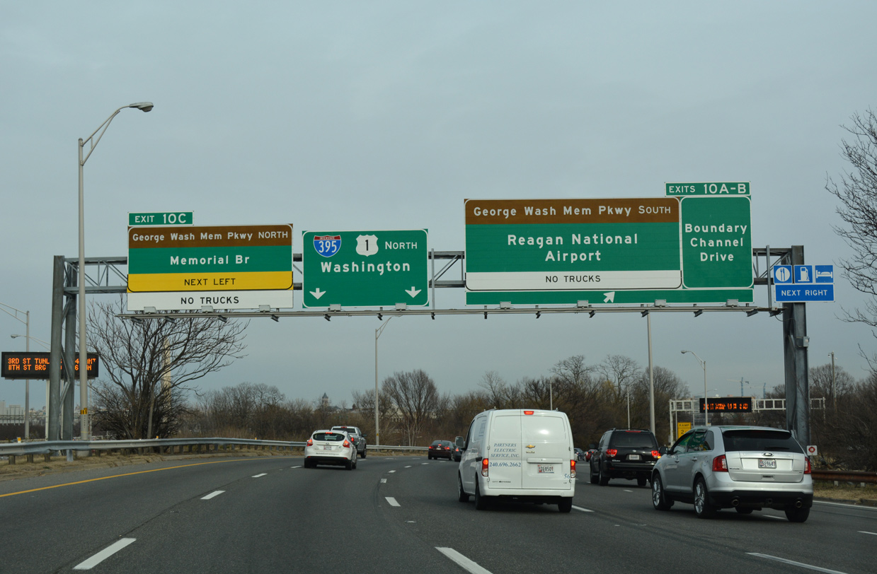
| Curving northeast through Long Bridge Park, Interstate 395 enters a cloverleaf interchange (Exits 10A/B) with Boundary Channel Drive. Exit 10A loops onto Boundary Channel Drive west to The Pentagon; Exit 10B stems east to George Washington Memorial Parkway south to Ronald Reagan Washington National Airport (DCA). 12/16/16 |
|
| Exits 10A/B leave I-395 north as U.S. 1 merges on from Jefferson Davis Highway. Northbound I-395 and U.S. 1 combine across the Arland D. Williams Jr. Bridge into Washington. I-395/U.S. 1 southbound follow the George Mason Bridge adjacent to the HOV roadways on the Rochambeau Bridge. 12/16/16 |
|
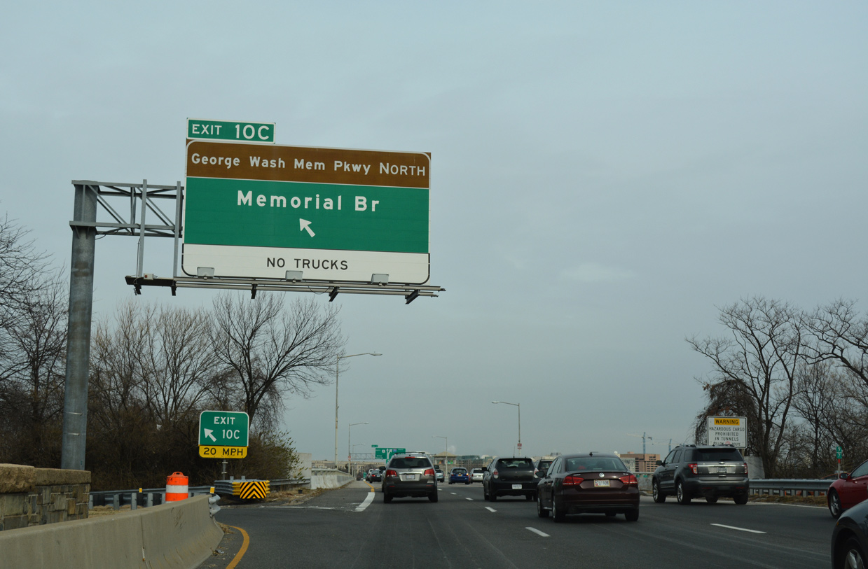
| Exit 10C joins I-395/U.S. 1 with George Washington Memorial Parkway north to Memorial Drive west to Arlington National Cemetery and the Arlington Memorial Bridge (former U.S. 50/240) east to the Lincoln Memorial. 12/16/16 |
Page Updated 12-17-2018.

 North
North