Guide by Thomas Decker.
|
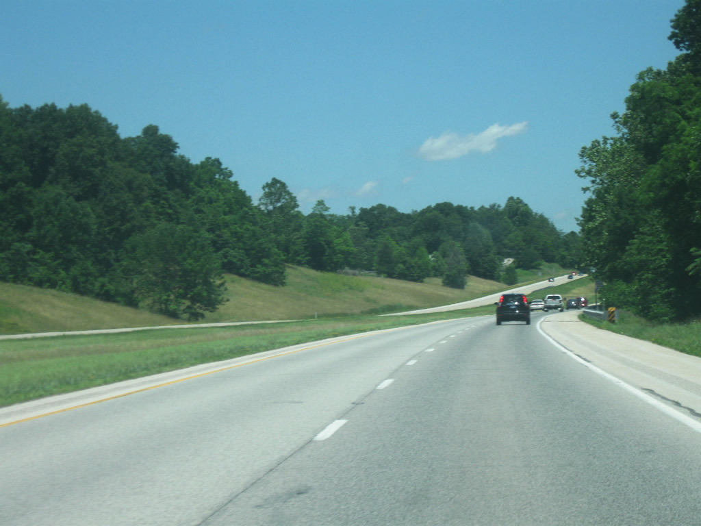
| SR 37 stays on the western side of the hills as it begins its decent into the White River Valley of Morgan County. These hills are part of the Morgan-Monroe State Forest, which is a popular recreational area in Morgan County. The current routing of SR 37 was a route meant to bypass the original route which followed county roads south of Martinsville and through the Morgan-Monroe State Forest. Around the 1950s the highway was moved to the west so that it went southwest of Martinsville before going south into Monroe County toward Bloomington. In the 1970s, as traffic got heavier the entire highway was expanded to four lanes. The northbound lanes represent the original SR 37 with the southbound lanes being the newer ones. 06/20/09 |
|
| A guide sign up ahead announces the upcoming "exits" for Martinsville. Of these three, only the first one, SR 39 is an actual exit. Burton Lane and Ohio Streets represent the next two intersections. 06/20/09 |
|
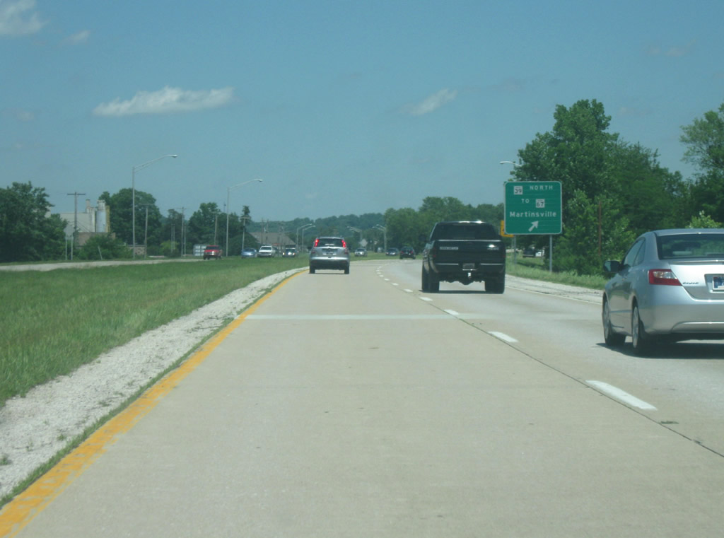
| A guide sign for the interchange with SR 39 first appears. SR 39 is separated into two segmented highways as well and it is from SR 37 here in Martinsville that the much longer northern segment begins. The highway goes on for 180 miles as it heads to the north through Monrovia, Danville, Lebanon, Frankfort, Delphi, Monticello, and LaPorte before ending at the Michigan border where it becomes M-239 and connects with Interstate 94. The southern segment exists for only 14 miles in Washington and Jackson Counties in southern Indiana. 11/13/11 |
|
| SR 39 exits off of SR 37 northbound as the highway begins its bypass of Martinsville. Around Martinsville, SR 39 is known as a connector route around the west side of Martinsville to SR 67, which is a four lane highway from Martinsville north to Mooresville and Indianapolis. It is also the only bridge across the West Fork of the White River, a link that is being repaired as of 2011. This interchange also designates the location where the original SR 37 goes into Martinsville. 06/20/09 |
|
| SR 37 begins its trip around the south and east sides of Martinsville, providing a bypass for the original highway which went through via Morgan Street and Main Street (which links up to the current SR 39.) As with many communities, much of the retail businesses in Martinsville have located themselves along the SR 37, making the road slow going on an otherwise free-flowing transit between Bloomington and Indianapolis. The highway has stoplights with Burton Lane, Ohio Street/Mahalasville Road, and Green Valley Boulevard. Currently, the plan for the future Interstate 69 is to have an interchange at the Ohio Street/Mahalasville Road intersection with a likely frontage road system linking up to the businesses along the highway. 06/20/09 |
|
| The next approaching intersection is with SR 252, a state highway connecting Martinsville with the town of Morgantown in southeastern Morgan County. The highway continues east from there across southern Johnson County and past Camp Atterbury on its way through Edinburgh and finally into Shelby County where it ends at SR 9. The highway is divided into two segments; the main western segment goes for 39 miles from Martinsville to SR 9 while the second segment is found in Franklin County in southeastern Indiana. 11/13/11 |
|
| Control cities of Morgantown and Martinsville for the upcoming intersection with SR 252. Morgantown is nine miles southeast of SR 37 on a windy stretch of SR 252. To the west, the road becomes Hospital Drive, providing access to Morgan Hospital as well as well as Morgan Street, which is the west-east road across Martinsville, linking up to downtown Martinsville. 11/13/11 |
|
| Up ahead is the next intersection, for SR 44. SR 44 is the first major west-east state highway across Indiana that is south of Interstate 70. The highway begins at the intersection with SR 37 and continues east for 90 miles across the state, touching with the cities of Franklin, Shelbyville, Rushville, Connersville, and Liberty before leaving the state at the Ohio border. Guide signs point to Franklin and Martinsville at the SR 44 intersection. To the west of SR 37, the road becomes Reuben Drive, which continues on to Morgan Street. 11/13/11 |
|
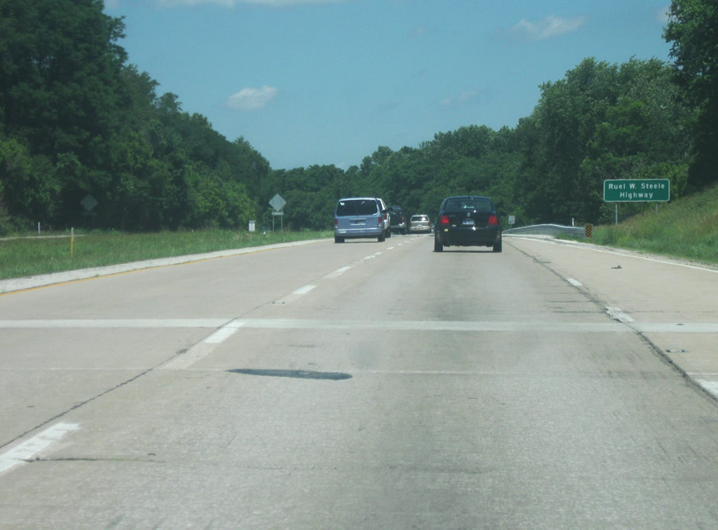
| SR 37 from Bedford north to Indianapolis is known as the Ruel W. Steele Highway, after the head of the Highway Commission for which the SR 37 expressway was built. But as with most Indiana highways that are given names, the highway is only referred to as SR 37. 06/20/09 |
|
| Trees cover part of the distance sign, designating that Waverly (where the next intersection is located) is 12 miles away with Indianapolis at 28 miles. 06/20/09 |
|
| The 15 mile stretch of SR 37 between Martinsville and Waverly has the highway heading further out of the hills and into the glaciated valley of the White River Valley. Morgan County represents where the glaciers stopped and therefore part of the county remains glaciated. The West Fork of the White River forms a valley across the central part of the county, with SR 37 following the eastern edge of the valley. There are currently plans for at least one, if not two interchanges for the new Interstate 69 within this valley, at Egbert Road. 06/20/09 |
|
| At this point, the intersection with Whiteland Road approaches, serving the town of Whiteland, located nearly 15 miles to the east near U.S. 31 and Interstate 65 in Johnson County. 11/13/11 |
|
| A sign for Banta Road / County Road 800 West, which leads to the unincorporated community of Banta, located just east of the Morgan County line in Johnson County. 11/13/11 |
|
| SR 37 enters the northwestern corner of Johnson County (Population: 139,694). SR 37 spends the next few miles within the boundaries of White River Township, more locally known as Center Grove. This is a growing suburban region of the Southside of Indianapolis that is adjacent to, but not a part of Greenwood (Population 49,791). 11/13/11 |
|
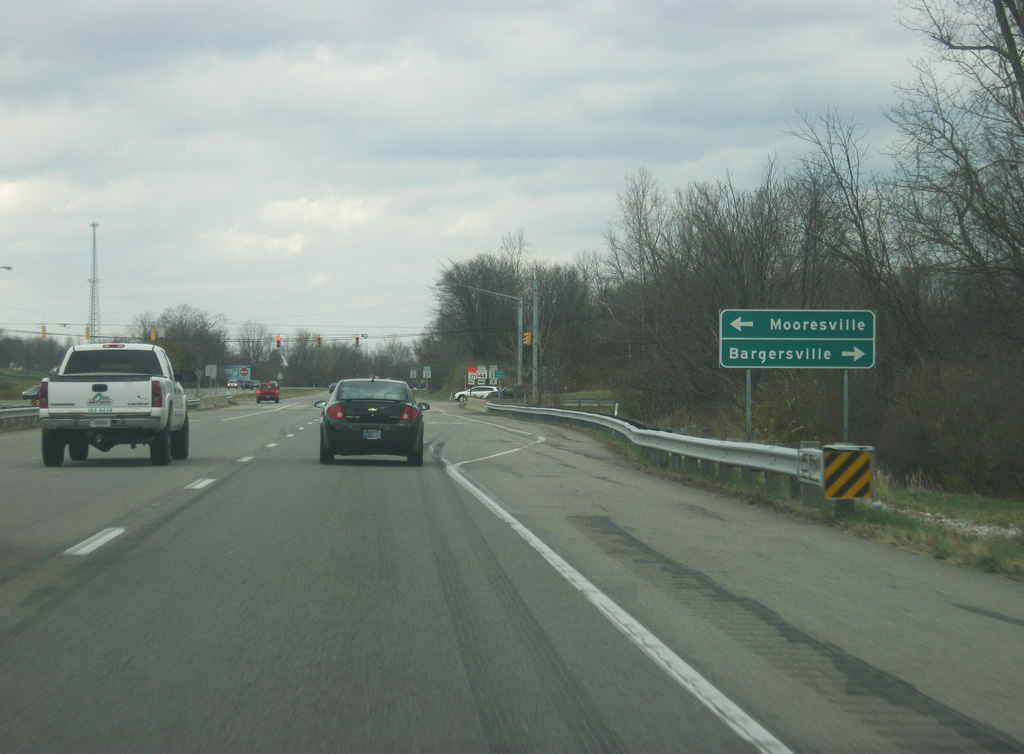
| SR 37 approaches the intersection with SR 144/CR144. SR 144 is broken up into two separate segments that are joined by CR 144 in the center. The road begins in Franklin toward the southeast and goes to the northwest toward Bargersville. From Bargersville, it becomes CR 144 for about seven miles up to the intersection with SR 37. West of there, it is SR 144 once again eight miles northwest to Mooresville. Largely, the road is simply known as 144 by those who pass it by. 11/13/11 |
|
| The control cities of Bargersville (for County Road 144) and Mooresville (for SR 144) appear at the intersection with SR 37. This intersection is the first one in the Indianapolis Metro area for those going north and has a couple of gas stations and restaurants to serve travelers along the route. This intersection is the beginning of the suburban portion of Indianapolis. 11/13/11 |
|
| North of the SR 144/County Road 144 intersection, Indianapolis is the sole control city, now only 15 miles from here. 11/13/11 |
|
| SR 37 advances north through White River Township. 11/13/11 |
|
| White River Township is a growing suburban region of the Southside of Indianapolis that is adjacent to, but not a part of Greenwood (population 49,791). Two roads, Smith Valley and Fairview Roads, cross Center Grove on their way toward Greenwood, which is situated along U.S. 31 and Interstate 65. This sign is at the approaching intersection with Smith Valley Road. The next interchange on the future Interstate 69 will be here. 11/13/11 |
|
| SR 37 continues north past the Smith Valley Road intersection. 11/13/11 |
|
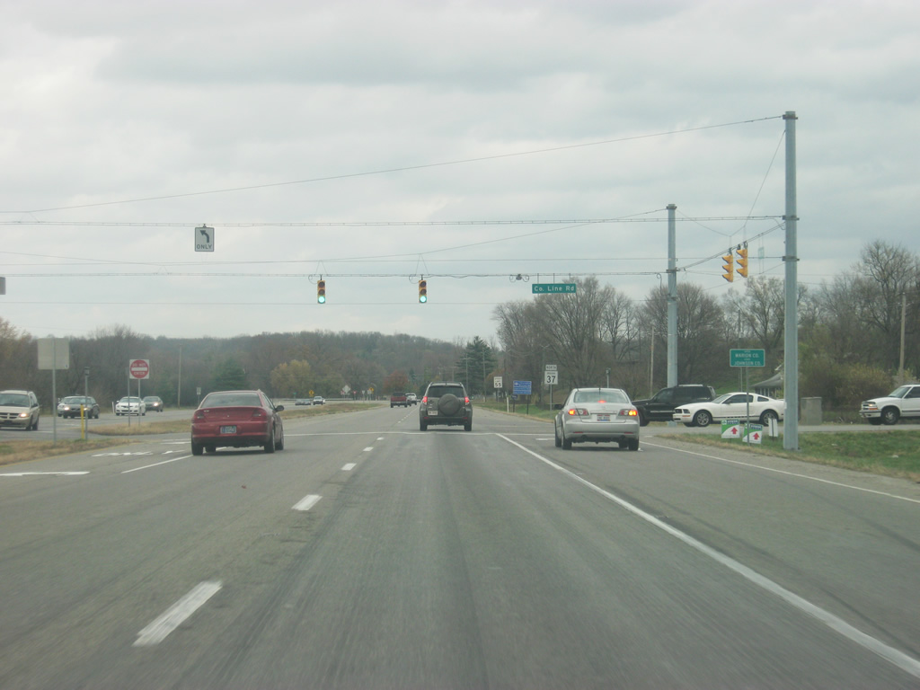
| Up ahead is the intersection with County Line Road, which as the name implies is the county line between Johnson and Marion Counties. The small community of Glenns Valley can be accessed via County Line Road. 11/13/11 |
|
| SR 37 now crosses County Line Road, where another Interstate 69 interchange is being planned. Crossing County Line Road, SR 37 enters Marion County (population 903,393), which is easily the most populous county in the state. 11/13/11 |
|
| By entering Marion County, SR 37 also enters the capital city of Indiana. Indianapolis (population 839,489) is the largest city in Indiana and heart of the Central Indiana region. Indianapolis (the Circle City) is best known as the home of Indianapolis Motor Speedway and the Indianapolis 500 auto race. As the sign indicates, Super Bowl XLVI took place in Indianapolis. 11/13/11 |
|
| SR 37 within Marion County is within Perry Township, on the Southside of Indianapolis. This is one of the few conflict regions for the new Interstate 69 extension which will follow SR 37 from Bloomington north toward Interstate 465. The other main conflict region famously is Bloomington itself. Through Perry Township, the highway is a four lane expressway with stoplights at most intersections, primarily Wicker Road, Southport Road, Banta Avenue and Edgewood Avenue. Within this stretch, SR 37 passes around Mann Hill, the tallest point in Indianapolis. By this point, the highway is well within the till plain of Central Indiana. 11/13/11 |
|
| SR 37 approaches the Southport Road intersection. Southport Road is a major west-east corridor across the Southside. To the east, the road connects SR 37 with Southport and Homecroft as well as Interstate 65 and to the west the road crosses the White River and connects with the town of West Newton in Decatur Township. This will be the last planned interchange of Interstate 69 before the highway approaches Interstate 465. 11/13/11 |
|
| SR 37 takes the appearance of a major commuter highway for those from the southern suburbs of Indianapolis. Most of the traffic takes the highway north to Interstate 465. The Harding Street Generator Station power plant looms ahead in the distance. The plant, a part of the Indianapolis Power and Light Company, provides electric power for Indianapolis. 11/13/11 |
|
| SR 37 expands to six lanes as the highway is now within a mile of Interstates 465 and 74. 11/13/11 |
|
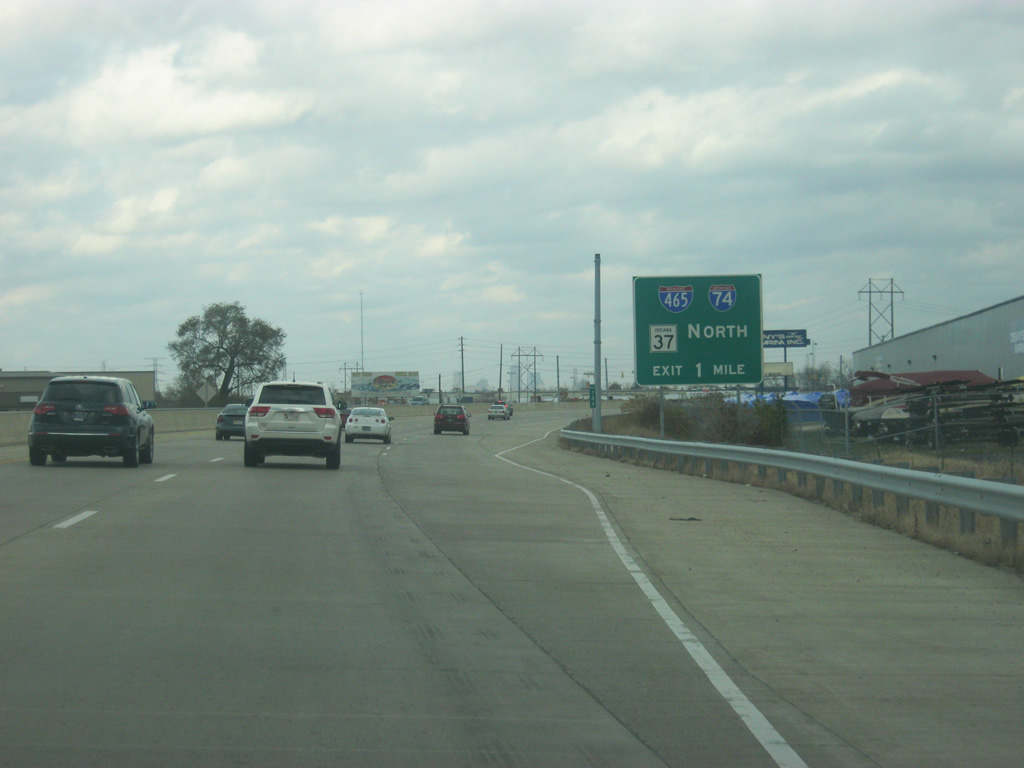
| SR 37 continues north of Epler Avenue as traffic is being directed into various lanes for those traveling to Interstates 465 and 74. The stretch of SR 37 from Epler north to the Interstate 465/Interstate 74 interchange was rebuilt to six lanes to accompany the additional traffic that is around this interchange. 11/13/11 |
|
| SR 37 now reaches the Interstate 465/Interstate 74 interchange. The interchange was rebuilt in 2011 to allow for the heavy truck and commuter traffic that goes through here. This interchange contains numerous truck stops and businesses and therefore receives heavy freight traffic. The diamond interchange was rebuilt to allow for additional turning lanes at each of the ramps as well as the stoplights to the immediate north and south of the interchange. SR 37 northbound traffic is advised to take Interstates 465 and 74 eastbound as a part of the large multiplex of U.S. and state highways. SR 37 continues on around Indianapolis toward Noblesville where it continues further northeast toward Marion. 11/13/11 |
|
| Now, technically off of SR 37, the exit ramp for Interstate 465 and 74 westbound approaches. 11/13/11 |
|
| North of I-465/74, the road becomes Harding Street, a four lane arterial road that heads north toward an interchange with Interstate 70 a couple of miles southwest of Downtown Indianapolis. 11/13/11 |
Page Updated 11-29-2011.