|
| MD 273 east splits from U.S. 1 north along Rising Sun Road. The initial 0.22 mile eastbound segment is inventoried as MD 273A. MD 273 west concludes along a short connector road from Rising Sun Road to U.S. 1. 06/25/10 |
|
| 0.60 miles east from the separation with U.S. 1 (Conowingo Road), MD 273 (Rising Sun Road) eastbound meets MD 276 at Harrisville. A roundabout replaced the signalized intersection with MD 276 (Jacob Tome Memorial Highway) in 2004. 06/25/10 |
|
| MD 276 previously doubled as MD 222 Truck between U.S. 1 and MD 275 (Perrylawn Drive). Signs for the truck route southbound were subsequently replaced with trailblazers for I-95 and U.S. 40. 06/05/05 |
|
| A guide sign directs motorists within the roundabout to MD 276 south toward Port Deposit. MD 276 travels 7.85 miles overall between MD 222 at Port Deposit and U.S. 1 nearby. 08/11/05 |
|
| MD 273 resumes along Rising Sun Road east from the roundabout to the town of Rising Sun. 06/25/10 |
|
| MD 273 eastbound reassurance shield posted after MD 276 (Jacob Tome Memorial Highway). Speed limits reduce along the state route ahead as Rising Sun Road descends into Rising Sun along Main Street. 06/25/10 |
|
| Rising Sun Road transitions into Main Street at the base of the hill west of Downtown Rising Sun. Trucks bound for North East must continue east to MD 272 south in lieu of MD 274 due to the tight intersection with MD 273 (Main Street). 06/05/05 |
|
| Main Street ascends 79 feet in elevation to the intersection with MD 274 (Queen Street) in Downtown Rising Sun. MD 274 (Joseph Biggs Highway) ventures southeastward from Rising Sun to MD 272 (North East Road) and Interstate 95 (Exit 100). 06/30/10 |
|
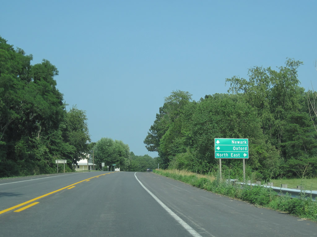
| Queen Street north to Walnut Street connects Downtown Rising Sun with U.S. 1 to the north. MD 273 east to Half Mile Turn and Sylmar Road norh to Pennsylvania represents the original U.S. 1 alignment through Rising Sun. 06/30/10 |
|
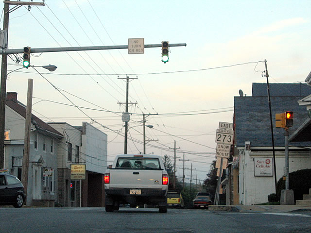
| MD 273 eastbound reassurance shield posted at Main and Queen Streets in Downtown Rising Sun. The state route continues 0.27 miles to the traffic light with Ryan Drive. 04/30/04 |
|
| Approaching MD 272 (Chrome Road north / Northeast Road south) along MD 273 near Calvert. MD 272 stretches southward from the Pennsylvania state line to Turkey Point on Chesapeake Bay for a distance of 20.67 miles. 06/25/10 |
|
| Replaced after 2012, a state named I-95 trailblazer preceded the intersection with MD 272. Following Northeast Road, MD 272 leads 5.3 miles south to its exchange with JFK Memorial Highway. 06/20/12 |
|
| A truck route for MD 274 was previously assigned to MD 273 (Telegraph Road) east out of Rising Sun to MD 272 (North East Road) south to MD 274 at Cecil College. This truck shield on MD 273 was removed by 2010. 06/22/00 |
|
| MD 272 runs 1.3 miles north along Chrome Road to the state line, where it transitions PA 272 ahead of Chrome and Nottingham. Future construction will convert the intersection with MD 273 into a roundabout. 06/20/12 |
|
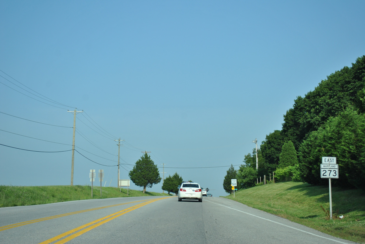
| Advancing east from MD 272, MD 273 (Telegraph Road) undulates across a mix of agricultural areas and timberland six miles to MD 213 (Lewisville Road) at Fair Hill. 06/20/12 |
|
| Entering Fair Hill, MD 273 (Telegraph Road) eastbound approaches MD 213. Fair Hill Drive branches east from Telegraph Road nearby as a former alignment of the state route. 06/20/12 |
|
| MD 213, designated as MD 280 until 1978, transitions into PA 841 at Lewisville. PA 841 connects with PA 472 to Oxford. 06/20/12 |
|
| MD 213 constitutes a minor arterial south along Singlery Road to Elkton and a rural major collector north along Lewisville Road to the Pennsylvania state line. 06/20/12 |
|
| MD 273 (Telegraph Road) continues beyond MD 213 through Fair Hill. Home to several equestrian tracks, the fairgrounds are also home to the annual Scottish Games during the Spring and other events year long. 06/20/12 |
|
| Telegraph Road commences a lengthy descent from Fair Hill into Fair Hill Natural Resources Management Area. The first of three equestrian overpasses spans MD 273 south of the Fair Hill Training Center. 06/20/12 |
|
| Traveling through Fair Hill Natural Resources Management Area. MD 273 drops 240 feet in elevation to cross Big Elk Creek. 06/20/12 |
|
| Fair Hill Natural Resources Management Area includes a 75 mile trail system. The state of Maryland purchased the 5,613 acre site in 1975. 06/20/12 |
|
| Obscured during the Summer months due to foliage, a narrow concrete bridge appears on the north side of MD 273 across Big Elk Creek. The bridge and portions of twin slab concrete roadway along old MD 273 remain nearby, including a segment at Stone House Lane. 04/24/04 |
|
| Telegraph Road climbs 190 feet from the valley fed by Big Elk Creek to meet Appleton Road. Completed in Spring 2018, a $2.4 million project replaced intersection here with a roundabout.1 Appleton Road leads north from MD 316 and MD 277 (Fletchwood Road) to Kemblesville, Pennsylvania. 06/20/12 |
|
| MD 273 (Telegraph Road) trends southward on the 1.43 mile straight away leading from Appleton Road to Newark, Delaware. Little Egypt Road stems northward from the ensuing stretch to New London Road (MSR 896). 06/20/12 |
06/22/00, 04/24/04, 04/30/04, 06/05/05, 08/11/05, 06/25/10, 06/30/10, 06/20/12 by AARoads
Page Updated 12-13-2018.