Built in 1954, Baltimore-Washington is maintained by the National Park Service south from a point just north of Fort Meade to Washington, D.C.
|
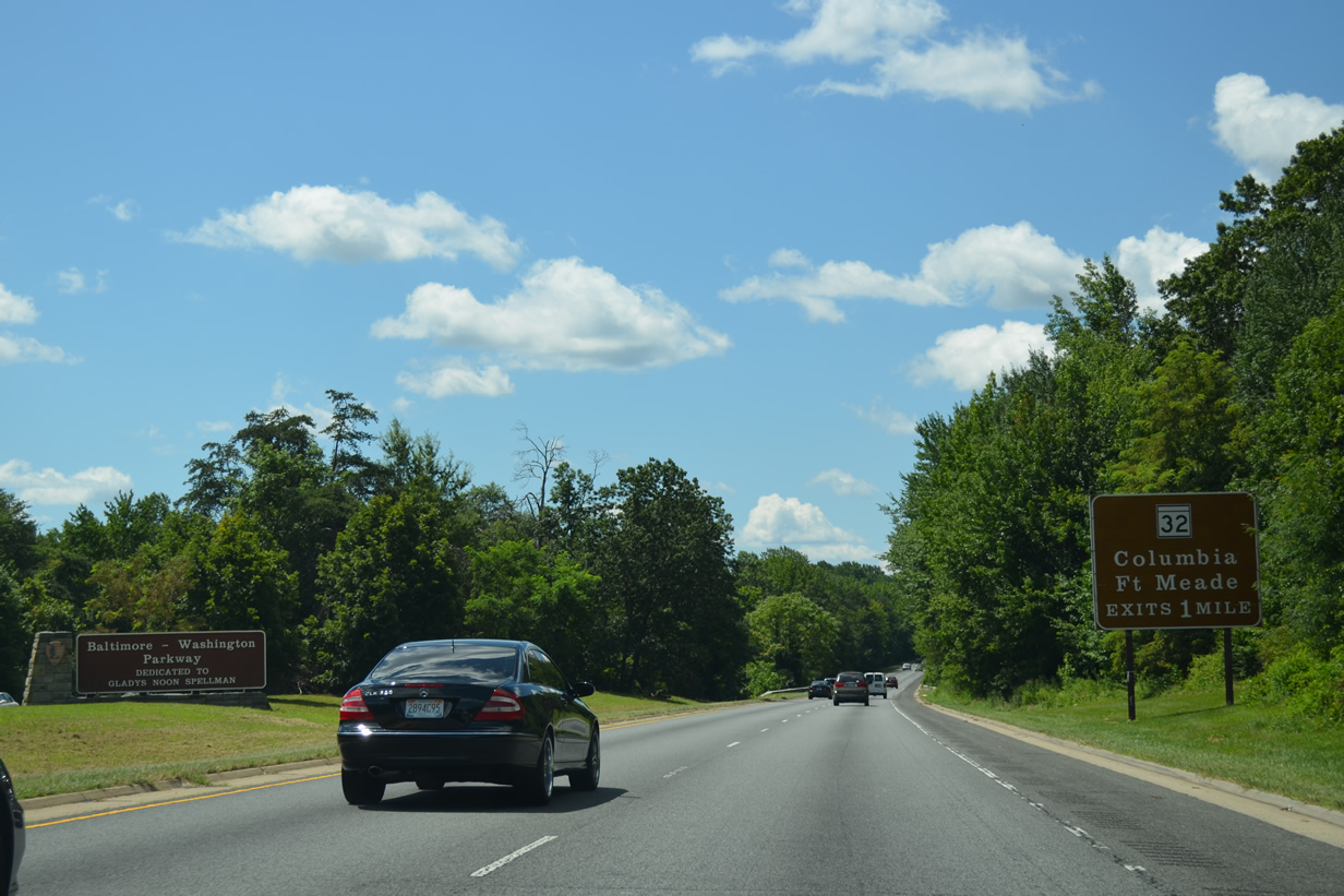
| This National Park Service sign welcomes visitors to the Baltimore-Washington Parkway. Signage used along the National Park Service maintained roadway uses Clarendon font, the same as used in other National Park areas. 08/04/13 |
|
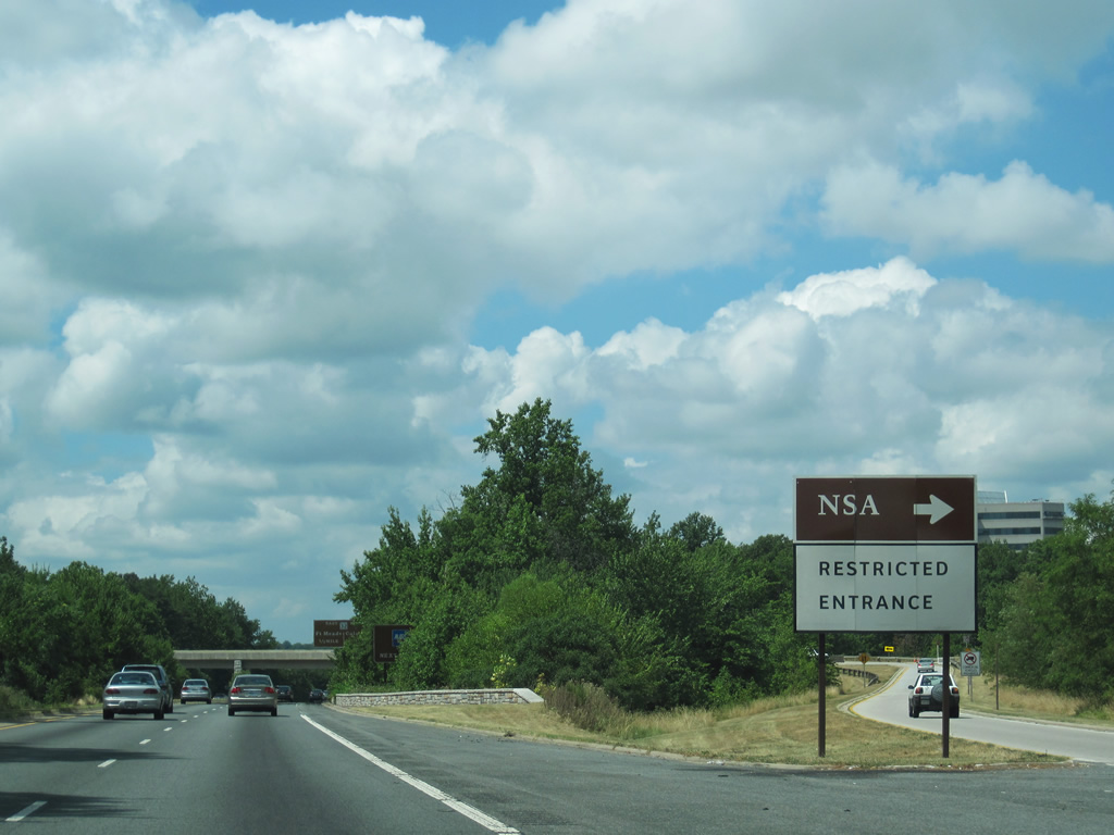
| A dedicated, restricted exit is in place for employees of the NSA (National Security Agency). 08/04/13 |
|
| Southbound Baltimore-Washington Parkway (Route 295) reaches the exit for the NSA, a wye interchange with Connector Road south at Technology Drive. Motorists bound for Technology Drive must use the MD 32 westbound off-ramp in one quarter mile. 08/04/13 |
|
| The restricted off-ramp to the NSA at Fort Meade departs Baltimore-Washington Parkway southbound. Commercial vehicles are prohibited from using the exit. 07/09/10 |
|
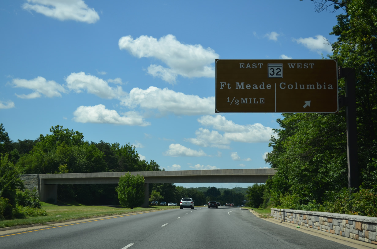
| Leaving immediately after the NSA exit is the westbound ramp to MD 32 to Savage and Columbia. The exit also connects with Guilford Road at National Business Parkway. 08/04/13 |
|
| The exit to MD-32 west also connects with Guilford Road at National Business Parkway. 08/04/13 |
|
| National Business Parkway extends Guilford Road northeast to a large business park. Guilford Road parallels MD-32 west as the former alignment of the state route. 08/04/13 |
|
| Southbound Baltimore-Washington Parkway (Route 295) reaches the loop ramp to MD 32 southeast to Fort Meade, Odenton, and Annapolis. The MD 32 freeway ends at Interstate 97 and MD 3 by Millersville. 07/09/10 |
|
| The next exit along southbound Baltimore-Washington Parkway (Route 295) is the six-ramp parclo interchange with MD 198 (Laurel-Fort Meade Road). 07/09/10 |
|
| MD 198 heads east to Fort Meade and west to Laurel, where it meets U.S. 1. The state route totals 12.98 miles between MD 650 at Browns Corner and MD 32. 07/09/10 |
|
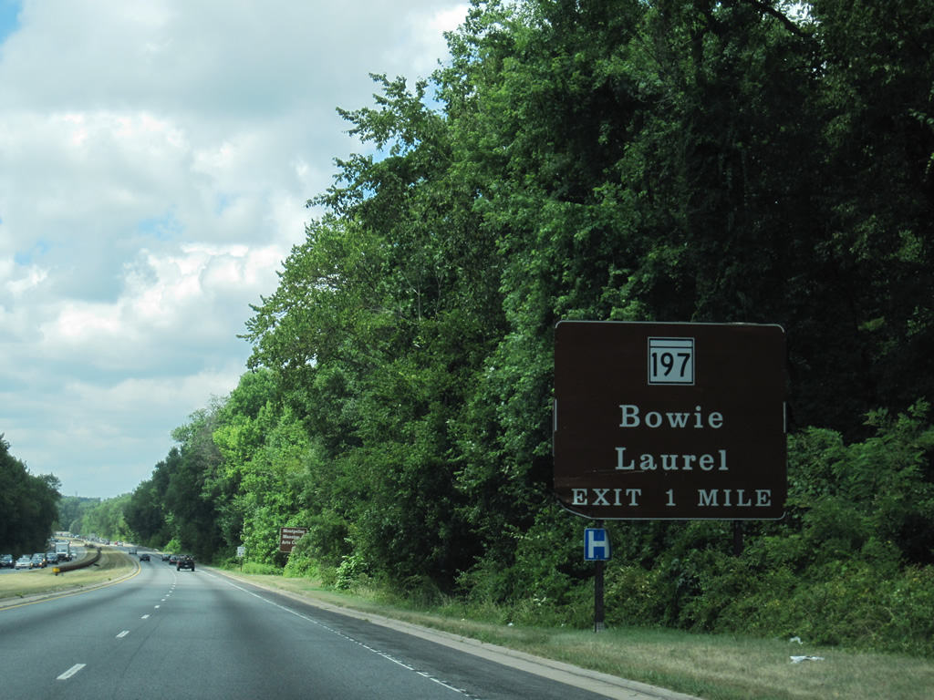
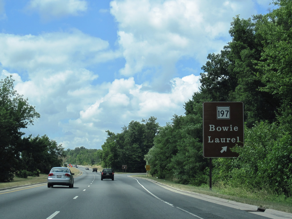
| Southbound drivers span the Patuxent River into Prince Georges County on the one mile approach to MD 197 (Laurel Bowie Road) and Montpelier. 07/09/10 |
|
| Southbound Baltimore-Washington Parkway (Route 295) reaches the parclo interchange with MD 197. MD 197 heads north to Laurel and southeast to Bowie (where it meets U.S. 301 south and U.S. 50/Interstate 595). 07/09/10 |
|
| Continuing south one half mile to the diamond interchange with Powder Mill Road within the Beltsville Agricultural Research Center. 07/09/10 |
|
| Southbound Baltimore-Washington Parkway (Route 295) reaches the exit for Powder Mill Road, which heads west to Beltsville and east to MD 197. 07/09/10 |
|
| A trumpet interchange connects the Baltimore-Washington Parkway with an access road leading to the Goddard Space Flight Center. This exit is restricted to employees at the facility. Public access to the site follows via MD 193 (Greenbelt Road) east. 07/09/10 |
|
| MD 193 (Greenbelt Road) crosses paths with Baltimore-Washington Parkway at a folded diamond interchange with Southway in Greenbelt. 06/07/04 |
|
| Southbound travelers immediately enter a cloverleaf interchange with the Capital Beltway after MD 198. 07/09/10 |
|
| MD 193 west leads to Greenbelt Park from southbound Baltimore-Washington Parkway (Route 295). Camping and hiking are among the many activities at Greenbelt Park. 06/07/04 |
|
| I-95/495 north follow the Capital Beltway's outer loop toward Silver Spring; Interstate 95 exits the beltway a few miles west of here and heads north toward Baltimore. 07/09/10 |
|
| The MD 198 (Greenbelt Road) off-ramp leaves Baltimore-Washington Parkway south. Drivers taking this ramp meet Southway north of its intersection with Greenbelt Road. MD 198 constitutes a 26.15 mile suburban arc from Kensington southeast to Oak Grove. 06/07/04 |
|
| Motorists bound for I-95/495 north to Silver Spring leave Baltimore-Washington Parkway south. Interstate 495 continues west from College Park to Interstate 270 near Rockville and south to Tysons Corner, Virginia. 07/09/10 |
|
| Southbound Baltimore-Washington Parkway (Route 295) passes over the Capital Beltway and sees the loop ramp onto I-95/495 south. The beltway continues from Greenbelt to Glenarden, Andres Air Force Base and across the Woodrow Wilson Bridge to Alexandria. Interstate 95 eventually meets Richmond, though Baltimore-Washington Parkway south to D.C. 295 and Interstate 295 provides a more direct route for long distance travelers over taking the beltway. 07/09/10 |
|
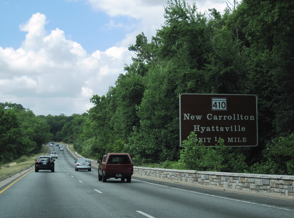
| Baltimore-Washington Parkway travels through Greenbelt Park between the beltway and Good Luck Road. A diamond interchange follows with MD 410 (Riverdale Road) east of Riverdale Park. 07/09/10 |
|
| Use Riverdale Road east from MD 410 (Veterans Parkway) to reach New Carrolltonand Veterans Parway south to Glenarden. MD 410 travels the East-West Highway from Riverdale Park to Hyattsville and Takoma Park. 07/09/10 |
|
| This picture shows a view of the MD 410 shield placed at the bottom of the exit ramp from southbound Baltimore-Washington Parkway (Route 295) as it approaches the traffic signal with MD 410. 06/07/04 |
|
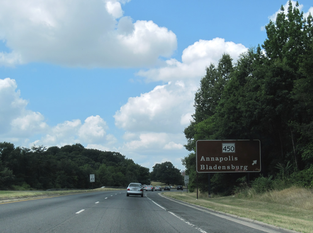
| MD 450 (Annapolis Road) meets Baltimore-Washington Parkway southbound at a parclo interchange between Bladensburg and Landhover Hills. 12/26/06 |
|
| Southbound B-W Parkway at the MD 450 (Annapolis Road) off-ramp. MD 450 represents the old alignment of U.S. 50 eastward from U.S. 1 Alternate (Bladensburg Road) to Annapolis. The state route travels 30.42 miles. 07/09/10 |
|
| MD 202 stems eastward from MD 450 in Bladensburg to meet Baltimore-Washington Parkway at Cheverly. 07/09/10 |
|
| MD 202 consists of a 13.92 mile route between Bladensburg and MD 725 at Upper Marlboro. Landover Road carries the state route from Annapolis Road eastward to Kentland and Landover. 07/09/10 |
|
| The final exit along southbound Baltimore-Washington Parkway is U.S. 50. U.S. 50 travels along a freeway east to Annapolis and west to New York Avenue toward Downtown Washington. Beyond here, the Parkway merges with MD 201 (Kenilworth Avenue) and enters the District of Columbia. 07/09/10 |
|
| Directional ramps carry drivers onto U.S. 50 west to New York Avenue in Washington, DC. U.S. 50 east ventures to Cheverly and I-95/495 at Glenarden. Overall the route links Ocean City, Maryland with Sacramento, California. 07/09/10 |
|
| MD 201 (Kenilworth Avenue) overtakes the National Park Service maintained Baltimore-Washington Parkway. Sign standards revert to MDSHA specifications as the state route nears the loop ramp onto U.S. 50 east. Richmond was signed as a second control city for U.S. 50 east originally but removed by 2010. 07/09/10 |
|
| U.S. 50 upgrades to Interstate 595 east of the Capital Beltway to MD 70 at Annapolis. This Interstate designation is not signed however. 12/26/06 |
|
| Nearly a right-turn is required to make the connection to U.S. 50 (John Hanson Highway) east from MD 201 (Kenilworth Avenue) south. 08/04/13 |
|
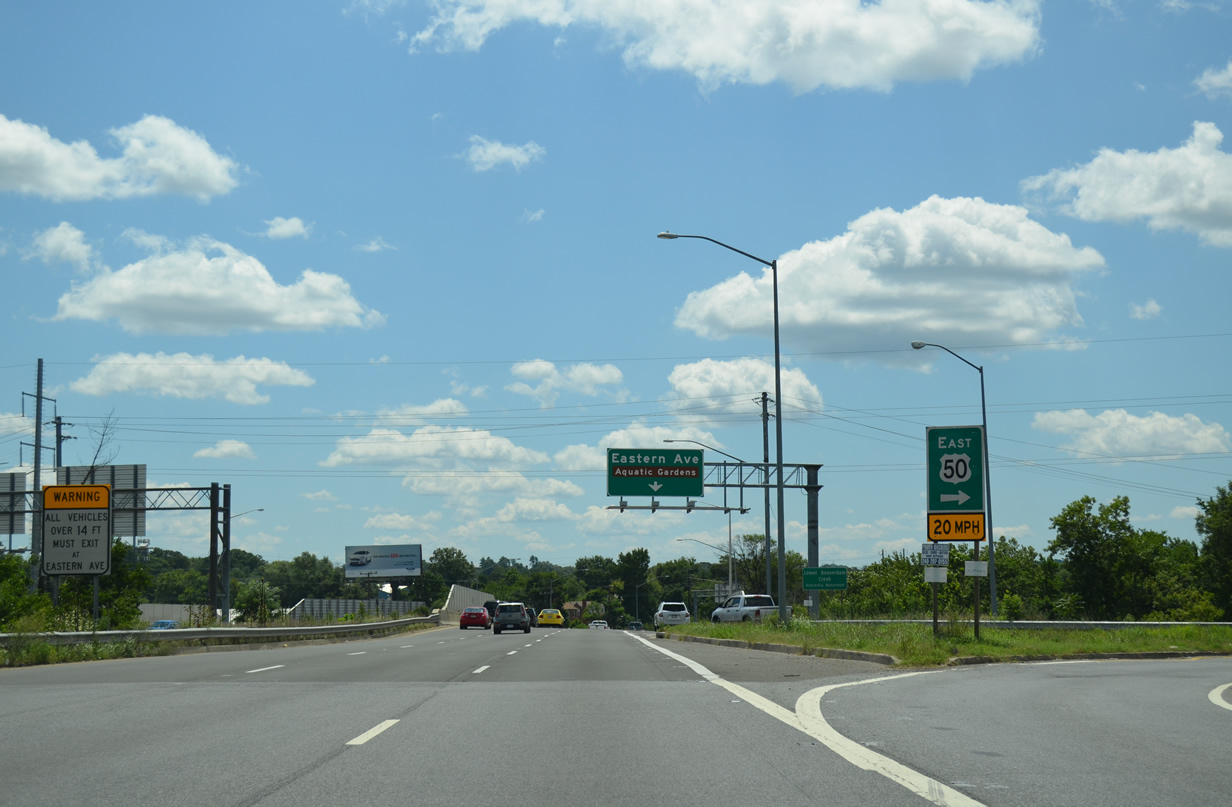
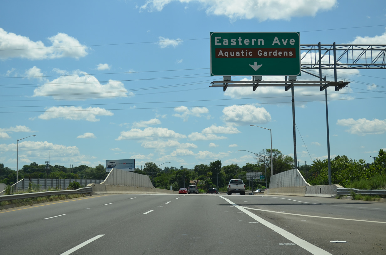
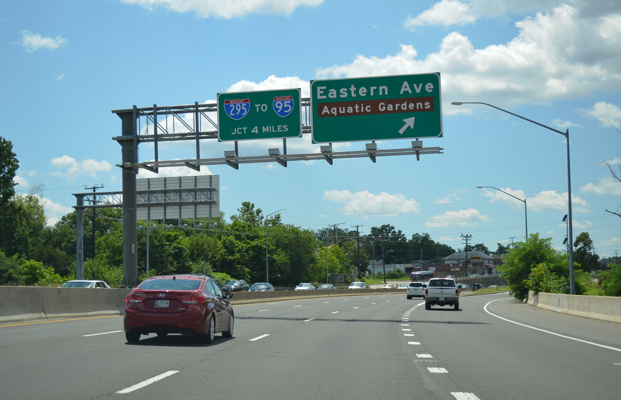
| MD 201 continues a short distance to the half diamond interchange with Eastern Avenue at the District of Columbia line. 08/04/13 |
|
| Eastern Avenue stems southeast from MD 201 along the D.C. border to MD 704 (Martin Luther King, Jr. Highway) at Seat Pleasant. Douglas Street leads west from the Kenilworth Avenue frontage road to Kenilworth Aquatic Gardens. 08/04/13 |
|
| District of Columbia Route 295 continues Kenilworth Avenue south four miles to Interstate 295. 07/09/10 |
Page Updated 06-05-2014.