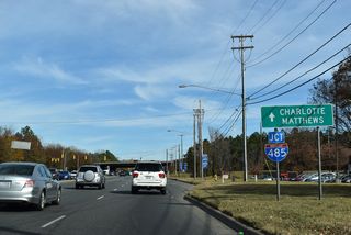
Wholly within Mecklenburg County, NC 51 is an urban route stretching 22.21 miles east from the South Carolina border at Pineville to NC 24/27 (Albemarle Road) in Mint Hill. NC 51 (Main Street) extends east from S.C. 51 north of Fort Mill along Main Street through the town of Pineville. Following Pineville-Matthews Road, NC 51 connects Downtown Pineville with Interstate 485 by Carolina Place mall.
Pineville-Matthews Road constitutes a heavily developed commercial arterial east from I-485 at Exit 64 to Carmel and McAlpine Creek. NC 51 continues east between an array of subdivisions to William R. Davie Regional Park, Cedarwood Country Club golf course and The Arboretum area at NC 16 (Providence Road).
NC 51 straddles the Matthews town line east to Courtney Lane. Passing north of the Matthews town center, NC 51 expands from a five lane boulevard into a four lane, divided arterial along Matthews Township Parkway. The state route converges with U.S. 74 (Independence Boulevard at a folded diamond interchange sandwiched between big box retail.
Overtaking Matthews-Mint Hill Road, NC 51 turns northward ahead of Purser-Hulsey Park and the Mint Hill town line at Idlewild Road (SR 3143). NC 51 passes through the Mint Hill business district ahead of Penny Place Lane (SR 5224), where the route transitions onto Blair Road. NC 218 (Fairview Road) stems east from NC 51 at the succeeding intersection to Fairview while Blair Road proceeds northeast to meet I-485 at Exit 43 and NC 24/27 along the northern Mint Hill town limits.
 North
North
NC 51 (Rock Hill-Pineville Road) enters the city of Pineville ahead of the McCullough development.
11/20/21

Reassurance marker posted between Johnston Drive south and Church Street north in Pineville.
11/20/21

Polk Street (SR 4982) north to Pineville Road and south to Lancaster Highway was part of U.S. 521 until 1996.
11/20/21

Johnston Road meanders south to the Carmel Commons community and I-485 at the north end of U.S. 521.
11/20/21

NC 16 (Providence Road) constitutes a major urban arterial from The Arboretum south to Weddington and north to Landsdowne, Providence Park and Eastover in Charlotte.
11/20/21
 South
SouthPhoto Credits:
11/20/21, 03/11/22 by AARoads
Connect with:
Interstate 485 - Charlotte Beltway
U.S. 74
Highway 16
Highway 24
Highway 51
Page Updated 02-02-2023.


