NC 104 represents one of two state routes leading northeast from the city of Mount Airy to Patrick County, Virginia. Measuring 4.83 miles in length, NC 104 originates east of Downtown Mount Airy along Riverside Drive from NC 103 (E Pine Street). Arcing northeast from Riverside Park along the Ararat River, NC 104 serves a number of industrial businesses and residential streets en route to Sulphur Springs.
NC 104 north becomes Virginia Route 773 southwest of Ararat. SR 773 runs 12.23 miles east along southern fringes of the Blue Ridge Mountains to Carters Mill, Meadowfield near Simmons Mountain and SR 103 at Claudville.
|
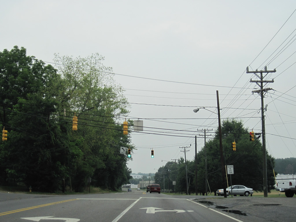
| The lone traffic light along NC 104 east is at Linville Road. Linville Road (SR 1727) runs 1.48 miles east to NC 103 (Pine Street) at Flat Rock and west to N Main Street in Mt. Airy. 07/09/10 |
|
| NC 104 transitions to Virginia Route 773 (Ararat Highway) in a rural area north of Sulphur Springs. SR 773 winds eastward to Ararat, Carters Mill and Virginia Route 103 at Claudville. 07/09/10 |
|
| SR 773 west from Patrick County, Virginia transitions into NC 104 into Surry County. 07/09/10 |
|
| The lone shield posted for NC 104 westbound stands between Virginia Line Road and a bridge across the Ararat River. 07/09/10 |
|
| South of Sulphur Springs, NC 104 (Riverside Drive) enters the city limits of Mt. Airy at Mount View Drive (SR 1716). 07/09/10 |
|
| Linville Road (SR 1727) meets Riverside Drive at this signalized intersection. The secondary route serves a large quarry nearby. 07/09/10 |
|
| NC 104 (Riverside Drive) ends at NC 103 (Pine Street). NC 103 concludes 0.23 miles to the west at U.S. 52 Business/NC 89 (Renfro Street). Eastward NC 103 travels 8.29 miles to the Virginia state line, becoming SR 103 en route to Claudville and SR 8, south of Stuart. 07/09/10 |
|
| Independence Boulevard (SR 1670) links U.S. 52 Business and NC 89 at Renfro Street with NC 104 (Riverside Drive), 0.27 miles to the east. 07/09/10 |
|
| NC 104 ends at NC 103, 0.18 miles south of Independence Boulevard by Riverside Park. This movement connects NC 89 with Pine Street east to Flat Rock. 07/09/10 |
Page Updated 11-23-2021.