|
| Toll 183A leaves the four-level interchange with SH 45 N and approaches the Avery Ranch Road off-ramp. U.S. 183 follows the Research Boulevard freeway north through Austin and splits with Toll 183A ahead of the Lakeline toll collection point. Avery Ranch Road heads west from the Toll 183A frontage road system to U.S. 183 (Bell Boulevard) and Riviera Drive in a nearby subdivision and east to the Avery Ranch community. 09/28/07 |
|
| Ramps converge near the Lakeline Boulevard under crossing. U.S. 183 traffic departs Toll 183A via the northbound frontage road before Lakeline Boulevard. U.S. 183 veers away from the toll road along Bell Boulevard to Twin Lake Park and the central part of the suburb. Lakeline Boulevard travels east-west between North Lake Creek Parkway and the Lakeline Mall area. 09/28/07 |
|
| Transitioning to the tolled portion of freeway, Toll 183A continues north to within one half mile of the Brushy Creek and Cypress Creek Road off-ramp. Brushy Creek Road travels east from Cypress Creek Road to Brushy Creek Recreation and Lake Parks. The road derives its name from the parallel Brushy Creek. 09/28/07 |
|
| Homes from the sprawling Forest Oaks subdivision line the horizon northeast of Toll 183A at Brushy Creek Road. Forest Oaks spreads across a huge swath of land east of the toll road and north of Brushy Creek Road. 09/28/07 |
|
| Northbound at the ramp departure to Brushy Creek Road east to FM 743 (Parmer Lane) and Cypress Creek Road west to U.S. 183 (Bell Boulevard). Cypress Creek Road continues southwest from Bell Boulevard through growing suburban areas to Anderson Mill Road on the city line. 09/28/07 |
|
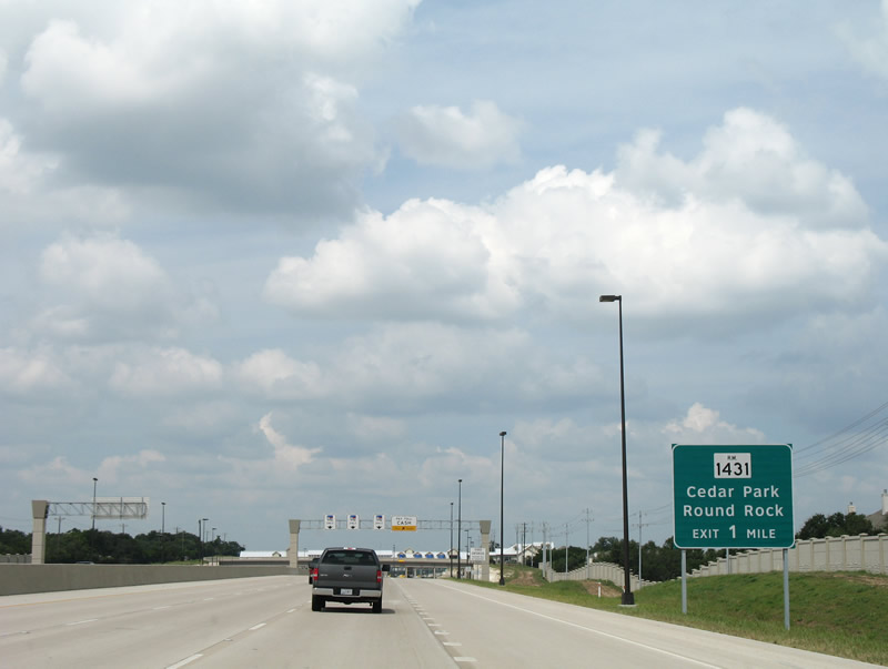
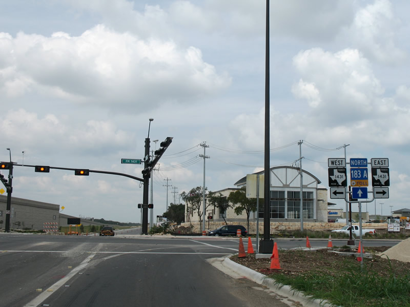
| Next in line for northbound drivers on Toll 183A is the Park Street Main Line toll gantry. RM 1431 (Whitestone Boulevard) meets the toll road beyond the toll collection point. 09/28/07 |
|
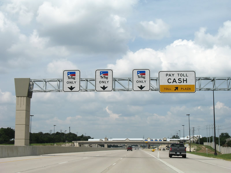
| Prior to December 1, 2008, drivers paying tolls with cash separated from the Toll 183A mainline to a set of toll booths. The booths no longer stand and concrete barriers block the former cash lanes now. 09/28/07 |
|
| RM 1431 (Whitestone Boulevard) joins the suburbs of Cedar Park to the west with Round Rock to the east. RM 1431 straddles the northern reaches of Round Rock at Mayfield Park to its east end at IH 35. 09/28/07 |
|
| Traveling north through the Toll 183A toll plaza at Forest Oaks. East Park Street passes over the toll road ahead of the collection point. Note the efforts made to blend the toll road architecturally into the surrounding area. 09/28/07 |
|
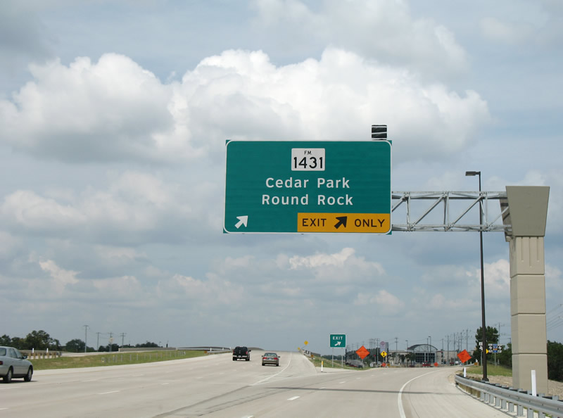
| The off-ramp for RM 1431 quickly departs Toll 183A northbound beyond the Forest Oaks toll plaza. Whitestone Boulevard carries the RM Road throughout Cedar Park. 09/28/07 |
|
| Two lanes leave Toll 183A northbound for RM 1431 (Whitestone Boulevard). RM 1431 travels west from Round Rock to Nameless, Village of Lago Vista, Travis Peak, Smithwick and Marble Falls (U.S. 281) among other points. The road ends at SH 261 and Lake Buchanan. 09/28/07 |
|
| Toll 183A and RM 1431 shield assembly posted along the northbound ramp to Whitestone Boulevard. The Toll 183A trailblazer stands along the ramp likely for motorists departing the route prematurely from the toll plaza. 09/28/07 |
|
| Shield assembly posted at the end of the RM 1431 off-ramp. Toll 183A ended here at this time. 09/28/07 |
Page Updated 10-29-2007.