A rural highway through Presidio, Jeff Davis and Reeves Counties in West Texas, SH 17 travels northeasterly from U.S. 67 and 90 in Marfa to Pecos. SH 17 totals 92.12 miles per the TxDOT Highway Designation File.
Texas 17 heads 21 miles north from Marfa to Fort Davis and Fort Davis National Historic Site. A winding course continues the route north 32 miles through the Barrilla Mountains to Toyahvale. Once in the small city of Balmorhea, SH 17 combines with Business Loop I-10 for a 2.9 mile concurrency east to Interstate 10. SH 17 then joins the freeway east to the subsequent interchange, where it branches northeast to Saragosa and bee lines 23 miles north to IH 20. The route concludes at Business Loop I-20 (West 3rd Street) on the west side of Pecos.
|
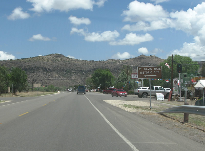
| SH 17 and SH 118 overlap for 1.7 miles through Fort Davis. The Fort Davis National Historic Site is along SH 17/118 within the unincorporated town. The fort is a very well preserved example of 19th century fortifications against Mexican incursions and Native Americans. 07/04/08 |
|
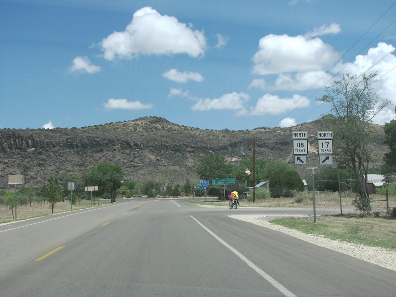
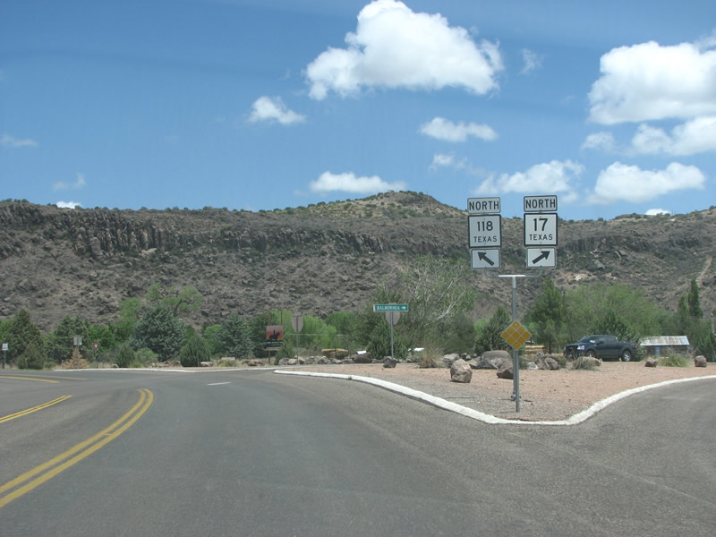
| Just north of Fort Davis, the state highways split. 07/04/08 |
|
| Two busy attractions, Davis Mountains State Park and the McDonald Observatory sit along SH 118 north of the town. 07/04/08 |
|
| SH 118 and SH 17 both eventually make their way to IH 10, and the control points here are located along the freeway. There is no indication of IH 10 in Fort Davis however. 07/04/08 |
|
| With Scobee Mountain in the background, SH 17 and SH 118 split. 07/04/08 |
|
| SH 17 northbound leaves Fort Davis and heads toward IH 10. This is the main route from the county seat of Jeff Davis County to IH 10 eastbound. As it leaves town, it follows Limpia Creek. 07/05/08 |
|
| SH 17 follows the creek into Limpia Canyon, as it begins to climb along the eastern edges of the Davis Mountains. Hills here, the much larger mountains sit about 20 miles to the west. 07/05/08 |
|
| An SH 17 reassurance marker just north of Limpia Canyon. 07/05/08 |
|
| Wild Rose Pass takes SH 17 over the hump of the eastern side of the Davis Mountains. Legend has it that in 1859 a band of Mescalero Apaches robbed and killed the driver of a mail coach running through the pass. The Apaches became so enamored with the fanciful illustrations in the captured newspapers and magazines that they allowed themselves to be caught by pursuing soliders. However, the soldiers killed 14 of the Indians and they forever believed afterwards that pictures were bad luck and avoided them at all costs. The pass has an elevation of about 4,300 feet, which is 900 feet lower than the surrounding peaks. 07/05/08 |
|
| Star Mountain forms the backdrop along this stretch stretch of SH 17 as it continues north from Wild Rose Pass. The mountain is more of a plateau that rises to an elevation of 6,344 feet. Its slopes support populations of ponderosa pine, Arizona Cypress, Aspens and Douglas fir trees. 07/05/08 |
|
| The speed limit remains at 70 mph on the two lane road as passing lanes open up past the mountains. 07/05/08 |
|
| Kaiser Peak and the Cole Hills form the backdrop for SH 17 as it heads west and then north in northern Jeff Davis County. Large mountains sit to either side of SH 17, however the view ahead is generally flat. 07/05/08 |
|
| The first numbered route encountered past Fort Davis on SH 17 is Ranch Road 1832. 07/05/08 |
|
| RR 1832 is a short spur route that runs west to a campground and through several ranches. The entire route is 10.86 miles long. 07/05/08 |
|
| An SH 17 northbound reassurance marker past RR 1832. The state highway has left the mountains for good here, although several more rise along the horizon. 07/05/08 |
|
| Balmorhea, and IH 10, is only 11 miles distance. Pecos sits along IH 20, 39 miles further along the state highway. 07/05/08 |
|
| SH 17 enters the Permian Basin here as it leaves the Davis Mountains. The basin once formed the backbone of the Texas oil industry and is still an important region for energy production. Its major cities are Midland and Odessa. 07/05/08 |
|
| SH 17 enters Reeves County south of Balmorhea. The county has a population of over 13,000 and was named after Confederate Colonel George R. Reeves. The county seat is Pecos. 07/05/08 |
|
| The first stop after Fort Davis on SH 17 north is at the intersection with FM 3078. 07/05/08 |
|
| Van Horn is the control point for FM 3078 west, the city where the western end of US 90 is located. FM 3078 was formerly the route of US 290, which was truncated due to the construction of IH 10. 07/05/08 |
|
| SH 17 overtakes old U.S. 290 northeast for 7.5 miles to IH 10. Turning west here will take motorists along FM 3078 to IH 10 west and eventually to El Paso. 07/05/08 |
|
| Balmorhea only is home to around 500 people and has no discernible business activity. The city began in 1906 as a place of reliable water in the desert, due to a spring. It was named after its three developers: Balcum, Moore, and Rhea. 07/05/08 |
|
| SH 17 meets Business Loop I-10 in town, and continues overlapped with the business route as they both head northeast. FM 2903 overlaps BL 10 northwest en route to Toyah. 07/05/08 |
Page Updated 08-24-2008.