|
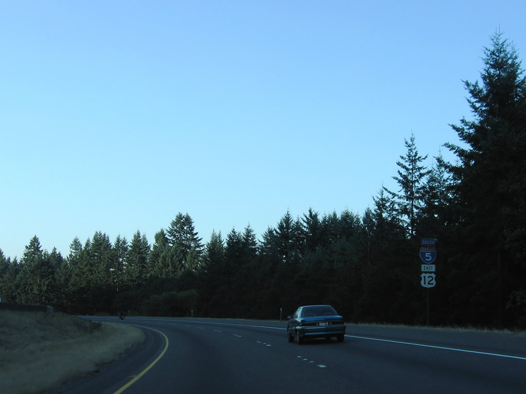
| I-5/U.S. 12 southbound reassurance markers posted at Grand Mound. Old U.S. 99 shifts to the westbound side of the freeway to the Harrison Avenue exit in Centralia. 09/02/06 |
|
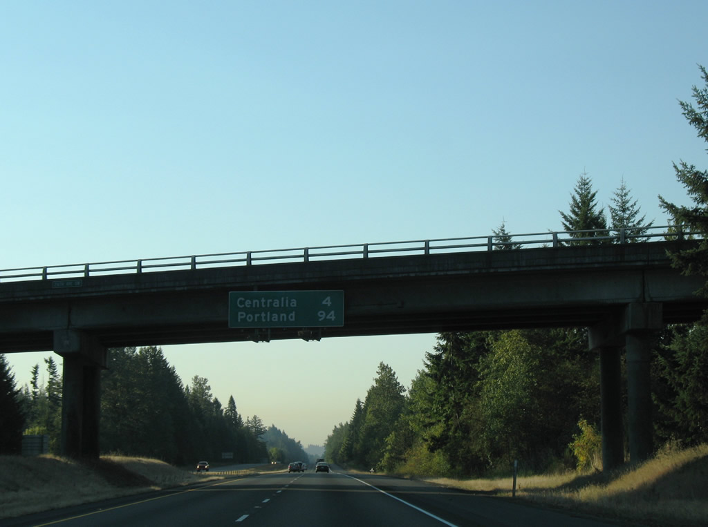
| Southbound distance sign attached to the 216th Avenue SW overpass over Interstate 5 & U.S. 12. Centralia lies four miles to the south, Portland is now less than a 100 mile drive. 09/02/06 |
|
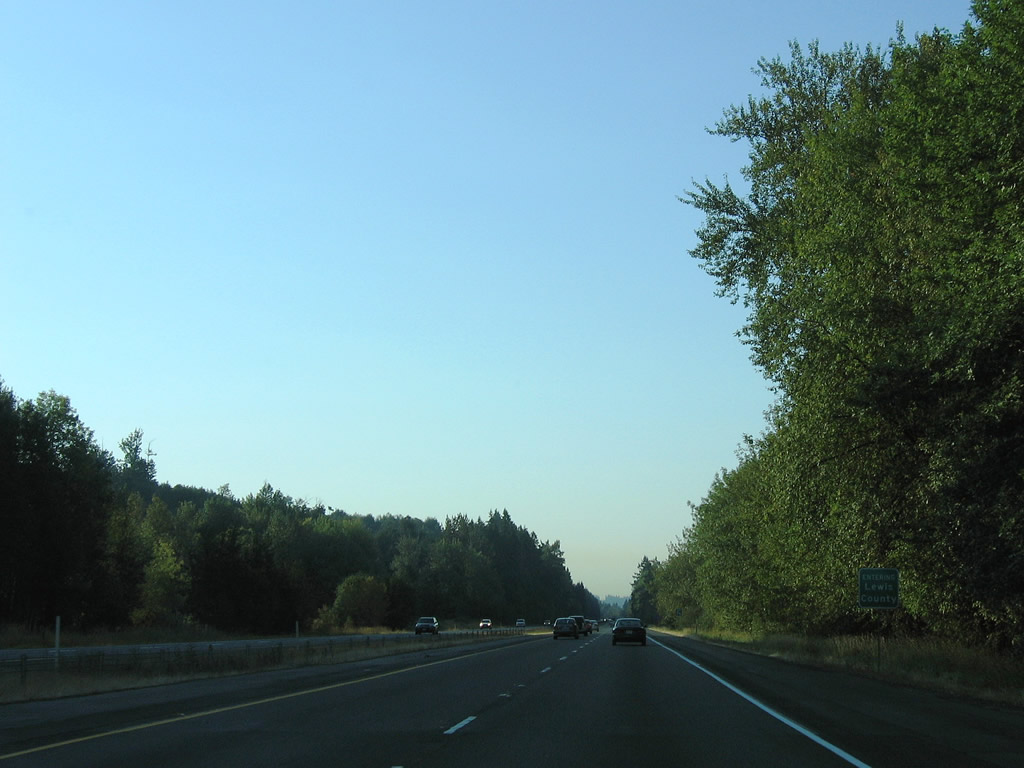
| Travelers enter Lewis County along I-5/U.S. 12 south. The freeway remains on the prairie below Davis Hill among other hills to the east. 09/02/06 |
|
| Old U.S. 99 angles southeast from the Thurston County line along Harrison Avenue through unincorporated Fords Prairie. Exit 81 consists of a diamond interchange with Harrison in the city of Centralia.
U.S. 99 shifted to the Interstate 5 freeway in the mid-1950s from Exits 79 to 102.1 09/02/06 |
|
| I-5/U.S. 12 south meet Exit 82, Harrison Avenue and Factory Outlet Way. Harrison Avenue (Old U.S. 99) continues east to become Main Street en route to the Centralia city center.
The Centralia Factory Outlets are located along Harrison Avenue on both sides of the freeway. Exit 82 points of interest include the Port of Centralia and Centralia College. 09/02/06 |
|
| Continuing south, Interstate 5 & U.S. 12 next meet the northbound beginning of SR 507 (Mellen Street). SR 507 consists of a 43.52 mile route from Centralia northeast to Tenino, Rainier, Yelm, to SR 7 south of Tacoma. 09/02/06 |
|
| Built originally for the U.S. 99 expressway, the Skookumchuck River truss bridges of Interstate 5 & U.S. 12 have been in service since 1951. 09/02/06 |
|
| I-5/U.S. 12 south travel between Plummer Lake and the Chehalis River into the diamond interchange with SR 507 (Mellon Street) at Exit 81. SR 507 follows a combination of Mellen, Alder, and Cherry Streets to a one way street couplet (Tower Avenue north / Pearl Street south). The couplet represents original U.S. 99 into the city center. 09/02/06 |
|
| Southbound motorists exit the city of Centralia and parallel the Chehalis River and flood plain. 09/02/06 |
|
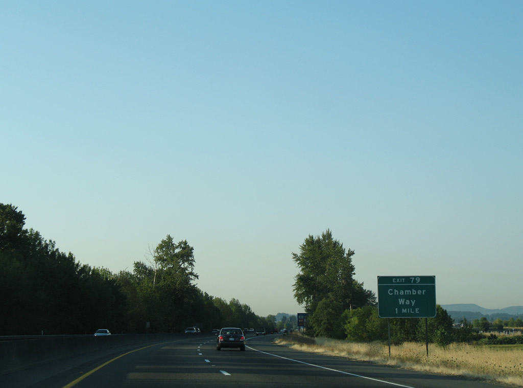
| Exit 79 (Chamber Way) is the first of three Chehalis area interchanges of I-5/U.S. 12 south. Officially named Chamber of Commerce Way for the Twin Cities Chamber of Commerce1, Chamber Way connects a big box retail center next to Chehalis-Centralia Airport (CLS), Interstate 5 & U.S. 12 and National Avenue (historic U.S. 99). 09/02/06 |
|
| I-5/U.S. 12 south connect with Chamber Way at the city of Chehalis. Historically, the original U.S. 99 expressway from Tumwater (Exit 102) south ended here. Later Chamber Way represented the northern leg of Business Loop I-5.1 Exit 79 provides access to the Chehalis city center via National Avenue south. Points of interest include the Lewis County Museum, a visitors information center, and the Fairgrounds. 09/02/06 |
|
| Main Street stems west from the Chehalis city center to become SR 6 at the diamond interchange (Exit 77) with Interstate 5 & U.S. 12. 09/02/06 |
|
| Exit 77 leaves I-5/U.S. 12 south after the West Street overpass. SR 6 takes a 51.37 mile drive west to Rainbow Falls State Park, Pe Ell, around P and E Ridge, to U.S. 101 at Raymond. 09/02/06 |
|
| An older state-named shield for Interstate 5 lies south of SR 6. Empty brackets below the sign may have held a U.S. 12 shield. 09/02/06 |
|
| Curving southeast, Interstate 5 & U.S. 12 approach the diamond interchange (Exit 76) with 13th Street in south Chehalis. 09/02/06 |
|
| 13th Street leads northeast from Exit 76 to Market Boulevard (old U.S. 99) and south as Rice Road to Stan Hedwall Park. 09/02/06 |
|
| Castle Rock is the next control city of Interstate 5 south. Vancouver joins Portland on this distance sign at the LaBree Road overpass. A diamond interchange opened at LaBree Road on June 2, 2009 as part of a project to expand Interstate 5 to six overall lanes from the new Exit 74 to Rush Road (Exit 72). 09/02/06 |
|
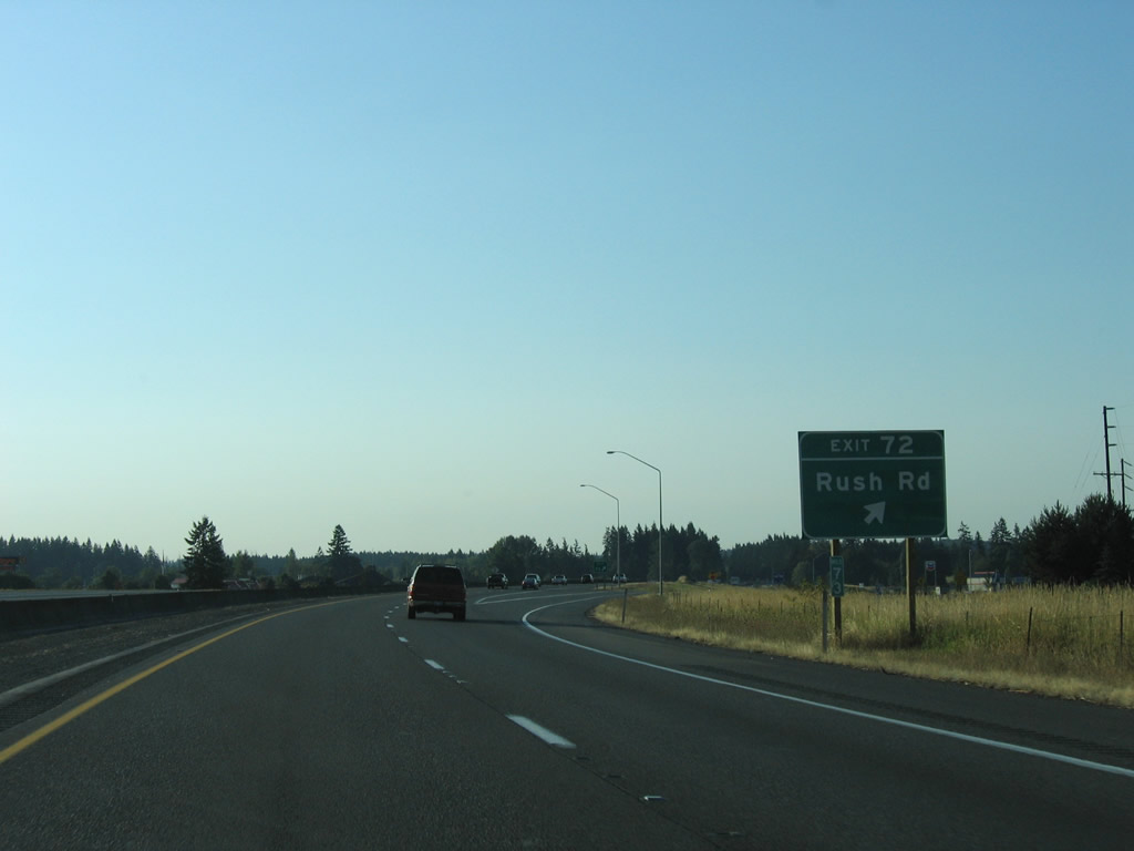
| I-5/U.S. 12 south approach the first of two Napavine exits. Rush Road travels south from Jackson Highway (Old U.S. 99) to the Exit 72 diamond interchange. 09/02/06 |
|
| Rush Road continues south from Exit 72 to become 2nd Avenue in Napavine. Napavine was served by SR 603 until 1992. SR 603 traveled between Exit 63 of Interstate 5 to SR 6 near Littell. 09/02/06 |
|
| Forest Napaville Road stems east from Stella Street in Napavine to become SR 508 at Exit 71. 09/02/06 |
|
| SR 508 stretches 32.84 miles east from Interstate 5 & U.S. 12 at Napavine to Onalaska, Cinebar, and SR 7 at Morton. 09/02/06 |
|
| The final set of shields posted along the I-5/U.S. 12 southbound overlap. 09/02/06 |
|
| U.S. 12 east parts ways with Interstate 5 south at a parclo interchange (Exit 68) west of Marys Corner. U.S. 12 resumes an eastward course, crossing the Cascade Range via White Pass east of Morton. 09/02/06 |
|
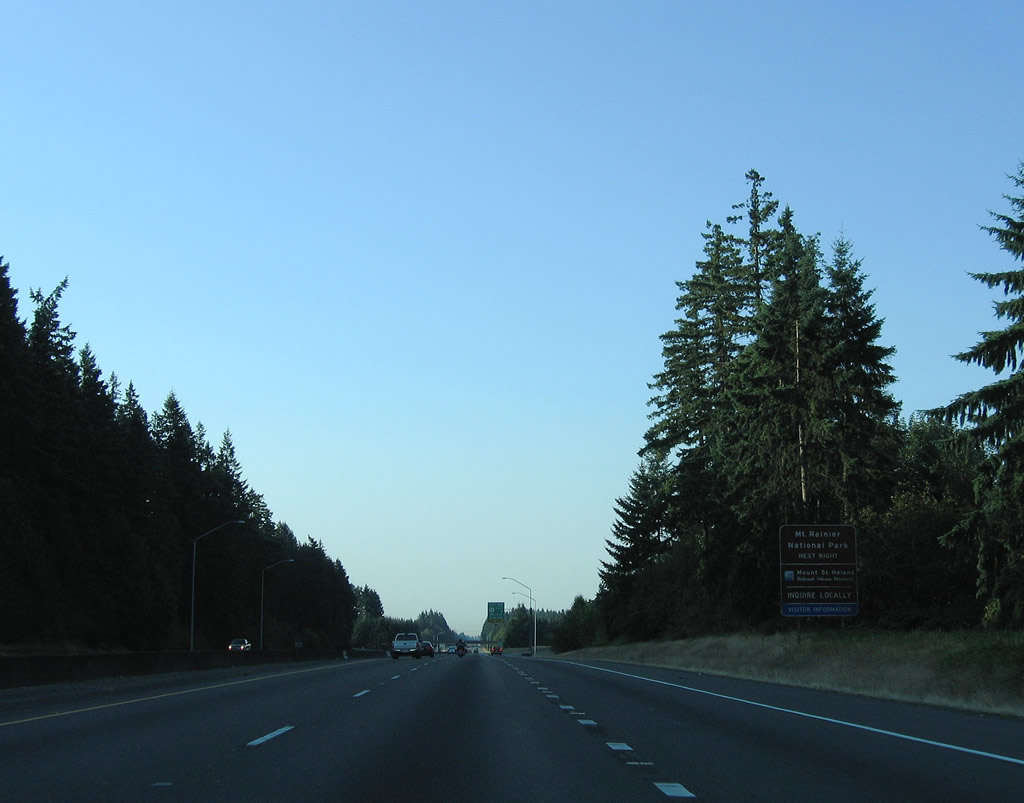
| The path of U.S. 12 takes the route north of Mount St. Helens National Volcanic Monument at Randle and just south of Mount Rainier National Park. Mount Rainier can be accessed via SR 7 on the west end, or SR 123 on the east end. Additionally U.S. 12 serves interests to Lewis & Clark State Park and reaches Mossyrock in 23 miles. 09/02/06 |
|
| Interstate 5 southbound at the ramp departure for U.S. 12 east (Exit 68). Morton is 30 miles distant; Yakima is 137. Once across the Cascade crest, U.S. 12 slowly descends into the dry side of Washington State, where annual rainfall totals are a fraction of those of the west side. U.S. 12 overtook the historic routing of U.S. 410 from near Naches east to Idaho in 1967. 09/02/06 |
|
| U.S. 12 travels an expressway southeast from Naches into the Yakima vicinity. The four lane highway sees a 60 mph speed limit and approaches a pair of steel truss bridges over the Naches River east of Powerhouse Road and Ramblers Park. 08/28/06 |
|
| The truss bridges over the Naches River were built when the expressway was still numbered as U.S. 410. The older westbound span was constructed in 1958; the eastbound span dates from 1966. 08/28/06 |
|
| Ackley Road and Clover Lane come together at the west end of the freeway portion of U.S. 12 through Yakima. Ackley Road connects with parallel Powerhouse Road adjacent to Cowiche Canyon. 08/28/06 |
|
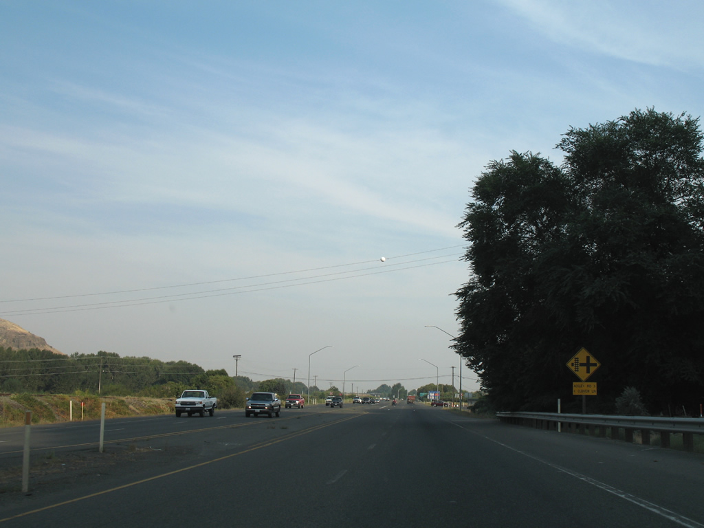
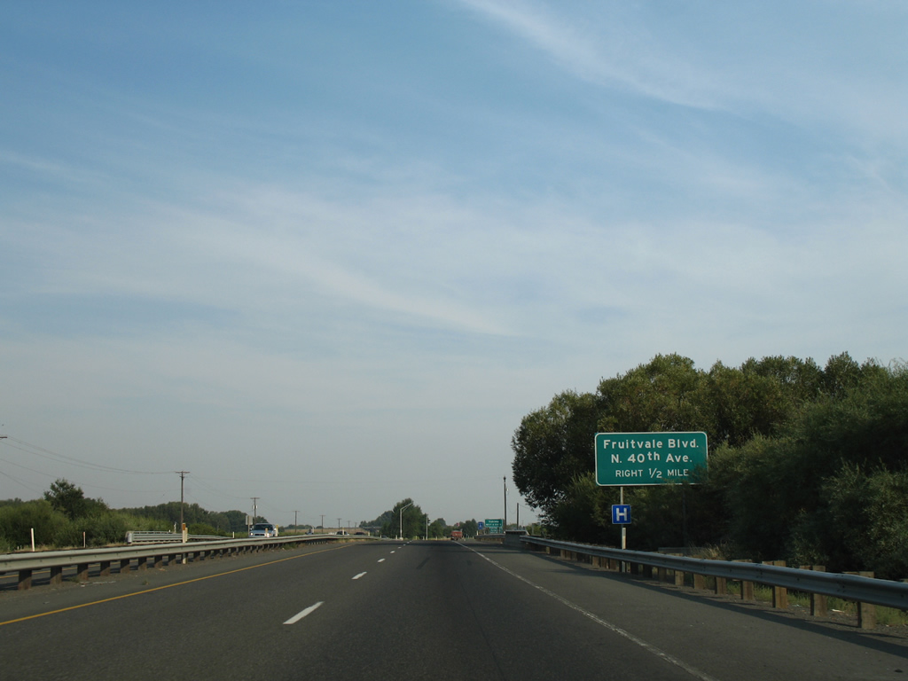
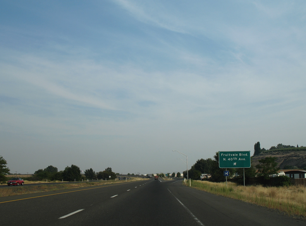
| U.S. 12 enters the city of Yakima on the half mile approach to the wye interchange with Fruitvale Boulevard east to North 40th Avenue. This is the first of six interchanges for the city when added to the I-82/U.S. 12 exits east of the city center. 08/28/06 |
|
| Fruitvale Boulevard angles southeast from the U.S. 12 freeway to North 5th Avenue. North 40th Avenue stems south from an adjacent wye interchange to Washington Avenue near Yakima Air Terminal (YKM). 08/28/06 |
|
| Eastbound travelers parallel the Naches River and man made ponds associated with the waterway to a diamond interchange with North 16th Avenue. 08/28/06 |
|
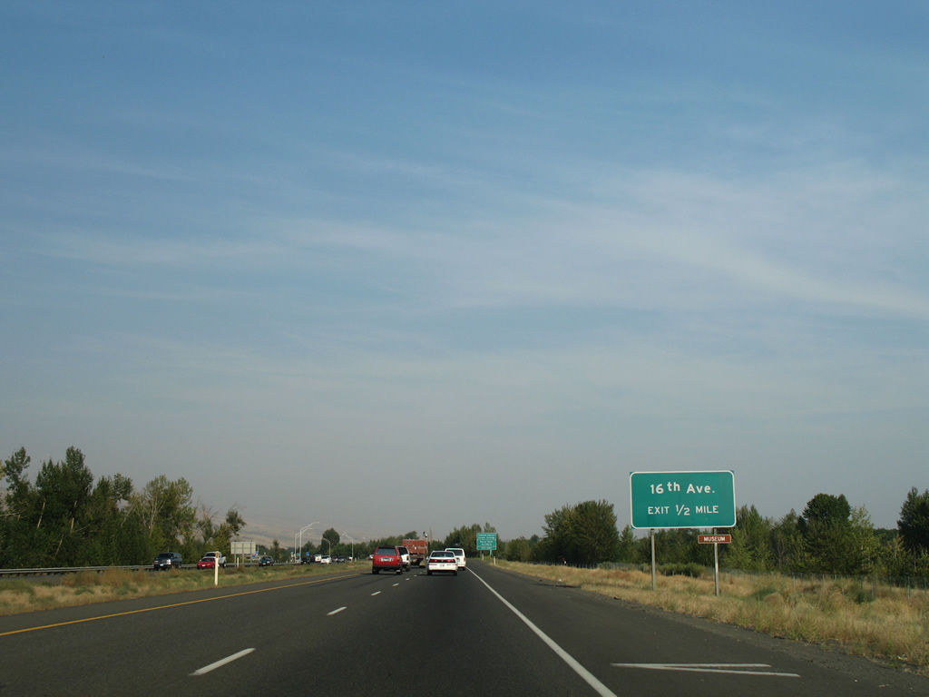
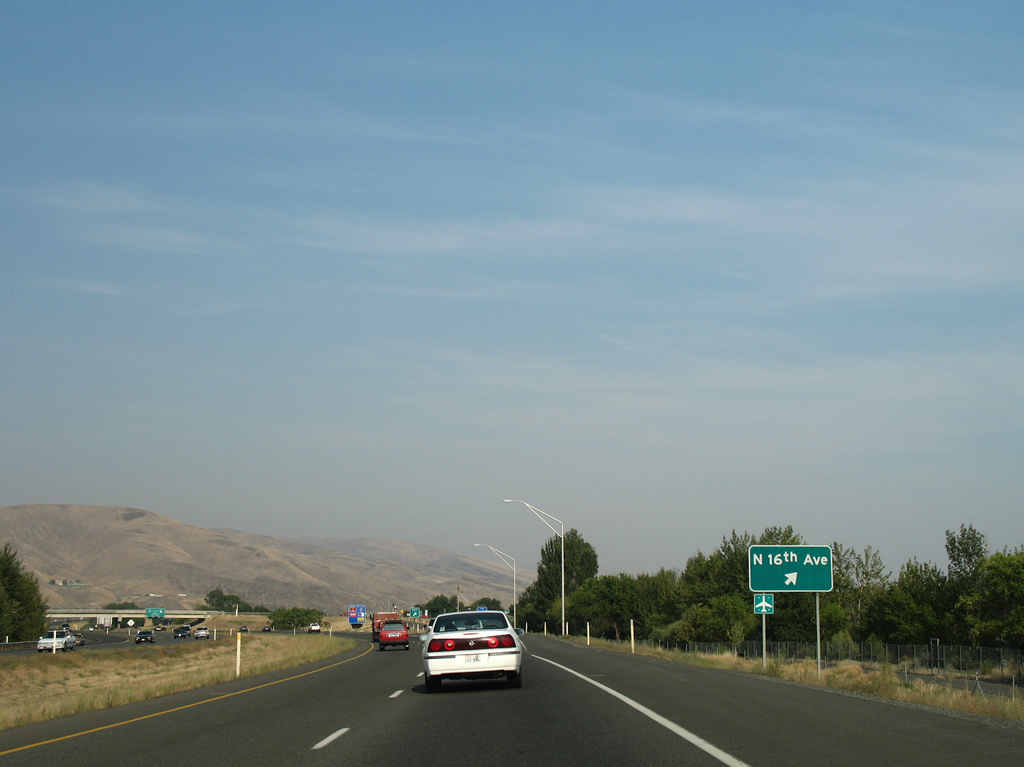
| North 16th Avenue begins at the U.S. 12 freeway and ventures south to Yakima Valley Community College and Yakima Air Terminal near Perry Technical Institute. The road south end was realigned onto a 2009-opened four lane extension of Valley Mall Boulevard. 08/28/06 |
|
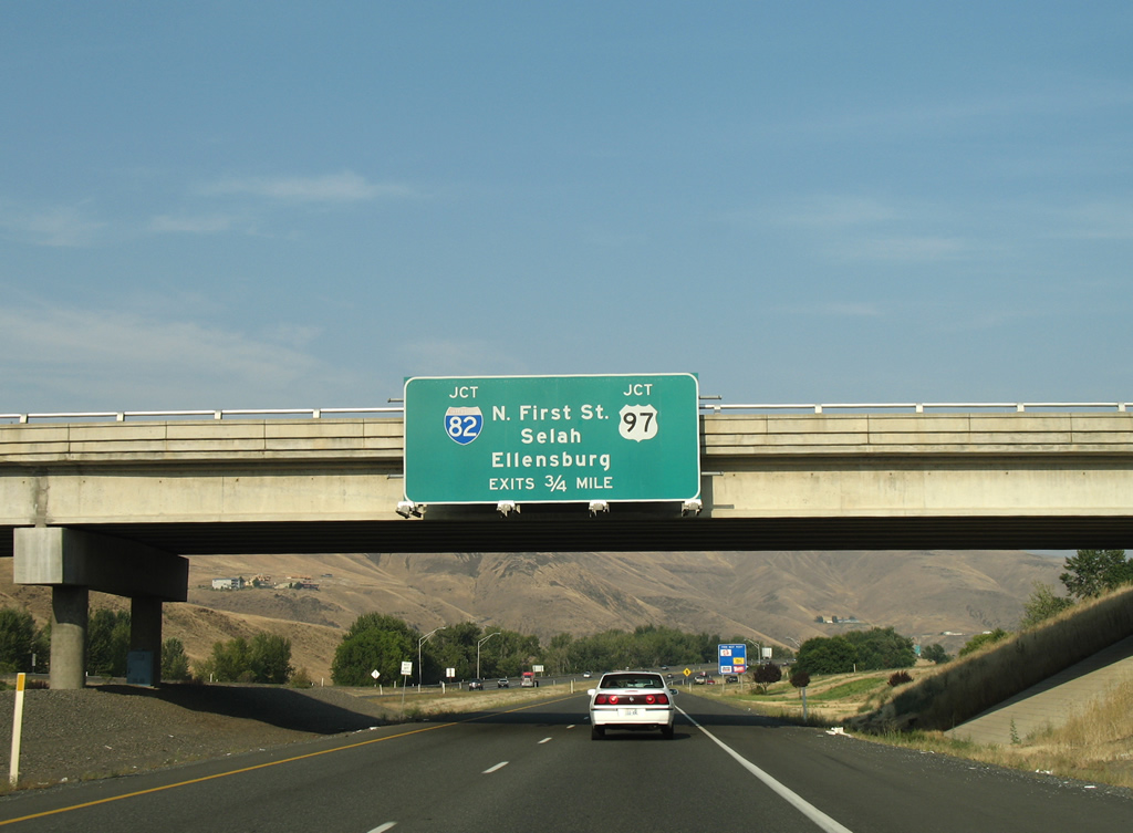
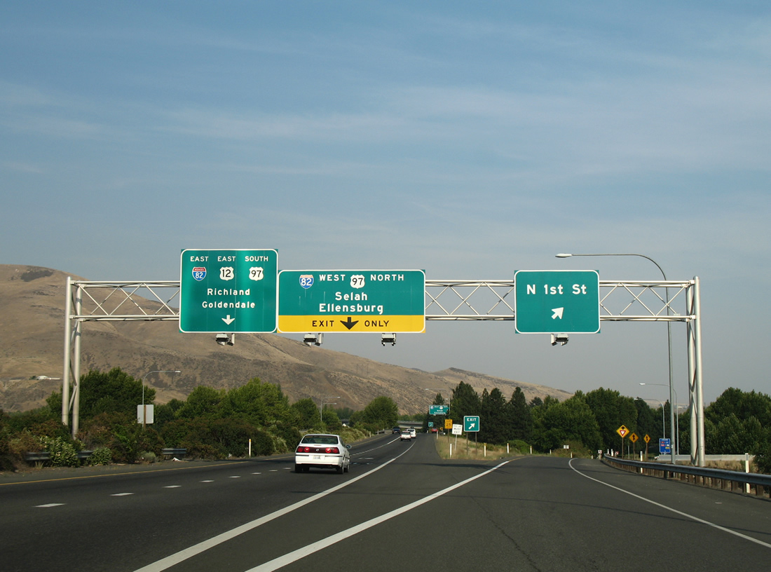
| U.S. 12 continues east 0.75 miles to merge with Interstate 82 east & U.S. 97 south to Union Gap. North 1st Street (former U.S. 97 and Business Loop I-82) ties into the exchange opposite the south end of SR 823 from Selah. 08/28/06 |
|
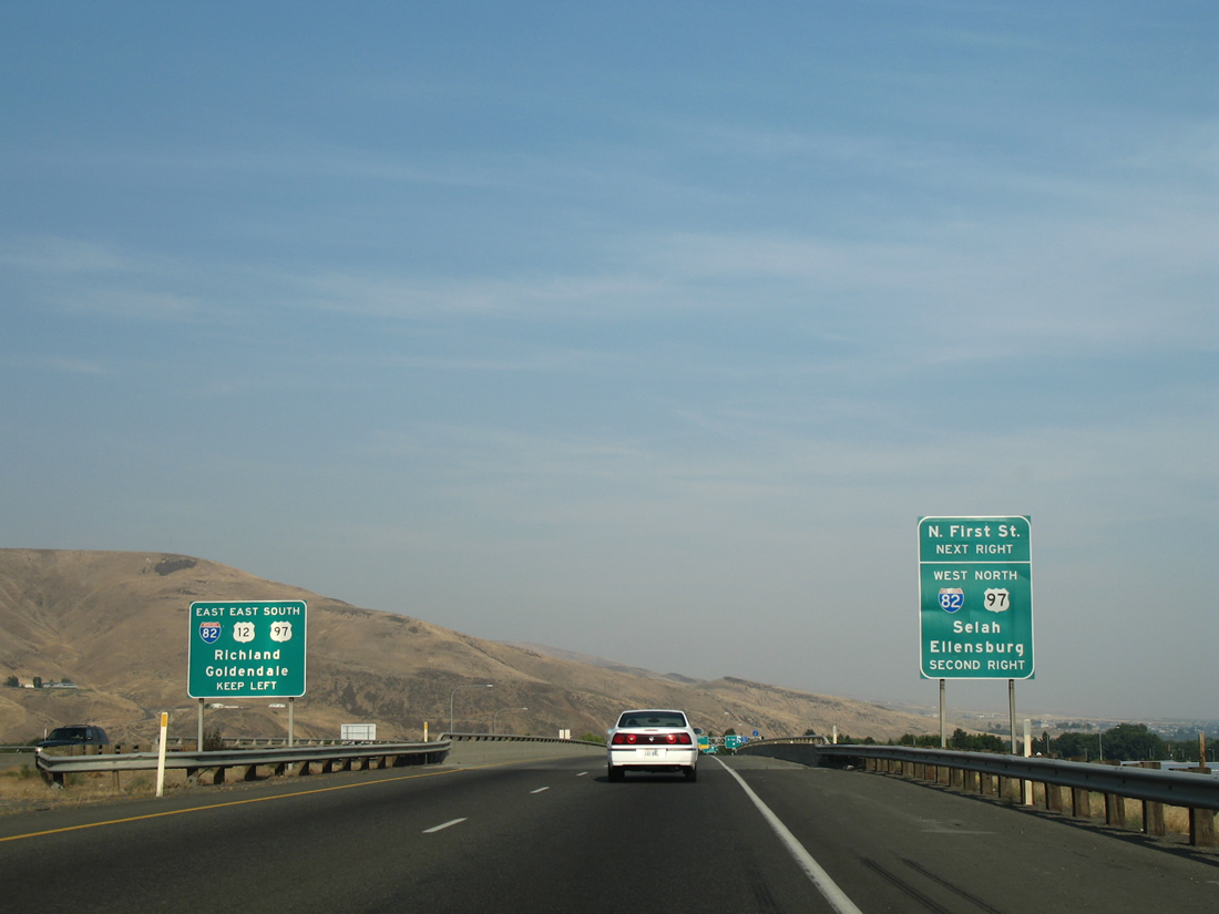
| A parclo interchange first joins the U.S. 12 freeway with North 1st Street south to the Yakima city center. Wye interchanges follow with the respective directions of I-82/U.S. 97. 08/28/06 |
|
| The ramp to North 1st Street drops down from U.S. 12 east ahead of the loop ramp onto the 1st Street ramp to Interstate 82 west & U.S. 97 north for Ellensburg. Access is not permitted to SR 823 from U.S. 12 east. 08/28/06 |
|
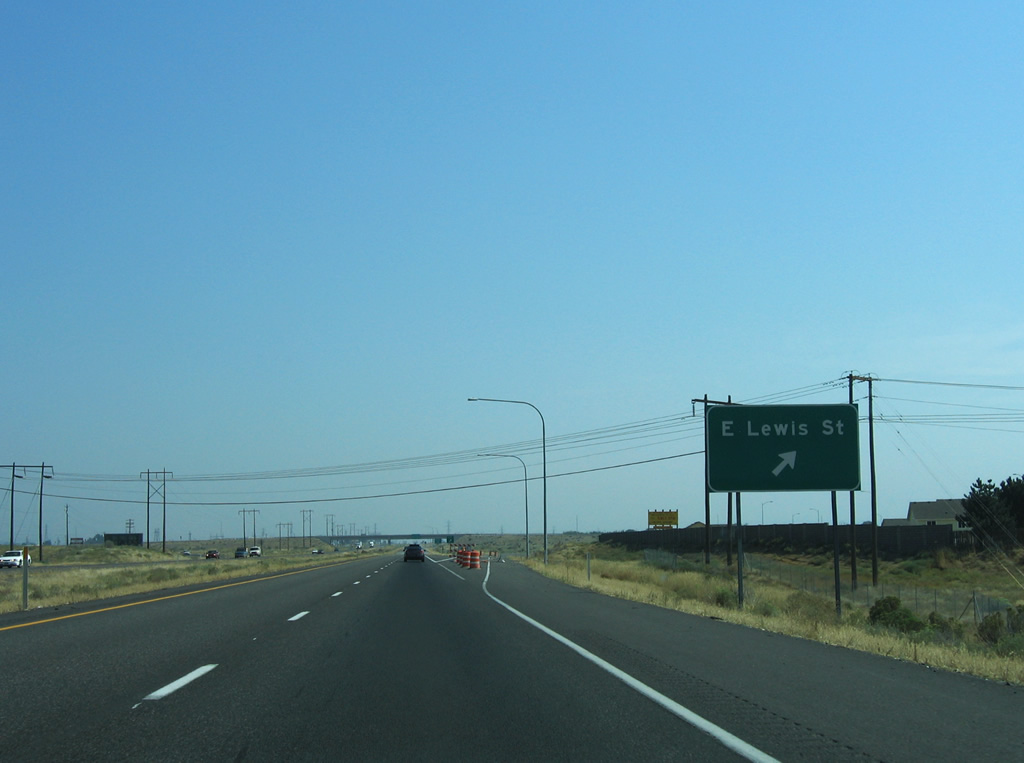
| U.S. 12 eastbound traffic parts ways with the East Lewis Street off-ramp to the Pasco city center. 08/28/06 |
|
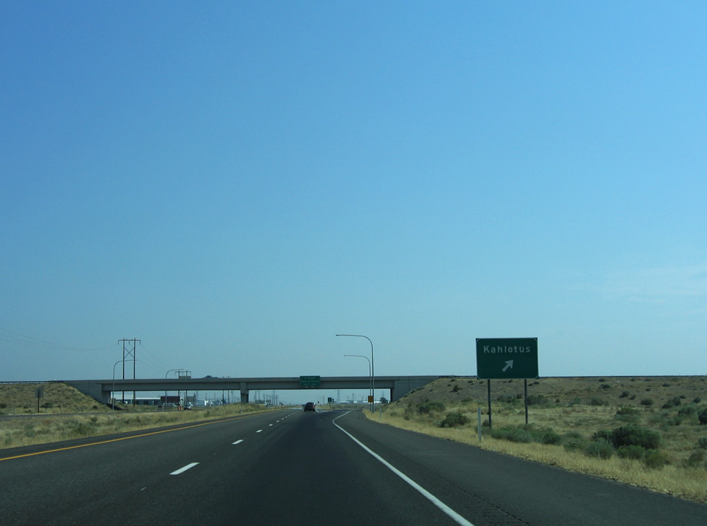
| A loop ramp connects U.S. 12 east with Pasco-Kahlotus Road north. Lewis Street and Pasco-Kahlotus Road originally met U.S. 12 at an at-grade intersection further south, but were relocated when Interstate 182 was built. 08/28/06 |
|
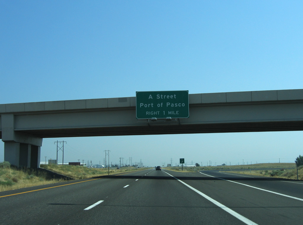
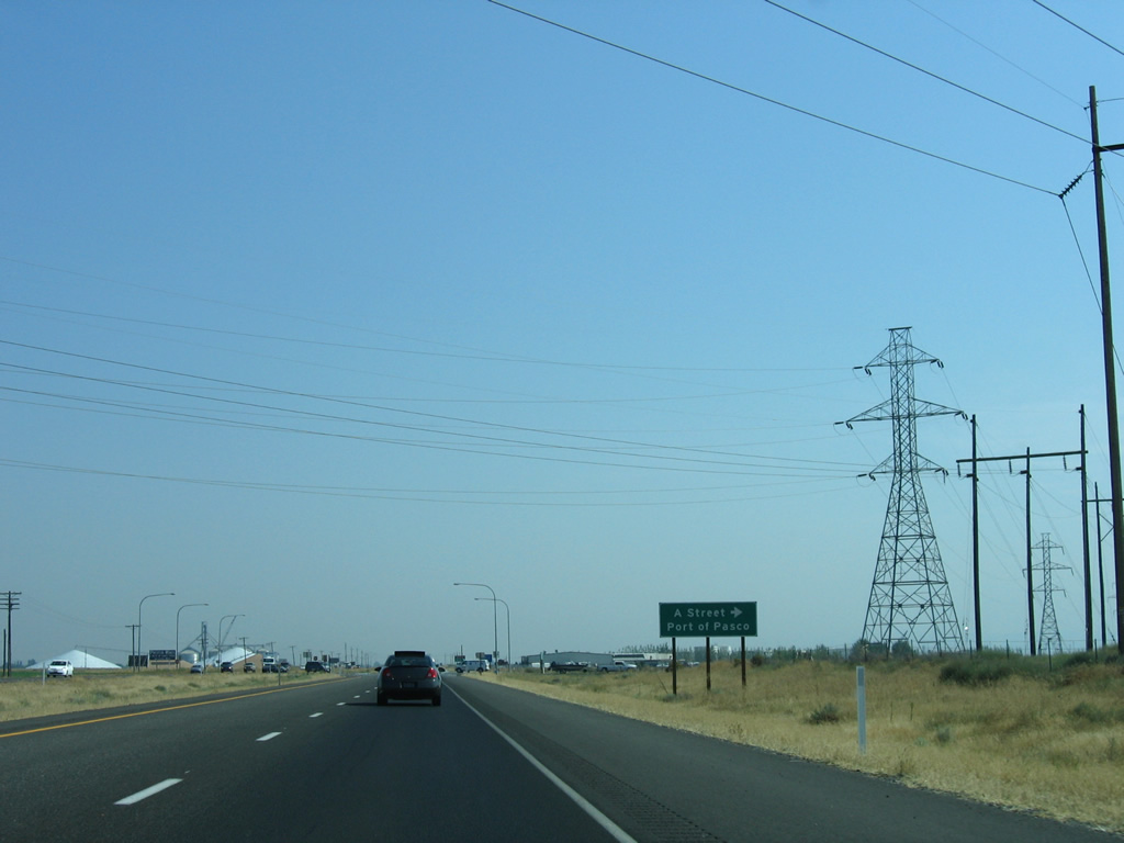
| East A Street travels west from the U.S. 12 freeway end to SR 397 (Oregon Avenue) near the Port of Pasco. 08/28/06 |
|
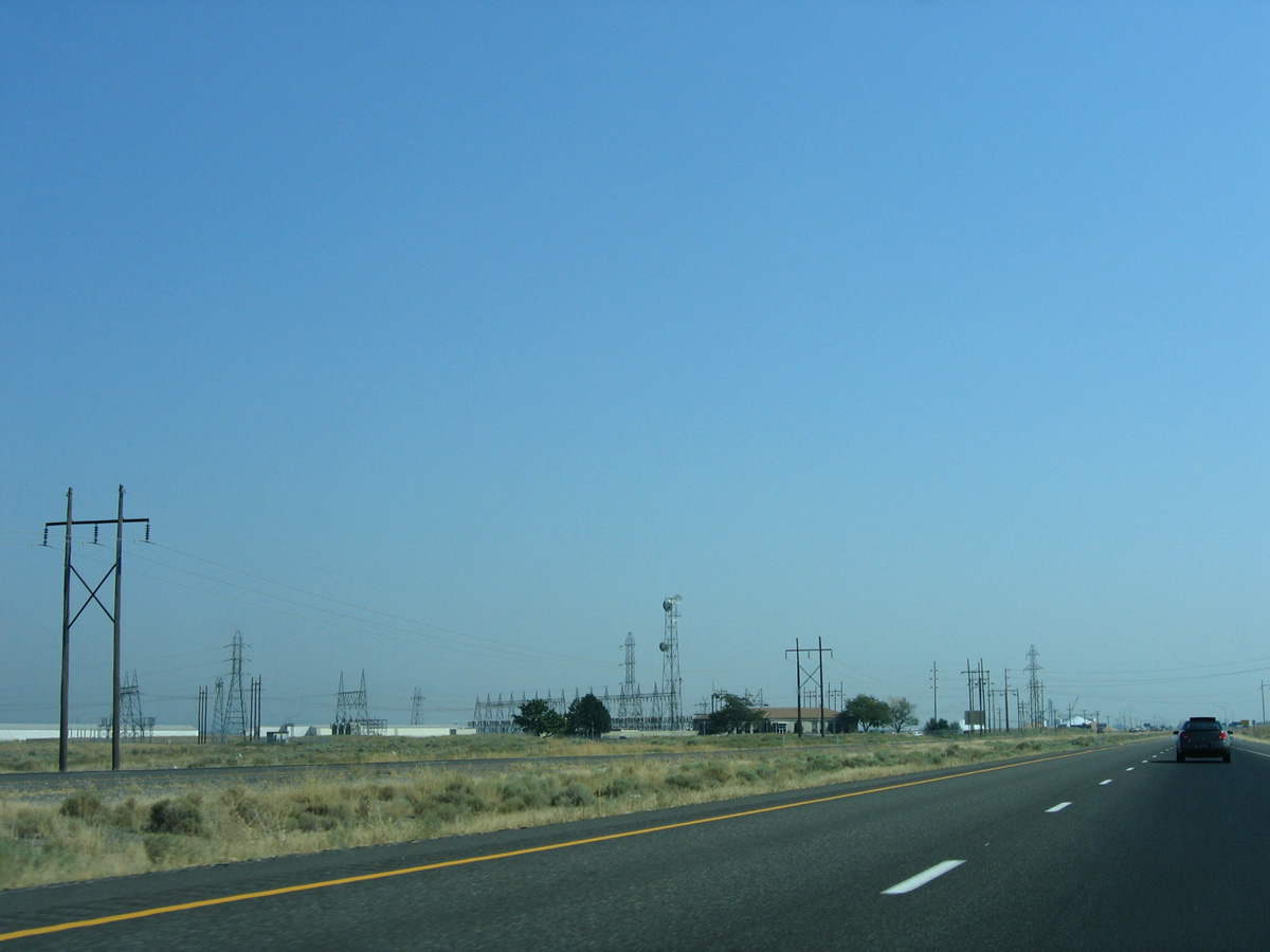
| Lining the east side of the U.S. 12 freeway is the Franklin Substation. 08/28/06 |
|
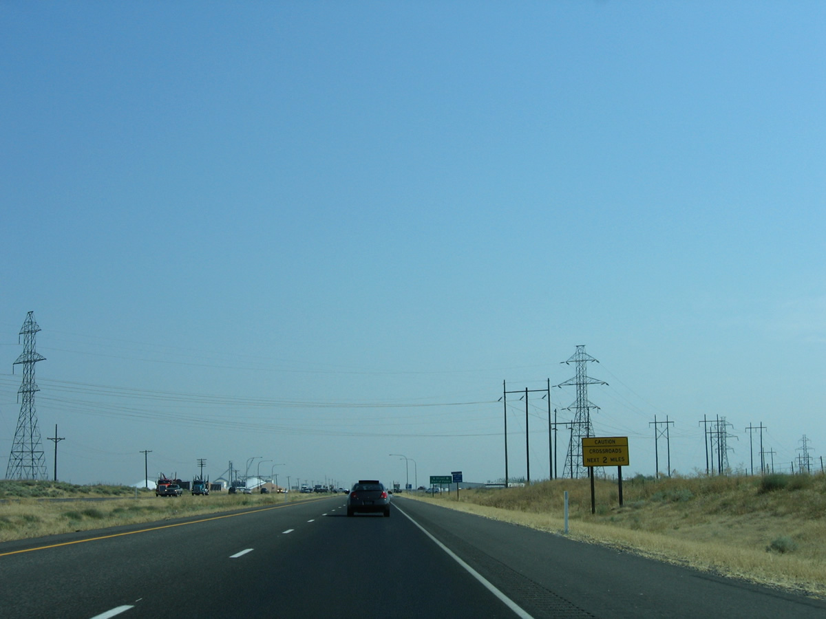
| An advisory sign ushers in the transition to expressway grade U.S. 12 from East A Street southeast to Burbank. 08/28/06 |
|
| Presently an at-grade intersection joins U.S. 12 with East A Street west. A WSDOT study involves constructing a new folded diamond interchange with Tank Farm Road further south to handle movements both to it and A Street via a new local access road. 08/28/06 |
|
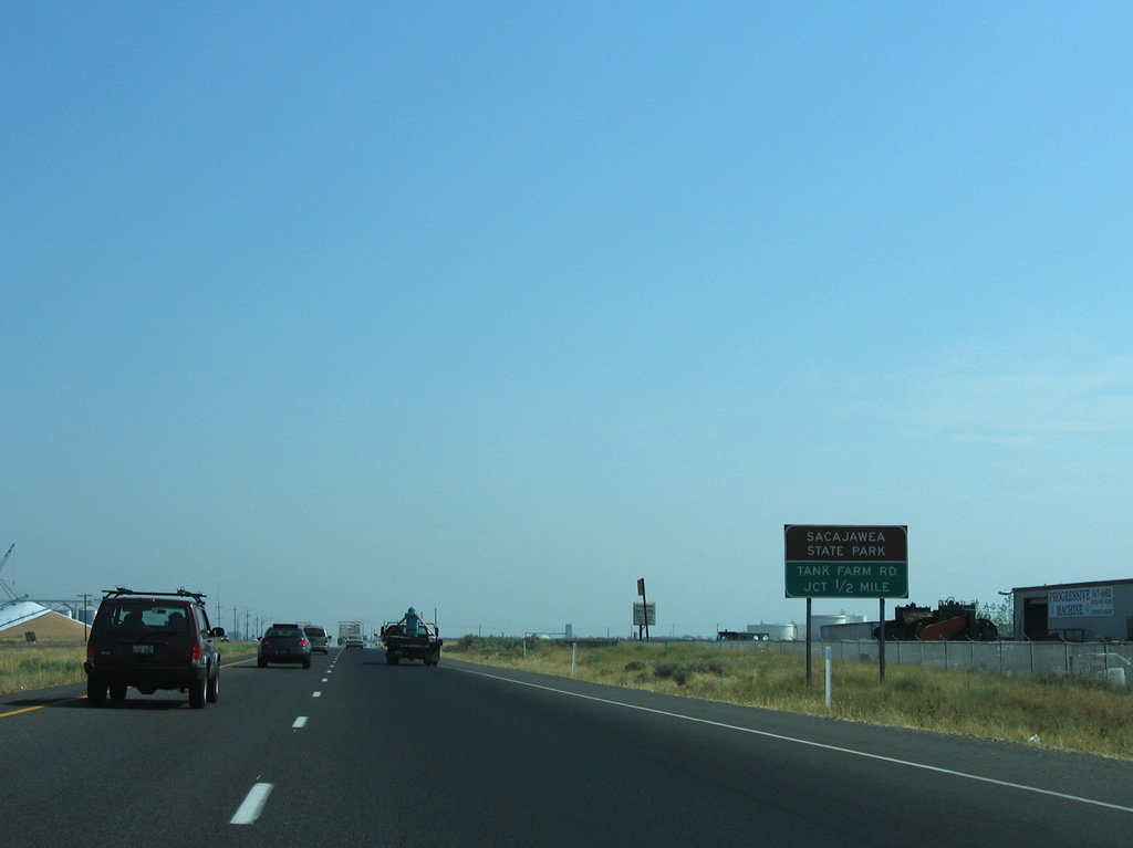
| The next intersection joins U.S. 12 with Tank Farm Road north and Sacajawea Park Road south. 08/28/06 |
|
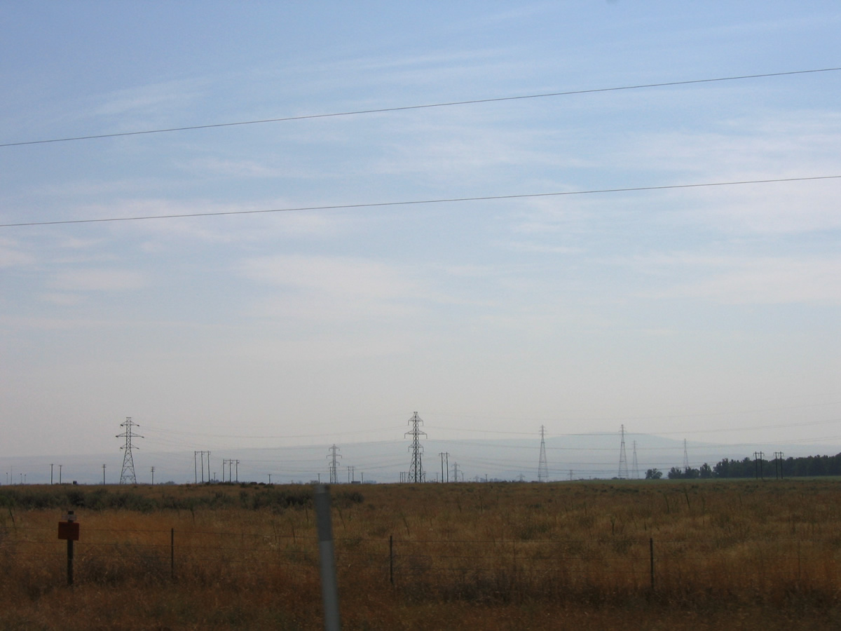
| Transmission lines head south from the Franklin Substation across Sacajawea State Park and the Columbia River to McNary Dam. 08/28/06 |
|
| Tank Farm Road spurs east to industrial storage tanks along the Columbia River. Sacajawea Park Road loops southward to Ainsworth Junction, the Port of Pasco and the state park. 08/28/06 |
|
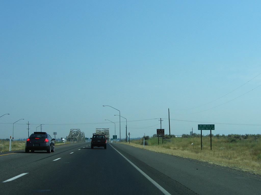
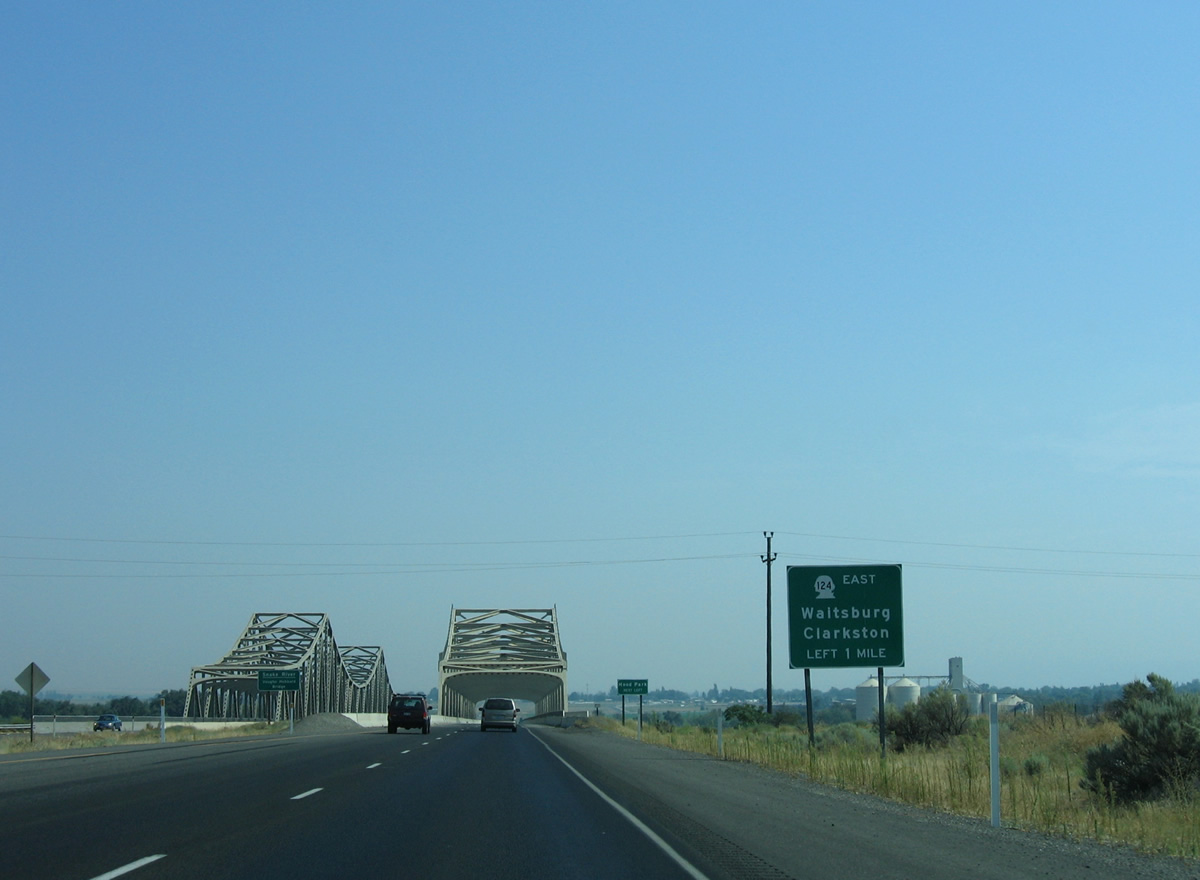
| U.S. 12 continues east one mile to the west end of SR 124 (Ice Harbor Drive). 08/28/06 |
|
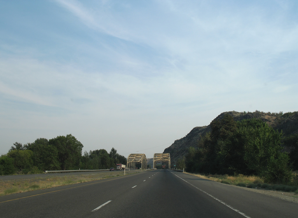
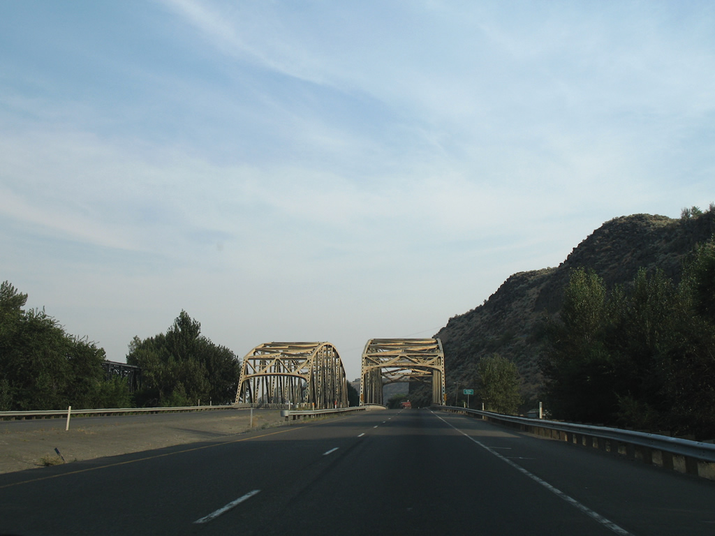
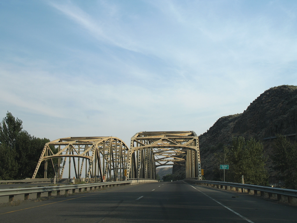
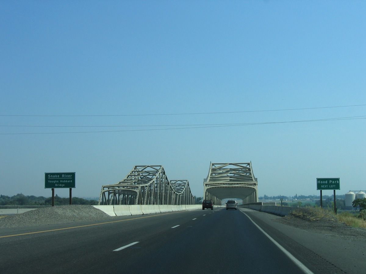
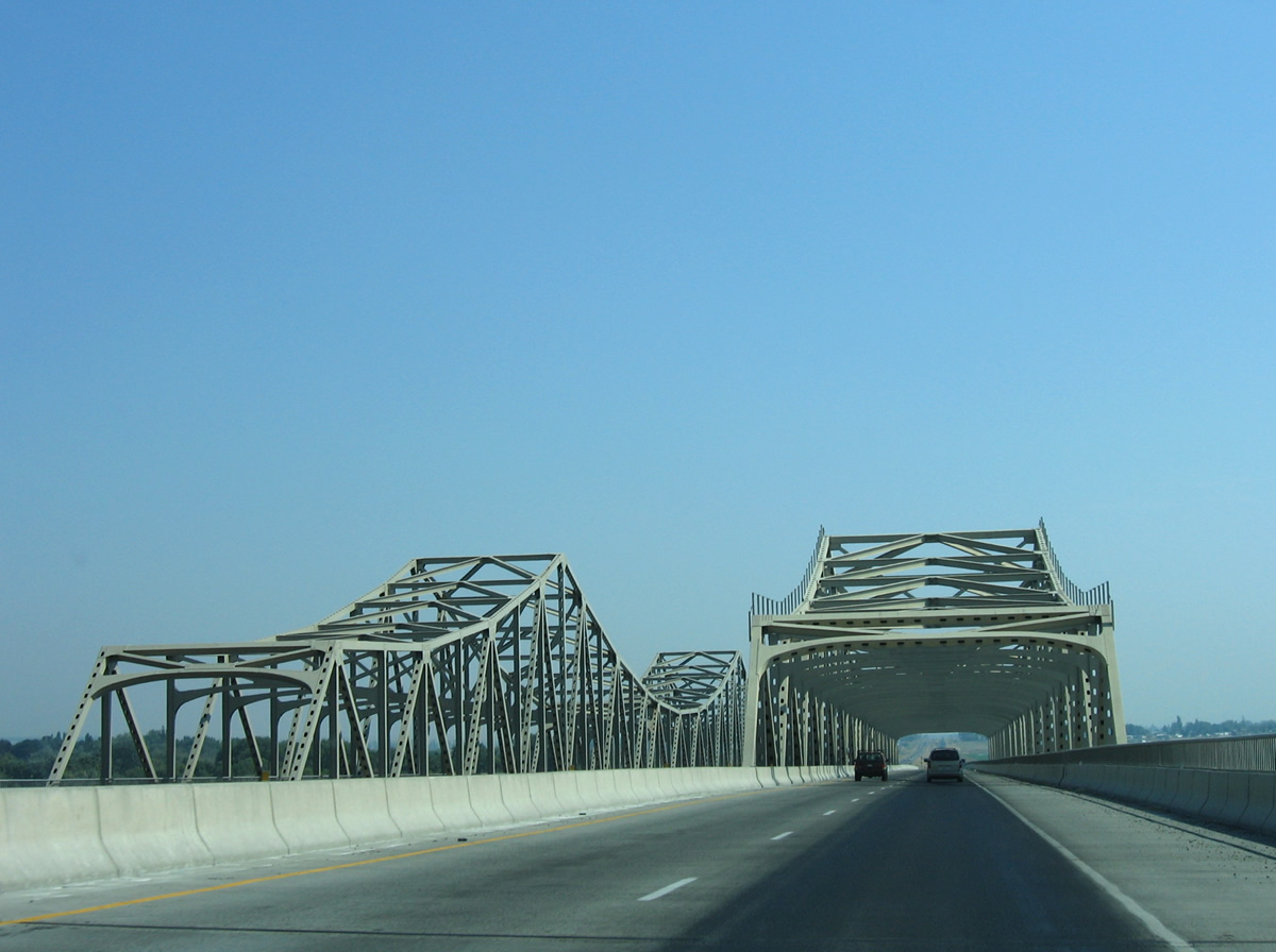
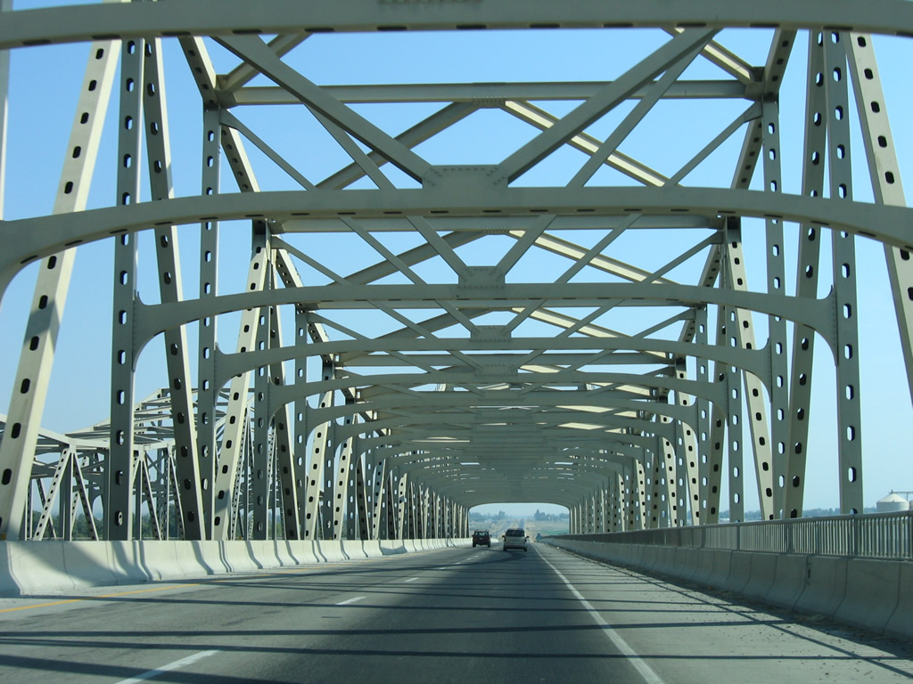
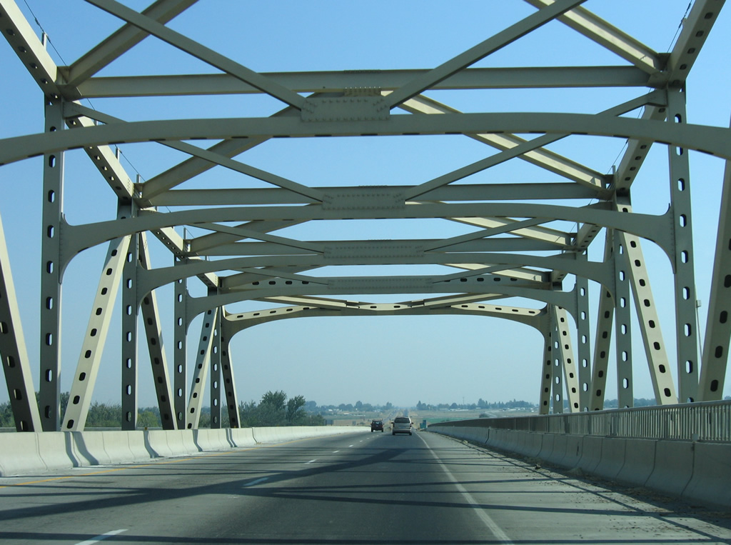
| A pair of steel truss bridges (Vaughn Hubbard Bridge) span the Snake River between Tank Farm Road and SR 124 at Hood Park. 08/28/06 |
|
| The eastbound Snake River bridge opened in 1986; the westbound span dates to 1950 as part of U.S. 410. 08/28/06 |
|
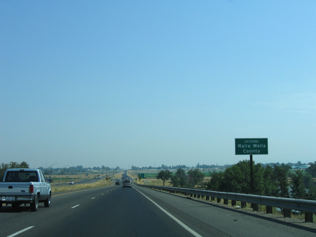
| The Snake River separates Franklin and Walla Walla Counties from the Columbia River northeastward. U.S. 12 totals 64.37 miles in Walla Walla County through Wallula, College Place, Walla Walla and Waitsburg. 08/28/06 |
|
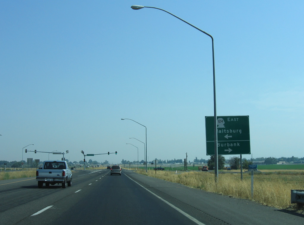
| SR 124 (Ice Harbor Drive) provides a more direct route to Waitsburg and Clarkston in lieu of the U.S. 12 loop south to Walla Walla. The route travels 44.68 miles between U.S. 12. 08/28/06 |
|
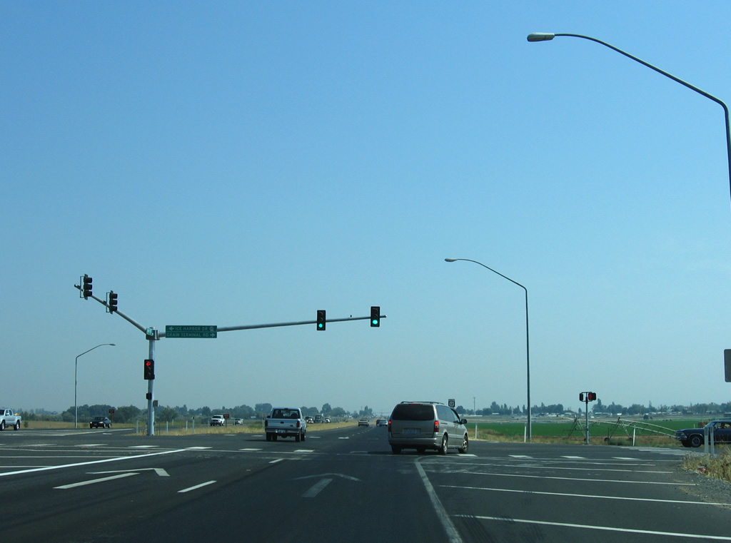
| Grain Terminal Road ties into the west end of SR 124 at a signalized intersection with U.S. 12 in this scene. A parclo interchange with roundabouts replaced the at-grade intersection with SR 124 east and 5th Avenue from Burbank by 2012. 08/28/06 |
Page Updated 10-13-2011.

 South
South  East
East