U.S. 29 is poorly signed route through Washington, DC with the exception of the 0.8 mile stint along the Whitehurst Freeway at Georgetown. U.S. 29 enters Washington across the Francis Scott Key Bridge from Rosslyn, Virginia to join the Whitehurst east to the westbound beginning of Interstate 66. There U.S. 29 transitions into K Street east through Washington Circle to 11th Street NW. 11th Street north doubles as U.S. 29 to Rhode Island Avenue NW. A few blocks east of there is the U.S. 29 turn onto 7th Street north to Silver Spring, Maryland. Left-hand turns from Rhode Island Avenue east onto 7th Street north are prohibited however, making U.S. 29 a discontinuous route.
The Whitehurst Freeway opened to traffic on October 8, 1949. It was named after Herbert C. Whitehurst, director of the D.C. highway department, who died a month before the viaduct completion.1 The elevated freeway was rehabilitated over an eight year period ending in August 1998 at a cost of $100 million.2 U.S. 29 followed M Street NW from the Francis Scott Key Bridge east to New Hampshire Avenue prior to its routing along the Whitehurst and K Street. The 1960s alignment took the route north onto 16th Street and Alaska Avenue to the D.C. line.
|
| U.S. 29 joins the Whitehurst Freeway directly from a on-ramp on the Francis Scott Key Bridge north. An advisory sign suggests 35 miles per hour for the 0.7 mile long viaduct. 08/04/13 |
|
| Straightening out due west of K Street, U.S. 29 (Whitehurst Freeway) north sees the first sign for Interstate 66 west. I-66 follows the Potomac River Freeway south by the Kennedy Center to combine with U.S. 50 west across the Theodore Roosevelt Memorial Bridge. 08/04/13 |
|
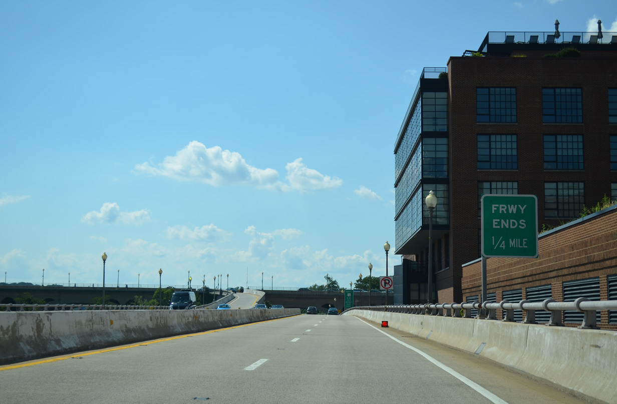
| An end sign precedes the Whitehurst Freeway transition to K Street by one quarter mile. U.S. 29 follows K Street east to Downtown. 08/04/13 |
|
| Interstate 66 travels 76.28 miles overall from U.S. 29 (Whitehurst Freeway / K Street) to Interstate 81 near Strasburg, Virginia. The Potomac River Freeway portion in D.C. includes access to the E Street Expressway to Foggy Bottom and Ohio Drive near the Lincoln Memorial. 08/04/13 |
|
| A lane configuration sign meant for an intersection resides at the split of U.S. 29 north and Interstate 66 west. Trucks are directed southward on I-66 west to the E Street Expressway. 08/04/13 |
|
| U.S. 29 appears for the first time on D.C. signage at the wye interchange with Interstate 66 west. The route passes over Rock Creek and Potomac Parkway to join K Street ahead of Washington Circle. I-66 meanwhile winds southward between the Watergate Complex, the Kennedy Center and George Washington University to Arlington, Virginia. 08/04/13 |
|
| The Whitehurst Freeway travels above Water Street and below the Francis Scott Key Bridge as it leaves Canal Road east and M Street west. 08/04/13 |
|
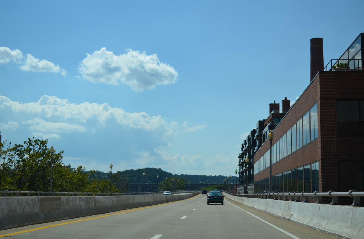
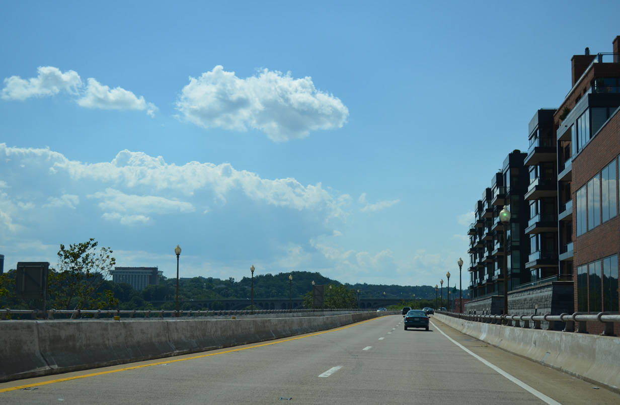
| U.S. 29 ascends onto the Whitehurst Freeway from K Street at the east end Interstate 66 (Potomac River Freeway). The elevated roadway parallels Georgetown Waterfront Park and the Potomac River for 0.7 miles. 08/04/13 |
|
| The Francis Scott Key Bridge comes into view along U.S. 29 (Whitehurst Freeway) south. The six lane concrete arch bridge carries U.S. 29 across the Potomac River to Rosslyn. 08/04/13 |
|
| A direct ramp connects U.S. 29 northbound from the Francis Scott Key Bridge onto the Whitehurst Freeway east as U.S. 29 south travels the remaining quarter mile of the viaduct. 08/04/13 |
|
| U.S. 29 south departs the Whitehurst Freeway end for M Street east to 35th Street NW and the Francis Scott Key Bridge south. 08/04/13 |
|
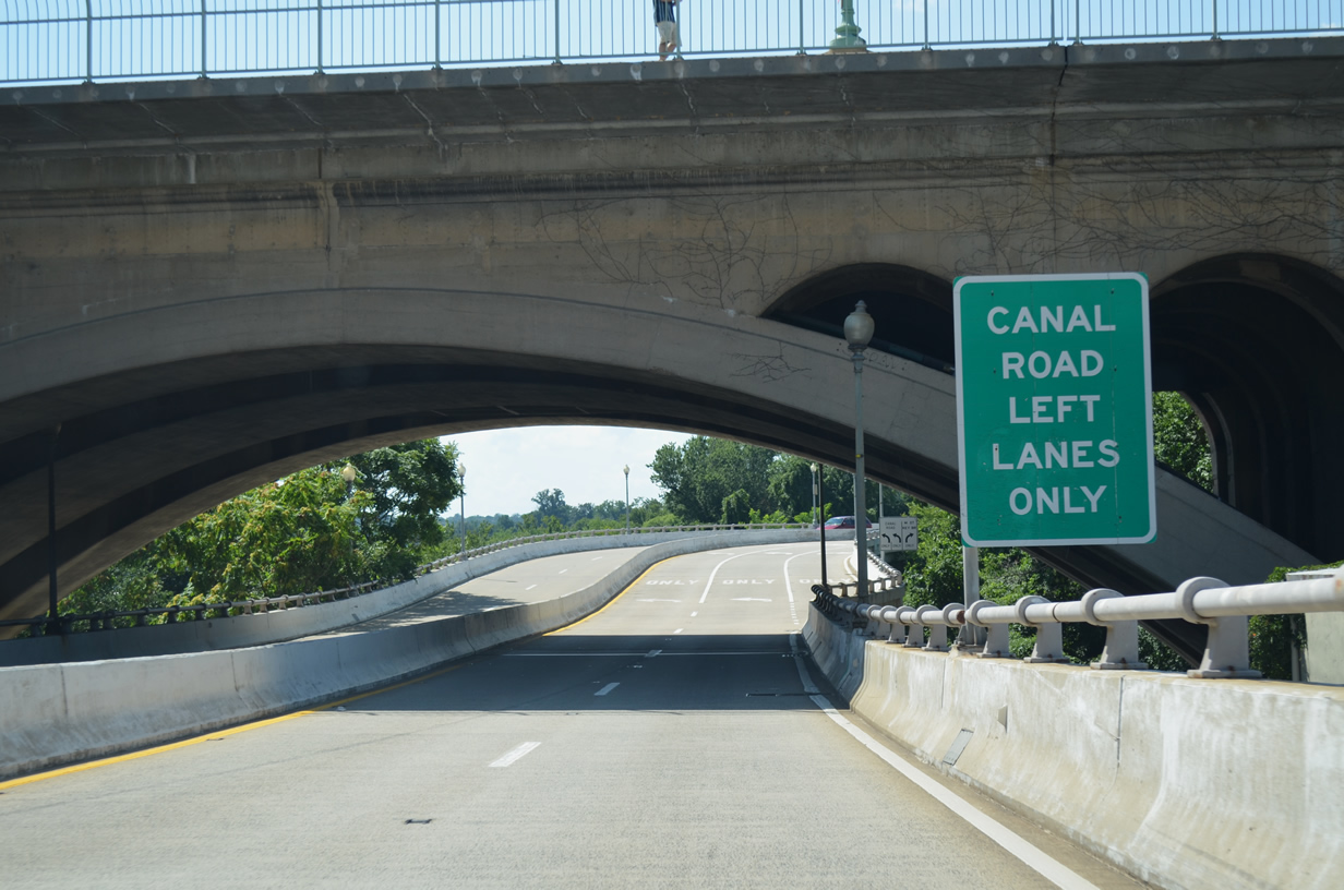
| Passing under the 1923-built Key Bridge, U.S. 29 (Whitehurst Freeway) curves northward to intersect M Street west and Canal Road east. Canal Road parallels the old C & O Canal westward to become Clara Barton Parkway at the Chain Bridge. 08/04/13 |
|
| A single turn lane carries U.S. 29 south onto M Street east while two lanes join Canal Road west to Georgetown University. 08/04/13 |
|
| Canal Road leads west from U.S. 29 (Whitehurst Freeway) and M Street to an access road for Georgetown University. 08/04/13 |
|
| Canal Road east from the Georgetown University access road partitions initially with a lane continuing east onto M Street and U.S. 29 south across the Francis Scott Key Bridge and a lane defaulting onto the Whitehurst Freeway (U.S. 29) north. 08/04/13 |
|
| Just ahead of the Whitehurst Freeway beginning, Canal Road expands with a second through lane onto M Street east. M Street represents a former route of U.S. 29 east to New Hampshire Avenue. 08/04/13 |
|
| Outline shields direct motorists onto U.S. 29 at the Whitehurst Freeway east. The elevated highway travels 0.7 miles to K Street at Interstate 66 west. 08/04/13 |
|
| U.S. 29 south turns east for one block along M Street to the Francis Scott Key Bridge south into Rosslyn, Virginia. 08/04/13 |
|
| Rock Creek Parkway passes under the interchange between Interstate 66 and the Whitehurst Freeway. The limited-access route sees ramps to K Street in both directions, with the northbound ramp here connecting also with U.S. 29 south onto the Whitehurst Freeway. 08/04/13 |
Page Updated 06-12-2014.

 North
North