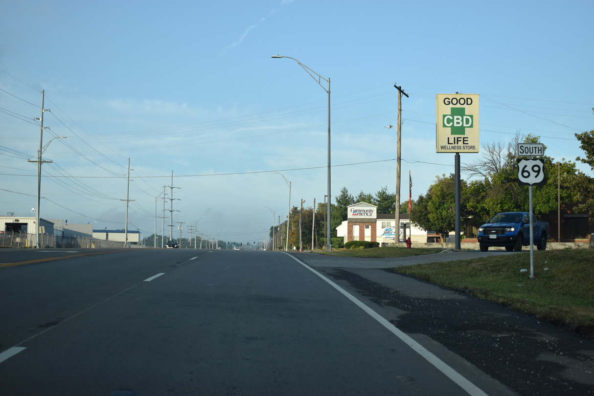
Generally paralleling the Interstate 35 corridor north from Kansas City, U.S. 69 measures 121.72 miles in length within Missouri. U.S. 69 crosses the Missouri River from Kansas City, Kansas along the Fairfax Bridge. The 3.18 mile section through Platte County includes overlaps with I-635 and the Route 9 expressway through Riverside. Running alongside Interstate 29, U.S. 69 enters Clay County through Northmoor and Gladstone.
Proceeding east into Kansas City, U.S. 69 meets I-35 at Exit 11. The two converge again at Exit 13 in Pleasant Valley, where U.S. 69 combines with the freeway northward into Liberty. U.S. 69 branches east from I-35 at Exit 20 to Mosby and Excelsior Springs. Continuing north to Lawson and into Clinton County, U.S. 69 connects with I-35 again at Exit 48.
U.S. 69 travels through Cameron while I-35 runs through eastern reaches of the city. Business Loop I-35 combines with U.S. 69 through Downtown. Heading northeast into Daviess County, U.S. 69 crosses paths with I-35 east to Winston and again north en route to Pattonsburg. The two parallel each other northward from Bethany to Eagleville and the Iowa state line.
|
| U.S. 69 splits with I-635 north to briefly join the Route 9 expressway east across Line Creek. 10/17/04 |
|
| U.S. 69 leaves Route 9 east for Riverway Boulevard north in the city of Riverside. 10/17/04 |
|
| Riverway Boulevard connects Route 9 with Tullison Road / Argosy Casino Parkway to the south and U.S. 69 north to Gateway Avenue. These trailblazers for I-635 and Route 9 were eventually removed. 10/17/04 |
|
| U.S. 69 (Riverway Boulevard) north at the entrance ramp for Route 9 north / U.S. 69 south. 02/23/20 |
|
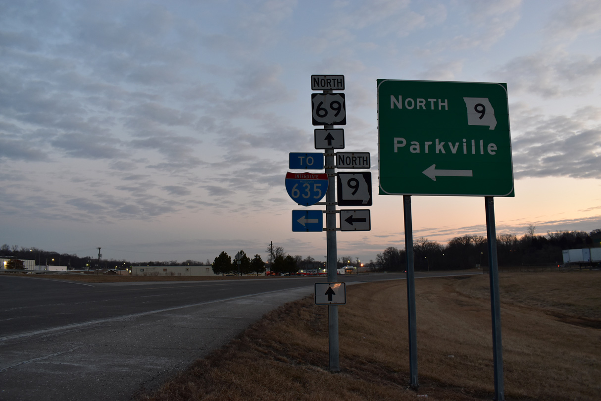
| Former button copy sign Route 9 west to Parkville on Riverway Boulevard. 10/17/04 |
|
| U.S. 69 follows Gateway Avenue north from Riverway Boulevard / Platte Road to Route A in Riverside. 10/17/04 |
|
| Route A branches north from U.S. 69, 1.25 miles to I-29/U.S. 71 at Houston Lake. 10/17/04 |
|
| Vivion Road leads U.S. 69 east from Route A into the city of Northmoor. 10/17/04 |
|
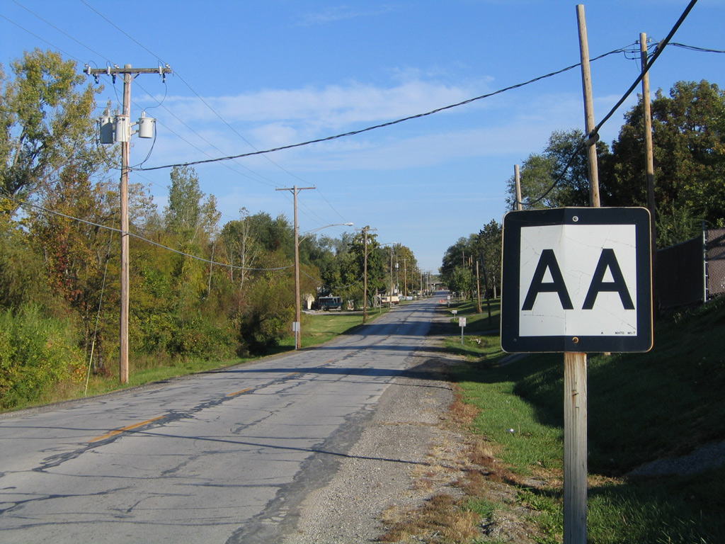
| Route AA lines Waukomis Drive north 0.63 miles from U.S. 69 (Vivion Road) to a half diamond interchange with I-29/U.S. 71 south. 10/17/04 |
|
| Waukomis Drive extends beyond Route AA to NW 68th Street in Kansas City. 10/17/04 |
|
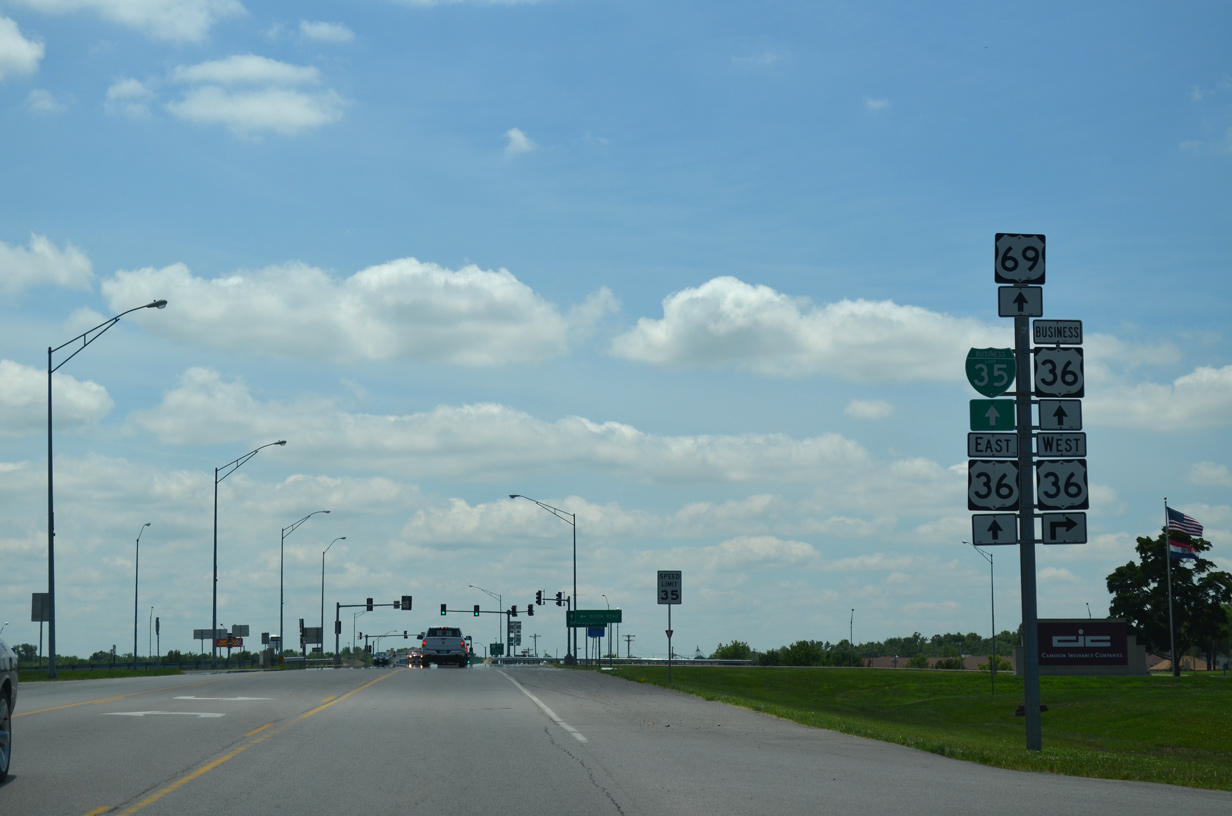
| Business Loop I-35/U.S. 69 overlap 1.51 miles north through Cameron along Walnut Street. 06/19/15 |
|
| Route A takes a stair stepped course southwest from Cameron to Route T near West Keystone. The 17.02 mile highway runs south to Turney and the intersection of Route 33 and 116 at Lathrop. 06/19/15 |
|
| U.S. 36 Business branches 1.04 miles southeast from U.S. 36 along Grand Avenue to U.S. 69 (Walnut Street). 06/19/15 |
|
| U.S. 36 Business returns to U.S. 36 via Business Loop I-35/U.S. 69 (Walnut Street) north for 0.46 miles. 06/19/15 |
|
| Business Loop I-35/U.S. 69 and U.S. 36 Business (Walnut Street) expand to a five lane boulevard north from Grand Avenue. 06/19/15 |
|
| U.S. 36 Business ends as Business Loop I-35 turns east alongside U.S. 36 back to Interstate 35. 06/19/15 |
|
| The U.S. 36 expressway runs across the north side of Cameron with just one signalized intersection. 06/19/15 |
|
| West from Cameron, U.S. 36 ventures 30 miles to Interstate 29/U.S. 71 at St. Joseph. 06/19/15 |
|
| U.S. 69 (Walnut Street) narrows back into a three lane boulevard north of the exchange with U.S. 36. 06/19/15 |
|
| Reassurance marker posted northbound at Platte-Clay Way in Cameron. 06/19/15 |
|
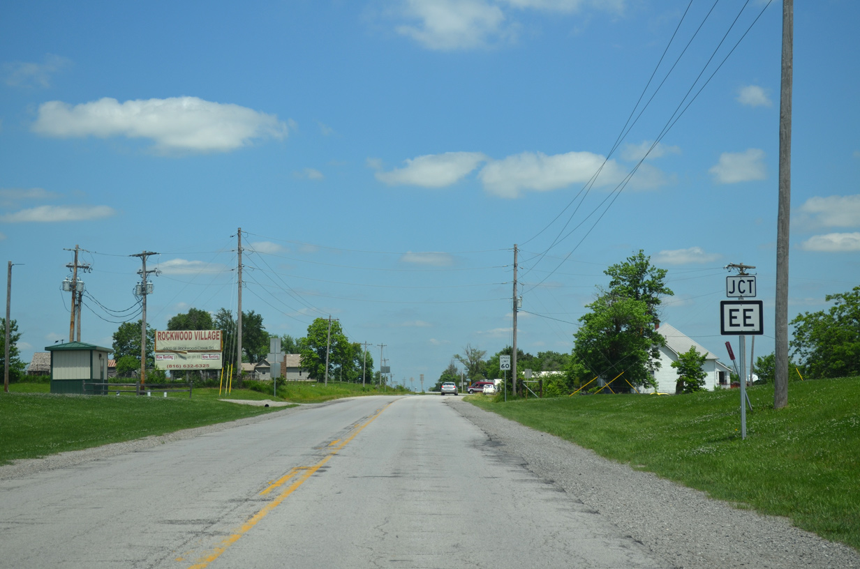
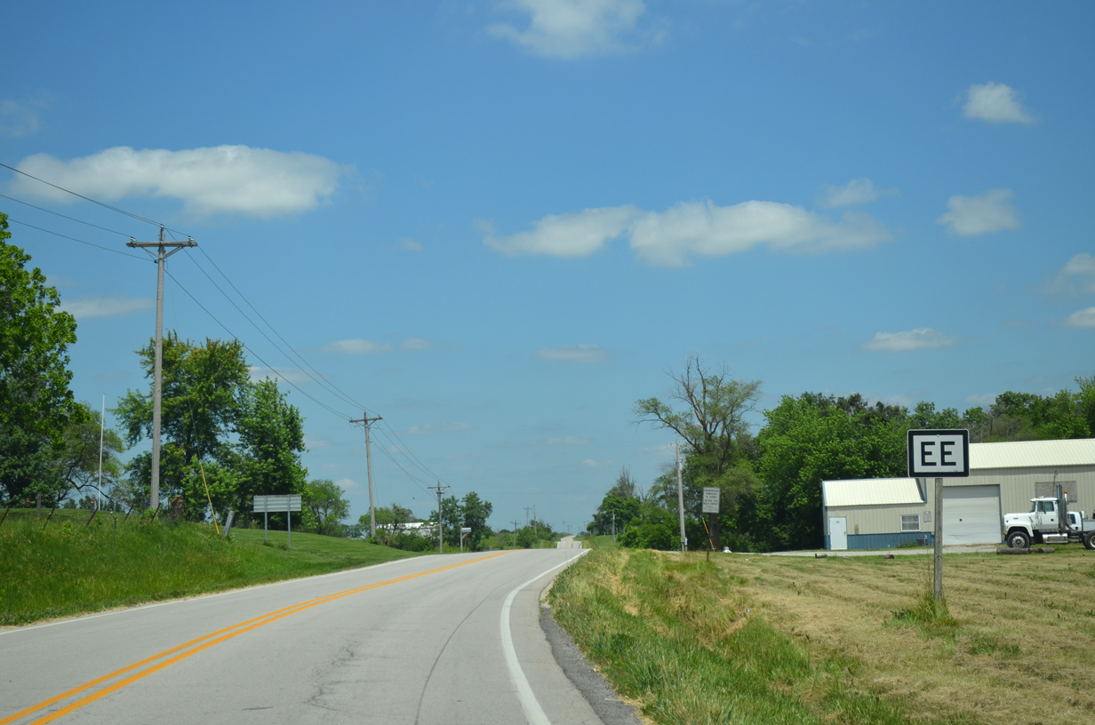
| Leaving the Cameron city limits, U.S. 69 splits with Route EE. 06/19/15 |
|
| A 10.69 mile long highway, Route EE heads north from U.S. 69 to Route 6, east of Weatherby. 06/19/15 |
|
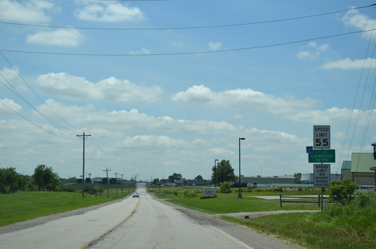
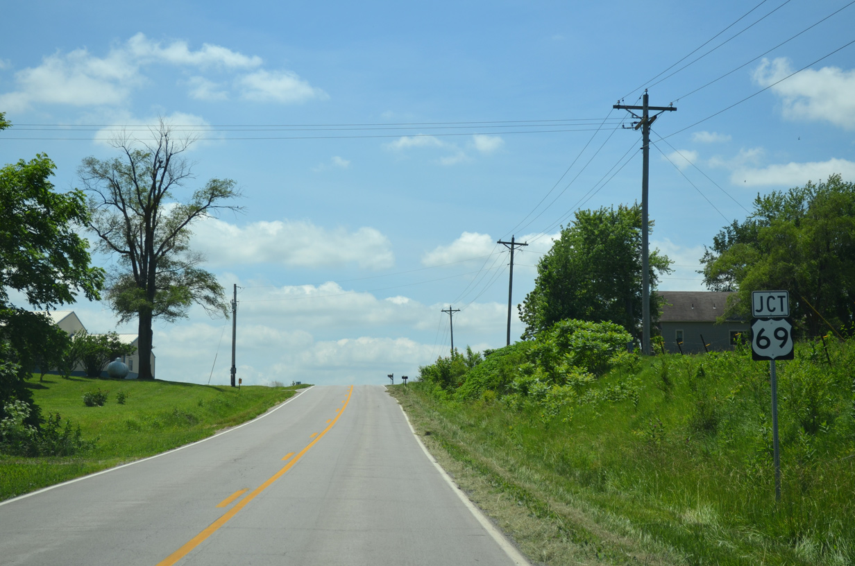
| U.S. 69 enters the city of Cameron just south of Route EE. Winston lies nine miles along the highway to the northeast. 06/19/15 |
|
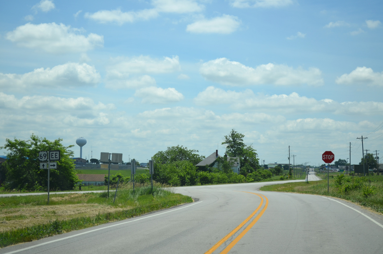
| The confirming marker for U.S. 69 south at Route EE outside Cameron includes an double headed arrow for the end of Route EE. 06/19/15 |
|
| U.S. 69 enters the city of Cameron along Walnut Street. 06/19/15 |
|
| Widening into a three lane commercial boulevard, U.S. 69 (Walnut Street) advances south to Business Loop I-35, U.S. 36 and U.S. 36 Business west. 06/19/15 |
|
| U.S. 36 bypasses Cameron along an expressway north of the city street grid. Business Loop I-35 overlaps with the highway between U.S. 69 (Walnut Street) and the nearby exchange with I-35. 06/19/15 |
|
| The U.S. 36 expressway extends west from Cameron to St. Joseph and east alongside Route 110 (Chicago Kansas City Expressway) to Hamilton. 06/19/15 |
|
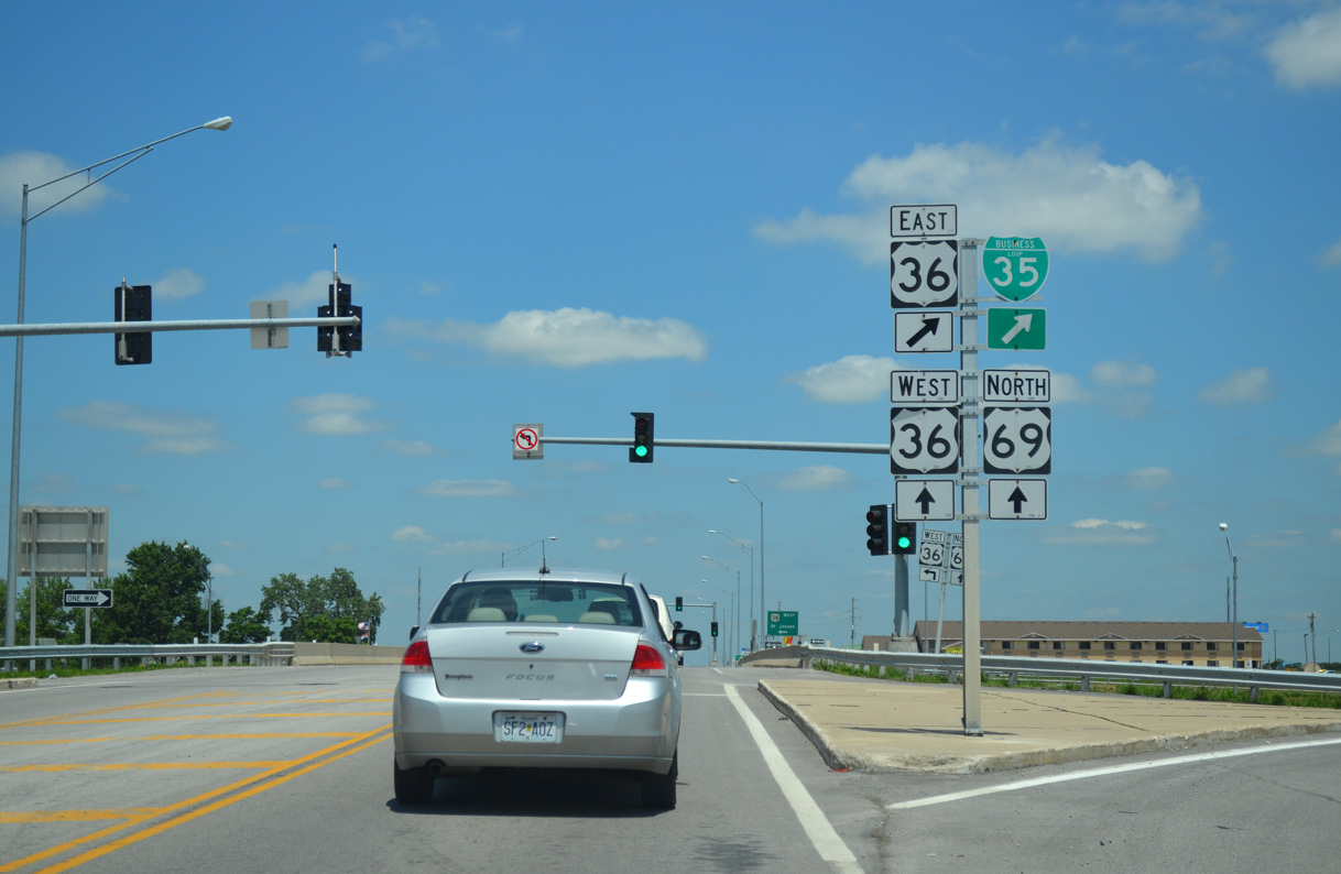
| U.S. 69 (Walnut Street) south at the westbound entrance ramp for U.S. 36 to Osborn, Stewartsville and St. Joseph. 06/19/15 |
|
| U.S. 36 Business and Business Loop I-35 combine with U.S. 69 south along Walnut Street to Grand Avenue in north Cameron. 06/19/15 |
|
| U.S. 36 stretches 158 miles across northern Missouri from U.S. 69 in Cameron to the Mark Twain Memorial Bridge (I-72) spanning the Mississippi River at Hannibal. 06/19/15 |
|
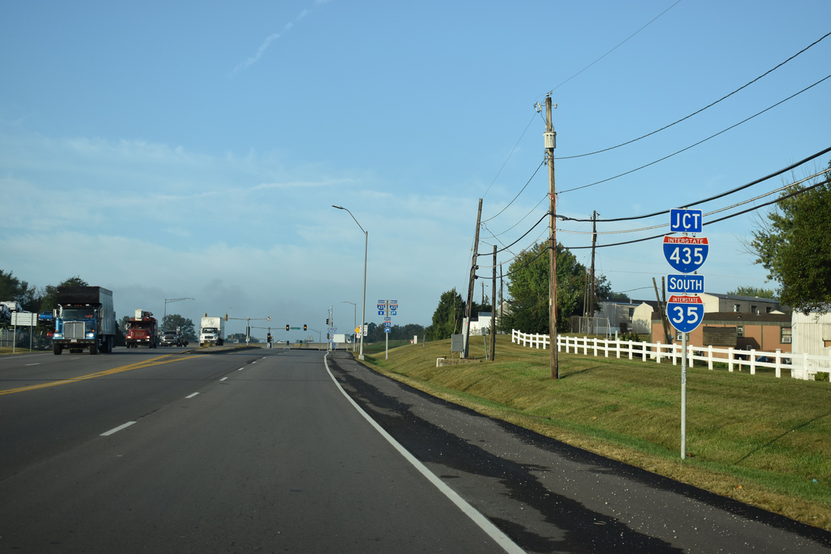
| U.S. 69 parts ways with I-35 south / Route 110 (CKC) west at Exit 14 in the city of Pleasant Valley. 10/07/21 |
|
| U.S. 69 runs along the east side of Interstate 35 south to the intersection of Pleasant Valley Road west and S Liberty Parkway east. 10/07/21 |
|
| S Liberty Parkway winds eastward past the city of Glenaire across south Liberty between U.S. 69 and Route 291. Pleasant Valley Road extends west from the arterial to the Ravenwood-Somerset neighborhood in Kansas City. 10/07/21 |
|
| U.S. 69 straddles the Pleasant Valley and Liberty city line southwest to the Ford Kansas City Assembly Plant. 10/07/21 |
|
| A half diamond interchange connects U.S. 69 with I-35 south at Pleasant Valley Road. 10/07/21 |
|
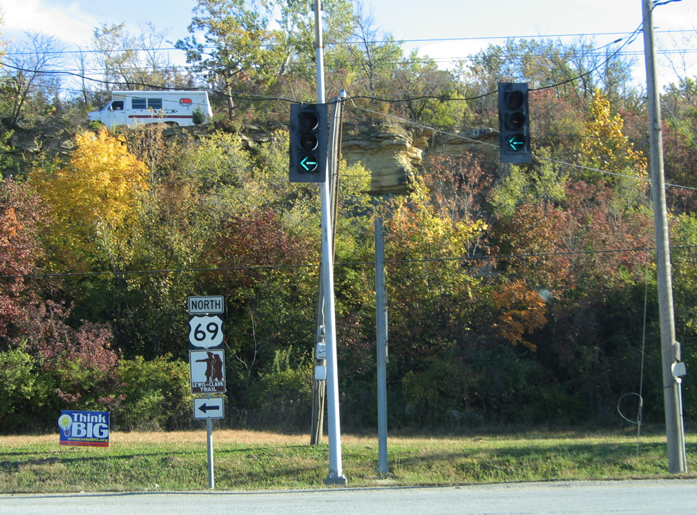
| U.S. 69 south from Pleasant Valley into Claycomo and Kansas City is part of the Lewis and Clark Trail. 10/07/21 |
|
| U.S. 69 previously separated from I-35 south from a left exit ramp ahead of Pleasant Valley Road. U.S. 69 was subsequently realigned in place of what was the northbound roadway for Interstate 35. 10/07/21 |
|
| Three residential streets tie into the west side of U.S. 69 south from Garrison Road in Pleasant Valley. 10/07/21 |
|
| Curving southwest across Shoal Creek, U.S. 69 enters the city of Claycomo. 10/07/21 |
|
| U.S. 69 runs along the west side of the Ford Kansas City Assembly Plant in Claycomo. 10/07/21 |
|
| Continuing west from Grove Street, U.S. 69 passes by the Northgate manufactured home community to Interstate 435 at N Palmer Street. 10/07/21 |
|
| The diamond interchange linking U.S. 69 (Lewis and Clark Trail) with I-435 overlays the adjacent three level exchange joining I-35/435. 10/07/21 |
|
| Interstate 435 loops northward across Kansas City to Shoal Creek, Nashua, Ferrelview and Kansas City International Airport (MCI). 10/07/21 |
|
| Interstate 435 heads south from Claycomo to Randolph, Blue Summit and southeastern Kansas City. 10/07/21 |
|
| The entrance ramp from U.S. 69 at Claycomo partitions with a flyover for I-35 south toward Downtown Kansas City. 10/07/21 |
|
| The on-ramp to Interstate 435 north from U.S. 69 leads to the Shoal Creek area in northeastern Kansas City. I-435 and U.S. 69 meet again in Overland Park, Kansas. 10/07/21 |
|
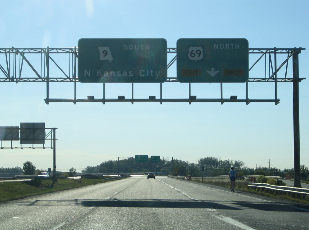
| U.S. 69 south combines with Route 9 north for 0.293 miles before turning south alongside I-635 to the Platte Purchase Bridge. 10/07/21 |
|
| U.S. 69 overlaps with I-635 for just 0.349 miles from the exchange with Route 9 to Left Exit 10 for the Platte Purchase Bridge. 06/19/15 |
|
| Confirming marker for Route AA posted north of U.S. 69 (Vivion Road) in Northmoor. 10/17/04 |
|
| Route EE branches north from U.S. 69 outside the city of Cameron through eastern Dekalb County. This is the first confirming marker for the 10.69 mile long highway. 06/19/15 |
|
| Approaching the south end of Route EE with U.S. 69 in Dekalb County. 06/19/15 |
|
| Shield assembly on U.S. 69 south for Route EE north. 06/19/15 |
|
Photo Credits:
10/17/04, 06/19/15 by AARoadsConnect with:
Interstate 29
Interstate 35
Interstate 435
Interstate 635
U.S. 136
Route 9
Page Updated 10-20-2021.
Page load link
|

 North
North