|
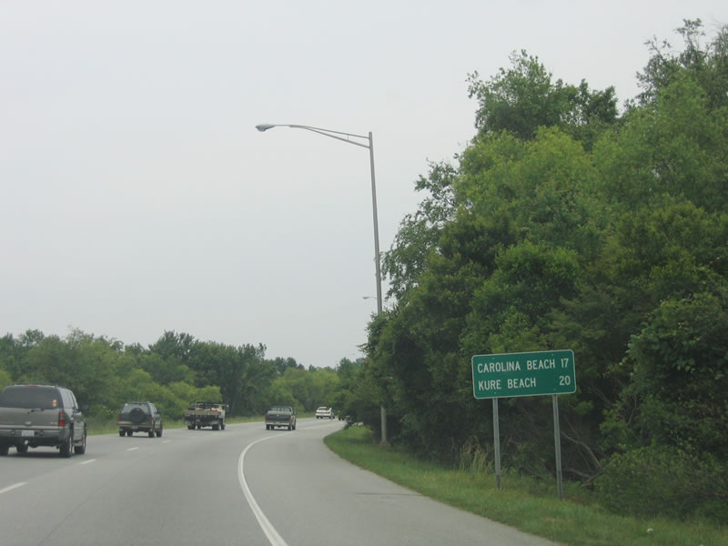
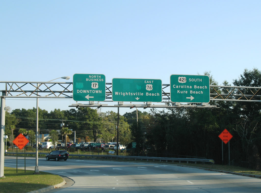
| This distance sign provides the distance to Carolina Beach and Kure Beach via U.S. 421 south after it merges with U.S. 17/76 east. 06/01/05 |
|
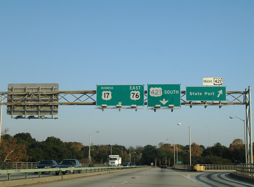
| Back to back ramps depart at the east end of the Cape Fear Memorial Bridge for U.S. 421 Truck south and Front Street north into Downtown Wilmington. 11/11/06 |
|
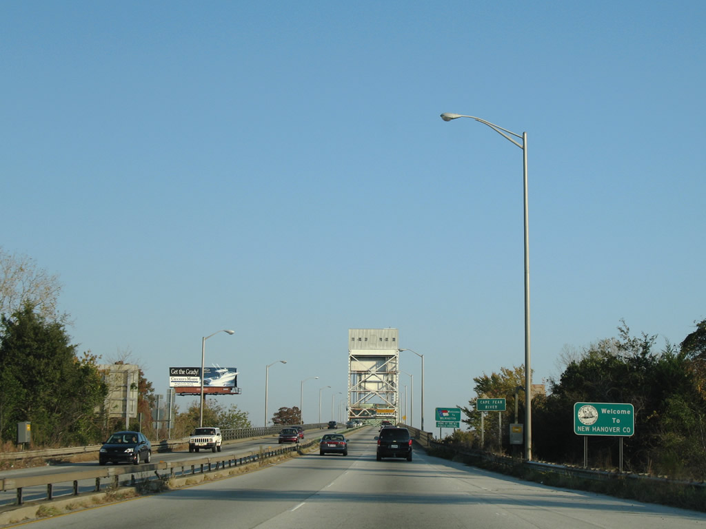
| U.S. 17-76-421 enter New Hanover County and the city of Wilmington across the Cape Fear River. 11/11/06 |
|
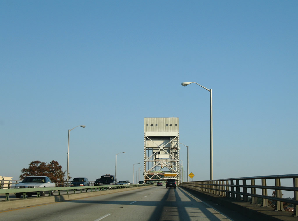
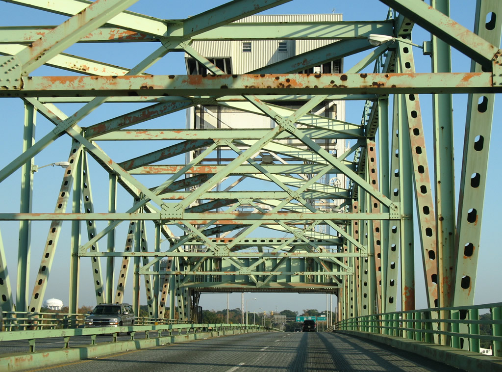
| The Cape Fear Memorial Bridge opened to traffic on October 1, 1969. The central section lifts between the two towers, providing more vertical clearance for larger passing ships. 11/11/06 |
|
| A steel deck supports traffic across the movable portion of the Cape Fear Memorial Bridge. The metal grating can be slippery during rainy weather. 11/11/06 |
|
| The U.S. 421 truck route lowers from the Cape Fear Memorial Bridge onto Front Street south toward the State Port. The port at Wilmington is one of two in North Carolina, with other located in Morehead City near the eastern end of U.S. 70. The truck route links with Burnett Boulevard south to Shipyard Boulevard (U.S. 117). 11/11/06 |
|
| A loop ramp follows from U.S. 17-76-421 east for Front Street north along the Cape Fear River waterfront in Downtown Wilmington. U.S. 421 splits with U.S. 17-76 at the ensuing intersection. 11/11/06 |
|
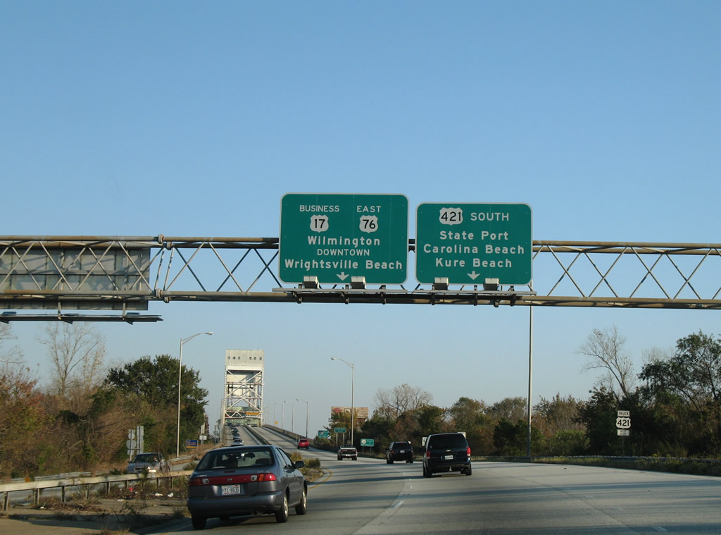
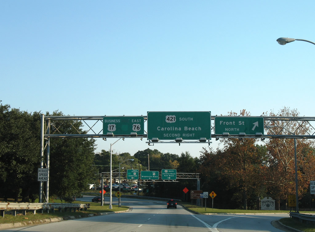
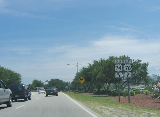
| U.S. 17-76 shift onto Dawson Street east at their separation with U.S. 17 Business north and U.S. 421 south at 3rd Street. U.S. 421 continues south to Carolina Beach, Kure Beach and Fort Fisher. 11/11/06 |
|
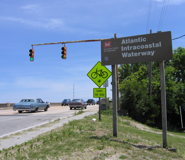
| U.S. 74-76 east cross the Intracoastal Waterway over a drawbridge. Maintained by the United States Army Corps of Engineers, the Intracoastal Waterway offers a commercial and recreational waterway along the Atlantic Ocean between Key West, Florida, and Boston, Massachusetts. The waterway connects existing waterways between the mainland and barrier islands, and it includes some sections that were dredged or created by the Army Corps in the 20th Century. Various boats and ships use the waterway because it has a minimum depth of 12 feet. 05/29/05 |
|
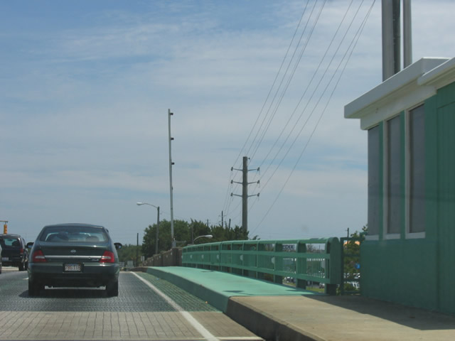
| The Wrightville Beach Bridge was built in 1956. The 731 foot long span includes a double leaf bascule.1 05/29/05 |
|
| Crossing onto Harbor Island, U.S. 74/76 separate at a wye intersection. U.S. 74 joins Salisbury Street to north Wrightsville Beach while U.S. 76 heads along Causeway Boulevard to south Wrightsville Beach. 05/29/05 |
|
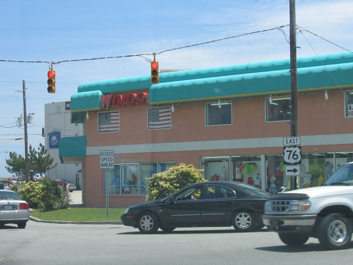
| U.S. 76 crosses the South Banks Channel Bridge and turns south from Causeway Boulevard onto Waynick Boulevard. Causeway Boulevard continues one block east to Lumina Avenue and the Wrightsville Beach business district. 05/29/05 |
|
| Heading south from Causeway Drive, a pair of signs reference the east end of U.S. 76 in 1.7 miles. 05/29/05 |
|
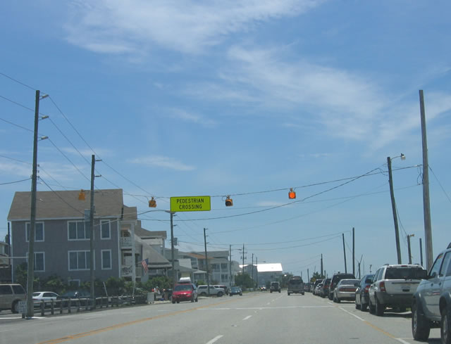
| This pedestrian crossing offers a connection from the west side of Waynick Boulevard along Banks Channel to the Atlantic Ocean off Lumina Avenue. 05/29/05 |
|
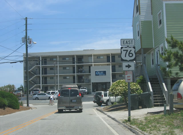
| U.S. 76 shifts east from Waynick Boulevard to Lumina Avenue via Sunset Avenue east at this turn. 05/29/05 |
|
| Turning south onto Lumina Avenue from Sunset Avenue east on U.S. 76. 05/29/05 |
|
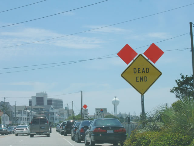
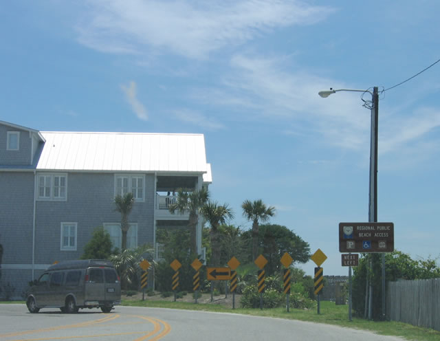
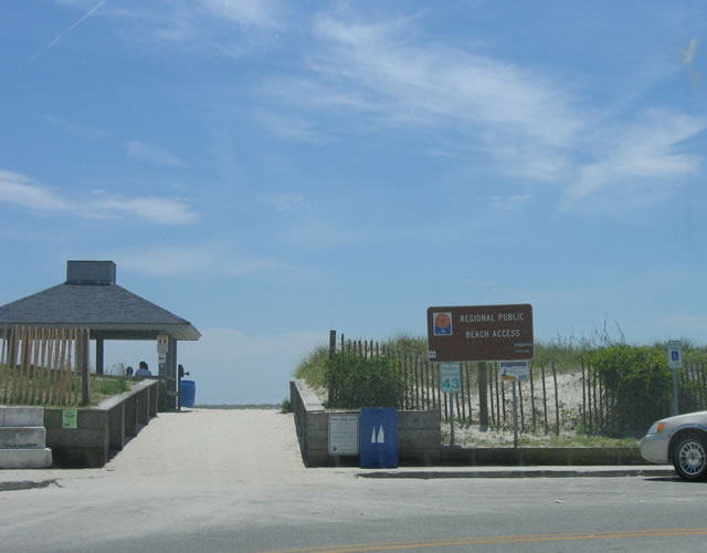
| Lumina Avenue extends south to Jack Parker Boulevard and beach access #43, the 43rd access point from north to south along the island. Jack Parker Boulevard represents the southernmost extent of U.S. 76 along the 1.84 mile long leg on Wrightsville Beach. 05/29/05 |
|
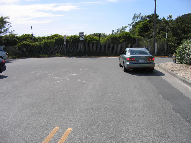
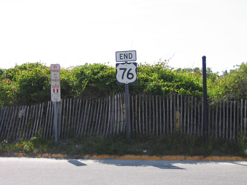
| Jack Parker Boulevard links Lumina Avenue with Water Street at the east end of U.S. 76. 05/29/05 |
Page Updated 09-12-2018.

 North
North  East
East  South
South