|
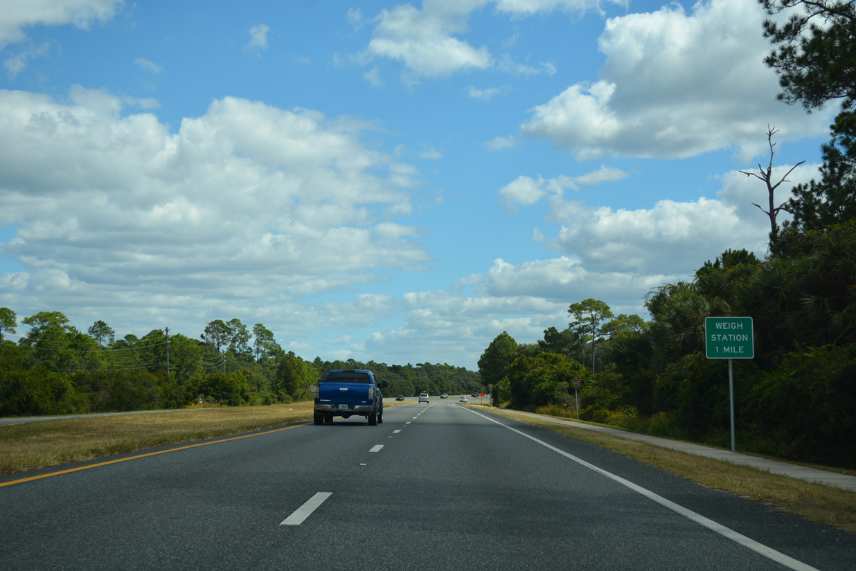
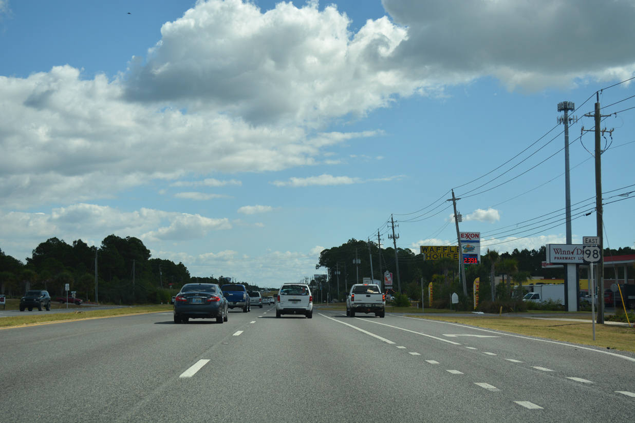
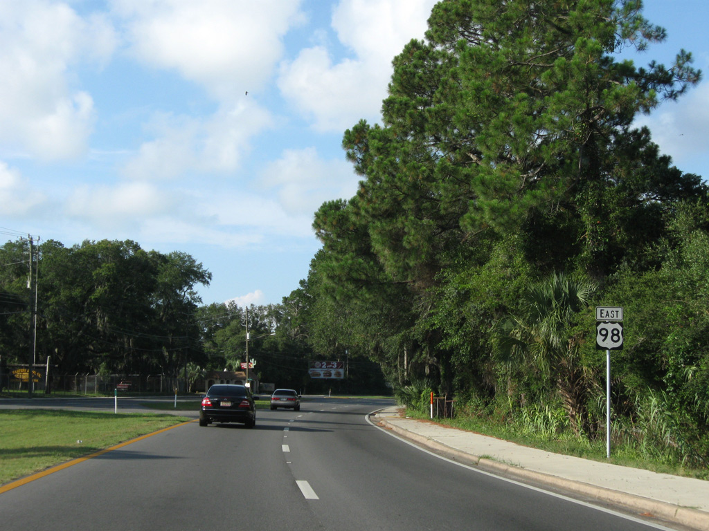
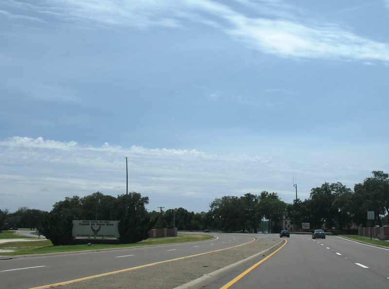
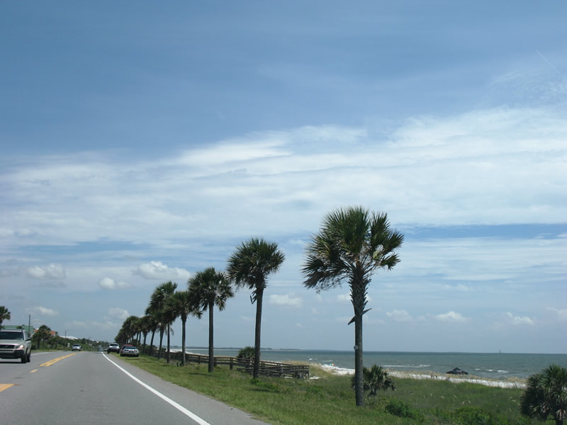
| U.S. 98 arcs east through Camp Helen State Park from the Walton County line to the twin bridges across Powell Lake / Philips Inlet. A weigh station follows the forthcoming spans. 10/13/16 |
|
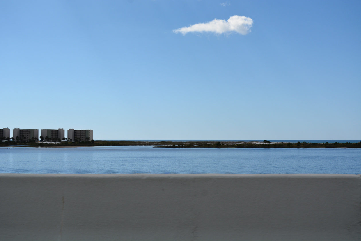
| Spanning waters between Philips Inlet and Lake Powell, the eastbound U.S. 98 bridge measures 2,102 feet in length. It was built in 1996 while the westbound crossing dates from 1989.1 10/13/16 |
|
| A narrow waterway links Philips Inlet with the Gulf of Mexico to the immediate south of U.S. 98. 10/13/16 |
|
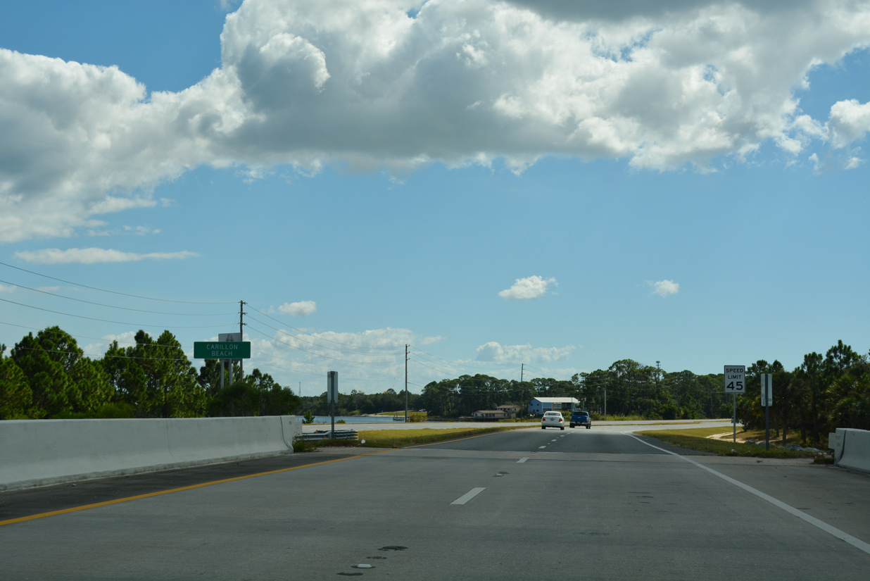
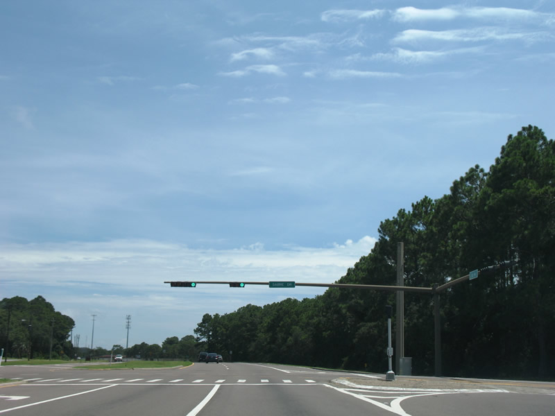
| U.S. 98 navigates through a second S-curve from Philips Inlet into the unincorporated community of Carillon Beach. 10/13/16 |
|
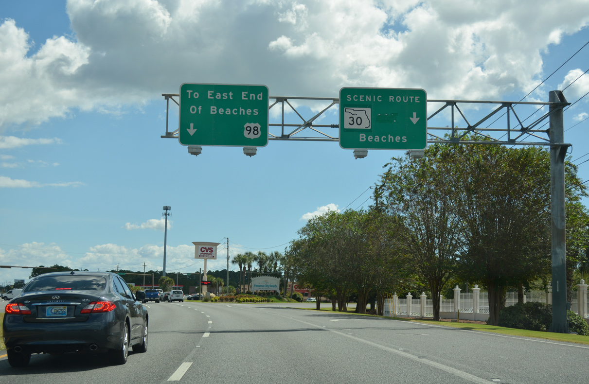
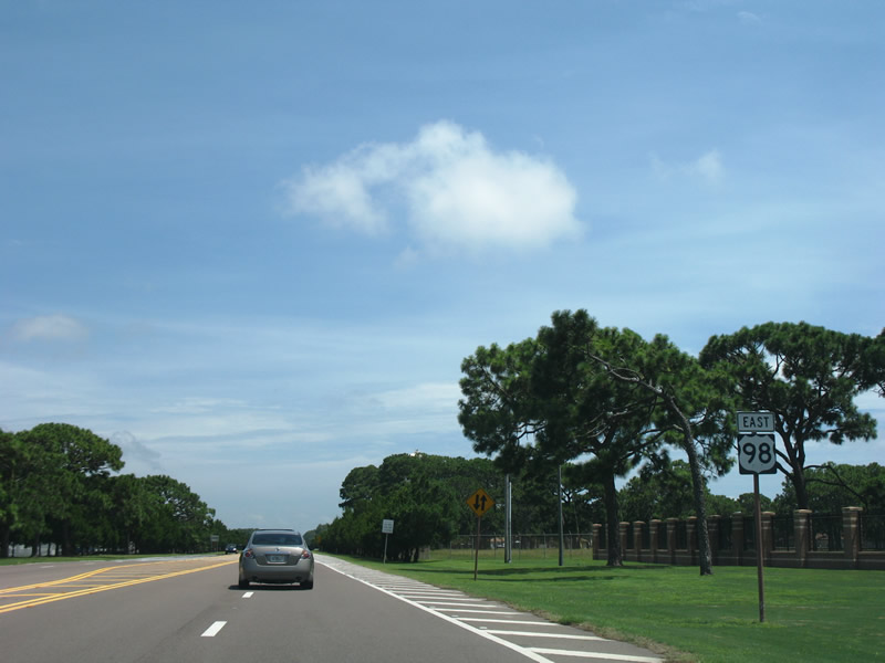
| Front Beach Road (old SR 30) is a coastal route branching southeast from U.S. 98 at Carillon Beach to Panama City Beach along the historic route of U.S. 98. 10/13/16 |
|
| Greenouts covered U.S. 98 Alternate, the former designation of Front Beach Road between Sunnyside and the Hathaway Bridge east of Panama City Beach. U.S. 98 Alternate was decommissioned in 2006 and resigned as State Road 30. Portions of SR 30 were subsequently relinquished to Bay County and Panama City and reclassified as CR 30. 10/13/16 |
|
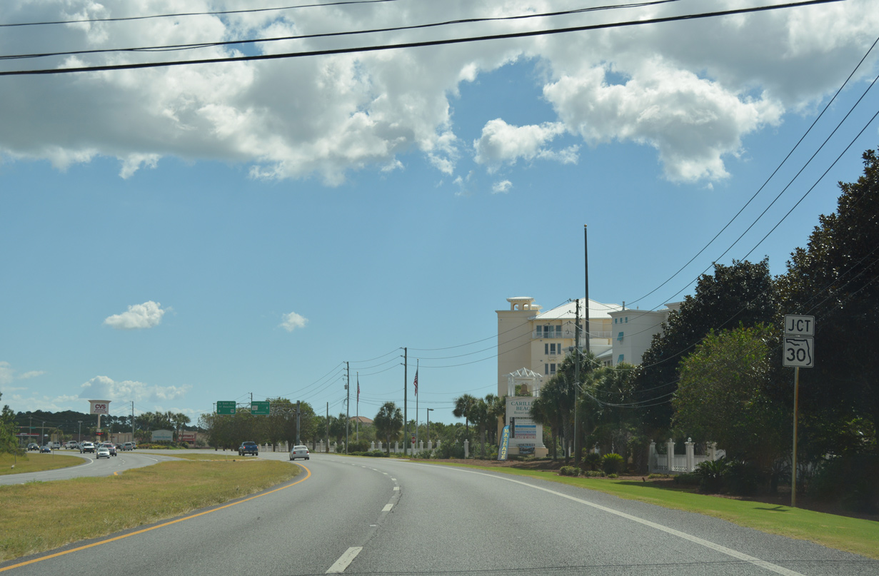
| The state road counterpart for U.S. 98 along Panama City Beach Parkway / Back Beach Road shifts from SR 30 to SR 30A beyond Front Beach Road. 10/13/16 |
|
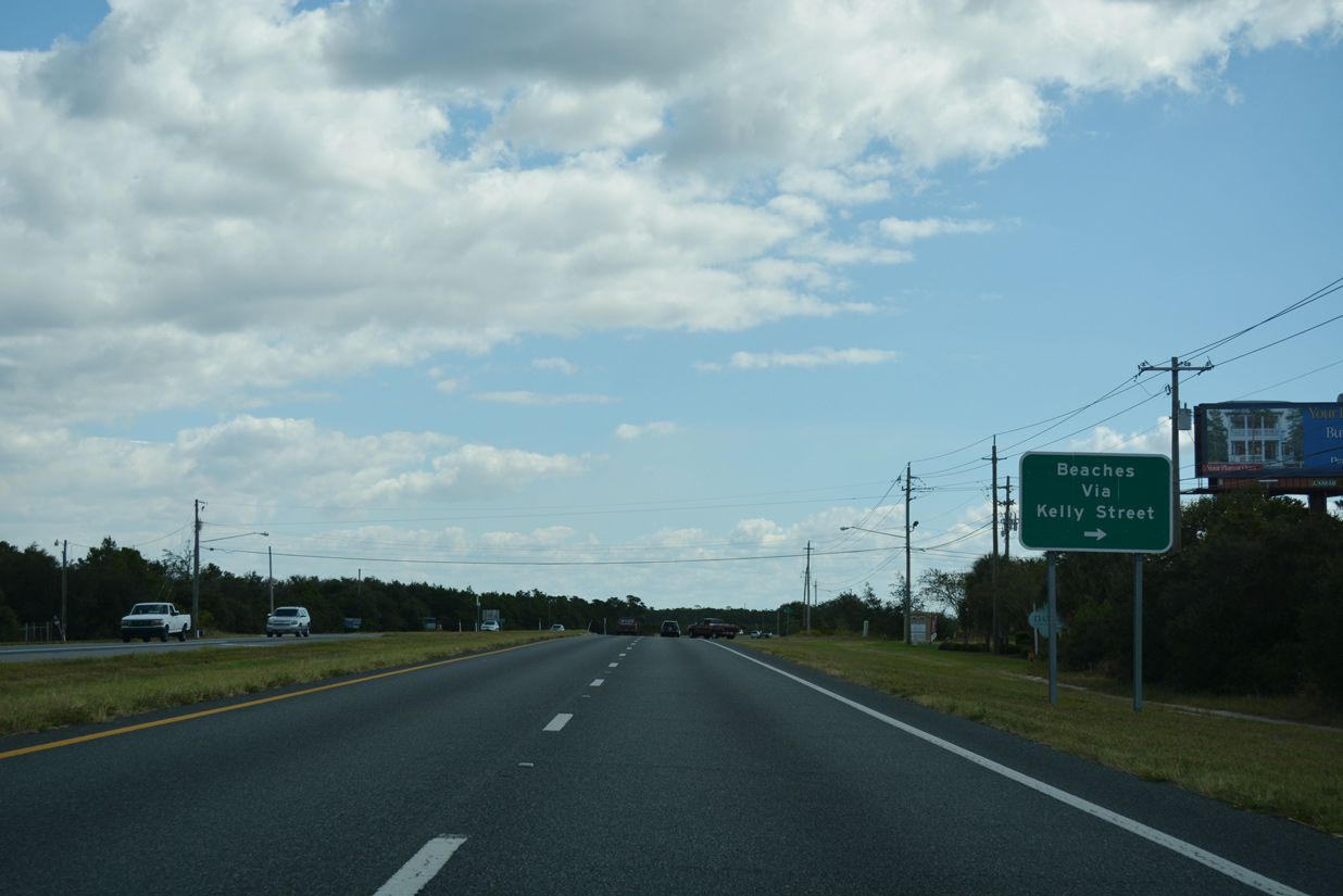
| Through roads linking U.S. 98 (Panama City Beach Parkway) with CR 30 / SR 30 (Front Beach Road) are signed with guide signs to aid motorists headed to the various beaches in western Bay County. Kelly Street heads south from the Panama City Beach line to Hollywood Beach. 10/13/16 |
|
| Panama City Beach Parkway east enters Laguna Beach ahead of Twin Lakes Drive. 04/04/09 |
|
| Twin Lakes Drive stems south from U.S. 98 to CR 30 (Front Beach Road) at Sunnyside. 04/04/09 |
|
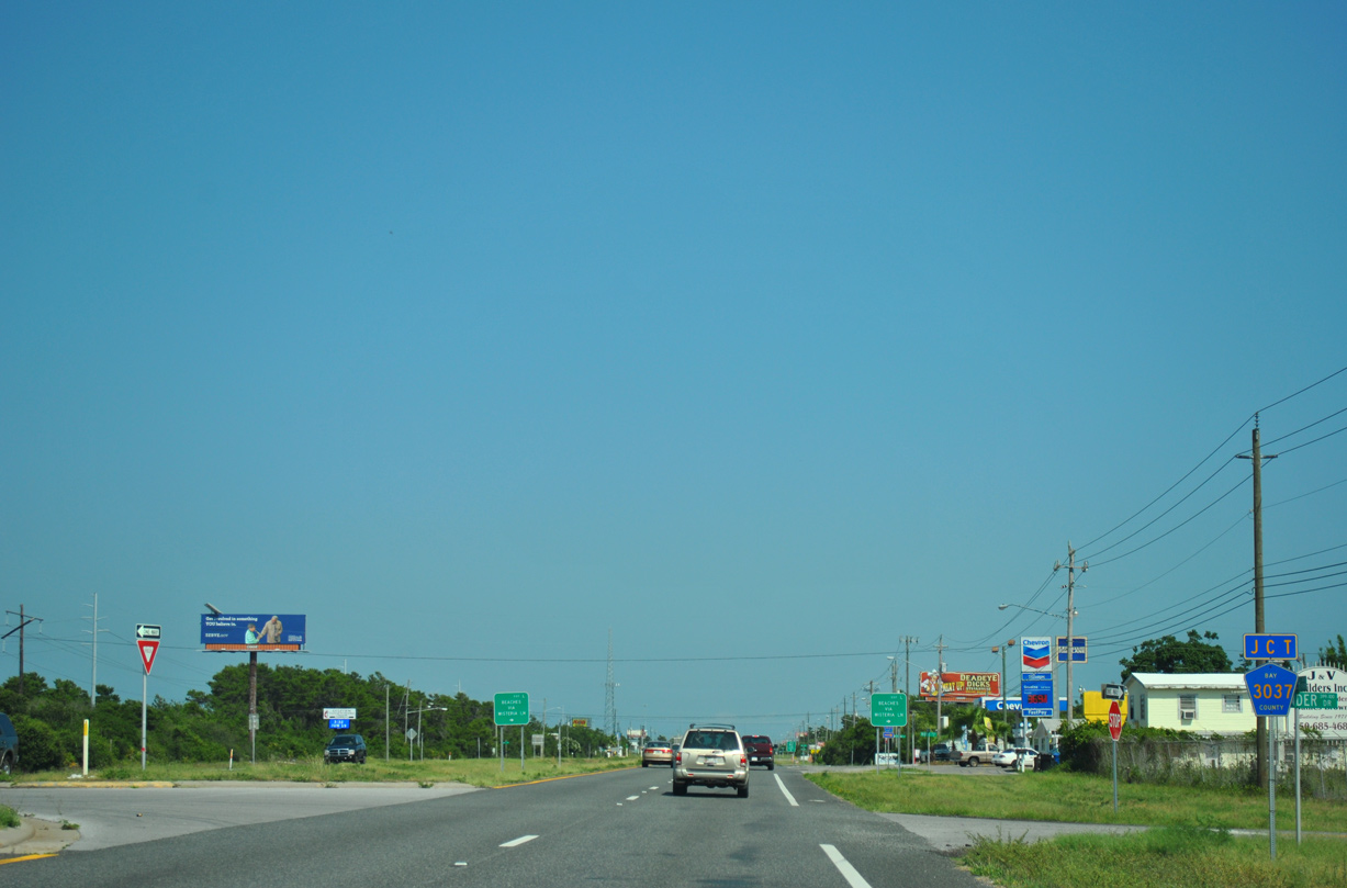
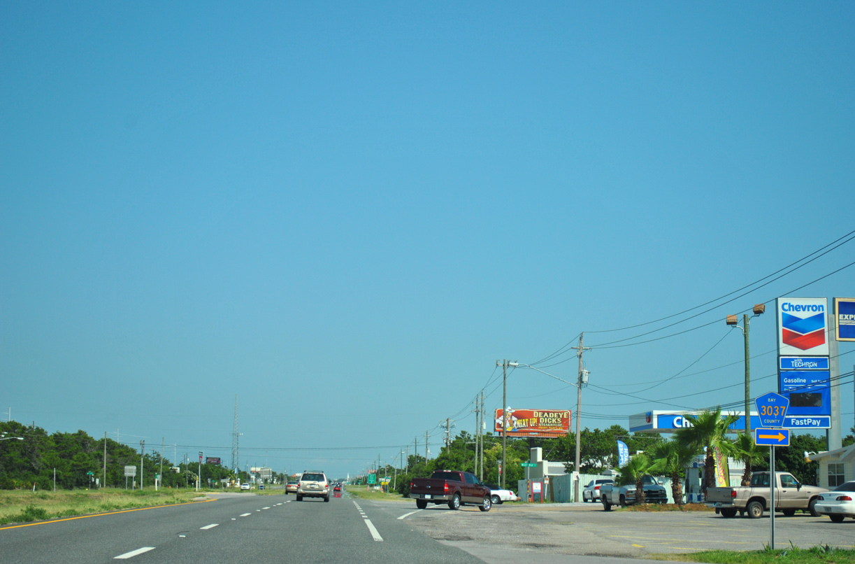
| County Road 3037 (Wisteria Lane) angles southwest 0.421 miles to Front Beach Road in Laguna Beach. 06/19/11 |
|
| Continuing 0.75 miles east from CR 3037 (Wisteria Lane), the succeeding beach access road from U.S. 98 is Toledo Place. 10/13/16 |
|
| U.S. 98 fully enters the Panama City Beach limits eastbound at Deluna Place. 10/13/16 |
|
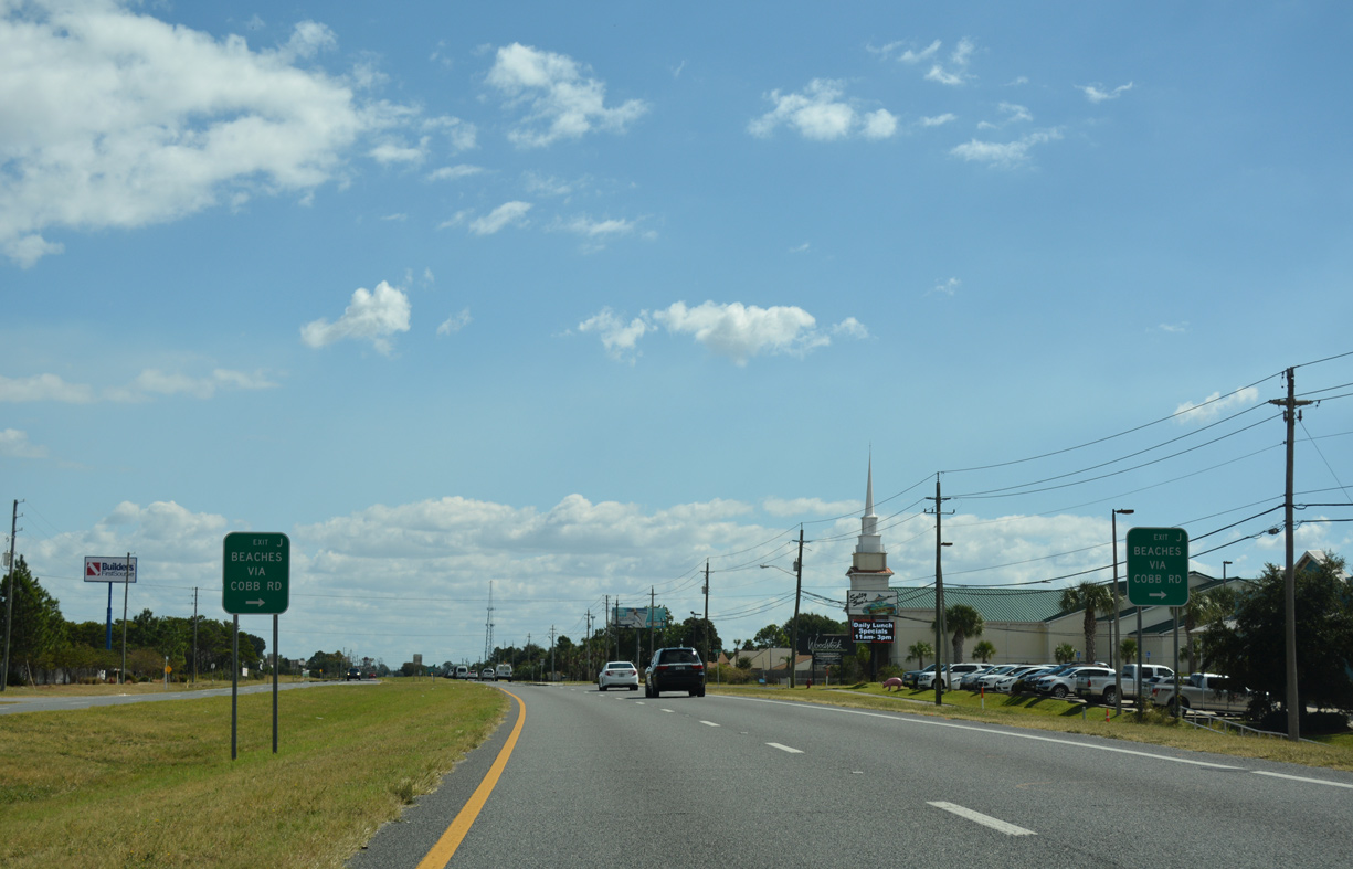
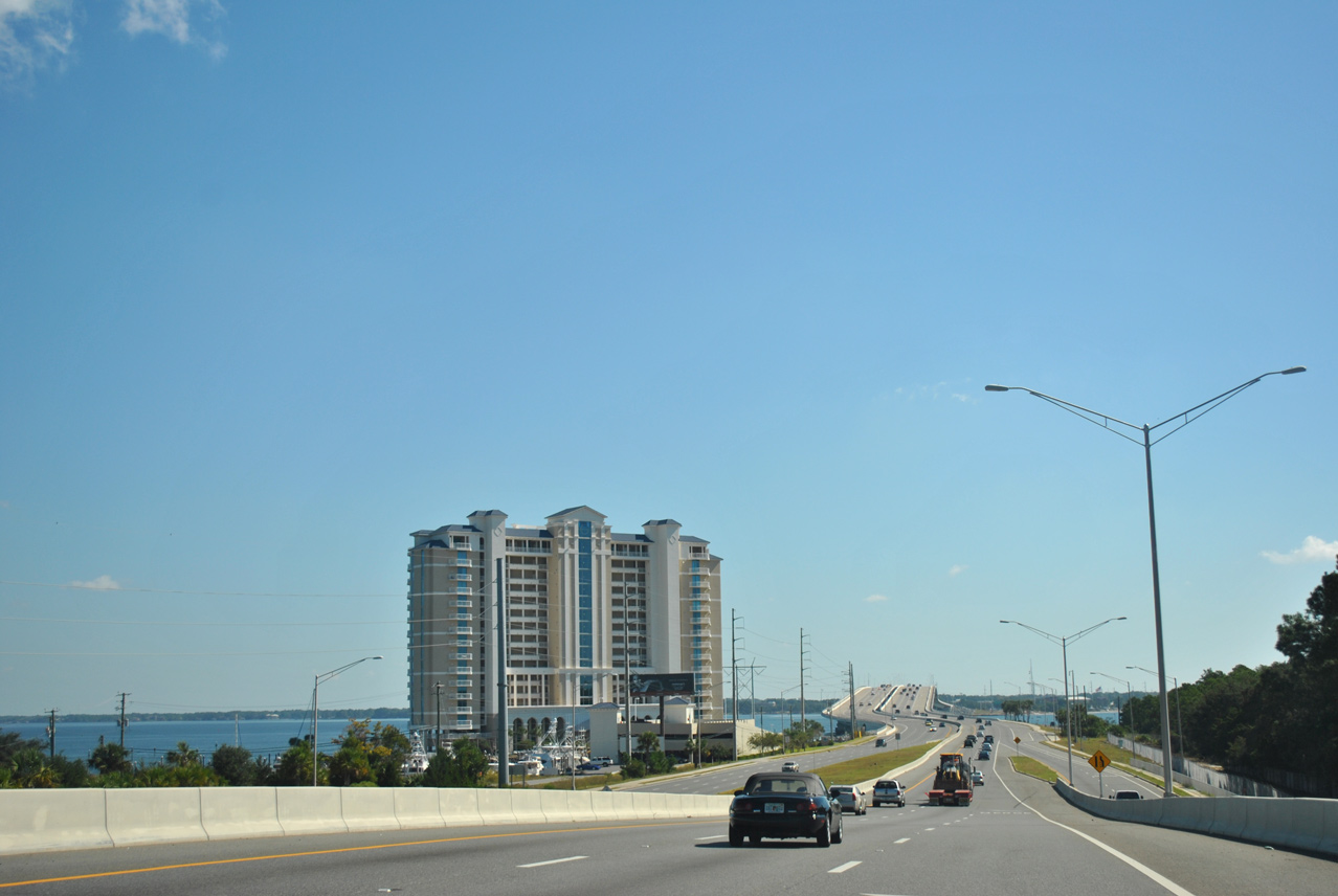
| Cobb Road leads south from U.S. 98 to Front Beach Road (SR 30) near the west end of the high rise condominium strip lining the Gulf of Mexico. 10/13/16 |
|
| Reassurance marker posted east of Cobb Road. 10/13/16 |
|
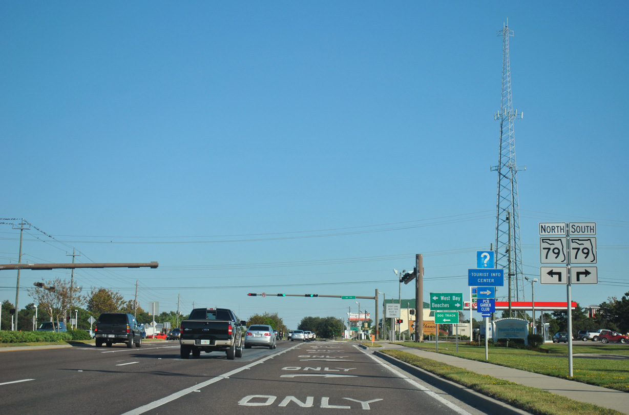
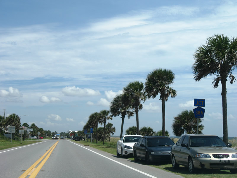
| SR 79 provides the first of three routes from the west connecting coastal Bay County with Interstate 10 and points north. The four lane corridor stretches north from Panama City Beach to SR 388 near Northwest Florida Beaches International Airport (ECP), Ebro and Vernon. 10/13/16 |
|
| The right lane of U.S. 98 eastbound formerly defaulted onto SR 79 south to SR 30 (Front Beach Road). Three lanes continue east here now. SR 79 otherwise travels 60.73 miles north to West Bay, Bonifay and Alabama 167 near Esto. 10/16/11 |
|
| Confirming shield for U.S. 98 east after SR 79 (Arnold Road). 09/23/09 |
|
| Perry, where U.S. 98 combines with U.S. 19 south at the Big Bend of Florida, debuts on the distance sign posted east of SR 79. Panama City is 16 miles to the east. 09/23/09 |
|
| Passing by Frank Brown Park, U.S. 98 (Panama City Beach Parkway) enters a retail anchored by the Pier Park Drive lifestyle center. Pier Park Drive was extended north to Bay Parkway west to SR 79 in 2017. 09/23/09 |
|
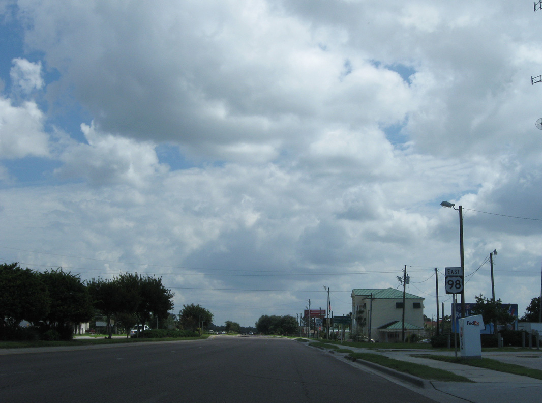
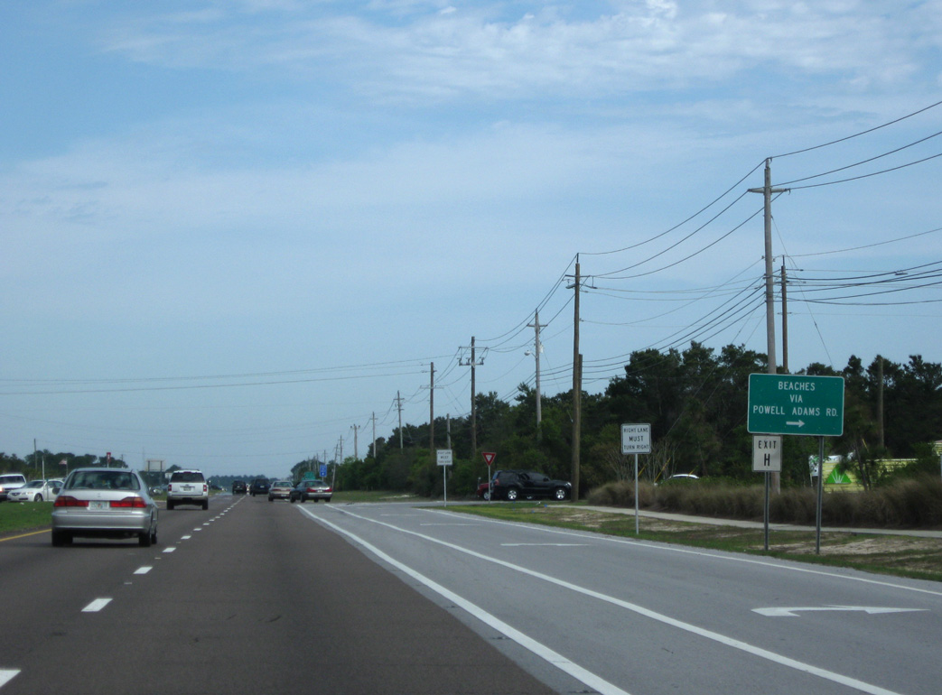
| Powell Adams Road connects with Panama City Beach Parkway north from SR 30 at Pier Park North shopping center. 04/04/09 |
|
| Hills Road provides the next beach access road linking U.S. 98 east with Front Beach Road (SR 30). 04/04/09 |
|
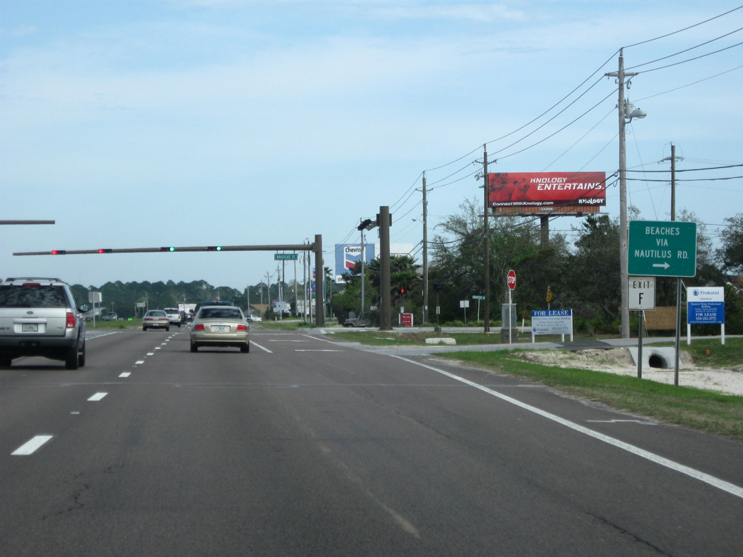
| Nautilus Road heads southwest from U.S. 98 to SR 30 at the east end of the high rise condominium row along Front Beach Road. Construction in 2019 will extend Nautilus Street north to Bay Parkway, a 2016-built road paralleling U.S. 98 northwest to SR 79. 04/04/09 |
|
| Advancing from Nautilus Street, U.S. 98 make a gradual eastern turn. A reassurance marker appears at Lantana Street. 04/04/09 |
|
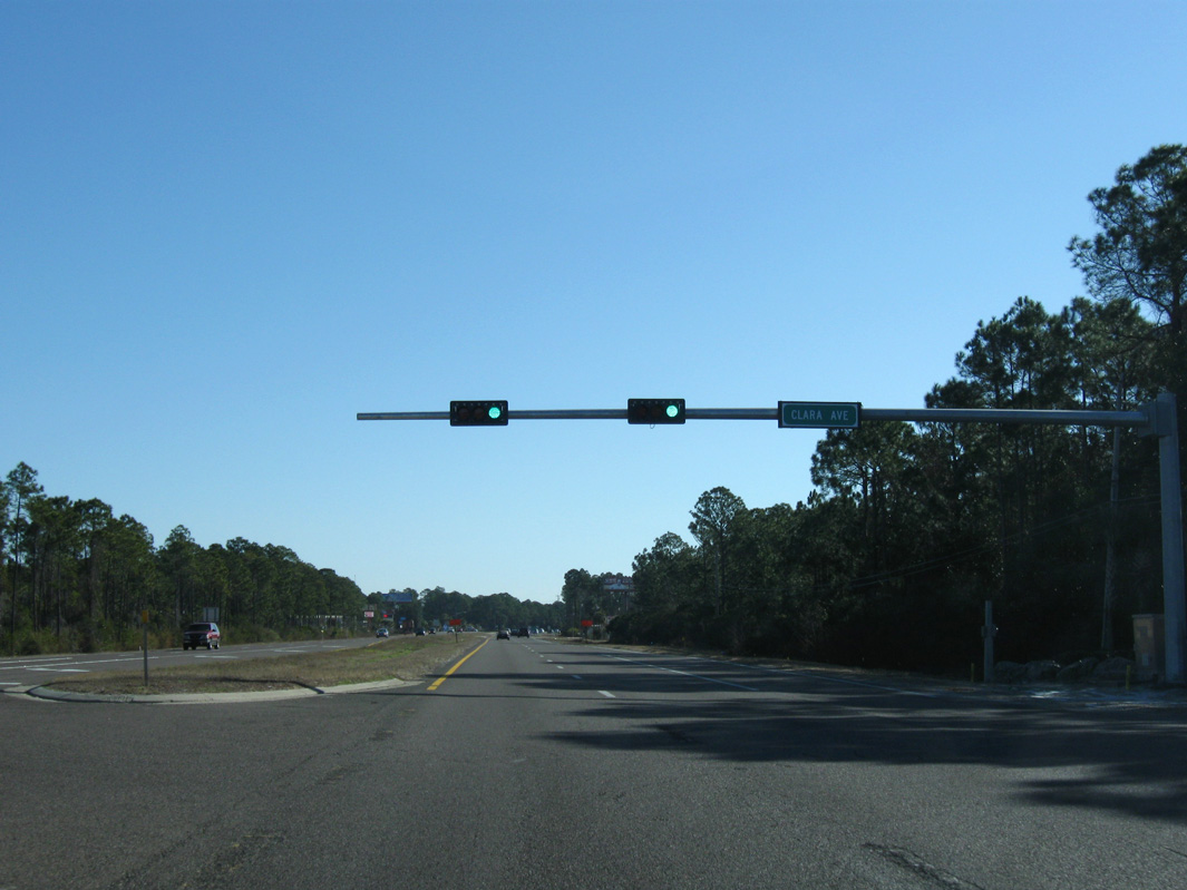
| Clara Avenue (old CR 30C) stems south 0.789 miles from U.S. 98 to SR 392A (Hutchinson Boulevard) and SR 30 (Front Beach Road). Traffic lights were installed here by 2010. 01/15/11 |
|
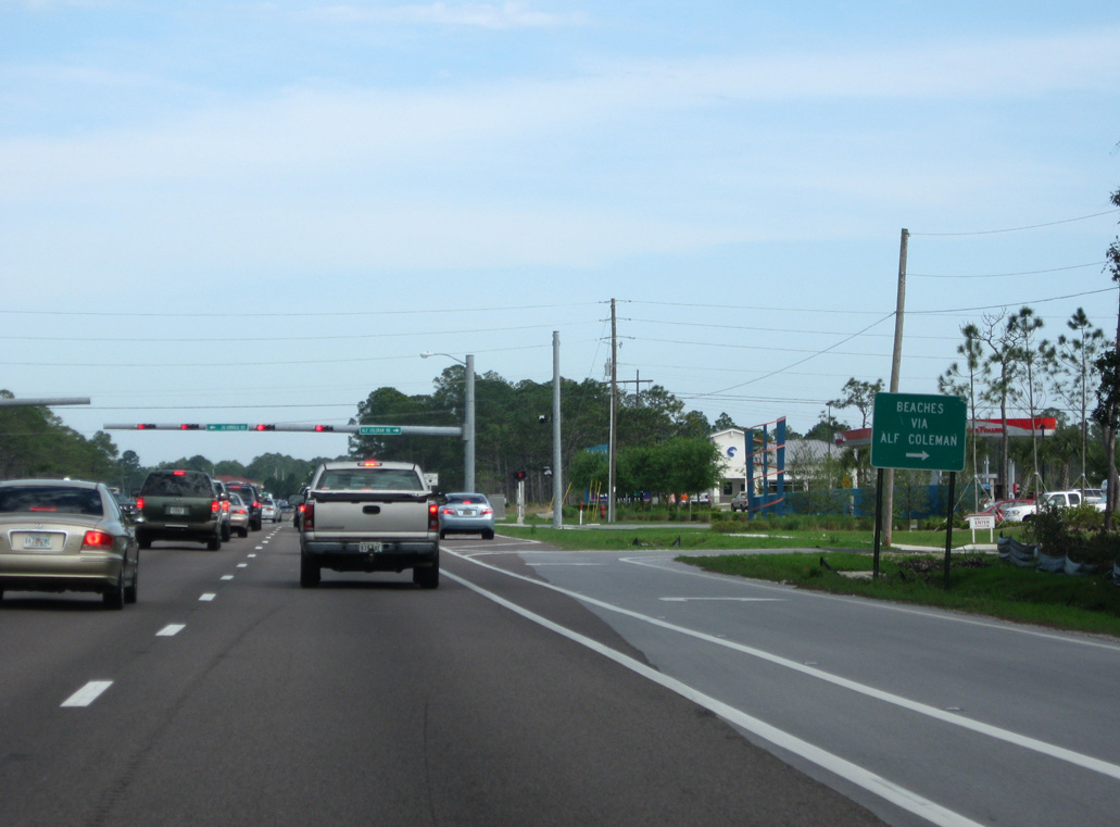
| Alf Coleman Road (old CR 30H) follows one mile east of Clara Avenue as the succeeding beach access road. 04/04/09 |
|
| Entering the commercialized intersection with Richard Jackson Boulevard (formerly Beckrich Road) on U.S. 98 eastbound. The four lane boulevard heads 0.6 miles southwest to SR 392A (Hutchinson Boulevard) at Edgewater Beach & Golf Resort. 04/04/09 |
|
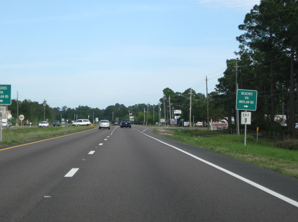
| Moylan Road, an old branch of County Road 30B, links Panama City Beach Parkway with the eastern segment of SR 30 along Front Beach Road. 04/04/09 |
|
| Allison Avenue south to North Lagoon Drive (CR 3030) represents the last lettered beach access point from U.S. 98 through Panama City Beach. 04/04/09 |
|
| The eastbound lanes of U.S. 98 elevate over forthcoming Thomas Drive (CR 3031) at the merge with SR 30 (Front Beach Road). 10/17/11 |
|
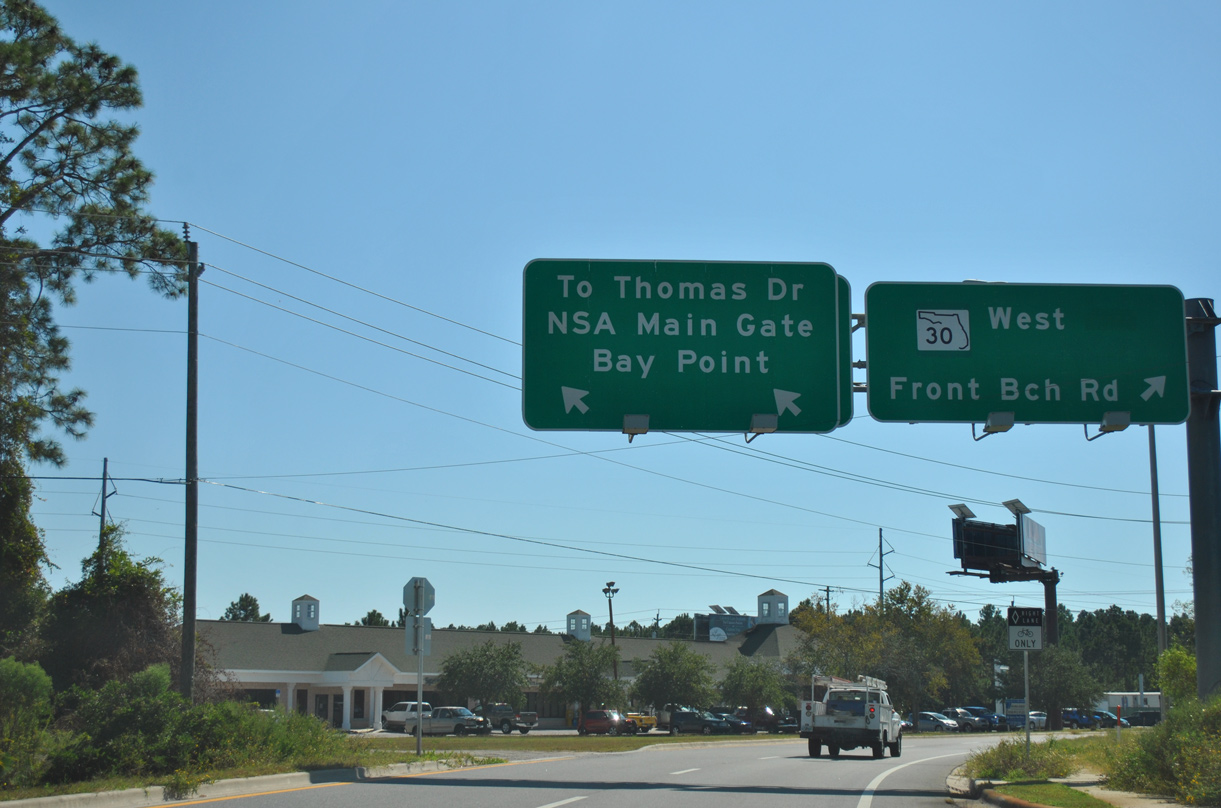
| A ramp departs for Front Beach Road eastbound ahead of the south side frontage road for U.S. 98 to CR 3031, the Naval Surface Warefare Center (NSWC) and Bay Point. 10/17/11 |
|
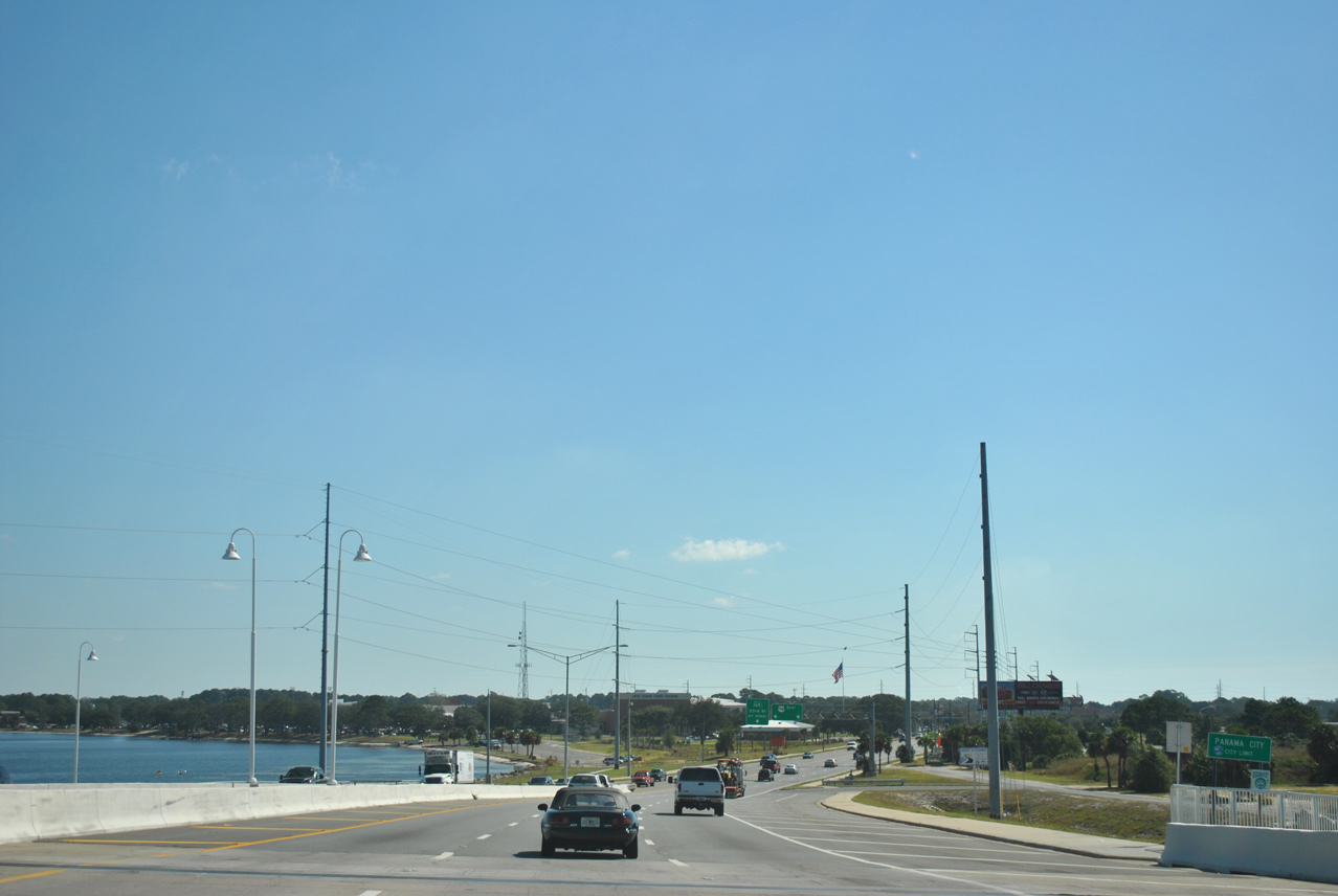
| U.S. 98 (Panama City Beach Parkway) and SR 30 (Front Beach Road) converge at a wye interchange preceding the Hathaway bridge into Panama City. A U-turn ramp links U.S. 98 east with SR 30 west directly. 04/04/09 |
|
| U.S. 98 eastbound rises onto a viaduct spanning Thomas Drive (CR 3031) and Woodlawn Drive / Solomons Drive. The westbound lanes travel at-grade. 10/17/11 |
|
| A lane drop along U.S. 98 precedes the eastbound merge with the south side frontage road beyond Woodlawn Drive. The elevated westbound lanes remain unbuilt here due to lack of funding. 10/17/11 |
|
| A turn-off connects the eastbound lanes with a boat ramp to St. Andrew Bay just ahead of the Hathaway Bridge. 08/03/08 |
|
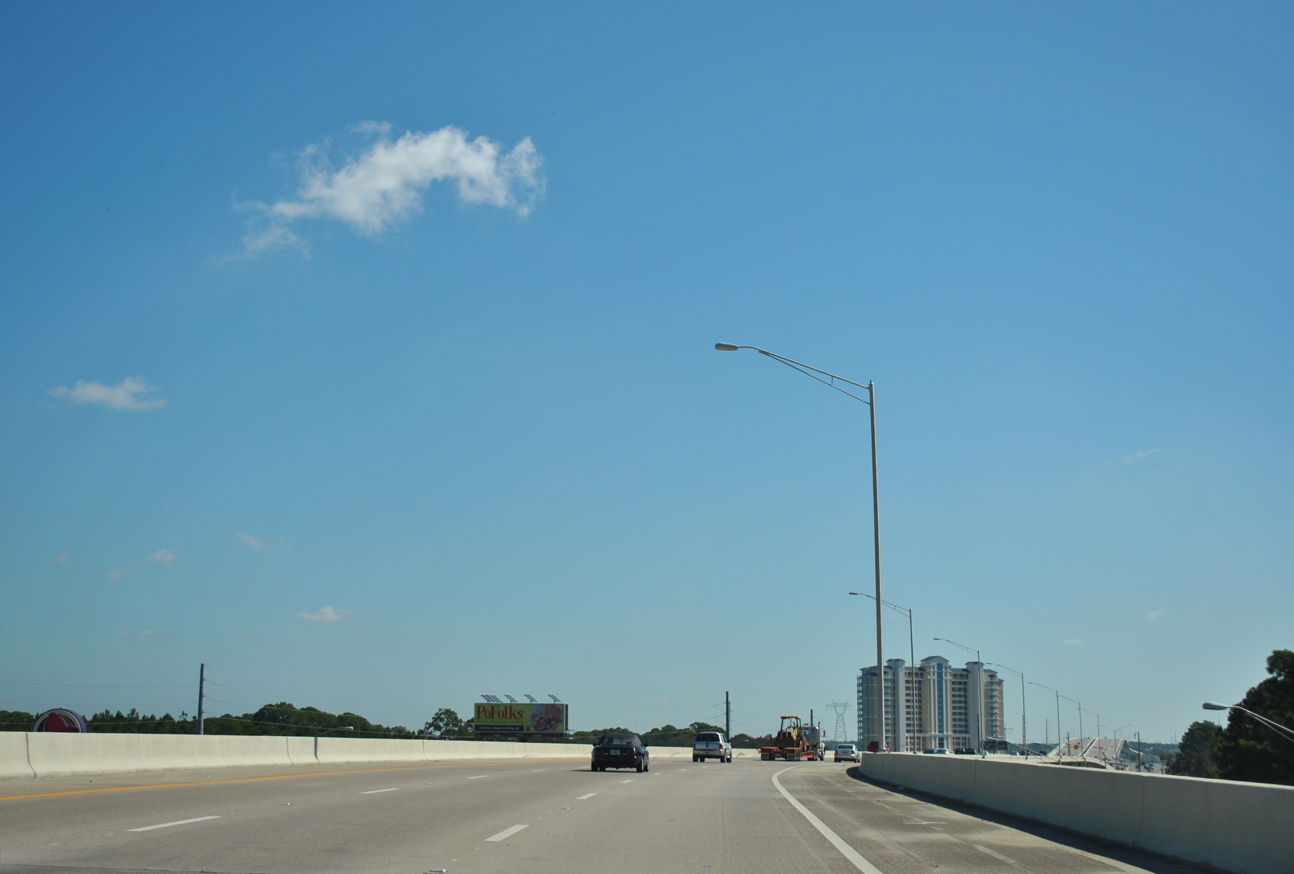
| The Hathaway Bridge crosses the Intracoastal Waterway linking West Bay and St. Andrew Bay ahead of Panama City. Costing $82.5 million, the 3,800-foot long twin bridges accommodate six lanes of traffic with 8' wide multi use paths in each direction.2 10/17/11 |
|
| The Hathaway Bridge crests at 65 feet above the St. Andrew Bay navigation channel. The 84 foot wide bridge decks can be restriped to accommodate additional lanes of traffic.1 10/17/11 |
|
| U.S. 98 lowers from the Hathaway Bridge into Panama City at Sulphur Point. Taking four years to build, the Hathaway Bridge replaced a 62-foot wide bridge with four lanes and no shoulders. It opened to traffic in May 2004.1 10/17/11 |
|
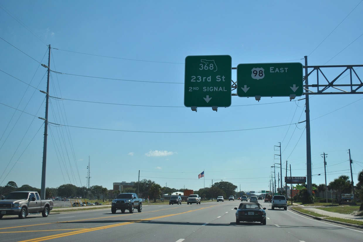
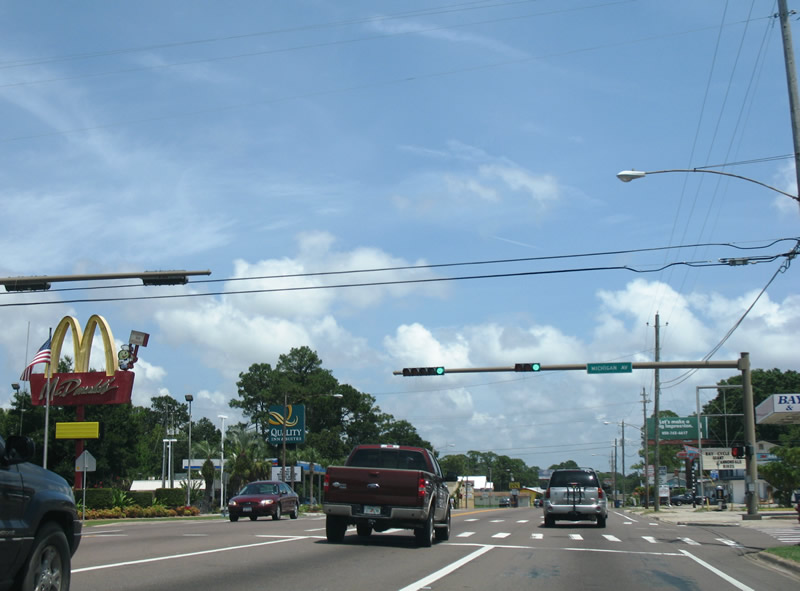
| U.S. 98 shifts southeast from the Hathaway Bridge to SR 368 (23rd Street) and 18th Street through Panama City. The $67.9 million 23rd Street Flyover project underway to Winter 2019 addresses congestion along what was previously a five lane boulevard by upgrading U.S. 98 between St. Andrew Bay and Michigan Avenue to limited access standards. 10/17/11 |
|
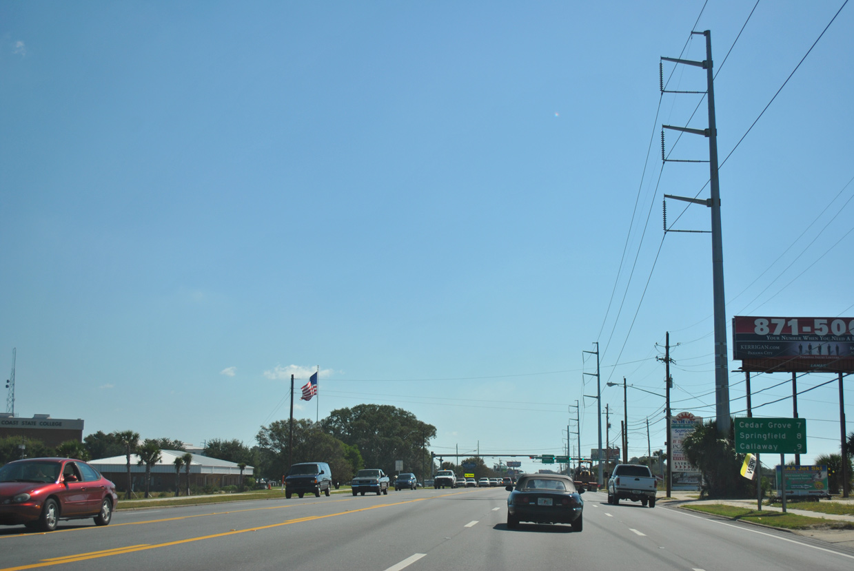
| This eastbound distance sign referenced the neighboring communities of Cedar Grove, Springfield, and Callaway, located to the east of Panama City. An off-ramp to Collegiate Drive (SR 368A) departs from U.S. 98 east here now. 10/17/11 |
|
| The 23rd Street Flyover project replaces the signalized intersection with Seaport Drive south and Collegiate Drive (SR 368A) east to Gulf State College with a split diamond interchange. 10/17/11 |
|
| SR 368 (23rd Street) winds northeast around Gulf State College to Posten Bayou. 23rd Street bee lines east from Frank Nelson Park and the Bayview community across Panama City to U.S. 231 near Diego Park and Panama City Mall. 10/17/11 |
|
| The 5.39 mile long state road provides an alternate route from U.S. 98 east to U.S. 231 north. 10/17/11 |
|
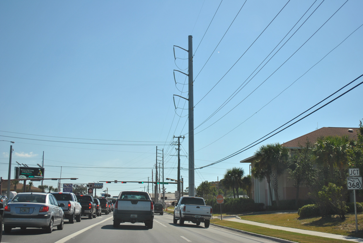
| The 1.093 mile long upgrade of U.S. 98 (Project Number 217976-3) replaces the signalized left turn for SR 368 (23rd Street) with a wye interchange. 10/17/11 |
|
| The 23rd Street Flyover project extends east along U.S. 98 to Brown Avenue, where it will transition onto the at-grade section of 18th Street. 10/17/11 |
|
| Michigan Avenue (former CR 30A) intersects U.S. 98 at the first Panama City traffic light along eastbound. Michigan Avenue heads north to Pretty Bayou and south to 15th Street at Lake Huntington. 08/03/08 |
|
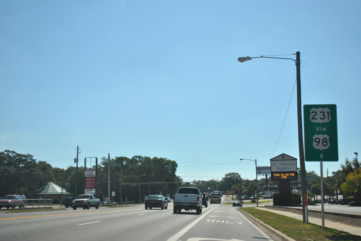
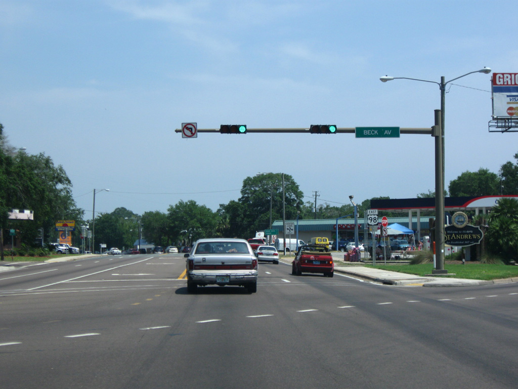
| U.S. 98 arcs southeast from 18th Street and splits with U.S. 98 Business (Beck Avenue). U.S. 98 Business is unmarked in this direction, with a trailblazer referencing U.S. 231 instead. The bannered route drops south to 9th Street and runs east along St. Andrew Bay to Downtown Panama City. 10/17/11 |
|
| SR 390 follows Beck Avenue south from Pretty Bayou to end at U.S. 98 opposite U.S. 98 Business. The state road loops north from Panama City to Lynn Haven and east to U.S. 231 near Brannonville. 06/20/09 |
|
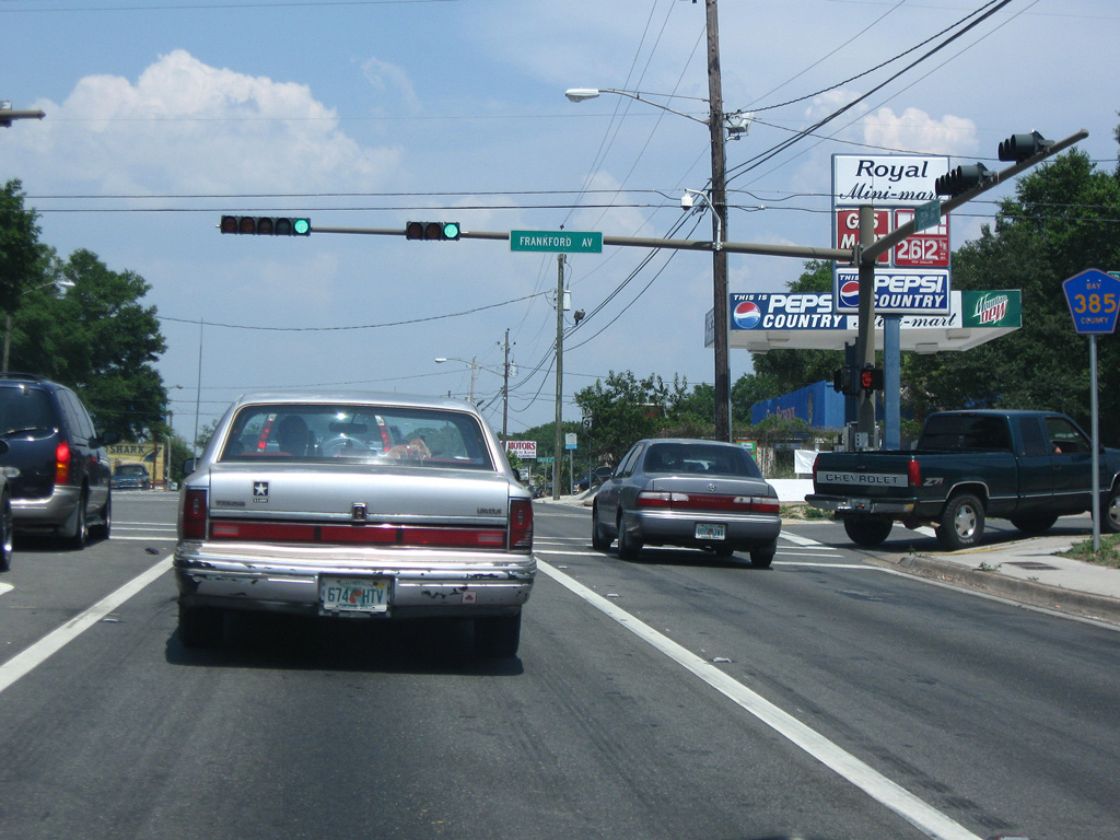
| Resuming an easterly heading on 15th Street, U.S. 98 approaches Bay County Road 385 at Frankford Avenue. 06/20/09 |
|
| CR 385 travels 3.63 miles through Panama City, heading south to U.S. 98 Business at 9th Street and north to the Florida A&M University gate on Frankford Avenue by Robinson Bayou. 06/20/09 |
|
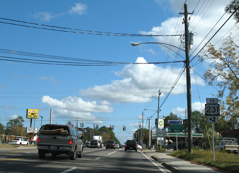
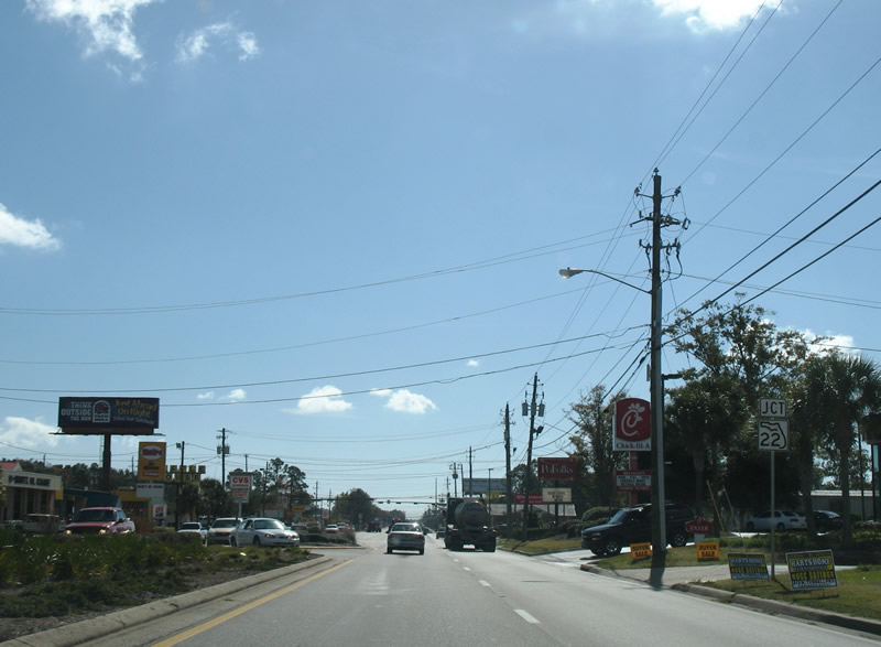
| 15th Street becomes more commercialized east of Lisenby Avenue (CR 327) with an array of car dealerships, strip malls and fast food. Crossing the Bayline Railroad, U.S. 98 advances east to back to back intersections with Jenks Avenue and U.S. 231 (Harrison Avenue). 06/20/09 |
|
| U.S. 98 (East 15th Street) leaves the intersection with SR 77 (Martin Luther King Jr. Boulevard) and crosses Palo Alto Avenue at this confirming marker. 11/27/06 |
|
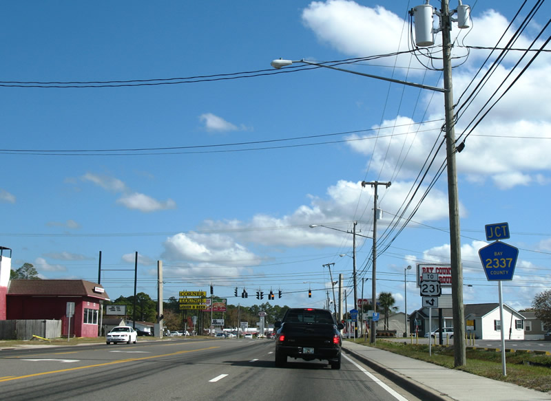
| Forthcoming Sherman Avenue (CR 2337) represents the first of three signed alternate routes leading north from U.S. 98 to U.S. 231. U.S. 231 extends northeast from Panama City to Youngstown, Fountain and Interstate 10 at Cottondale. 11/27/06 |
|
| Bay County Road 2337 (Sherman Avenue) meets U.S. 98 (East 15th Street) at Cedar Grove. Sherman Avenue provides a cutoff to SR 389 north for U.S. 231 at Hiland Park. 11/27/06 |
|
| CR 2337 overlays Sherman Avenue south 1.25 miles to U.S. 98 Business (5th Street) in east Panama City and north 1.36 miles to SR 389 (East Avenue). 11/27/06 |
|
| Continuing east from Sherman Avenue through Cedar Grove along U.S. 98 (15th Street). Prior to 2008, Cedar Grove was incorporated as a town. 11/27/06 |
|
| Two additional routes provide connections with U.S. 231 north from U.S. 98 before the route turns southward to Callaway. 11/27/06 |
|
| SR 389 (East Avenue) stems 1.25 miles north from U.S. 98 Business (5th Street) in Panama City to meet U.S. 98 (East 15th Street) in Cedar Grove. 11/27/06 |
|
| U.S. 231 trailblazer directing traffic east to Transmitter Road (CR 2327) and north onto SR 389 (East Avenue). 11/27/06 |
|
| SR 389 concludes a 3.03 mile route north at U.S. 231 opposite County Road 389. CR 389 extends northward 3.95 miles to SR 77 in the city of Lynn Haven. 11/27/06 |
|
| Another eastbound U.S. 98 reassurance marker posted along East 15th Street in Cedar Grove. 11/27/06 |
|
| Panama City's neighboring city of Parker lies five miles to the south along St. Andrew Bay. Perry, where U.S. 98 merges with U.S. 19 and U.S. 27 Alternate, is 159 miles to the east. 11/27/06 |
|
| U.S. 98 enters the city of Springfield along an undeveloped stretch east of School Avenue. 11/27/06 |
|
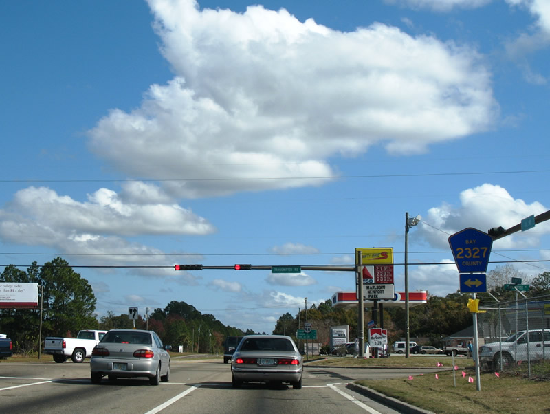
| Approaching CR 2327 (Transmitter Road) on U.S. 98 east in Springfield. County Road 2327 provides the final connection to U.S. 231 before U.S. 98 turns south back to the coast. 11/27/06 |
|
| Bay County Road 2327 travels 4.14 miles northward from SR 22 (East 3rd Street) in Springfield to U.S. 231 near Brannonville and CR 390 in Lynn Haven. 11/27/06 |
|
| U.S. 98 shield and distance sign posted after Transmitter Road. Port St. Joe replaced Perry as the long distance control city. Perry largely remains on distance signs throughout Florida due to old signing practices that are carbon copied onto new assemblies. 11/27/06 |
|
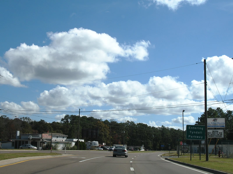
| U.S. 98 turns southward 90 degrees from 15th Street at Springfield onto Tyndall Parkway through Callaway. 11/27/06 |
|
| Tyndall Parkway south next meets the east end of Bay County Road 28 (11th Street). CR 28 largely constitutes a residential through route from Springfield west across Panama City to U.S. 98 Business (Beck Avenue) near Buena Vista Point. 11/27/06 |
|
| U.S. 98 (Tyndall Parkway) enters the city of Callaway south of CR 28 and approaches SR 22 (Wewa Highway). 11/27/06 |
|
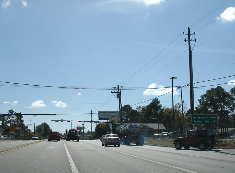
| SR 22 leads west to U.S. 98 Business in Springfield and east to SR 71 in Wewahitchka. 11/27/06 |
|
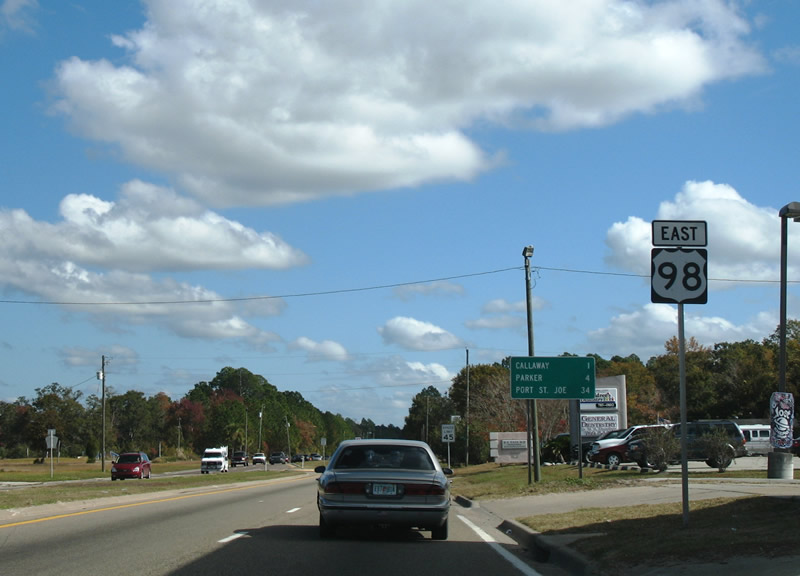
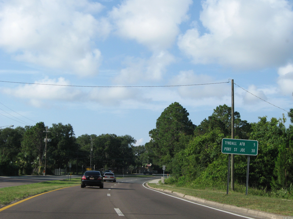
| U.S. 98 Business returns to U.S. 98 (Tyndall Parkway) east from the city of Parker ahead of Pitts Bayou. Beyond the merge is this distance sign with the distances to Tyndall Air Force Base and the Gulf County seat of Port St. Joe. 06/27/09 |
|
| Reassurance shield posted along Tyndall Parkway near Wallace Road. 06/27/09 |
|
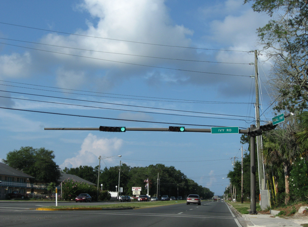
| Ivy Road is a residential street spurring east from U.S. 98 (Tyndall Parkway) to East Lake in south Callaway. 06/27/09 |
|
| Spanning East Bay, U.S. 98 crosses the DuPont Bridge between Parker and Tyndall Air Force Base. This span replaced an adjacent 1929-built truss bridge that extended south from what is now Oak Shore Drive. 08/03/08 |
|
| Viewing St. Andrew Bay to the northwest at Ferry Point and Panama City from the DuPont Bridge. 06/27/09 |
|
| Supporting four lanes across a 58 foot wide deck, the DuPont Bridge opened to traffic in 1965 and is of typical construction for that era with no shoulders and concrete guard rails. The 2,748 foot long span peaks at 49.9 feet above the Intracoastal Waterway.3 08/03/08 |
|
| U.S. 98 enters Tyndall Air Force Base east of Pearl Bayou. 08/03/08 |
|
| Sabre Drive provides access to northwest reaches of Tyndall AFB including Wood Manor Housing, the Youth Center, the Marina and Golf Course, among other points of interest. Tyndall AFB Visitors Center lies on the northeast corner of U.S. 98 and Sabre Drive. 08/03/08 |
|
| U.S. 98 (Tyndall Parkway) continues another 1.7 miles south from Sabre Drive to Tyndall Drive east, Airey Avenue west and the Main Gate to Tyndall AFB. A $19 million project underway by late 2018 replaces the traffic light here with a single point interchange. 08/03/08 |
|
| U.S. 98 (Tyndall Parkway) narrows from a four lane divided highway to two lanes beyond the signal at Airey Avenue and Tyndall Drive. The 1.00 mile long upgrade (Project Number 431684-1) along U.S. 98 includes adding an overpass across forthcoming Louisiana Avenue. 08/03/08 |
|
| U.S. 98 bee lines southeast through vast forest and wetland areas through the remainder of Tyndall AFB and Tyndale Air Force Base Wildlife Management Area. 08/03/08 |
|
| 2017 FDOT traffic counts reduced from 20,500 to 5,900 vehicles per day along U.S. 98 southeast through Tyndall AFB. 08/03/08 |
|
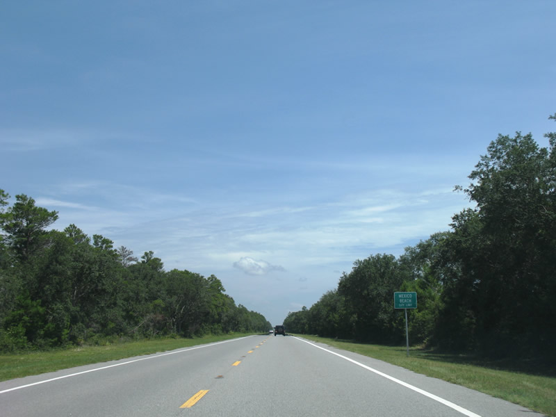
| U.S. 98 enters the city limits of Mexico Beach 1.4 miles beyond the air force base grounds. The community of 1,200 took a direct hit from the eye of Hurricane Michael, which made landfall in Bay County on the afternoon of October 10, 2018. 08/03/08 |
|
| Crossing the Charles M. Parker Bridge along U.S. 98 east in Mexico Beach. Built in 2006, this bridge spans a waterway connecting several marines with Salt Creek and the Gulf of Mexico. 06/27/09 |
|
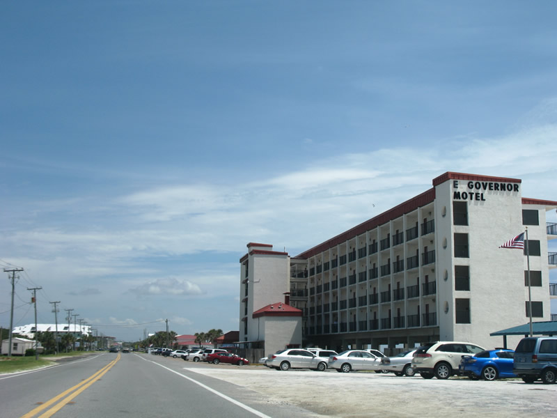
| The largest building within Mexico Beach is the El Governor Motel. The city generally consists of a narrow street grid mainly along the coast.
155 mile per hour winds from Hurricane Michael pushed a nine foot storm surge that inundated this coastal city on October 10, 2018. 08/03/08 |
|
| Eastbound reassurance marker posted after the intersection with 15th Street (unsigned CR 386A). CR 386A provides a 1.21 mile long cut-off for CR 386 north to Overstreet. 08/03/08 |
|
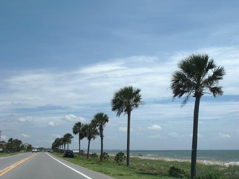
| Unobstructed views of the Gulf of Mexico shoreline are visible along U.S. 98 from 8th Street southward to the county line. 08/03/08 |
|
| County Road 386 straddles the Bay/Gulf County line north from U.S. 98 and Mexico Beach to CR 386A (15th Street) before turning more inland to Overstreet. 08/03/08 |
|
| County Road 386 arcs 19.46 miles northeast from Mexico Beach to SR 71 near the city of Wewahitchka. 08/03/08 |
|
| U.S. 98 leaves Mexico Beach and Bay County for Beacon Hill in Gulf County. The county line represents the boundary between Central and Eastern Time Zones. 08/03/08 |
Page Updated 10-12-2018.


 East
East