U.S. 150 generally serves local traffic throughout its 264.4 mile route across north central Illinois. Paralleling Interstate 74, the highway ventures south from Moline and the Quad Cities to Galesburg. Both turn east from East Galesburg, with U.S. 150 remaining north of the freeway corridor into Peoria. Through Peoria, U.S. 150 expands into an arterial route along War Memorial Drive southeast to the McClugage Bridge across the Illinois River.
Combining with U.S. 24, U.S. 150 back tracks southwest along the east banks of the Illinois River to meet Interstate 74 again at East Peoria. The US route resumes an easterly course from there along I-74 to Morton and the west side of Normal. Both routes turn south again and converge in Bloomington. U.S. 150 joins Interstates 55 and 74 with Downtown Bloomington, navigating through the city street grid including a one-way couplet along Locust Street east, Clinton Street north, Empire Street west and Lee Street south. The route dog legs east from Clinton Street to the commercial strip along Morrissey Drive via Oakland Avenue in southeast Bloomington.
Heading southeast from Bloomington, U.S. 150 resumes along a rural course through an array of small cities beside Interstate 74. Entering the Champaign-Urbana area, U.S. 150 loops south from I-74 along Prospect Avenue, Springfield Avenue, Wright Street and University Avenue through Downtown Champaign and the University of Illinois at Urbana-Champaign. The two routes advance east from Urbana to cross paths with one another again leading into Danville. U.S. 150 parts ways with the I-74 corridor south from Danville to Georgetown, Chrisman and Paris, exiting the state ahead of Terre Haute, Indiana.
|
| U.S. 150 initially leads south from U.S. 6 along the east side of Quad City International Airport (MLI). The first confirming marker appears here. 03/31/16 |
|
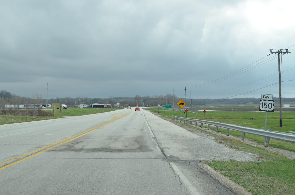
| U.S. 150 angles southeast from Moline two miles to Coal Valley and nine miles to Orion. The route parallels Interstate 74 southward to Galesburg. 05/24/08 |
|
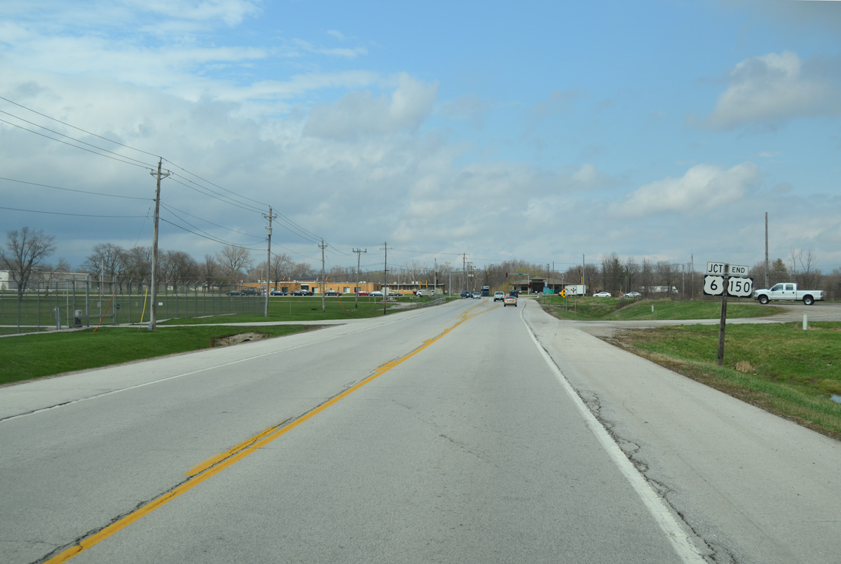
| U.S. 150 concludes with an end shield ahead of U.S. 6 in southeast Moline. U.S. 150 originally ended at the Centennial Bridge (U.S. 67) in Downtown Rock Island, but was truncated to U.S. 6 by 1977. 03/31/16 |
|
| U.S. 6 travels west from U.S. 150 to Quad City International Airport (MLI), Moline, and Rock Island. U.S. 6 continues east parallel to I-74/280 to Colona and the Henry County seat of Geneseo. 03/31/16 |
|
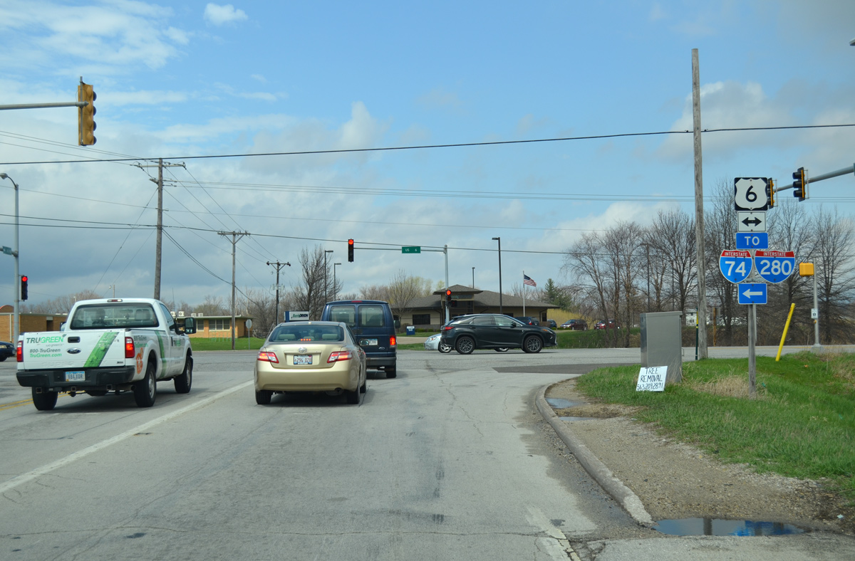
| U.S. 6 turns northward at 23rd Street and the airport directly into a cloverleaf interchange with I-74/280. I-74/U.S. 6 travel together to the Iowa-Illinois Memorial Bridge into Bettendorf, Iowa. 03/31/16 |
|
| Morton Avenue provides a 0.4 mile link from Interstate 74 to U.S. 150 (Jackson Street) for Downtown Morton. 05/07/10 |
Photo Credits:05/24/08, 05/07/10, 03/31/16 by AARoads
Connect with:
Interstate 55
Interstate 74
U.S. 6
U.S. 24
Page Updated 05-09-2018.

 East
East