U.S. 250 travels 167.38 miles in Virginia from the Mountain State west of Lantz Mountain and Hightown to the intersection of Broad Street and N 23rd Street at Church Hill in Richmond. The majority of the highway parallels Interstate 64, from Staunton and I-81 east to Waynesboro, Charlottesville and Short Pump.
Entering the capital city of Richmond, U.S. 250 combines with U.S. 33 along Broad Street. The two routes overlap for 3.92 miles to the couplet of Harrison and Hancock Streets, where U.S. 33 shifts 0.24 miles north to SR 33 at Leigh Street. However left turns are prohibited from Broad Street east onto Harrison Street north and Hancock Street south is one way from Marshall Street to Broad Street west. U.S. 33 is only acknowledged at the T intersection with Hancock and Leigh Streets, where SR 33 takes over east from the Carver neighborhood.
|
| Blue Ridge Parkway becomes Skyline Drive at U.S. 250 and Rockfish Gap. A grade separated intersection connects U.S. 250 (Rockfish Gap Turnpike) with the parkway maintained by the National Park Service. 06/05/05 |
|
| U.S. 250 (Rockfish Gap Turnpike) passes through Nelson County 1.27 miles east from Rockfish Gap and north of Afton. 06/05/05 |
|
| Traversing the Blue Ridge Mountains, Interstate 64 runs just above U.S. 250 between Rockfish Gap and the Augusta County line. 06/05/05 |
|
| SR 6 (Afton Mountain Road) concludes at U.S. 250 (Rockfish Gap Turnpike) north of Afton. 06/05/05 |
|
| SR 6 and SR 151 switched places from U.S. 250 south to Avon. The two routes combine south through Rockfish Valley 6.22 miles to a point just beyond Greenfield. 06/05/05 |
|
| SR 6 constitutes a scenic route south from U.S. 250 to U.S. 29 at Woods Mill and east to Manakin-Sabot in Powhatan County. The state route travels 102.26 miles overall to SR 161 (Arthur Ashe Boulevard) in Richmond. 06/05/05 |
|
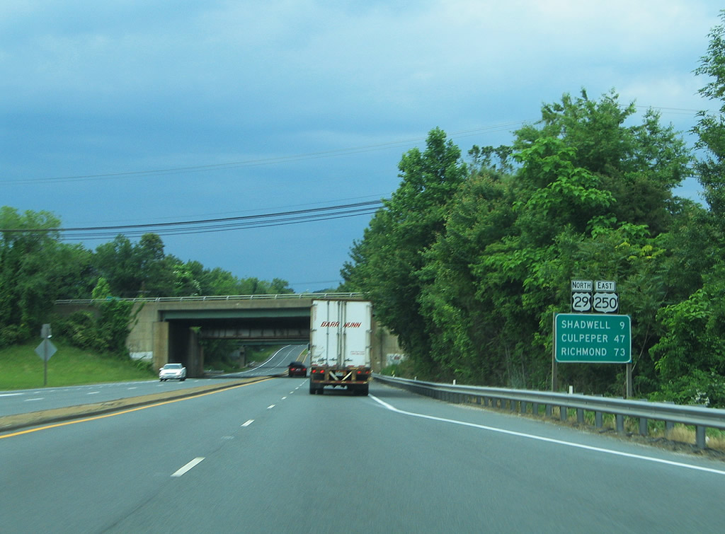
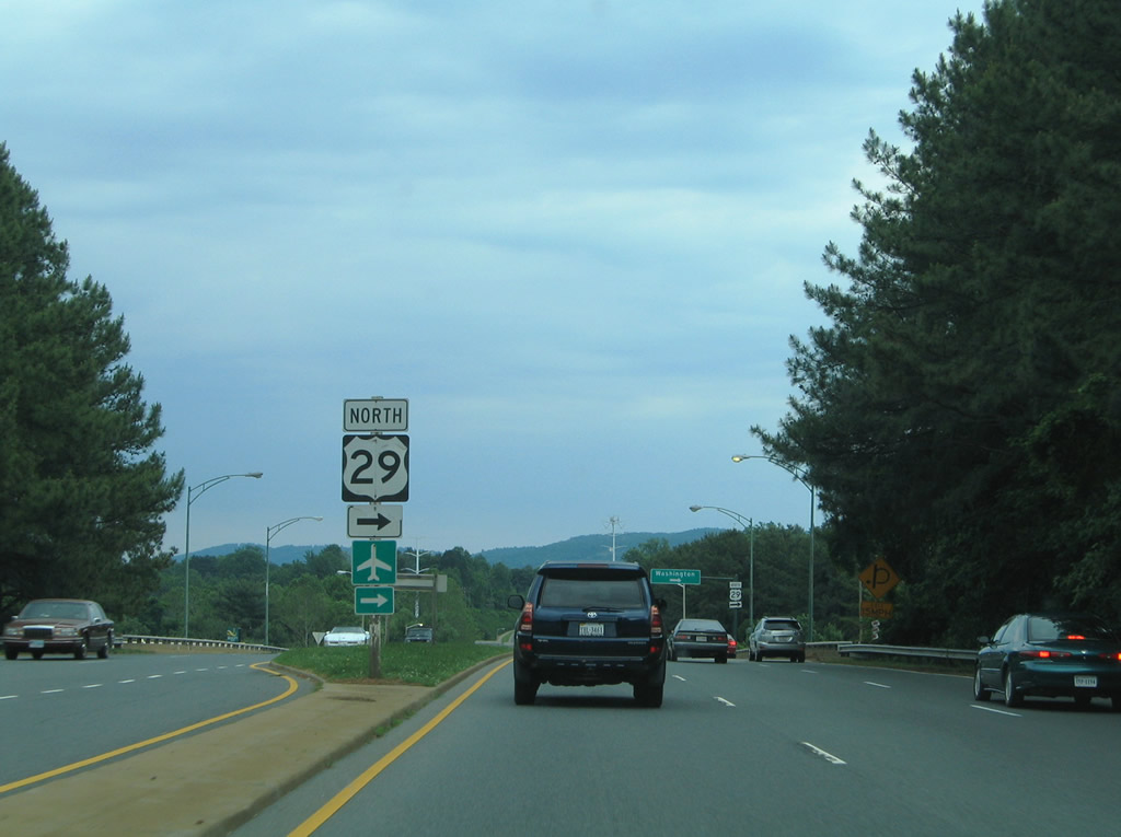
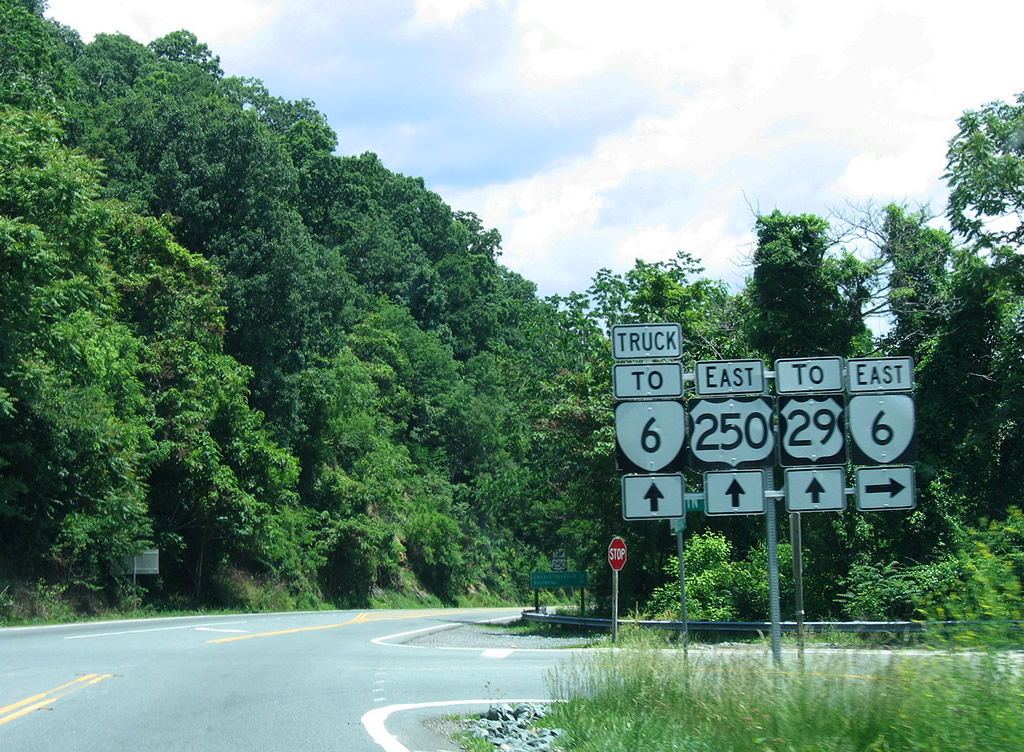
| U.S. 250 overlaps with U.S. 29 (Monacan Trail) for 2.37 miles around the north side of Charlottesville. Beyond their concurrency, U.S. 250 continues to Shadwell while U.S. 29 ventures north to Culpeper. 05/30/05 |
|
| Opened in January 2006, RIRO ramps connect U.S. 29/250 north with Leonard Sandridge Road south to the University of Virginia. The North Grounds Connector was renamed for the executive vice president and chief operating officer of the University on September 30, 2006.1 05/30/05 |
|
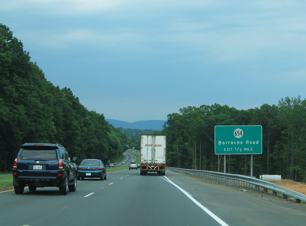
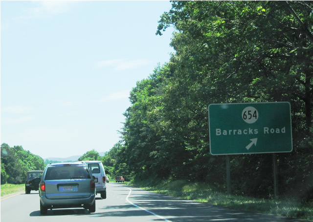
| SR 654 (Barracks Road) heads 1.94 miles northwest from U.S. 29/250 to SR 601 (Garth Road) west to White Hall. Barracks Road continues 0.87 miles south to U.S. 29 Business (Emmet Street) at Barracks Road Shopping Center. 06/02/04 |
|
| U.S. 29/250 advance east from SR 654 (Barracks Road) to a cloverleaf interchange with the north end of U.S. 29 Business (Emmet Street). 06/02/04 |
|
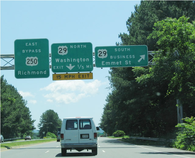
| Beyond U.S. 29 (Emmett Street), U.S. 250 continues along an expressway to the north of Downtown Charlottesville. 05/30/05 |
|
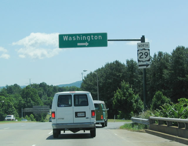
| U.S. 29 follows a loop ramp onto a heavily commercialized stretch of Emmett Street north. U.S. 29 eventually reaches Washington, but well after Madison, Culpeper and Warrenton. 06/02/04 |
|
| U.S. 250 approaches SR 208 (Courthouse Road) east to Louisa County seat of Louisa and SR 659 (Kents Store Road) south to Kents Store in Fluvanna County. 06/06/04 |
|
| SR 208 (Courthouse Road) travels 9.33 miles northeast from U.S. 250 (Three Notch Road) and SR 607 (Kents Store Road) to U.S. 33 in the town of Louisa. 06/06/04 |
|
| SR 208 (Courthouse Road) links U.S. 250 with parallel Interstate 64, 0.38 miles to the north. 06/06/04 |
|
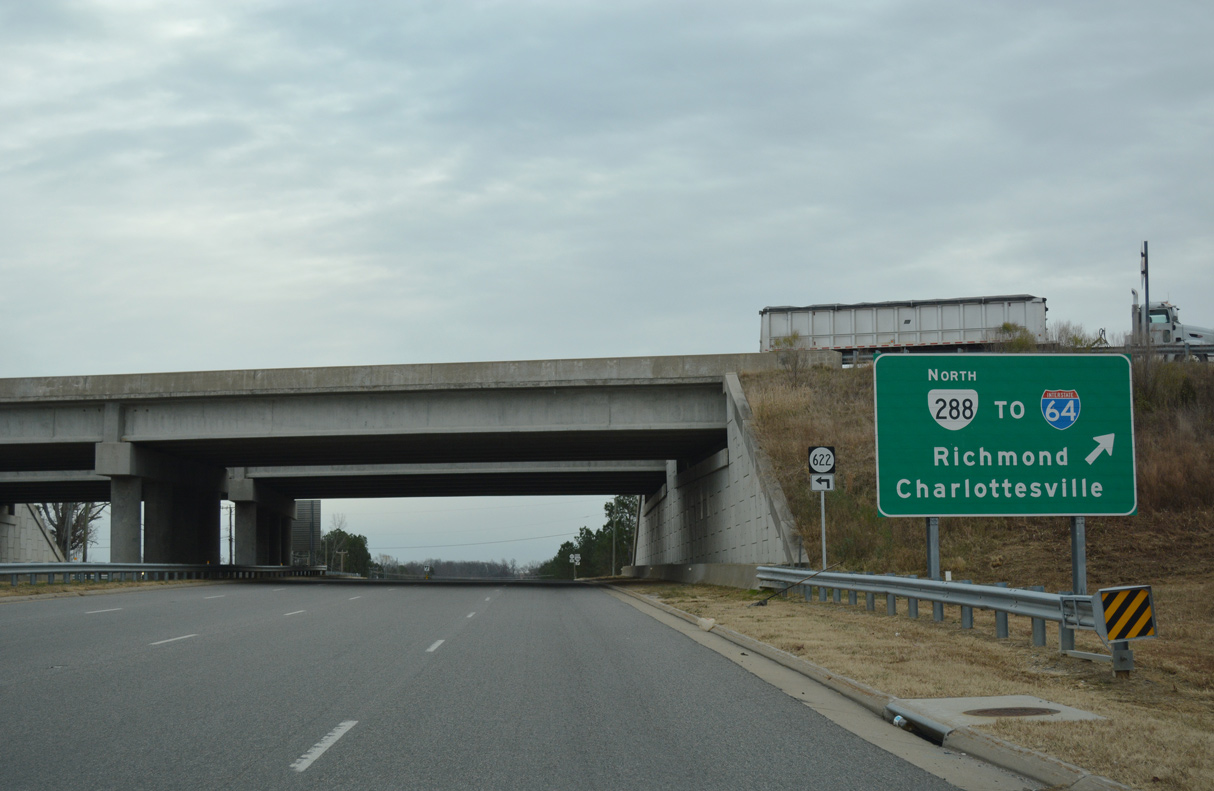
| U.S. 250 (Broad Street Road) meets SR 288 at a folded diamond interchange between Tuckahoe Creek and Little Tuckahoe Creek. 12/16/16 |
|
| SR 288 (World War II Veterans Memorial Highway) concludes to the immediate north of U.S. 250 (Broad Street Road) at I-64 west of I-295 and the Henrico County line. 12/16/16 |
|
| Left turns are restricted from U.S. 250 (Broad Street) east to U.S. 33 (Staples Mill Road) west weekdays. A jughandle movement along Chantilly Street south and Radford Avenue west links with Staples Mill Road. 06/02/03 |
|
| Combining at the intersection of Broad Street and Staples Mill Road, U.S. 33-250 enter the city of Richmond. City maintenance takes over, including the installation of signs and this former set of cutouts east of Westmoreland Street. 06/02/03 |
|
| SR 197 crosses U.S. 33-250 (Broad Street) north from the Malvern Gardens and Sauer's Gardens neighborhoods to Rosedale. 06/02/03 |
|
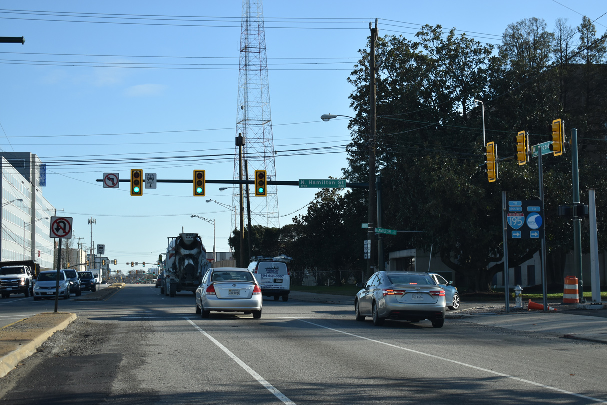
| Trailblazers to I-195 (Beltline Expressway) previously posted along U.S. 33/250 (Broad Street) east at Kent Road in the Sauer's Garden neighborhood. Kent Road south to Cutshaw Avenue provides an alternate route to the I-195 entrance ramp from Hamilton Street. 08/08/04 |
|
| Paralleling Hamilton Street south to SR 147 (Cary Street Road), Interstate 195 travels below grade by the Museum District and Carytown in this part of Richmond. 12/17/20 |
|
| Thompson Street (SR 1013) extends 0.97 miles north from SR 76 (Powhite Parkway) alongside I-195 to U.S. 33/250 (Broad Street). 12/17/20 |
|
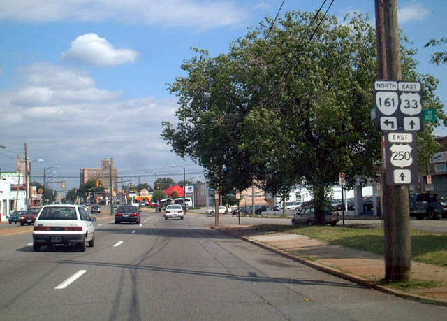
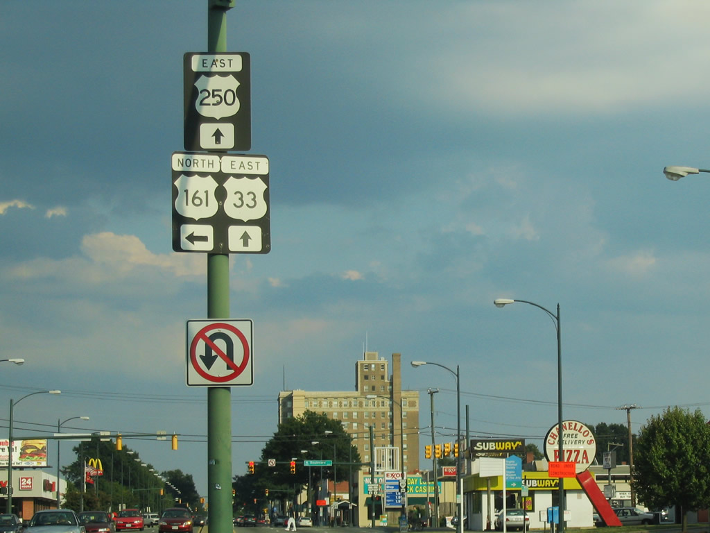
| Sheppard Street north to Marshall Street east links U.S. 33/250 (Broad Street) with SR 161 (Arthur Ashe Boulevard) northbound. 06/02/03 |
|
| Left turns are not permitted from U.S. 33/250 (Broad Street) east onto SR 161 (Arthur Ashe Boulevard) north. The connection via Sheppard Street north was previously referenced with an erroneous U.S. 161 shield. 08/08/04 |
|
| SR 161 (Arthur Ashe Boulevard) leads south from U.S. 33/250 (Broad Street) to Grant Street at William Byrd Park. SR 161 crosses the James River on the Boulevard Toll Bridge to Westover Hills. 06/02/03 |
|
| U.S. 250 (Broad Street) meets U.S. 1/301 (Belvidere Street) along the east side of Virginia Commonwealth University (VCU). U.S. 1/301 run along Jackson Ward north to I-64/95 and along Monroe Ward south to SR 195 (downtown Expressway). 06/02/03 |
|
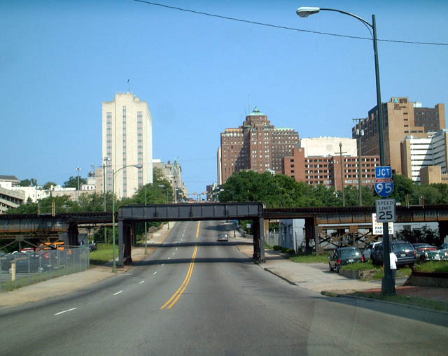
| A trumpet interchange and access road links U.S. 250 (Broad Street) with Interstate 95 (Richmond-Petersburg Turnpike) from N 14th Street at the Capitol District. 06/02/03 |
|
| U.S. 250 (Broad street) passes under two sets of CSX Railroad lines west from U.S. 360 (17th Street) to Interstate 95 (Richmond-Petersburg Turnpike). 06/02/03 |
|
| U.S. 250 (Broad Street) spans I-95 ahead of the trumpet interchange and access road to the freeway from N 14th Street. 06/02/03 |
|
| SR 617 (Oilville Road) stems 0.56 miles north from U.S. 250 (Broad Street Road) to a diamond interchange (Exit 167) with I-64. 06/02/03 |
|
| SR 617 heads 5.41 miles north from U.S. 250 near Oilville to SR 610 (Taylors Creek Road) southwest of Montpelier. SR 620 branches east from SR 617 north of I-64 to Rockville. 06/02/03 |
|
| U.S. 33/250 (Broad Street) west of SR 161 (Arthur Ashe Boulevard) and Sheppard Street at Scott's Addition in Richmond. 08/08/04 |
|
| Thompson Street parallels I-195 (Beltline Expressway) north from Carytown to U.S. 33/250 at the Museum District. 12/17/20 |
|
| Hamilton Street (SR 949) connects U.S. 33/250 (Broad Street) with I-195 north leading to the exchange I-64/95. 12/17/20 |
|
| South from U.S. 33/250, Hamilton Street continues two blocks to an entrance ramp for Interstate 195 to Powhite Parkway (SR 76) and the Downtown Expressway (SR 195). 12/17/20 |
|
| SR 617 in Goochland County ends at U.S. 250 (Broad Street Road) just south of an interchange with I- 64. U.S. 250 leads east to Short Pump and Richmond and west to Goochland (via SR 632 west) and Charlottesville. 06/05/04 |
Page Updated 02-21-2021.

 East
East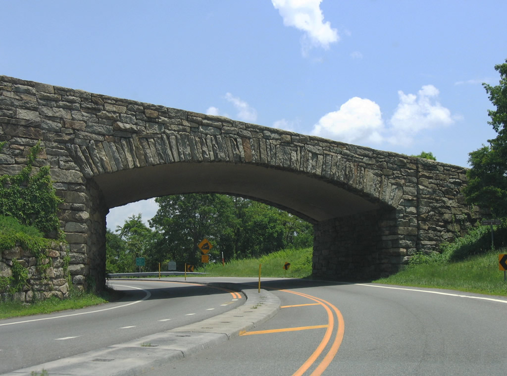


 North
North