
 North
North
U.S. 601 (St. Matthews Road) constitutes a five lane, commercial boulevard north from Orangeburg to Interstate 26.
09/25/22

Construction from August 2016 to May 2017 eliminated two of the loop ramps at the cloverleaf interchange (Exit 145) joining Interstate 26 with U.S. 601 (St. Matthews Road).
09/25/22

09/25/22

North from U.S. 176 (Old State Road) and Wertz Crossroads, U.S. 601 (St. Matthews Road) reduces from a five to three lane boulevard.
11/19/21

U.S. 601 continues north into the town of St. Matthews along Harry C. Raysor Drive.
11/19/21

S.C. 6 (Bridge Street) meets U.S. 601 adjacent to a Norfolk Southern Railroad line in the St. Matthews business district.
11/19/21

11/19/21

11/19/21

11/19/21

11/19/21

Lone Star Road (Road 11) branches southeast from U.S. 601 (Colonel Thomson Highway) 7.30 miles to S.C. 33/267 near Lone Star.
11/19/21

11/19/21

11/19/21

11/19/21

11/19/21

U.S. 601 crosses paths with S.C. 419 (Fort Motte Road) at Wiles Crossroads.
11/19/21

S.C. 419 (Fort Motte Road) constitutes a 6.51 mile long spur northwest from S.C. 267 (McCords Ferry Road) to Town Square Street at Fort Motte.
11/19/21

11/19/21

11/19/21

U.S. 601 (Colonel Thomson Highway) proceeds 2.01 miles north from the end of S.C. 267 (McCords Ferry Road) at Adams Road (Road 80) to the Congaree River.
11/19/21

11/19/21

The Congaree River separates Calhoun and Richland Counties across U.S. 601.
11/19/21

U.S. 601 (McCords Ferry Road) traverses areas of Fork Swamp north to the Bates Old River.
11/19/21
U.S. 601 (McCords Ferry Road) traverses areas of Fork Swamp north to the Bates Old River.
11/19/21

S.C. 48 (Bluff Road) east ties into U.S. 601 at the settlement of Wateree.
11/19/21

S.C. 48 runs 28.98 miles west from U.S. 601 to U.S. 21/176/176/321 (Elmwood Avenue) in Columbia.
11/19/21

S.C. 764 (Old Eastover Road) comprises an 8.95 mile long loop northwest from U.S. 601 to the town of Eastover and U.S. 76/378 (Garners Ferry Road).
11/19/21
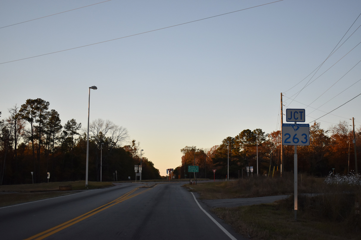
S.C. 263 (Vanboklen Road) angles 5.25 miles northeast from S.C. 764 in Eastover to U.S. 76/378 (Garners Ferry Road).
11/19/21

S.C. 263 provides a cutoff from U.S. 601 north for U.S. 76/378 east to Sumter.
11/19/21

The intersection joining U.S. 601 and S.C. 263 was converted into a roundabout in 2018.
11/19/21

11/19/21

11/19/21

U.S. 76/378 travels west from Sumter to Columbia.
11/19/21

The diamond interchange linking U.S. 601 with U.S. 76/378 dates back to 1957.
11/19/21

11/19/21

11/19/21

U.S. 601 north crosses Colonels Creek east of Murray Pond.
11/19/21

S.C. 262 (Leesburg Road), a 14.75 mile long route west to U.S. 76/378 (Garners Ferry Road) at Columbia, runs along the southern boundary of Fort Jackson.
11/19/21

11/19/21

11/19/21

Crossing Raglins Creek, U.S. 601 (McCords Ferry Road) north enters Kershaw County.
11/19/21

11/19/21

11/19/21

U.S. 601 expands to a four lane, divided highway ahead of the parclo B2 interchange with Interstate 20.
11/19/21

11/19/21

11/19/21

11/19/21

11/19/21

S.C. 12 parallels Interstate 20 west from the exchange with U.S. 601 to Fort Jackson and Woodfield en route to Columbia.
11/19/21

09/20/21

09/20/21

09/20/21

11/19/21

11/19/21

11/19/21

U.S. 601 north converges with U.S. 1 at a wye intersection leading into Lugoff.
11/19/21

U.S. 1 heads west from Lugoff to the town of Elgin and the suburbs of Columbia at Pontiac.
11/19/21

U.S. 1/601 combine east into the Kershaw County seat of Camden.
11/19/21

11/19/21
Photo Credits:
09/20/21, 11/19/21, 09/25/22 by AARoads
Connect with:
Interstate 20
U.S. 1
U.S. 76
U.S. 176
U.S. 378
Highway 6
Highway 12
Highway 34
Highway 48
Page Updated 12-02-2022.