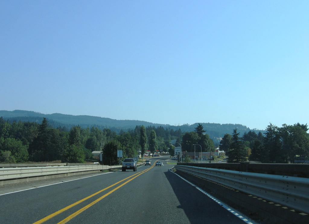
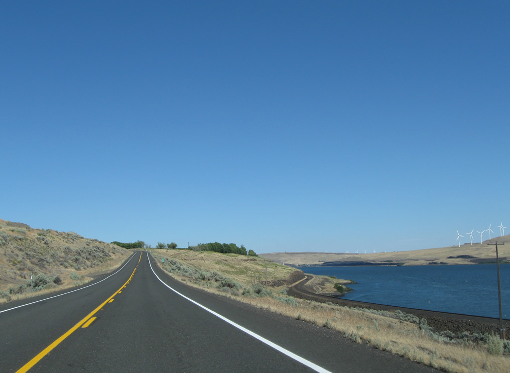
State Route 14 eastbound near Milepost 130 and Sundale Park. This scenic stretch of state route parallels the Columbia River and Lewis & Clark Trail. 08/03/11
State Route 14 replaced U.S. 830 between Vancouver and Maryhill when the US Highway was decommissioned in 1968.
|
| SR 14 (Evergreen Highway) leaves the Bridge of the Gods and travels a causeway between Ashes Lake and the Columbia River. 08/28/06 |
|
| SR 14 enters the City of Stevenson and intersects Rock Creek Drive north. Rock Creek Drive travels by the Columbia Gorge Interpretive Center and Skamania Lodge on an arc north of Rock Cove. 08/28/06 |
|
| A second causeway carries drivers between Rock Cove and the Columbia River toward the Stevenson city center. 08/28/06 |
|
| The parallel BNSF Railroad sees a truss bridge across the outlet of Rock Cove onto the Columbia River. Rock Creek feeds the cove from the north. 08/28/06 |
|
| A 1938-bridge carries SR 14 (Evergreen Highway) across Rock Creek. SR 14 follows 2nd Street through the city center, the split with 1st Avenue lies east of the creek crossing. 08/28/06 |
|
| Eastbound 2nd Street after the intersection with Russell Avenue in Stevenson. Russell Avenue ends at Stevenson Landing of the Port of Skamania County. 08/28/06 |
|
| Leaving the Stevenson city center, SR 14 travels a causeway between Rock Cove and the Columbia River. 08/28/06 |
|
| Spanning Rock Creek along a 1938-built span of SR 14 (Evergreen Highway) west. 08/28/06 |
|
| The parallel BNSF Railroad sees a truss bridge across the outlet of Rock Cove onto the Columbia River. Rock Creek feeds the cove from the north. 08/28/06 |
|
| Table Mountain (elevation 3,417 feet) and Greenleaf Peak (elevation 3,422 feet) rise northwest of Stevenson in this scene along SR 14 at Rock Cove. 08/28/06 |
|
| SR 14 west nears the intersection with Rock Creek Drive north near the City of Stevenson line. Use Rock Creek Drive for both the Skamania Lodge and Columbia Gorge Interpretive Center. 08/28/06 |
|
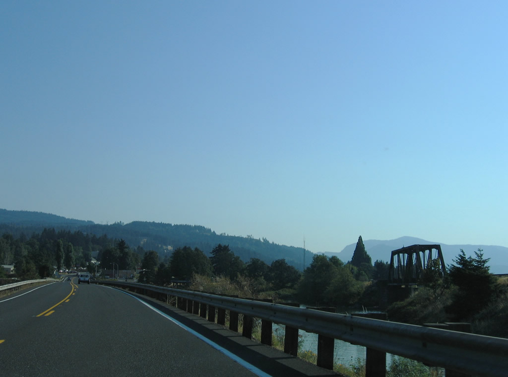
| A second causeway sees SR 14 and the adjacent BNSF Railroad travel between Ashes Lake and the Columbia River. 08/28/06 |
|
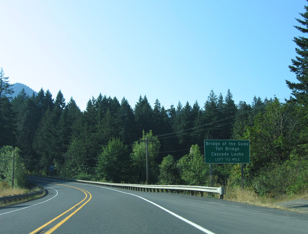
| One half mile east of the Bridge of the Gods along SR 14 (Evergreen Highway) west. The cantilever span connects Stevenson with Cascade Locks, Oregon (U.S. 30). 08/28/06 |
|
| SR 14 west at the Bridge of the Gods south across the Columbia River. The toll bridge was built in 1926. The bridge's name is derived from a landslide that once blocked the Columbia River. 08/28/06 |
|
| SR 14 meets Interstate 205 in an unusual interchange configuration resembling two wye interchange overlaid with a folded diamond interchange. A loop ramp carries divers onto Interstate 205 south from both directions of SR 14. 08/27/06 |
|
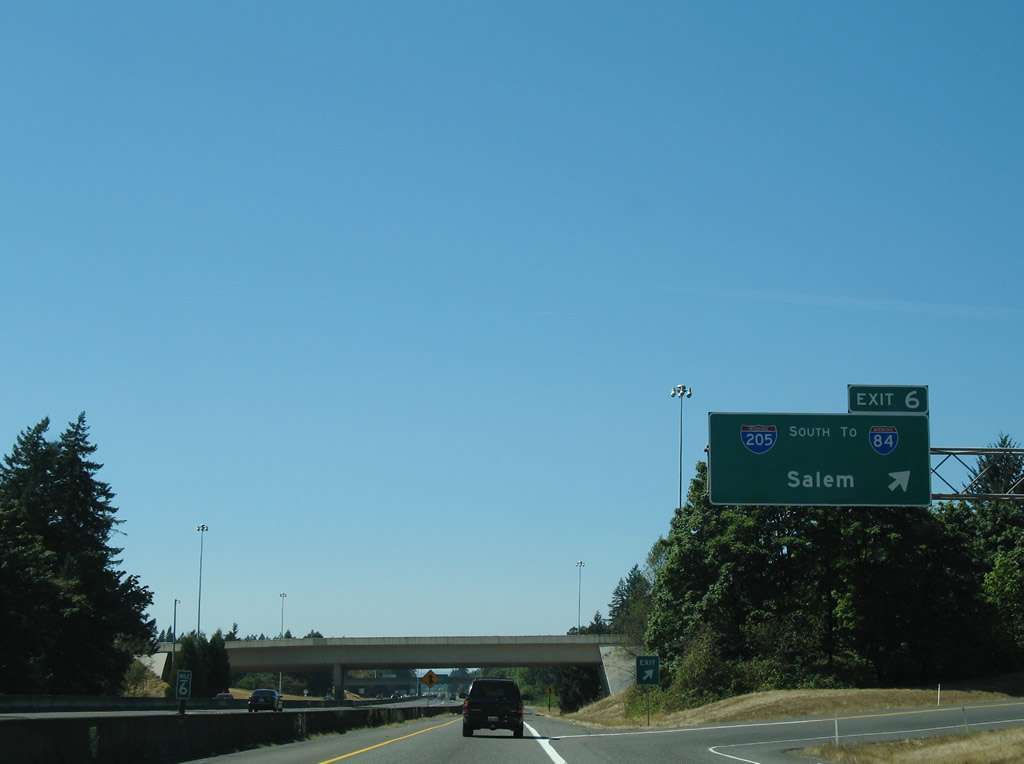
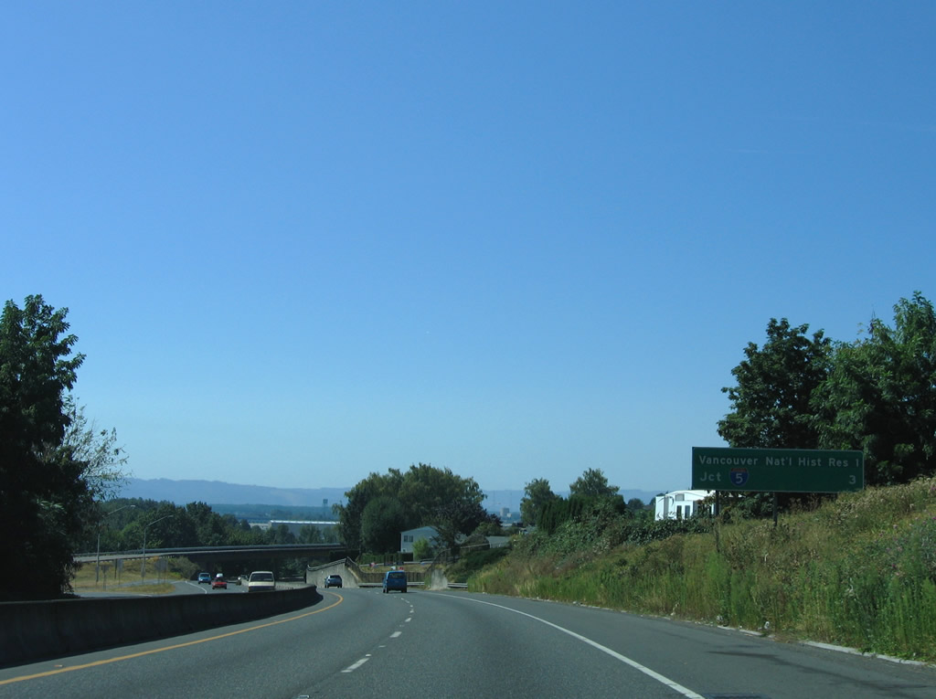
| The SR 14 freeway utilizes exit numbers through the city of Vancouver. Exit 6 serves Interstate 205 south to Portland International Airport and Interstate 84 at Parkrose in Portland, Oregon. 08/27/06 |
|
| A half diamond interchange with SE Ellsworth Avenue adds traffic to SR 14 west one mile mile east of the Exit 4 off-ramp to Lieser Road north and SE 88th Avenue south. 08/27/06 |
|
| SE 88th Avenue connects SR 14 (Lewis and Clark Highway) with parallel SE Evergreen Highway near Russell Landing. Leiser Road continues the road north from the diamond interchange at Exit 4 to East Mill Plain Boulevard. 08/27/06 |
|
| A split diamond interchange (Exit 3) joins SR 14 with Evergreen Boulevard south of McLoughlin Heights in Vancouver. 08/27/06 |
|
| Evergreen Boulevard is split between two segments at SR 14 (Exit 3) and McLoughin. Exit 3 provides access to the westbound continuation of the road. There is no direct access to the section of Evergreen leading east. 08/27/06 |
|
| Evergreen Boulevard travels above the retaining wall along the westbound roadway of SR 14 in this scene. 08/27/06 |
|
| SR 14 ends in three miles. Fort Vancouver National Historic Site is served by the final mainline interchange (Exit 1). 08/27/06 |
|
| Exit 1 departs SR 14 west for the Vancouver National Historic Reservation. The ties into the intersection of Grove Street north and Columbia House Boulevard. Interests to Fort Vancouver and Pearson Field (VUO) are directed onto 5th Street west from Grand Boulevard. 08/27/06 |
|
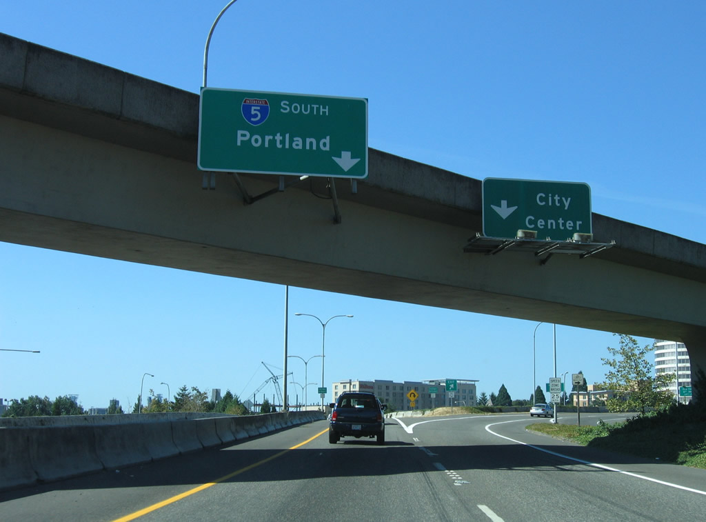
| Interstate 5's Interstate Bridge across the Columbia River comes into view as SR 14 leaves the SPUI with SE Columbia Way. 08/27/06 |
|
| SR 14 enters the final approach to Interstate 5 near the Vancouver city center. Ramps provide access to Interstate 5 south to Portland, Interstate 5 north to Seattle and C Street north into downtown. 08/27/06 |
|
| Drivers bound for Interstate 5 north to Olympia, Tacoma and Seattle leave SR 14 west. A wye interchange connects the two freeways independent of the cloverleaf ramp with southbound to the Interstate Bridge. 08/27/06 |
|
| SR 14 ends at the ramp partition to Interstate 5 south and C Street north / East 6th Street west. Until 1968, U.S. 830 traveled the route of SR 14. The US highway merged with U.S. 99 north from this interchange to Kelso until it was decommissioned. 08/27/06 |
|
| Taking the City Center ramp from the SR 14 terminus brings drivers to a split between C Street north and 6th Street west. 6th Street travels three blocks from the ramp to the intersection with Washington Street south. Washington Street, an old alignment of U.S. 99, provides return access to SR 14 east and Interstate 5 south to Portland, Oregon. 08/27/06 |
|
| Washington Street splits into three prongs at West 5th Street: A ramp onto Interstate 5 south into Oregon, a ramp onto the eastbound beginning of SR 14 toward Camas, and the continuation of the street south to West 3rd Street. Towers from the Interstate Bridge rise beyond the industrial buildings south of the interchange. 08/27/06 |
|
| Russell Street ends at Stevenson Landing, two blocks south of SR 14 (2nd Street) in Stevenson. 08/28/06 |
|
| Eastward view from Stevenson Landing along the Columbia River. 08/28/06 |
|
| A BNSF train makes its approach to the Rock Creek truss bridge at Stevenson. Table Mountain rises to the northwest of town. 08/28/06 |
|
| The Bridge of the Gods links SR 14 (Evergreen Highway), west of Stevenson, with U.S. 30 (Wa-Na-Pa Street) in Cascade Locks, Oregon. 08/28/06 |
|
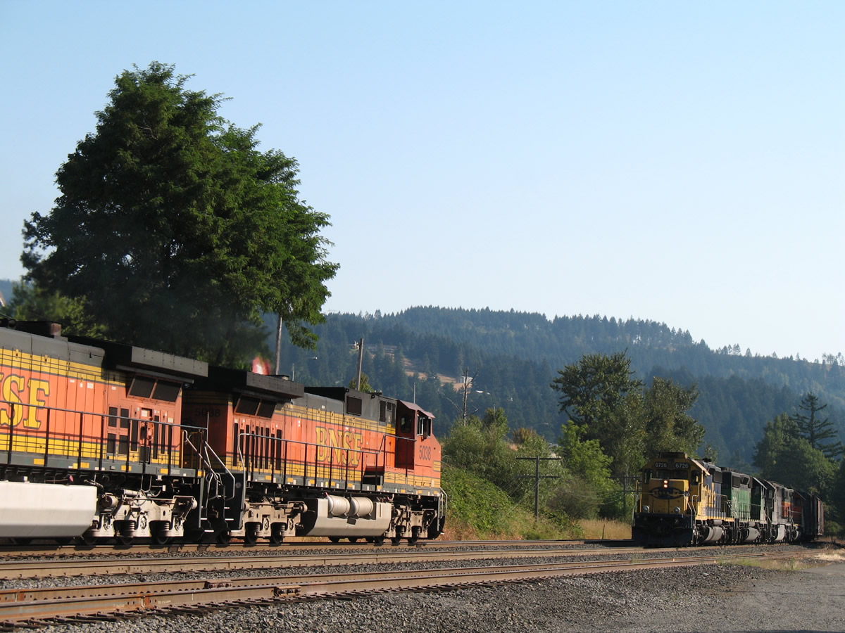
| A BNSF Railroad treks eastward through Stevenson, two blocks south of SR 14 (2nd Street). SR 14 parallels a BNSF Railroad line through much of its trek along the Columbia River. 08/28/06 |
|
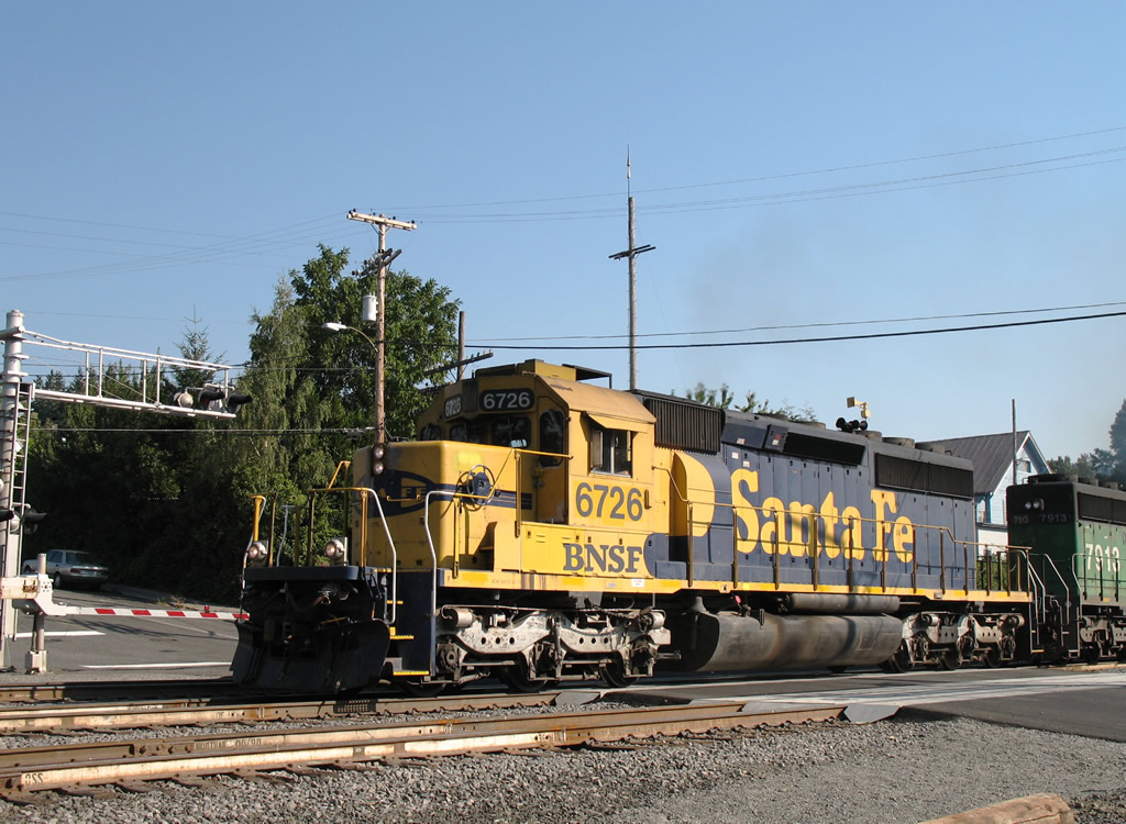
| A westbound BNSF train begins to accelerate and cross Russell Street in the Stevenson city center. 08/28/06 |
Page Updated 10-28-2011.

 East
East