|
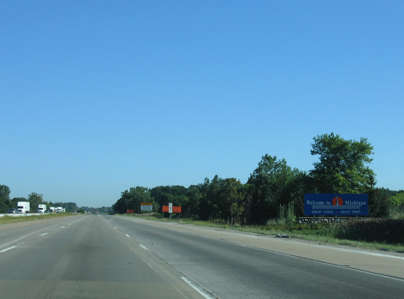
| Interstate 75 northbound enters Monroe County, Michigan ahead of Halfway Creek in Erie township. 09/02/05 |
|
| Interstate 75 constitutes a six lane freeway through Monroe County. 09/02/05 |
|
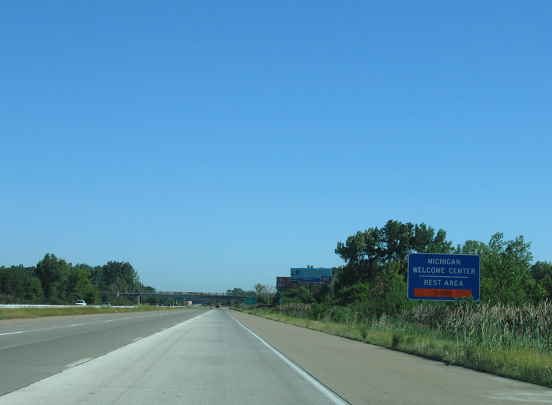
| The Michigan Welcome Center follows Exit 9 / Otter Creek Road along Interstate 75. The facility was closed for reconstruction between October 2004 and 2005.1 09/02/05 |
|
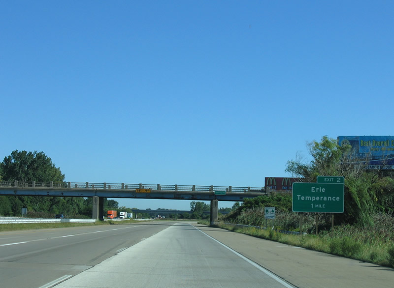
| Exit 2 departs one mile beyond the Sterns Road overpass for Summit Street to Erie and Temperance. 09/02/05 |
|
| Summit Street north ties into I-75 from a wye interchange west of North Maumee Bay ahead of this confirming marker. 09/02/05 |
|
| An auxiliary lane extends north from Summit Street to the continuation of the four lane highway northwest from Exit 2. Summit Street historically was part of U.S. 24 ALT north from Ohio to then-U.S. 25 (M-125) in Erie township. 09/02/05 |
|
| Summit Street extends 2.4 miles north from the wye interchange at Exit 2 to M-125. M-125 parallels I-75 and U.S. 24 from Toledo, Ohio northward to Monroe. The trunk highway was originally U.S. 25. 09/02/05 |
|
| Truck traffic to M-50 (Custer Road) west of Monroe was directed northward from Summit Street to M-125. M-50 stems west from U.S. 24 in Monroe to Dundee. This trailblazer was removed by 2018. 09/02/05 |
|
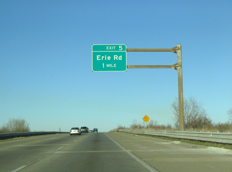
| I-75 ascends across a Detroit-Toledo Shoreline Railroad spur one mile ahead of the diamond interchange (Exit 5) with Erie Road. 11/13/04 |
|
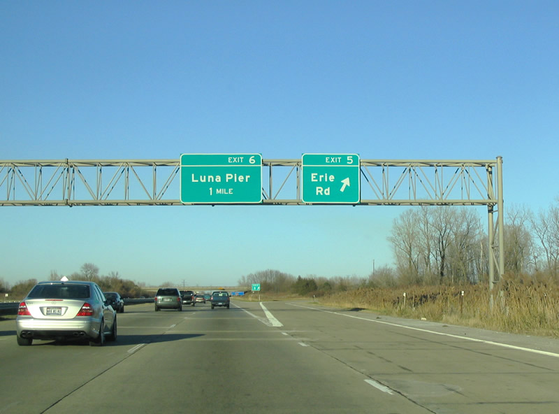
| Erie Road spurs 0.8 miles east to a dead end near Lake Erie. West from Exit 6, Erie Road continues 1.8 miles west to M-125 (Dixie Highway) at Erie and 5.5 miles to Lewis Avenue at Temperance. 11/13/04 |
|
| Interstate 75 advances north to a diamond interchange (Exit 6) with Luna Pier Road at the lakefront city of Luna Pier. Luna Pier Road runs 3 miles east from U.S. 24 at Lakeside Road to the Luna Pier Lighthouse at Lakeside Drive. 11/13/04 |
|
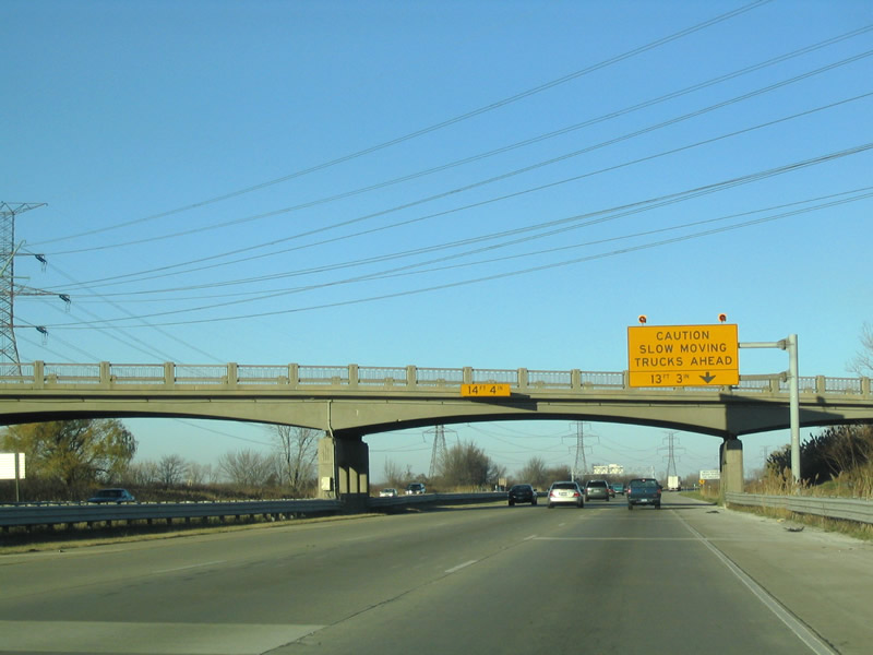
| A truck weigh station operates 1.2 miles north of the Luna Pier Road over crossing. 11/13/04 |
|
| Interstate 75 straddles the Luna Pier city limits north to the weigh station near Allens Cove. 11/13/04 |
|
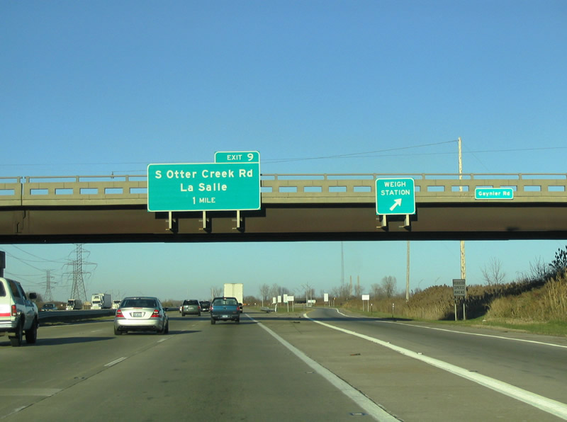
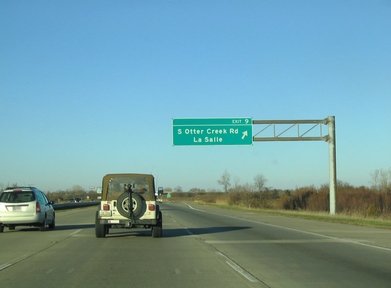
| The weigh station along I-75 northbound in Monroe County follows the Gaynier Road overpass, one mile from the folded diamond interchange (Exit 9) with S Otter Creek Road. 11/13/04 |
|
| Heading 2.4 miles west to M-125 (Dixie Highway), S Otter Creek Road joins Interstate 75 with LaSalle township. 11/13/04 |
|
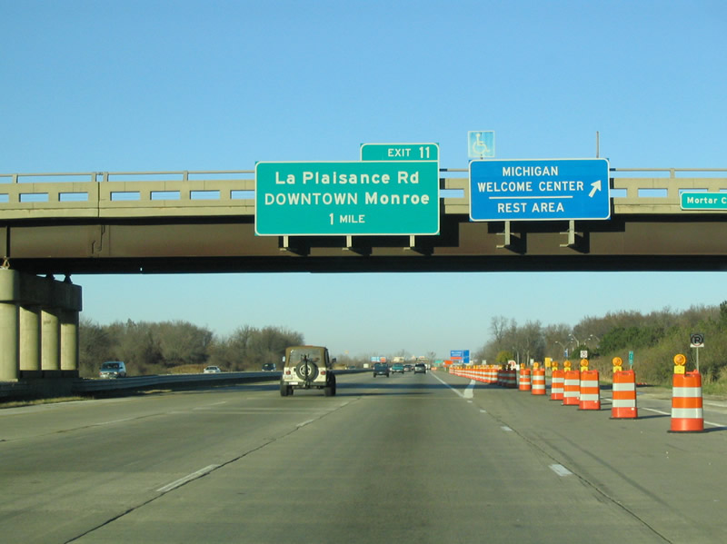
| Continuing north past Otter Creek, Interstate 75 reaches the Michigan Welcome Center at the Mortar Creek Road over crossing. Exit 11 follows in one mile for La Plaisance Road near Bolles Harbor. 11/13/04 |
|
| La Plaisance Road loops east from Interstate 75 to Bolles Harbor and Avalon Beach along Lake Erie. North from the dumbbell interchange at Exit 11, La Plaisance Road connects with E 6th Street in 2.3 miles near Downtown Monroe. 11/13/04 |
|
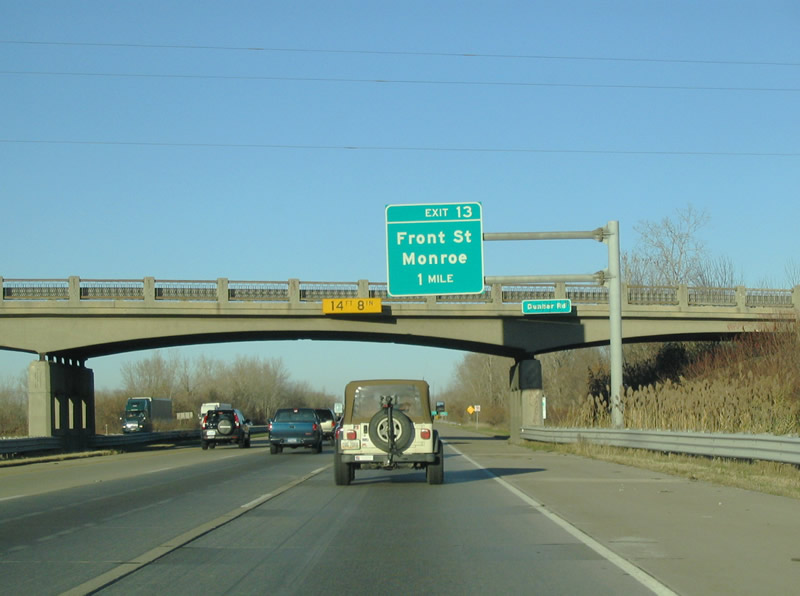
| Front Street travels along the River Raisin through Monroe to Interstate 75 at Exit 13. East of the freeway, Front Street spurs to an industrial area at Monroe Harbor. 11/13/04 |
|
| Interstate 75 northbound at the folded diamond interchange (Exit 13) with Front Street. Front Street leads 1.7 miles west to M-125 (Monroe Street) and the former end of M-50 in Downtown Monroe. M-50 lined Front Street west to U.S. 24 (Telegraph Road) and Custer Road. 11/13/04 |
|
| Leaving the Monroe County seat of Monroe, Interstate 75 next meets Nadeau Road at Exit 18. Nadeau Road joins the freeway with Woodland Beach to the east and M-125 (Monroe Street) to the west. 11/13/04 |
|
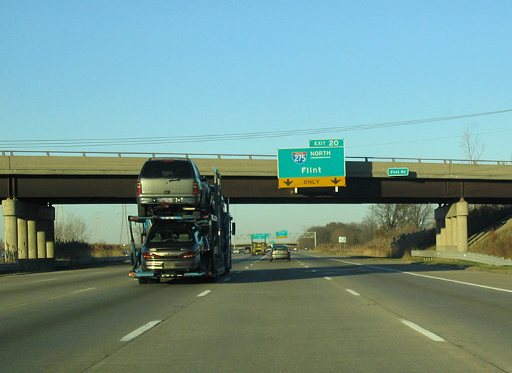
| The first sign for the split with Interstate 275 at Exit 20 appears at the diamond interchange (Exit 18) linking I-75 with Nadeau Road. Woodland Beach lies 2.4 miles to the southeast. 11/13/04 |
|
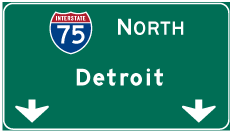
| Interstate 275 provides a partial bypass route of I-75 through Detroit in conjunction with I-96 west to Brighton and U.S. 23 north to Flint. The freeway also serves western suburbs such as Romulus, Canton Township and Livonia. 11/13/04 |
|
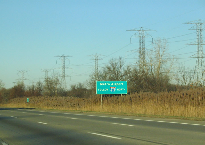
| Interstate 275 north to Exit 15 / Eureka Road leads motorists to Detroit Metropolitan Airport (DTW). 11/13/04 |
|
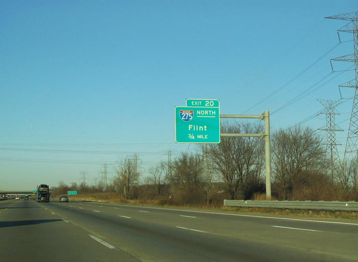
| Northbound I-75 expands to five lanes ahead of the modified trumpet interchange (Exit 20) with Interstate 275. I-275 travels 18 miles north to I-94 and 30 miles to an overlap with I-96 west. Cancelled plans extended the suburban freeway north back to I-75 at Davisburg. 11/13/04 |
|
| 88 miles separates Flint from Exit 20 via Interstate 275 north, I-96 west and U.S. 23 north. 11/13/04 |
|
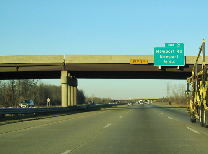
| Newport Road connects with I-75 at a folded diamond interchange (Exit 21) and the community of Newport in 0.75 miles. Newport Road heads west to U.S. 24 and southeast to Oldport via Swan Creek Road. 11/13/04 |
|
| The parclo interchange at Exit 26 links Interstate 75 north with Sylvania Drive at S Huron River Drive in the village of South Rockwood. Points of interest for Exit 26 include the Pointe Mouillee State Game Area. 11/13/04 |
|
| Huron River Drive parallels the Huron River 2.7 miles southeast from Sylvania Road to US Turnpike near East Rockwood and 3.1 miles northwest to U.S. 24 (Telegraph Road) by Flat Rock. 11/13/04 |
|
| I-75 proceeds north across the Huron River into Wayne County and the city of Rockwood. Huron River Drive runs east from forthcoming Exit 27 to Lake Erie Metropark and northwest into the city of Flat Rock. 11/13/04 |
Page Updated 10-22-2009.