|
| The 277 mile long overlap of I-80/90 eastbound concludes at Exit 142 in Amherst township. 09/30/10 |
|
| Interstate 90 shifts northward from the wye interchange at Exit 142 to combine with SR 2 across the north side of Elyria. 09/30/10 |
|
| Interstate 90 turns east at the city of Avon to Westlake, Rocky River and along the Northwest Freeway to Lakewood and Cleveland. 09/30/10 |
|
| Confirming marker posted eastbound on I-80 after the trumpet interchange (Exit 145) for SR 57 in the city of Elyria. 06/14/10 |
|
| W River Road N crosses over I-80 north to a retail area anchored by Midway Mall. 06/14/10 |
|
| Interstate 80 spans the Black River just north of parallel SR 57/113 (John F. Kennedy Memorial Parkway). 06/14/10 |
|
| Interstate 480 branches northeast along the Outerbelt South Freeway in five miles. 06/14/10 |
|
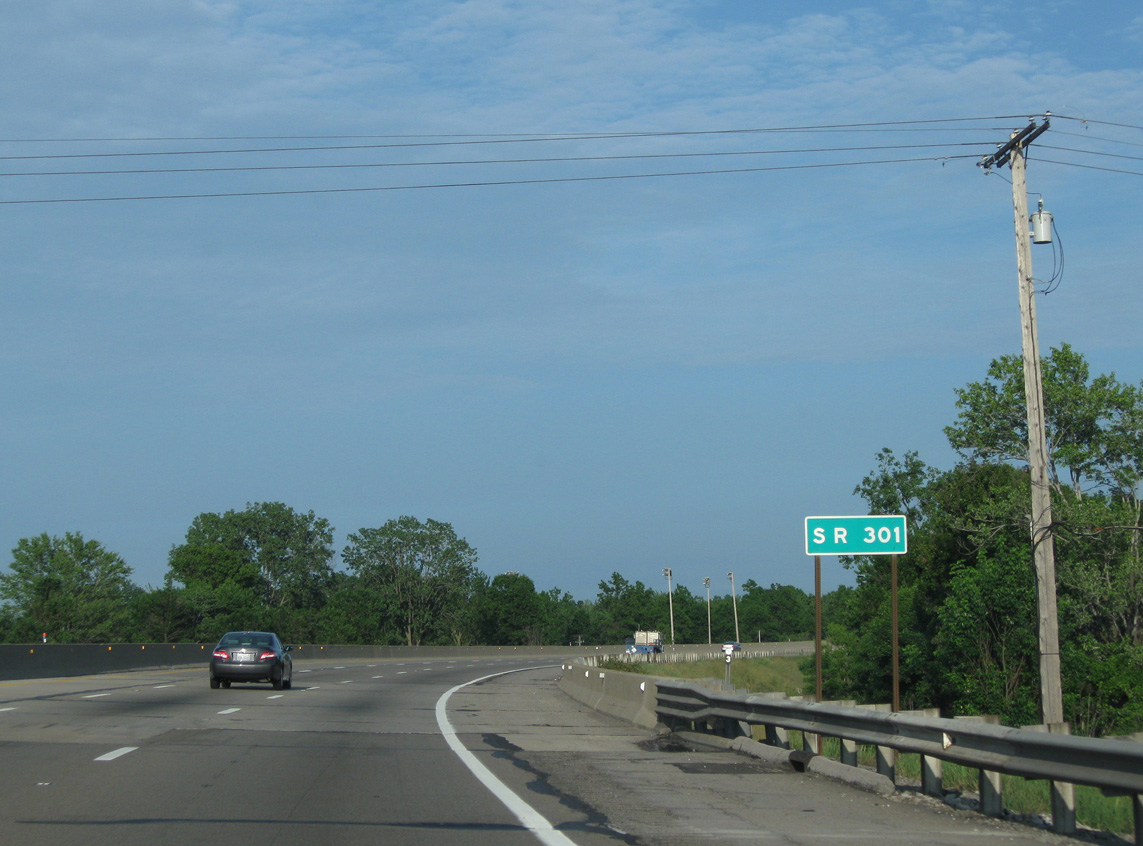
| SR 301 stems north from SR 57/113 below the Ohio Turnpike en route to the village of Sheffield. 06/14/10 |
|
| U.S. 20 encircles Elyria to the south and east, combining with SR 113 east from Cleveland Street below I-80 to North Ridgeville. 06/14/10 |
|
| Continuing east through the city of North Ridgeville, the Ohio Turnpike reaches Exit 151 for Interstate 480 in two miles. 06/14/10 |
|
| Interstate 480 runs northeast to North Olmstead and Cleveland Hopkins International Airport (CLE) at the Riverside neighborhood in southwest Cleveland. 06/14/10 |
|
| SR 83 (Wooster Lake Road) passes over Interstate 80 a half mile ahead of the wye interchange (Exit 151) with I-480 east. 06/14/10 |
|
| Interstate 480 constitutes a 43.07 mile long loop from the Ohio Turnpike north into Cleveland and back to I-80 at Streetsboro. 06/14/10 |
|
| SR 10 extends southwest from I-480 along a freeway to U.S. 20/SR 57-301 near Elyria and northeast along Lorain Road into North Olmstead. A trumpet interchange (Exit 152) connects the Ohio Turnpike with SR 10C (Lorain Road) just beyond the split with I-480. 06/14/10 |
|
| Interstate 80 curves southeast from the Trumbull County line two miles to the trumpet interchange (Exit 209) with SR 5. 05/17/02 |
|
| SR 5 travels southwest by Newton Falls and Camp James A. Garfield to Ravenna and northeast with SR 82 along a bypass of Warren. 05/17/02 |
|
| Continuing southeast into Jackson township in Mahoning County, the Ohio Turnpike separates with I-80 and combines with Interstate 76 at Exit 218. 05/17/02 |
|
| Ramps from the trumpet interchange joining the Ohio Turnpike with I-76 west and I-80 east connects with Mahoning Avenue (CR 18) to the south. CR 18 parallels I-76 west to North Jackson and I-80 east to West Austintown. 05/17/02 |
|
| East from the Ohio Turnpike, Interstate 80 follows a toll free route for the first time since the Borman Expressway in northwestern Indiana. I-80 runs between Niles and Youngstown en route to Hubbard and Sharon, Pennsylvania. 05/17/02 |
|
| Interstate 80 crosses the Meander Creek Reservoir east into Austintown township. Meeting the freeway at a parclo interchange (Exit 223) next is SR 46 (Canfield Niles Road). 10/07/01 |
|
| SR 46 parallels to the freeway along SR 11 south from Austintown to Canfield and Columbiana. SR 46 north heads to Mineral Ridge and Niles in southern Trumbull County en route to Cortland and Jefferson. 10/07/01 |
|
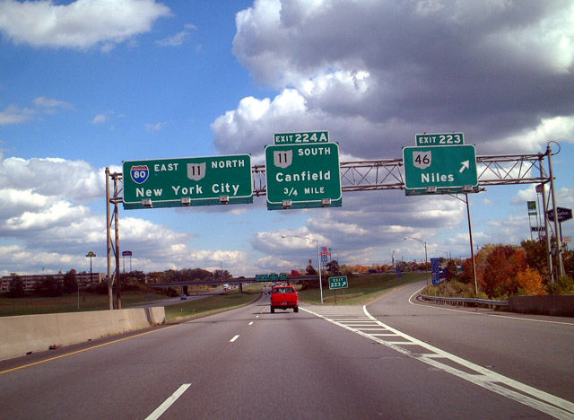
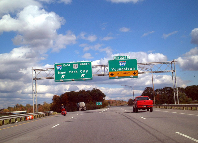
| A directional interchange at Exit 224 joins I-80 east with SR 11 and Interstate 680. SR 11 constitutes a freeway from Exit 224A to East Liverpool along the Ohio River. I-680 is an urban loop southeast to Downtown Youngstown and I-76 in Beaver township. 10/07/01 |
|
| SR 11 stays west of Youngstown, running south to Canfield at U.S. 62 and U.S. 224. I-680 parallels the Mahoning River past Downtown to the South Side in Youngstown. 10/07/01 |
|
| Exit 224A departs I-80 east for SR 11 south six miles to Canfield and 11 miles to Columbiana. SR 11 north combines with I-80 for 3.83 miles to SR 711 at Girard. 10/07/01 |
|
| Interstate 680 heads five miles east into Youngstown before turning south toward the suburbs of Struthers, Boardman and Poland. 10/07/01 |
|
| 16.43 miles in length, Interstate 680 links Youngstown with the Ohio Turnpike (I-76) east toward Pittsburgh, Pennsylvania. 10/07/01 |
|
| Reassurance marker posted east of the parclo interchange (Exit 229). A traffic jam was underway at this time as a result of bridge reconstruction to the east. This back up lasted for over seven miles at speeds of less than five miles an hour. 05/25/02 |
Page Updated 09-04-2021.


 East
East