|
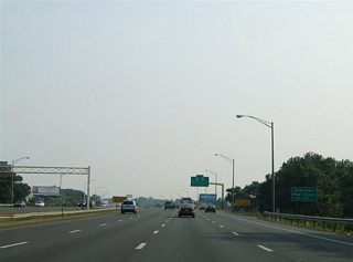
| Interstate 91 and Route 15 south intermingle near the city of Meriden at Exit 17. Route 15 follows Berlin Turnpike south to Meriden where it takes over the Wilbur Cross Highway from Interstate 91. Exit 17 provides a connection to Route 15 south and East Main Street through Meriden. 06/26/05 |
|
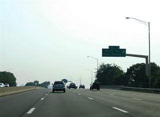
| A slip ramp provides the connection between Exit 17 and the East Main Street off-ramp from Route 15. East Main Street constitutes the original route of Route 66 through Downtown Meriden to the west. 06/26/05 |
|
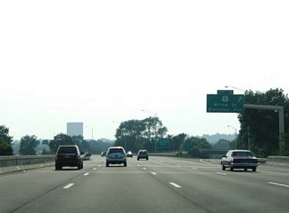
| A second slip ramp allows travelers along Route 15 southbound to make the jump onto Interstate 91 to New Haven. Route 15 travels along a parkway south to Wallingford and Hamden and west to Trumbell and Norwalk. The parkway aspect of the road means that commercial trucks are prohibited from using the road. 06/26/05 |
|
| Exit 67S leaves Route 15 south for Interstate 91 at the split between the two highways. Route 15 next meets Wallingford in six miles and Hamden in 11 miles. The state route follows Wilbur Cross Parkway southwest to Merritt Parkway and its connection to the Hutchinson River Parkway in New York. 06/26/05 |
|
| A parting shot of the Interstate 91 and Route 15 southbound split. A wye interchange separates the two freeways. 06/26/05 |
|
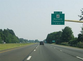
| Interstate 91 continues another three miles south to Route 68 (Barnes Road) at Exit 15. The east-west state route joins the freeway with the Durham town center to the east and the town of Yalesville to the west. 06/26/05 |
|
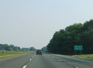
| Drivers cross the Wallingford town line ahead of the diamond interchange (Exit 15) with Route 68 (Barnes Road). Route 68 overall travels 22.05 miles between Route 68 in Durham and Route 63 in Naugatuck. Exits 15, 14 and 13 serve the town of Wallingford. 06/26/05 |
|
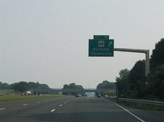
| Southbound at the half mile overhead for Route 68 (Exit 15). Route 68 travels 5.3 miles east across the Middlesex County line to the Durham town center. Westward, the state route meets U.S. 5 (North Colony Road) in just two miles within north Wallingford. 06/26/05 |
|
| Six lanes of Interstate 91 pass underneath Route 68 (Barnes Road) at Exit 15. Route 68 continues west from Wallingford five miles to Cheshire, seven miles to Yatesville and ten miles to Prospect. 06/26/05 |
|
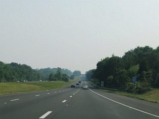
| Continuing south through Wallingford along Interstate 91. Durham Road passes over the pastoral freeway beyond Exit 15. 06/26/05 |
|
| A southbound only rest area lies between Exits 15 and 14 at Wallingford. The only northbound area in Connecticut lies north of Interstate 691. 06/26/05 |
|
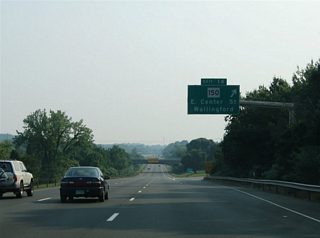
| A split diamond interchange (Exit 14) joins Interstate 91 with Route 150 (Woodhouse Avenue) via E Center Street. Route 150 travels southeast from the Wallingford town center to Route 22 near Northford. 06/26/05 |
|
| East Center Street combines with Route 150 three quarters of a mile west of Interstate 91 at Main Street. The surface road meets Interstate 91 between North and South Airline Roads, local service roads for the freeway.
East of Exit 14, Center Street continues to Northford, Scard and Whirlwind Hill Roads, local roads serving the Trimountain State Park and Pistapaug Pond areas. 06/26/05 |
|
| Interstate 91 southbound at the off-ramp (Exit 14) to East Center Street and Route 150. Route 150 overall measures 9.04 miles in length from Route 22 near Northford to U.S. 5 near Meriden. 06/26/05 |
|
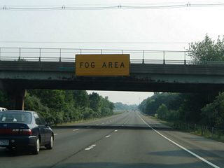
| Attached to the East Center Street overhead is a fog advisory sign warning motorists of the potential for sea fog from here southward to New Haven. A half diamond interchange ahead will bring additional motorists onto Interstate 91 southbound from Route 150 (Woodhouse Avenue). 06/26/05 |
|
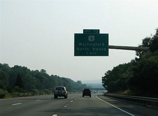
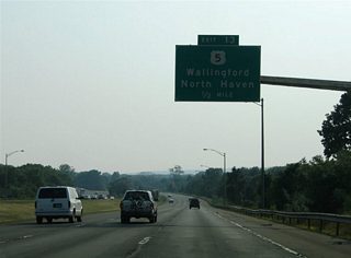
| Next in line for southbound travelers is the tri-level stack interchange with the Wharton Brook Connector. The Connector provides direct access to U.S. 5 (South Colony Road) from Interstate 91 at south Wallingford. 06/26/05 |
|
| The Wharton Brook Connector, also designated unsigned Route 702, provides a high speed connection to nearby U.S. 5. During the 1960s the connector was touted as part of an unconstructed freeway for Route 42 between Route 8 at Beaver Brook and Interstate 91 (and also Route 17 to the east).1 06/26/05 |
|
| Motorists departing Interstate 91 south for the Wharton Brook Connector west meet U.S. 5 near the North Haven town line. U.S. 5 travels south from the Wallingford town center four miles to North Haven. 06/26/05 |
|
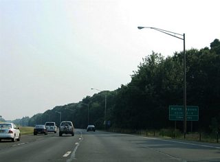
| Interstate 91 itself crosses the North Haven town line itself on the three mile drive between Exits 13 and 12. North Haven was founded on October 19, 1786, and is the home of the first ever brick found in North America with the discovery of clay on the west bank of the Quinnipiac River. Brickyards grew as an industry here into the 20th century, and today North Haven exists as a suburban community of New Haven. 06/26/05 |
|
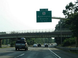
| U.S. 5 and Interstate 91 cross paths for the third time in Connecticut at a parclo interchange (Exit 12) at North Haven. The US highway follows Washington Avenue between the Wallingford town line (South Colony Road) and Clintonville Road at the North Haven town center. 06/26/05 |
|
| Interstate 91 is known as the Century Division Memorial Highway, honoring the 100th Infantry Division of World War II, on the approach to New Haven. U.S. 5 meanwhile serves interests to Route 22 (Clintonville Road) for Hampden (Route 15) and Northford (Route 17). 06/26/05 |
|
| Kinking westward, Interstate 91 southbound splits with the off-ramp (Exit 12) to U.S. 5 (Washington Avenue). U.S. 5 and Route 22 (Clintonville Road) overlap for 0.7 miles between State Street and Route 103 (Maple Avenue). Route 103 leads south 5.31 miles, parallel to Interstate 91, from U.S. 5 to Route 80 (Foxon Road) in east New Haven. 06/26/05 |
|
| Route 40 (Mt. Carmel Connector) joins Interstate 91 with Route 10 (Whitney Avenue) and Hamden at Exit 10. The state route consists of a freeway spur west to Hamden, with ramps to U.S. 5 (State Street) and a partial interchange at Whitney Avenue. 06/26/05 |
|
| The freeway passes over U.S. 5 (Clintonville Road) one half mile north of the directional-T interchange (Exit 10) with CT 40. Route 40 stems west from I-91 and a connector roadway to Bailey Road. Bailey Road joins the freeway with Route 103 (Maple Avenue) at North Haven; There is no access onto Bailey Road from Interstate 91 directly however. 06/26/05 |
|
| Exit 40 departs Interstate 91 southbound for the Mt. Carmel Connector westbound. Route 40 travels just 3.08 miles between Interstate 91 and Route 10.
Route 10 heads north from New Haven and Hampden to Mt. Carmel, Chesire and Southington to the west. The CT 40 freeway was considered as a leg of a New Haven freeway bypass in its early planning during the 1940s. Completion of the route did not occur until the mid 1960s.3 06/26/05 |
|
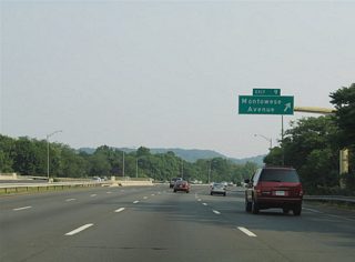
| Continuing south on I-91 toward the parclo interchange (Exit 9) with Montowese Avenue. Montowese Avenue travels east-west between Universal Drive and Cloudland Road. 06/26/05 |
|
| Exit 9 loops onto Universal Avenue just south of its intersection with Montowese Avenue. Montowese Avenue intersects Route 103 (Quinnipiac Avenue) 0.4 miles east of Interstate 91. 06/26/05 |
|
| Four southbound lanes continue beyond Exit 9 toward Downtown New Haven. 06/26/05 |
|
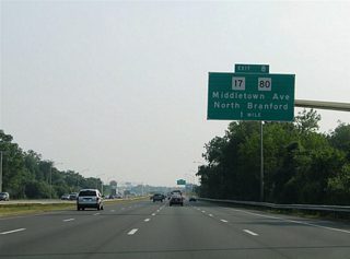
| Middletown Avenue (Route 17) crosses paths with Interstate 91 at Exit 8. Route 17 follows Middletown Avenue southwest from Northford. Route 80 enters the scene from Foxon Boulevard and North Branford, tying into Exit 8 from the east. 06/26/05 |
|
| As Interstate 91 continues south through New Haven, travelers destined for Downtown are advised to take Exit 1 (Route 34 / Richard C. Lee Connector west). 06/26/05 |
|
| Middletown Avenue continues west from the parclo interchange (Exit 8) across the Quinnipiac River to Ferry Street and U.S. 5 (State Street). 06/26/05 |
|
| Southbound at the off-ramp (Exit 8) to Middletown Avenue west, Route 80 (Foxon Boulevard) east and Route 17 north. Use Route 80 east to Quinnipiac Avenue south to Fairhaven East, Eastern Street south to East Haven, and Foxon Boulevard east to North Branford. 06/26/05 |
|
| Interstate 91 continues west across the Quinnipiac River alongside Middletown Avenue to central New Haven. A half diamond interchange (Exit 7) joins the freeway with Middletown Avenue ahead of its intersection with Ferry Street. 06/26/05 |
|
| The Ferry Street off-ramp serves the Fair Haven community of New Haven. Ferry Street leads south from Middletown Avenue to Quinnipiac Avenue at Fair Haven East. 06/26/05 |
|
| Exit 7 leaves Interstate 91 southbound for Middletown Avenue and Ferry Street. Middletown Avenue otherwise ends at nearby U.S. 5 (State Street) and May Street. Ferry Street intersects Grand Avenue 0.7 miles to the south. 06/26/05 |
|
| A more direct ramp to U.S. 5 (State Street) bypasses the intersection of Middletown Avenue and State Street from Exit 6. U.S. 5 intertwines with Interstate 91 briefly between Exits 6 and 5 (northbound) within the vicinity of Willow Street. 06/26/05 |
|
| Exit 6 follows in quick succession from Exit 7 directly onto Willow Street west of U.S. 5 (State Street). Willow Street stems west from the State Street and Bleckley Avenue intersection to Whitney Avenue. Bleckley Street continues the street south of U.S. 5 to Grand Avenue and Chapel Street in Fair Haven. 06/26/05 |
|
| Exit 4 provides another opportunity for southbound drivers to access State Street (former U.S. 5) via the connection with Humphrey Street. Forthcoming exits serve Trumbull Street and Interstate 95. U.S. 5 meanwhile ends at the Exit 5 partial-interchange from Interstate 91 north. 06/26/05 |
|
| The New Haven skyline appears over the southwestern horizon as Interstate 91 passes over the State Street Bridge. 06/26/05 |
|
| The four southbound lanes of Interstate 91 prepare to partition for off-ramps to Interstate 95 north and south, and Route 34 west. Meanwhile Exit 4 departs for Humphrey Street and parallel State Street. State Street originally carried U.S. 5 southward to U.S. 1 (Water Street / Union Avenue) at Downtown New Haven. 06/26/05 |
|
| Interests to Tweed New Haven Regional Airport (HVN) should use the northbound on-ramp to Interstate 95 and Route 337 (Townsend Avenue) south. 06/26/05 |
|
| Southbound I-91 at the trumpet interchange (Exit 3) with the Trumbell Street connector. High speed ramps carry travelers over State Street directly into the intersection of Trumbell and Orange Streets. Trumbell Street links State Street, Whitney Avenue and Prospect Street north of the New Haven central business district. 06/26/05 |
|
| Traffic snarls as Interstate 91 approaches the "Mixmaster Interchange" with Interstate 95. The outdated interchange joins the freeways in conjunction with Route 34 (Richard C. Lee Connector). Road work associated with the I-95 New Haven Harbor Crossing Corridor Improvement Program addresses left side ramps between I-91 and 95 and weaving traffic concerns by adding new flyover ramps. Work runs through 2015.
Exit 2 meanwhile consists of a partial interchange to Hamilton Street and Ives Place just east of the freeway. The two surface streets serve the Grand Avenue, Chapel Street, and East Street/Long Wharf Drive area along the industrial Quinnipiac waterfront. 06/26/05 |
|
| Trudging southward along I-91 by Exit 2 to Hamilton Street and Ives Place east. I-95 New Haven Harbor Crossing Corridor Improvement Program addressed not only congestion at the exchange with I-91, but also the "Q" Bridge over the Quinnipiac River. A new signature bridge for New Haven, the Pearl Harbor Memorial Bridge, ties into the south end of I-91 from the east. The new span replaced the original 1958 bridge for I-95 with work running through 2016. 06/26/05 |
|
| Exit 1 links the ending Interstate 91 south with the adjacent Route 34 (Richard C. Lee Connector) as traffic partitions to Interstate 95 (Connecticut Turnpike). Route 34 travels 24.37 miles overall from here to Interstate 84 at Newtown.
The Richard C. Lee Connector consists of a short freeway for Route 34 to Church Street. This freeway was shortened in 2013 from a point west of College Street. The state route otherwise continues west from the freeway along a pair of one way streets to Dwight and Howe Streets, and along that couplet to Chapel and George Streets. The original plan for Route 34 extended the route along a freeway west to Route 10 (Ella T. Grasso Boulevard). Community opposition ultimately thwarted the westward progress, curtailing it to a premature end ahead of the frontage road intersections with York Street. Work through 2014 demolished a portion of the unused roadway beyond Church street for redevelopment. The Connector is named after former New Haven Mayor Richard C. Lee.4 06/26/05 |
|
| Exit 1 links the ending Interstate 91 south with the adjacent Route 34 (Richard C. Lee Connector) as traffic partitions to Interstate 95 (Connecticut Turnpike). >Route 34 travels 24.37 miles overall from here to Interstate 84 at Newtown.
The Richard C. Lee Connector consists of a short freeway for Route 34 to Church Street. This freeway was shortened in 2013 from a point west of College Street. The state route otherwise continues west from the freeway along a pair of one way streets to Dwight and Howe Streets, and along that couplet to Chapel and George Streets. The original plan for Route 34 extended the route along a freeway west to Route 10 (Ella T. Grasso Boulevard). Community opposition ultimately thwarted the westward progress, curtailing it to a premature end ahead of the frontage road intersections with York Street. Work through 2014 demolished a portion of the unused roadway beyond Church street for redevelopment. The Connector is named after former New Haven Mayor Richard C. Lee.4 06/26/05 |
|
| The left lanes of Interstate 91 south default onto the Q Bridge and Interstate 95 north to East Haven, New London and Providence, Rhode Island. The rest of the travel lanes continue to the Exit 1 split for Route 34 west to Downtown and Interstate 95 south to West Haven, Bridgeport, Norwalk, Stamford and New York City. Interstate 95 follows the original Connecticut Turnpike, an extremely busy six lane freeway with numerous on and off-ramps, along coastal Connecticut. 06/26/05 |
|
| The northbound ramp to Interstate 95 combines with traffic from Route 34 east before merging onto the Q Bridge. A second on-ramp ties into this movement from Franklin and Wooster Streets. 06/26/05 |
Page Updated 10-07-2006.
 South
South


