|
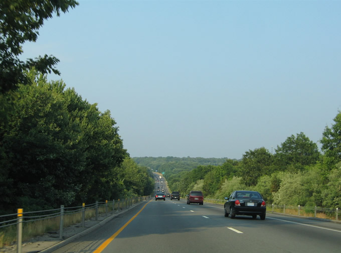
| Next in line for I-95 northbound is the parclo interchange (Exit 74) with Route 161 (Flanders Road) to Chesterfield and Niantic. 03/23/23 |
|
| The Connecticut Turnpike descends approximately 100 feet in elevation ahead of Exit 74 to Route 161. Flanders represents a subsection of East Lyme based around the crossroads of U.S. 1 (Boston Post Road) and Route 161. 03/23/23 |
|
| Route 161 emanates from Route 156 in downtown Niantic, initially following Pennsylvania Avenue. Flanders Road continues the state route north from Roxbury Road to I-95 at Exit 74. 03/23/23 |
|
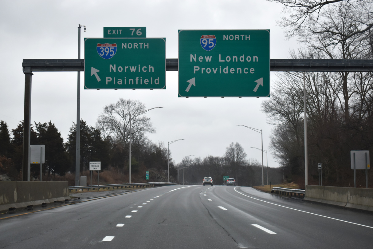
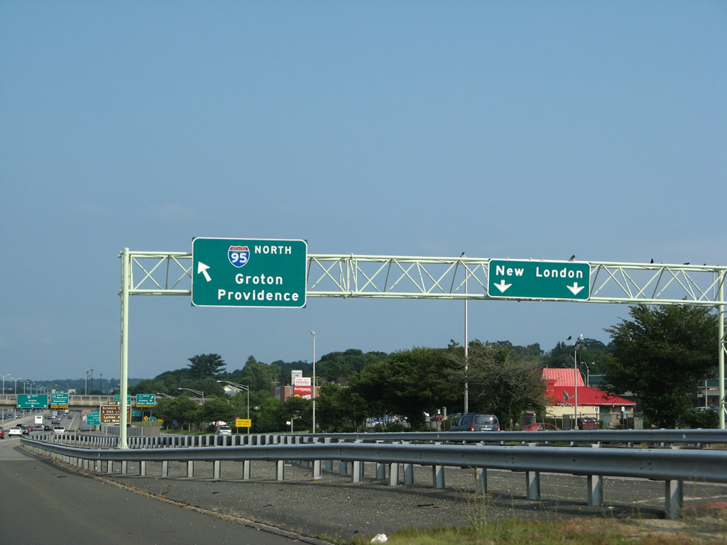
| Interstate 395 continues the Connecticut Turnpike northward to Norwich and Plainfield in 1.60 miles. 03/23/23 |
|
| Route 161 travels 8.03 miles between Route 156 at Niantic and Route 85 at Chesterfield in southwest Montville, meeting I-95 near Flanders. Improvements at the interchange began Spring 2023, with an estimated completion of Spring 2027.4 03/23/23 |
|
| Remaining north of I-95 since Old Lyme, U.S. 1 (Boston Post Road) returns to the Connecticut Turnpike in three quarters of a mile. 03/23/23 |
|
| I-395 branches northeast from a wye interchange (Exit 76) on a 13.60 mile course to Norwich following Exit 75 to U.S. 1 north to Waterford. 03/23/23 |
|
| Exit 75 joins Interstate 95 with the Eugene O'Neill Theater Center, Harkness Memorial State Park and Ocean Beach Park, all located south of Central Waterford and New London. 03/23/23 |
|
| U.S. 1 travels southeast from Interstate 95 4.5 miles to Central Waterford before turning northeast for New London. 03/23/23 |
|
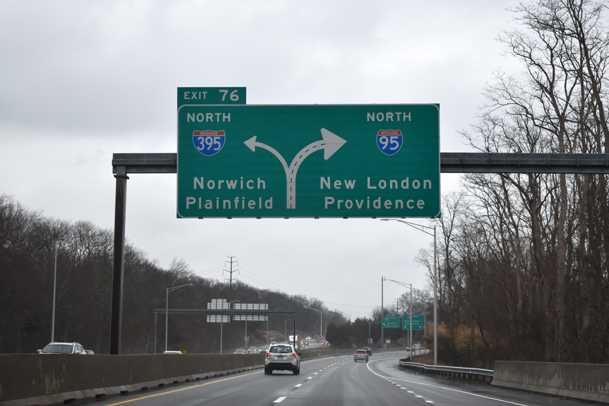
| The continuation of the Connecticut Turnpike northeast along I-395 north results in a Left Exit 76. I-395 travels 54.69 miles within the Constitution State, using the original toll road from I-95 north to unsigned Route 695, the Turnpike spur to U.S. 6 and Rhode Island. I-395 was designated on June 20, 1983 to replace Route 52 throughout its routing.1 03/23/23 |
|
| Left Exit 76 consists of a single lane off-ramp onto the northbound beginning of I-395 north from I-95 north. I-395 continues the Connecticut Turnpike Exit numbering scheme, meeting Exit 77 (Route 85) in two miles. 03/23/23 |
|
| The northbound beginning of I-395 departs I-95 north for Norwich and Plainfield. The freeway reaches Plainfield in 30 miles and I-90/290 and U.S. 20 in 67 miles. I-395 and I-290 provide a seamless freeway to Worcester, Massachusetts. 03/23/23 |
|
| Leaving Exit 76, Interstate 95 resumes its easterly course across the Waterford town line and Old Mill Brook. 07/28/07 |
|
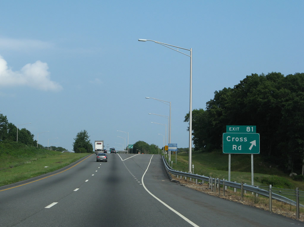
| Crossing a hill west of Stony Brook, I-95 next meets Cross Road at a RIRO interchange (Exit 81). 07/28/07 |
|
| Mid-2000s construction resulted in the conversion of the split diamond interchange of Exit 81 with new ramps to and from I-95 north. Waterford Parkway South intersects Cross Road just east of Exit 81. Cross Road travels south to U.S. 1 (Boston Post Road) at Spithead Road and north 1.25 miles to end at Route 85 (Hartford Turnpike). 07/28/07 |
|
| Exit 81 leaves I-95 north for adjacent Waterford Parkway South.
Cross Road and Spithead Road lead south to Graniteville and Route 156 (Rope Ferry Road). Route 85 (Hartford Turnpike) continues northwest from Cross Road 0.8 miles to Interstate 395 (Exit 77). 07/28/07 |
|
| Nearing the Cross Road overpass, Interstate 95 northbound next approaches a weigh station at the site of the former Exit 81 on-ramp. 07/28/07 |
|
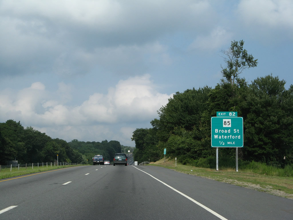
| Route 85 follows Broad Street into western reaches of New London from Exit 82 of I-95 eastward. The state route travels southeast from Salem and Chesterfield to U.S. 1 (Colman Street) in New London. 07/28/07 |
|
| Interstate 95 climbs from a valley preceding Twomile Hill to Exit 82. 07/28/07 |
|
| U.S. 1 arcs northward from the Waterford center three miles to meet Route 85 (Broad Street) west of Downtown New London. Route 85 ends at U.S. 1, but Broad Street continues east one mile to Huntington Street in Downtown. 07/28/07 |
|
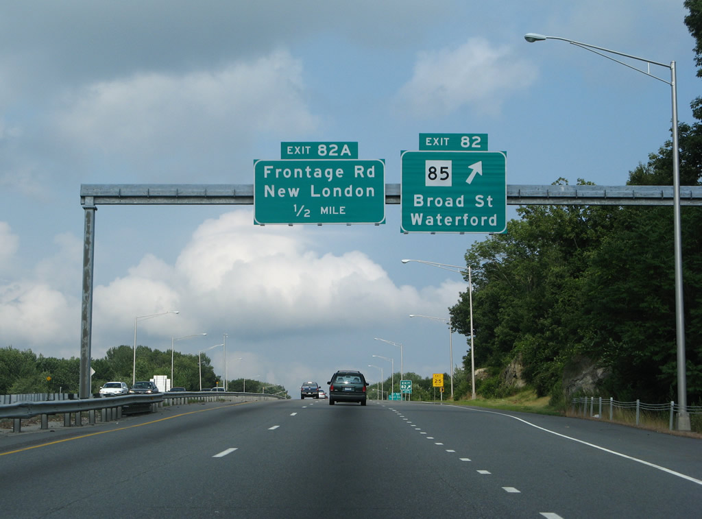
| Northbound (eastbound) at the diamond interchange (Exit 82) with Route 85 (Broad Street). Route 85 follows a 37.38 mile route from New London north to U.S. 6 & 44 at the Town of Bolton. The state route provides the main route northward to Salem, bridging the gap of the unconstructed Route 11 freeway from Salem Four Corners south to Interstate 395.
Route 11 parallels the state route from Salem north to Colchester and Route 2, an east-west freeway between Hartford and Norwich. 07/28/07 |
|
| Exit 82A constitutes a slip ramp onto the northbound side frontage road at Vauxhall Street near New London. The frontage road provides the movements to Route 32 north to the U.S. Coast Guard Academy and the city of New London and Mitchell College to the south. 07/28/07 |
|
| The I-95 frontage road system through New London acts as local lanes to Vauxhall Street, U.S. 1 (Colman Street south of the freeway) and Briggs Street. U.S. 1 utilizes the frontage roads east from Colman Street to its merge onto the freeway at Exit 83. 07/28/07 |
|
| A short on-ramp joins the northbound frontage road (collector distributor roadway) from Vauxhall Street ahead of the Vauxhall Street overpass. 07/28/07 |
|
| Motorists may return to Interstate 95 northbound via a slip ramp or continue along the c/d roadway to U.S. 1 (Colman Street), Briggs Street or Route 32 (Mohegan Avenue). 07/28/07 |
|
| New London is home to a myriad of attractions including the Lyman Allyn Art Museum, the Nathan Hale Schoolhouse, the Shaw Mansion, the Eugene O'Neil Homestead, Connecticut College and Fort Trumbull State Park among others. A series of recreational signs directs motorists to the points of interest at Exit 83. 06/26/05 |
|
| Interstate 95 and its associated c/d roadways increase the overall lane total to 11 lanes briefly between the Vauxhall Street over crossing and the folded diamond interchange with U.S. 1 (Colman Street). U.S. 1 follows Colman Street south to a one way street couplet with Jefferson Street through west New London. Colman Street north leads to Bayonet Street. 06/26/05 |
|
| The Interstate 95 mainline prepares to shed a lane for the off-ramp (Exit 83) to Huntingdon Street south into Downtown New London and Route 32 (Mohegan Avenue) north along the Thames River to Quaker Hill, Montville and Norwich. The Colman Street off-ramp to U.S. 1 south departs from the parallel c/d roadway. 07/28/07 |
|
| U.S. 1 follows the frontage road through its intersection with Briggs Street before joining Interstate 95 ahead of the Gold Star Bridge. Briggs Street ventures north from Vauxhall Street to Bayonet Street, Route 32 (Mohegan Avenue) and Williams Street. A second connection with Route 32 lies along the c/d roadway off-ramp that ties together with Exit 83.
The overheads here were replaced with reflectorized panels by 2011. 07/28/07 |
|
| Exit 83 branches off Interstate 95 north to join the c/d roadway ramp ahead of their intersection with Williams Street. Williams Street leads south into Downtown and north to an interchange with Route 32 near the U.S. Coast Guard Academy. Route 32 is part of a multi state highway between New London and Keene, New Hampshire. The route travels 54.88 miles in the Constitution State, entering Massachusetts from the Town of Stafford. The shield on the pull-through panel for Interstate 95 includes the state name. 07/28/07 |
|
| Approaching the Gold Star Bridge along I-95/U.S. 1 northbound. Opened in 1943 to carry U.S. 1 across the Thames River, the Gold Star Bridge was added to the Interstate system in 1958. A second span was added in 1975, bringing the total lanes over the river to nine.2 07/28/07 |
|
| The eastern descent from the Gold Star Bridge partitions into ramps with the departure of U.S. 1 north onto Long Hill Road and the eastbound beginning of Route 184 on the Gold Star Highway. Exit 85 partitions into separate ramps for U.S. 1 south and for Thames Street, a north-south along the Groton river front. 07/28/07 |
|
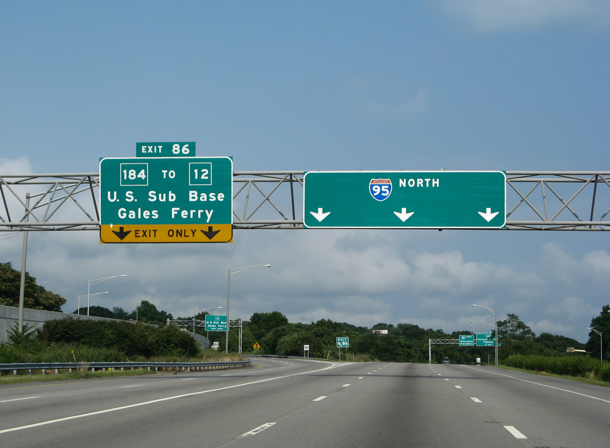
| Exit 86 consists of a wye interchange with both ramps emanating from the inside lanes of Interstate 95. Route 184 splits initially as an expressway with a parclo interchange nearby at Route 12. Route 12 leads north from I-95/U.S. 1 to Naval Submarine Base New London. 07/28/07 |
|
| Mid span over the Thames River on I-95/U.S. 1 north. The river divides the Towns of Waterford and Groton. 07/28/07 |
|
| A two lane off-ramp carries travelers onto the continuation of U.S. 1 (Long Hill Road) and to Thames Street for Downtown Groton. U.S. 1 meanders south of Interstate 95 to Poquonnock Bridge, Mystic and Stonington, finally parting ways with Interstate 95 far enough to not meet the freeway again until Cranston, Rhode Island. 07/28/07 |
|
| Exit 85 partitions into ramps for Thames Street and U.S. 1 (Long Hill Road). The Thames Street ramp joins Bridge Street midway between its ends at Thames Street and U.S. 1. Thames Street leads south through Downtown Groton to Eastern Point and Poquonnock Roads.
Beyond I-95, U.S. 1 first meets the south end of Route 12 and then an interchange with Route 349 (Clarence B. Sharp Highway). Route 12 passes under Interstate 95 between Route 184 and Long Hill Road. 07/28/07 |
|
| Exit 86 also consists of two lanes as Route 184 (Gold Star Highway) begins and veers eastward to Center Groton. 07/28/07 |
|
| A loop ramp leaves from the departing CT 184 for the northbound beginning of Route 12 to the submarine base and Gales Ferry. Route 12 is part of a multi state highway between Groton and Morrisville, Vermont. The state route parallels the Interstate 395 corridor northward to Webster, Massachusetts. 07/28/07 |
|
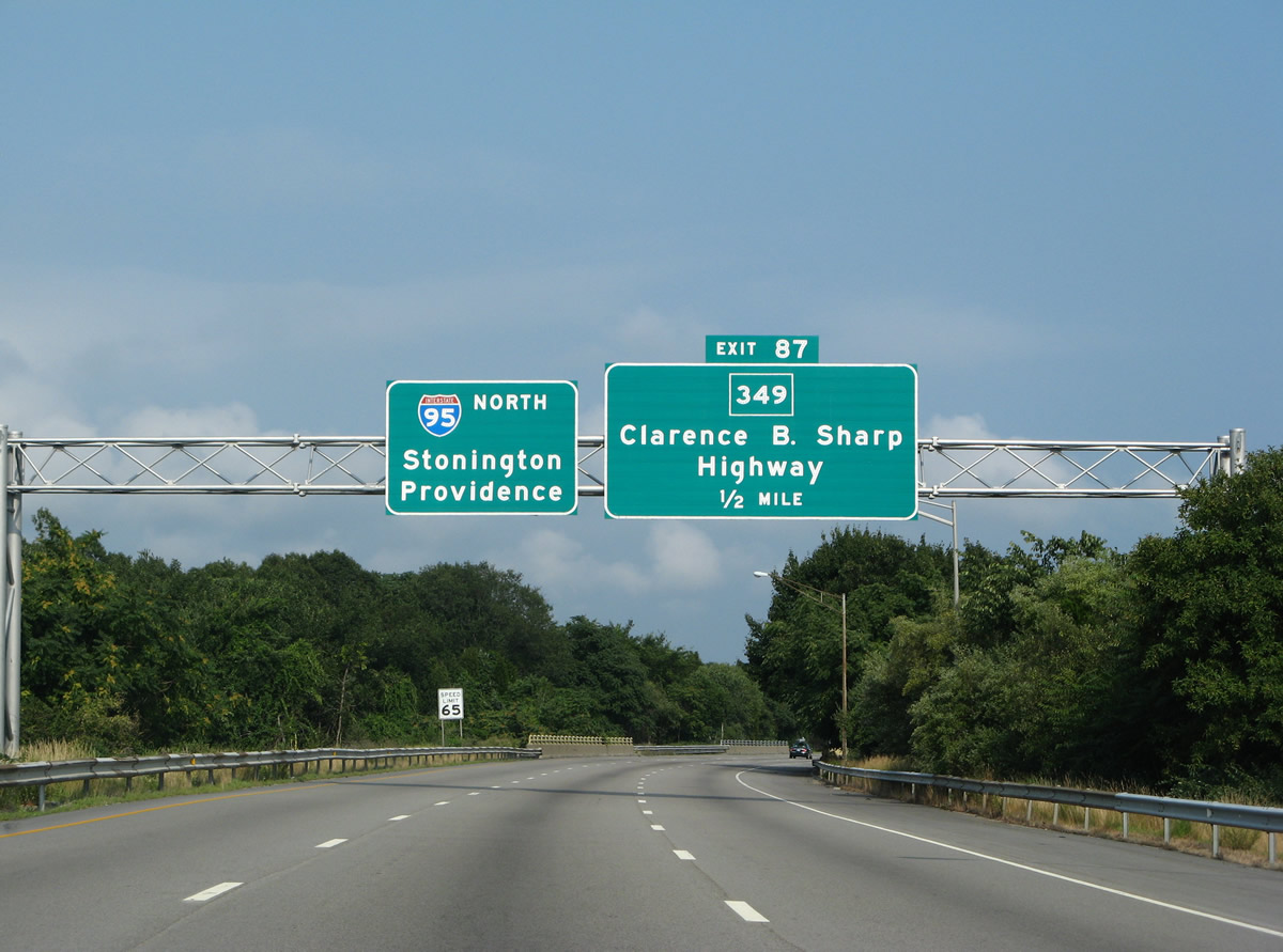
| Interstate 95 meets the north end of Route 349 (Clarence B. Sharp Highway) quickly after the split with Route 184 and U.S. 1. Route 349 comprises a short expressway southwest to Rainville Avenue in Groton. The state route spurs south from Groton to Groton Heights and the University of Connecticut at Avery Point. 07/28/07 |
|
| Interstate 95 northbound reaches the directional interchange (Exit 87) with Route 349; the freeway continues east to Stonington, North Stonington and Providence, Rhode Island. Route 349 intersects Meridian Street east of Fort Griswold Battlefield State Park. Route 349 runs 4.17 miles between Avery Point and Interstate 95. 07/28/07 |
|
| The 1.25 mile guide sign for Route 117 (North Road) lies ahead of the Route 349 on-ramp to Interstate 95 north. Route 117 travels south one mile to U.S. 1 (Fort Hill Road) at Poquonnock Bridge near Groton-New London Airport (GON). 06/26/05 |
|
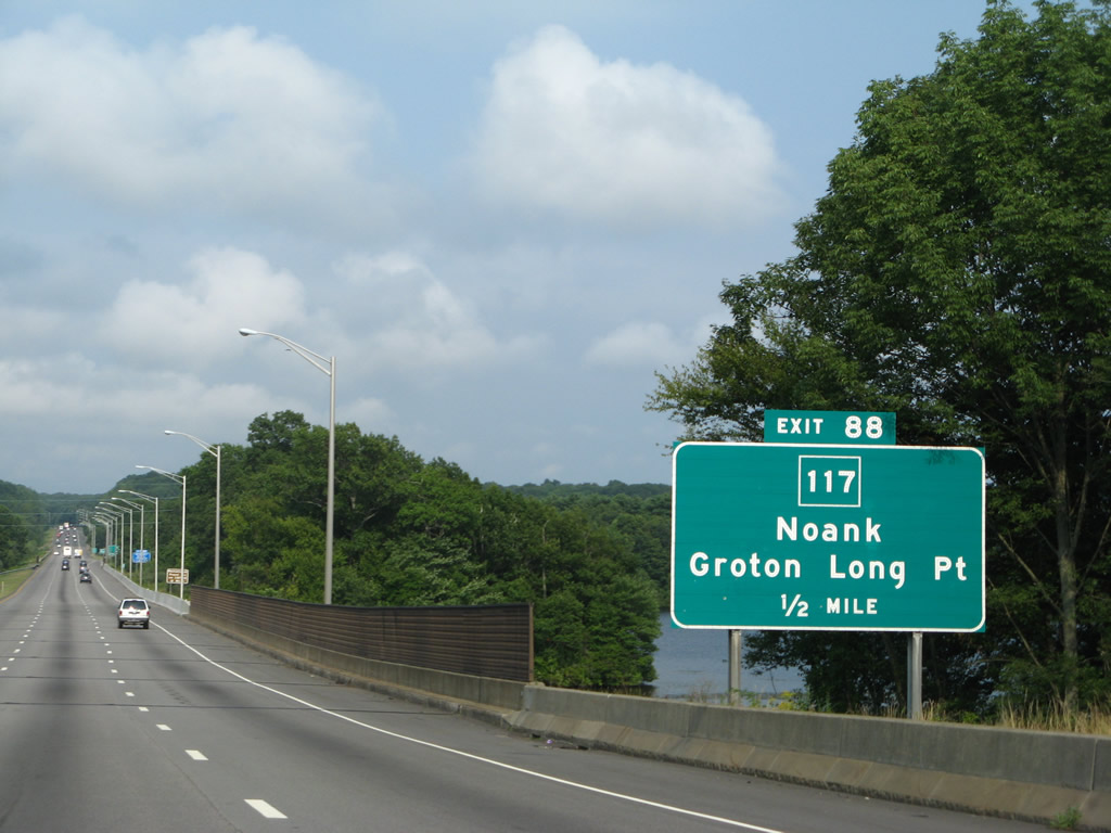
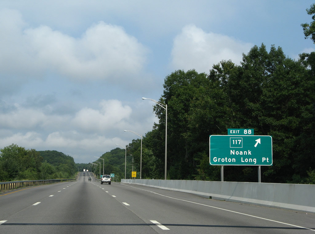
| Interstate 95 passes through the areas of Groton Reservoir, Pohegnut Reservoir and Smith Lake between the Buddington Road underpass and the parclo interchange (Exit 88) with Route 117 (North Road). Route 117 follows a 11.32 mile route between U.S. 1 (Fort Hill Road) and Route 2 at Hallville. 07/28/07 |
|
| Drivers bound for Route 117 south to Poquonnock Bridge and north to Center Groton and Ledyard Center depart Interstate 95 north at Exit 88. Connections with U.S. 1 and Route 215 provide the routing south to the coastal communities of Noank and Groton Long Point. 07/28/07 |
|
| The roadways of Interstate 95 diverge ahead of the Exits 89 and 90 interchanges with West Mystic and Mystic. 07/28/07 |
|
| The freeway reduces to four overall lanes from just ahead of Exit 88 to the Rhode Island border. 07/28/07 |
|
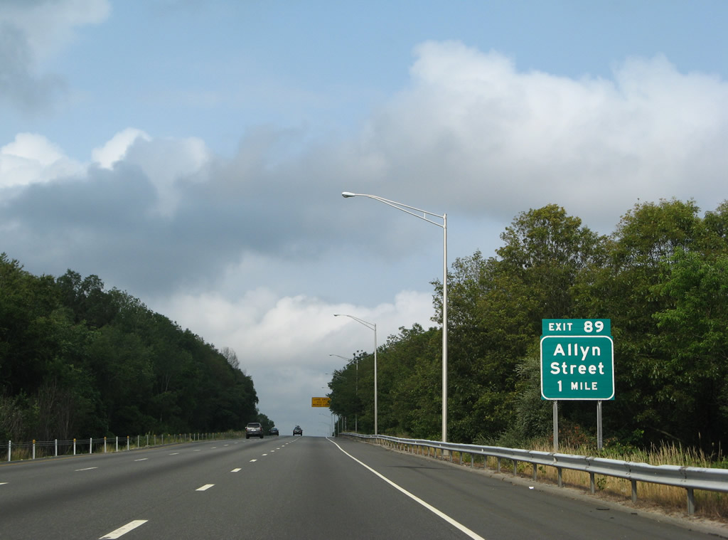
| One mile west of the parclo interchange (Exit 89) with Allyn Street on I-95 north. Allyn Street leads south to the intersection of U.S. 1 (New London Road / West Main Street) at West Mystic Avenue. West Mystic Avenue ends at Route 215 (Noank Road) near Mystic Harbor. 07/28/07 |
|
| The lane drop occurs midway between the Flanders and Noank Ledyard Road overpasses as Interstate 95 crests near 200 feet above sea level. 07/28/07 |
|
| Noank Ledyard Road passes over Interstate 95 one half mile west of the off-ramp (Exit 89) to Allyn Street. Interests to Downtown Mystic and the Mystic area attractions of Mystic Seaport and Mystic Aquarium should remain on Interstate 95 to Exit 89 with Route 27 (Whitehall Avenue). 07/28/07 |
|
| Interstate 95 northbound at the off-ramp (Exit 89) to Allyn Street. Allyn Street heads north from West Mystic to I-95 and Cow Hill Road. Cow Hill Road continues the drive northward to Route 184 (Gold Star Highway) at Burnetts Corner.
Cow Hill Road and Allyn Street are part of unsigned Route 61 between Route 184 and U.S. 1 (New London Road). 07/28/07 |
|
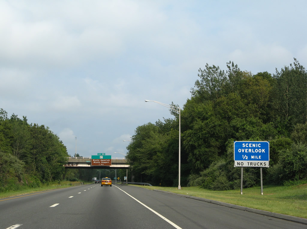
| A scenic overlook provides a view of the upcoming Mystic River along the south side of the freeway. 07/28/07 |
|
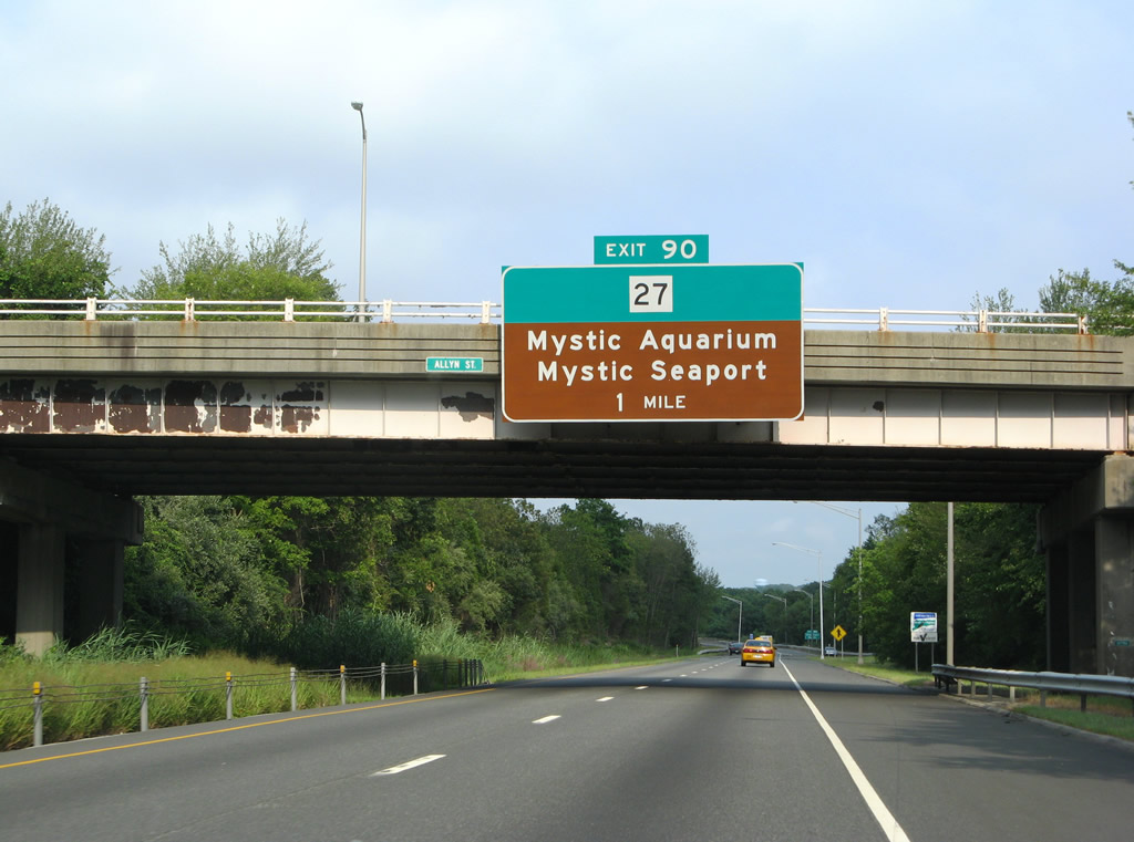
| Interstate 95 continues eastward toward the Mystic River crossing and Route 27 (Exit 90). The river represents the Town line between Groton and Stonington. Exits 90, 91 and 92 serve Stonington. 07/28/07 |
|
| Northbound drivers reach the Mystic River scenic overlook just one half mile ahead of Exit 90 to CT 27.
Route 27 straddles the river southward from Exit 90 into Mystic, ending at U.S. 1 (Williams Avenue) near Downtown. Mystic Seaport lies along the state route (Greenmanville Avenue) ahead of U.S. 1. Mystic Aquarium is located nearby along parallel Coogan Boulevard. Access to Coogan Boulevard is provided by a turn off from the northbound on-ramp. 07/28/07 |
|
| The freeway spans the Mystic River at a narrow point just west of the parclo interchange at Exit 90. Route 27 (Whitehall Avenue) continues north from Interstate 95 to Route 234 and Old Mystic. The route runs 3.21 miles between Mystic and Route 184. 07/28/07 |
|
| A truck climbing lane ensues along I-95 north on the rise from Exit 90 to Mystic Reservoir. 07/28/07 |
|
| Heading east through Stonington, Interstate 95 next meets Route 234 via Taugwonk Road. Route 234 meanders east-west between the Old Mystic area and U.S. 1 near Pawcatuck, passing over Interstate 95 via Pequot Trail west of Exit 91. 07/28/07 |
|
| Route 234 (Pequot Trail) passes over Interstate 95 one half mile west of the parclo interchange at Exit 91. The state route turns east at the intersection of Taugonk Road and the Exit 91 northbound off-ramp. Taugwonk Road ventures north from there to Route 184 (New London Turnpike) at Jeremy Hill Road near the North Stonington Town line. 06/26/05 |
|
| Route 234 (Pequot Trail) continues east from Exit 91 and Taugonk Road to U.S. 1 (West Broad Street) on the outskirts of Pawcatuck. Route 234 west ties into North Main Street nearby; North Main Street heads southward to U.S. 1 and U.S. 1A at the Stonington Town center. 07/28/07 |
|
| The final Connecticut control point is the Town of North Stonington. Interstate 95 skims the southeastern reaches of North Stonington between Exits 92 and the Rhode Island state line. The Rhode Island capital city remains 44 miles to the northeast beyond Exit 91. 07/28/07 |
|
| Nearing the North Stonington Town line on Interstate 95 north, the freeway sees a half diamond interchange with Route 2 (Liberty Street) and Route 49 (Pendleton Hill Road). Unsigned Route 617 provides a frontage road between the two north-south state routes. 07/28/07 |
|
| Route 2 and 49 combine just north of the Route 78 (Westerly Bypass) en route to Pawcatuck. Route 2 continues southward along Liberty Street to U.S. 1 (West Broad Street) next to the Pawcatuck River, the division between Pawcatuck, Connecticut and Westerly, Rhode Island. 06/26/05 |
|
| The aforementioned connection with MSR Route 78 (Westerly Bypass) provides a major beach route to U.S. 1 (Post Road) and the Rhode Island shore line. The Westerly Bypass is a two lane freeway leading six miles Route 2 (Liberty Street) and U.S. 1 in Rhode Island. Route 78 was originally envisioned to continue west from Liberty Street to a directional interchange with Interstate 95. Additionally the freeway was planned to continue northwest to the Route 2 freeway in Norwich in the 1960s. The Connecticut portion of the Westerly Bypass opened in 1979, with completion of the existing partial exchange at Route 2 finished by 1983.3 06/26/05 |
|
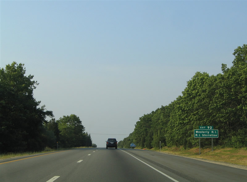
| Interstate 95 northbound at the off-ramp (Exit 92) to Route 2 (Liberty Street) and Route 49 (Pendleton Hill Road). Route 2 runs northwest to the North Stonington Town center en route to the Mashantucket Pequot Reservation, Norwich and its freeway to Hartford. The state route travels 58.03 miles between Hartford and U.S. 1 in Pawcatuck. Route 49 straddles the eastern reaches of the state 21.91 miles from Route 2 north to Voluntown and its end at Route 14A at Sterling Hill. 07/28/07 |
|
| The roadways of Interstate 95 separate for the remainder of the freeway in Connecticut, creating a picturesque landscape for the final miles preceding Rhode Island. 06/26/05 |
|
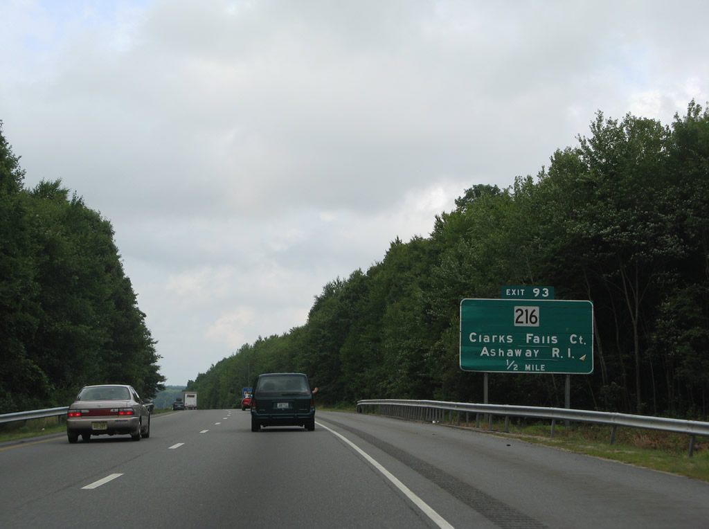
| Meeting Interstate 95 at Exit 93, the last Constitution Street interchange, is Route 216 (Clark Falls Road). Route 216 comprises a north-south roadway between Clarks Falls and Ashaway, Rhode Island. 07/28/07 |
|
| Route 216 travels 2.78 miles east from Route 49 (Pendleton Hill Road) to the Rhode Island state line. The state route intersects the east end of Route 184 (Providence New London Turnpike) on the north side of the diamond interchange (Exit 93) with I-95.
Route 184 was once designed Route 95 before the completion of the Interstate 95 freeway between Groton and Rhode Island. 07/28/07 |
|
| Northbound I-95 at the ramp departure (Exit 93) to Route 216 (Clarks Falls Road). Route 216 becomes Route 216 (High Street) as it enters Bethel, Rhode Island. The multi-state route continues south to Ashaway, Route 3 (Main Street) and Ashaway Road southeast to Bradford. Route 216 ends at U.S. 1 (Post Road) west of Burlingame State Park and Charlestown. 06/26/05 |
|
| Route 216 shields posted at the end of the Exit 93 off-ramp. Route 216 intersects Route 184 nearby to the north and quickly enters Rhode Island southward. 06/26/05 |
|
| A last Interstate 95 Connecticut marker resides at the Rhode Island state line. The freeway continues northeast to Canonchet, Hope Valley and West Warwick. 07/28/07 |
Page Updated 04-28-2023.

 North
North


 North
North