Lake Ontario State Parkway originates at Lakeside Beach State Park in Orleans County. Running along the south shore of Lake Ontario, the limited access highway connects the towns of Carlton and Kendall with Hamlin Beach State Park in Orleans County. Heading east into Monroe County, Lake Ontario State Parkway travels through the towns of Hamlin and Parma to Braddock Bay Wildlife Management Area in Greece. The parkway concludes at Lake Avenue and Pattonwood Avenue in the city of Rochester.
Inventoried by the New York State Department of Transportation (NYSDOT) as Route 947A and maintained by the State Parks system, Lake Ontario State Parkway measures 35.06 miles in length. Similar to other parkways across the state, the roadway is restricted to passenger vehicles only.
|
| Lake Ontario State Parkway east at the U-turn ramp between Long Pond Road and NY 390 south. 05/28/00 |
|
| Lake Ontario State Parkway and Seaway Trail markers posted east of the trumpet interchange with NY 390 south. 05/10/05 |
|
| A parlco A2 interchange joins Dewey Avenue (CR 132) with Lake Ontario State Parkway in a half mile. NY 18 follows Latta Road west from Dewey Avenue to North Greece. 05/10/05 |
|
| Dewey Avenue (CR 132) heads north to Beach Avenue and south to NY 18 (Latta Road) at Mount Read. NY 18 follows Dewey Avenue 3.61 miles south from Latta Road to NY 104 (Ridge Road). 05/10/05 |
|
| Confirming markers for Lake Ontario State Parkway and Seaway Trail at the Dewey Avenue underpass. A new shield for Lake Ontario State Parkway posted further east replaced this assembly in 2012. 05/10/05 |
|
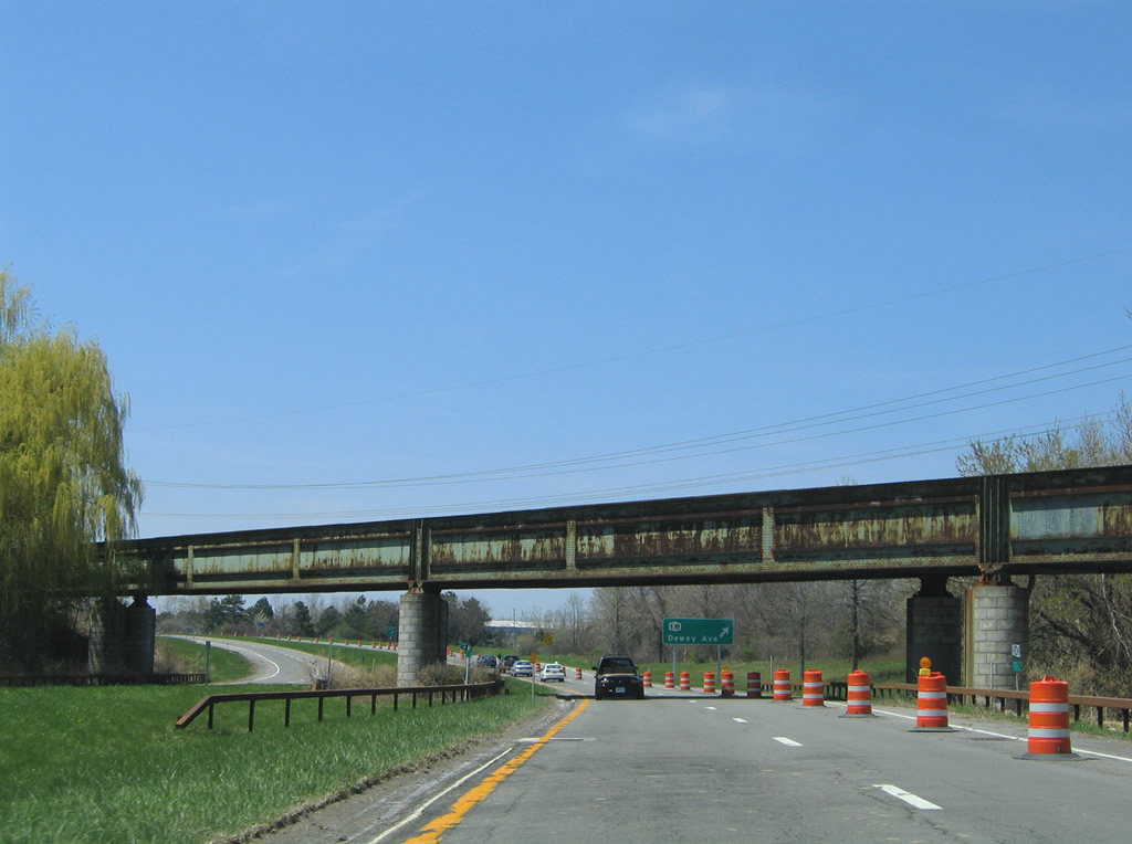
| An abandoned Penn Central Railroad overpass spans Lake Ontario State Parkway east of Dewey Avenue. 05/10/05 |
|
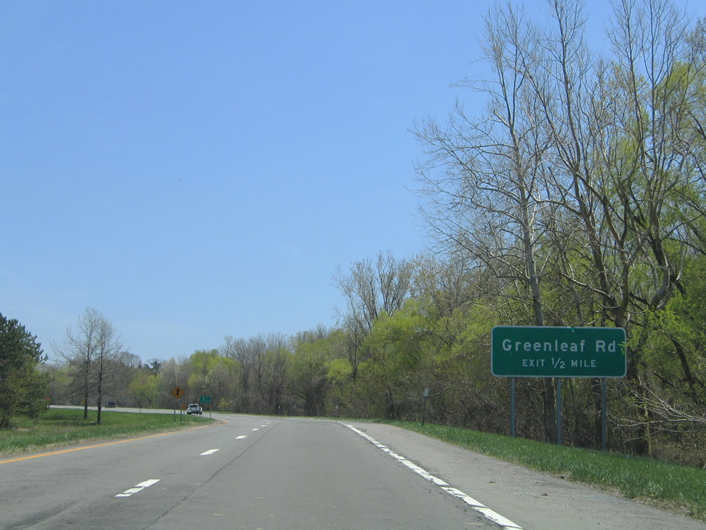
| Greenleaf Road (CR 126) meets the parkway at a diamond interchange next. 05/10/05 |
|
| U-turn ramps provide access to the opposite directions of Lake Ontario State Parkway between Dewey Avenue and Greenleaf Road. 05/10/05 |
|
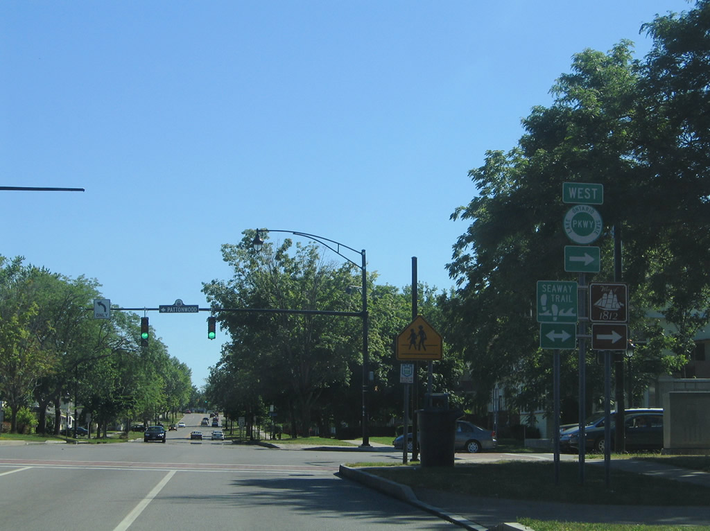
| Lake Avenue intersects the westbound beginning of Lake Ontario State Parkway at Pattonwood Drive east. Pattonwood Drive crosses the Genesee River east across the Col. Patrick O'Rorke Memorial Bridge, a span that replaced the original Stutson Street Bridge. This sign was removed by 2012. 07/02/05 |
|
| Lake Ontario State Parkway is a part of the Seaway Trail west from Lake Avenue to Hamlin Beach. Pattonwood Drive extends the Seaway Trail east to St. Paul Boulevard. This Lake Ontario State Parkway shield was removed by 2017, and the guide sign for Hamlin Beach by 2019. 07/02/05 |
|
| Pattonwood Drive transitions to Lake Ontario State Parkway west form Lake Avenue. Decorative light posts line the initial stretch of the four lane highway. 07/02/05 |
|
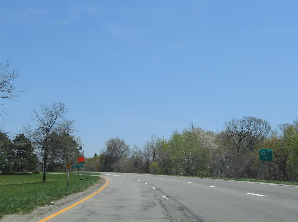
| Shifting northward, Lake Ontario State Parkway meets Latta Road a a three quarter diamond interchange. 07/02/05 |
|
| Greenleaf Road stems north from Latta Road and Hampton Boulevard to a diamond interchange with Lake Ontario State Parkway. 07/02/05 |
|
| Greenleaf Road (CR 126) heads north to Beach Avenue between Rigney Bluff and Ontario Beach along Lake Erie. 07/02/05 |
|
| Removed by 2012, a reassurance marker for Lake Ontario State Parkway was posted beyond the gore point for the Greenleaf Road off-ramp. 07/02/05 |
|
| Lake Ontario State Parkway curves northward by George Badgerow Park along the ensuing stretch. 07/02/05 |
|
| A U-turn ramp provides return access to Lake Ontario State Parkway east toward Greenleaf Road and Lake Avenue. 07/02/05 |
|
| A parclo A2 interchange joins Lake Ontario State Parkway with Dewey Avenue (CR 132) in a half mile. 05/10/05 |
|
| An abandoned Penn Central Railroad line spans the parkway ahead of the off-ramp for Dewey Avenue. Dewey Avenue heads north to Beach Avenue at Round Pond and Rigney Bluff. 05/10/05 |
|
| NY 18 originates along Dewey Avenue from NY 104 (Ridge Road), 3.61 miles south of Latta Road. Turning west, NY 18 follows Latta Road 1.16 miles to NY 390. 05/10/05 |
|
| Curving northward, Lake Ontario State Parkway crosses Round Pond Creek ahead of the trumpet interchange with NY 390 south. 05/10/05 |
|
| NY 390 constitutes the northwestern quadrant of the Rochester Outer Loop between Lake Ontario State Parkway and I-390/490. The freeway serves the western suburbs and Greater Rochester International Airport (ROC). 05/10/05 |
|
| Looping onto NY 390 (Rochester Outer Loop) south from Lake Ontario State Parkway west. South of I-490, NY 390 upgrades to Interstate 390, a freeway that connects Rochester with Geneseo and I-86/NY 17 in the Southern Tier. 05/10/05 |
Page Updated 03-09-2020.