U.S. 2 meanders eastward from the New Hampshire state line at White Mountain National Forest to Rumford, Farmington, Skowhegan, Newport, Bangor, Lincoln and Houlton. The highway parallels Interstate 95 northward from Bangor to their respective ends at Houlton. U.S. 2A provides an alternate route between Houlton and Macwahoc.
|
| U.S. 2 & Maine 100 follow Hammond Street through western reaches of Bangor near Bangor International Airport (BGR). The four lane arterial intersects Odlin Road before transitioning into Interstate 395 east. 04/15/16 |
|
| Hammond Street originally traveled north of here but construction of the airport severed the route leaving two separate Hammond Streets. U.S. 2 & Maine 100 use Odlin Road between the two segments of Hammond Street. 04/15/16 |
|
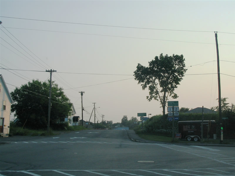
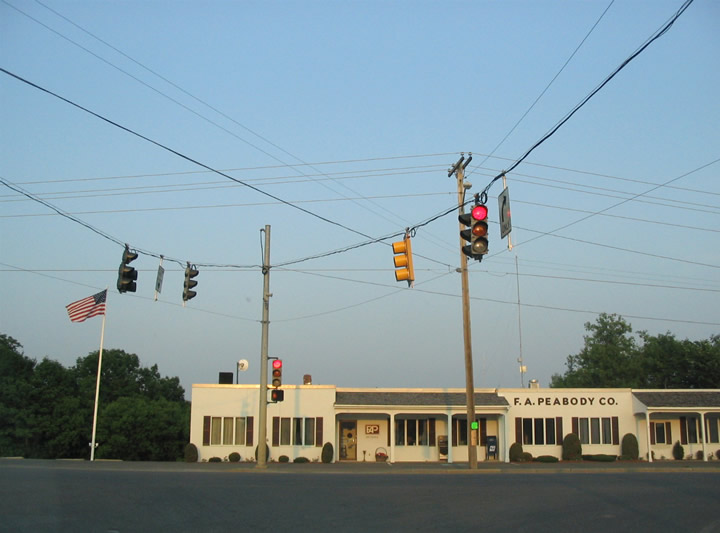
| A busy intersection handles the movements of U.S. 2 & Maine 100 between Hammond Street and Odlin Road. Interstate 395 begins here and quickly intersects I-95 & Maine 15. The freeway continues east to U.S. 202, U.S. 1A and Maine 9, serving the city of Brewer east of the Penobscot River. U.S. 2 & Maine 100 follow Odlin Road to Hammond Street to meet I-95 at Exit 183. 04/15/16 |
|
| U.S. 2 & Maine 100 follow Hammond Street east from Interstate 95 (Exit 183) into Downtown Bangor. Hammond Street becomes one way eastbound between the intersections of Central Street (U.S. 2 west) / Main Street (U.S. 202) and Exchange Street / Harlow Street (U.S. 2 west). U.S. 2 west follows the loop of Harlow and Central Streets north of the eastbound Hammond Street. Hammond Street becomes State Street beyond the crossing of Kenduskeag Stream. 06/27/05 |
|
| U.S. 2 (State Street) east at Harlow Street (U.S. 2 west) and Exchange Street. State Street carries two-way traffic from Exchange / Harlow Streets east to Veazie. The US route continues along the Penobscot River northward to Orono and Old Town from Bangor. 06/27/05 |
|
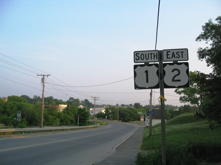
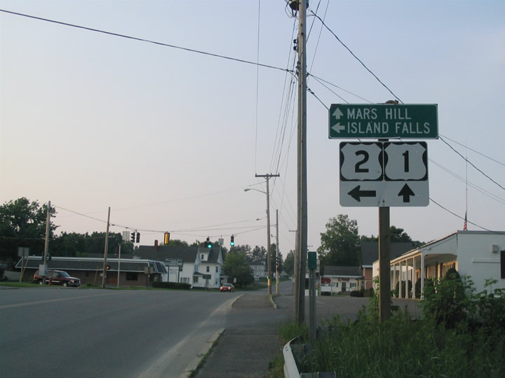
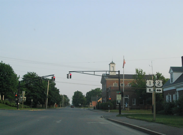
| U.S. 2 enters Houlton via Smyrna Street and approaches U.S. 1 (North Street) for a brief overlap. A signalized intersection joins U.S. 1 and 2 a short distance south of Interstate 95 (Exit 302). 06/27/05 |
|
| Turning southward on North Street, U.S. 1 & 2 travel three blocks to Military Street west of Downtown. Pictured here is their first reassurance assembly, posted between Smyrna and Mill Streets. 06/27/05 |
|
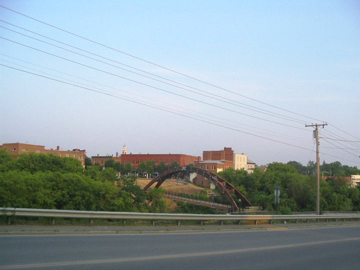
| Peering eastward at Downtown Houlton, an arched pedestrian bridge spans the Meduxnekeag River. North Street becomes Kendall Street at Mill Street ahead. 06/27/05 |
|
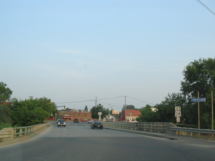
| U.S. 1 south & 2 east (Kendall Street) span the Meduxnekeag River between Mill Street and U.S. 2A (Bangor Street). U.S. 2A begins here and travels southwest to Linneus, Haynesville, Glenwood, Reed and Macwahoc. 06/27/05 |
|
| Southbound at the signalized intersection with the westbound beginning of U.S. 2A (Bangor Street) and Market Square east into the central business district. U.S. 2A merges with Military Street one block to the west to Carys Mill. 06/27/05 |
|
| U.S. 1 & 2 travel one block south on Kendall Street to Military Street. 06/27/05 |
|
| U.S. 1 south & 2 east turn onto Military Street briefly between Kendall and Court Streets. Military Street is considered a part of U.S. 2A between Bangor Street and U.S. 1 & 2. 06/27/05 |
|
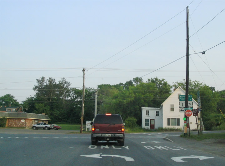
| One block east of Kendall Street is the split of U.S. 1 south from U.S. 2 east. U.S. 1 follows Court Street south to Calais Road and Hodgdon Corners. The US highway continues though Weston, Topsfield and Calais in extreme southeastern Maine. 06/27/05 |
|
| U.S. 2 continues east along Military Street to Houlton International Airport (HUL) outside of town. 06/27/05 |
|
| A flasher hangs above the intersection of Military Street (U.S. 2) and Kelleran Street outside Downtown Houlton. 06/27/05 |
|
| U.S. 2 continues along Military Street east to Airport Road. Airport Road stems north from Houlton International Airport (HUL) to Interstate 95 at Exit 305. U.S. 2 turns north onto Airport Road briefly before ending at the parclo interchange with the freeway. 06/27/05 |
|
| An end shield for U.S. 2 stands at the northbound entrance ramp to Interstate 95. I-95 north transitions to New Brunswick Route 95 en route to Woodstock just beyond the adjacent port of entry for Canada. 06/27/05 |
|
| Drivers that do not turn onto Border Lane east or Interstate 95 northbound default onto Interstate 95 southbound for Houlton. Interstate 95 continues three miles to U.S. 1 (Exit 305). Airport Road does not continue north of the freeway otherwise. 06/27/05 |
|
| U.S. 2 begins westbound at a parclo interchange (Exit 305) with Interstate 95. Following Airport Road, the US highway intersects Border Lane (old U.S. 2 into Canada) before turning west onto Military Street. Airport Road continues south to Houlton International Airport (HUL). 06/27/05 |
|
| Looking southwest at the first U.S. 2 westbound shield and grounds of Houlton International Airport (HUL). 06/27/05 |
|
| Traveling westward along Military Street as U.S. 2 leaves Airport Road. U.S. 2 travels 460 miles overall between here and Rouses Point, New York. 06/27/05 |
|
| Once in Houlton, U.S. 2 merges with U.S. 1 at the intersection of Military and Court Streets south of Downtown. The two follow Military Street west one block to Kendall Street. A leg of U.S. 2A follows Military Street west one block to Bangor Street. 06/27/05 |
|
| Kendall Street carries U.S. 1 north & 2 west one block north to the westbound beginning of U.S. 2A at Bangor Street. Bangor Street continues Market Square west out of Downtown to Carys Mills. U.S. 2A loops southwest to Linneus, Haynesville and Macwahoc east of the U.S. 2 mainline through Island Falls and Golden Ridge. 06/27/05 |
|
| U.S. 1 north & 2 west span the Meduxnekeag River between U.S. 2A (Bangor Street) and Mill Street. Kendall Street becomes North Street. 06/27/05 |
|
| Ascending northward from the Meduxnekeag River, an I-95 trailblazer directs motorists to the diamond interchange at Exit 302 with the freeway ahead. 06/27/05 |
|
| North Street northbound at the U.S. 1 & 2 split. U.S. 2 turns onto Smyrna Street for its western exit from Houlton. The US highway parallels Interstate 95 westward to Ludlow and Smyrna Mills. U.S. 1 extends north beyond I-95 to Caribou, Fort Kent and Presque Isle. 06/27/05 |
|
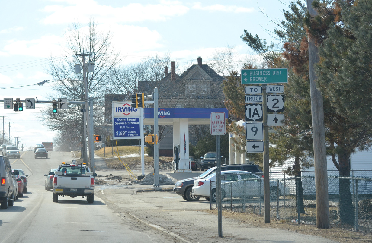
| Shifting to Bangor, U.S. 2 follows State Street through eastern reaches of the city to the central business district. Pictured here is the intersection with Hancock Street, which veers southward along the Penobscot River as a truck route to both U.S. 1A and Maine 9 in Brewer. 04/03/14 |
|
| U.S. 2 separates into a one way street couplet with westbound using Harlow Street north and Central Street south through Downtown Bangor. State Street flows eastbound as U.S. 2 between the two streets. 04/03/14 |
|
| U.S. 2 west turns south from Harlow onto Central Street to Hammond Street at Main Street (U.S. 202. Harlow Street extends north to the Bangor Federal Building and Valley Avenue along Kenduskeag Stream. 06/27/05, 04/03/14 |
|
| Central Street carries U.S. 2 westbound across the Kenduskeag Stream between Harlow and Hammond Streets. 06/27/05 |
|
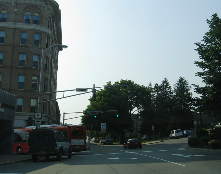
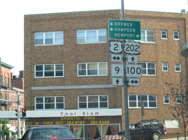
| The intersection of Harlow and Hammond Streets represents the northern terminus of U.S. 202. U.S. 202 begins and travels southward along Main Street, joining U.S. 1A and Maine 9 in the process, to Interstate 395 (Exit 3). U.S. 2 west turns onto Hammond Street with Maine 100 toward the University of Maine at Bangor. U.S. 2 east remains wholly on Hammond Street through its name change to State Street.
The sign assembly for U.S. 2, U.S. 202 and SR 9 and 100 was removed by 2011. 06/27/05 |
|
| A closer look at the removed U.S. 2, U.S. 202, Maine 9 and Maine 100 shield assembly posted on Harlow Street south at Hammond Street. Hammond Street carries U.S. 2 & Maine 100 west toward Bangor International Airport (BGR) and Interstate 95 (Exit 183). State Street carries U.S. 2 east to Veazie. U.S. 202 follows Main Street south three blocks to Union Street and U.S. 1A & Maine 9. U.S. 202 & 1A and Maine 9 continue along Main Street to Interstate 395 where U.S. 202 joins the freeway briefly between Exits 3 and 2. U.S. 1A & Maine 9 span the Penobscot River into Brewer. 06/27/05 |
|
| Complicating the intersection of U.S. 2, U.S. 202 and Maine 100 is Broad Street which stems southeast from Main Street nearby. Broad Street represents a short street between Main Street and Market Square to the east. 04/03/14 |
|
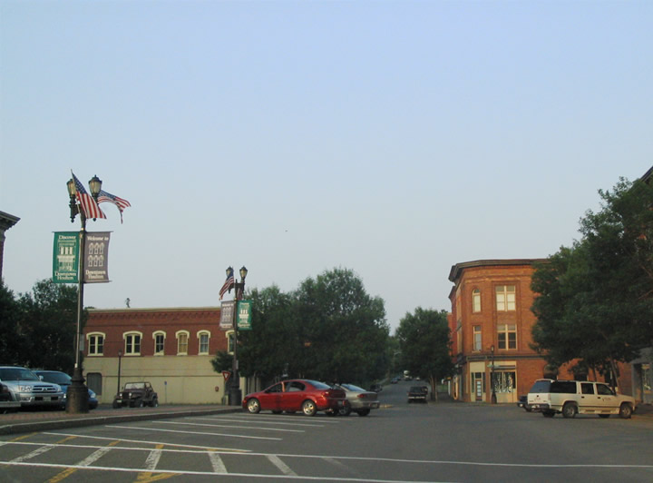
| U.S. 1/2 bypass Downtown Houlton via Kendall and Military Streets to the south and west. One block north of Military Street is Market Square/Main Street. This scene looks at Main Street eastbound within Downtown. 06/27/05 |
|
| Court Street at Main Street/Market Square in Downtown Houlton. The intersecting street becomes part of U.S. 1 south of Military Street. 06/27/05 |
|
| Court Street southbound at U.S. 1/2 (Military Street). U.S. 2 east follows Military Street to Houlton International Airport (HUL) and the north end of I-95. U.S. 1 follows Court Street southward out from Houlton en route to Calais. U.S. 1/2 follow Military Street one block west to U.S. 2A. 06/27/05 |
Page Updated 04-16-2016.


 / State Route 100 East
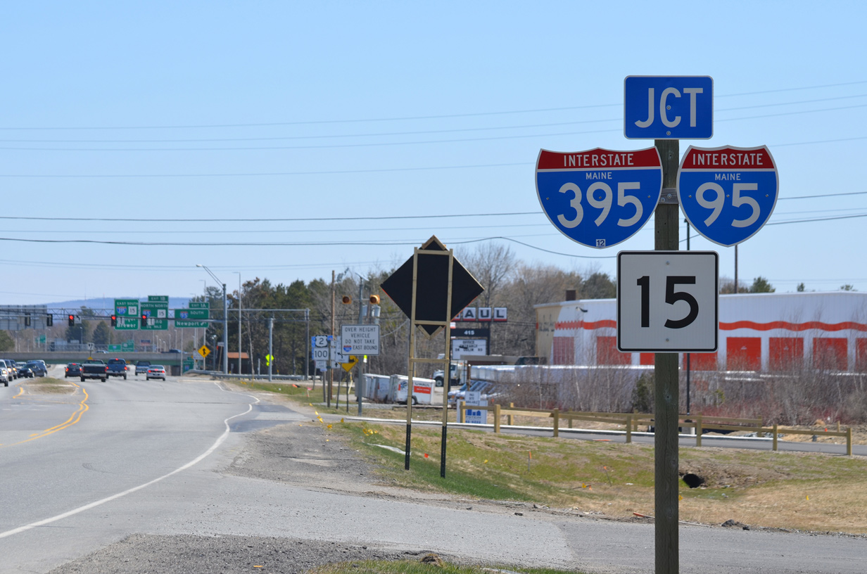


 South
South