|
| KY 57 ends here at New Circle Road. The state highway is generally two lanes as it winds its way north to the Ohio River at Concord. 06/05/08 |
|
| New Circle Road is a grueling and endless parade of traffic lights through here. Residential subdivisions here in northeast Lexington include Hi-Acres, Kenawood, and Rockwood. This is the only section of New Circle Road that is not limited access, and its a doozy. Traffic engineers estimate that the average time it takes to get through the 3 mile signalized portion of the road is 22 minutes. 06/05/08 |
|
| KY 4's first interchange east of the signalized section is with US 60 as it heads east out of the city. After it opened in 1951 and was widened repeatedly, the first study to turn the rest into a freeway came out in 1966 and was acted upon. The original grade separation opened in 1961. The overpass was low and kept getting hit by trucks, and had to be repaired on several occasions. In 1999-2000 the entire interchange was rebuilt into a SPUI. 06/05/08 |
|
| This northeastern section of New Circle Road is derisively called "Stringtown" by locals, for the strings of strip malls and business along the route. This section of roadway opened in 1951 and had to be widened in 1958 because of the congestion. 06/05/08 |
|
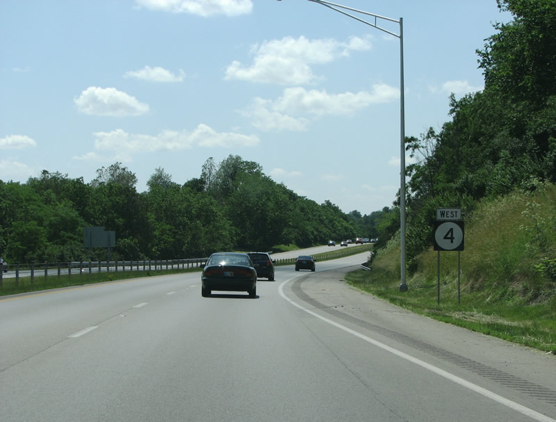
| KY 4 is signed as southbound here, it eventually goes through every cardinal direction. 06/05/08 |
|
| KY 4 southbound at Liberty Road. Liberty heads east out of town towards upscale neighborhoods and the Andover Country Club. Through here, horse farm owners paid to have driveway access to the new loop road. It soon became apparent that their horse farms were on a road far too busy and their land turned into housing tracts. This helped spur Lexington to create the first urban service boundary in the nation in 1958. 06/05/08 |
|
| In 2001, the county paid $690,000 for a study on New Circle Road's traffic problems. The report concluded, basically, that the left turn lanes needed to be longer. 06/05/08 |
|
| US 25, Richmond Road, is the first interchange on the freeway section of KY 4. This also marks the end of the original section of road, sections south of here opened in stages ending in 1967. 06/05/08 |
|
| Alumni Drive is an important secondary arterial on the south and east sides of town. It begins at US 27 at the University of Kentucky and continues eastward through leafy subdivisions and eventually to Man O' War Blvd (named after a horse) which forms a secondary outer loop of the city. 06/05/08 |
|
| At this point, KY 4 changes directions from north/south to east/west. 06/05/08 |
|
| As New Circle Road makes its turn from south to west, it passes through some of Lexington's nicer subdivisions. Tates Creek Golf Course and Chinoe Creek and near here. At this point, the road is the farthest point away from the city's urban boundary. 06/05/08 |
|
| KY 1974 is also known as Tates Creek Road. The Tates Creek area saw the fastest sprawl growth in the early 1990s, with over 4,000 houses built in the first three years of that decade. The road was planned as one of two residential corridors in the city, and was widened in 1991. 06/05/08 |
|
| Lexington does not necessarily have any challenges to its growth pattern. There are no large rivers or blocks to the spread of the city's sprawl. However it has historically grown to the south, because that's where there were more tobacco farms vs. horse farms. Tobacco farms were considered replaceable while horse farms were not. Today, 70% of the city lives to the south - which happens to be the opposite direction from the interstate. Thus, New Circle Road through here gets very busy. 06/05/08 |
|
| US 27, also known as Nicholasville Road, is the most important north/south arterial in the city. Through the US, US 27 generally follows I-75 on its path from Miami to Michigan. In town, the road marks the western side of the University of Kentucky as well as an important shopping street. 06/05/08 |
|
| KY 4 westbound at US 27. US 27 carries more traffic than any other road in Lexington, and it contains its largest employer (the University) and its regional mall. The road underwent a rebuilding and widening in 1989, and in 1997 extra turn lanes were added. This particular exit at New Circle Road was reconstructed in 2003 when ramps were lengthened. 06/05/08 |
|
| KY 4 passes over Clays Mill Road, which runs southwest from town. The road is an important residential connector route. Officials have on several occasions tried to add an interchange at Clays Mill but the cost alongside homeowner opposition has stopped them every time. 06/05/08 |
|
| US 68 is the next exit along KY 4. This exit includes suburban mid-rise office blocks and Beaumont Centre, one of the largest planned communities in Kentucky. Beaumont features 670 acres of development including 385 single family homes, apartments, professional space, and retail. 06/05/08 |
|
| US 60 is the westernmost exit along New Circle Road. The interchange includes a parclo and maintains a rural feel quite unlike earlier intersections along the route. Lexington's urban growth boundary is reached here and farms and horses await any motorist exiting here and going west. 06/05/08 |
|
| Versailles Road, as US 60 is known here, connects Lexington with historic Versailles to the west - as well as the regional airport. In 1996, residents along the corridor banded together to create a group to control growth on the road. They were largely successful. Versailles Road forms the first impression newcomers get as they leave Lexington's airport, and its is a positive one. 06/05/08 |
|
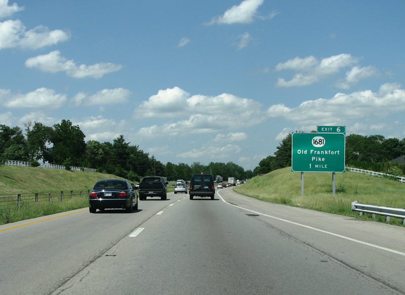
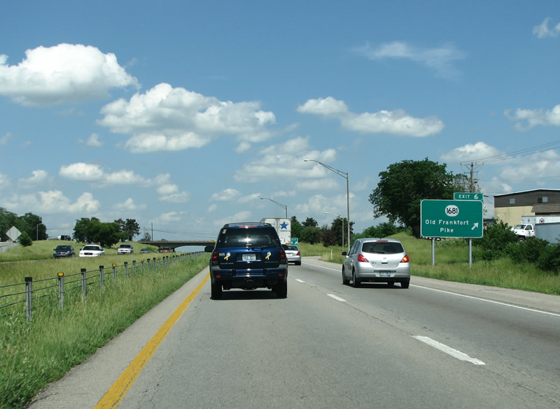
| KY 1681 is the Old Frankfort Pike, the original road from Lexington west to the state capitol. It was later replaced with US 421 and I-64. 06/05/08 |
|
| KY 4 returns to northbound here. 06/05/08 |
|
| New Circle Road is far more rural on this western side of the city. 06/05/08 |
|
| KY 4 northbound at the Old Frankfort Pike. 06/05/08 |
|
| US 421 runs 941 miles from Lake Michigan in Indiana to the Atlantic Ocean at Fort Fisher, North Carolina. In Lexington it forms Main Street and, out here, Leestown Road. 06/05/08 |
|
| Leestown Road runs northwest out of Lexington. Historically black communities like Bracktown and industrial areas line the road out of town. Newer developments began in 1994 along the road. 06/05/08 |
|
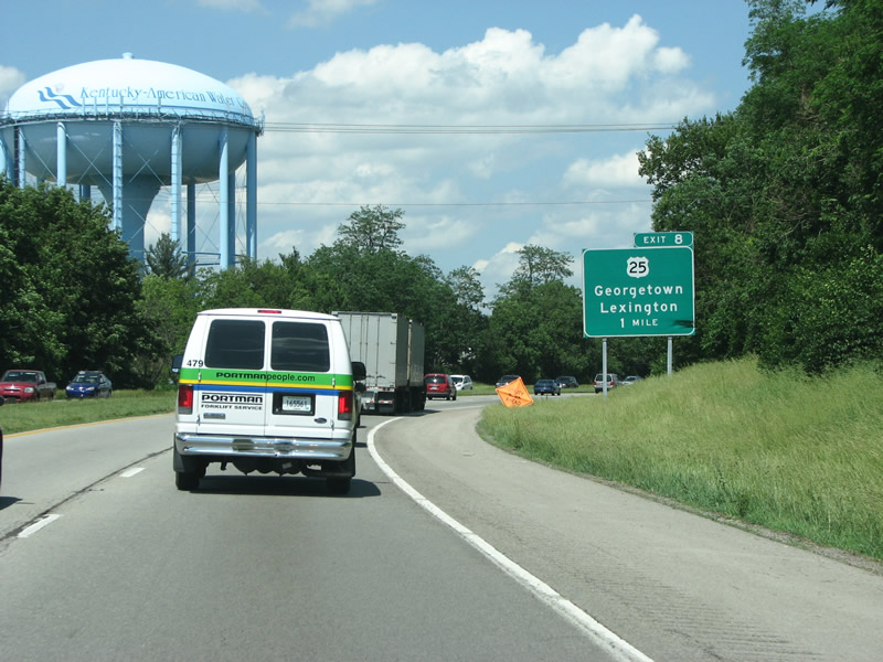
| US 25 heads north of Lexington here, meeting New Circle Road for the second time. 06/05/08 |
|
| US 25 is known locally as Georgetown Road, the old way to get north before I-75 was constructed. Development has always been sparse along this roadway, but pressures increased in 1997 to build new houses through here. There is no direct access to the interstate from US 25 northbound, but the US highway crosses both I-64 and I-75. 06/05/08 |
|
| KY 922 is also known as Newtown Pike, and is the first exit from New Circle Road to have direct access to I-64/75. The pike was extended into downtown Lexington in 2003, diffusing a long time traffic snarl. 06/05/08 |
|
| KY 4 (now eastbound) returns to an expressway here, with no lights but with grade separations at major junctions. 06/05/08 |
|
| Newtown Pike meets New Circle Road in a cloverleaf interchange, which is missing its southwest loop ramp. This is where New Circle Road began life in 1951, and headed east, however the interchange dates from 1964. At that time about 20,000 cars per day traveled through here - but today the figure is closer to 60,000. KYTC began studying a fix in 2005 but construction is still far off. 06/05/08 |
|
| Coming full circle, literally, returns the driver to the dreaded strings of retail and trafficked roadway. 06/05/08 |
|
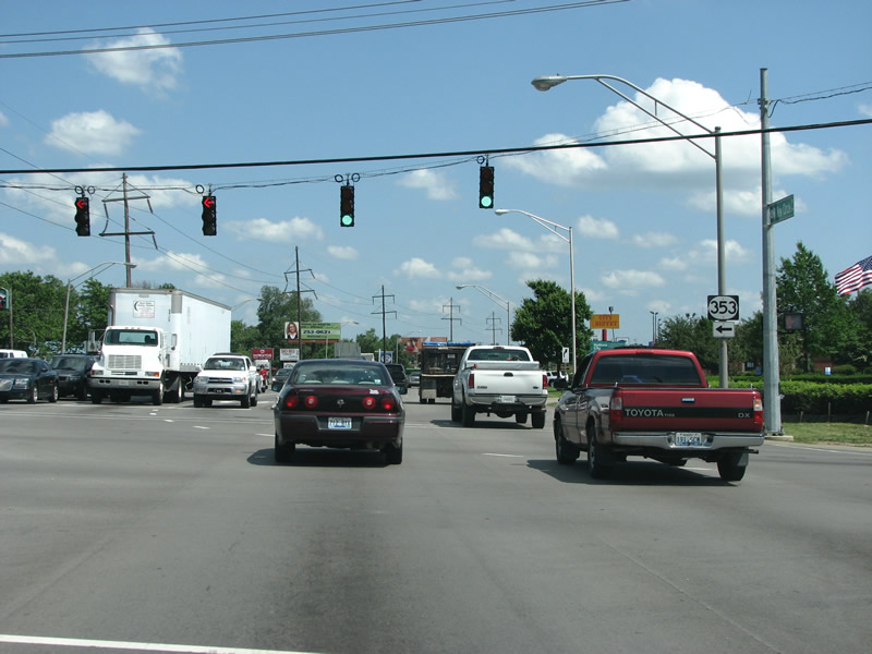
| KY 353, Russell Cave Road, continues north out of Lexington and under the interstate. It runs through rolling bluegrass hills with horse farms at every turn. 06/05/08 |
|
| Whoops! These US 27/68 markers are turned upside down here as KY 4 prepares to meet this busiest at-grade intersection. 06/05/08 |
|
| KY 4 returns to its US highways here, on the north side of town. Turning left will almost immediately take motorists to I-64/75. 06/05/08 |
Page Updated 05-18-2011.