|
| A decorative monument welcomes motorists to the Lone Star State at the FM 1905 (Antonio Street) overpass in Anthony. 04/25/17 |
|
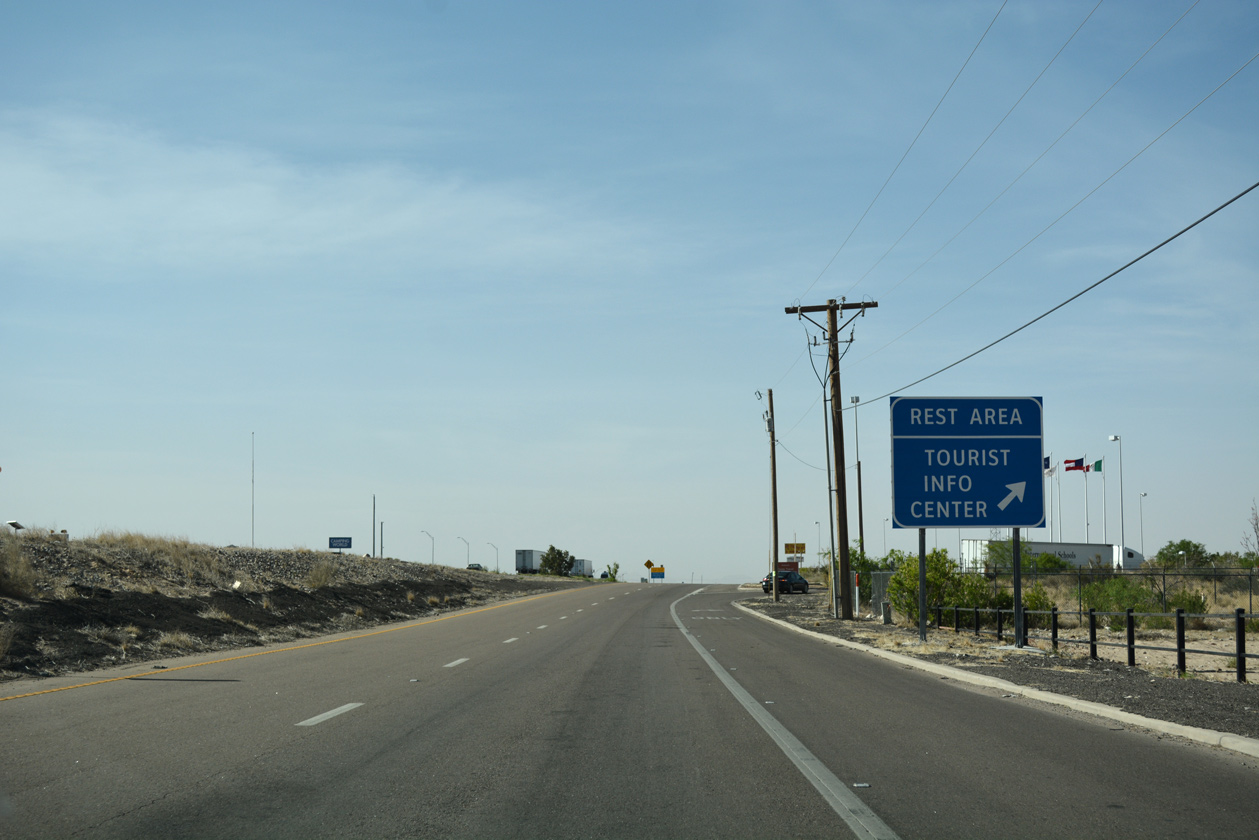
| Exit 1 departs just south of the FM 1905 entrance ramp for parallel Desert Boulevard to an off freeway rest area at the Texas Travel Information Center. 04/25/17 |
|
| IH 10 travels across the width of the Lone Star State, 881 miles from the town of Anthony to the city of Orange. 04/25/17 |
|
| The IH 10 tourist information center lies just within the Anthony town limits. Anthony was incorporated in 1952 as an agricultural service center. 04/25/17 |
|
| U.S. 85 south and U.S. 180 east appear for the first time along IH 10 east at this assembly posted ahead of the Vinton city line. U.S. 85 is not acknowledged along either IH 10 or IH 25 in New Mexico. U.S. 180 overlaps with IH 10 east from Deming, New Mexico, but is not marked. 04/25/17 |
|
| A diamond interchange joins IH 10/U.S. 85-180 with SS 36 (Vinton Road) west into the village of Vinton and Westway Boulevard east to the Westway community at Exit 2. 04/25/17 |
|
| IH 10/U.S. 180 east and U.S. 85 south enter the El Paso city limits ahead of the truck check (weigh) station at Exit 5. 04/25/17 |
|
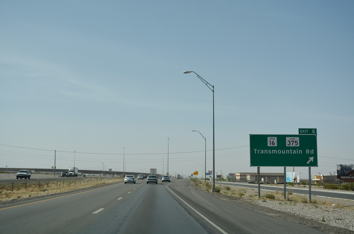
| State Loop 375, a 49 mile long beltway encircling the north, east and south sides of El Paso, originates at Talbot Drive and SH 20 (Doniphan Drive) in Canutillo. Designated in 2012 in place of SS 216, SS 16 extends the four lane roadway of SL 375 southwest from IH 10, 1.21 miles to SH 20 at the Borderland community in El Paso. 04/25/17 |
|
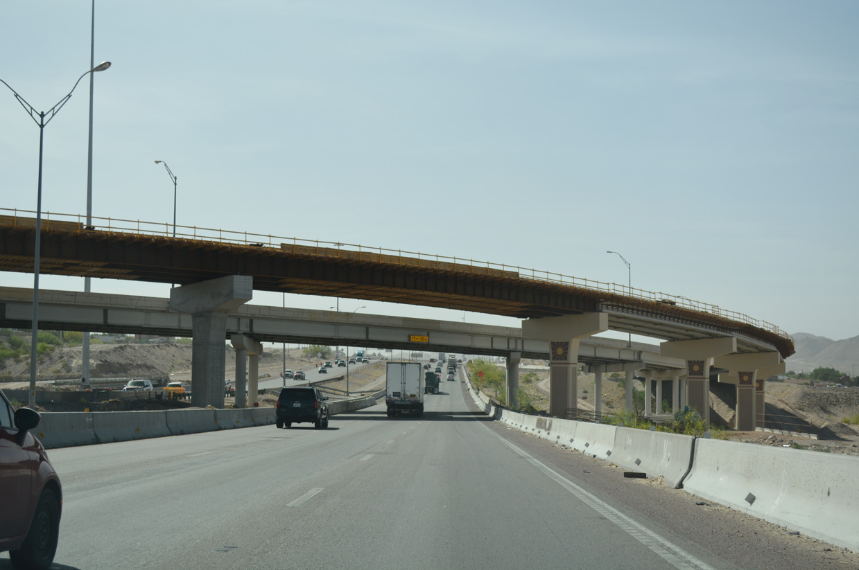
| Exit 6 departs IH 10/U.S. 85-180 for SL 375 (Transmountain Road) east, SS 16 south and SL 375 (Talbot Avenue) west. SL 375 traverses the Franklin Mountains east through Franklin Mountain State Park to U.S. 54 (Patriot Freeway) in northeast El Paso. The scenic, winding expressway was the largest excavation project undertaken by TxDOT when it was constructed in 1967-70. 04/25/17 |
|
| Two flyovers were constructed over the diamond interchange at IH 10 and SL 375 during the Trans Mountain West Project. Underway from 2012 to a ribbon cutting ceremony held on June 2, 2014, the $61 million project expanded SL 375 to a four lane, divided highway with frontage roads from IH 10 to Franklin Mountains State Park.1 04/25/17 |
|
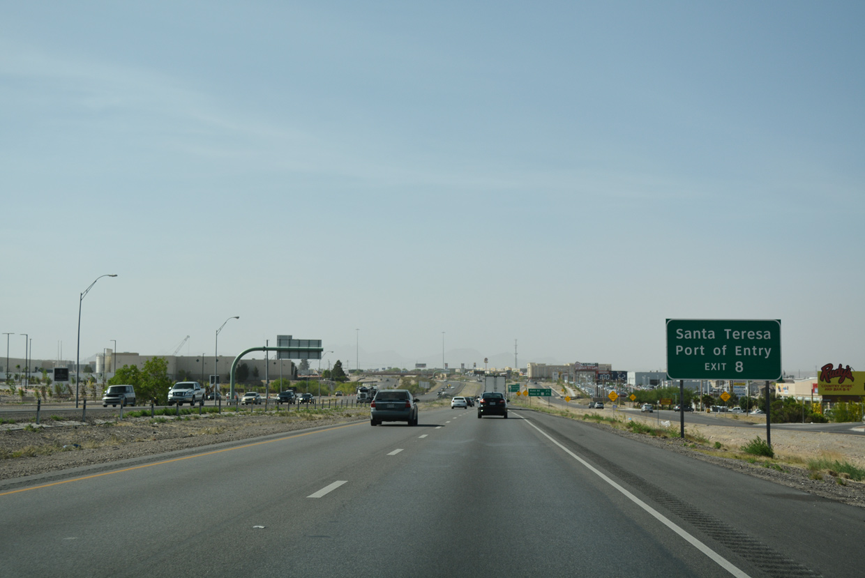
| Continuing south from Canultillo, IH 10 meets SH 178 (Artcraft Road) west and Paseo del Norte east at Exit 8. 04/25/17 |
|
| SH 178 was designated in 1991 from IH 10 west 3.04 miles to the New Mexico state line. The four lane highway transitions to NM 136 there, which arcs 9.16 miles south to the Santa Teresa border crossing to Mexico. 04/25/17 |
|
| IH 10 becomes more suburban on the succeeding stretch south from SH 178 (Exit 8) to Redd Road at the Ridge and Three Hills neighborhoods and the commercialized corridor along SH 20 (Mesa Street). 04/25/17 |
|
| Exit 8 departs IH 10 east for SH 178 (Artcraft Road) west and Paseo Del Norte, a local arterial east to Northern Pass Drive near the Kohlberg community in north El Paso. 04/25/17 |
|
| An auxiliary lane opens eastbound from SH 178 to Exit 9 for Redd Road. 04/25/17 |
|
| Redd Road heads west to the Lindbergh neighborhood and Montoya Drive and northeast to Desierto Plaza and Bear Ridge. 04/25/17 |
|
| SH 20, which extends south from NM 478 at Anthony through the Mesilla Valley, turns east along Mesa Street to meet IH 10/U.S. 85-180 at Exit 11. Mesa Street is one of the old alignments of U.S. 80 through El Paso. 04/25/17 |
|
| The Go 10 construction along IH 10 on El Paso's WestSide expanded and modernized the freeway from N Mesa Street (Exit 11) to Executive Center Boulevard (Exit 16). Running from 2015 to Summer 2019, the $158 project added collector distributor roadways, built the exchange with the Border West Expressway (Toll SL 375) and reconfigured ramps with SH 20, Resler Drive and Sunland Park Drive.2 04/25/17 |
|
| SH 20 (Mesa Street) arcs southeast from Doniphan Drive (old U.S. 85) to the Lambka Park, Upper Mesa Hills, and Festival Hills neighborhoods en route to the University of Texas at El Paso (UTEP) and Downtown. 01/14/06 |
|
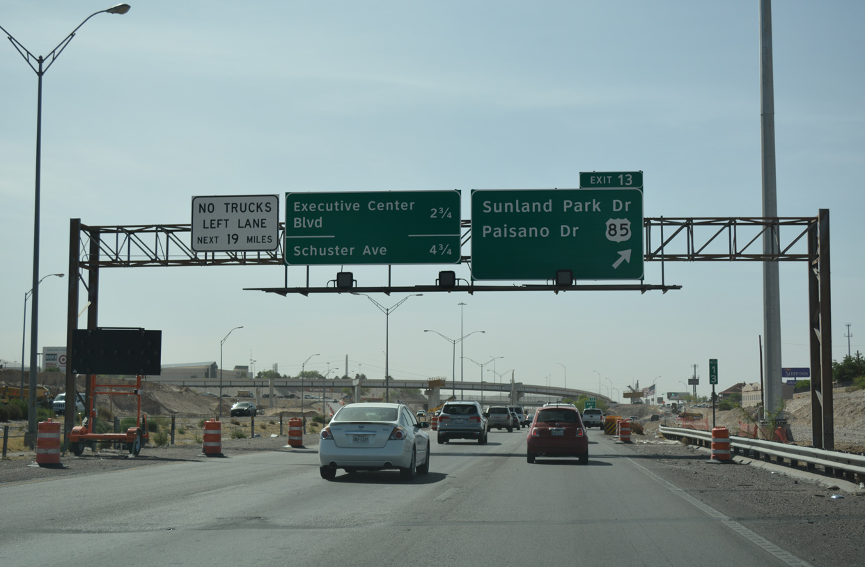
| The Go 10 project expanded IH 10 eastbound with a c/d roadway (Exit 13) leading to Sunland Park Drive and Sunland Park Mall. 04/25/17 |
|
| U.S. 85 separates from IH 10/U.S. 180 east along Paisano Drive 5.68 miles south to U.S. 62 in Downtown El Paso. U.S. 62/85 combine along Stanton Street five blocks south to the Good Neighbor Bridge across the Rio Grande. 04/25/17 |
|
| The flyover connecting Resler Drive south with IH 10 east was replaced during the 2015-19 Go 10 project. 04/25/17 |
|
| Sunland Park Drive comprises a commercial arterial southwest to Sunland Park Racetrack & Casino and northeast from Sunland Park Mall to the Sunand Park North and Crestmont communities. 04/25/17 |
|
| A high flyover connects Sunland Park Drive west with the c/d roadway leading into the wye interchange constructed for U.S. 85 and the Border West Expressway (Toll SL 375). 04/25/17 |
|
| Opening in Summer 2019, the Border West Expressway (SL 375) comprises a 7.5 mile long toll road providing an alternative for IH 10 to Downtown El Paso. 04/25/17 |
|
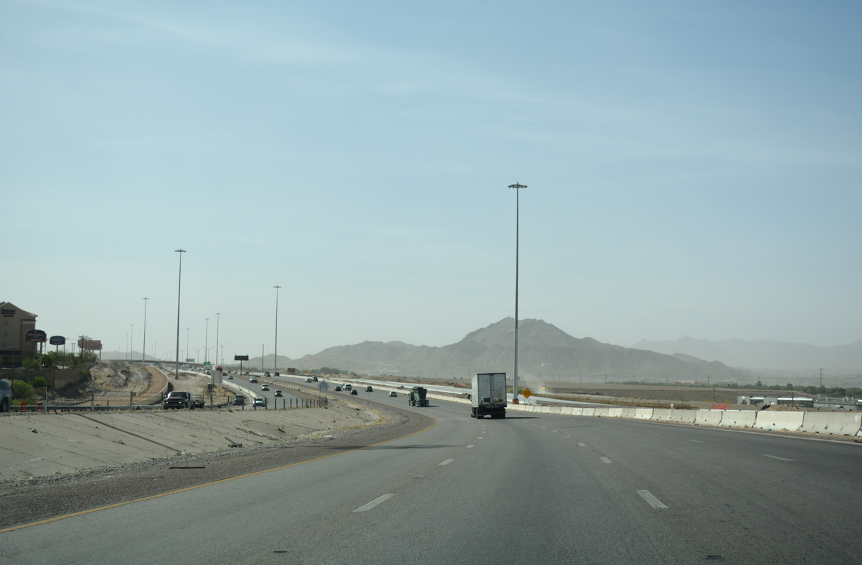
| Mount Franklin and Ranger Peak rise from the Franklin Mountains east of IH 10 and north of Downtown El Paso. 04/25/17 |
|
| Curving south toward the diamond interchange (Exit 16) with Executive Center Boulevard on IH 10/U.S. 180 east. The Go 10 project widened this stretch to eight overall lanes. 04/25/17 |
|
| Executive Center Boulevard is an arterial connecting IH 10/U.S. 180 with the La Calavera neighborhood and U.S. 85 (Paisano Drive) to the west and SH 20 (Mesa Street) at Ridgecrest to the east. 04/25/17 |
|
| The main border crossing from Downtown El Paso to Juárez, Mexico is the Good Neighbor Bridge at the south end of U.S. 62/85 along Stanton Street. Exit 19 to Santa Fe Street provides the most direct route from IH 10 to the port of entry. 04/25/17 |
|
| Northern reaches of Juárez, Mexico and Mt. Christo Rey come into view west of IH 10. 04/25/17 |
|
| IH 10 squeezes alongside Union Pacific Railroad tracks, the Border West Expressway (SL 375) and U.S. 85 (Paisano Drive) between the campus of UTEP and the border fence separating the U.S. from Mexico along the Rio Grande. 04/25/17 |
|
| Exit 18A connects IH 10/U.S. 180 with Schuster Avenue and Sun Bowl Drive to UTEP and Sun Bowl stadium. 04/25/17 |
|
| Entering the diamond interchange (Exit 18A) with Schuster Avenue on IH 10/U.S. 180 eastbound. Porfirio Diaz Street stems south from Schuster Avenue through the Sunset Heights neighborhood to meet the freeway at the succeeding exit. 04/25/17 |
|
| Residential areas of Juárez spread to the west of the Rio Grande in this scene from IH 10 above Schuster Avenue. 04/25/17 |
|
| Spur 1966, a 0.261 mile link between U.S. 85 (Paisano Drive) and Schuster Avenue at UTEP, passes over IH 10 just north of Exit 18B. Spur 1966 was numbered to honor the Texas Western College (predecessor to UTEP) national basketball championship won in 1966. The overpass and roundabout with Schuster Avenue were constructed as part of a $31 million project underway from May 2012 to May 2015.3 04/25/17 |
|
| Pillars for the adjacent Border West Expressway (SL 375) take the elevated toll road across U.S. 85 beside IH 10 at Porfiro Diaz Street. Franklin Avenue extends east from the off-ramp at Exit 18B to Durango Street at Southwest University Park and the El Paso Convention and Performing Art Center. 04/25/17 |
|
| Curving northeast by Union Plaza, IH 10 travels just north of Downtown El Paso. Exit 19 follows onto Wyoming Avenue at Santa Fe Street. 04/25/17 |
|
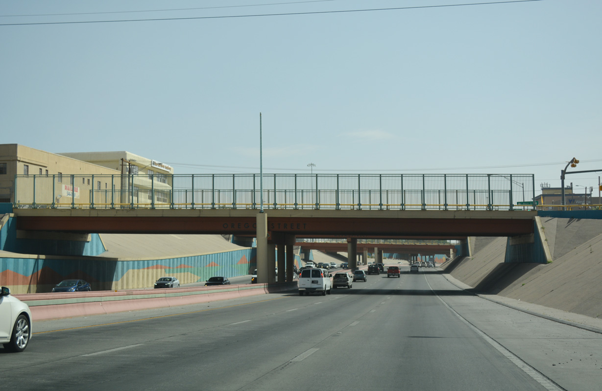
| Exit 19 was formerly signed for SH 20. SH 20 (old U.S. 80) crosses IH 10 again three blocks to the east of Santa Fe Street along Mesa Street. SH 20 proceeds five blocks south to San Jacinto Plaza and Texas Avenue in Downtown. 04/25/17 |
|
| The sunken portion of IH 10 at Downtown El Paso joined two previously completed sections of freeway when it opened in 1969. Overpasses along the section feature a Southwestern color palette. 04/25/17 |
|
| 2017 traffic counts along IH 10 range between 153,000 vpd at UTEP and 195,000 vpd at Five Points. With projections of over 300,000 vpd by 2042, an estimated $1.1 billion overhaul of the freeway at Downtown is proposed by TxDOT to add an additional lane per direction and add gateways along each side.4 04/25/17 |
|
| IH 10/U.S. 180 emerge from the below grade freeway by Downtown between a Union Pacific Railroad yard and the Virginia community along Missouri Avenue. The ensuing off-ramp (Exit 20) departs for Cotton Street to the Magoffin and Golden Hill neighborhoods. 04/25/17 |
|
| IH 10 continues east from Cotton Street between the UP Railroad yard and the Five Points west neighborhood. 04/25/17 |
|
| Exit 21 to Piedras Street is the first of four of closely spaced ramps departing IH 10 east over a 1.25 mile stretch along the Durazno and Loretto Place neighborhoods north of Chamizal National Memorial. 04/25/17 |
|
| Six lanes of IH 10 east continue toward the systems interchange (Exit 22B) with U.S. 54 (Patriot Freeway) and IH 110 south. IH 110 is not acknowledged from IH 10 in either direction, but is signed from U.S. 54 and at the Bridges of the Americas north from Juarez, Mexico. 04/25/17 |
|
| Exit 22A departs from IH 10/U.S. 80 next for Gateway Boulevard East to SL 478 (Copia Street). SL 478 parallels U.S. 54 (Patriot Freeway) south to U.S. 62 (Paisiano Drive) at Chamizal and north to U.S. 54 Business at Sunrise Acres along a 5.82 mile course. 04/25/17 |
|
| A dual lane drop occurs along IH 10/U.S. 180 east for Exit 22B to U.S. 54 (Patriot Freeway) north and IH 110 south. The I-10 Connect Project rebuilt the forthcoming interchange to provide full access from IH 10 and U.S. 54 and SL 375 to the south. 04/25/17 |
|
| IH 10 advances through the exchange with U.S. 54 and IH 110 to Exit 23A for Raynolds Street and the Medical Center of the Americas. 04/25/17 |
|
| Exit 22B partitions with the ramp for IH 110 south to the Bridge of the Americas and Juarez, Mexico. The Chamizal National Memorial, located just west of IH 110 along U.S. 62 (Paisano Drive), commemorates the settling of a border dispute with Mexico. Before 1963, there was a disputed section of land east of Downtown that was claimed by both Mexico and the U.S. due to a shift in the Rio Grande. After the dispute was settled, the land was turned into a national memorial. 04/25/17 |
|
| A two lane flyover connects IH 10/U.S. 180 east with U.S. 54 (Patriot Freeway) north toward Fort Bliss, Biggs Army Airfield and Alamogordo, New Mexico. 01/14/06 |
|
| Exit 23 leaves IH 10/U.S. 180 east at the four level interchange with U.S. 54 to Raynolds Street south to SH 20 and U.S. 62 at Buena Vista and north to Austin Terrace. 01/14/06 |
|
| U.S. 180 parts ways with IH 10 to combine with U.S. 62 along Paisano Drive north at forthcoming Exit 23B. U.S. 62 branches north to IH 10/U.S. 180 through the San Juan community from a pair of roundabouts with Alameda Street. 01/14/06 |
|
| Flyovers from IH 110 north and U.S. 54 form an auxiliary lane along IH 10 eastbound to Exit 23 B. U.S. 62/180 follow Paisano Drive north onto Montana Avenue, a major arterial route east between Fort Bliss and Cielo Vista and other neighborhoods to the south. 04/25/17 |
|
| U.S. 180 splits with IH 10 east ahead of Chelsea Street and U.S. 62. U.S. 62/180 run concurrently 258 miles northeast from El Paso to Carlsbad and Hobbs, New Mexico, and Seminole in the Texas Panhandle. A 7.6 mile long section of the highway along Montana Avenue, between Global Reach Road and FM 659 (Zaragoza Road) is being upgraded to a freeway with the first portion complete in Summer 2022.5 04/25/17 |
|
| Navingating through an S-curve by Basset Place Mall and the Tejas neighborhood, IH 10 next meets Trowbridge Drive at Exit 24A. 04/25/17 |
|
| Exit 24B quickly follows from IH 10 east at the Trowbridge Drive underpass for Geronimo Drive to Tejas, Normandy Park and the adjacent retail area. 04/25/17 |
|
| Airway Boulevard winds northward from IH 10 to El Paso International Airport (ELP) and Airport Road at the Buffalo Solider Road gate into Fort Bliss. 04/25/17 |
|
| Angling southeast by a warehouse and industrial park area, IH 10 proceeds to Exit 26 with Hawkins Boulevard. Hawkins Boulevard is an arterial connecting with FM 76 (N Loop Drive) southwest at Stiles Garden and north to Cielo Vista Mall and U.S. 62/180 (Montana Avenue) at the Cielo Vista community. 01/14/06 |
|
| Viscount Boulevard circles around the north side of shopping centers lining IH 10 to become Hunter Drive south from Exit 27 to the Ranchland and Hacienda Heights neighborhoods. 01/14/06 |
|
| Advancing southeast along a heavily commercial stretch, IH 10 continues to Exit 28A with Giles Road south and McRae Boulevard (FM 2316) north. 01/14/06 |
|
| FM 2316 (McRae Boulevard) runs 2.51 miles north from IH 10 by the Travis White and Montclair neighborhoods to U.S. 62/180 (Montana Avenue). 01/14/06 |
|
| Yarborough Drive angles northeast from Sageland to Vista de Oro in El Paso through a commercialized diamond interchange (Exit 28B) with Interstate 10. 01/14/06 |
|
| Lomaland Drive heads south from IH 10 at Exit 29 between the Mesa Vista and Loma Terrace neighborhoods and north through a industrial park area to Vista Hills Park. 01/14/06 |
|
| Lee Trevino Drive heads south from Exit 30 to Loma Terrace, Loma Park and FM 78 (N Loop Drive) and north to the Vista Hills and Vista del Sol neighborhoods. 01/14/06 |
|
| The southern leg of FM 659 (Zaragoza Road) connects with IH 10 just south of George Dieter Drive at Exit 32. George Dieter Road constitutes a four lane arterial north by Las Palmas, Sandy Creek and other neighborhoods to U.S. 62/180 (Montana Avenue). 01/14/06 |
|
| FM 659 (Zaragoza Drive) angles 9.73 miles northeast from FM 78 to SL 375 at the Los Paseos community and U.S. 62/180 (Montana Avenue) near Homestead Meadows South. 01/14/06 |
|
| SL 375 returns to IH 10 by the Southview community in southeastern El Paso. The freeway loops west to the Cesar E. Chavez Border Highway toward Downtown and north to Fort Bliss. 02/27/05 |
|
| Located 3.5 miles to the west, SL 375 links IH 10 with the Zaragosa International Bridge to Mexico at Chihuahua. 01/14/06 |
|
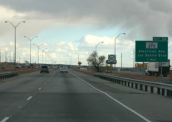
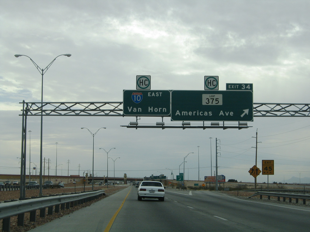
| Americas Avenue to the south and Joe Battle Boulevard to the north represent the freeway frontage roads for Loop 375. A cloverleaf interchange joins them with the IH 10 service roads at Exit 34. 01/14/06 |
|
| Loop 375 was first designated in 1962, and extended numerous times to encircle the entire El Paso metropolitan area. With a growing role as a commuter freeway, the exchange with IH 10 was upgraded into a systems interchange during a two phase project. Costing $146 million, the first phase started in October 2010. Finished in January 2013, it added three flyovers.6 01/14/06 |
|
| The second phase of the I-10/Loop 375 Americas interchange project added three additional flyovers. Underway from April 2013 to Spring 2015, the $48 million project preceded a third phase constructing the final two connectors.7 01/14/06 |
Page Updated 07-18-2019.


 East
East  South
South