|
| Continuing past the diamond interchange (Exit 799) with the temporary end of SH 99 (Grand Parkway) north from Baytown, the succeeding exit along IH 10 east is with FM 3180, a 4.06 mile connector south from Eagle Drive in Mont Belvieu to FM 2354 at Beach City. 01/15/06 |
|
| Progressing east from the cloverleaf interchange with FM 3180, IH 10 (East Freeway) next meets FM 565 at the city of Cove. 01/15/06 |
|
| FM 565 constitutes a 15.46 mile loop northwest from Exit 803 to FM 1409 at Old River-Winfree and SL 207 in Mont Belvieu and southwest from IH 10 to SH 146 at Baytown. 01/15/06 |
|
| IH 10 spans the Old River and Lost River across a causeway and bridge system north of their convergence at Old River Lake. 01/15/06 |
|
| The Chambers County seat of Winnie lies 24 miles east of the Lost River along IH 10. Beaumont is 25 miles further northeast from there. 01/15/06 |
|
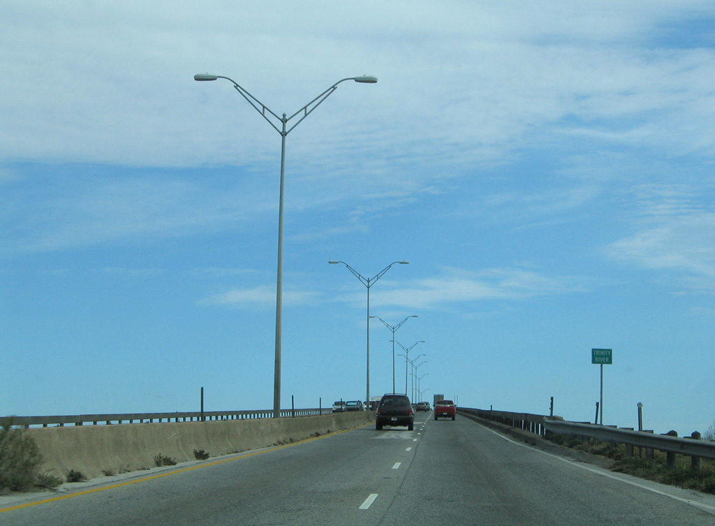
| The Trinity River turnaround and boat ramp was numbered as Exit 805 during widening of IH 10 and replacement of the adjacent span built for SH 73. 01/15/06 |
|
| The 60 year old Trinity River Bridge along IH 10 was replaced during $48 million in construction. Work started in 2007 and was completed in September 2011.1 01/15/06 |
|
| Exit 806 to the IH 10 frontage road system was eliminated during expansion of the freeway to six lanes. Exit 807 was relocated a half mile westward as well. 01/15/06 |
|
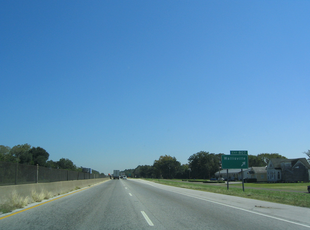
| Exit 807 departs IH 10 east for the Trinity River Island Recreation Area and nearby community of Wallisville. 10/22/03 |
|
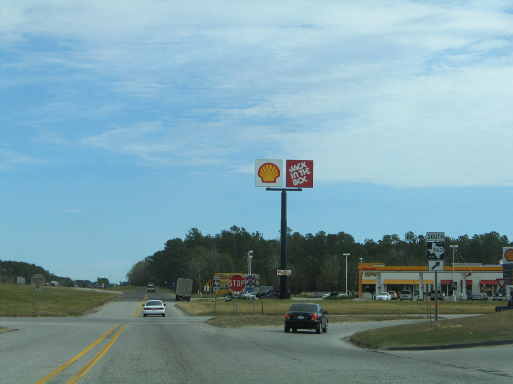
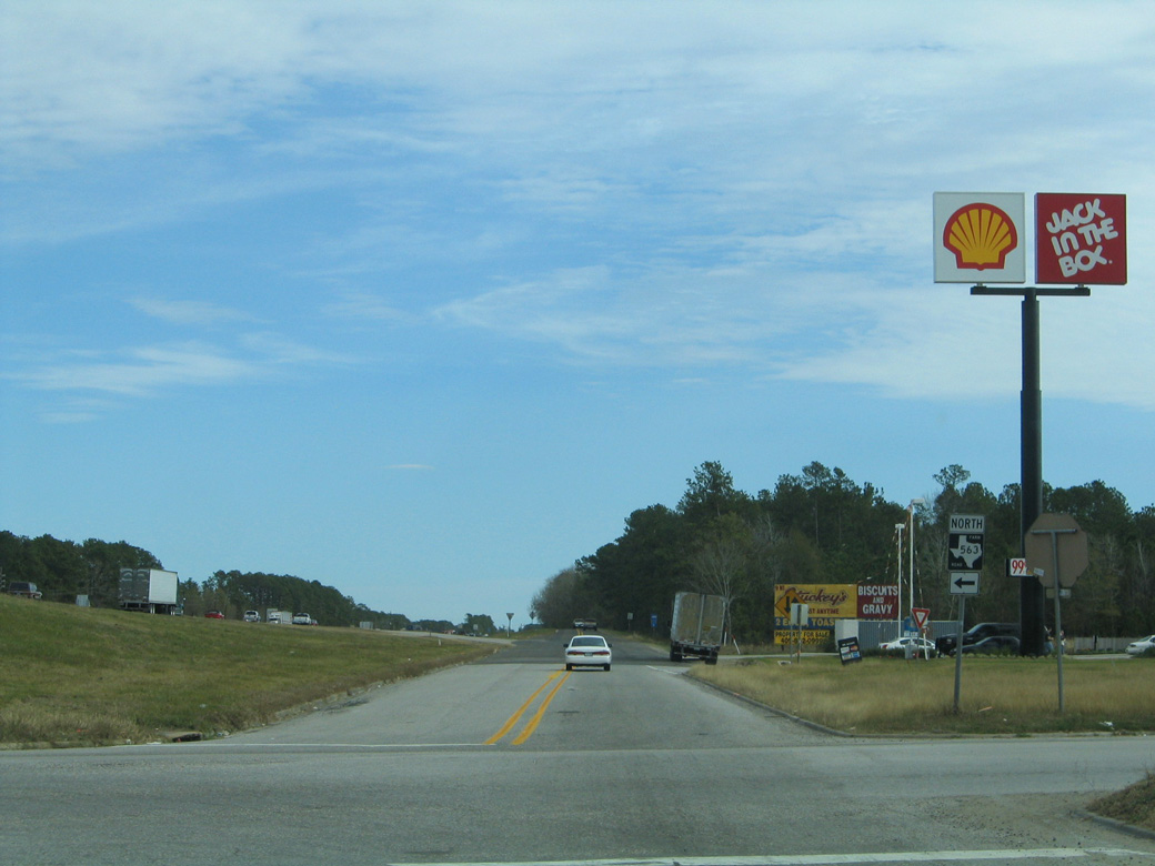
| Progressing east between Lake Charlotte and Lake Anahuac, IH 10 approaches a diamond interchange (Exit 810) with FM 563. 10/22/03 |
|
| A 27.52 mile long highway, FM 563 starts south of the city of Anahuac, and travels around Lake Anahuac before crossing IH 10 en route to Shiloh and U.S. 90 at Liberty. 01/15/06 |
|
| Prior to 2005-09 road work, the IH 10 frontage road system had a gap at Turtle Bayou, where a turnaround was in place. 10/22/03 |
|
| The departure of Exit 812 to SH 61 was relocated westward ahead of Turtle Bayou during the IH 10 lane enhancement and feeder road transformation project. 01/15/06 |
|
| SH 61 begins in Anahuac and travels north across IH 10 at Exit 812 and Hankamer to meet U.S. 90 at Devers. 01/15/06 |
|
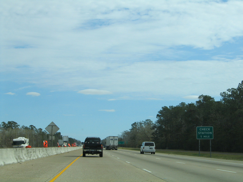
| Check (weigh) stations along IH 10 were removed during widening and subsequently replaced with frontage road access ramps (Exit 814). Two rest areas with visitor's centers were constructed along the feeder roads during a $14 million project started in 2010.3 The safety rest areas opened on March 1, 2012.4 01/15/06 |
|
| IH 10 between SH 61 and FM 1410 was expanded to six lanes in 1992. This was the first segment of the 85 mile stretch between Harris County and the Sabine River widened.5 01/15/06 |
|
| The freeway proceeds east to a rural diamond interchange (Exit 817) with FM 1724. 01/15/06 |
|
| A 4.90 mile state highway, FM 1724 links IH 10 with parallel FM 1663 at Hankamer Loop Road to the north and SH 65 to the south. 01/15/06 |
|
| Confirming marker posted ahead of the East Fork of Double Bayou. 01/15/06 |
|
| Exit 819 connects with Jenkins Road, a rural highway running 4.73 miles between SH 65 and FM 1663. This exit is home to one of the few remaining Stuckey's located in Texas. 10/22/03 |
|
| IH 10 bee lines across farm land eight miles east to Winnie. 10/22/03 |
|
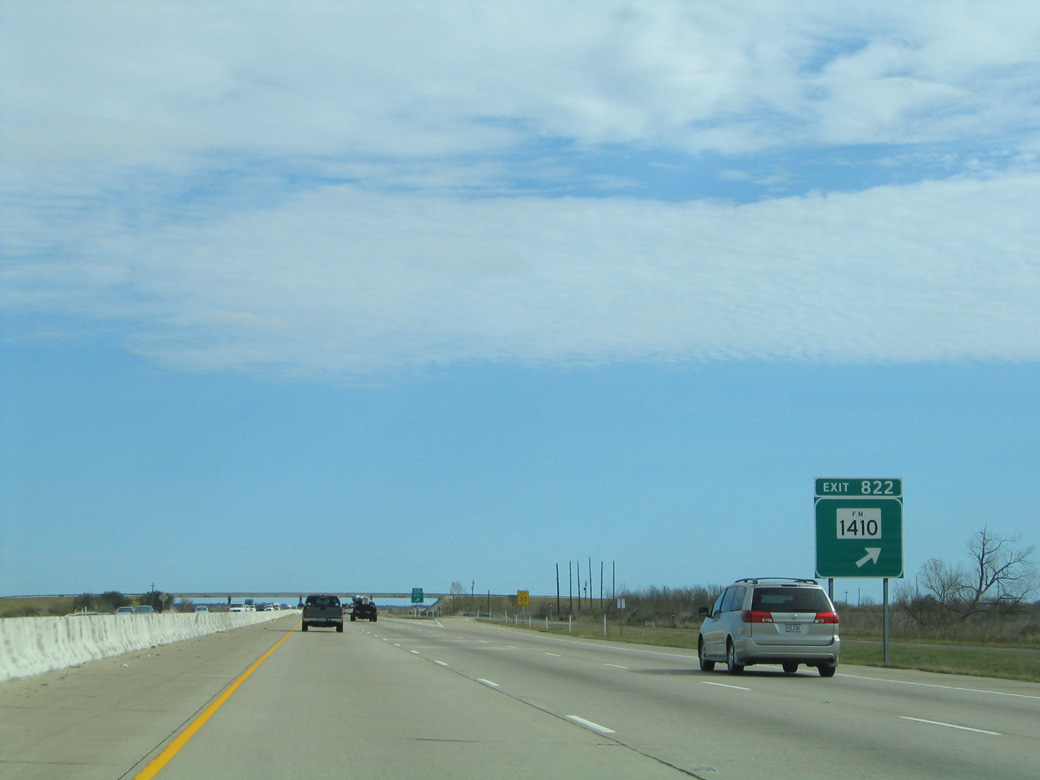
| The succeeding exit along IH 10 eastbound follows Devers Canal at FM 1410. 01/15/06 |
|
| Comprising a 15.46 mile loop, FM 1410 arcs southeast from SH 61 south of Devers, to SH 65 south of IH 10 near Stowell. 01/15/06 |
|
| Approaching the unincorporated community of Winnie, IH 10 meets SH 73 east and SH 124 south one mile beyond Spindletop Bayou. SH 124 provides a direct route south 19.65 miles to SH 87 at High Island on the Gulf of Mexico. 01/15/06 |
|
| FM 1406 follows Broadway Avenue east from IH 10 at Exit 827 through Winnie. The northern leg of the 12.78 mile highway extends to FM 365 near Turkey Island. 01/15/06 |
|
| SH 73 branches east from a wye interchange (Exit 828) just beyond FM 1406 along an expressway bypass of Winnie with SH 124. 01/15/06 |
|
| Exit 827 departs for FM 1406 (Broadway Avenue). SH 124 (Gulfway Drive) stems south from a diamond interchange with SH 73 to meet FM 1406 in the Winnie business district. SH 124 angles northeast to Hampshire and Beaumont. 10/22/03 |
|
| SH 73 leads east from Exit 828 and Winnie to Port Arthur and north to Bridge City and Orange. while IH 10 travels northeast to meet U.S. 90 in Beaumont. 01/15/06 |
|
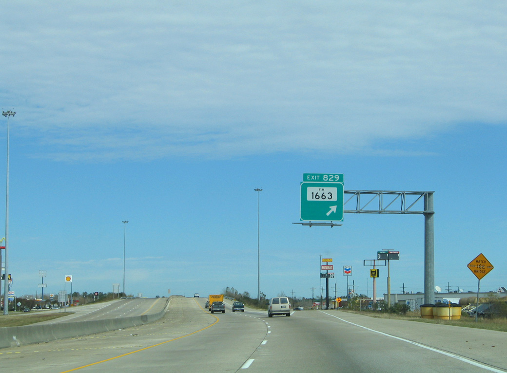
| FM 1663 stems north from the exchange joining SH 73 and SH 124 in Winnie to IH 10 at Exit 829 and North Lake. 10/22/03 |
|
| FM 1663 forms an L-shaped route along a 16.72 mile course. FM 1663 turns west beyond North Lake at Hampshire Road and parallels IH 10 back to Hankamer at SH 61. 01/15/06 |
|
| A multi year project widens a five mile section of IH 10 to six overall lanes from Winnie across the Jefferson County line to Beaumont. Work started in 2018 runs through June 2021.6 01/15/06 |
|
| Hampshire Road joins IH 10 with the community of Hampshire at Exit 833 in one mile. 01/15/06 |
|
| Entering the diamond interchange (Exit 833) with Hampshire Road on IH 10 east. Hampshire Road follows a stair stepped route west from SH 124 in Hampshire 4.16 miles to League Road on the Chambers County line. 10/22/03 |
|
| IH 10 remains rural, crossing the South Fork of Taylor Bayou on the ensuing stretch. 10/22/03 |
|
| A picnic area was previously located along IH 10 eastbound one mile north of the North Folk of Taylor Bayou. The Texas Department of Transportation (TxDOT) permanently closed the stops along both directions of IH 10 in June 2010.3 01/15/06 |
|
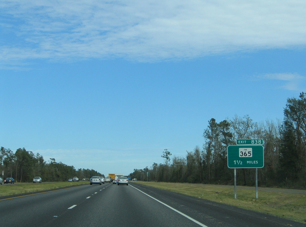
| FM 365 crosses paths with IH 10 at Exit 838 and the unincorporated community of Fannett. 01/15/06 |
|
| Exit 838 parts ways with IH 10 eastbound for FM 365. A 35.85 mile long route, FM 365 arcs northwest to U.S. 90 and SH 326 at Nome and east to Port Arthur, Nederland and Port Neches. 01/15/06 |
|
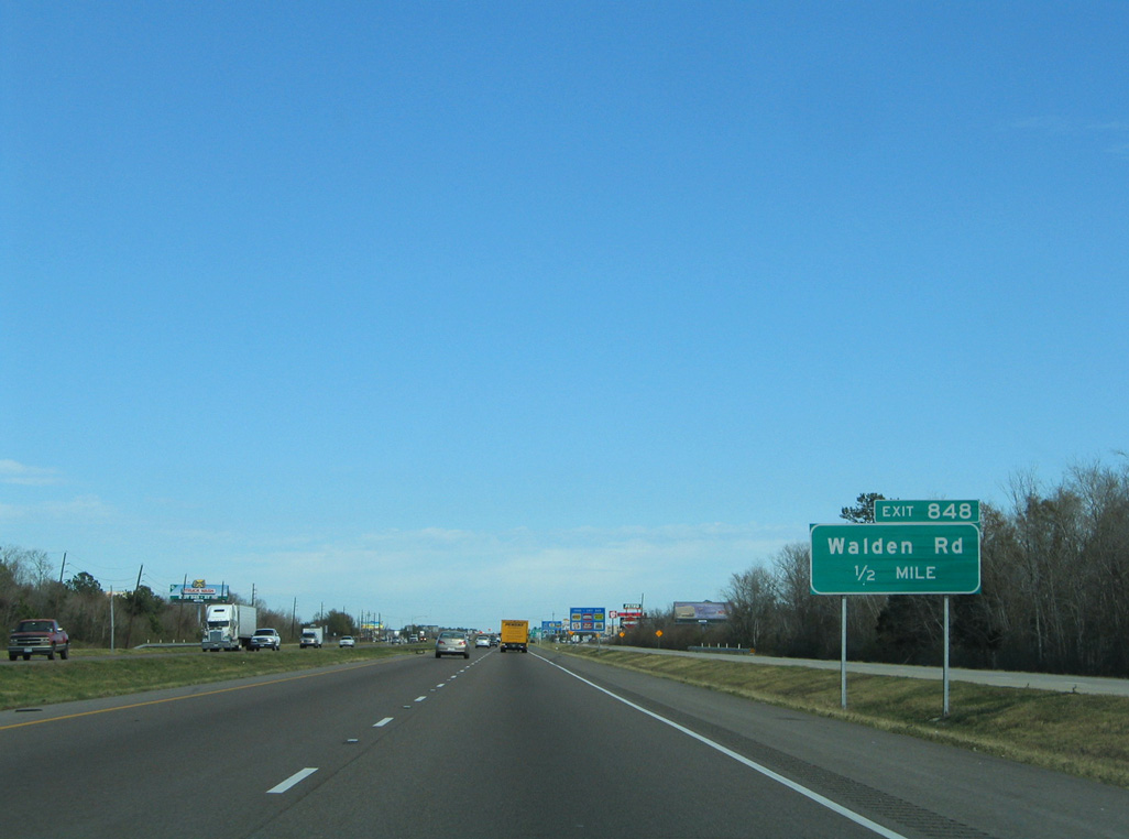
| Exit 848 connects IH 10 with Smith Road to the community of Creek and a Goodyear Plant. 01/15/06 |
|
| Downtown Beaumont lies ten miles to the northeast of Exit 843, followed by Orange in 35 miles. 01/15/06 |
|
| Forthcoming Exit 845 with Major Drive (FM 364) marks the southwestern extent of the Beaumont city limits. The Ford Park Entertainment Complex is located nearby along SH 124 (Fannett Road). 01/15/06 |
|
| FM 364 (Major Drive) stems 11.68 miles north from SH 124 along the west side of Beaumont to Tram Road near Pine Island Bayou. 10/22/03 |
|
| IH 10 proceeds northeast parallel to SH 124 to a commercialized diamond interchange (Exit 848) with Walden Road. 01/15/06 |
|
| Walden Road is a three to five lane boulevard linking IH 10 with SH 124 east to U.S. 69 and extending west to suburban development and FM 364 (Major Drive). 01/15/06 |
|
| U.S. 69-96-287 ties into IH 10 at a two-wye interchange (Exit 849) just across Hillebrandt Bayou and Port Arthur Canal. 01/15/06 |
|
| U.S. 69-96-287 constitute a freeway across south Beaumont to Lamar University, Jack Brooks Regional Airport (BPT) and Nederland. 01/15/06 |
|
| Exit 849 leaves IH 10 east for U.S. 69-96-287 south to Port Arthur. The three US highways overlap 17.8 miles south to a mutual terminus at SH 87 (Gulfway Drive). 10/22/03 |
|
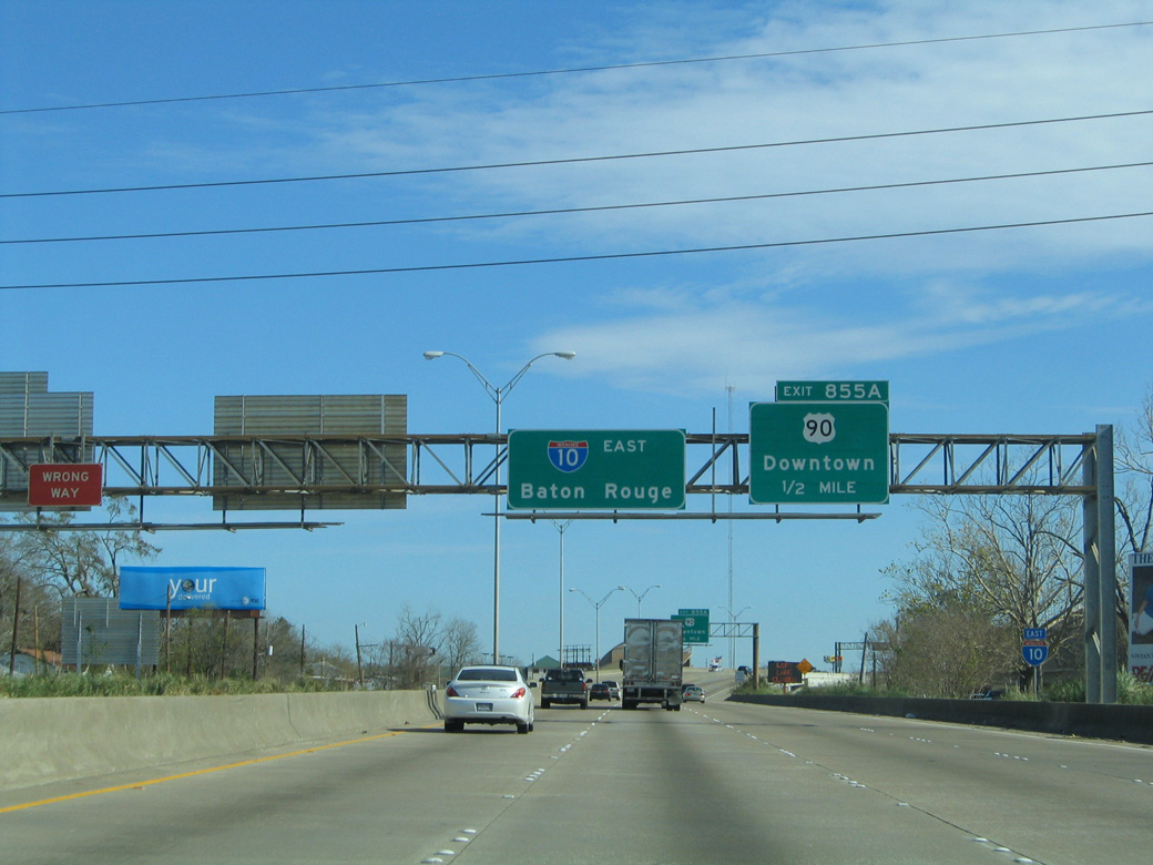
| Heading north after their merge, IH 10 & U.S. 96-96-287 next approach the half diamond interchange (Exit 851) with U.S. 90 (College Street). This is the first meeting of U.S. 90 and IH 10 since their split at Houston. Clearview font based sign changes replaced College Street for U.S. 90 with the control city of Liberty, the seat of Liberty County located midway between Houston and Beaumont. 01/15/06 |
|
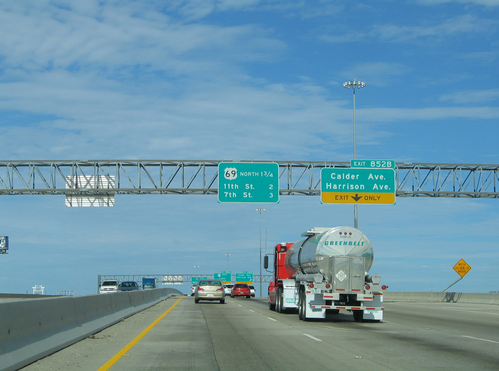
| Exit 851 departs the six lane freeway of IH 10 for U.S. 90 and Downtown Beaumont. The next exit is Exit 852B, serving Calder and Harrison Avenues. Sign changes now properly reflect all US highways overlapped add the control cities of Lake Charles for IH 10 east and Lufkin for US 69 north. 10/22/03 |
|
| The right lane previously defaulted onto Exit 852B for Calder and Harrison Avenues, but freeway expansion extended the fourth lane directly to the split with U.S. 69-96-287. Wide shoulders on the IH 10 overpass above College Street include provisions to add lanes southward. 01/15/06 |
|
| Traffic to Calder and Harrison Avenues descend from the IH 10 overpass and forms a c/d roadway northward to Rusk Street. Calder Avenue comprises a commercialized boulevard east to Downtown while Harrison Avenue lines the north side of Christus Hospital-St. Elizabeth.
Sign replacements here change the IH 10 control city from Baton Rouge to Lake Charles and reflect the U.S. 69-90-96-287 overlap with the addition of Jasper for U.S. 96 north. 10/22/03 |
|
| The adjacent c/d roadway for Exit 852B splits into a return ramp for IH 10 east and the IH 10 Frontage Road to Calder and Harrison Avenues. These signs were replaced and the IH 10 panel now includes U.S. 69-96-287. 01/15/06 |
|
| Approaching the Liberty Avenue overpass, IH 10/U.S. 90 and U.S. 69-96-287 part ways at a three wye interchange (Exit 853A) in one half mile. 10/22/03 |
|
| This sign, since removed, directed drivers onto Exit 853A for U.S. 96 & 287 north. The pair of US routes are now properly signed on all IH 10 signage. 10/22/03 |
|
| IH 10/U.S. 90 east reduces to two through lanes at the split with U.S. 69-96-287 north (Exit 853A). The three US highways continue ten miles to split with U.S. 96 outside Lumberton. U.S. 69 & 287 continue together for another 44 miles before partitioning at Woodville. 10/22/03 |
|
| Two lanes separate from IH 10 east for the continuation of US 69-96-287 north at Exit 853A. US 69 continues north to Lufkin, then Tyler and eventually Denison before entering Oklahoma. US 96 continues to Silsbee, Buna and Jasper while US 287 turns more westerly to Corrigan, Crockett and Palestine. 10/22/03 |
|
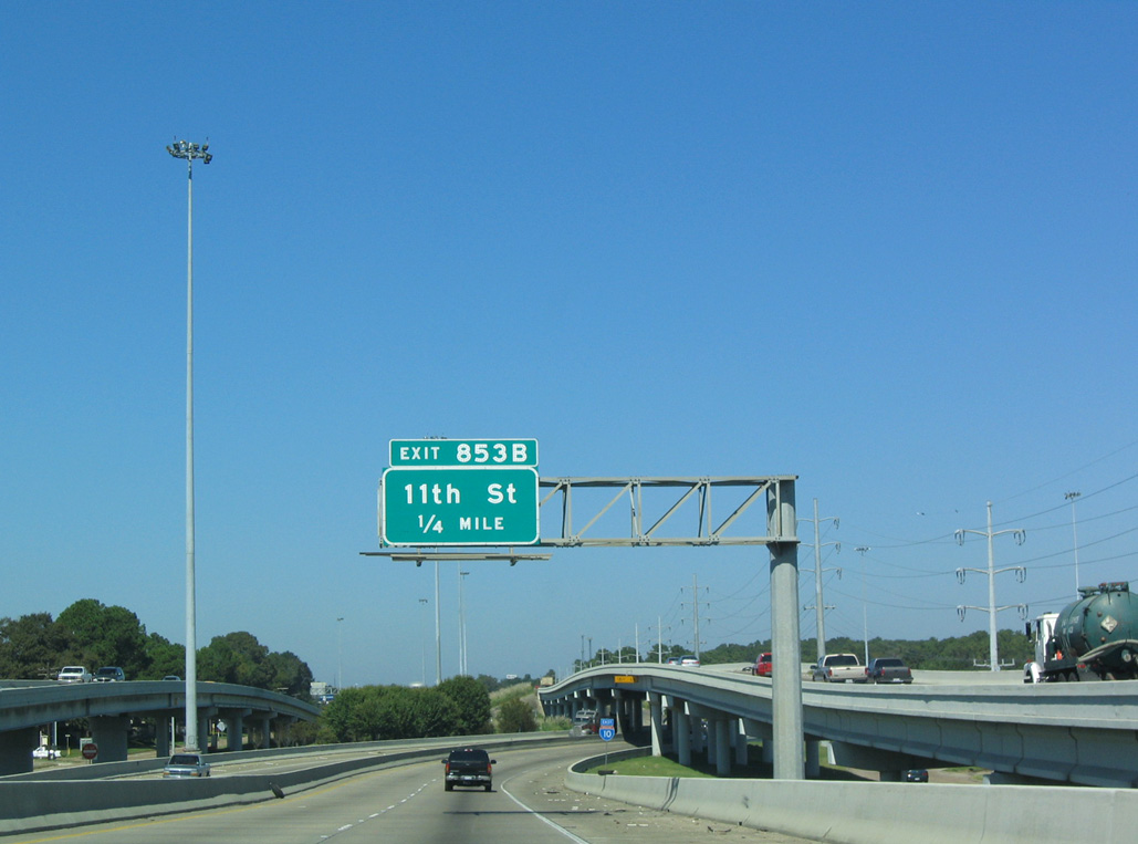
| IH 10 & U.S. 90 turn east and partition with Exit 853B to 11th Street within the exchange at U.S. 69-96-287. 10/22/03 |
|
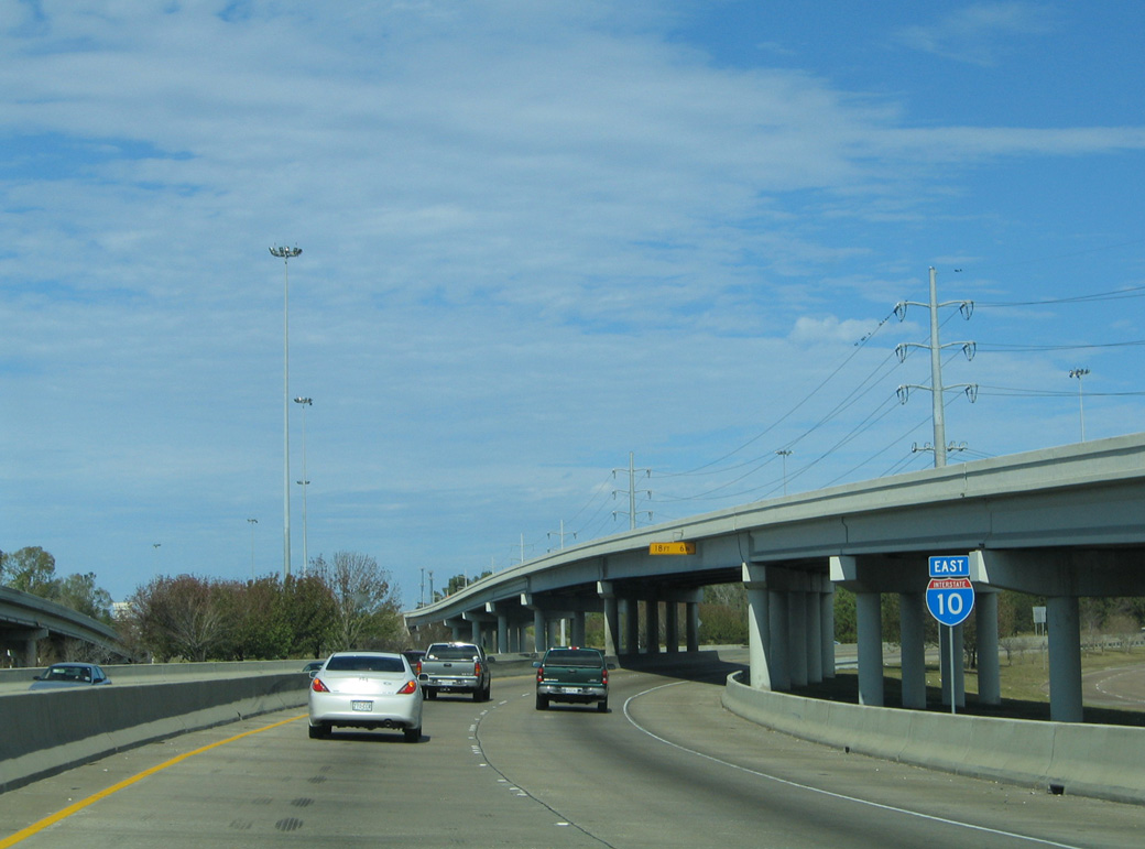
| With U.S. 90 realigned away from Downtown Beaumont per the Texas Transportation Commission and AASHTO in 2017, the highway overlaps with IH 10 for the remaining miles to the Louisiana state line. 01/15/06 |
|
| 11th Street south from Exit 853B to College Street represents a former alignment of U.S. 69-90-96-287. 01/15/06 |
|
| Continuing east from 11th Street, auxiliary lanes open in each direction of IH 10 to Exit 854 for Spur 380 (Martin Luther King, Jr. Parkway). Exit 858C departs next for 7th Street and the Oaks Historic District. 10/22/03 |
|
| IH 10/U.S. 90 ascends across the BNSF Beaumont Yard Railroad beyond the off-ramp (Exit 853C) to 7th Street. A split diamond interchange (Exit 854) follows with the couplet of Gulf Street south and MLK Parkway north. 01/15/06 |
|
| SS 330 (MLK Parkway) angles southeast from IH 10/U.S. 90 through Downtown Beaumont along a 5.83 mile course to the Port of Beaumont and U.S. 69-96-287 at SH 347. 10/22/03 |
|
| IH 10/U.S. 90 lower to grade level at Exit 854 before rising again on a viaduct system east to Magnolia Street and the Neches River. MLK Parkway (formerly Mariposa Street) was part of the first alignment of U.S. 287 through Beaumont. 01/15/06 |
|
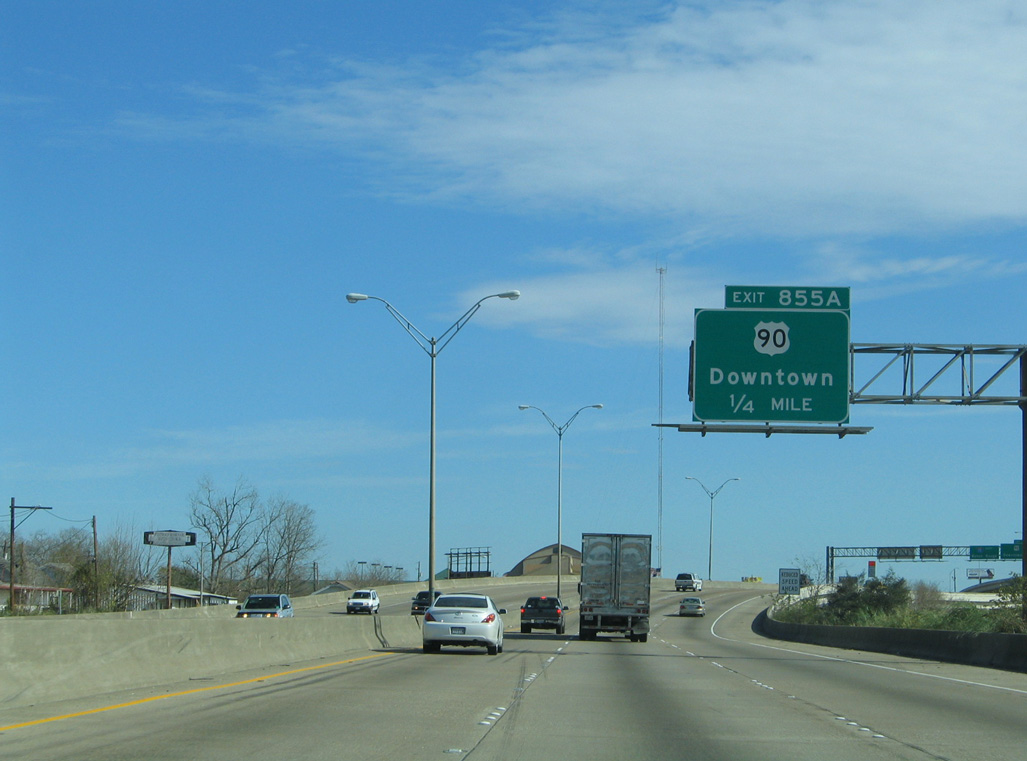
| U.S. 90 formerly connected with IH 10 via the elevated ramps (Exit 855A) with Willow and Pearl Streets out of Downtown Beaumont. 01/15/06 |
|
| The IH 10 connector from Exit 855A leads south 0.331 miles to Willow Street at North Street. The Beaumont Museum District and Civic Center lie a short distance south from there. 01/15/06 |
|
| A directional T interchange (Exit 855A) joins IH 10/U.S. 90 with Willow Street south and Pearl Street north. The former 3.3 mile alignment of U.S. 90 through Downtown and along College Street was transferred to the city of Beaumont. 01/15/06 |
|
| IH 10/U.S. 90 rise across the Neches River on the Pearl Heart Bridge. The original span was replaced during a $59 million project started in November 2012.1 Anticipated for completion in Fall 2015, three separate delays pushed work back. The new span fully opened to traffic on September 12, 2018.7 01/15/06 |
|
| IH 10/U.S. 90 enter Orange County midway across the Neches River. The ensuing exit is with Old Highway 90 at Bairds Bayou. 01/15/06 |
Page Updated 07-25-2019.


 East
East


 North
North


 East
East