|
| IH 35E and IH 35W combine near milepost 468 in Denton. Interstate 35 resumes through the Denton County and advances to interchanges with U.S. 380 (University Drive), Loop 288 and U.S. 77 (Elm Street) south. 10/20/03 |
|
| U.S. 380 (University Drive) crosses paths with IH 35 at diamond interchange (Exit 469). Comprising an arterial through Denton, U.S. 380 links the city with Decatur 23 miles to the west and McKinney 35 miles to the east. 10/20/03 |
|
| All trucking interests to U.S. 380 (University Drive) east are advised to take Loop 288 around the north side of Denton to access the US highway near Cooper Creek. 10/20/03 |
|
| Exit 469 leaves IH 35 northbound for U.S. 380 (University Drive). U.S. 380 heads 2.25 miles east to combine with U.S. 377 at U.S. 77 (Elm / Locust Streets). Overall the highway continues east from Denton and McKinney to Greenville. 10/20/03 |
|
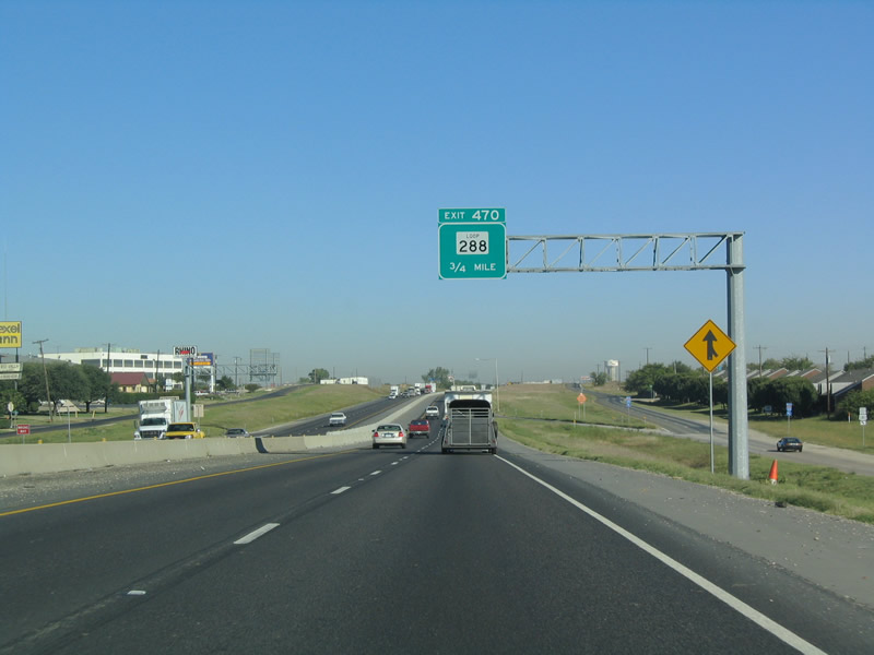
| Interstate 35 passes over U.S. 380 (University Drive) one mile south of the cloverleaf interchange ( Exit 470) with Loop 288. Loop 288 is an expressway encircling Denton east from IH 35. 10/20/03 |
|
| Loop 288 travels along a freeway 2.75 miles east to FM 2164 (Locust Street). Further south, Loop 288 underwent a $38.9 million, six lane widening project between U.S. 380 and IH 35E, completed in September 2009.1 10/20/03 |
|
| Confirming marker posted beyond the entrance ramp from U.S. 380. 10/20/03 |
|
| The cloverleaf interchange with SL 288 joins the respective frontage road systems. SL 288 concludes a 10.12 mile route at a dead end on the west side of Exit 470. 10/20/03 |
|
| U.S. 77 rejoins IH 35 at Exit 471 via Elm Street north of Denton. The off-ramp also provides access to FM 1173, which stems west from the freeway frontage roads 3.5 miles to Krum. 10/20/03 |
|
| Exit 471 departs IH 35 northbound ahead of the frontage road intersections with U.S. 77 (Elm Street). U.S. 77 travels through Downtown Denton along the one way couplet of Elm Street south and Locust Street north. 10/20/03 |
|
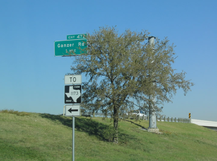
| Ganzer Road meets Interstate 35 in a rural area north of Denton one mile beyond U.S. 77 on Elm Street. 10/20/03 |
|
| Northbound at the diamond interchange (Exit 472) to Ganzer Road. Ganzer Road takes a stair stepped route east to Bonnie Brae Road and Tedrow Lake. Westward Ganzer Road continues 2.5 miles to Hopkins Road near FM 156 on outside Krum. 10/20/03 |
|
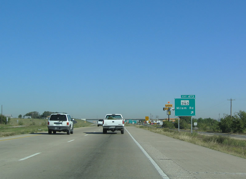
| Interstate 35 next meets FM 3163 (Milam Road) at Exit 473. Milam Road carries FM 3163 east 2.66 miles to FM 2164 north of Denton. 10/20/03 |
|
| Interstate 35 north at the west end of FM 3163 (Milam Road). Milam Road continues west from the IH 35 frontage road system 1.5 miles to Rector Road near Dalton. 10/20/03 |
|
| Exit 474 departs IH 35 northbound ahead of Moores Branch for Cowling Road. Cowling Road loops northward from the frontage road to Sanger along the historic route of U.S. 77. 10/20/03 |
|
| Rector Road arcs northeast from FM 156 at Dalton to IH 35 at Exit 475B. 10/20/03 |
|
| The Denton city limits extend northward to the exchange (Exit 475B) with Rector Road. Cowling Road converges with the east side frontage road nearby before diverging eastward to South 5th Street in Sanger. 10/20/03 |
|
| Exit 477 represents the first of three Sanger area interchanges from IH 35. Business Loop I-35 separates from the freeway along a 1.81 mile course along old U.S. 77 via 5th Street to the city center. Keaton Road ties into the diamond interchange from Duck Creek Road to the west. 10/20/03 |
|
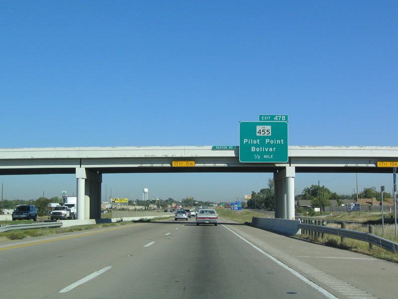
| IH 35 progresses north a half mile to Exit 478 for FM 455 (Chapman Drive). Chapman Drive skirts the north side of the Sanger street grid between Bolivar and Lake Ray Roberts. The creation of Lake Ray Roberts flooded a large portion of the original FM 455 between FL 2164 and Pilot Point, resulting in a new alignment to the south. 10/20/03 |
|
| FM 455 travels west from Exit 478 four miles to FM 2450 at Bolivar. FM 455 extends 13.6 miles east to the Isle du Bois Unit of Ray Roberts Lake State Park and U.S. 377 south of Pilot Point. 10/20/03 |
|
| Reassurance shield posted at the Bolivar Street pedestrian bridge in Sanger. 10/20/03 |
|
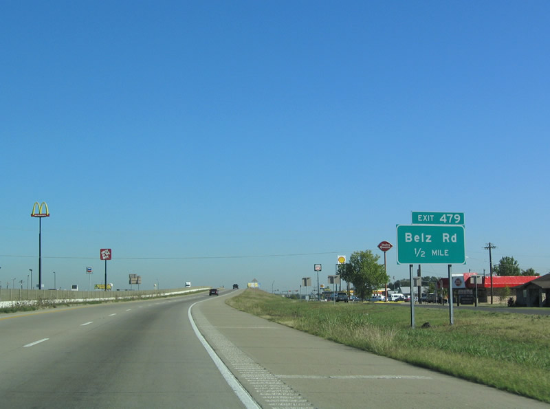
| One half mile south of Exit 479 to Belz Road. Belz Road stems west from the IH 35 frontage road to Metz Road. 10/20/03 |
|
| A pair of loop ramps join the respective frontage roads of IH 35 beyond Exit 479 to connect northbound motorists with Belz Road. Belz Road navigates along a stair stepped route 2.75 miles west to Sam Bass Road across rural areas outside Sanger. 10/20/03 |
|
| Exit 480 joins separate sections of Lois Road with Interstate 35 via a diamond interchange. 10/20/03 |
|
| Exit 480 departs IH 35 north for Lois Road and a Walmart Distribution Center. Lois Road spurs 2.3 miles east to Lake Ray Roberts from the IH 35 frontage roads. Westward the rural road continues 2.4 miles to Sam Bass Road. 10/20/03 |
|
| View Road stems west from a diamond interchange (Exit 481) with Interstate 35 in north Denton County. 10/20/03 |
|
| View Road heads 2.75 miles west across ranch land to Lois Road. 10/20/03 |
|
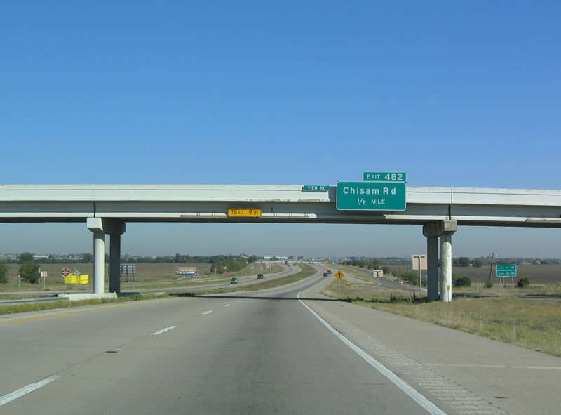
| IH 35 advances a half mile north from the loop ramps joining the frontage roads at View Road to Exit 482 for Chisam Road. 10/20/03 |
|
| IH 35 northbound reaches the diamond interchange (Exit 482) with Chisham Road just ahead of Pond Creek. Chisam Road takes a stair-step route 3.6 miles northeast to FM 3002 (Lone Oak Road) at Lake Ray Roberts. 10/20/03 |
|
| Curving northeast into Cooke County, IH 35 converges with FM 3002 (Lone Oak Road) at a diamond interchange (Exit 483) in one mile. 10/20/03 |
|
| FM 3002 (Lone Oak Road) constitutes an 8.49 mile route east from IH 35 to the Johnson Branch Unit of Ray Roberts Lake State Park, Hemming and FM 372. 10/20/03 |
|
| Continuing north within the Valley View city limits, IH 35 next meets FM 1307 (Lee Street) in one mile. 10/20/03 |
|
| Interstate 35 crosses Spring Creek ahead of the diamond interchange (Exit 486) with FM 1307 (Lee Street). FM 1307 follows old U.S. 77 along Lee Street 2.42 miles north from Exit 486 to Exit 488. 10/20/03 |
|
| Upcoming FM 922 crosses Valley View along Obuch Street. 10/20/03 |
|
| Exit 487 leaves IH 35 northbound for FM 922 (Obuch Street). FM 922 follows a rural course through southern Cook County, seven miles west to Era and 8.1 miles east to Mountain Springs. 10/20/03 |
|
| A diamond interchange (Exit 488) joins IH 35 with Hockley Creek Road beyond the return of FM 1307 (Lee Street) in north Valley View. 10/20/03 |
|
| Hockley Creek Road ventures 2.61 miles east from IH 35 at Exit 488 to FM 2071. 10/20/03 |
|
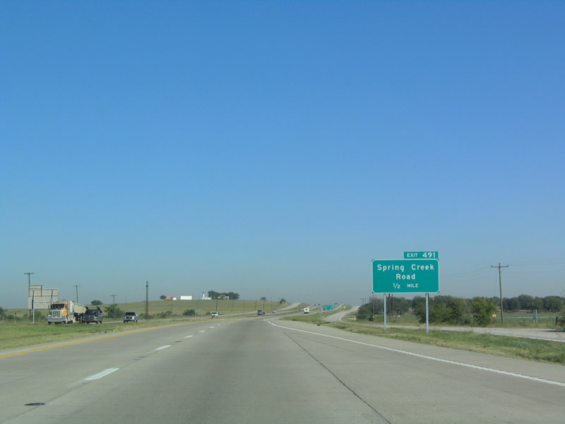
| Spring Creek Road converges with IH 35 at Exit 491 and the north end of the Valley View city limits in a half mile. 10/20/03 |
|
| Spring Creek Road heads two miles west from IH 35 to County Road 307 and 4.2 miles east to FM 2071 at Terrapin Hill across agricultural areas. 10/20/03 |
|
| IH 35 passes by a southbound side picnic area beyond Exit 491. 10/20/03 |
|
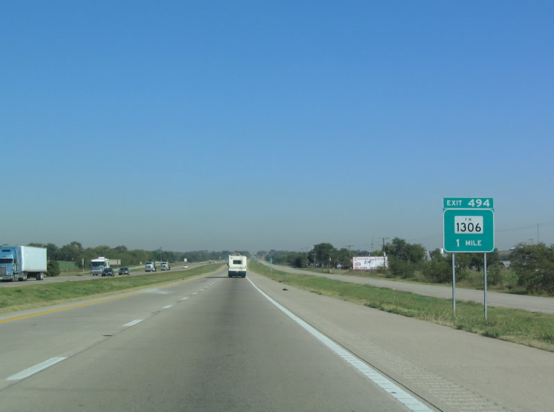
| Entering the city of Gainesville, IH 35 meets the south end of FM 1306 at Exit 494. FM 1306 comprises a 1.75 mile route north to FM 51 (West California Street). 10/20/03 |
|
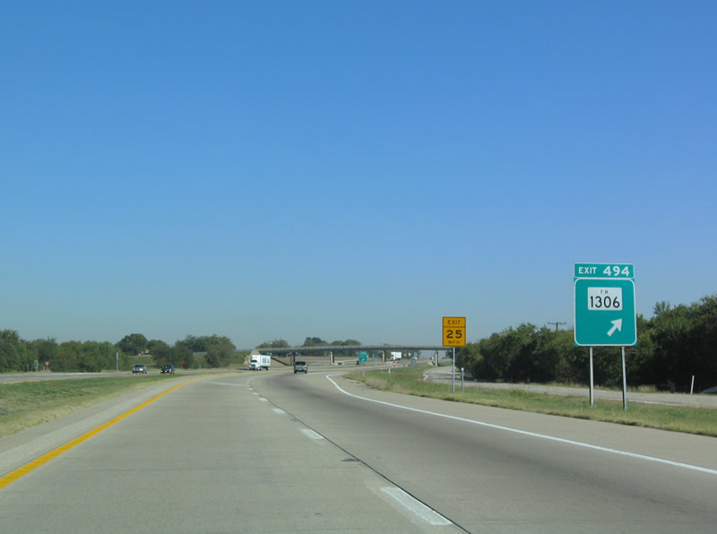
| IH 35 shifts northeast at the diamond interchange (Exit 494) with FM 1306 north and CR 218 east. FM 1306 follows the historic alignment of U.S. 77 north to FM 51 at North Central Texas College (NCTC) - Gainesville. 10/20/03 |
|
| Continuing into Gainesville, IH 35 passes east of Gainesville High School. 10/20/03 |
|
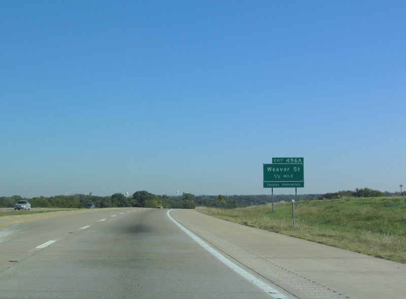
| Exit 496 departs IH 35 northbound next for parallel Weaver Street in residential areas south of Downtown Gainesville. 10/20/03 |
|
| Interstate 35 crosses the Elm Fork of the Trinity River just ahead of Exit 496. 10/20/03 |
|
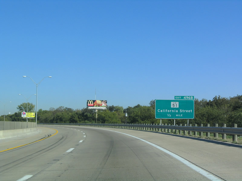
| A split diamond interchange (Exit 497) connects IH 35 with FM 51 (California Street) between Moffitt and Leonard Parks and Downtown Gainesville. 10/20/03 |
|
| A 38.41 mile long highway, FM 51 (California Street) angles southwest from Gainesville to Era and Decatur. FM 51 east ends 1.12 miles from IH 35 at FM 372 (Grand Avenue). 10/20/03 |
|
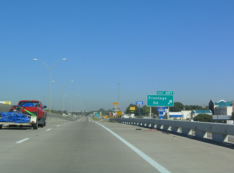
| Previously numbered as Exit 497, Exit 498 departs immediately north of FM 51 for U.S. 82 (Summit Avenue). 10/20/03 |
|
| The six-ramp parclo interchange linking Interstate 35 with U.S. 82 directly at Exit 498 was removed after 2008. 10/20/03 |
|
| U.S. 82 constitutes a commercial arterial through north Gainesville and a major route between the city and Sherman to the east and Wichita Falls alongside U.S. 287 to the west. 10/20/03 |
|
| U.S. 82 travels 1.25 miles east to a diamond interchange with FM 372 (Grand Avenue), 14 miles to Whitesboro and 31 miles to Sherman. 10/20/03 |
|
| The former loop ramp (Exit 498B) joining IH 35 north with U.S. 82 west to Gainesville Municipal Airport (GLE), Lindsey and Muenster. U.S. 82 constitutes a divided highway west 34.5 miles to Nocona and 81 miles to Wichita Falls. 10/20/03 |
|
| FM 372 (Grand Avenue) converges with IH 35 on the north side of Gainesville at Exit 500. 10/20/03 |
|
| IH 35 spans a BNSF Railroad line at this reassurance shield preceding Exit 500. 10/20/03 |
|
| Exit 500 departs from IH 35 northbound for FM 372 south. FM 372 travels 19.59 miles overall from Gainesville south to Bloomfield on Ray Roberts Lake. The route originally continued further south to FM 455 west of Pilot Point until the Elm Fork of the Trinity River was impounded to form Ray Roberts Lake. 10/20/03 |
|
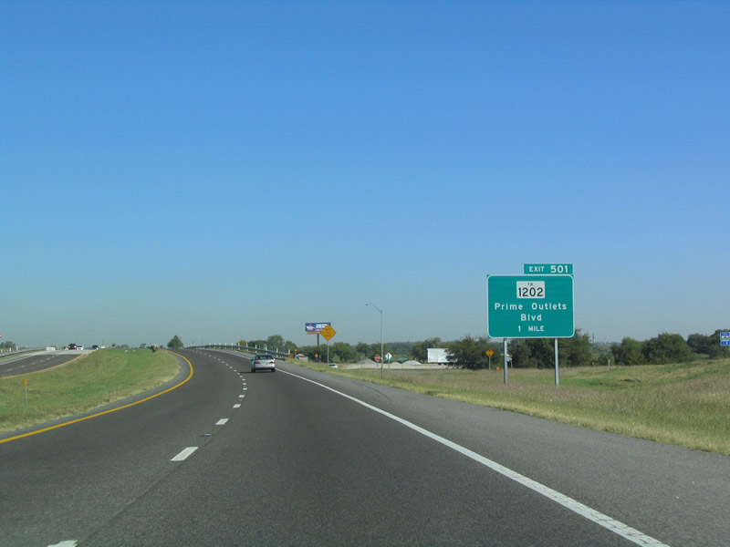
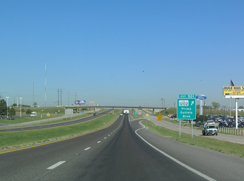
| A 2.85 mile route west to FM 1201 north of Gainesville Municipal Airport (GLE), FM 1202 ties into IH 35 at a diamond interchange (Exit 501). 10/20/03 |
|
| A loop ramp joins the east side frontage road with FM 1201 between CR 137 and the former Gainesville Factory Shops retail complex. Opened in 1993, business began to decline at the 315,725-square-foot center by the early 2000s. Most businesses at the site closed by the time the facility was sold in December 2017.2 10/20/03 |
|
| The Red River valley spreads into view along IH 35 northbound by the Texas Welcome Center. 10/20/03 |
|
| Exit 503 joins IH 35 north with the adjacent frontage road 1.1 miles south of the Red River. 10/20/03 |
|
| Exit 504 connects IH 35 with the Red River turnaround just ahead of the Oklahoma state line. 10/20/03 |
Page Updated 07-06-2019.


 North
North


 North
North