|
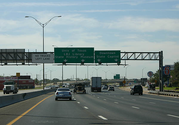
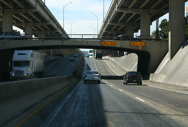
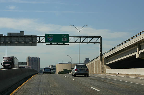
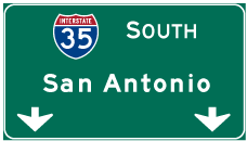
| IH 35 southbound partitions into upper and lower levels at the exchange (Exit 237A) with Airport Boulevard. The inside lanes form the lower level, serving the University of Texas at Austin (UT Austin), the LBJ Presidential Library and the Bullock Texas State History Museum. The outside lanes rise onto the upper deck leading toward Downtown and the State Capitol. 09/27/06 |
|
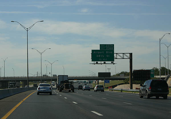
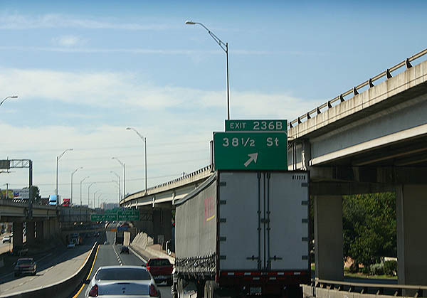
| Exit 237A for Airport Boulevard and 38 1/2 Street departs ahead of the 51st Street overpass, 0.75 miles ahead of the upper/lower roadway split. 09/27/06 |
|
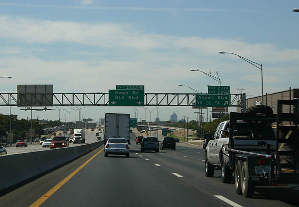
| Lower roadway exits join IH 35 south with Manor Road and Dr. Martin Luther King, Jr. Boulevard. Airport Boulevard crosses the freeway southeast by the Mueller Community, a development built in place of former Mueller Municipal Airport. 38 1/2 Street joins the freeway with the North Loop and French Place neighborhoods. 09/27/06 |
|
| The upper level of IH 35 south along Downtown Austin was constructed between 1971 and 1975. Elevating alongside the campus of UT Austin, the upper level of IH 35 south extends to Exit 235A for MLK Boulevard and 15th Street. 09/27/06 |
|
| The lower level of IH 35 advances south to Exit 236B for 38 1/2 Street. Expansion of IH 35 here into a double deck configuration was due to the narrow right of way between UT Austin and Oakwood Cemetery. 09/27/06 |
|
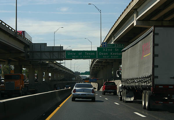
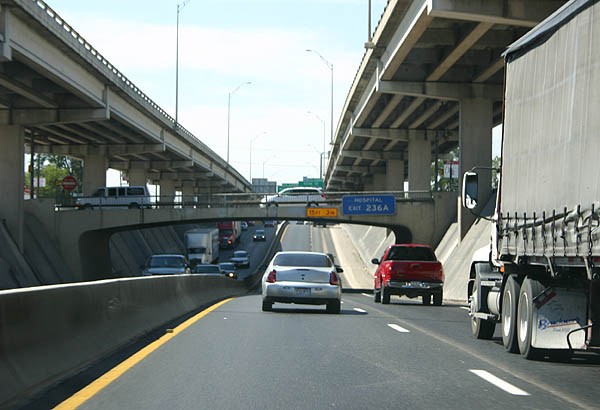
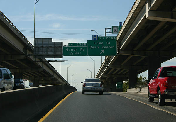
| Forthcoming Exit 236A to 32nd Street and Dean Keeton Street is the first of three southbound ramps for UT Austin. 09/27/06 |
|
| Dropping below grade at 38 1/2 Street with four lanes, the lower level of Interstate 35 opened to traffic in 1962. 09/27/06 |
|
| Exit 236A consists of a slip ramp onto the west side frontage road ahead of 32nd Street to St. Davis Medical Center and Central Austin. Dean Keaton parallels to the south through UT Austin. 09/27/06 |
|
| 38 1/2 Street spans the lower level of IH 35 with a low overhead clearance. 09/27/06 |
|
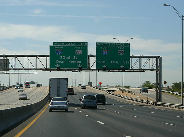
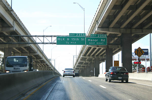
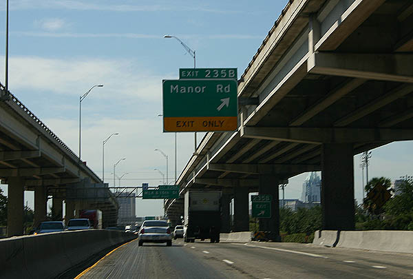
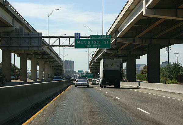
| Exit 235B to Manor Road and Exit 235A to Dr. Martin Luther King, Jr. Boulevard and 15th Street depart over the succeeding half mile from the IH 35 lower level southbound. 09/27/06 |
|
| Manor Road angles east from Clyde Littlefield Drive near Darrell K Royal - Texas Memorial Stadium at UT Austin to French Place and the Mueller Community. 09/27/06 |
|
| MLK Boulevard runs west between UT Austin and the Medical District to the North Side of Downtown Austin. Heading east from IH 35, the urban arterial becomes a part of FM (UR) 969 at Airport Boulevard (SL 111) en route to U.S. 183 and Webberville. 09/27/06 |
|
| Exit 235A leaves the lower level of IH 35 at the Manor Road over crossing. 15th Street stems west from the freeway frontage road by the Frank C. Erwin, Jr., Special Events Center to the Texas Capitol. 09/27/06 |
|
| The split roadways of IH 35 southbound converge just ahead of the MLK Boulevard overpass west of UFCU Disch-Falk Field. 09/27/06 |
|
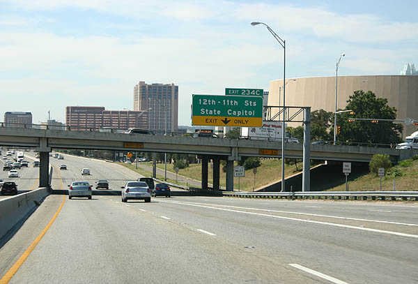
| IH 35/U.S. 290 proceeds south to Exit 234C for 12th/11th Streets and the Texas State Capitol. 09/27/06 |
|
| A lane drop occurs along the freeway southbound at Exit 234C. 09/27/06 |
|
| Exit 234C leaves IH 35 south & U.S. 290 west for the adjacent frontage road ahead of 12th Street east of the State Capitol and west of the Central East Austin neighborhood. 09/27/06 |
|
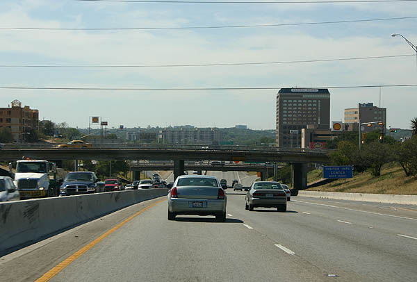
| Interstate 35 and U.S. 290 run along the east side of Downtown Austin on the ensuing stretch. 09/27/06 |
|
| A split diamond interchange (Exit 234B) connects IH 35/U.S. 290 with the Downtown Austin street grid between 9th and 6th Streets. 09/27/06 |
|
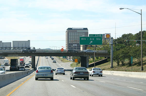
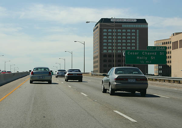
| IH 35 spans 8th through 6th Streets on a viaduct one half mile ahead of Exit 234A for Cesar Chavez and Holly Streets. 09/27/06 |
|
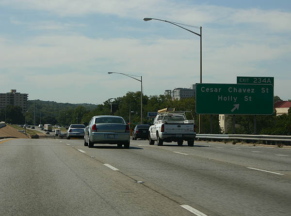
| Exit 234A departs IH 35/U.S. 290 at Cesar Chavez Street and the Rainey Street Historic District. Holly Street parallels to the south through the East Cesar Chavez district. 09/27/06 |
|
| A short auxiliary lane opens between the 6th Street entrance ramp and Cesar Chavez Street off-ramp at Exit 234A. 09/27/06 |
|
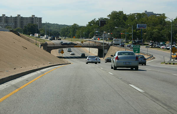
| The southbound lanes dive under Cesar Chavez Street through the 1962 underpass, while the northbound lanes stay elevated on a newer bridge. 09/27/06 |
|
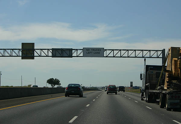
| IH 35 has a truck lane restriction through Austin. This is used on congested, narrow freeways such as IH 45 in Houston, to reduce lane congestion and improve safety. 09/27/06 |
|
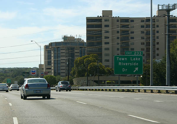
| Exit 233 serves Town Lake and Riverside Drive. Town Lake was created by damming the Colorado River, while Riverside Drive was once planned to be a freeway. 09/27/06 |
|
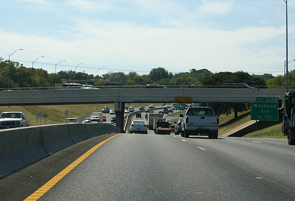
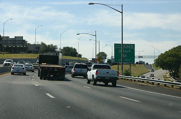
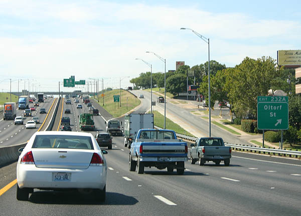
| Crossing the Colorado River / Town Lake, IH 35/U.S. 290 pass below East Riverside Drive one quarter mile ahead of Exit 232 for both Woodland Avenue and Oltorf Street. 09/27/06 |
|
| Separate ramps (Exit 232B/A) for Woodland Avenue and Oltorf Street were consolidated into a single exit during a $42.6 million reconstruction project along IH 35 between Woodland Avenue and Woodward Street. Underway from February 2017 to mid 2019, work reconstructed the Oltorf Street bridge, improved exit ramps and frontage roads and added U-turns at Oltorf Street.1 09/27/06 |
|
| Woodland Avenue passes below IH 35 between the Travis Heights and Riverside communities. Oltorf Street constitutes a four to five lane boulevard through Greater South River City and the East Riverside - Oltorf community. 09/27/06 |
|
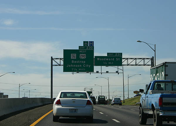
| 2017-19 reconstruction along IH 35 included building extended ramps for Exit 231 to Woodward Street and Ben White Boulevard. Ben White Boulevard is the frontage road system for the U.S. 290 and SH 71 freeway across south Austin. 09/27/06 |
|
| Woodward Street arcs northwest from the industrial corridor along Ben White Boulevard (SH 71) to St. Edward's University and the Dawson neighborhood. 09/27/06 |
|
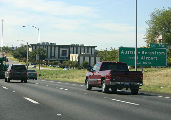
| SH 71 overlaps with U.S. 290 west to Sunset Valley and Oak Hill. The state highway extends the freeway along Ben White Boulevard east from IH 35 and U.S. 290 to Austin-Bergstrom International Airport (AUS). 09/27/06 |
|
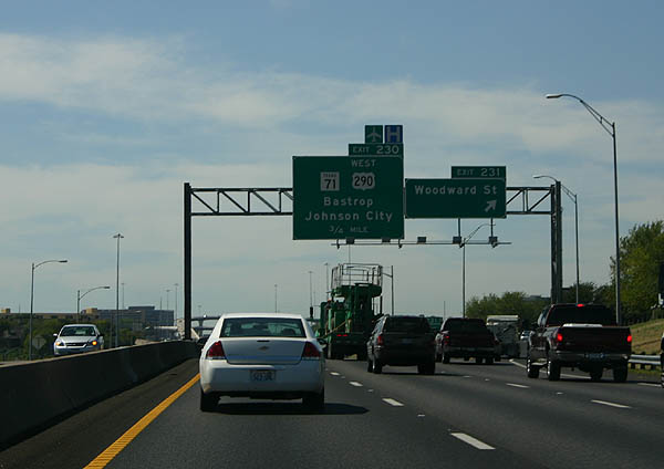
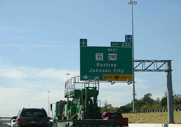
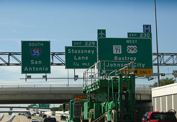
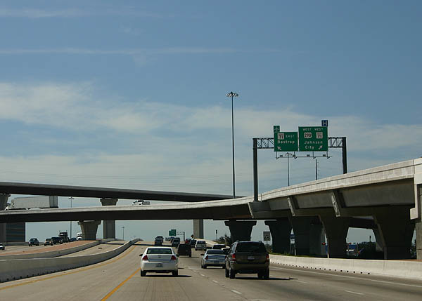
| Westbound U.S. 290 separates from IH 35 south with two lanes leading into the systems interchange (Exit 230) with SH 71. 09/27/06 |
|
| U.S. 290 parts ways with Interstate 35 and travels west from Austin to Dropping Springs and the Blanco County seat of Johnson City. SH 71 branches northwest to Bee Cave, Lakeway and Marble Falls. Heading east from AUS Airport, SH 71 expands with tolled express lanes to SH 130. 09/27/06 |
|
| Replacing a routinely congested junction, the four level interchange with U.S. 290 west and SH 71 (Ben White Boulevard) was completed in 2003. SH 71 and US 290 were progressively converted to freeways in the 1990s and early 2000s. 09/27/06 |
|
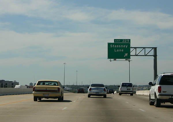
| Exit 229 connects IH 35 south with Stassney Lane to the South Congress and Franklin Park communities in Austin. A $78.8 million project underway from July 2016 to early 2020 rebuilds overpasses for Stassney Lane and William Cannon Drive across IH 35, adds U-turns and improves exit ramps and frontage roads.2 09/27/06 |
|
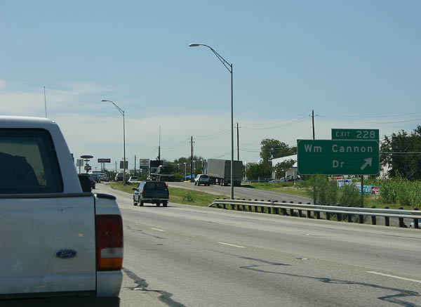
| Exit 228 follows from IH 35 southbound for William Cannon Drive, a six lane commercial arterial. 09/27/06 |
|
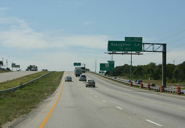
| Continuing south, IH 35 meets Slaughter Lane at Exit 227 in a half mile. 09/27/06 |
|
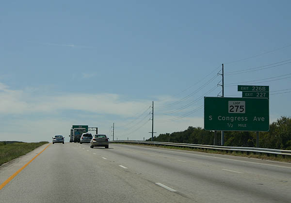
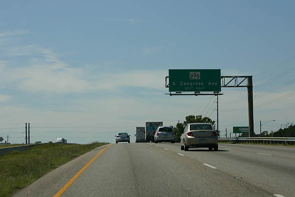
| Exit 227 represents the south end of SL 275, a 3,43 mile route along Congress Avenue leading north to Wasson Road. 09/27/06 |
|
| SL 275 along Congress Avenue follows old US 81, which was bypassed in 1962 by IH 35. 09/27/06 |
|
| Exit 227 departs IH 35 south for Slaughter Lane and Loop 275 north by the Southpark Meadows retail complex. 09/27/06 |
|
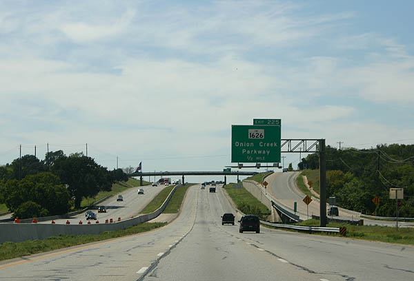
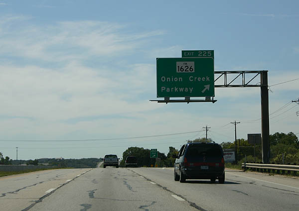
| Crossing Slaughter Creek, IH 35 next meets Exit 225 for FM 1626 west and Onion Creek Parkway. 09/27/06 |
|
| FM 1626 forms a 13.23 mile loop southwest from IH 35 to the city of Kyle via the village of San Leanna and small city of Hays. 09/27/06 |
|
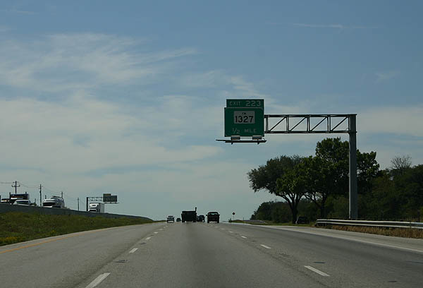
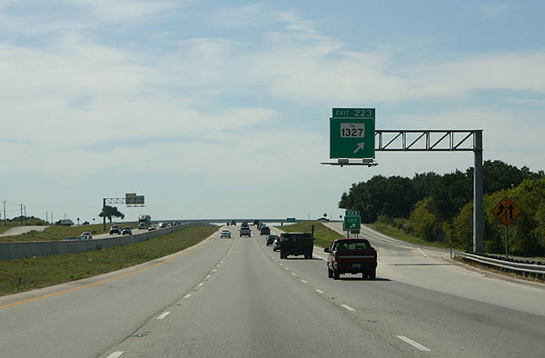
| Vacating the Austin city limits, IH 35 progresses south to FM 1327 east to Creedmoor and SH 45 South toll road east to SH 130 at Mustang Ridge. 09/27/06 |
|
| FM 1327 parallels SH 45 South along a 7.20 mile course from IH 35 east to U.S. 183 in Mustang Ridge. 09/27/06 |
|
| The systems interchange joining with SH 45 South is partially constructed with the exception of a high speed ramp from IH 35 southbound. SH 45, SH 130 and SH 45 North form a tolled bypass around the east side of Austin. 09/27/06 |
|
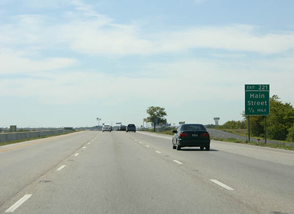
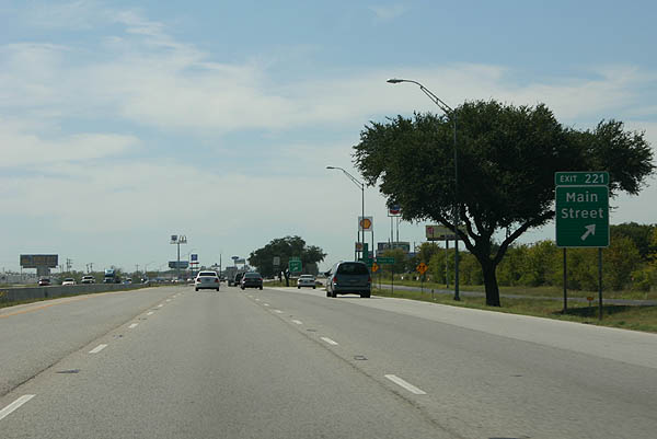
| Main Street represents the first of three southbound exits from IH 35 to the city of Buda. 09/27/06 |
|
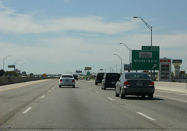
| Exit 221 departs well ahead of Main Street. The succeeding ramp is with FM 2001 southeast to Niederwald. 09/27/06 |
|
| Main Street heads west from IH 35 to the Buda city center and east to an array of suburban development. 09/27/06 |
|
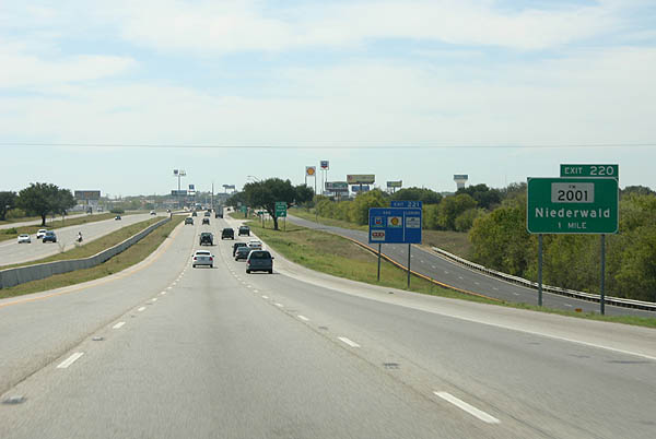
| FM 2001 takes a stair stepped route 8.93 miles to SH 21 at Neiderwald. The southern branch continues from SH 21 to U.S. 183 at Lockhart. 09/27/06 |
|
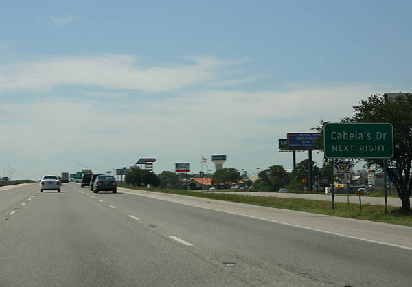
| Cabela's Drive stems south from Main Street to FM 2001 at White Wing Trail. Cabelas is a destination outdoor retailer, and is a major sales tax generator for the city of Buda. 09/27/06 |
|
| Exit 220 leaves IH 35 south for FM 2001 (Old Goforth Road), Cabela's Drive north and White Wing Trail east to newer subdivisions. 09/27/06 |
|
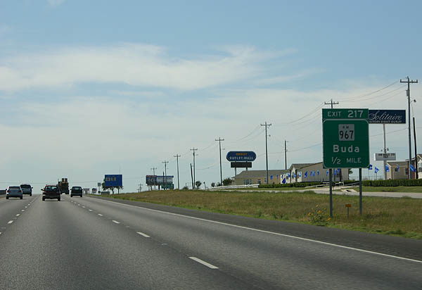
| FM 967 follows Main Street through Buda and extends south to conclude at IH 35 along the Kyle city line. 09/27/06 |
|
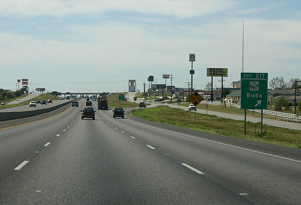
| Exit 217 joins the west side frontage road by the Meadows at Buda subdivision one mile ahead of RM 967 north. RM 967 constitutes a 15.12 mile long highway west from Buda to RM 1826. 09/27/06 |
|
| The truck lane restriction along IH 35 continues well south of Austin. 09/27/06 |
|
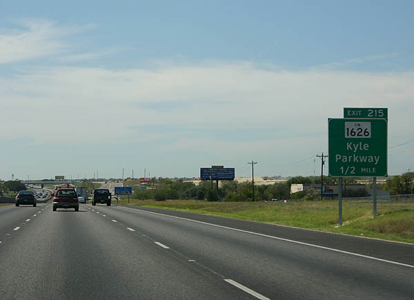
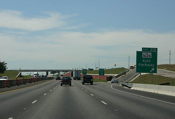
| FM 1626 returns to IH 35 opposite Kyle Parkway. Exit 215 connects with the commercial arterial 1.6 miles to the north. 09/27/06 |
|
| Exit 215 leaves IH 35 southbound beyond the Windy Hill Road overpass. The freeway passes west of the Amberwood development ahead of Bunton Branch and the Village at Kyle retail complex. 09/27/06 |
Page Updated 07-08-2019.

 South
South