|
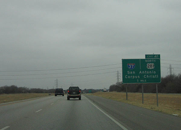
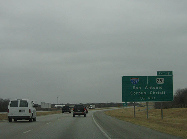
| IH 410/SH 130 arc southwest one mile to the four-level interchange (Exit 41) with IH 37/U.S. 281. 02/18/06 |
|
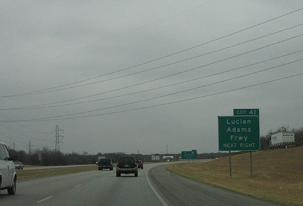
| IH 37 is named the Lucian Adams Freeway in San Antonio, between IH 410 and IH 35 outside Downtown San Antonio. 02/18/06 |
|
| Despite still being in the San Antonio city limits, IH 37 is signed with a control city of San Antonio. IH 37 joins the Alamo City with Corpus Christi and the Gulf Coast. 02/18/06 |
|
| U.S. 181 branches southeast from IH 37, 1.3 miles to the south of IH 410. An intrastate route, U.S. 181 heads to the Wilson County seat of Floresville, Portland along Corpus Christi Bay, and IH 37 at Downtown Corpus Christi. 02/18/06 |
|
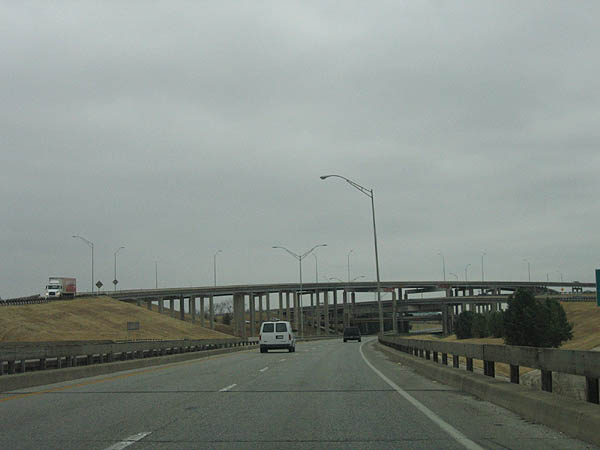
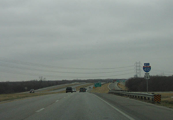
| Entering the systems interchange (Exit 41) with IH 37/U.S. 281. U.S. 281 overlaps with IH 37 through central San Antonio. The two routes parallel one another south from IH 410 to Pleasanton. 02/18/06 |
|
| This style of four-level exchange is a classic late-1960s Texas interchange, similar in construction to the demolished IH 10/IH 610 West interchange in Houston. 02/18/06 |
|
| U.S. 281 southbound overlaps with IH 410 west 3.7 miles to Roosevelt Avenue. The freeway remains below grade on the initial stretch west from IH 37 to Spur 122 (Presa Street). 02/18/06 |
|
| Renumbered in 1974 when US 181 was truncated at IH 37, Spur 122 (Presa Street) is former US 181. Southton Road stems south from Presa Street nearby to Southton and Brauning Lake. 02/18/06 |
|
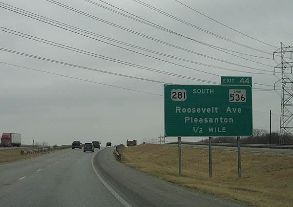
| Advancing west, IH 410/SH 130 split with U.S. 281 south in one mile beyond the San Antonio River at Roosevelt Avenue (Exit 44). 02/18/06 |
|
| IH 410/U.S. 281 confirming markers posted ahead of bridges across the Union Pacific Railroad and San Antonio River at Mission San Juan Capistrano park. 02/18/06 |
|
| US 281 travels south through Pleasanton to meet IH 37, then branches off IH 37 at Three Rivers. 02/18/06 |
|
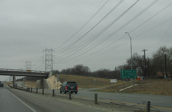
| San Antonio Missions National Park lies north of IH 410 via Spur 536 (Roosevelt Avenue). The park holds five historical mission sites along the San Antonio River 02/18/06 |
|
| Spur 536 is former US 281, bypassed in 1978 with the completion of the US 281 freeway north of IH 410 and IH 37. 02/18/06 |
|
| Exit 44 departs IH 410/SH 130 westbound ahead of Espada Road. U.S. 281 lines the north frontage road 1.4 miles to Roosevelt Avenue (Spur 536 north). 02/18/06 |
|
| Continuing west from Roosevelt Avenue, IH 410/SH 130 meet Moursund Boulevard in 0.75 miles. 02/18/06 |
|
| Entering the split diamond interchange (Exit 46) with Moursund Boulevard along Interstate 410 westbound. 02/18/06 |
|
| Zarzamora Street extends south from the Gillette Area of San Antonio and Exit 48 to Texas A&M University San Antonio and Applewhite Road south to the Toyota Texas Manufacturing plant. 02/18/06 |
|
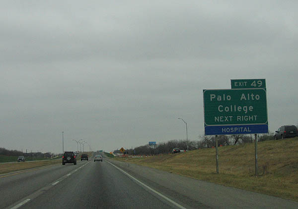
| Palo Alto College lines the north side of Interstate 410 between Zarzamora Street and SH 16 (Palo Alto Road) south and Spur 422 north. 02/18/06 |
|
| Spur 422 is former SH 16 north to IH 35. SH 16 travels south to Poteet, while northbound SH 16 joins IH 410 for a 16.5 mile long overlap. 02/18/06 |
|
| IH 410 remains in the original four lane configuration as it crosses Leon Creek. 02/18/06 |
|
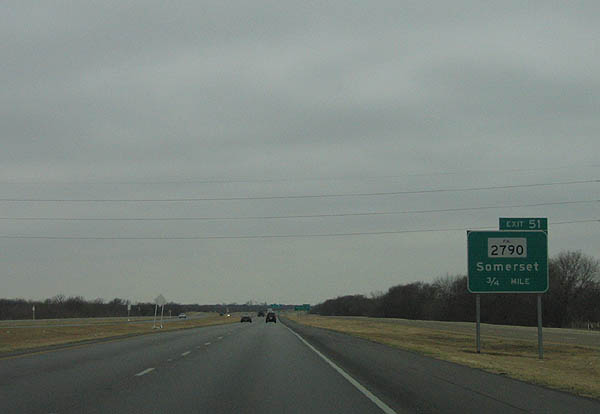
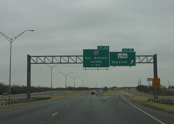
| Advance signage for FM 2790 to Somerset. 02/18/06 |
|
| Somerset Road extends north from FM 2790 and Exit 51 as a local roadway to the IH 35 frontage road system and Palo Alto Road. 02/18/06 |
|
| FM 2790 forms a 22.44 mile loop south from IH 410/SH 16-130 to Somersett, west to IH 35 at Lytle and north to FM 471 at LaCoste. IH 35 meets the Connally Loop one mile to the west. 02/18/06 |
|
| As with IH 37, the control city northbound for IH 35 from IH 410 is San Antonio. 02/18/06 |
|
| The IH 35 southwest interchange, unlike the IH 35 northeast (Fratt) interchange, is a simple cloverleaf. IH 35 joins Laredo and the Rio Grande Valley with Austin and Dallas-Fort Worth. 02/18/06 |
|
| C/d roadways connect ramps between IH 410 and IH 35. The two freeways meet along the southwestern San Antonio city line. 02/18/06 |
|
| SH 130 concludes at the loop ramp for Interstate 35 south ahead of Von Ormy. 02/18/06 |
Page Updated 07-04-2019.

 West
West