|
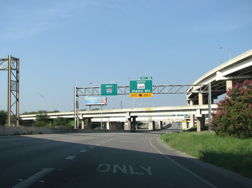
| IH 410 westbound passes under frontage roads alongside IH 35 and a UP Railroad line leading to the semi-directional T interchange (Exit 26) with SL 368 (Austin Highway). 09/01/08 |
|
| Loop 368 (Austin Highway) was the main route out of San Antonio in the pre-Interstate era, carrying the U.S. 81 designation. The highway was built as the grand gateway to the city in the 1930s, but fell into disrepair mid-century. Efforts to restore the road to part of its former glory got underway in 2001. 09/01/08 |
|
| The ensuing exit after Austin Highway is for Perrin-Beitel Road. This arterial's German-sounding name is common in San Antonio. The northern part of the county was originally settled almost exclusively by German immigrants in the 19th century. 09/01/08 |
|
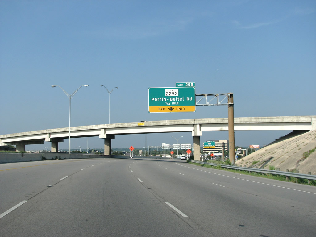
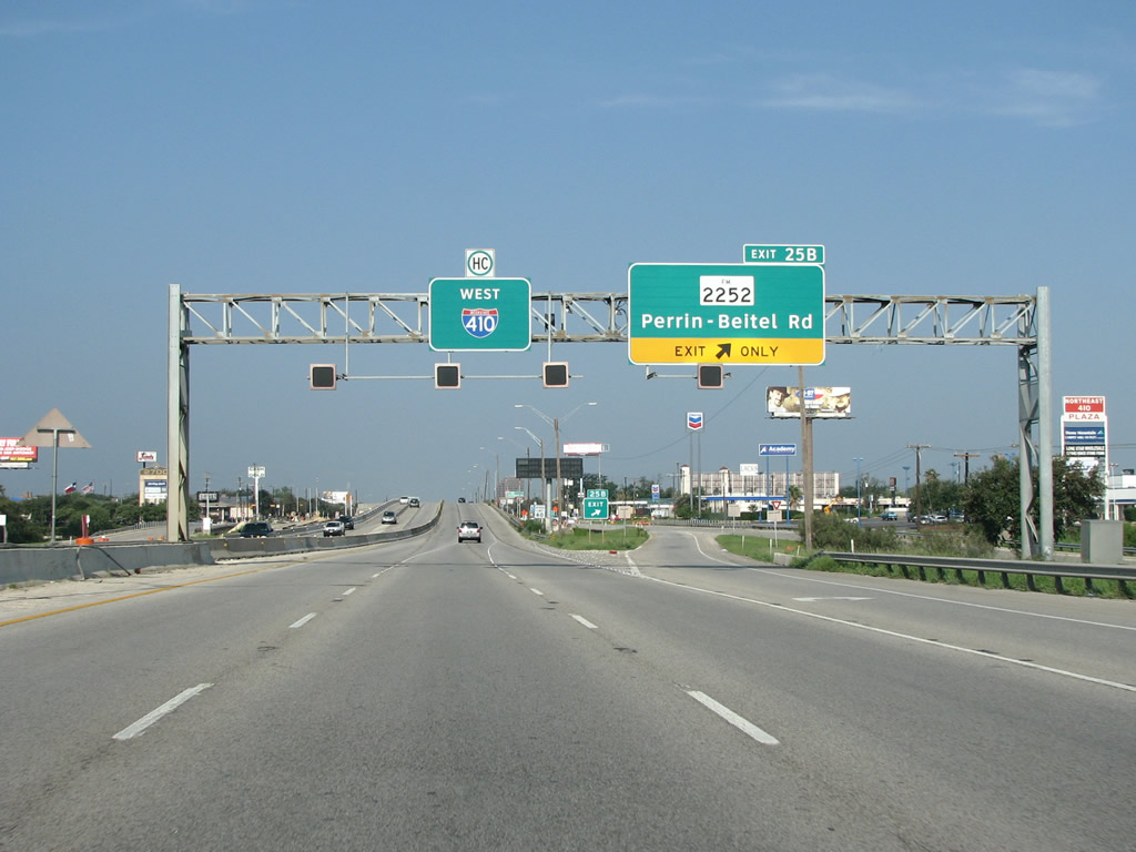
| IH 410 westbound at Exit 25B loses one lane and travels with three lanes in each direction across Perrin-Beitel Road goes down to three lanes in each direction. FM 2252 follows Perrin-Beitel Road north from Loop 410 to Nacogdoches Road en route to Garden Ridge. 09/01/08 |
|
| Exit 24 departs IH 410 west beyond Herry Wurzbach Road for Nacogdoches Road. An array of city office blocks rise along the freeway frontage leading toward San Antonio International Airport (SAT). 09/01/08 |
|
| Nacogdoches Road is the oldest road in the urban area. It was originally the El Camino Real, the Spanish built route to connect their two settlements then in Texas: Nacogdoches and San Antonio. In 1908 a survey crew retraced the route, using the centuries-old diary of a monk. Today a commemorative marker for the El Camino Real, placed there that year, sits just off of this exit. A few hundred miles east of here, the same route is signed by the state as OSR, the Old Spanish Road. 09/01/08 |
|
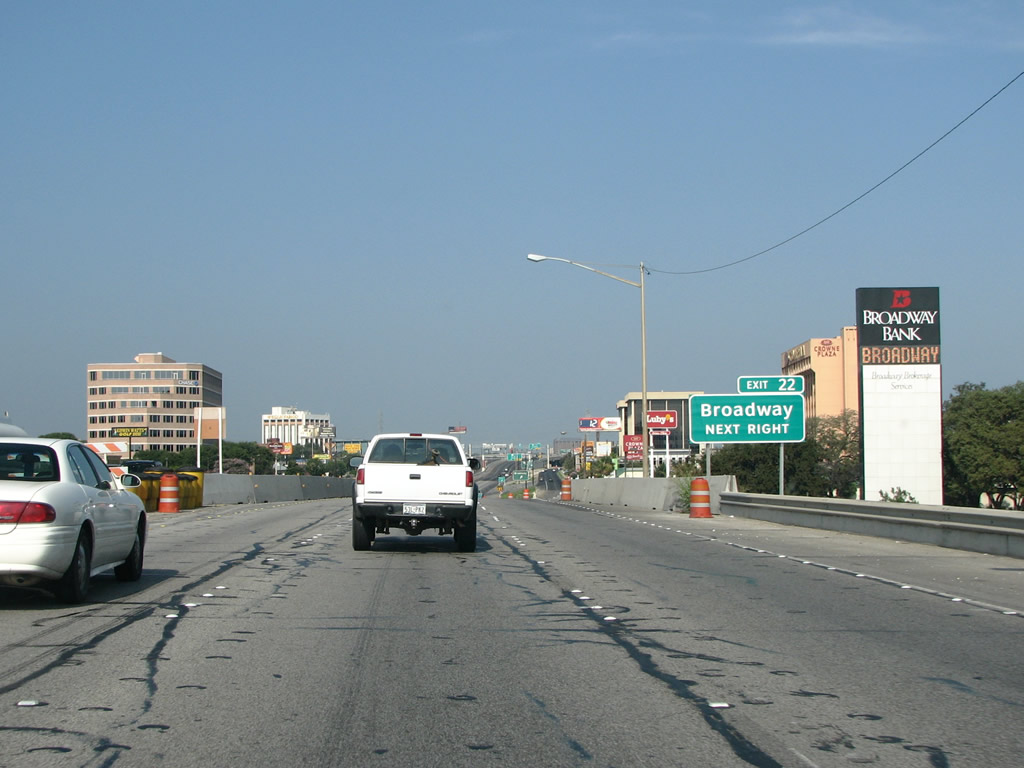
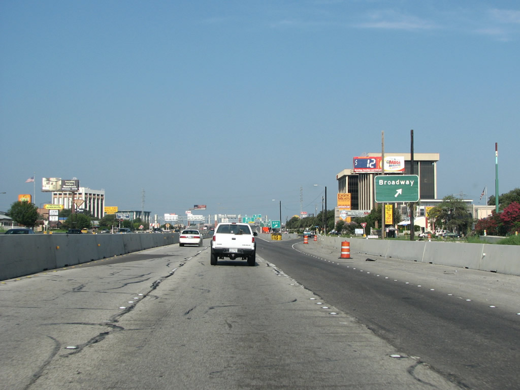
| Exit 22 to Broadway separates from westbound IH 410 at the Nacogdoches Road underpass. 09/01/08 |
|
| Broadway runs north out of Downtown and through Alamo Heights, the wealthiest and one of the oldest suburbs in the area. Broadway also runs through the city'' largest park, Breckenridge, and near the zoo and other important cultural institutions. 09/01/08 |
|
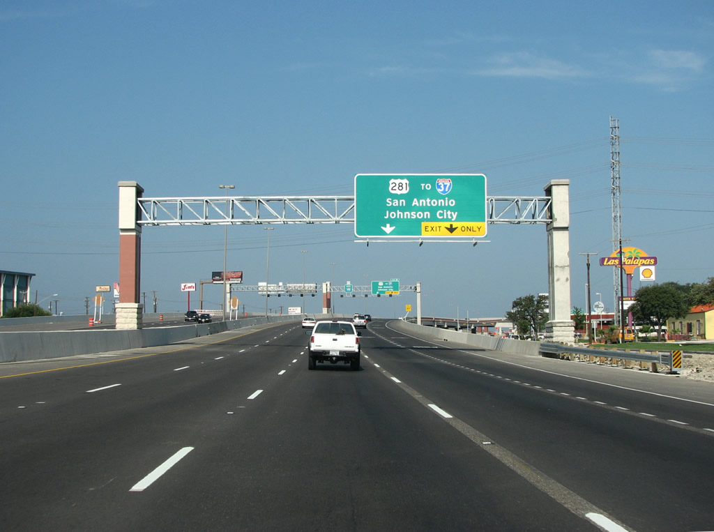
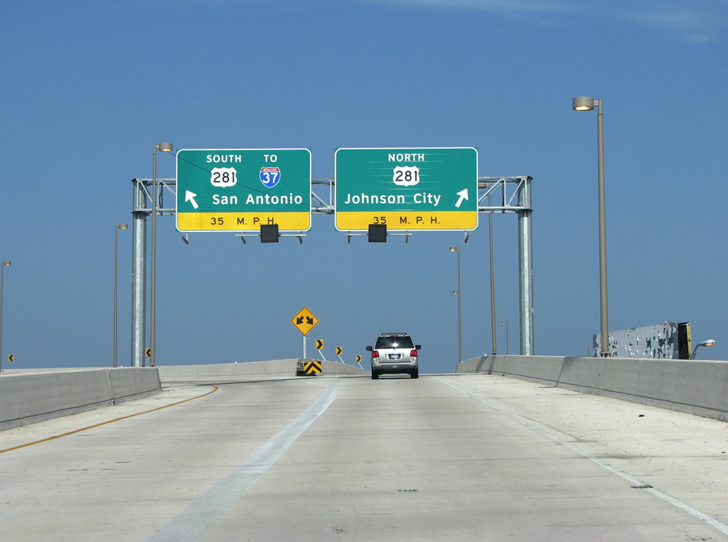
| US 281 extends north out of Downtown San Antonio along a well traveled freeway. North from the city, U.S. 281 continues through the Texas Hill Country along a busy two lane road. 09/01/08 |
|
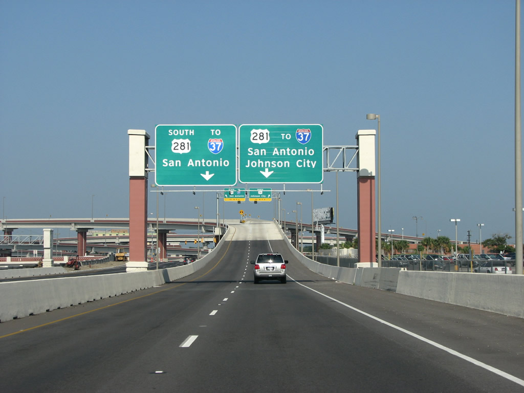
| IH 37 ends in Downtown San Antonio and can be accessed by taking U.S. 281 south from Exit 21. 09/01/08 |
|
| The flyover from westbound IH 410 to U.S. 281 travels high above the main lanes and continues for a long way before reaching the actual stack. 09/01/08 |
|
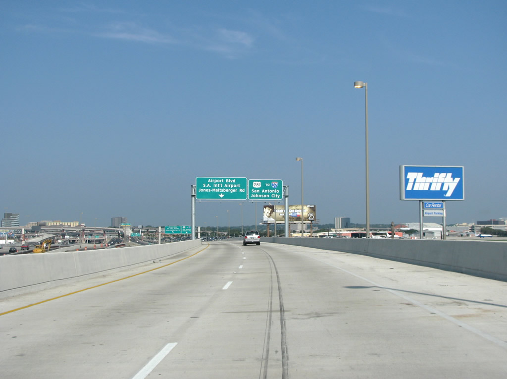
| San Antonio International Airport (SAT) sits immediately to the northeast of the systems interchange with U.S. 281 (McAllister Freeway). 09/01/08 |
|
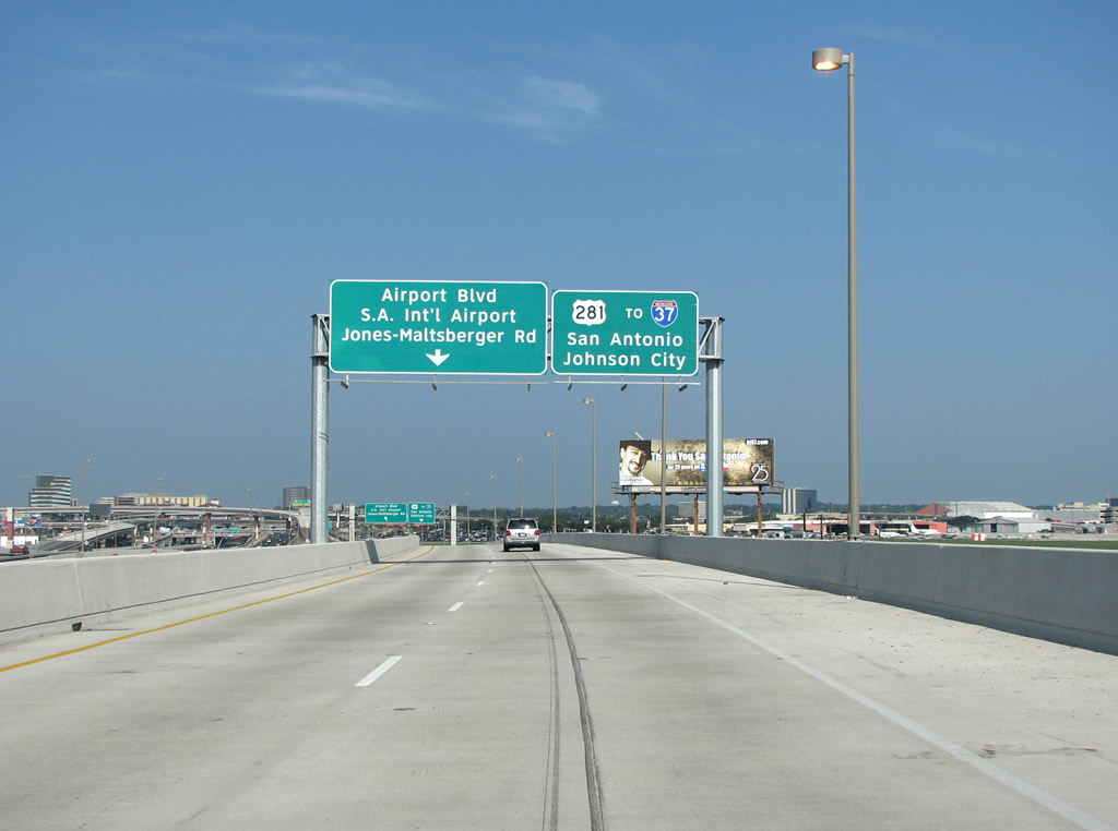
| A left side ramp departs from Exit 21 for the IH 410 frontage road to Airport Boulevard for the passenger terminal at SAT Airport and Jones-Maltsberger Road to the west. 09/01/08 |
|
| IH 410 traffic to U.S. 281 splits for Downtown San Antonio, IH 37 to Corpus Christi, the northern Bexar County suburbs and Johnson City, seat of Blanco County. 09/01/08 |
|
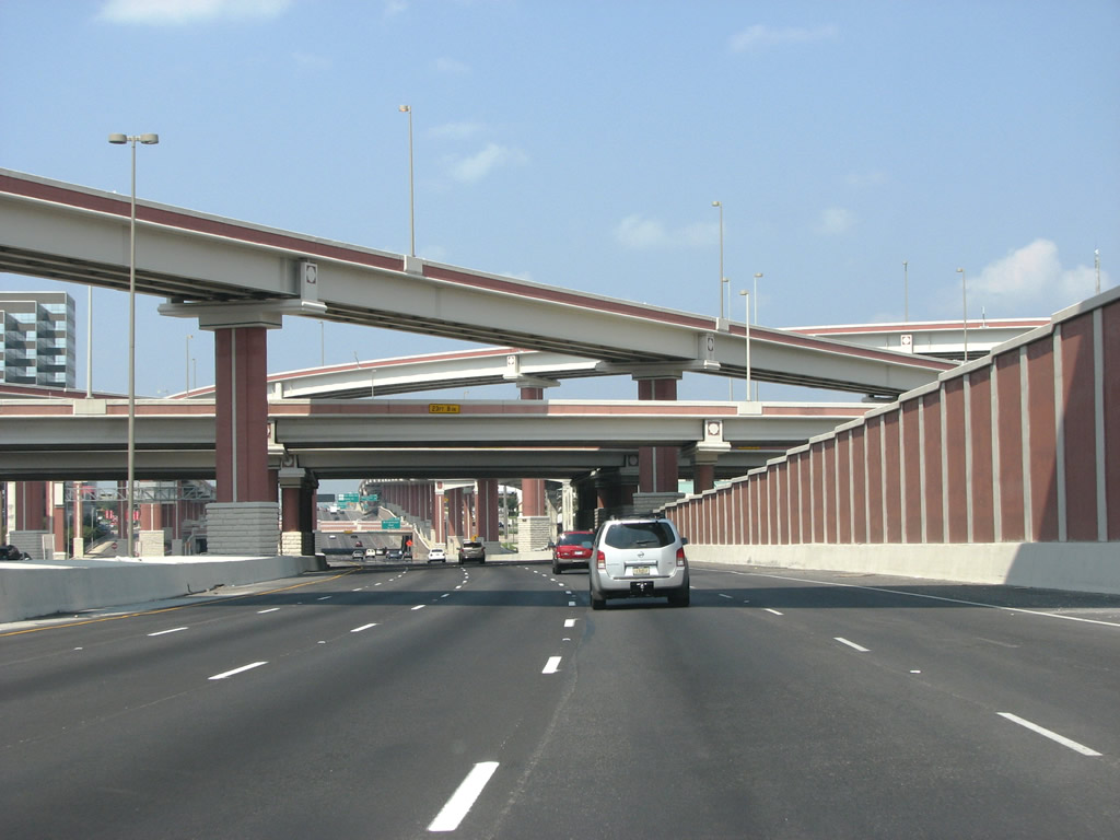
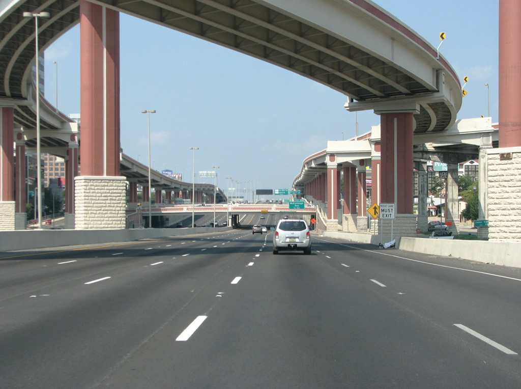
| The four level interchange with U.S. 281 (McAllister Freeway) comes into view here south of SAT Airport. With ramps in all directions opened in June 2008, the high speed exchange here replaced an interchange that connected with signalized frontage roads. 08/31/08 |
|
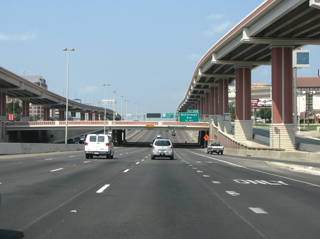
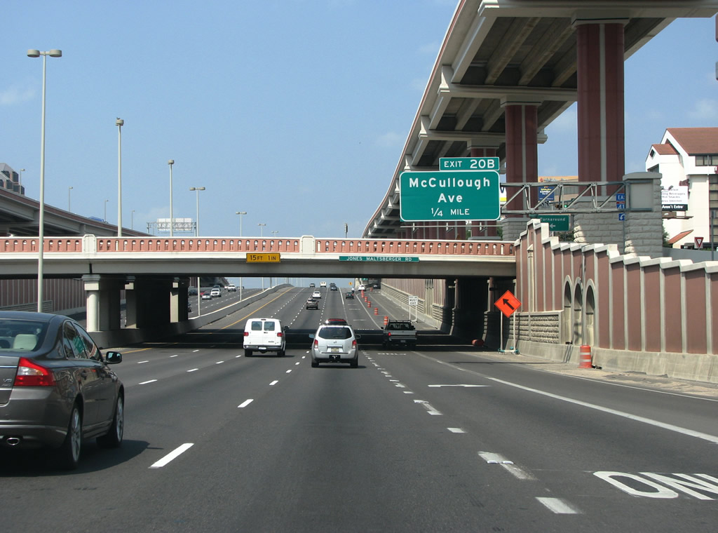
| Advancing west from U.S. 281, IH 410 reaches the off-ramp (Exit 20B) for McCullough Avenue in one half mile. 08/31/08 |
|
| The IH 410/U.S. 281 interchange features distinctive Spanish inspired accents, with a lot of dark red. 08/31/08 |
|
| Opened north to IH 410 in 1978, the McAllister Freeway was a controversial freeway when it was constructed. Due to a three-year halt in construction, environmental lawsuits, and the requirement of a new federal law to get it built, an interchange linking U.S. 281 with IH 410 was shelved to cut cost. 08/31/08 |
|
| The stack interchange at U.S. 281 was first proposed way in the 1980s, when northern San Antonio was expanding very quickly. A TxDot panel voted to accelerate the project in 1993. However funding was an issue that ultimately required bond sales for the $155 million project. 08/31/08 |
|
| Flyovers with U.S. 281 span IH 410 at Jones-Maltsberger Road, one quarter mile out from Exit 20B to McCullough Avenue. 08/31/08 |
|
| McCullough Avenue runs south into Downtown San Antonio and through the upscale areas of Olmos Park and Monte Vista. 08/31/08 |
|
| Representing the pre-freeway alignment of U.S. 281, San Pedro Avenue was originally the main road north out of San Antonio. A cloverleaf interchange opened between IH 410 and San Pedro Avenue in 1957. During the reconstruction project in 2004, the cloverleaf was removed and replaced with a diamond. 08/31/08 |
|
| IH 410 west at San Pedro Avenue was historically the busiest arterial-to-freeway junction in the San Antonio metro area. The beltway here carries the most daily traffic of any road in South Texas. 08/31/08 |
|
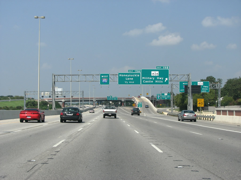
| IH 410 passes mid-rise office blocks and large hotels at San Pedro Avenue. Much of San Antonio's business is based up here, rather than Downtown which is heavily geared towards conventions and tourism. The succeeding exit is with Military Highway (FM 1535). 08/31/08 |
|
| Lane control markers were implemented along IH 410 west toward IH 10 during reconstruction. Forthcoming FM 1535 leads 8.07 miles north to Eisenhower Park outside Camp Bullis. 08/31/08 |
|
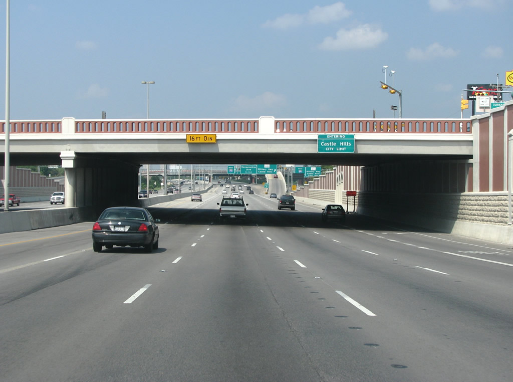
| The freeway briefly enters the city of Castle Hills, an enclave suburb of San Antonio. Home to around 4,400 people, Castle Hillls is zoned almost entirely residential, with ranch style houses sitting on large lots. 08/31/08 |
|
| Military Highway forms the main street north through Castle Hills. The highway runs northwest to Shavano Park towards the army installation at Camp Bullis. 08/31/08 |
|
| The first reference of IH 10 along westbound IH 410 appears after the flyover ramp for Military Highway (FM 1535). FM 1535 spans IH 410 on a replacement bridge for one built in 1958. 08/31/08 |
|
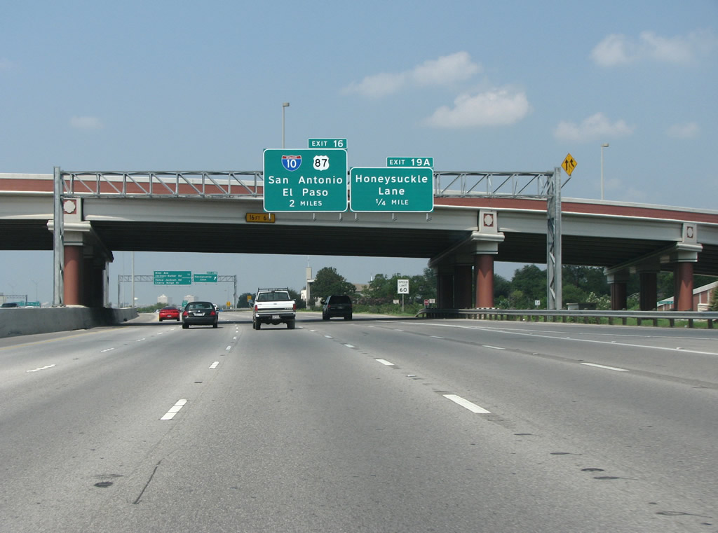
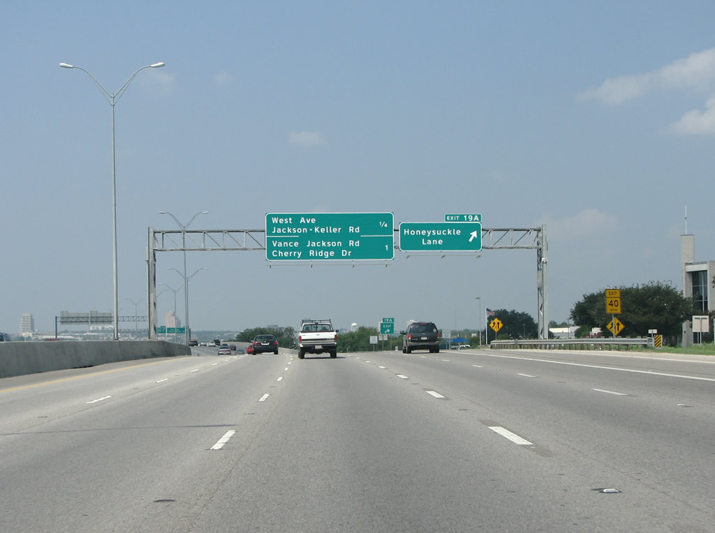
| Honeysuckle Lane is a short, minor residential street. Exit 19A is used primarily for traffic headed to businesses on the adjacent frontage road. 08/31/08 |
|
| West Avenue is a north/south arterial that was originally built on the far western side of San Antonio's original street grid. Jackson-Keller Road is a short diagonal arterial that was previously built connecting the two communities of Jackson and Keller. 08/31/08 |
|
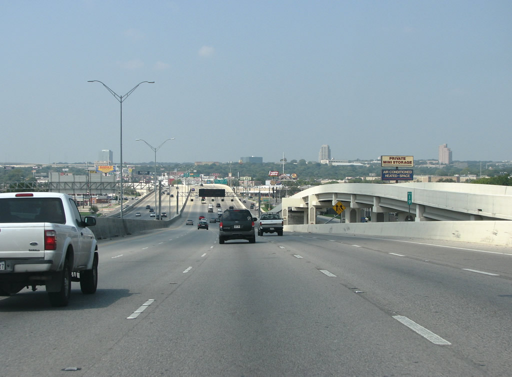
| Making a gradual southwesterly turn through northern San Antonio along IH 410. Originally designated Loop 13 when it was built in 1938, the highway was built to connect four of San Antonio's new army and air force bases. The northern portion of Loop 13 was renamed as Loop 410 in 1963 and it was upgraded entirely to a freeway. Loop 410 was merged into the existing IH 410 some years later. Locals still refer to the road as "the loop" or "loop 410", although that usage is archaic. Loop 13 still exists, but only along the southern and eastern sides of the city. 08/31/08 |
|
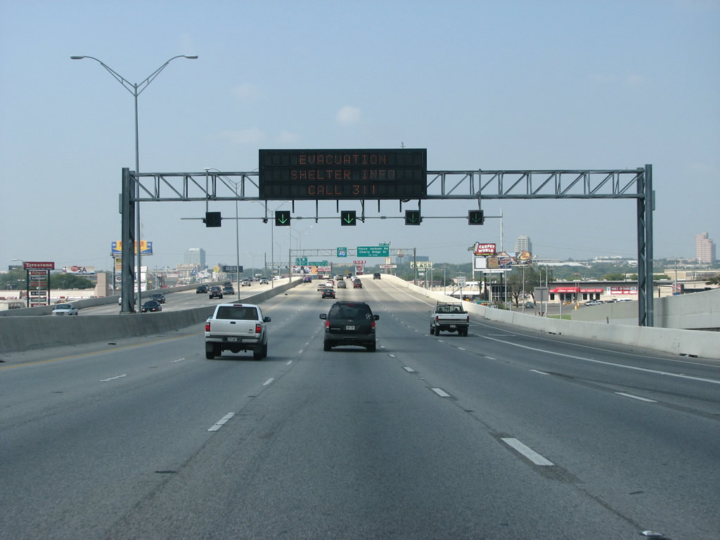
| The Connally Loop briefly expands to 12 overall lanes above West Avenue. This VMS, at the time this photo was taken, displayed information for Hurricane Gustav evacuees. 08/31/08 |
|
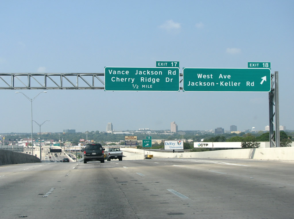
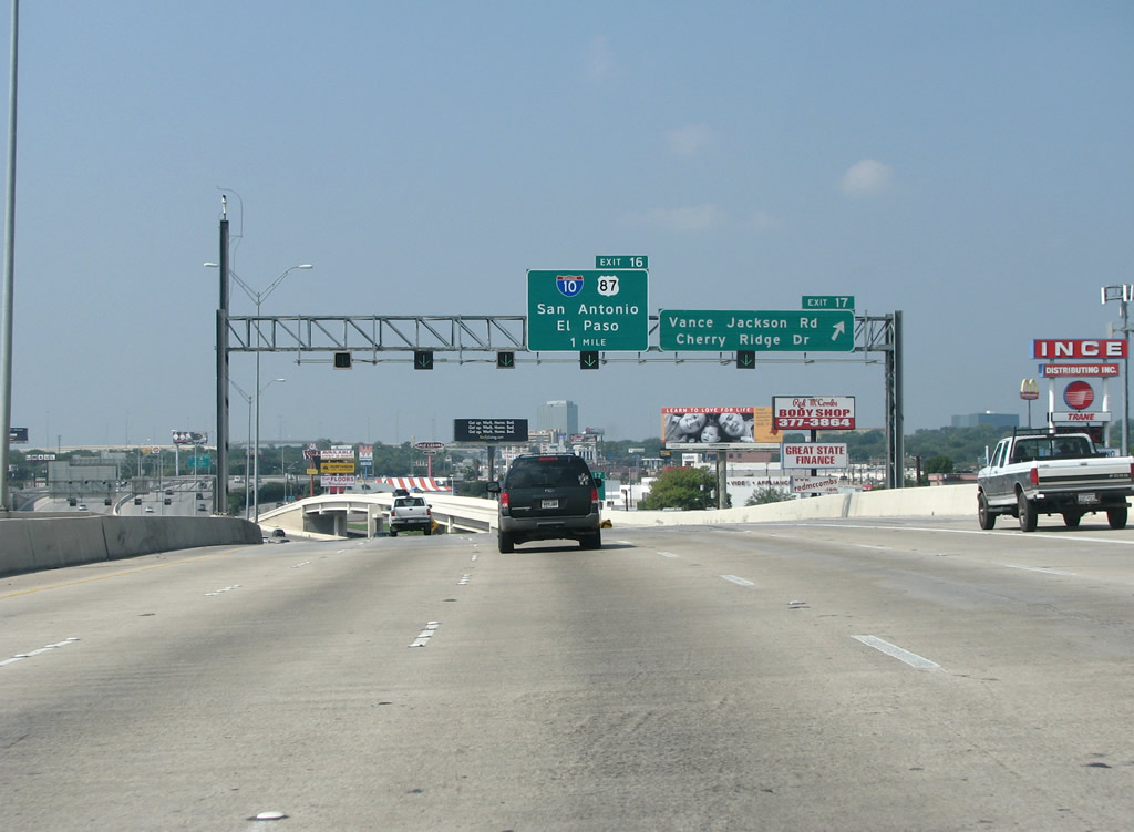
| IH 410 elevates over Jackson-Keller Road and the Union Pacific Railroad as it leaves Castle Hills and re-enters the city of San Antonio. Exit 17 departs from the viaduct end for Vance Jackson Road next. 08/31/08 |
|
| Green arrow lights show no slow downs ahead as IH 410 runs west towards Exit 17 to Vance Jackson Road. Suburban areas such as Colonial Hills, Oakcreek and Mission Trace are northwest of here along the route of Vance Jackson Road. Cherry Ridge Drive runs west along the freeway in a business area. 08/31/08 |
|
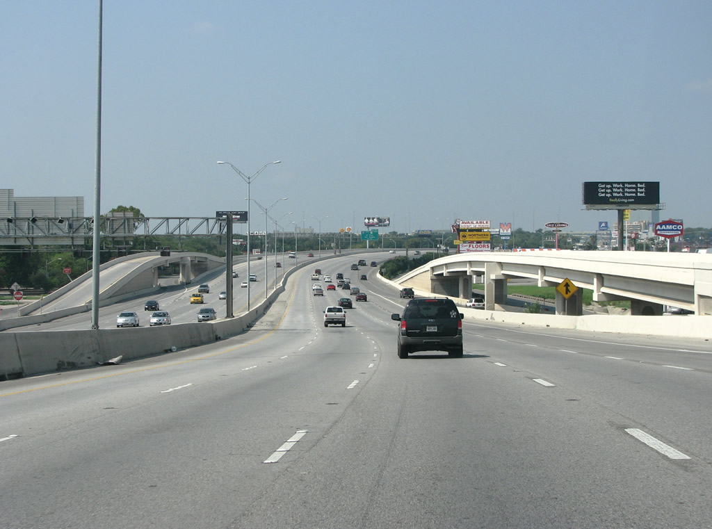
| Turning more southward, IH 410 advances one mile toward the systems interchange (Exit 16) with IH 10 and U.S. 87. 08/31/08 |
|
| IH 410 meets IH 10 at the largest freeway interchange in southern Texas. U.S. 87 accompanies IH 10 northwest from San Antonio to Comfort, where it branches northward to San Angelo. 08/31/08 |
|
| The freeway has 12 main lanes northeast of IH 10. It remains very busy at peak periods. 08/31/08 |
|
| Two lanes separate from IH 410 west for IH 10/U.S. 87 at Exit 16. The size of Texas is partially revealed here with the control point of El Paso. Still in the Lone Star State, it is over 550 miles away. 08/31/08 |
|
| Completed in 2006, the four level exchange with IH 10/U.S. 87 replaced a directional cloverleaf interchange dating from 1960. 08/31/08 |
Page Updated 07-08-2019.

 West
West