|
| Shields for IH 635 switch to east/west cardinal directions beyond the half diamond interchange (Exit 9B on eastbound) with La Prada Drive on the Garland / Mesquite city line. 09/04/09 |
|
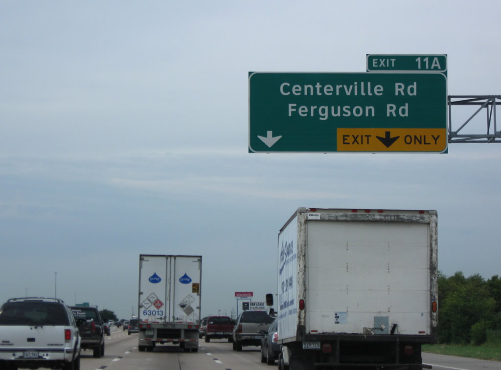
| The LBJ Freeway lines the Garland and Dallas city line to the Walnut Hill Lane / Kingsley Road underpass beyond Exit 13. Meeting the freeway next is Ferguson Road north and Centerville Road south at Exit 11A. 09/04/09 |
|
| Seven lanes lead northwest from La Prada Drive to Exit 11A with Centerville and Ferguson Road. 09/04/09 |
|
| Ferguson Road extends Centerville Road southwest from Garland through the Casa View area of northeast Dallas. 09/04/09 |
|
| Northwest Drive winds northwest from Belt Line Road in Mesquite to become Northwest Highway, a commercial arterial west through Garland to forthcoming Exit 11B. 09/04/09 |
|
| Northwest Highway is unnumbered at Exit 11A, but a part of Spur 244 west from SH 78 (Garland Avenue) nearby. Further west, NW Hwy forms the northern portion of Loop 12 en route to University Park. 09/04/09 |
|
| Two lanes branch away from the LBJ west for the adjacent service road ahead of Northwest Highway and Shiloh Road. Shiloh Road runs north from Casa View in Dallas to the industrial west side of Garland. 09/04/09 |
|
| A half diamond interchange (Exit 12 on eastbound) adds traffic from SH 78 (Garland Avenue) on the half mile approach to Exit 13 with Jupiter Road. 09/04/09 |
|
| IH 635 reassurance marker posted at the SH 78 (Garland Road) and KCS Railroad underpass. 09/04/09 |
|
| Jupiter Road north from Exit 13 connects the LBJ Freeway with Walnut Hill Road west back into Dallas and Kingsley Road east. 09/04/09 |
|
| Interstate 635 parallels a KCS Railroad line to the diamond interchange (Exit 14) with Plano Road. 09/04/09 |
|
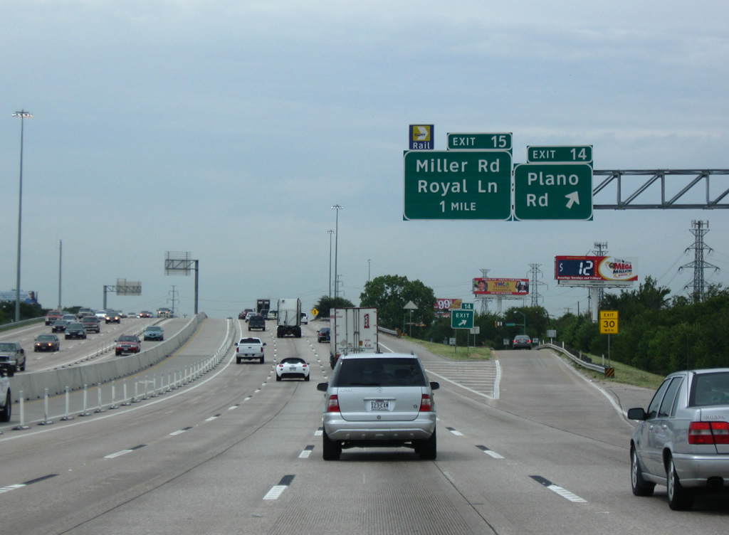
| Now fully within the city of Dallas, IH 635 west reaches the off-ramp (Exit 14) for Plano Road. Plano Road leads south to the Lake Highlands neighborhood and north through industrial west Garland to Richardson. 09/04/09 |
|
| A parclo interchange (Exit 15) joins IH 635 with Royal Lane west and Miller Road east. 09/04/09 |
|
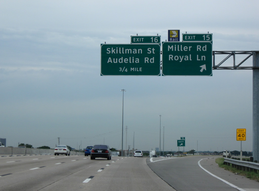
| Skillman Street and Audelia Road come together with IH 635 at a diamond interchange (Exit 16). Audelia Road extends north to Richardson while Skillman Street ends at Forest Lane ahead of the Garland city line. 09/04/09 |
|
| Reassurance marker posted for IH 635 west after Exit 16 (Audelia Road / Skillman Street). 09/11/15 |
|
| The Lyndon B. Johnson Freeway service roads begin at the half diamond interchange (Exit 17) with Forest Lane and Adams Road. The frontage roads accompany IH 635 westward to Loop 354 (Harry Hines Boulevard). 09/11/15 |
|
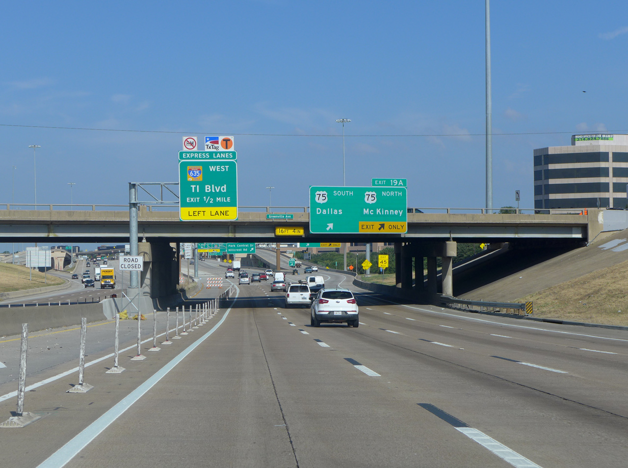
| Passing under Forest Lane, the IH 635 (LBJ Freeway) mainline progresses another half mile to the off-ramp (Exit 18) for Greenville Avenue and TI Boulevard. 09/11/15 |
|
| Exit 18 joins the LBJ service road ahead of Greenville Road north to Richardson and south to Harry Moss Park in Dallas. TI Boulevard winds north-south parallel to Floyd Branch to the Texas Instruments (TI) headquarters campus. 09/11/15 |
|
| A toll schedule sign for the LBJ Express lanes appears beyond this shield assembly for IH 635 at the Exit 18 gore point. 09/11/15 |
|
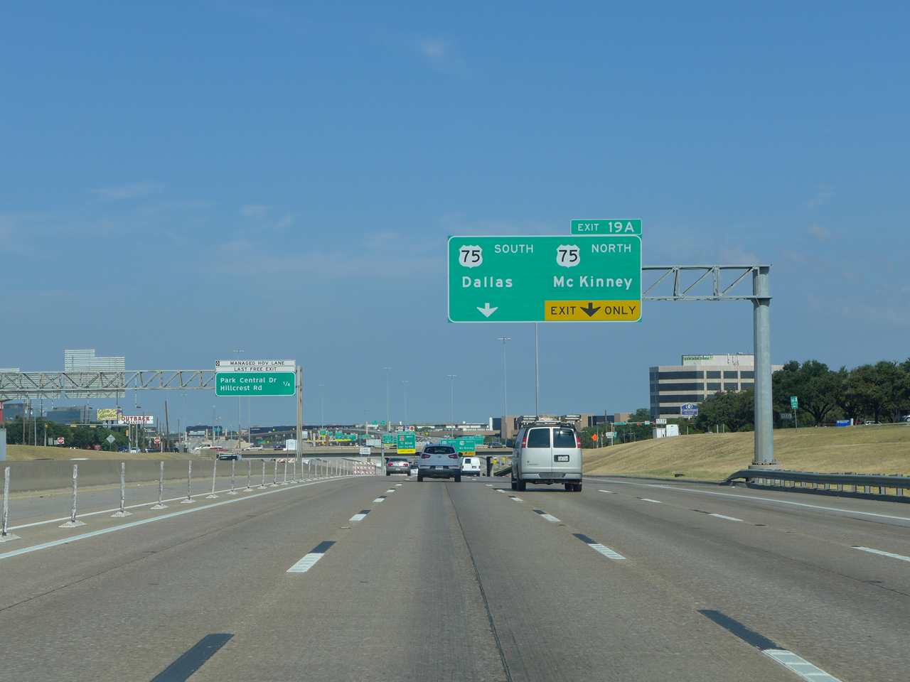
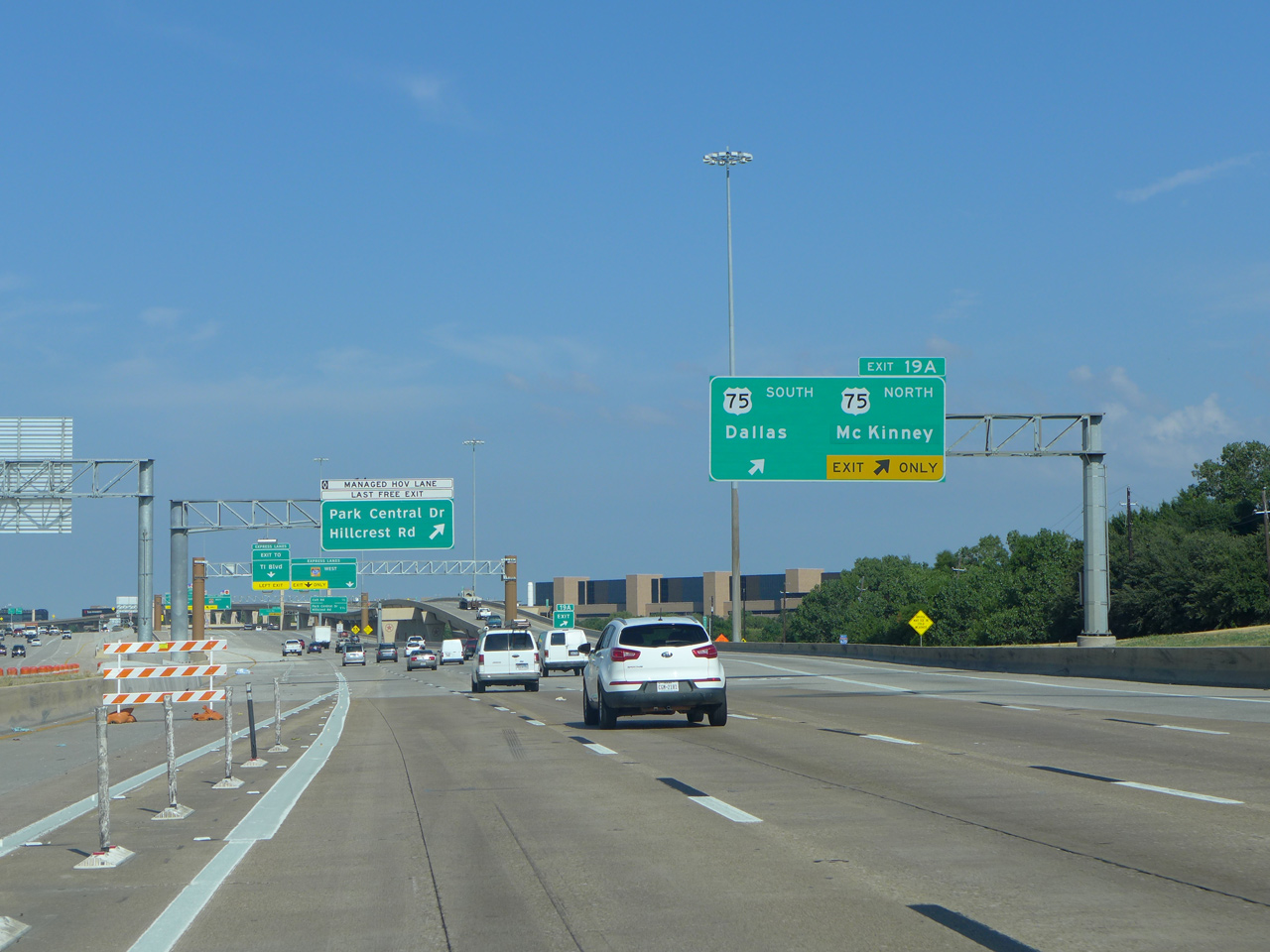
| The Dallas High Five Interchange, where IH 635 and US 75 come together in north Dallas, is next along the LBJ Freeway west. U.S. 75 (Central Expressway) joins Downtown Dallas with Plano, Allen and McKinney among other Collin County suburbs. 09/11/15 |
|
| A ingress point for the LBJ Express lanes lies west of the Greenville Avenue overpass as Exit 19A departs with two lanes for the Central Expressway. U.S. 75 commences a 1,239 mile route to Moorhead, Minnesota from IH 30 and 45 in Downtown Dallas. 09/11/15 |
|
| The Dallas High Five Interchange was completed in January 2007. It provides high speed flyovers for U.S. 75 south to North Dallas, University Park, Highland Park and Oak Lawn in Dallas and north to Richardson, McKinney and Sherman. 09/11/15 |
|
| Motorists destined for Exit 20 to Park Central Drive and Hillcrest Road depart the LBJ Express lanes opposite the ingress point within the Dallas High-Five Interchange. 09/11/15 |
|
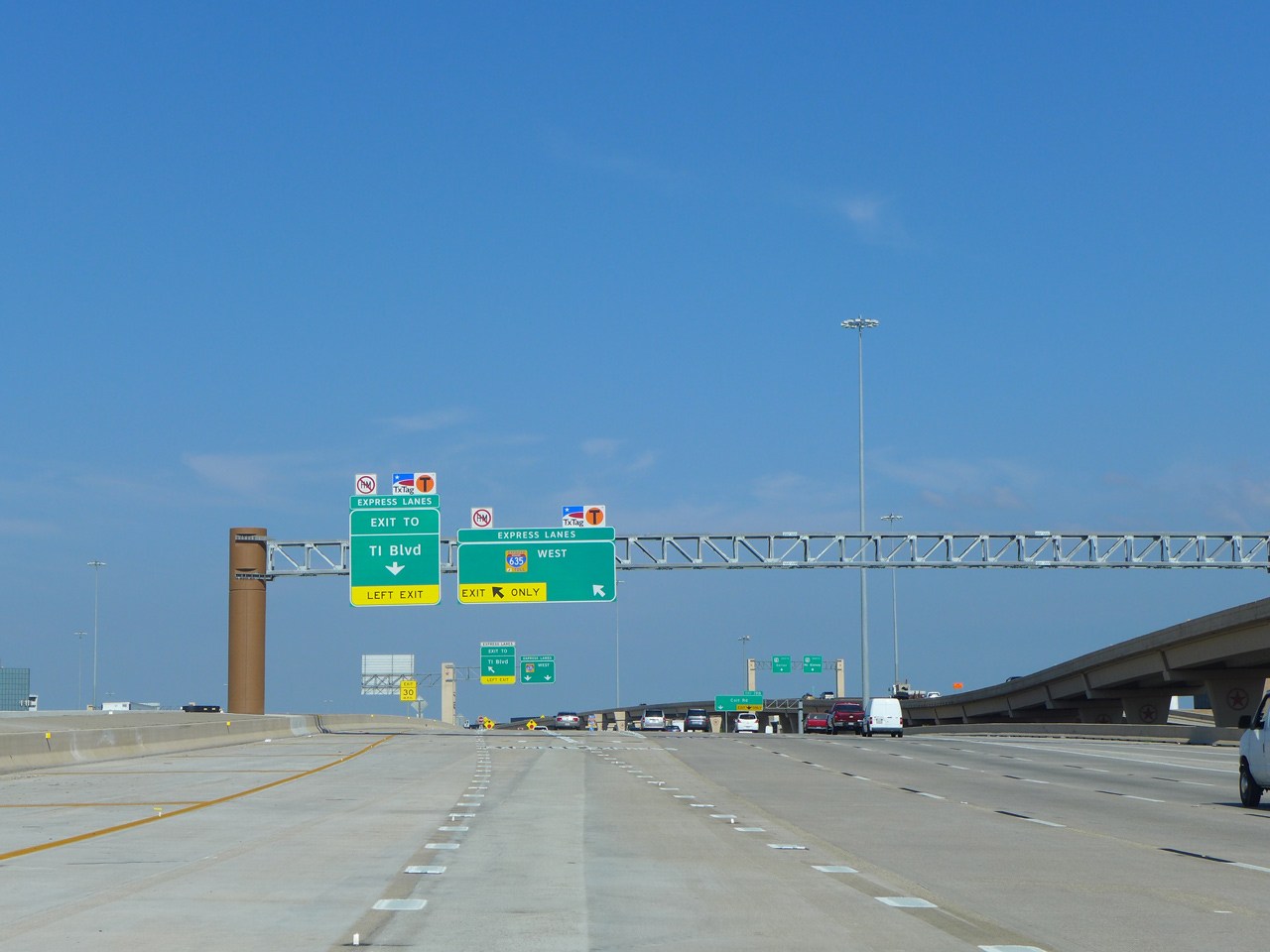
| The left lane of the LBJ Express lanes defaults to a connector road linking the managed lanes with TI Boulevard. Two lanes continue to Preston Road (SH 289). 09/11/15 |
|
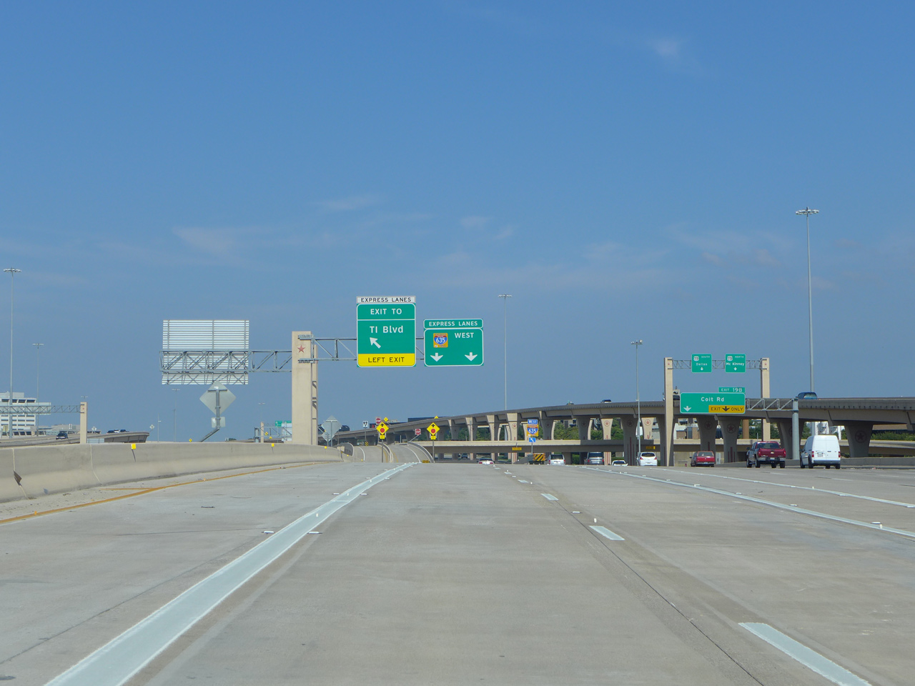
| Exit 19B leaves from within the Dallas High-Five Interchange for Coit Road and North Dallas in a half mile. 09/11/15 |
|
| The tolled LBJ Express lanes branch away from the four lane westbound IH 635 mainline. 09/11/15 |
|
| Two lanes follow onto Exit 19B for the adjacent service road to Coit Road as a barrier separates the tolled LBJ Express lanes from the free IH 635 mainline. 09/11/15 |
|
| An on-ramp ties into the flyover system for the Central Expressway from the adjacent LBJ service road. McKinney replaced Sherman as the northbound control city for U.S. 75 in 2007. 09/04/09 |
|
| Another view of the High Five stack interchange from the flyovers to U.S. 75. 09/04/09 |
|
| Single lane flyovers separate for the Central Expressway. U.S. 75 end 10.5 miles to the south opposite the beginning of IH 45. McKinney, seat of Collin County, is a 21 mile drive to the north. 09/04/09 |
|
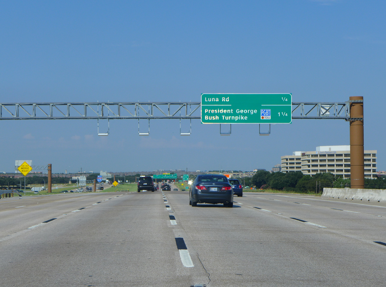
| Spanning a BNSF Railroad, Interstate 635 continues from IH 35E (Stemmons Freeway) to the diamond interchange (Exit 28) with Luna Road. 09/11/15 |
|
| This interchange sequence sign outlines the first three Irvine exits along Interstate 635 west beyond the President George Bush Turnpike. 09/06/09 |
|
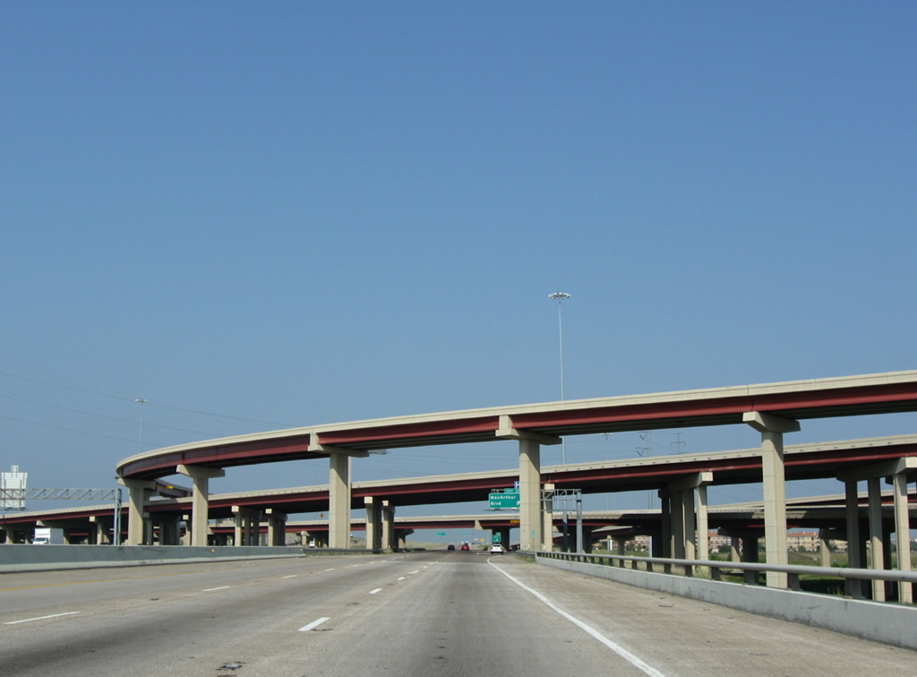
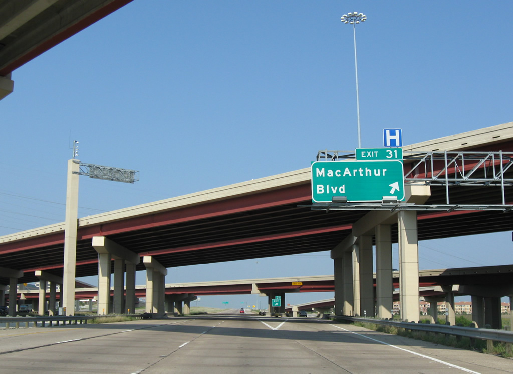
| Exit 31 departs from within the stack interchange with the PGBT for the resumption of the LBJ Freeway frontage road system ahead of MacArthur Boulevard. 09/06/09 |
|
| The full billion-dollar PGBT connection was completed and opened to traffic in late 2005. 09/06/09 |
|
| MacArthur is an important north-south arterial spanning all of Irving and connecting IH 30 in Grand Prairie with IH 35E in Lewisville. This exit sports a lot of big box retail. 09/06/09 |
|
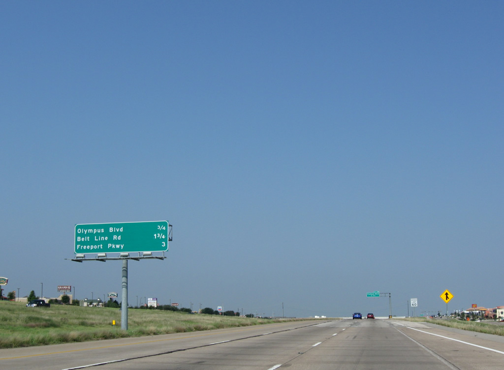
| Olympus Blvd is the next exit westbound on IH 635 in 0.75 miles. 09/06/09 |
|
| Exit 31B was opened in the late 90s to serve more of the big box retail and corporate parks in the area. 09/06/09 |
|
| IH 635 westbound at Olympus Blvd north to Ranch Trail in Irving. The freeway reduces to three through-lanes in each direction here. 09/06/09 |
|
| This interchange sequence sign lists interchanges all serving the northwestern Dallas suburb of Coppell. 09/06/09 |
|
| Westbound reassurance marker posted ahead of the Olympus Boulevard overpass. 09/06/09 |
|
| IH 635 westbound at Belt Line Road in Coppell. Belt Line Road forms a 96 mile arterial loop around Dallas. 09/06/09 |
|
| Drivers enter the final 3.25 miles of the LBJ Freeway ahead of Exit 34 with Freeport Parkway. 09/06/09 |
|
| Interstate 635 bends northwest along the Irving and Coppell city line from Beltline Road to Royal Lane South. 09/06/09 |
|
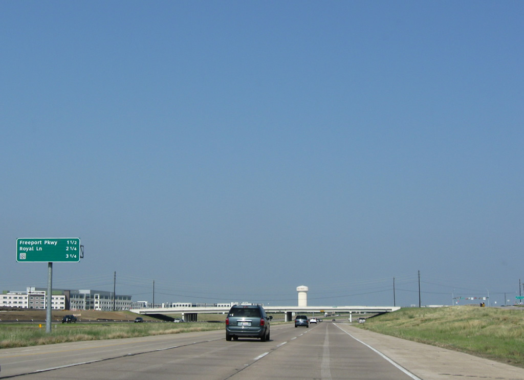
| One half mile ahead of Freeport Parkway on IH 635 west. Freeport Pkwy, much like Olympus Blvd, was simply a short connector road with local industrial parks. Extensions have taken the boulevard north to Sandy Lake Road. 09/06/09 |
|
| IH 635 westbound at the parclo interchange with Freeport Pkwy in Coppell. 09/06/09 |
|
| IH 635 westbound before Royal Lane, the last mainline exit on the interstate. Royal Lane runs along the length of north Dallas, east to west. It was extended westward and northward throughout the 80s. 09/06/09 |
|
| Entering the diamond interchange (Exit 35) with Royal Lane on Interstate 635 west in Coppell. The exit serves a number of industrial parks and warehouses. 09/06/09 |
|
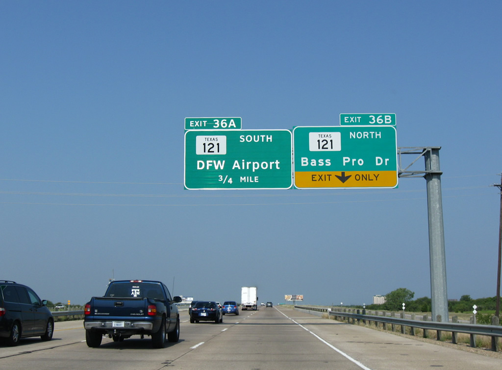
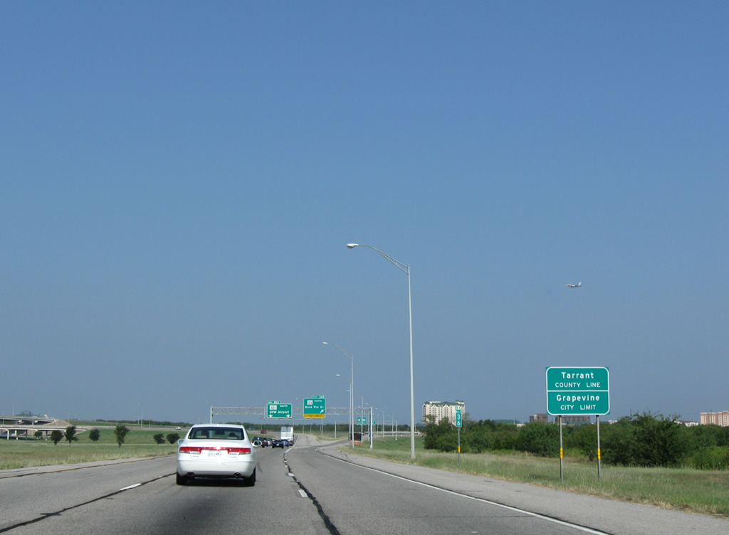
| IH 635 nears its end at SH 121 in Grapevine as the LBJ Freeway spans a DART line. Bass Pro Dr is a separate, local road and is not SH 121 as this sign seems to indicate. 09/06/09 |
|
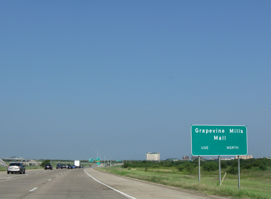
| Grapevine Mills mall, part of a nationwide chain, anchors the area at the western end of IH 635. The facility opened in the fall of 1997 as the largest mall in the region, but has since been upstaged. 09/06/09 |
|
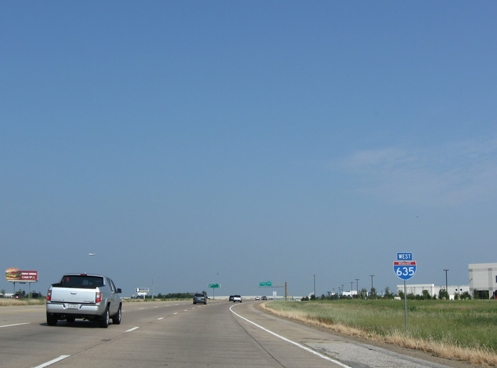
| The west end of Interstate 635 falls just within Tarrant County in the city of Grapevine. This gives Tarrant two three digit Interstates. 09/06/09 |
|
| Two lanes default travelers onto Exit 36A for SH 121 south to International Parkway to DFW International Airport, Grapevine and Fort Worth. 09/06/09 |
|
| Exit 36B splits with ramps for adjacent Bass Pro Drive and the SH 121 freeway north at FM 2499 (Grapevine Mills Parkway) in Grapevine. 10/19/03 |
|
| Exit 36A takes drivers south to a split for SH 114 west & 121 toward Fort Worth and SR 114 east and International Parkway south. 09/06/09 |
Page Updated 09-17-2015.

 West
West